AURA: Aerial Unpaved Roads Assessment System Demonstration - October 20, 2015
•
1 like•610 views

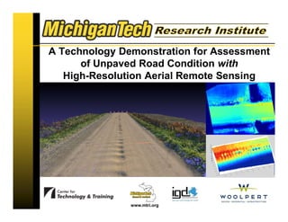
A Technology Demonstration for Assessment of Unpaved Road Condition with High-Resolution Aerial Remote Sensing

Recommended
Recommended
More Related Content
What's hot
What's hot (20)
Similar to AURA: Aerial Unpaved Roads Assessment System Demonstration - October 20, 2015
Similar to AURA: Aerial Unpaved Roads Assessment System Demonstration - October 20, 2015 (20)
Recently uploaded
Recently uploaded (20)
AURA: Aerial Unpaved Roads Assessment System Demonstration - October 20, 2015
- 1. www.mtri.org A Technology Demonstration for Assessment of Unpaved Road Condition with High-Resolution Aerial Remote Sensing
- 2. www.mtri.org Colin N. Brooks, Michigan Tech Research Institute cnbrooks@mtu.edu 734-604-4196 (cell/texting) Demonstration: Rapid City, South Dakota October 20, 2015 A Technology Demonstration for Assessment of Unpaved Road Condition with High-Resolution Aerial Remote Sensing
- 3. Introductions & Welcome Integrated Global Dimensions (Valerie Lefler) Michigan Tech Research Institute (MTRI team – Colin Brooks, Rick Dobson, David Dean) Michigan Tech Center for Technology & Training (CTT – Dr. Tim Colling) 3
- 4. Agenda 4
- 5. Your Time is Appreciated! 5
- 6. Demonstration Overview Research Goal – Key Objectives – Road Characteristics – Requirements Implementation – Equipment – Analysis – Software Next Steps – Cost – Regulations – Other Applications 6
- 8. Project Goal Phase 1: Extend available Commercial Remote Sensing and Spatial Information (CRS&SI) tools to enhance and develop an unpaved road assessment system by developing a sensor for, and demonstrating the utility of remote sensing platform(s) for unpaved road assessment. Phase 2: Take our working prototype technologies from a useful, successfully demonstrated research-level tool to a commercially-available, implemented system available to transportation agencies for objective unpaved road assessment on a day-to-day, as needed basis. 8
- 9. Original Project Objectives 1. Commercially viable in that it can measure inventory and distress data at a rate and cost competitive with traditional methods 2. Rapid ID & characterization of unpaved roads 3. Inventory level with meaningful metrics 4. Develop a sensor for, & demonstrate the utility of remote sensing platform(s) for unpaved road assessment 5. Platform could be a typical manned fixed-wing aircraft, UAV, or both; depends on relative strengths & weaknesses in meeting user community requirements 6. Simplify mission planning, control of sensor system, & data processing fitting for a commercial entity or large transportation agency 7. Demonstrate prototype system(s) to stakeholders for potential implementation developed through best engineering practices 8. Develop a decision support system to aid the user in asset management and planning 9
- 10. New Outreach & Implementation Phase: Additional Project Activities Update and maintain www.mtri.org/unpaved project website with focus on professional outreach materials. Organize and meet with the Technical Advisory Committee for input on moving our Aerial Unpaved Road Assessment (AURA) system to full commercial implementation and providing advice on related project direction. Provide a state of the practice for available UAVs and systems that could be used for AURA Prepare the AURA remote sensing system (RSPS) project to be moved towards an operational commercial-ready product. – Investigate additional assessment functionality for transportation agencies such as road geometry evaluations. – Includes new task of assessing capabilities of fixed-wing UAVs Develop and provide professional outreach for implementation to a nationwide audience. Work closely with the private sector to commercialize AURA for day-to- day operation in light of new FAA regulations to likely to take effect in 2016/2017. 10
- 11. Road Characteristic Analysis Detail 11 – Surface Width • Collected every 10', with a precision of +/- 4” – Cross Section (Loss of Crown) • Facilitates drainage, typically 2% - 4% (up to 6%) vertical change, sloping away from the centerline to the edge • Measure the profile every 10' along the road direction, able to detect a 1% change across a 9'-wide lane – Potholes • <1', 1'-2', 2'-3', >3‘ width bins • <2”, 2”-4”, >4” depth bins – Ruts • Detect features >5”, >10' in length, precision +/-2”
- 12. Road Characteristic Analysis Detail Cont. – Corrugations (Washboarding) • Classify by depth to a precision of +/-1” – <1”, 1”-3”, >3” • Report total area of the reporting segment affected – Roadside Drainage • System should be able to measure ditch bottom relative to road surface within +/-2”, if >6” • Detect the presence of water, elevation +/-2”, width +/-4” – Float Aggregate (Berms) 12
- 13. Combined Methods: Dept. Army Unsurfaced Road Condition Index (URCI) Representative Sample Segments 2 Part Rating System – Density • Percentage of the Sample Area – Severity • Low, Medium, High Clear Set of Measurement Requirements Realistic Possibility of Collecting Most of the Condition Indicator Parameters Potential Applicability to a Wide Variety of U.S. Unpaved Roads Endorsed by TAC as Effective Rating System 13
- 14. Combined Methods: Dept. Army Unsurfaced Road Condition Index Decision Matrix from Distress Criteria (Eaton 1987a) 14
- 15. Summary of Requirements 15 Number Name Type Definition 1 Data Collection Rate Sensor The systems must collect data at a rate that is competitive with current practice (to be determined, TBD) 2 Data Output Rate System Processed outputs from the system will be available no later than 5 days after collection 3 Sensor Operation Sensor “easy”, little training required 4 Platform Operation Platform Training needed TBD, based on platform choice 5 Reporting Segment System <100ft x 70ft, with location precision of 10ft. Map position accuracy +/- 40ft 6 Sample locations System Specified by the user a map waypoints 7 Inventory System A classified inventory of road types is required prior to system operation. This will consist of 3 classes: Paved, Gravel, Unimproved Earth 8 Surface Width System This is part of the inventory, and may also be estimated by the system measured every 10ft, precision of +/- 4” 9 Cross Section Distress Estimate every 10ft, able to detect 1” elevation change in 9’, from center to edge. 10 Potholes Distress Detect hole width >6”, precision +/-4”, hole depth >4”, precision +/-2”. Report in 4 classes: <1’, 1’-2’, 2’-3’, >3’
- 16. Summary of Requirements Cont. 16 precision +/-2”. Report in 4 classes: <1’, 1’-2’, 2’-3’, >3’ 11 Ruts Distress Detect >5” wide x 10’ long, precision +/-2” 12 Corrugations Distress Detect spacing perpendicular to direction of travel >8” - <40”, amplitude >1”. Report 3 classes: <1”, 1”-3”, >3”. Report total surface area of the reporting segment exhibiting these features 13 Roadside Drainage Distress Detect depth >6” from pavement bottom, precision +/-2”, every 10ft. Sense presence of standing water, elevation precision +/-2”, width precision +/-4” 14 Loose Aggregate Distress Detect berms in less-traveled part of lane, elevation precision +/-2”, width +/-4” 15 Dust Distress Optional – measure opacity and settling time of plume generated by pilot vehicle
- 17. Demonstration Overview Research Goal – 8 Key Objectives – Road Characteristics – Requirements Implementation – Equipment – Analysis – Software Next Steps – Cost – Regulations – Other Applications 17
- 19. Equipment Platforms 19 Bergen Helicopter (1st year platform) – Total flight time: 16 minutes (not including 2 minute reserve); flight time for a 200 meter (650’) section ~ 4 minutes. – Flown at 2 m/s at 25 and 30 meters (4.5 mph @ 80-100 feet) – 50mm prime lens
- 20. Equipment Platforms 20 Cessna 172 and 152 Aircraft – Average air speed: 65 knots (~ 75 mph) – Flown at altitudes of 500 and 1000 feet – 105 mm prime lens (2012), 70-200mm zoom (2013) – Not able to provide sub-inch 3D reconstruction (angular diversity issue)
- 21. Equipment Platforms 21 Bergen Hexacopter – Total flight time: up to 30 minutes with small payloads – Weight: 4kg unloaded – Maximum Payload: 5kg – Includes autopilot system, stabilized mount that is independent of platform movement, and first person viewer system (altitude, speed, battery life, etc.) Success!
- 22. Selected Sensor: Nikon D800 Nikon D800 – Full-Sized (FX) Sensor 36.3 Megapixels 4 Frames per Second Cost: $3,000 Evaluating Sony A7R Mirrorless camera Same cost/resolution, half the weight. 22
- 23. Manned Aerial Sensor Performance Algorithm performance and the ability to meet the stringent requirements on resolution, depends on the ability to collect data that has enough angular diversity to be able to reconstruct three dimensions from two dimensions. – As distance from the ground increases, the solid angle that an object subtends decreases, and at some point, becomes too small for high-res reconstruction. – Data taken from an altitude of 500 feet do not meet the system requirements in resolution. This is due to the lack of sufficient angular diversity. 23
- 24. Airframe Recommendation - updated 24 Airframe recommendations • Multirotor systems recommended – Bergen Hexacopter still meets requirements – Other airframes in selected 6 and 8 rotor configurations also meet requirements (“quad-8” below – heavier lift, more rotors – more redundancy) – details in Project Deliverable 5-B (Updated Requirements, Feb. 2015)
- 25. Fixed-wing UAV options – ongoing evaluation Can fly for longer, further, but carries a lighter payload (lower resolution 18mp point & shoot camera vs. 36mp DSLR) – different systems can be right for different needs – Partnering with Dr. Jarlath O’Neil-Dunne, Univ. Vermont, also funded by USDOT Currently evaluating the tradeoffs of flight time vs. resolution 25 Sensefly eBee system – RTK GPS version, 40 min flight time - $51k Orthoimage from Sensefly eBee system MTRI fixed wing tests, Oct. 2014
- 26. Performance – Collected Imagery 26 Taken from 25m
- 27. Ground Truth 27
- 28. 3D Reconstruction – Initial & Densified Point Cloud 28
- 29. 3D Reconstruction – Surface 29
- 30. 3D Model of Rutting 30
- 31. 3D of Piotter Rd (Hexacopter, 27 images) 31
- 32. 3D of an Iowa Road (Hexacopter, 18 images) 32
- 33. 3D Data Examples Important to categorizing distresses by severity Obtaining 0.9 cm ground sample distance 33
- 34. Distress Detection – Potholes Canny Edge Detection Used to Locate Edges Hough Circle Transform is Used to Locate Potholes 34 Note: circles near edges ignored. Edge Detection Identified Circles
- 35. Distress Detection – Washboarding 35
- 36. Distress Detection – Washboarding 36 Ground Truth Corrugation Area: 19.6 sq. m Computed Corrugation Area: 17.2 sq. m Missing due to area threshold
- 37. Crown estimation – better than 1% 37
- 38. June, 2014 technical demo in Sioux Falls, SD Successful demonstration to South Dakota DOT & local transportation agencies in Sioux Falls, June 26, 2014 – 36 attendees, 15 groups (state & local agencies) – SDDOT, SDLTAP, 3 local counties, Nebraska LTAP, ND LTAP – Overview, live field demo, quick data processing, round table discussion – Feedback: • Definite improvement over “windshield surveys” • A practical system – “see tremendous use” • Strong interest in accessing as a third-party service – Other interests expressed: Haul road inventories, road geometry evaluations, encroachment issues, natural disaster documentation Partnered with outreach specialist (Valerie Lefler, Integrated Global Dimensions - IGD) – organized June demonstration workshop – www.mtriaura.com (updated)
- 39. July, 2015 technical demo in Salina, KS 39
- 40. Algorithm Performance Summary Data Collection Parameters Meet System Performance Requirements: 1. 24mp to 36mp Sensor 2. 50mm, f/1.4 Lens Set at f/2.8 3. 1/250s (max) Shutter Speed (shorter is better) 4. ISO Set as Needed for Proper Exposure Given Ambient Lighting 5. Distance of 20m-30m from Surface 6. 2m/s (max) Forward Speed 7. 2fps (min) Image Capture Rate 8. 64GB High-Speed Storage Medium 40
- 41. Pothole Detection: 96% accuracy Crown Damage: within 0.1% Rut Detection: (being updated) Corrugation Detection: (being updated) Algorithm Performance Summary 41
- 42. Road Analysis Process Flow – RoadSoft DSS integration 42 3 Identify Unsurfaced Road Network Maintenance Plan & Budget Surface Identification Data From Images Surface Identification Manual Inspection 4 Identify Sample Locations In Flight System 5 Fly Data Collection Sorties with Platform Distress Data From Platform 7 Compile Distress and Inventory Data For Samples Distress Data From Manual Inspection 1 Collect Aerial Imagery 2 Aerial Imagery Analysis 8 Assign Samples to Represent Network 9 DSS Analysis of Data 10 Selection of Candidates & Scheduling 11 Record Competed Work Field Report Completed Project History Network Condition Report Functions in RoadSoft 12 Determine Data Needs and Repeat Cycle Functions in eCognition Functions in Platform System 6 Data Processing
- 43. RoadSoft GIS 43
- 44. Analyzed Data Integrated into RoadSoft GIS Decision Support System 44
- 46. All of these together – components of the AURA system! Aerial Unpaved Road Assessment (AURA) system www.mtri.org/unpaved (project details site) www.auramtri.com (public outreach site) 46
- 47. Commercialization of AURA for Day-to-Day Usage Outputs – Inclusion of private sector inputs on the best practices for third- party commercialization of AURA – Working with Woolpert, Inc. of Dayton, Ohio • Provide expertise on commercialization potential form a business perspective • Expertise in commercial UAV deployment Woolpert to write “Commercialization Report on AURA for Day-to-Day Operations” 47
- 48. Demonstration Overview Research Goal – 8 Key Objectives – Road Characteristics – Requirements Implementation – Equipment – Analysis – Software Next Steps – Cost – Regulations – Other Applications 48
- 50. Costs – Manual Characterization 50
- 51. Costs – Remote Sensing Manned Fixed Wing: • Cost per mile rated $54.47 per mile assessed for up to five sites per mile • $10.26 per mile (generous assumption of continuous data collection) • $16,340 for same type of analysis as listed above 51
- 52. Costs – Remote Sensing UAV, high-resolution camera, and good-quality lens: • Cost per mile rated $30,590/yr/1575 mi/yr = $19.42/mi rated. • HOWEVER…two 100-foot measured segments represent one mile of road, so 5,280 ft/200ft is 26.4. Therefore each mile of measured road represents a road network 26 times larger. • Therefore cost is $0.74 per mile, in addition to the cost of vehicle use ($0.55/mi) – 8 hours/day, 3 days/week, 21 week season to collect 300 road-miles of data segments Caution must be made for cost comparisons between remote sensing and manual characterization of road conditions due to the resolutions of the outputs; centimeter-by-centimeter analysis of entire road segments is essentially impossible via manual inspection. 52
- 53. FAA Regulation Situation Current FAA regulations do not adequately address UAS operations for private entities. – The FAA document (14 CFR Part 91) specifically excludes individuals or companies flying model aircraft for business (commercial) purposes. Commercial exemptions (Sec. 333) are available now – As of June 9, 548 commercial exemptions approved, more every week – For public entities (such as the USDOT), the process of operating a UAS had involved obtaining a Certificate of Authorization (COA) for a particular mission. • Some agencies with COAs were able to get them reapproved within relatively short time periods (< 1 month). – Dec. 2013 5-year FAA UAV integration RoadMap – New “sUAS” (small UAV) draft rules released Feb 2015 Likely approval of sUAS rules in 2016/2017 – Line of sight operation (for now) – 55 lbs max gross weight – UAS operator permit (no pilot certificate) - ~$300 cost – No airworthiness certificate required 53
- 54. Next steps in light of changing FAA regulations FAA Section 333 program has enabled over 1,700 commercial exemptions for use of small UAVs since Dec. 2014 (3-4 months for initial approval) – up from 548 in July, 2015! New “Small UAS” (sUAS) rules proposed by FAA Feb. 2015, comment period closed Apr. 2015, implementation in 2016/2017 – $300 operators permit instead of pilot’s license, line of sight, rapid deployment – more practical, 55 lbs max gross weight, no manned aircraft certificate Beyond line of sight testing efforts under FAA Pathfinder program (BNSF – railroads, CNN – newsgathering, PrecisionHawk - agriculture) Continued need for R&D efforts – integrating multiple sensors, testing capabilities of new platforms (fixed wing), automated feature detection, converting data into useful information (algorithm development) – Applied research services – MTRI interested in partnering – Commercializing MTRI efforts – looking for partners in all parts of the country (road condition assessment, bridge condition evaluation) 54
- 55. Inventory: Surface Type How many miles of unpaved road are there? Not all counties have this. Need to able to determine inventory c. 43,000 (1984 estimate) – but no up-to-date, accurate state inventory exists c. 800 miles in Oakland County estimate We are extracting this from recent, high-resolution aerial imagery, focusing on unincorporated areas – attribute existing state Framework roads layer Completed Oakland, Monroe, Livingston, St. Clair, Macomb, Washtenaw, Counties; shared with SEMCOG, adding to RoadSoft GIS asset management tool 87%-94% accuracy Ex: Livingston Co.: 894 miles unpaved 1289 miles unpaved 55
- 56. Unpaved Road Detection Results Users Producers Overall Unpaved 93.9% 77.5% 94.3% Paved 94.3% 98.7% Monroe County Accuracy Assessment at 30% coverage Mileage Paved 1390.0 Unpaved 351.9 Total Mileage 1741.9
- 57. Integration of Unpaved Road Inventory Results with RoadSoft GIS 57
- 58. Demonstration Overview Research Goal – 8 Key Objectives – Road Characteristics – Requirements Implementation – Equipment – Analysis – Software Next Steps – Cost – Regulations – Other Applications 58
- 59. Questions? 59
- 60. Travel to Test Collection Site 60
- 61. Rest of Day Overview 1:00: Welcome, Brief Overview of Research Development, System Capabilities & Features (Colin Brooks, MTRI) 2:00: Travel to Demonstration Site 2:15: Live Demonstration of Data Collection (Rick Dobson, MTRI) 3:30: Review of Data Collection & Asset Management Decision Support Systems – Dr. Tim Colling, Michigan Tech Transportation Institute, Michigan Tech University – Rick Dobson, MTRI 4:30: Panel Discussion of Costs & Implementation, Wrapup – Colin Brooks, Valerie Lefler, others 61
- 62. Questions? 62
- 63. Panel Discussion Colin Brooks – Michigan Tech Research Institute (Michigan Technological University) – Project PI Tim Colling, P.E. – Center for Technology and Training (Michigan Technological University) – Project Co-PI Valerie Lefler, M.P.A. – President, CEO – Integrated Global Dimensions, LLC Local agency representative (TBD) 63
- 64. Thank you! 64
- 65. 65 Contact Info Colin Brooks cnbrooks@mtu.edu Desk: 734-913-6858, Mobile: 734-604-4196 Michigan Tech Research Institute, MTRI 3600 Green Court, Suite 100 Ann Arbor, MI 48105 www.mtri.org Tim Colling, Ph.D., P.E. tkcollin@mtu.edu Chris Roussi croussi@mtu.edu Rick Dobson rjdobson@mtu.edu Ben Hart behart@mtu.edu Joe Garbarino jgarb@mtu.edu David Dean dbdean@mtu.edu Valerie Lefler, M.P.A. valerie.lefler@integratedglobaldimensions.com www.mtri.org/unpaved Project #: RITARS-11-H-MTU1
- 66. 66 DISCLAIMER: The views, opinions, findings and conclusions reflected in this presentation are the responsibility of the authors only and do not represent the official policy or position of the USDOT/OST-R, or any State or other entity.
- 67. www.mtri.org Evaluating the Use of Unmanned Aerial Vehicles for Transportation Purposes MDOT research project, contract no. 2013- 067, Auth. No. 1, OR13-008 Michigan Tech team members: Colin Brooks (cnbrooks@mtu.edu, 734-604-4196), Thomas Oommen, Timothy C. Havens, Theresa M. Ahlborn, Richard J. Dobson, Dave Dean, Ben Hart, Chris Roussi, Nate Jesse, Rudiger Escobar Wolf, Michelle Wienert, Blaine Stormer, John Behrendt MDOT program manager: Steve Cook; MDOT Research Manager: André Clover http://www.mtri.org/mdot_uav.html
- 68. www.mtri.org Evaluating the Use of Unmanned Aerial Vehicles for Transportation Purposes Michigan Tech team members: Colin Brooks (cnbrooks@mtu.edu, 734- 604-4196), Thomas Oommen, Timothy C. Havens, Theresa M. Ahlborn, Richard J. Dobson, Dave Dean, Ben Hart, Chris Roussi, Nate Jesse, Rudiger Escobar Wolf, Michelle Wienert, Blaine Stormer, John Behrendt MDOT program manager: Steve Cook; MDOT Research Manager: André Clover http://www.mtri.org/mdot_uav.html
- 69. Confined space inspection Initial flights - understand capability to fly in confined spaces; later flights - smaller UAVs – MDOT Pump Station – 4’ culvert (1.2m) Is it safe to send a person into the pump station? – Eventually: unlit, retrieve through opening DJI Phantom 1, Walkera QR W100S, Helimax 1Si; Blackout Mini H Quad ready to fly 69
- 70. Tethered Blimps for Traffic Monitoring Aerostats/Blimps • Long loitering time on station – up to several days • Can be sized to payload requirements • Tethered, lower FAA requirements for flight operations, can operate at night • Area needed for launch and recovery • Some designs can operate in windy weather • Less need for permanent equipment
- 71. Support for emergency response 71 Post-spill response; post-flooding evaluation, crash scene reconstruction, landslide mapping, thermal mapping
- 72. Bridge asset management & condition assessment imagery: collecting data 72
- 73. Bridge asset management & condition assessment imagery: examples 73
- 74. Automated spall detection Automated spall detection algorithm (developed by Brooks, Dobson) Applied to high- resolution 3D elevation model (DEM) for Merriman East (pictured), Stark Road bridges. Merriman East: 4.4% spalled (150.0 square feet) 74
- 75. Combined thermal data for 2 bridges Merrim an Stark
- 76. Automated delamination detection Delamination should be evident in thermal but not in visible! Criteria can be added: eliminate small areas (e. g. single pixels, pixels with low number of neighbors, etc.), look at individual bands, etc. Only pixels with more than 6 neighbors. Area = 0.18 m2
- 77. UAV-Based LiDAR LiDAR sensor pod developed – Hokuyo UTM-30LX LIDAR – VectorNAV MEMS IMU – Beaglebone Black onboard computer – WIFI bridge – LiPo battery power Three-dimensional Simultaneous Localization and Mapping (SLAM) algorithms developed 77 sensing sensing Comm. with cloud Comm. with ground sta on Intra-vehicle comm. sensing NavigationGlobal map Cloud Computing Cloud Simultaneous Localization and Mapping (SLAM) Onboard UAV • Motor control • GPS • IMU • Local SLAM • Local map • Local naviga on • Basic sensor processing • Telemetry and communica on Sensor Fusion Machine Intelligence Operations Chemical spill Injured person Suspicious activity Damaged infrastructure Bridge with linear interpolation assumption
- 78. ITS World Congress 2014 demonstrations Indoor flights at the indoor Test Track by the Demo Launch area Live video feed of Belle Isle from blimp displayed in MDOT Traffic Operations Center at Cobo Hall Outdoor demonstrations at Belle Isle – Technology Showcase Spotlight, technical session talks Mock Incident participation – UAV, blimp demos 78
- 79. 79 Contact Info Colin Brooks cnbrooks@mtu.edu Desk: 734-913-6858, Mobile: 734-604-4196 Michigan Tech Research Institute, MTRI 3600 Green Court, Suite 100 Ann Arbor, MI 48105 www.mtri.org www.mtri.org/mdot_uav.html