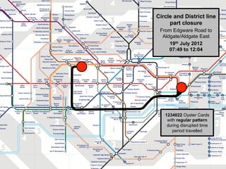
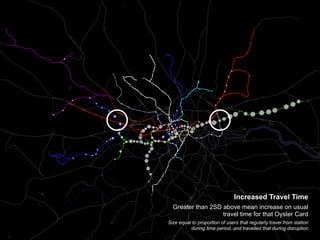
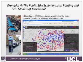
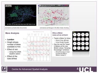
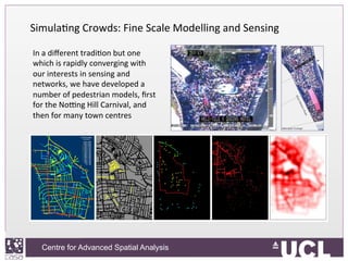
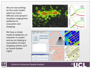
The Centre for Advanced Spatial Analysis at University College London conducts research on urban modelling and simulation. This includes developing integrated land use and transport models to forecast urban growth, an agent-based model of mobility in London, and analyzing big data sources like smart card taps and bike sharing data. The group is also involved in projects on the science of cities, using techniques like percolation theory and network analysis to study city structure and growth patterns.