Download to read offline

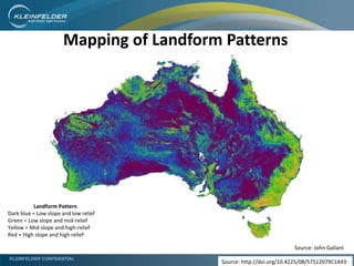
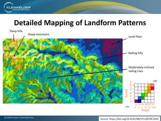
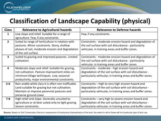
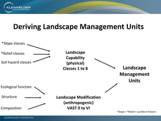
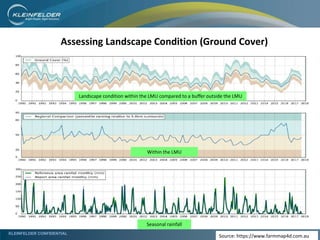
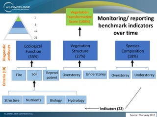
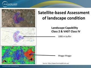
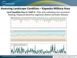
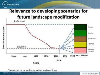
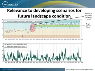

This document presents a nationally consistent method for monitoring and reporting landscape condition on defence lands. It defines key concepts like landscape capability and modification. It describes mapping landform patterns and landscape modification classes. A case study demonstrates assessing landscape condition at Kapooka Military Area using landscape management units, remote sensing, and criteria/indicators of ecological function. The methodology allows evaluating changes in landscape condition over time to inform land management practices and ensure defence land remains suitable for purpose.


