Rapid Sensor Data Modeling
•Download as PPTX, PDF•
0 likes•406 views

2014 Ocean Exchange Registrant

Recommended
Recommended
More Related Content
What's hot
What's hot (17)
Similar to Rapid Sensor Data Modeling
Similar to Rapid Sensor Data Modeling (20)
More from Alys Spillman
More from Alys Spillman (20)
Recently uploaded
Recently uploaded (20)
Rapid Sensor Data Modeling
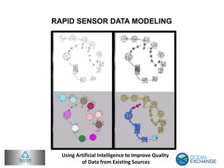
- 1. RAPID SENSOR DATA MODELING Using Artificial Intelligence to Improve Quality of Data from Existing Sources
- 2. RAPID SENSOR DATA MODELING The problem of sensor-based datastreams from oceanographic data has computational features, making it a ripe target for application of new Artificial Intelligence technology. Realtime data streams, as measured from a group of collection sensors like these buoys, have systemic and unique problems in their analysis. In short, it is difficult to continuously and autonomously refine models and predictions while simultaneously correcting for biases on individual “no- two-are-exactly- alike” physical sensors. A system which could automatically highlight troublesome areas of interest and highlight potentially problematic measurements would speed the rate of research in this field, and quickly surmise critical data patterns for end users to make decisions and/or identify paths of action from the data.
- 3. Iterati Technologies is a company which specializes in addressing these type of “big data, quick decision” problems through the use of cutting-edge artificial intelligence techniques. The implementation of these techniques is intended to be useful across a wide swath of environmentally relevant applications which rely on data streams. The ability to take a large amount of sensor data, rapidly model it in this fashion, and present areas of interest/anomaly, has the following applications: - Short term prediction based on up-to-date information - Systemic correction for biases of individual sensors - Ease of merging disparate data into singular prediction - Rapid identification of anomalous events
- 4. To learn more about this and other innovative solutions Go to OceanExchange(dot)Org Iterati Technologies proposes a cloud-based approach, backed by already-deployed data collection systems, to highlight areas of problems and research for use by the oceanographic community. The application of rapid AI models and software is intended to augment the abilities of individual researchers, and corporate actuary teams, to inevitably guide research and analysis in the direction of current ocean problems. Doing so will also increase the reliability of sensor data and allow for the creation of enhanced models of specific areas. In brief, such a system will increase the usefulness of the already-available network of collection systems.