Development Plan- Planning Intervention by School of Planning and Architecture (SPA Vijayawada)
•Download as PPTX, PDF•
3 likes•2,391 views

This presentation was given by SPA Vijayawada for "Samavesh" - XVl Annual NOSPlan Convention. The Theme of Presentation - "Accessibility in Peri-urban area" case study of Vijayawada Zonal Development Plan".

Recommended
Recommended
More Related Content
Viewers also liked
Viewers also liked (19)
More from NOSPlan - National Organisation of Students of Planning
More from NOSPlan - National Organisation of Students of Planning (19)
Recently uploaded
Recently uploaded (20)
Development Plan- Planning Intervention by School of Planning and Architecture (SPA Vijayawada)
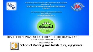
- 1. • DEVELOPMENT PLAN: ACCESSIBILITY TO PERI-URBAN AREAS (Zonal Development Plan Vijayawada) Presentation By School of Planning and Architecture, Vijayawada
- 2. Master Plan Provision Zonal Development Plan Vijayawada Contents 1) Zonal Development Plan 2) Vijayawada and Peri-urban Area 3) Case study 4) Public transportation 5) Problems and Proposal Submitted By:- School of Planning and Architecture, Vijayawada
- 3. Zonal Development Plan 1 KM Gollapudi Zone Vijayawada Zone Kanuru Zone Andhra Pradesh Urban Areas (Development) Act,1975 Vijayawada Guntur Tenali Mangalgiri Urban Development Authority (VGTM UDA) Zonal Development Plan (2004-2024) Land-use plans for peri-urban area and development area. Source:- Google earth image and ZDP Vijayawada, Kanuru and Gollapudi Year 2001 2010 2021 2025 Population (In Thousand) 845 1438 1640 2545 Source:- VGTM UDA ZDP, Global Cities of Future (Mckinsey 2010)
- 4. Vijayawada Settlement growth and Peri-urban area Map Not to Scale Source:- Google earth image and ZDP Vijayawada, Kanuru and Gollapudi • The inmigration to the city (VMC) has suddenly declined to 2% of cities population in 1991-2001 • 1971-81 (12%) • 1981-1991 (17%) Late 1850’s 1890’s 1920’s 1960’s 1980’s 2001- Railway line Canal N Kanuru Gollapudi
- 5. Case Study: Kanuru • Improper monitoring of Land-use 0 0.5 1 1.5 2 2.5 3 3.5 4 Primary Healthcare center Recrational area Public utilities offices Educational Institute Market Kanuru (Distance traveled) • No PHC Planned for population of 60000 • 73 % Population is literate (as per 2001 Census),Highest education level is High-school (45%). • 76 % HH has income of Rs. 2000-5000. • 28 % people use cycle as mode of transport. 49% 24% 27% 30% 2% 68% KANURU OCCUPATION PATTERN Primary Secondary Tertiary Source:- Primary Survey 2012 Source:- Google map ( Timeline 2007 and 2014) 1991 2001 Year 2007Year 2014
- 6. Case Study: Gollapudi 0 0.2 0.4 0.6 0.8 1 1.2 1.4 1.6 1.8 2 Primary Healthcare center Recrational area Public utilities offices Educational Institute Market Gollapudi (Distance traveled) • 52 % Population is literate (as per 2001 Census), Highest education level is Highschool (45%). • 69 % HH has income of Rs. 2000-5000. • 34 % people use cycle as mode of transport. • Improper monitoring of Land-use. • No public utilities office in area. 69% 8% 23% 57% 4% 39% GOLLAPUDI OCCUPATION PATTERN Primary Secondary Tertiary Source:- Primary Survey 2012 Source:- Google map ( Timeline 2007 and 2014) 1991 2001 Year 2007Year 2014
- 7. Connectivity with Public Transport Peri-urban areas are well connected with public transportation but frequency of buses varies. Bus Route APSRTC Buses has good connectivity with Vijayawada and its Peri- Urban area. Bus stop Coverage Major Activity Centre Kamayathopu Bustop, Kanuru Kanuru Bustop, Kanuru Bustop, near Kanuru Lake
- 8. Problems and Proposal • Both case study area has change in occupation pattern. More people working in tertiary sector. • More than 50% mode of transport in both case study area is NMT. • No preference was given to cyclist or walking person. Infrastructure related to public transportation is in poor condition in peri-urban areas. • Because of zonal development plan, focus was given to peri-urban area too. • Public transportation has good connectivity for city and peri-urban area but has problem related to frequency in some areas. • Desire pattern of motorized goods vehicle consist 51% share of External to External (2001 primary survey), need of outer ring road connecting other peri-urban areas and avoiding major urban areas like Vijayawada, Guntur in Region. • Goods traffic cause delays in peak hours on arterial and sub arterial roads. Source:- Andhra nation, wordpress.