Intertech masterplan presentation.pdf
•
0 likes•13 views

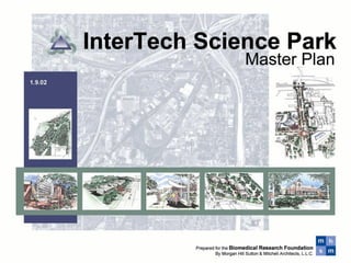
Slide presentation of the Intertech Science Park Plan

Recommended
More Related Content
Similar to Intertech masterplan presentation.pdf
Similar to Intertech masterplan presentation.pdf (20)
More from Kim Mitchell
More from Kim Mitchell (20)
Recently uploaded
Recently uploaded (20)
Intertech masterplan presentation.pdf
- 2. InterTech Science Park Portland San Francisco Palo Alto Southern California Dallas Austin Houston Colorado Springs Chicago Birmingham Research Triangle Maryland/ Washington D.C./ Virginia New York/ New Jersey Boston Montreal New Orleans Philadelphia You don’t need an M.I.T. or Stanford
- 3. Barksdale AFB Shreveport Regional Airport InterTech Science Park Central Business District Downtown Airport I-220 Port of Shreveport / Bossier Shreveport Bossier Transportation InterTech Science Park is well served by transportation
- 4. InterTech Partner Neighborhoods InterTech “hub and spoke” relationship to surrounding inner city neighborhoods 1 2 3 4 5 6 7 8 9 10 1 Queensborough 2 Lakeside & Allendale 3 Martin Luther King 4 Shreveport’s Historic Music Village 5 Stoner Hill 6 Highland and South Highland 7 Hollywood and Cedar Grove 8 Ingleside and Caddo Heights 9 Werner Park 10 Mooretown InterTech Science Park
- 5. Doctors Hospital Northwestern School of Nursing Biomedical Research Foundation Shriner's Hospital InterTech Science Park
- 6. 200 Acres 120 Acres 100 Acres 170 Acres 160 Acres InterTech Development Areas 25-Year Buildout: ➢ $500M constr. ➢ 6,000 tech jobs ➢ $225M annual payroll ➢ $16.5M taxes
- 7. 400’ Master Plan Kings Highway I-49 Claiborne Dalzell Southern Avenue Mansfield Linwood LSUHSC Shriners Post Office Fed Ex Proposed UPS Samford • “Vision Plan” • 20 to 25 year Redevelopment • Greater role of BRF in land assembly • Shared parking • Shared retention • LSUHSC master plan The Vision is a campus of technology commercial clusters and various character zones
- 8. 400’ Development Land Use Kings Highway I-49 Claiborne Dalzell Southern Avenue LSUHSC Shriners Post Office Fed Ex Proposed UPS Samford Tech Commercial Hotel / Mixed Use / Conference Residential (25+ units / acre) Live Work two & three story Buildings front streets with generous landscape or as a pedestrian oriented urban village
- 9. InterTech Plan Guiding Principals Inventing the Future • Campus Environment • Identity – strong gateways, street corridors & edges • Range of housing choices • Mix of uses – tech clusters, urban village, commercial centers & residential neighborhoods • Compact Development Patterns – density & diversity •Alternative modes of transportation • Shared drainage detention / retention features • Shared & unobtrusive parking • Quality open space amenities & pedestrian preference • Nurture connections & collaborations
- 10. •Existing bus routes •Proposed shuttle routes •Proposed cross-town bus route •Proposed initial bus route •Long term light rail to CBD •Bus stops and shelters •Light rail stop and bus stop •Mini transfer terminal Green space & pedestrian pathway development Public Transportation Plan Custom bus shelters are an element of defining InterTech as a Science Park Proposed shelters Kings Highway Claiborne Dalzell Southern Avenue Mansfield Mall St. Vincent
- 11. The listed capacities for locations A.-L. are approximate and should serve as a guide for project detention design. Recommended detention capacity for a 100 year flood for drainage area 1 is 122,900 cubic yards. Recommendations for area 2 have not been developed. Drainage Detention Plan Drainage Area 1 Drainage Area 2 A B C D E F G H J K A. 6,000 cubic yards (water level 222.5, capacity to 226) B. 97,000 cubic yards (water level 200, capacity to 209) C. 12,000 cubic yards (5 ft. avg. depth) D. 4,000 cubic yards (6 ft. avg. depth) E. 10,000 cubic yards (5 ft. avg. depth) F. 3,000 cubic yards (5 ft. avg. depth) 132,000 c.y. total L Drainage Area 1 Drainage Area 2 G. 14,000 cubic yards (4 ft. avg. depth) H. 5,500 cubic yards (5 ft. avg. depth) J. 10,000 cubic yards (5 ft. avg. depth) K. 5,000 cubic yards (3 ft. avg. depth) L. 10,000 cubic yards (4 ft. avg. depth) 44,500 c.y. total Kings Highway Claiborne Dalzell Southern Avenue Samford Mansfield Section 400’ Elev. 208’ Elev. 200’ North South Section Detention / Retention B
- 12. Existing Streetscape Pattern Parking Buildings Street Urban Village Streetscape Pattern Village Streetscape Option Buildings Streetscape Parking configuration Technology Cluster streetscape Pattern Buildings Landscape amenity Streetscape Parking configuration Service not visible from street Streetscape Concepts Cluster and village patterns: more inviting, less congested & greater development intensity
- 13. Flood Plains
- 15. Kings Highway Tech Center Plaza B.T.I. BioSpaces Detention / Retention Pond Tech Village Phase1: The First Ten Years
- 16. Phase 1: Tech Center 10-Yr Buildout Impact ➢ 19 technology buildings ➢ 180 room business conference hotel ➢ 60,000 SF support retail ➢ 200 units residential housing ➢ Kings Highway landscaped boulevard ➢ $175M total construction ➢ $5M annual property, sales & occupancy tax ➢ 2,000 jobs with $76M annual payroll
- 17. Phased Development Strategy Phase 1 – The first 5 years – 2002 to 2007 400’ Kings Highway Claiborne Dalzell Southern Avenue LSUHSC Shriners Post Office Fed Ex Samford Initial Tech Commercial Development focus Mansfield Linwood 1 2 Property acquisition during first five years Development Opportunity Infrastructure improvements during the first five years 1 2 Proposed UPS (or other InterTech Location)
- 18. 400’ Kings Highway Claiborne Linwood Dalzell Southern Avenue LSUHSC Shriners Post Office Fed Ex Samford Mansfield Phased Development Strategy Phase 2 –The second 5 years - 2007 to 2012 Development during the second five years Property acquisition during first ten years Infrastructure improvements during the second five years 1 1 Proposed UPS (or other InterTech Location) 2 2 Kings Highway improvements could be included in phase 1
- 19. Mansfield and Kings Highway Cluster LSUHSC Phase 1: Tech Center Plaza
- 20. Phase 1: Tech Village • Business Hotel, Retail, & Residential
- 21. Landscape and retention pond amenities increase the number of desirable development sites Linwood and LSUHSC recurring storm water flooding – photos from April 1997
- 23. Mansfield to Hearne Linwood to Mansfield Samford to Linwood Kings Highway - Proposed Improvements
- 24. Gateway at I-49 and Kings Highway
- 26. m m s h Kings Highway – Streetscape Section Boulevard Plan Paver crosswalks Landscaped median Pedestrian scale lighting – 150’ spacing Street Lighting in median – 150‘ spacing Wide walks (15’ to 20’) at intense development Landscaping and pedestrian amenities at intersections Paver or patterned concrete intersections Custom traffic signals and public signage
- 27. Section Streetscape Plan Custom Bus shelters Landscape – street trees scheduled for primary and secondary corridors- spacing and groupings vary- trees located behind business signage zone Pedestrian scale lighting – 150’ spacing Business signage location zone- See sample sign standard Street Lighting– 150‘ spacing 5 to 6’ wide walks at campus cluster development Landscaping and pedestrian amenities at intersections Paver or patterned concrete intersections Custom traffic signals and public signage m m s h Kings Highway – Streetscape
- 28. I-49 Shriner’s Hospital LSUHSC Suggested development intensity Proposed drainage improvements m m s h Kings Highway I-49 to Linwood Proposed improvements Morgan, Hill, Sutton, & Mitchell 1-10-01
- 29. A Mixed-Use Development Project © Morgan Hill Sutton & Mitchell • Architects, LLC Architecture • Interior Design • Planning 11.30.01
- 30. Site A Alternate site B Proposal for Site A A B Kings Highway at Linwood Mixed Use Development Proposed Scenarios Proposal for Site B © 12.10.10
- 31. Parking & Mixed Use Parking & Mixed Use Potential campus expansion Potential campus expansion Kings Highway Kings Highway Linwood Linwood Potential campus expansion LSUHSC LSUHSC Kings Highway at Linwood Mixed Use Development Proposed Scenarios LSUHSC Potential Campus Expansion served by Mixed-Use Facilities © 12.10.10 A B