CHSurvey introduce
•Download as PPTX, PDF•
1 like•862 views

Very good slide for introduce a company

Recommended
Recommended
More Related Content
What's hot
What's hot (20)
Viewers also liked
Viewers also liked (18)
Similar to CHSurvey introduce
Similar to CHSurvey introduce (20)
Recently uploaded
Recently uploaded (20)
CHSurvey introduce
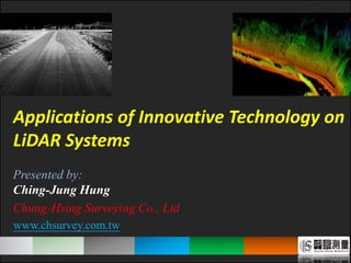
- 1. 1 Presented by: Ching-Jung Hung Chung-Hsing Surveying Co., Ltd www.chsurvey.com.tw Applications of Innovative Technology on LiDAR Systems 1
- 3. 3 3 Initial (Local Project) Stable (Region Project) Growthful (National Project) Innovative (Global Project) 1969 1991 2001 2011 Founded in Taichung, Taiwan Since July, 1969 The first private surveying company in Taiwan 6 departments, 82 employees
- 4. 4 4 General Manager Planning Office General Consultant Project department Quality Control department Engineering department LiDAR System department General Affairs department Photogrammetry department - GPS control points - Precise leveling - Gravimetric surveying Control Surveying - Digital terrain surveying - Cadastral surveying - Engineering surveying - Urban planning surveying - Hydrographic Surveying Application Surveying - Terrestrial LiDAR Syetem - Mobile LiDAR Syetem - Airborne LiDAR Syetem - Hyperspectral Innovative Surveying
- 7. 7 7 - 40 Trimble GNSS receivers GNSS control surveying - Imported and Adopted GPS in 1992 (first company in Taiwan) GPS tracking station Geodetic control points
- 8. 8 8 - 90% Work at night Precise leveling - Establised TWVD2001 (4500km,5years) Precise levelingDatum bench-mark Leveling network
- 9. 9 9 Gravimetric surveying - Gravity control network since 2003 (the only compamy) - Surface and Marine Gravity Gravity networkSurface Gravimetric surveyingMarine Gravimetric surveying
- 11. 11 11 Terrestrial LiDAR System TLS System - Manufacturer: Zoller + Fröhlich (Z+F) - System: Z+F IMAGER 5010 - Range measurment way: Phase Lasers scanner Accuracy (Range is 50m) - Laser rep rate: up to 1000 kHz (Most pts/s) - Range: 187.3m - 37% reflectivity : ± 1.2mm - 80% reflectivity : ± 0.8mm Scanned by traditional TLS(Pluse) Scanned by Z+F 5010 (Phase)
- 12. 12 12 X2 X1 Z+F Imager 5006ex - explosion proof
- 13. 13 13 Oil groove City modeling Factory building Historic sites preservation Tunnel detection
- 14. 14 Scanner list 3D mode 2D point cloud modeScanner location
- 15. 15 1. draw ascending pipeline (in 2D mode) 2. LFM select the appropriate diameter 3. Result show in 3D mode
- 16. 16
- 17. 17 • There are two ways to check result. 17 2. Put 3D point cloud to model 1. Put model to 2D point cloud
- 18. 18 - *.mac(PDMS) - *.dwg(AutoCAD)、 - *.dgn(MicroStation) - other format Convert model to *.mac Convert model to *.dwg
- 19. 19 19
- 20. 20 20
- 21. 2121 MLS System - Manufacturer: Optech - System: Lynx M1 - Components : 2 Laser scaners , 4 cameras 2 GNSS receivers Lasers scanner - Laser rep rate: up to 500 kHz each(Most pts/s) - Frequence: 80Hz-200Hz - Range: 200m @ 20% reflectivity Accuracy - Range accuracy : ± 8mm (1 sigma) - Point accruacy : ± 5cm (1 sigma) CAMERA(S) Adjustable
- 22. 22 ALS System - Manufacturer: Optech - System: ALTM 3070 (first ALS in Taiwan, 2003) ALTM Pegasus (in 2011) 22ALTM 3070 ALTM Pegasus Track Record Scanned area
- 23. 23 23 Hyperspectral System - Manufacturer: ITRES - System: CASI1500 (first commerical and airborne Hyperspectral) Imager - FOV: 40 degrees - Pixel Size: 20*20 microns - Spectral Range: 380-1500 mm - Spectral Channels: Up to 288 bands
- 24. 2424 Initial (Local Project) Stable (Region Project) Growthful (National Project) Innovative (Global Project) 1969 1991 2001 2011 First private surveying company(1969) First imported Adopted GPS(1992) First Airborne LiDAR System(2003) First commercial Hyperspectral (2011)
- 25. 25 Chung-Hsing Surveying Co., Ltd. No. 159, Zhongren St. West Dist., Taichung City 40355 Taiwan (R.O.C) Tel +886-4-22242788 Fox +886-4-22242168 E-mail chs@chsurvey.com.tw Web http://www.chsurvey.com.tw/index.html Q & A
Editor's Notes
- Good afternoon. Ladies and gentlemen. Thank you very much for your visiting. It is my pleasure to introduce Chung-Hsing Surveying (CHS) company today. First, let me introduce myself. My name is ching jung hung, is the engineer in CHS. Today I will introduce our innovative technology on LiDAR System.
- I’d like to start this presentation by introducing CHS, just as this shows, And the abbreviation CHS also represents Certificated, honesty and Service. We staff always provide excellent service with our (加個形容詞) certificated and (加個形容詞) honesty.
- If you want to know where we are, just google it. Chung Hsing Surveying was founded in Taichung in July, 1969, We were the first private surveying company in Taiwan. During the past 40 years, our history can divide into four stages, from initial stage, stable stage, Growth stage and innovative stage. Now, It’s innovative time. Currently, we already have 6 departments and 82 employees in our company.
- Here shows our organization chart. There are six departments, including General Affairs , Project , LiDAR System , Engineering , Photogrammetr, Quality Control department. We will take you look around after this presentation. With the comprehensive departments, we can provide widely range of services, such as control surveying, Application Surveying and innovative Surveying.
- And CHS totally has three offices in Taichung. Just like the map shows. So, if time is permitted, we will move to the LiDAR office to see our Terrestrial LiDAR Syetem.
- Now, I will introduce our Services, start from Control survey. It contains GNSS control surveying, precise leveling and gravimetric surveying.
- In 1992, we were the first private surveying company that imported and adopted GPS. so far, we already have 40 Trimble GNSS receivers.
- And we established TaiWan Vertical Datumn 2001 (TWVD2001) for 5 years , total length is about 4500km. The marvelous things is that the 90% of surveying area was done at night.
- And we also did the gravity control network since 2003 . Including Surface and Marine Gravity.
- Now, Let us focus on the following innovative survey. TLS, MLS, ALS and Hyperspectral.
- First, Let me introduce our Terrestrial LiDAR Syetem Z+F Imager 5010, The range measurement is phase way, There are two pictures that show the difference between phase and pluse way. We find that phase way has higher point density and resolusions. If we have the opportunity to get the project, we will use the phase way system to do this. Besides, It‘s Laser rep rate up to 1000 khz which is the most points per second in the current instrument.
- So far, there are two Z+F 5010 and one rigel vz1000 in our company. Or, For the safety reason, we can use Z+F Imager 5006ex which is the explosion proof 3D laser scanner.
- So, we use the Z+F 5010 to detect variation of oil groove, build city model and factory model, Preserve the historic sites and detect the crack , leak , repair and spall or other information of tunnel.
- In the Factory building, we use LFM software. The software interface like this ppt shows, including…
- In LFM, first we draw pipeline from point cloud. And select the appropriate diameter from LEM according to point cloud. Result show in 3D mode like this.
- Here shows the achievement.
- And we can convert the modeling pipeline data to - *.mac(PDMS)、 *.dwg(AutoCAD) 、*.dgn(MicroStation) or other format .
- And then, I introduce our Mobile LiDAR System, Lynx M1. (Lynx M1 equips 2Laser scanners, 4cameras, 2GNSS receivers. All the equipment are adjustable) It’s Laser rep rate up to 500 kHz for each which is also the most points per second in the cruuent MLS. The point accuracy reaches 5cm.
- Next introduce our ALS, In 2003, we imported the first ALS (ALTM3070) in Taiwan. In order to provide more services with high accuracy, we imported another high performance ALS (ALTM Pegasus) in 2011. So far, we have already provided ALS services for more than 10 years, Scanned area over 15000 square kilometers shows in this photograph (grid area),
- Final introduce our Hyperspectral system, CASI1500 which is first commerical and airborne Hyperspectral in Taiwan. Spectral Range is from 380 to 1500 mm. Spectral Channels: Up to 288 bands.
- Finally, I would like to end this presentation by recapping our history. In 1969, we were the first surveying private company. In 1992, Chung Hsing Surveying was the first that imported and Adopted GPS. In 2001, Chung Hsing Surveying was the first that imported ALS. In 2011, Chung Hsing Surveying was still the first that imported airborne and commercial Hyperspectral. So, we are proud that we have always been on the leading edge of surveying field from then on. Now, we force on integrating multi-source LiDAR and imager to provide more services and higher accuracy.
- Finally shows combination ALS with aerial photogrammetry to produce 3D emulation model. Thank you for your listening.