SlideShare a Scribd company logo
1 of 431
Download to read offline
The Geology of Somalia: a Selected Bibliography of Somalian
Geology, Geography and Earth Science.
AD
By R. Lee Hadden
Topographic Engineering Center February 2007
US Army Corps of Engineers
7701 Telegraph Road
Alexandria, Virginia 22315
UNCLASSIFIED / UNLIMITED
Bibliography of Liberian Earth Science
R. L. Hadden 3/13/2007 2
REPORT DOCUMENTATION PAGE
Public reporting burden for this collection of information is estimated to average 1 hour per response, including the time for reviewing instructions, searching existing data sources,
gathering and maintaining the data needed, and completing and reviewing this collection of information. Send comments regarding this burden estimate or any other aspect of this
collection of information, including suggestions for reducing this burden to Department of Defense, Washington Headquarters Services, Directorate for Information Operations and
Reports (0704-0188), 1215 Jefferson Davis Highway, Suite 1204, Arlington, VA 22202-4302. Respondents should be aware that notwithstanding any other provision of law, no person
shall be subject to any penalty for failing to comply with a collection of information if it does not display a currently valid OMB control number. PLEASE DO NOT RETURN YOUR FORM
TO THE ABOVE ADDRESS.
1. REPORT DATE 02-2007 2. REPORT TYPE: Bibliography
4. TITLE AND SUBTITLE: The Geology of Somalia: a Selected
Bibliography of Somalian Geology, Geography and Earth Science.
6. AUTHOR(S) HADDEN, Robert Lee
7. PERFORMING ORGANIZATION NAME(S) AND ADDRESS(ES)
US Army Corps of
Engineers
Topographic Engineering
Center
ATTN CEERD TO I
7701 Telegraph Road
Alexandria, VA 22315-3864
9. SPONSORING / MONITORING AGENCY NAME(S) AND ADDRESS(ES)
Geospatial Information 7701 Telegraph Road
Library (GIL) Alexandria, VA 22315-3864
12. DISTRIBUTION / AVAILABILITY STATEMENT
Unclassified/Unlimited
13. SUPPLEMENTARY NOTES:
14. ABSTRACT
This bibliography on the geographical, water and geological information of
Somalia was begun to fill a request for current information on that war torn
state. This bibliography brings together selected citations from a variety of
different cartographic, geographical, geological and hydrological resources
and a number of specialized library collections. Most of the citations have
location information on where these items can be located and either used on
site, or borrowed through inter-library loan, or where copies of the items
can be purchased from the originating source, or through commercial document
delivery services.
15. SUBJECT TERMS: Somalia. Agriculture. Climate. Drainage. Earth Sciences.
Economy. Energy. Forests. Geology. Geography. Groundwater. Hydrology. Maps.
Mining. Rivers. Soils. Surface-water. Terrain. Topography. Transportation.
Vegetation Water Wells
16. SECURITY CLASSIFICATION OF:
Unclassified
17. LIMITATION
OF ABSTRACT
18.
NUMBER
a.
REPORT
b. ABSTRACT c. THIS PAGE Unlimited
404
Somalian Earth Sciences
Engineering Research and Development Center 1
Introduction
This bibliography on the geology, geography and earth sciences of Somalia was
gathered from a variety of different abstracting, bibliographical and cartographical
resources. They include citations from agriculture, botany, engineering, geology,
geography, medical, military science, soils, transportation and other subject resources.
These citation resources are provided by a number of scientific societies, such as the
American Geographical Society; from government resources, such as the Defense
Technical Information Center; non-governmental organizations such as the United
Nation’s Food and Agricultural Organization (FAO); and from commercial databanks
such as GeoRef, WorldCat and GeoBase. Many unique citations were collected from the
catalogs and resources of major research libraries, such as the Library of Congress and
the US Geological Survey Library.
Within this bibliography, the article retrieval information is given as much as
possible. These include specific ISSN, ISBN, OCLC and Library of Congress numbers
that allow the electronic borrowing or copying of these items through library networks.
Alternately, the citations also include information on acquiring these items through
document delivery companies and commercial services. Very often, scientific
publications in less developed countries are not published in large numbers, and it is very
difficult to retrieve reports or maps more than even a few years old. This bibliography is
intended to be a resource for those scientific citations on Somalia that can still be
retrieved.
Within these citations are many variations in spelling and place names. Many
scientific and cartographic investigations were done in Cushitic, European and Semitic
languages, such as Arabic, English, French, Italian and Somali. Thus, the same name may
be spelled differently according to the language(s) used. Variations on single and doubled
consonants (geminated consonants) and single and doubled vowels (diphthongs) are
common. Mogadisco, Mogadiscio, Mogadishu, Mogadischu and Muqdisho are all
variations on the name of the capital city. The river Juba can be spelled Jubba, Juba,
Giuba, etc., according to the language used, as can the port city of Chisimaio, Chisimayo,
Kismayo, Kisimayo, Kisymao, etc. So any search for authors, place names and locations
in this bibliography should take into account spelling variations.
Abbreviations and links to resources used:
(All links and URLs in this bibliography are current as of January 2007)
AGI: American Geological Institute, Alexandria, VA. See: www.agiweb.org
AGS: American Geographical Society Library, University of Wisconsin,
Milwaukee Campus. See: http://www.amergeog.org
AS&T: Applied Science & Technology from H.W. Wilson is a bibliographic
database that indexes articles of at least one column in length. English-language
periodicals published in the United States and elsewhere are covered; non-English
language articles are included if English abstracts are provided. Periodical coverage
includes trade and industrial publications, journals issued by professional and technical
societies, and specialized subject periodicals, as well as special issues such as buyers'
guides, directories, and conference proceedings. See:
http://www.hwwilson.com/Databases/applieds.htm#Abstracts
Somalian Earth Sciences
Engineering Research and Development Center 2
ASFA: Aquatic Sciences and Fisheries Abstracts Input to ASFA is provided by a
growing international network of information centers monitoring more than 5,000 serial
publications, books, reports, conference proceedings, translations, and limited
distribution literature. ASFA is a component of the Aquatic Sciences and Fisheries
Information System (ASFIS), formed by four United Nations agency sponsors of ASFA
and a network of international and national partners. Aquatic Sciences and Fisheries
Abstracts are produced by CSA under contract to FAO. See: http://www.csa.com/
British Library: The British Library Document Supply Service can supply many
of the article citations and reports given in this bibliography, especially those maps and
other materials owned by the British Library. See:
http://www.bl.uk/services/document/dsc.html
CISTI: Canada Institute of Scientific and Technical Information. This is a
Canadian document supply service for scientific and technical literature. “Through
Global Service, CISTI can obtain any document for you, from anywhere in the world.
Most documents are supplied within four weeks. You can specify the level of service you
prefer at the time of ordering by choosing the appropriate line from the drop down menu
on any of the CISTI order forms.” See: http://cisti-icist.nrc-cnrc.gc.ca/
CSA Technology Research Database: This comprehensive database provides a
single mega-file of all the unique records available through its 3 components: the CSA
Materials Research Database with METADEX, CSA High Technology Research
Database with Aerospace, and the CSA Engineering Research Database. The database
content represents the most comprehensive and current coverage of the relevant serial and
non-serial literature available. Sources covered include over 4,000 periodicals,
conference proceedings, technical reports, trade journal/newsletter items, patents, books,
and press releases. See: http://www.csa.com/
DTIC: Defense Technical Information Center, Alexandria, VA. See:
www.dtic.mil
ESPM: The CSA Environmental Sciences and Pollution Management database
offers access to the international literature in the environmental sciences. Abstracts and
citations are drawn from over 6000 serials including scientific journals, conference
proceedings, reports, monographs, books and government publications. See:
http://www.csa.com/
FAO: Food and Agriculture Organization Library, United Nations, Rome, Italy.
See: www.fao.org
GeoBase: GEOBASE is a unique multidisciplinary database supplying
bibliographic information and abstracts for development studies, the Earth sciences,
ecology, geomechanics, human geography, and oceanography. The database provides
current coverage of almost 2,000 international journals, including both peer-reviewed
titles and trade publications, and provides archival coverage of several thousand
additional journal titles and books. GEOBASE is unequalled in its coverage of
international literature of the core scientific and technical periodicals. Papers are selected,
read, and classified using a unique classification scheme that is versatile and updated
annually to adapt coverage to current research trends. The material covered includes
refereed scientific papers; trade journal and magazine articles, product reviews,
directories and any other relevant material. GEOBASE has a unique coverage of non-
English language and less readily available publications including books, conference
Somalian Earth Sciences
Engineering Research and Development Center 3
proceedings and reports, making this the best resource available for multidisciplinary
searches of international literature. The content crosses over subject, language, and
cultural boundaries, providing a unique research tool to users. All material in GEOBASE
is also available as print in the following Elsevier/Geo Abstracts journals: Geographical
Abstracts, Physical Geography, Human Geography, Geological Abstracts, Ecological
Abstracts, International Development Abstracts and Oceanographic Literature Review,
Geomechanics Abstracts. See: www.elsevier.com
GeoRef: American Geological Institute, Alexandria, VA. The American
Geological Institute not only identified materials for the abstracting database, GeoRef,
but also locates and supplies materials as a document delivery service. See:
www.agiweb.org
ISBN: International Standard Book Number. This unique number can be used to
identify and locate library holdings of a particular book or report title. See:
http://www.isbn.org/standards/home/index.asp
ISSN: International Standard Serial Number. This unique number can be used to
locate libraries which have subscriptions to this journal, magazine or serial. See:
http://www.issn.org/
Library of Congress Control Number – LCCN: This is a unique number applied
by the Library of Congress to identify individual publications. This number can be used
to identify copies of this item in libraries held in the US and abroad. See:
http://www.loc.gov/marc/lccn_structure.html
LC or LOC: Library of Congress, Geography and Map Division, Washington,
DC. The Geography and Map Division has the largest collection in the world, with 5.4
million maps, 75,000 atlases, 500 globes, 3,000 three-dimensional objects and thousands
of digital files. Recently, the Library of Congress has digitally scanned and mounted its
10,000th
map online. See: http://www.loc.gov/rr/geogmap/
Linda Hall Library: “Our Document Delivery Services Department allows
students, researchers, and businesses to request copies of journal articles, conference
proceedings, historical documents, or many other documents housed at the Linda Hall
Library. We are committed to filling every in-scope, properly cited request within 24-48
hours. Requests are processed during the local working hours of 8 am – 5 pm, U. S.
Central Time, Monday through Friday. Our fee is a cost recovery fee intended to support
a strong collection and dedicated services.” See:
http://www.lhl.lib.mo.us/services/document_delivery/index.shtml
Northwestern University Transportation Library: The Transportation Library was
founded in 1958 to support the curricula and research programs of the Transportation
Center and the Center for Public Safety of Northwestern University, including the School
of Police Staff and Command. Containing over 400,000 items, the Transportation Library
of Northwestern University is one of the largest transportation information centers in the
world, encompassing information on all transportation modalities, including: air, rail,
highway, pipeline, water, urban transport and logistics. Its collection of environmental
impact statements is one of the most complete in the world. See:
http://www.library.northwestern.edu/transportation/
NTIS: National Technical Information Service, Alexandria, VA. See:
www.ntis.gov
OA: Oceanic Abstracts. For over 32 years, Oceanic Abstracts from Cambridge
Scientific Abstracts has been focused exclusively on worldwide technical literature
Somalian Earth Sciences
Engineering Research and Development Center 4
pertaining to the marine and brackish-water environment. The journal has long been
recognized as a leading source of information on topics relating to oceans. It focuses on
and is totally comprehensive in its coverage of marine biology and physical
oceanography, fisheries, aquaculture, non-living resources, meteorology and geology,
plus environmental, technological, and legislative topics. See:
http://www.csa.com/factsheets/oceanic-set-c.php
OCLC: Founded in 1967, OCLC Online Computer Library Center is a nonprofit,
membership, computer library service and research organization dedicated to the public
purposes of furthering access to the world's information and reducing information costs.
More than 41,555 libraries in 112 countries and territories around the world use OCLC
services to locate, acquire, catalog, lend and preserve library materials. Researchers,
students, faculty, scholars, professional librarians and other information seekers use
OCLC services to obtain bibliographic, abstract and full-text information when and
where they need it. See: http://www.oclc.org/
SWRA: Selected Water Resources Abstracts (1967-94). SWRA provides more
than 271,138 abstracts compiled by the Water Resources Scientific Information Center
(WRSIC) of the USGS. SWRA provides thorough coverage of worldwide technical
literature across the life, physical, and social-science aspects of water resources as well as
U.S. Government documents produced by the USGS's many research facilities. Records
are drawn from journals, monographs, conference proceedings, reports, court cases, and
other federal and state publications. SWRA, and now Water Resources Abstracts, are your
best sources for issues pertaining to groundwater, water quality, water planning, and
water law and rights.
TRIS: TRIS is a bibliographic database funded by sponsors of the Transportation
Research Board (TRB), primarily the state departments of transportation and selected
federal transportation agencies. TRIS Online is hosted by the National Transportation
Library under a cooperative agreement between the Bureau of Transportation Statistics
and TRB. See: http://ntlsearch.bts.gov/tris/index.do
UN: United Nations Library, New York, NY. See: www.un.org
USGS: US Geological Survey Library, Reston, VA. See: www.usgs.gov/library
University of Texas at Austin. Perry-Castañeda Library Map Collection: “Many
of these maps have been scanned and are available for downloading and other uses.” See:
http://www.lib.utexas.edu/maps/
WorldCat: Among other things, this a free database from OCLC showing local
library holdings of desired publications. See: http://www.worldcat.org/
Acknowledgements
The author also wants to acknowledge the help of Mr. Abdirahman S. Ali, a
native of Somalia, for his help in resolving some of the multi-lingual questions in this
bibliography and for his help in interpreting the cultural geography of Somalia.
Mr. Matt Marks and Mr. Willie Sayyad of Refworks.com has kindly provided the
bibliographer with a temporary subscription to their reference management software, and
this bibliography would have been much more difficult to produce without this valuable
resource. Refworks.com allowed the bibliographer to place the paper and electronic
citations from very different resources and different libraries into one large file, and to
allow for the automatic formatting and preparation of the bibliography. “RefWorks
Somalian Earth Sciences
Engineering Research and Development Center 5
supports hundreds of online databases and output styles covering a broad range of subject
areas. RefWorks collaborates with some of the world's most prestigious online
information service providers, including CSA Illumina, BioOne, EBSCOhost, Elsevier,
H.W. Wilson, ISI Web of Science, OCLC, Ovid and ProQuest, to name a few.” Their
support for this project is gratefully acknowledged. See: http://www.refworks.com/
Somalian Earth Sciences
Engineering Research and Development Center 6
Somalia1
Somalia (“Soomaaliya” in the Somali language2
; “As-Suumaal” in Arabic),
formerly known as the Somali Democratic Republic, is a coastal nation at the “Horn of
Africa” in East Africa. Somalia is shaped at an angle somewhat like the number “7”, and
this country is also called “The Horn of Africa” due to its shape somewhat like the horn
of a rhinoceros.
Somalia has about 637,540-637,657 square kilometers (estimates vary), of which
only 10,320 km² is covered with water, and the country is slightly smaller in land area
than the state of Texas.
Inland, Somalia has borders 58 kilometers long with the country of Djibouti to the
north; Ethiopia shares a border 1,626 km long with Somalia in the north and west, and in
the south and west, Kenya shares a border with Somalia of some 682 km.
Seaward, the country lies on the coast of the Gulf of Aden and the Indian Ocean,
and has a coastline of some 3,025 km. Somalia occupies a strategic location on Horn of
Africa along southern approaches to Bab el Mandeb and sea route through the Red Sea
and the Suez Canal. Somalia's long coastline has been of strategic and tactical importance
chiefly in permitting trade with the Middle East and the rest of East Africa. The
exploitation of the shore and the continental shelf for fishing and other purposes had
barely begun by the early 1990s. Sovereignty was claimed over territorial waters up to
200 nautical miles.
A generation ago, Somalia had an estimated population of around 8,591,000
people. However, population estimates are very difficult to verify because of the political
situation and the mostly nomadic nature of the Somalis. The last accurate census was
taken almost a generation ago in 1975. Currently, Somalia is believed to be one of the
fastest growing countries in Africa and the world. Recent population estimates from 2005
range greatly between 15 and 25 million inhabitants. About 60% of all Somalis are
nomadic or semi-nomadic pastoralists who raise cattle, camels, sheep, and goats. About
25% of the populations are settled farmers who live mainly in the fertile agricultural
region between the Juba and Shebelle rivers in southern Somalia. The remainder of the
population (15%-20%) is urban.
Because of the wars and conflict, Somalia has a large dispersed community, one
of the largest of the whole continent. There are over a million Somalis living outside of
Africa. This “Diaspora” adds stress to the society, since the Somali clan structure is
extremely important to their identity and way of life. Breaking the clan cohesion by
distance or displaced refugees induces stress on both the refugees and the family
members left behind. The US Department of State says on their website: “The status of
expatriate Somalis has been an important foreign and domestic issue. The Somali-
populated region of the Horn of Africa stretches from the Gulf of Tadjoura in modern-
day Djibouti through Dire Dawa, Ethiopia, and down to the coastal regions of southern
Kenya. Unlike many countries in Africa, the Somali nation extends beyond its national
1
This review of Somalia has been taken from a wide number of open source information, including the US
Department of State; the CIA Factbook; the American University’s Foreign Area Study, “Somalia, A
Country Study”; the US Geological Survey’s commodities reports, geological maps and other data; and
data acquired from various general reference sources such as soil maps, regional encyclopedias,
geographical gazetters and geological dictionaries.
2
“Soomaal” in Somali means “to milk,” as in “to milk a goat or to milk a camel.”
Somalian Earth Sciences
Engineering Research and Development Center 7
borders. Since gaining independence in 1960, the goal of Somali nationalism, also known
as Pan-Somalism, has been the unification of all Somali populations, forming a Greater
Somalia. This issue has been a major cause of past crises between Somalia and its
neighbors--Ethiopia, Kenya, and Djibouti.”3
Ethnic groups in the country include the Bajuni people who live in the coastal
settlements and islands south of Kismayo and are of East African Swahili origin. The
Bajuni people in Somalia speak Kibajuni and the Bravanese people speak Chimwiini.
Both of these languages are dialects of Swahili.
The Bravanese live in Brawa and are believed to be of mixed Arab, Portuguese
and other descent.
The Benadiri (Reer Hamar), are an urban people of East African Swahili origin
who live in cities in the “gobolka Benadir” coastal region.
The Bantu are agricultural workers who live along the Juba River.
Several thousand Arabs also live in Somalia, along with some hundreds of Indians
and Pakistanis.
A small population of people of Italian descent, which dated back to Somalia's
colonial era, began to emigrate following independence, and by the outbreak of war most
Italian Somalis had left the country.
Nearly all the inhabitants speak Somali, the official language of the country. The
Somali language is based on various dialects from the Mudug province. The Somali
language was not used extensively for writing until 1973, when a standard orthography
using the Latin alphabet was decreed by the Supreme Revolutionary Council (SRC).
Somali is now the language of instruction in schools, although there are few schools
operating today. Arabic, English, and Italian languages are also used extensively. Maay, a
language closely related to Somali, is spoken by the Rahanweyn.
Politically, Somalia is divided into 18 regions (singular “gobolka”; plural is
“gobollada”), and subdivided into districts. The regions are: Awdal; Bakool (Bakol);
Banaadir (Benadir); Bari; Bay; Galguduud (Galgudud); Gedo; Hiiraan (Hiran); Jubbada
Dhexe (Middle Jubba); Jubbada Hoose (Lower Jubba); Mudug; Nugaal (Nugal); Sanaag;
Shabeellaha Dhexe (Middle Shabelle); Shabeellaha Hoose (Lower Shabelle); Sool;
Togdheer (Togder) and Woqooyi Galbeed.
The northwestern area has declared its independence as the "Republic of
Somaliland"; the northeastern region of Puntland is a semi-autonomous state; and the
remaining southern portion is riddled with the struggles of rival factions.
In May of 1991, the major northern Somaliland clan, the “Isaqs,”declared an
independent Republic of Somaliland (Somali: Soomaaliland), that now includes the
administrative regions of Awdal, Woqooyi Galbeed, Togdheer, Sanaag, and Sool.
Although not recognized by any other government, this entity has maintained a stable
existence, aided by the overwhelming dominance of a ruling clan and economic
infrastructure left behind by British, Russian, and American military assistance programs.
According to the US Department of State, “The self-declared "Republic of Somaliland"
3
See: http://www.state.gov/r/pa/ei/bgn/2863.htm, “US Department of State, Background Note: Somalia,”
accessed January 10, 2007.
Somalian Earth Sciences
Engineering Research and Development Center 8
consists of a regional authority based in the city of Hargeisa, including a President, Vice
President, parliament, and cabinet officials.”4
Somaliland now covers roughly the region of the former British Somaliland
protectorate, an area of about 137,600 square kilometers (53,128 sq mi), which was also
briefly an independent country for about five days in 1960. Somaliland is bordered by
Ethiopia on the south, Djibouti on the west, the Gulf of Aden on the north, and the
autonomous region Puntland in Somalia on the east. The capital of Somaliland is
Hargeisa. The majority of the people are Sunni Moslems, and Somali and Arabic are the
languages used mostly, with English taught in the schools.
Yet another secession from Somalia took place in the northeastern region. The
regions of Bari, Nugaal, and northern Mudug now comprise a neighboring self-declared
autonomous state of Puntland. Puntland is centered on the capital, Garowe, in the Nugaal
Gobolka. Puntland has also made strides toward reconstructing a legitimate,
representative government, but has suffered some civil strife. Puntland disputes its border
with Somaliland as it also claims portions of eastern Sool and Sanaag.
In 1998 Puntland seceded and declared itself to be an autonomous state. This
semi-secession is apparently an attempt to reconstitute Somalia as a federation of semi-
autonomous states. Unlike neighboring Somaliland, Puntland does not seek outright
independence from Somalia. The self-proclaimed state took the name “Puntland” after
declaring "temporary" independence in 1998, with the intention that it would participate
in any Somali reconciliation to form a new central government. The name is derived from
the “Land of Punt” mentioned by ancient Egyptian sources, which is believed by some to
have existed in what is now Somalia.
A third secession occurred in 1998 with the declaration of the state of Jubaland.
The territory of Jubaland is now encompassed by the state of Southwestern Somalia and
its status is unclear. Jubaland (Somali: Jubbaland) or Juba Valley (Somali: Dooxada
Jubba), formerly Trans-Juba (Italian: Oltre Giuba), is the southwestern most part of
Somalia, on the far side of the Juba River (thus "Trans"-Juba), bordering on Kenya.
It has a total area of 87,000 km² (33,000 sq mi), and the main city is Kismayo, on
the coast near the mouth of the Juba. The area was mainly inhabited by the Ogaden
nomads sub clan with other Dir and Hawiye clans
Jubaland is divided among the administrative regions of Gedo, Middle Juba, and
Lower Juba and is technically part of the Transitional Government of Somalia. Despite
this, until recently the actual administration of Jubaland was carried out by the Juba
Valley Alliance led by Barre Adan Shire Hiiraale, also known as "Barre Hiiraale".
A fourth self-proclaimed entity led by the Rahanweyn Resistance Army (RRA)
was set up in 1999. This "temporary" secession was reasserted in 2002, leading to de
facto autonomy of Southwestern Somalia. The RRA had originally set up an autonomous
administration over the Bay and Bakool regions of south and central Somalia in 1999.
The central and southern areas of Somalia are flat, with an average altitude of less
than 180 metres (600 ft). South and west of the central area, extending to the Shabeelle
River, lays a plateau whose maximum elevation is 685 meters (2,250 feet). The
southwestern part of Somalia is largely savanna, or grassland. Only about 13 percent of
4
See also: http://www.state.gov/r/pa/ei/bgn/2863.htm The self-declared "Republic of Somaliland" consists
of a regional authority based in the city of Hargeisa, including a President, Vice President, parliament, and
cabinet officials.
Somalian Earth Sciences
Engineering Research and Development Center 9
the country is suitable for farming. The region between the Juba and Shabeelle Rivers is
low agricultural land, and the area that extends southwest of the Jubba River to Kenya is
low pastureland.
The Jubba and Shabeelle Rivers originate in Ethiopia and flow toward the Indian
Ocean. They provide water for irrigation but the rivers are not navigable by commercial
vessels. The Shabeelle, with a total length of 2,011 kilometers (1,250 miles), dries up
before reaching the ocean, but it is still the longest river in the country. Most of Somalia's
food crops are grown in the fertile region in the south between Somalia's two permanent
rivers, the Juba and the Webi Shabeelle. The amount of water in both rivers is highly
variable, depending on rainfall. In periods of heavy rainfall there are also a number of
seasonal streams, none of which can be used for irrigation or as dependable sources of
drinking water.
Despite its lengthy shoreline, Somalia has only one natural harbor, Berbera. There
is also a limited area around Baidoa that receives an average of 500–600 mm of rainfall
each year.
At present there are still many species of wildlife found throughout the country,
especially in the far southern part of the nation: small antelopes, a large variety of birds,
foxes, hyenas, leopards, lions, ostriches and warthogs. Unfortunately, many of the large
game mammals have been nearly wiped out: the giraffes, the hippopotami, the oryx, the
rhinoceri, zebras, and, above all, the elephants. The elephants are slaughtered chiefly by
ivory poachers. Some measures to protect the endangered animals have recently been
taken by creating a national wildlife reserve in the lower Shabeelle swamp region.
Soils
The types of soil vary according to climate and parent rock. The arid regions of
northeastern Somalia have mainly thin and infertile desert soils. The limestone plateaus
of the interfluvial area have fertile, dark gray to brown, calcareous residual soils that
provide good conditions for rain-fed agriculture. The most fertile soils in Somalia are
found on the alluvial plains of the Jubba and Shabeelle rivers. These deep vertisols (black
cotton soils) have a high water-retention capacity and are mainly used for irrigation
agriculture. Irrigated land in Somalia is between 1,800 km² and 2,000 sq km², according
to 1993 estimates.
There are also large areas of dark cracking clays (vertisols) in the southern part of
Somalia that appear to have a higher water-holding capacity than the generally sandy
soils found elsewhere. According to both the FAO and USDA soil taxonomy, a vertisol is
a soil in which there is a high content of expansive clay known as montmorillonite. This
soil forms deep cracks in drier seasons or years. Alternate shrinking and swelling of the
soil causes self-mulching, where the soil material consistently mixes itself, causing
vertisols to have an extremely deep A horizon and with no B horizon. (A soil with no B
horizon is called an A/C soil). This heaving of the underlying material to the surface
often creates microrelief known as “gilgai”.
Vertisols typically form from highly basic rocks such as basalt in climates that are
seasonally humid or subject to erratic droughts and floods. Depending on the parent
material and the climate, they can range from grey or red to the more familiar deep black.
Vertisols are found between 50° N and 45° S of the equator. In their natural state,
Somalian Earth Sciences
Engineering Research and Development Center 10
vertisols are covered with grassland or grassy woodland. The heavy texture and unstable
behavior prevents forest from growing.
The shrinking and swelling of vertisols can damage buildings and roads, leading
to extensive subsidence. Vertisols are generally used for grazing of cattle or sheep. It is
not unknown for livestock to be injured through falling into cracks in dry periods.
However, the shrink-swell activity allows rapid recovery from compaction.
When irrigation is available, crops such as cotton, wheat, sorghum and rice can be
grown. Vertisols are especially suitable for rice because they are almost impermeable
when saturated. Rainfed farming is very difficult because vertisols can be worked only
under a very narrow range of moisture conditions: they are very hard when dry and very
sticky when wet.
The Somali farmers have developed their own system of making a checker-board
of small ridges to retain the limited rainfall. Sorghum is grown in the basins that are
formed, and in a year of average or above-average rainfall a reasonable crop can be
harvested. Where they are well maintained, these basins probably also help to prevent
soil erosion, but the crop-failure rate in seasons of below average rainfall can be high.
One way in which the cultivators have attempted to respond to this crop uncertainty is by
ratooning5
their first “gu” rainy season sorghum crop in the hope that the re-growth may
produce some grain in the second “dayr” rains. Yields obtained by this method appear to
be generally low, and it may also contribute to the carry over of moth stemborers such as
Busseola fusca6
, Chilo partellus7
and Sesamia calamistis8
, that often cause severe damage
to the crop.
The cultivators usually try to plant a second crop during the second rainy period,
the “dayr”, but the yields are usually low and the crop may fail as often as once in every 3
years. In 1986, for example, much of this area did not receive any rain at all in the second
rainy season, so that all crops failed and severe hardship was caused to many people in
early 1987.
Population pressure is increasing on the better soil regions, and deficiencies of
phosphate are widespread. Some of these soils have a high phosphate-fixation capacity,
so that heavy and uneconomic broadcast applications were sometimes found to be
necessary to increase yields. Recently, it has been found that good responses can be
obtained from small phosphate applications placed near the seed at the time of planting.
Few other crops except sorghum are grown, although some cowpeas may be
planted in pure stands or intercropped, and a little maize, some groundnuts, watermelon,
sesame, and tomato are sometimes grown in low-lying areas. Attempts have been made
to introduce cotton with some success in limited areas.
5
Ratoon: A shoot sprouting from a plant base, as in the banana, pineapple, or sugar cane.
6
Busseola fusca is indigenous to Africa and is present in high and mid altitude areas (3500 ft and above sea
level). Adult moths lay eggs on maize plants, larvae emerge and after feeding on leaves for two to three
days enter inside the maize stems. Busseola fusca lays its eggs between the stem and the leafsheaths
7
Chilo partellus accidentally came to Africa from Asia in the 1930s. Chilo partellus is present on low and
mid-altitude areas (zero to 4000 ft above sea level). Chilo partells lays its eggs on plant surface in form of
egg batches.
8
The Sesamia calamistis, aka “Pink Stalk Borer” or “Pink Maize Borer”, is indigenous to Africa,
occurring in savanna areas with a distinct dry season. Host plants include a wide variety of native grass
species but also include cultivated grasses such as sugarcane, wheat and maize.
Somalian Earth Sciences
Engineering Research and Development Center 11
As elsewhere in the arid and subarid zones, the most widespread agricultural
activity in Somalia is livestock keeping. Many of these stocks belong to nomadic
herdsmen, who often move to and from the Ogaden area of Ethiopia or other areas with
their herds, depending on the availability of grazing and water supplies. However,
although some Somalis have cultivated sorghum for many years, many relied mainly on
their livestock for their food supplies. In recent years, in suitable growing areas, an
increasing number have taken to both growing some sorghum while also maintaining
their livestock, which are taken to the traditional seasonal grazing areas by some of the
young men of the family. Animal traction is used by some farmers, but this is not
widespread. Manure is not generally used to fertilize the soil.
The two important rivers in the south of the country, the Shebelle and the Juba,
are being increasingly used for irrigation, particularly of maize and sorghum. There are
also limited areas of plantation crops, principally bananas for export, sugar cane, and
some citrus and other crops.
Terrain, Vegetation, and Drainage
Somalia's terrain consists mainly of plateaus, plains, and highlands. In the far
north, however, the rugged east-west ranges of the Karkaar Mountains lie at varying
distances from the Gulf of Aden coast.
“Somalia consists of the eastern fringe of the Ethiopian plateau, consisting of a
series of tablelands sloping to the southeast, the natural continuation of the great
highlands that rise to the east of the Gall-Danakil tectonic trench. The mountains along
the Coast of Aden are an extension of the raised rim forming the interface between the
highlands and the Danakil depression, and contain the country’s highest elevations…
…which drop down to the sea in steep cliffs all the way to rocky Ras Asir. From the
mountainous rim, the highlands slope away toward the southeast, merging into the
plateaus of Ogaden in Ethiopia and Mijertins regions, which in turn descend to the vast
peneplain of Mudug and the coastal plain of Benadir, surrounded by long chains of sand
dunes that block the passage of the Webi Shabelle, Somalia’s largest river, as it flows to
the ocean. Geologically, these lowlands constitute an ancient substructure of crystalline
rocks that, as they sank, were invaded by the sea and blanketed with sediments of
Cenozoic and Recent age, which were then overlain by alluvial deposits caused by
surface erosion. Somalia can therefore be divided into two major natural regions: the
north, characterized by highly incised highlands sloping toward the ocean; and the south,
where the low tablelands fall away to the wide coastal plains.”9
The far northern part of Somalia consists of hills and low mountains, which reach
to about 8,000 feet (2,440 meters) in height. The northern region is somewhat
mountainous, with plateaus reaching between 900 and 2,100 meters (3,000 and 7,000
feet). The highest point in the country, Mount Shimbiris, is at an elevation of 2,450
meters (8,000 feet). To the northeast there is an extremely dry, dissected plateau that
reaches a maximum elevation of nearly 2,450 meters (8,000 feet).
The weather is hot throughout the year, except at the higher elevations in the
north. Rainfall is sparse, and most of Somalia has a semiarid-to- arid environment
suitable only for the nomadic pastoralism practiced by well over half the population.
Only in limited areas of moderate rainfall in the northwest, and particularly in the
9
World Geographical Encyclopedia. 1994. Volume I “Africa”. Milan. Page 114.
Somalian Earth Sciences
Engineering Research and Development Center 12
southwest, where the country's two perennial rivers are found, is agriculture practiced to
any great extent.
Somalia has problems with recurring droughts; frequent dust storms over the
eastern plains in summer; floods during rainy season. It also has famine; the use of
contaminated water contributes to human health problems; deforestation; overgrazing;
soil erosion and desertification. Owing to inappropriate land use, the original vegetation
cover, especially in northern Somalia, has been heavily degraded and in various places
has been entirely destroyed. This progressive destruction of plant life also has impaired
animal habitats and reduced forage, affecting not only Somalia's greatest resource, its
livestock (chiefly goats, sheep, camels, and cattle), but also the country’s wildlife.
Most of Somalia consists of dry savanna, suitable only for limited pasturage and
occasional cultivation. A good deal of Somalia is arid and able to sustain only limited
numbers of people and animals. The long coastline has a number of ports and some
fishing villages but is for the most part uninhabitable. A coastal plain on the Gulf of Aden
is backed by the mountains of the Karkaar Range. The tallest peak is Shimber Beris
(Surad Ad; 2,408 m/7,900 ft). Below the mountains is a plateau region averaging 915 m
(3,000 ft) in elevation, the western part of which stretches into the Ogaden of Ethiopia,
which is considered the Somali "heartland."
Physiographically, Somalia is a land of limited contrast. In the north, a maritime
plain parallels the Gulf of Aden coast, varying in width from roughly twelve kilometers
in the west to as little as two kilometers in the east. Scrub-covered, semiarid, and
generally drab, this plain, known as the “guban” or “scrub land”, is crossed by broad,
shallow watercourses that are beds of dry sand except in the rainy seasons. When the
rains arrive, the vegetation, which is a combination of low bushes and grass clumps, is
quickly renewed, and for a time the guban provides some grazing for nomad livestock.
Inland from the gulf coast, the plain rises to the precipitous northward-facing
cliffs of the dissected highlands. These form the rugged Karkaar mountain ranges that
extend from the northwestern border with Ethiopia eastward to the tip of the Horn of
Africa, where they end in sheer cliffs at Caseyr. The general elevation along the crest of
these mountains averages about 1,800 meters above sea level south of the port town of
Berbera, and eastward from that area it continues at 1,800 to 2,100 meters almost to
Caseyr. The country's highest point, Shimber Berris, which rises to 2,407 meters, is
located near the town of Erigavo.
Southward the mountains descend, often in scarped ledges, to an elevated plateau
devoid of perennial rivers. This region of broken mountain terrain, shallow plateau
valleys, and usually dry watercourses is known to the Somalis as the “Ogo.”
In the Ogo's especially arid eastern part, the plateau is broken by several isolated
mountain ranges, and gradually slopes toward the Indian Ocean and in central Somalia
constitutes the Mudug Plain. A major feature of this eastern section is the long and broad
Nugaal Valley, with its extensive network of intermittent seasonal watercourses. The
eastern area's population consists mainly of pastoral nomads. In a zone of low and erratic
rainfall, this region was a major disaster area during the great drought of 1974 and early
1975.
The western part of the Ogo plateau region is crossed by numerous shallow
valleys and dry watercourses. Annual rainfall is greater than in the east, and there are flat
areas of arable land that provide a home for dry land cultivators. Most important, the
Somalian Earth Sciences
Engineering Research and Development Center 13
western area has permanent wells to which the predominantly nomadic population returns
during the dry seasons. The western plateau slopes gently southward and merges into an
area known as the Haud, a broad, undulating terrain that constitutes some of the best
grazing lands for Somali nomads, despite the lack of appreciable rainfall more than half
the year. Enhancing the value of the Haud are the natural depressions that during periods
of rain become temporary lakes and ponds.
The Haud10
zone continues for more than sixty kilometers into Ethiopia, and the
vast Somali Plateau, which lies between the northern Somali mountains and the highlands
of southeast Ethiopia, extends south and eastward through Ethiopia into central and
southwest Somalia. The portion of the Haud lying within Ethiopia was the subject of an
agreement made during the colonial era permitting nomads from British Somaliland to
pasture their herds there. After Somali independence in 1960, it became the subject of
Somali claims and a source of considerable regional strife.
Southwestern Somalia is dominated by the country's only two permanent rivers,
the Jubba and the Shabeelle (Shabele). With their sources in the Ethiopian highlands,
these rivers flow in a generally southerly direction, cutting wide valleys in the Somali
Plateau as it descends toward the sea; the plateau's elevation falls off rapidly in this area.
The adjacent coastal zone, which includes the lower reaches of the rivers and extends
from the Mudug Plain to the Kenyan border, averages 180 meters above sea level.
The Jubba River enters the Indian Ocean at Chisimayu (Kismaayo). Although the
Shabeelle River at one time apparently also reached the sea near Merca, its course is
thought to have changed in prehistoric times. The Shabeelle now turns southwestward
near Balcad (about thirty kilometers north of Mogadishu) and parallels the coast for more
than eighty-five kilometers. The river is perennial only to a point southwest of
Mogadishu; thereafter it consists of swampy areas and dry reaches and is finally lost in
the sand east of Jilib, not far from the Jubba River. During the flood seasons, the
Shabeelle River may fill its bed to a point near Jilib and occasionally may even break
through to the Jubba River farther south. Favorable rainfall and soil conditions make the
entire riverine region a fertile agricultural area and the center of the country's largest
sedentary population.
In most of northern, northeastern, and north-central Somalia, where rainfall is
low, the vegetation consists of scattered low trees, including various acacias, and widely
scattered patches of grass. This vegetation gives way to a combination of low bushes and
grass clumps in the highly arid areas of the northeast and along the Gulf of Aden.
A broad plateau encompassing the northern city of Hargeysa, which receives
comparatively heavy rainfall, is covered naturally by woodland (much of which has been
degraded by overgrazing) and in places by extensive grasslands. Parts of this area have
been under cultivation since the 1930s, producing sorghum and corn; in the 1990s it
constituted the only significant region of sedentary cultivation outside southwestern
Somalia.
The Haud south of Hargeysa is covered mostly by a semi-arid woodland of
scattered trees, mainly acacias, underlain by grasses that include species especially
favored by livestock as forage. As the Haud merges into the Mudug Plain in central
Somalia, the aridity increases and the vegetation takes on a sub-desert character. Farther
10
Merriam-Webster’s Geographical Dictionary: Haud or Hawd, a region in SE Ethiopia and SW Somalia;
a semi-desert plateau that also has grassy plains.
Somalian Earth Sciences
Engineering Research and Development Center 14
southward the terrain gradually changes to semiarid woodlands and grasslands as the
annual precipitation increases.
Along the Indian Ocean from Mereeg, about 150 kilometers northeast of
Mogadishu, southwestward to near Chisimayu (Kismaayo) lies a stretch of coastal sand
dunes. This area is covered with scattered scrub and grassy clumps. Overgrazing,
particularly in the area between Mogadishu and Chisimayu, has resulted in the
destruction of the protective vegetation cover and the gradual movement of the once-
stationary dunes inland. Beginning in the early 1970s, efforts were made to stabilize these
dunes by replanting.
Land
Estimates vary, but from about 46 to 56 percent of Somalia's land area can be
considered permanent pasture. About 14 percent of the land area is classified as forest.
Approximately 13 percent of the land is suitable for cultivation, but most of that area
would require additional investments in wells and transportation for it to be usable. The
remaining land is not economically feasible for exploitation. In the highlands around
Hargeysa, relatively high rainfall has raised the organic content in the sandy calcareous
soils characteristic of the northern plains, and this soil has supported some dry farming.
South of Hargeysa begins the Haud, whose red calcareous soils continue into the
Ethiopian Ogaden. This soil supports vegetation ideal for camel grazing. To the east of
the Haud is the Mudug Plain, leading to the Indian Ocean coast; this region, too, supports
a pastoral economy. The area between the Jubba and Shabeelle rivers has soils varying
from reddish to dark clays, with some alluvial deposits and fine black soil. This is the
area of plantation agriculture and subsistence agro-pastoralism.
Practices concerning land rights varied from rural to urban areas. In pre-colonial
times, traditional claims and inter-clan bargaining were used to establish land rights. A
small market for land, especially in the plantation areas of the south, developed in the
colonial period and into the first decade of Somalia’s independence. The socialist regime
sought to block land sales and tried to lease all privately owned land to cooperatives as
concessions. Despite the government's efforts, a de facto land market developed in urban
areas; in the bush, the traditional rights of clans were maintained.
The Siad Barre regime also took action regarding the water system. In northern
Somalia from 1988 to 1991, the government destroyed almost all pumping systems in
municipal areas controlled by the Somali National Movement, or failing that, stole the
equipment. In rural areas, the government poisoned the wells by either inserting animal
carcasses or engine blocks that leaked battery acid. As a result, northern Somalis had to
rely on older gravity water systems, use poor quality water, or buy expensive water.
Following the declaration of the independent Republic of Somaliland in the north in May
1991, the government of the republic began ongoing efforts to reconstruct the water
system.
In the south, in the late 1980s onward, as a result of war damage and anarchy, the
water situation in the towns tended to resemble that in the north. Few pumping systems
were operational in early 1992. Conditions in rural areas varied. Many villages had at
least one borehole from which poor quality water could be obtained in buckets; pumps
generally were nonfunctioning. Somalis who lived near the Jubba or Shabeelle rivers
could obtain their water directly from the river.
Somalian Earth Sciences
Engineering Research and Development Center 15
Climate
Due to Somalia's location on the equator, there is relatively little seasonal
variation in climate. The weather is hot throughout the year, with mean maximum
temperatures of 30–40° C (86–104° F) except at higher elevations and along the Indian
Ocean coast. Mean daily minimums usually vary from about 15°C to 30°C (60°F-85°F).
Somalia has some of the highest mean annual temperatures in the world. At Berbera on
the northern coast the afternoon high averages more than 100° F (38° C) from June
through September. Temperature maxima are even higher inland, but along the coast of
the Indian Ocean temperatures are considerably lower because of a cold offshore current.
The average afternoon high at Mogadishu, for example, ranges from 83° F (28° C) in July
to 90° F (32° C) in April. Northern Somalia experiences the greatest temperature
extremes, with readings ranging from below freezing in the highlands in December to
more than 45° C in July in the coastal plain skirting the Gulf of Aden. The north's relative
humidity ranges from about 40 percent in mid-afternoon to 85 percent at night, varying
somewhat with the season.
Along the coast and in lowland areas it is very humid. During the colder months,
December to February, visibility at higher elevations is often restricted by fog. In
summation, major climatic factors are a year-round hot climate, seasonal monsoon winds,
and irregular rainfall with recurring droughts.
Climate is the primary factor in much of Somali life. For the large nomadic
population, the timing and amount of rainfall are crucial determinants of the adequacy of
grazing and the prospects of relative prosperity. During droughts such as occurred during
1974-75 and 1984-85, widespread starvation can occur. There are some indications that
the climate has become drier in the last century and that the increase in the number of
people and animals has put a growing burden on water and vegetation.
Unlike typical climates at this latitude, conditions in Somalia range from arid in
the northeastern and central regions to semiarid in the northwest and south. Long-term
mean annual rainfall is less than 4 inches (100 millimeters) in the northeast and
approximately 8 to 12 inches in the central plateaus. The southwest and northwest receive
an average of 20 to 24 inches a year. While the coastal areas experience hot, humid, and
unpleasant weather year-round, the interior is most often dry and hot. The problem in the
dry land areas is that neither rainy season is sufficiently reliable in quantity or distribution
to produce a crop regularly, so that production is uncertain at the best of times.
The climatic year in Somalia comprises of four seasons. The “gu,” or main rainy
season, lasts from April to June. The second rainy season, the “day” or “dayr”, lasts from
October to December. Each rainy season is followed by a dry season: the main one
(jilaal) lasts from December to March and the second dry season, the “hagaa” or “xagaa”,
lasts from June to September.
The gu rains, the Southwest monsoons, begin in April and last until June,
producing a fresh supply of pasture and for a brief period turning the desert into a
flowering garden. Lush vegetation covers most of the land, especially the central grazing
plateau where grass grows tall. Milk and meat abound, water is plentiful, and animals do
not require much care. The clans, reprieved from four months' drought, assemble to
engage alternately in banter and poetic exchange or in a new cycle of hereditary feuds.
They also offer sacrifices to Allah and to the founding clan ancestors, whose blessings
Somalian Earth Sciences
Engineering Research and Development Center 16
they seek. Numerous social functions occur: marriages are contracted, outstanding
disputes are settled or exacerbated, and a person's age is calculated in terms of the
number of gus he or she has lived. The monsoon season lasts from May until October,
and is torrid in the north and hot in the south, with irregular rainfall.
The gu season is followed by the “hagaa” or “xagaa” drought (July-September)
and the hagaa by the day rains (October-November). The southwest monsoon, a sea
breeze, makes the period from about May to October the mildest season at Mogadishu.
The southwest monsoons blow parallel to the coast and brings in maritime air masses, but
quickly loses its moisture and brings little rain. During the second dry season, showers
fall in the coastal zone.
The periods that intervene between the two monsoons (October through
November and March through May) are hot and humid, and are called "tangambili" by
the Somalians.
The second rainy season, called the “dayr,” extends from October to December.
Next is the second dry season, the jiilaal, which lasts from December through
March. This is the harshest season for the pastoralists and their herds. From December
until February is also the northeast monsoon season, with moderate temperatures in north
and very hot temperatures in the south. Temperatures in the south are less extreme,
ranging from about 20° C to 40° C. The December-February period of the northeast
monsoon is also relatively mild, although prevailing climatic conditions in Mogadishu are
rarely pleasant. The dry but cool winter monsoon blows from the Asian continent, gets
weaker as it moves south, and often is imperceptible in Mogadishu.
The hottest months are February through April. Coastal readings are usually five
to ten degrees cooler than those inland. The coastal zone's relative humidity usually
remains about 70 percent even during the dry seasons.
Most of the country receives less than 500 millimeters of rain annually, and a
large area encompassing the northeast and much of northern Somalia receives as little as
50 to 150 millimeters. Certain higher areas in the north, however, record more than 500
millimeters a year, as do some coastal sites. The southwest receives 330 to 500
millimeters. Generally, rainfall takes the form of showers or localized torrential rains and
is extremely variable.
Forestry
There is little forestland, much of that diminishing. Nearly 14 percent of
Somalia's land area was covered by forest in 1991. Frankincense and myrrh, both forest
products, generated some foreign exchange. In 1988, myrrh exports alone were valued at
almost 253 million shillings. A government parastatal (a semi-autonomous, quasi-
governmental, state-owned enterprise) in 1991 no longer had monopoly rights on the sale
of frankincense and myrrh, but data on sales since privatization were not available.
In accordance with rainfall distribution, southern and northwestern Somalia has a
relatively dense thornbush savanna, with various succulents and species of acacia. By
contrast, the high plateaus of northern Somalia have wide, grassy plains, with mainly low
formations of thorny shrubs and scattered grass tussocks in the remainder of the region.
Northeastern Somalia and large parts of the northern coastal plain, on the other hand, are
almost devoid of vegetation. Exceptions to this are the wadi areas and the moist zones of
the northern coastal mountains, where the frankincense tree (Boswellia) grows. The
Somalian Earth Sciences
Engineering Research and Development Center 17
myrrh tree (Commiphora) thrives in the border areas of southern and central Somalia.
More efficient and careful handling of Boswellia, Commiphora, and other resin-exuding
trees could increase yields of aromatic gums.
Savanna trees had been Somalia's principal source of fuel, but desertification had
rapidly eroded this fuel source, especially because refugees from the Ogaden War had
foraged the bush in the vicinity of refugee camps for fuel. The acacia species of the
thorny savanna in southern Somalia supply good timber and are the major source of
charcoal, but charcoal production has long exceeded ecologically acceptable limits.
The government's 1988 development report stated that its sand dune stabilization
project on the southern coast remained active: 265 hectares of a planned 336 hectares had
been treated. Furthermore, thirty-nine range reserve sites and thirty-six forestry plantation
sites had been established. Forestry amounted to about 6 percent of the Gross Domestic
Product.
As elevations and rainfall increase in the maritime ranges of the north, the
vegetation becomes denser. Aloes are common, and on the higher plateau areas of the
Ogo are woodlands. At a few places above 1,500 meters, the remnants of juniper forests
(protected by the state) and areas of candelabra euphorbia (a chandelier-type cactus)
occur. In the more arid highlands of the northeast, boswellia and commiphora trees are
sources, respectively, of the frankincense and myrrh for which Somalia has been known
since ancient times.
The region encompassing the Shabeelle and Jubba rivers is relatively well
watered and constitutes the country's most arable zone. The lowland between the rivers
supports rich pasturage. It features arid to sub-arid savanna, open woodland, and thickets
that include frequently abundant underlying grasses. There are areas of grassland, and in
the far southwest, near the Kenyan border, some dry evergreen forests are found.
Other vegetation includes plants and grasses found in the swamps into which the
Shabeelle River empties most of the year and in other large swamps in the course of the
lower Jubba River. Mangrove forests are found at points along the coast, particularly
from Chisimayu to near the Kenyan border. Uncontrolled exploitation appears to have
caused some damage to forests in that area. Other mangrove forests are located near
Mogadishu and at a number of places along the northeastern and northern coasts.
Transportation
Inadequate transport facilities are a considerable impediment to Somalia's
economic development. In 1988 the total expenditure for transportation and
communications was $57.8 million. Nearly 55 percent of this amount was for new
infrastructure; 28 percent was for rehabilitation and maintenance of existing
infrastructure. This activity must be understood in the context of the ongoing civil war in
Somalia; much of the infrastructure particularly bridges in the north, either had
deteriorated or been destroyed, as a result of the fighting. As of early 1992, no systematic
study existed of the infrastructural costs of the ongoing civil war.
At independence, Somalia inherited a poorly developed transportation system
consisting of a few paved roads in the more populated areas in the south and northwest,
four undeveloped ports equipped only with lighterage facilities, and a handful of usable
airstrips. During the next three decades, some improvement was made with the help of
substantial foreign aid. By 1990 all-weather roads connected most of the important towns
Somalian Earth Sciences
Engineering Research and Development Center 18
and linked the northern and southern parts of the country. Three ports had been
substantially improved, eight airports had paved runways, and regular domestic air
service also was available. But in early 1992, the country still lacked the necessary
highway infrastructure to open up undeveloped areas or to link isolated regions, and
shipping had come to a virtual halt because of the security situation.
Roads and Railroads
There are no railways in Somalia; internal transportation is by truck and bus. The
national road system nominally comprises 22,100 kilometers (13,702 mi.) of roads that
include about 2,600 kilometers (1,612 mi.) of all-weather roads, although most roads
have received little maintenance for years and have seriously deteriorated. In 1990
Somalia had more than 21,000 kilometers of roads, of which about 2,600 kilometers were
paved, 2,900 kilometers were gravel, and the remainder was improved and unimproved
dirt roads. The country's principal highway was a 1,200-kilometer two-lane paved road
that ran from Chisimayu in the south through Mogadishu to Hargeysa in the north. North
of Mogadishu, this route ran inland, roughly paralleling the border with Ethiopia; a 100-
kilometer spur ran to the Gulf of Aden at Berbera. By early 1992 much of this road,
especially the northern part between Hargeysa and Berbera, was relatively unsafe because
of land mines. Somalia's 1988 plan provided for another connection from this main route
to Boosaaso on the Gulf of Aden. Somalia had only one paved road that extended from
north of Mogadishu to Ethopia; all other links to neighboring countries were dirt trails
that are impassable in rainy weather.
Only about 1,800 miles of the paved roads are passable year-round, and in the
rainy seasons most rural settlements are not accessible by motor vehicle. Buses, trucks,
and minibuses are the main means of transport for the population. In rural areas camels,
cattle, and donkeys are still used for personal transportation and as pack animals. Motor
vehicles registered in 1995 numbered only 24,000.
Currently, there are no operating railways in Somalia; the railroad between
Jawhar and Mogadishu has been closed since 1988.
Ports and Airports
Four ports handled almost all of Somalia's foreign trade. Berbera, Mogadishu, and
Chisimayu were deepwater ports protected by breakwaters. Merca, just south of
Mogadishu, was a lighterage port that required ships to anchor offshore in open
roadsteads while loading and unloading. Mogadishu was the principal port of entry for
most general cargo. Berbera received general cargo for the northern part of the country
and handled much of the nation's livestock exports. United States aid enabled the
doubling of the berths at the port of Barkera and the deepening of the harbor, completed
in 1985. Maydh, northwest of Erigaro, was the only other and much smaller northern
port. Chisimayu's main function was the export of bananas and meat; the meat was
processed and packed at the port. The United States also financed the development of
Chisimayu port in the latter half of the 1980s. Merca was an export point for bananas. In
1986 the Somali Ports Authority launched a modernization project for all ports, with
concentration on Mogadishu.
Ports and terminals are located in Boosaaso, Berbera, Chisimayu (Kismaayo),
Merca and Mogadishu. The three larger cities, Mogadishu, Berbera, and Kismaayo, also
have deep-water harbors, but dangerous coral reefs keep coastal traffic to a minimum.
Somalian Earth Sciences
Engineering Research and Development Center 19
There are no commercial water transport facilities. The ports of Mogadishu, Chisimayu,
and Berbera are served by vessels from many parts of the world.
The major airfields are in Mogadishu and Berbera. Mogadishu International
Airport was the nation's principal airfield. In the 1980s, the runway was extended to
4,500 meters, and is one of Africa's longest runways. The runway was built with the
United States’ financial aid. The airport was further expanded in 1989 by Italy's
contribution from its emergency aid fund for Africa. Only Mogadishu’s airport offered
international flights.
Somali Airlines, the nation's flag carrier, was partially owned by Alitalia, the
Italian national airline. Somali Airlines in 1989 replaced its fleet of five aging 707
airplanes with one Airbus 310, making it a one-plane international airline. In 1990
domestic service linked Mogadishu with Berbera and six other Somali cities; flights were
scheduled at least once a week. As of April 1992, Somali Airlines had no scheduled
flights, domestic or international, and no other regular flights existed.
According to statistics from 2005, there are 64 airports in Somalia. Of these, 6 are
paved, and 58 are not. Of the paved airports, only 4 have runways in excess of 3,000
meters; of the unpaved airports, only 4 are over 3,000 meters, and 6 more are less than
914 meters. During peacetime, the state-owned Somali Airlines operated national routes
as well as on international routes to Kenya, Arabia, and Europe. Mogadishu, Berbera, and
Kismaayo; all have airports with runways long enough for major aircraft takeoff and
landing.
In 1989, before the collapse of the government, the national airline had only one
airplane. According to a World Bank report, the "private airline business in Somalia is
now thriving with more than five carriers and price wars between the companies." The
owner of Daallo Airlines says, "Sometimes it's difficult without a government and
sometimes it's a plus, but corruption is not a problem, because there is no government."11
Economy
Somalia's economic fortunes are driven by its deep political divisions. Economic
life continues, in part because much activity is local and relatively easily protected.
Agriculture is the most important sector, with livestock normally accounting for about
40% of Gross Domestic Product (GDP) and about 65% of export earnings, but Saudi
Arabia's ban on Somali livestock, due to Rift Valley Fever12
concerns, has severely
hampered the sector. Nomads and semi-nomads, who are dependent upon livestock for
their livelihood, make up a large portion of the population.
Somalia’s agricultural products include bananas, sorghum, corn, coconuts, rice,
sugarcane, mangoes, sesame seeds, beans; cattle, sheep, goats and fish. Livestock, hides,
fish, charcoal, and bananas are Somalia's principal exports, while sugar, sorghum, corn,
11
Africa Open for Business, World Bank, March 18, 2005.
12
According to the World Health Organization, “The virus, which causes Rift Valley Fever, is a member
of the Phlebovirus genus, one of the five genera in the family Bunyaviridae. Since 1930, when the virus
was first isolated during an investigation into an epidemic amongst sheep on a farm in the Rift Valley of
Kenya, there have been outbreaks in sub-Saharan and North Africa. In 1997-98, there was a major outbreak
in Kenya and Somalia. In September 2000, RVF was for the first time reported outside of the African
Continent. Cases were confirmed in Saudi Arabia and Yemen. This virgin-soil epidemic in the Arabian
Peninsula raises the threat of expansion into other parts of Asia and Europe.” See:
http://www.who.int/mediacentre/factsheets/fs207/en/
Somalian Earth Sciences
Engineering Research and Development Center 20
qat, and machined goods are the principal imports. Somalia’s industries include a few
light industries, including sugar refining, textiles and wireless communication. However,
the small industrial sector, based mostly on the processing of agricultural products, has
largely been looted and sold as scrap metal.
Despite the seeming anarchy, Somalia's service sector has managed to survive and
grow. The ongoing civil disturbances and clan rivalries, however, have interfered with
any broad-based economic development and international aid arrangements. Somalia's
arrears to the IMF continued to grow in 2005. Statistics on Somalia's GDP, growth, per
capita income, and inflation should be viewed skeptically. In late December 2004, a
major tsunami caused an estimated 150 deaths and resulted in destruction of property in
coastal areas.
Before the start of civil war in the early 1990s, the manufacturing sector was
beginning to develop. However, all industries suffered major losses during the civil war.
In 2000 industry and manufacturing accounted for only 10% of GDP. Industries mainly
serve the domestic market and, to a lesser extent, provide some of the needs of Somalia's
agricultural exports, such as the manufacture of crates for packing bananas.
The most important industries were petroleum refining (as of 2000 shut down),
the state-owned sugar plants at Jowhar and Gelib, an oilseed-crushing mill, and a soap
factory. Other industries manufactured corrugated iron, paint, cigarettes and matches,
aluminum utensils, cardboard boxes and polyethylene bags, and textiles. A cement plant
at Berbera was completed in 1985.
The fish- and meat-canning export industries operate below capacity. Textiles are
produced at the SOMALTEX plant, which supplies virtually the entire domestic market.
Most major enterprises were government-owned, but private plants produce food,
beverages, chemicals, clothing, and footwear. There are also plants for milk processing,
vegetable and fruit canning, and wheat flour and pasta manufacturing, as well as several
grain mills. The country's first pharmaceuticals factory, near Mogadishu, opened in 1986.
Local craft industries produce sandals and other leather products, cotton cloth, pottery,
baskets, and clay or meerschaum vessels.
Since the collapse of the state, Somalia has transformed from what Mohamed
Siad Barre referred to as "scientific socialism" to a free market economy. It has long been
one of the world's poorest and least developed countries and has relatively few natural
resources. Somalia's poverty was even further aggravated by the hostilities of the civil
war started in 1991. Agriculture is the most important sector, with livestock accounting
for about 40% of GDP and about 65% of export earnings. Somalia continues to have one
of the highest child mortality rates in the world, with 10% of children dying at birth and
25% of those surviving birth dying before age five. The international aid group,
Medecins Sans Frontieres (Doctors Without Borders) has further stated that the level of
daily violence due to the lack of government is "catastrophic."
There are some signs of growth in Somalia. The CIA Factbook says: "Despite the
seeming anarchy, Somalia's service sector has managed to survive and grow.
Mogadishu's main market offers a variety of goods from food to the newest electronic
gadgets. Hotels continue to operate, and militias provide security." Infrastructure, such as
roads are as numerous as those in neighboring countries but of much lower quality. A
World Bank report states that the private sector has found it too hard to build roads due to
Somalian Earth Sciences
Engineering Research and Development Center 21
high transaction costs and the fact that those who pay road fees are not the only ones
using the road, presenting a problem with recuperation of investment.
The thriving telecommunications industry is private, offering wireless service and
internet cafés. Competing phone companies have agreed on interconnection standards,
which were brokered by the United Nations funded Somali Telecom Association.
Electricity is furnished by entrepreneurs, who have purchased generators and divided
cities into manageable sectors.
The private sector also supplies clean water. However, a statistic from 2000
indicated that only 21% of the population had access to safe drinking water at that time.
The main problem affecting economic growth is the lack of stability, or the
perception of it. For businesses to operate, it is necessary to provide some level of
security and internationally recognized governments are widely perceived as being more
reliable in this than the traditional tribal leadership that currently holds sway in Somalia.
However, investors are feeling more comfortable lately; for example, a Coca-Cola
bottling plant opened in Mogadishu in 2004. Remittance services has become a large
industry in Somalia. Successful people from the world-wide diaspora who fled because of
the war contribute to the economy around $2 billion annually. In the absence of a formal
banking sector, money exchange services have sprouted throughout the country, handling
between $500 million and $1 billion in remittances annually. Wireless communications
has also become a giant economic force in Somalia. Because of the war, nobody really
knows the size of the economy or how much it is growing.
Somalia's economy is based on agriculture; however, the main economic
activity is not crop farming but livestock raising. Between 1969 and the early 1980s, the
military government imposed a system of “Scientific Socialism,” which featured the
nationalization of banks, insurance firms, oil companies, and all large industrial firms.
This “Scientific Socailism” also included the setting up of state-owned enterprises, farms,
and trading companies, and the organizing of state-controlled cooperatives. In the end,
this experiment weakened the Somalian economy considerably, and since the collapse of
the military regime the economy has suffered even more as a result of civil war.
Generally speaking, at the present, the Somalian economy cannot survive without
foreign aid.
Somalia's most valuable resources are the natural pastures that cover most of the
country. Another resource that has scarcely been exploited is the abundant fish life in the
coastal waters, still unpolluted by industrial waste. A potential source of hydroelectricity
is the Jubba River.
By far the most important sector of the economy is agriculture, with livestock
raising surpassing crop growing fourfold in value and earning about 90 percent of
Somalia's foreign exchange. Agriculture in Somalia can be divided into three subsectors.
The first is nomadic pastoralism, which is practiced outside the cultivation areas. This
sector, which raises goats, sheep, camels, and cattle, has become increasingly market-
oriented. The second sector is the traditional, chiefly subsistence, agriculture practiced by
small farmers. This traditional sector takes two forms: rain-fed farming in the south and
northwest, which raises sorghum, often with considerable livestock; and small irrigated
farms along the rivers, which produce corn (maize), sesame, cowpeas, and, near towns,
vegetables and fruits. The third sector consists of market-oriented farming on medium-
Somalian Earth Sciences
Engineering Research and Development Center 22
and large-scale irrigated plantations along the lower Jubba and Shabeelle rivers. Here the
major crops are bananas, sugarcane, rice, cotton, vegetables, grapefruit, mangoes,
papayas, and other fruits.
In the small fishing sector, tunny and mackerel are caught and canned in the
north, sharks are often caught and sold dried by artisanal inshore fishers, and, in southern
Somalia, choice fish and shellfish are processed for export. A small fishing industry
exists in the north where tuna, shark, and other warm-water fish are caught, although
fishing production is seriously affected by poaching.
In the late 1980s, industry was responsible for just under 10 percent of Somalia's
gross domestic product. Mogadishu was the chief industrial center, with bottling plants,
factories producing spaghetti, cigarettes, matches, and fishing boats, a petroleum refinery,
a small tractor assembly workshop, and small enterprises producing construction
materials. In Kismaayo there were a meat-tinning factory, a tannery, and a modern fish
factory. There were two sugar refineries, one near Jilib on the lower reach of the Jubba
and one at Jawhar (Giohar) on the middle reach of the Shabeelle.
Even before the destruction caused by Somalia's civil wars of the 1980s and '90s,
the productivity of Somalian factories was very low. Often entire works did not operate at
full capacity or produced nothing at all over long periods. The few existing power
stations, located at Mogadishu, Hargeysa (Hargeisa), and Kismaayo, were often out of
order, resulting in frequent power cuts with adverse effects on factory production. (Rural
areas have no power plants at all.) A significant portion of commodities necessary for
daily life is produced by small workshops in the informal sector.
Somalia has a large trade deficit. Its chief export commodities are livestock (to
Arab countries, mainly Saudi Arabia) and bananas (to Italy and Arab countries). Other,
much less important exports are hides and skins, fish, and frankincense and myrrh.
Almost everything is imported, even food for an urban population no longer accustomed
to the traditional diet.
Besides the official market, there is also a flourishing black market, by means of
which tens of thousands of Somali workers in Arab countries provide commodities
missing on the Somali market while avoiding the duties levied on imports. Since wages
in Somalia are very low, almost every family is directly or indirectly involved in informal
trading.
Energy
Somalia relied principally on domestic wood and charcoal and on imported
petroleum to meet its energy needs. Attempts to harness the power of the Jubba River at
the proposed Baardheere Dam had not come to fruition as of early 1992. Electrical
utilities had been state owned since 1970, when foreign-owned enterprises were
nationalized. Throughout the country, about eighty different oil-fired thermal and diesel
power plants relied on imported petroleum. With aid from Finland, new plants were
constructed in the Chisimayu and Baidoa areas in the mid-1980s.
Somalia relied on foreign donors, first the Soviet Union and then Saudi Arabia, to
meet its petroleum needs. In the late 1970s, Iraq helped Somalia build a refinery at
Jasiira, northeast of Baraawe, that had a capacity of 10,000 barrels a day. But when the
Iran-Iraq War broke out in 1980, deliveries were suspended, and Somalia again required
refined oil imports. As of mid-1989, Somalia's domestic requirements were again being
Somalian Earth Sciences
Engineering Research and Development Center 23
met by this refinery, but deliveries of Iraqi crude oil were erratic. In May 1989, Somalia
signed an agreement with the Industrial Export, Import, and Foreign Trade Company of
Romania by which the company was to construct an oil refinery on the outskirts of
Mogadishu. The project was to cost US$500 million and result in a refining capacity of
200,000 barrels per day. Because of subsequent events in Romania and Somalia, the
refinery project had not materialized as of early 1992.
Throughout the 1980s, various international oil companies explored for oil and
natural gas deposits in Somalia. In October 1991, the World Bank and the UN
Development Programme announced the results of its hydrocarbon study in the countries
bordering the Red Sea and the Gulf of Aden. The study indicated the potential for oil and
gas in northern Somalia was good. However, exploitable oil and natural gas have not yet
been found. In view of the civil war in Somalia following the fall of Siad Barre, however,
various foreign oil exploration plans were canceled.
There is some evidence that both oil and natural gas are present, and the now-
defunct transitional government installed in 2000 and two of the breakaway republics
signed exploration agreements with foreign oil companies. But exploration and extraction
are likely to be difficult and expensive for the foreseeable future.
The oil refinery at Mogadishu, with a production capacity of 10,000 barrels per
day, has been out of operation since 1991. There is one natural gas field, but exploration
and exploitation of oil and natural gas has been suspended since political conflict began.
A successful innovation was the completion of a wind energy utilization project.
Four wind turbines, each rated at 50 kilowatts, were embedded in the Mogadishu
electrical grid. In 1988 these turbines produced 699,420 kilowatt hours of energy. Total
electric energy produced in 1988, the latest year for which figures were available in early
1992, was 257 million kilowatt hours. Five self-contained wind energy conversion
systems in rural centers also were planned, but as of May 1992 there was no information
that these had been built.
Mining
The local geology suggests the presence of valuable mineral deposits, but both
quantity and quality are too low for mining to be commercially worthwhile. No
commercially exploitable quantities of minerals have been found in Somalia, with the
possible exception of uranium (for which at this time there is no market). However, as of
1992, only a few significant mining sites had been located, and mineral extraction played
a very minor role in the economy. Natural resources in Somalia include uranium and
largely unexploited reserves of bauxite, coal, copper, guano, gypsum, iron ore, phosphate,
salt, tin, uranium, natural gas and possibly some oil reserves.
Tin was commercially mined by the British in Somalia before World War II. Sea
salt is collected at several sites on the coast. The deposits of the clay mineral sepiolite, or
meerschaum, in south-central Somalia are among the largest known reserves in the world.
The Somali minerals sector, which was not a significant economic force before
the 1991 overthrow of the government, failed to expand in the ensuing years of political
and economic instability. In 2003, small quantities of gypsum, marine salt, and sepiolite
(meerschaum) were exploited, and the country also presumably produced clays, sand and
gravel, crushed and dimension stone, and limestone (for lime manufacture and
agriculture). Officially reported mineral and trade data have been unavailable owing to
Somalian Earth Sciences
Engineering Research and Development Center 24
lack of a central government from 1991 to 2000, and because of the secession of
Somaliland and Puntland.
In 2003, Somalia's output of gypsum, marine salt and sepiolite were estimated at
1,500 metric tons, 1,000 metric tons and 6 metric tons, respectively. The civil war forced
the closure of Somalia's cement plant and oil refinery (a leading industry), and halted
exploration for natural gas and other resources. There were unexploited deposits of
anhydrite, bauxite, columbite, feldspar, natural gas, iron ore, kaolin, quartz, silica sand,
tantalum, thorium, tin, and uranium. The mining outlook shows little change for the short
run.
Recent discoveries of amethyst, aquamarine, emerald, garnet, opal, ruby, and
sapphires indicate a possible source of gemstones. But current mining of the gemstones in
Somaliland has been limited by a lack of modern equipment, civil strife, and damage to
the infrastructure. An EU-funded non-governmental organization was working with
Somaliland's government to exploit these gemstone resources.
History
From their connection with the Ethiopian hinterland, their proximity to Arabia,
and their export of precious gums, ostrich feathers, ghee (clarified butter), and other
animal products as well as slaves from farther inland, the northern and eastern Somali
coasts have for centuries been open to the outside world. This area probably formed part
of Punt, “the land of aromatics and incense,” mentioned in ancient Egyptian writings.
Between the 7th and 10th centuries, immigrant Muslim Arabs and Persians developed a
series of trading posts along the Gulf of Aden and Indian Ocean coasts. Many of the early
Arab geographers mentioned these trading posts and the sultanates that grew out of them,
but they rarely described the interior of the country in detail.
Intensive European exploration really began only after the occupation of Aden by
the British in 1839 and the ensuing scramble for Somali possessions by Britain, France,
and Italy. In 1854, while Richard Burton was exploring the country to the northwest in
the course of his famous journey from Berbera to Harer, his colleague, John Hanning
Speke, was making his way along the Makhir coast in the northeast.
This region had previously been visited by Charles Guillain, captain of the brig
Ducouedid, between 1846 and 1848. Guillain also sailed down the Indian Ocean coast
and went ashore at Mogadishu, Marka, and Baraawe, penetrating some distance inland
and collecting valuable geographic and ethnographic information.
In 1865 the German explorer Karl Klaus von der Decken sailed up the Jubba
River as far as Baardheere in the small steamship Welf, which foundered in rapids above
the town. Decken was killed by a Somali, but much valuable information collected by his
expedition survived.
In 1883 a party of Englishmen, F.L. and W.D. James, G.P.V. Aylmer, and E.
Lort-Phillips, penetrated from Berbera as far as the Shabeelle, and between 1886 and
1892 H.G.C. and E.J.E. Swayne surveyed the country between the coast and the
Shabeelle and also reached farther east toward the Nugaal valley.
During 1894–95, A. Donaldson-Smith explored the headwaters of the Shabeelle
in Ethiopia, reached Lake Rudolf, and eventually descended the Tana River to the
Kenyan coast.
Somalian Earth Sciences
Engineering Research and Development Center 25
In 1891 the Italian Luigi Robecchi-Bricchetti trekked from Mogadishu to Hobyo
and then crossed the Ogaden to Berbera. About the same time, further explorations were
made by another Italian, Captain Vittorio Bottego.
In the 20th century several extensive surveys were made, especially in the British
protectorate, by J.A. Hunt between 1944 and 1950, and much of the country was mapped
by aerial survey.
During World War II the British protectorate evacuated their European citizens in
1940. But the British Protectorate was recaptured along with Italian Somalia in 1941, at
the same time when Ethiopia also was liberated. Just before and during World War II, a
number of maps were made by the British, French, US and Italian forces. Many of these
maps and geological surveys, now de-classified, are now available for public use from
the British Library and the Library of Congress.
With the exception of French Somaliland, all the Somali territories were united
under one British military administration. In 1948 the protectorate reverted to the
Colonial Office; the Ogaden and the Hawd regions were gradually surrendered to
Ethiopia; and by 1950 the Italians had returned to southern Somalia with a mandate of 10
years to prepare the country for independence under a United Nations trusteeship.
Taking advantage of the modest progress that the British military administration
had effected, the Italians rapidly pursued social and political advancement, although
commercial development and infrastructure improvement was much more difficult. The
independence of the British Somaliland Protectorate from the United Kingdom was
proclaimed on June 26, 1960. A few days later, on July 1, 1960, Italian Somalia followed
suit, and the two territories were unified as the Somali Republic. The government was
formed by Abdullahi Issa. Aden Abdullah Osman Daar was appointed as President and
Abdirashid Ali Shermarke as Prime Minister. Later, in 1967, Mohammed Ibrahim Egal
became Prime Minister in the government appointed by Abdirishid Ali shermarke. Egal
was later chosen as President of the self-declared independent Somaliland. He died in a
hospital in Pretoria on May 3, 2002.
The politics of the new republic were conditioned by clan allegiances, but the first
major problems arose from the last-minute marriage between the former Italian trust
territory and the former British protectorate. Urgent improvements in communication
between the two areas were necessary, as were readjustments in their legal and judicial
systems. The first independent government was formed by a coalition of the southern-
based Somali Youth League (SYL) and the northern-based Somali National League
(SNL).
While modest developments were pursued internally with the help of mainly
Western aid, foreign policy was dominated by the Somali unification issue and by the
campaign for self-determination of adjoining Somali communities in the Ogaden, French
Somaliland, and northern Kenya. The Somalian government strongly supported the
Kenyan Somali community's aim of self-determination (and union with Somalia); when
this failed in the spring of 1963, after a commission of inquiry endorsed Somali
aspirations, Somalia broke off diplomatic relations with Britain, and a Somali guerrilla
war broke out in northern Kenya, paralyzing the region until 1967. By the end of 1963 a
Somali uprising in the Ogaden led to a brief confrontation between Ethiopian and
Somalian forces. Since the United States and the West provided military support to
Ethiopia and Kenya, Somalia turned to the Soviet Union for military aid. Nevertheless,
Somalian Earth Sciences
Engineering Research and Development Center 26
the republic maintained a generally neutral but pro-Western stance, and, indeed, a new
government formed in June 1967 under the premiership of Maxamed Xaaji Ibrahiim
Cigaal (Muhammad Haji Ibrahim Egal) embarked on a policy of détente with Kenya and
Ethiopia, muting the Pan-Somali campaign.
In March 1969 more than 1,000 candidates representing 64 parties (mostly clan-
based) contested the 123 seats in the National Assembly. After these chaotic elections, all
the deputies (with one exception) joined the SYL, which became increasingly
authoritarian. The assassination of President Cabdirashiid Cali Sherma'arke (Abdirashid
Ali Shermarke) on October 15, 1969, provoked a government crisis, of which the military
took advantage to stage a coup on October 21.
The overthrow of Cigaal brought to power as head of state and president of a new
Supreme Revolutionary Council the commander of the army, Major General Maxamed
Siyaad Barre (Muhammed Siad Barre). At first the new regime concentrated on
consolidating its power internally. Siyaad quickly adopted “Scientific Socialism,” which,
he claimed, was fully compatible with his countrymen's traditional devotion to Islam.
Leading a predominantly military administration, Siyaad declared a campaign to liberate
the country from poverty, disease, and ignorance. The president was soon hailed as the
“Father” of the people (their “Mother” was the “Revolution,” as the coup was titled).
Relations with socialist countries (especially the Soviet Union and China) were so greatly
strengthened at the expense of Western connections that, at the height of Soviet
influence, slogans proclaiming a trinity of “Comrade Marx, Comrade Lenin, and
Comrade Siyaad” decorated official Orientation Centres throughout the land. Siyaad's
authoritarian rule was reinforced by a national network of vigilantes called Victory
Pioneers, by a National Security Service headed by his son-in-law, and by National
Security Courts notorious for ruthless sentencing. Rural society was integrated into this
totalitarian structure through regional committees on which clan elders (now renamed
“peace-seekers”) were placed under the authority of a chairman, who was invariably an
official of the state apparatus. Clan loyalties were officially outlawed, and clan-inspired
behavior became a criminal offense. Of the government's many crash programs designed
to transform society, the most successful were mass literacy campaigns in 1973 and 1974,
which made Somali a written language (in Latin characters) for the first time.
After 1974, Siyaad Barre turned his attention to external affairs. Somalia joined
the Arab League, gaining much-needed petrodollar aid and access to political support
from those Persian Gulf states to which Somali labor and livestock were exported at a
growing rate. Following Haile Selassie's overthrow in September 1974, Ethiopia began to
fall apart, and guerrilla fighters of the Western Somali Liberation Front (WSLF) in the
Ogaden pressed Siyaad (whose mother was an Ogaadeen) for support. When in June
1977 France granted independence to Djibouti (under a Somali president), the WSLF,
backed by Somalia, immediately launched a series of fierce attacks on Ethiopian
garrisons. By September 1977 Somalia had largely conquered the Ogaden region and the
war was at the gates of Harer. Then the Soviet Union turned to fill the superpower
vacuum left in Ethiopia by the gradual withdrawal of the United States. In the spring of
1978, with the support of Soviet equipment and Cuban soldiers, Ethiopia re-conquered
the Ogaden, and hundreds of thousands of Somali refugees poured into Somalia.
In late 1969, a military government assumed power following the assassination of
Shermarke, who had been chosen, and served as, President from 1967–1969. Mohamed
Somalian Earth Sciences
Engineering Research and Development Center 27
Siad Barre, a General in the armed forces became the President in 1969 following a coup
d'état. The revolutionary army leaders, headed by Major General Mohamed Siyad Barre,
who came from the majority tribe in Somalia, established large-scale public works
programs. They also successfully implemented an urban and rural literacy campaign, in
which they helped to dramatically increase the literacy rate from a mere 5% to 55% by
the mid-1980s.
In the meantime, Barre assassinated a major figure in his cabinet, Major General
Gabiere, and two other officials. Intermittent civil war has been a fact of life in Somalia
since 1977. In 1991, first insurgent forces led by Abdullahi Yusuf Ahmed, leader of the
(SSDF), and President Ali Mahdi Mohamed officially unrecognised, ousted Siad Barre's
government. Turmoil, factional fighting, and anarchy have followed in the years since.
The same year, the northern portion of the country declared its independence as
Somaliland; although de facto independent and relatively stable compared to the
tumultuous south, it has not been recognized by any foreign government.
Many years of conflict, severe drought, and famine have left Somalia in a
continuing state of crisis. Hundreds of thousands of Somali have been displaced by
warfare and civil unrest. Chronic food shortages have led to high rates of malnutrition in
many parts of the country. Much of Somalia is without adequate water supplies or
sanitation. Cholera, measles, tuberculosis, and malaria are widespread. The absence of
health or welfare infrastructure in the country, which are largely destroyed after years of
conflict, has left international relief organizations struggling to provide essential services
normally offered by the government. However, their efforts are hindered by continuing
violence, and most Somali have little or no access to health care.
Conditions in the Republic of Somaliland and Puntland are somewhat better than
in the rest of the country but still fall short of ideal. Because of the overall level of
stability enjoyed by the two self-governing regions, they have been able to rebuild much
of their health care infrastructure.
Somalia was also one of the many countries affected by the tsunami which struck
the Indian Ocean coast following the 2004 Indian Ocean earthquake, destroying entire
villages and killing an estimated 300 people.
Somalian Earth Sciences
Engineering Research and Development Center 28
A
Abbate, E. 1985. “Costituzione Geologica Del Bacino dell'Uebi Scebeli in
Relazione Al Contenuto Salino Delle Acque Superficali e Sotterranee.” Translated title:
“Geological Constitution of Scebeli River Basin in Connection to the Saline Contents of
the Surface Water and Ground Water.” Somalia: Universita Nazionale Somala, Facolt
Agraria, Mogadishu, Somalia. Descriptors: Africa; agriculture; East Africa; ground
water; saline composition; Scebeli River basin; Somali Republic; surface water; water
resources. Database: GeoRef. Accession Number: 1996-040304.
Abbate, E., Abdi Salah, H., Bruni, P. and Sagri, M. 1993. Pre- and Synrift
Sedimentation in a Tertiary Basin along the Gulf of Aden (Daban Basin, Northern
Somalia). Firenze; Istituto Agronomico L'Oltremar; 1993. Relazioni E Monografie
Agrarie Subtropicali E Tropicali Nuova Serie113 A, pages: 211-240. International
Meeting; 1st- 1987 Nov: Mogadishu. Notes: Geology of Somalia and surrounding
regions: Geology and mineral resources of Somalia and surrounding regions. OCLC
Accession Number: 34175029.
Abbate, E. Abdi, Saleh H. Bruni, P. and Sagrim, M. 1987. Geology of the Daban
Basin; Excursion B, Guidebook. Somalia: Universita Nazionale Somala, Mogadishu,
Somalia. Descriptors: Africa; areal geology; Daban Basin; East Africa; guidebook;
northern Somalia; Somali Republic. Notes: Guidebook for GeoSom 87, Nov. 23-30,
1987. Database: GeoRef. Accession Number: 1996-040305.
Abbate, E. Bigazzi, G. Norelli, P. and Quercioli, C. 1993. Fission-Track Ages and
the Uplift of the Northern Somali Plateau. Firenze; Istituto Agronomico L'Oltremar;
1993. Relazioni E Monografie Agrarie Subtropicali E Tropicali Nuova Serie113 A,
pages: 369-378. International Meeting; 1st- 1987 Nov: Mogadishu. Notes: Geology of
Somalia and surrounding regions: Geology and mineral resources of Somalia and
surrounding regions. OCLC Accession Number: 34175029.
Abbate, E. Bruni, P. Fazzuoli, M. and Sagri, M. 1987. The Continental Margin of
Northern Somalia and the Evolution of the Gulf of Aden; GeoSom 87; International
Meeting; Geology of Somalia and Surrounding Regions; Abstracts. Somalia: Somali
Natl. Univ., Mogadishu, Somalia. GeoSom 87; Geology of Somalia and Surrounding
Regions, Mogadishu. Somalia Conference: Nov. 23-30, 1987. Descriptors: Africa;
Arabian Plate; Arabian Sea; Cenozoic; continental margin; East Africa; en echelon faults;
evolution; faults; Gulf of Aden; Indian Ocean; intrusions; magnetic anomalies; Miocene;
Neogene; Nubian Plate; Oligocene; Paleogene; plate tectonics; reactivation; rifting; sea-
floor spreading; Somali Republic; structural geology; tectonics; tectonophysics; Tertiary;
upper Miocene. OCLC Accession Number: 34175029.
Abbate, E. Dal Piaz, G. V. and Del Moro, A., et al. 1987. Review of Late
Proterozoic-Cambrian Evolution of Northeastern Somali Continental Crust; GeoSom 87;
International Meeting; Geology of Somalia and Surrounding Regions; Abstracts.
Somalia: Somali Natl. Univ., Mogadishu, Somalia. GeoSom 87; Geology of Somalia and
Surrounding Regions, Mogadishu. Somalia Conference: Nov. 23-30, 1987. Descriptors:
Africa; age; areal geology; Basaso; Cambrian; clastic rocks; correlation; Crinozoa; East
Africa; Echinodermata; facies; greenschist facies; Heis; Inda Ad Complex; intrusions;
Invertebrata; Mait; Mait Complex; metamorphic rocks; metasedimentary rocks; molasse;
Neoproterozoic; northeastern Somali Republic; Paleozoic; Pan-African Orogeny; passive
margins; plate tectonics; Porifera; Precambrian; Proterozoic; review; sedimentary rocks;
earthsciences.pdf
earthsciences.pdf
earthsciences.pdf
earthsciences.pdf
earthsciences.pdf
earthsciences.pdf
earthsciences.pdf
earthsciences.pdf
earthsciences.pdf
earthsciences.pdf
earthsciences.pdf
earthsciences.pdf
earthsciences.pdf
earthsciences.pdf
earthsciences.pdf
earthsciences.pdf
earthsciences.pdf
earthsciences.pdf
earthsciences.pdf
earthsciences.pdf
earthsciences.pdf
earthsciences.pdf
earthsciences.pdf
earthsciences.pdf
earthsciences.pdf
earthsciences.pdf
earthsciences.pdf
earthsciences.pdf
earthsciences.pdf
earthsciences.pdf
earthsciences.pdf
earthsciences.pdf
earthsciences.pdf
earthsciences.pdf
earthsciences.pdf
earthsciences.pdf
earthsciences.pdf
earthsciences.pdf
earthsciences.pdf
earthsciences.pdf
earthsciences.pdf
earthsciences.pdf
earthsciences.pdf
earthsciences.pdf
earthsciences.pdf
earthsciences.pdf
earthsciences.pdf
earthsciences.pdf
earthsciences.pdf
earthsciences.pdf
earthsciences.pdf
earthsciences.pdf
earthsciences.pdf
earthsciences.pdf
earthsciences.pdf
earthsciences.pdf
earthsciences.pdf
earthsciences.pdf
earthsciences.pdf
earthsciences.pdf
earthsciences.pdf
earthsciences.pdf
earthsciences.pdf
earthsciences.pdf
earthsciences.pdf
earthsciences.pdf
earthsciences.pdf
earthsciences.pdf
earthsciences.pdf
earthsciences.pdf
earthsciences.pdf
earthsciences.pdf
earthsciences.pdf
earthsciences.pdf
earthsciences.pdf
earthsciences.pdf
earthsciences.pdf
earthsciences.pdf
earthsciences.pdf
earthsciences.pdf
earthsciences.pdf
earthsciences.pdf
earthsciences.pdf
earthsciences.pdf
earthsciences.pdf
earthsciences.pdf
earthsciences.pdf
earthsciences.pdf
earthsciences.pdf
earthsciences.pdf
earthsciences.pdf
earthsciences.pdf
earthsciences.pdf
earthsciences.pdf
earthsciences.pdf
earthsciences.pdf
earthsciences.pdf
earthsciences.pdf
earthsciences.pdf
earthsciences.pdf
earthsciences.pdf
earthsciences.pdf
earthsciences.pdf
earthsciences.pdf
earthsciences.pdf
earthsciences.pdf
earthsciences.pdf
earthsciences.pdf
earthsciences.pdf
earthsciences.pdf
earthsciences.pdf
earthsciences.pdf
earthsciences.pdf
earthsciences.pdf
earthsciences.pdf
earthsciences.pdf
earthsciences.pdf
earthsciences.pdf
earthsciences.pdf
earthsciences.pdf
earthsciences.pdf
earthsciences.pdf
earthsciences.pdf
earthsciences.pdf
earthsciences.pdf
earthsciences.pdf
earthsciences.pdf
earthsciences.pdf
earthsciences.pdf
earthsciences.pdf
earthsciences.pdf
earthsciences.pdf
earthsciences.pdf
earthsciences.pdf
earthsciences.pdf
earthsciences.pdf
earthsciences.pdf
earthsciences.pdf
earthsciences.pdf
earthsciences.pdf
earthsciences.pdf
earthsciences.pdf
earthsciences.pdf
earthsciences.pdf
earthsciences.pdf
earthsciences.pdf
earthsciences.pdf
earthsciences.pdf
earthsciences.pdf
earthsciences.pdf
earthsciences.pdf
earthsciences.pdf
earthsciences.pdf
earthsciences.pdf
earthsciences.pdf
earthsciences.pdf
earthsciences.pdf
earthsciences.pdf
earthsciences.pdf
earthsciences.pdf
earthsciences.pdf
earthsciences.pdf
earthsciences.pdf
earthsciences.pdf
earthsciences.pdf
earthsciences.pdf
earthsciences.pdf
earthsciences.pdf
earthsciences.pdf
earthsciences.pdf
earthsciences.pdf
earthsciences.pdf
earthsciences.pdf
earthsciences.pdf
earthsciences.pdf
earthsciences.pdf
earthsciences.pdf
earthsciences.pdf
earthsciences.pdf
earthsciences.pdf
earthsciences.pdf
earthsciences.pdf
earthsciences.pdf
earthsciences.pdf
earthsciences.pdf
earthsciences.pdf
earthsciences.pdf
earthsciences.pdf
earthsciences.pdf
earthsciences.pdf
earthsciences.pdf
earthsciences.pdf
earthsciences.pdf
earthsciences.pdf
earthsciences.pdf
earthsciences.pdf
earthsciences.pdf
earthsciences.pdf
earthsciences.pdf
earthsciences.pdf
earthsciences.pdf
earthsciences.pdf
earthsciences.pdf
earthsciences.pdf
earthsciences.pdf
earthsciences.pdf
earthsciences.pdf
earthsciences.pdf
earthsciences.pdf
earthsciences.pdf
earthsciences.pdf
earthsciences.pdf
earthsciences.pdf
earthsciences.pdf
earthsciences.pdf
earthsciences.pdf
earthsciences.pdf
earthsciences.pdf
earthsciences.pdf
earthsciences.pdf
earthsciences.pdf
earthsciences.pdf
earthsciences.pdf
earthsciences.pdf
earthsciences.pdf
earthsciences.pdf
earthsciences.pdf
earthsciences.pdf
earthsciences.pdf
earthsciences.pdf
earthsciences.pdf
earthsciences.pdf
earthsciences.pdf
earthsciences.pdf
earthsciences.pdf
earthsciences.pdf
earthsciences.pdf
earthsciences.pdf
earthsciences.pdf
earthsciences.pdf
earthsciences.pdf
earthsciences.pdf
earthsciences.pdf
earthsciences.pdf
earthsciences.pdf
earthsciences.pdf
earthsciences.pdf
earthsciences.pdf
earthsciences.pdf
earthsciences.pdf
earthsciences.pdf
earthsciences.pdf
earthsciences.pdf
earthsciences.pdf
earthsciences.pdf
earthsciences.pdf
earthsciences.pdf
earthsciences.pdf
earthsciences.pdf
earthsciences.pdf
earthsciences.pdf
earthsciences.pdf
earthsciences.pdf
earthsciences.pdf
earthsciences.pdf
earthsciences.pdf
earthsciences.pdf
earthsciences.pdf
earthsciences.pdf
earthsciences.pdf
earthsciences.pdf
earthsciences.pdf
earthsciences.pdf
earthsciences.pdf
earthsciences.pdf
earthsciences.pdf
earthsciences.pdf
earthsciences.pdf
earthsciences.pdf
earthsciences.pdf
earthsciences.pdf
earthsciences.pdf
earthsciences.pdf
earthsciences.pdf
earthsciences.pdf
earthsciences.pdf
earthsciences.pdf
earthsciences.pdf
earthsciences.pdf
earthsciences.pdf
earthsciences.pdf
earthsciences.pdf
earthsciences.pdf
earthsciences.pdf
earthsciences.pdf
earthsciences.pdf
earthsciences.pdf
earthsciences.pdf
earthsciences.pdf
earthsciences.pdf
earthsciences.pdf
earthsciences.pdf
earthsciences.pdf
earthsciences.pdf
earthsciences.pdf
earthsciences.pdf
earthsciences.pdf
earthsciences.pdf
earthsciences.pdf
earthsciences.pdf
earthsciences.pdf
earthsciences.pdf
earthsciences.pdf
earthsciences.pdf
earthsciences.pdf
earthsciences.pdf
earthsciences.pdf
earthsciences.pdf
earthsciences.pdf
earthsciences.pdf
earthsciences.pdf
earthsciences.pdf
earthsciences.pdf
earthsciences.pdf
earthsciences.pdf
earthsciences.pdf
earthsciences.pdf
earthsciences.pdf
earthsciences.pdf
earthsciences.pdf
earthsciences.pdf
earthsciences.pdf
earthsciences.pdf
earthsciences.pdf
earthsciences.pdf
earthsciences.pdf
earthsciences.pdf
earthsciences.pdf
earthsciences.pdf
earthsciences.pdf
earthsciences.pdf
earthsciences.pdf
earthsciences.pdf
earthsciences.pdf
earthsciences.pdf
earthsciences.pdf
earthsciences.pdf
earthsciences.pdf
earthsciences.pdf
earthsciences.pdf
earthsciences.pdf
earthsciences.pdf
earthsciences.pdf
earthsciences.pdf
earthsciences.pdf
earthsciences.pdf
earthsciences.pdf
earthsciences.pdf
earthsciences.pdf
earthsciences.pdf
earthsciences.pdf
earthsciences.pdf
earthsciences.pdf
earthsciences.pdf
earthsciences.pdf
earthsciences.pdf
earthsciences.pdf
earthsciences.pdf
earthsciences.pdf
earthsciences.pdf
earthsciences.pdf
earthsciences.pdf
earthsciences.pdf
earthsciences.pdf
earthsciences.pdf
earthsciences.pdf
earthsciences.pdf
earthsciences.pdf
earthsciences.pdf
earthsciences.pdf
earthsciences.pdf
earthsciences.pdf
earthsciences.pdf
earthsciences.pdf
earthsciences.pdf
earthsciences.pdf
earthsciences.pdf
earthsciences.pdf
earthsciences.pdf
earthsciences.pdf
earthsciences.pdf
earthsciences.pdf
earthsciences.pdf
earthsciences.pdf
earthsciences.pdf
earthsciences.pdf
earthsciences.pdf
earthsciences.pdf
earthsciences.pdf
earthsciences.pdf

More Related Content

Similar to earthsciences.pdf

Defra: Data Round Table
Defra: Data Round TableDefra: Data Round Table
Defra: Data Round TableAlex Coley
 
Dive_Med_Lit11
Dive_Med_Lit11Dive_Med_Lit11
Dive_Med_Lit11Gene Hobbs
 
Botanical Literature Goes Global: The Biodiversity Heritage Library
Botanical Literature Goes Global: The Biodiversity Heritage Library Botanical Literature Goes Global: The Biodiversity Heritage Library
Botanical Literature Goes Global: The Biodiversity Heritage Library warnemen
 
An information system for integrated land and water resources management in t...
An information system for integrated land and water resources management in t...An information system for integrated land and water resources management in t...
An information system for integrated land and water resources management in t...ijdms
 
Open access in developng countries african
Open access in developng countries africanOpen access in developng countries african
Open access in developng countries africanDr Lendy Spires
 
Free Internet Resources For Libraries
Free Internet Resources For LibrariesFree Internet Resources For Libraries
Free Internet Resources For LibrariesLauren Kipaan
 
2- Arabic-English Thematic Lexicon.pdf
2- Arabic-English Thematic Lexicon.pdf2- Arabic-English Thematic Lexicon.pdf
2- Arabic-English Thematic Lexicon.pdfSalwaElSamannoudy
 
assistdata.org/conferences 2002 presentations.
assistdata.org/conferences 2002 presentations.assistdata.org/conferences 2002 presentations.
assistdata.org/conferences 2002 presentations.MedicineAndHealthNeurolog
 
The Encyclopedia of Life, Biodiversity Heritage Library, Biodiversity Informa...
The Encyclopedia of Life, Biodiversity Heritage Library, Biodiversity Informa...The Encyclopedia of Life, Biodiversity Heritage Library, Biodiversity Informa...
The Encyclopedia of Life, Biodiversity Heritage Library, Biodiversity Informa...drielinger
 
2016-10-12 MUSIT & GBIF - Dataset portals
2016-10-12 MUSIT & GBIF - Dataset portals2016-10-12 MUSIT & GBIF - Dataset portals
2016-10-12 MUSIT & GBIF - Dataset portalsDag Endresen
 
Shane Donaghy (2013) Dissertation (Full Text)
Shane Donaghy (2013) Dissertation (Full Text)Shane Donaghy (2013) Dissertation (Full Text)
Shane Donaghy (2013) Dissertation (Full Text)Shane Donaghy
 
DAFNE case study on the Zambezi river basin
DAFNE case study on the Zambezi river basinDAFNE case study on the Zambezi river basin
DAFNE case study on the Zambezi river basinDAFNE project
 
A BIBLIOGRAPHY OF IDAHO FRESHWATER AND TERRESTRIAL MOLLUSKS
A BIBLIOGRAPHY OF IDAHO FRESHWATER AND TERRESTRIAL MOLLUSKSA BIBLIOGRAPHY OF IDAHO FRESHWATER AND TERRESTRIAL MOLLUSKS
A BIBLIOGRAPHY OF IDAHO FRESHWATER AND TERRESTRIAL MOLLUSKSKelly Lipiec
 
David Keith Todd_ Larry W Mays - Groundwater hydrology-Wiley (2005).pdf
David Keith Todd_ Larry W Mays - Groundwater hydrology-Wiley  (2005).pdfDavid Keith Todd_ Larry W Mays - Groundwater hydrology-Wiley  (2005).pdf
David Keith Todd_ Larry W Mays - Groundwater hydrology-Wiley (2005).pdfNIKETADAYMA
 

Similar to earthsciences.pdf (20)

Stockton pathfinder
Stockton pathfinderStockton pathfinder
Stockton pathfinder
 
Defra: Data Round Table
Defra: Data Round TableDefra: Data Round Table
Defra: Data Round Table
 
Dive_Med_Lit11
Dive_Med_Lit11Dive_Med_Lit11
Dive_Med_Lit11
 
7362317 star0516
7362317 star05167362317 star0516
7362317 star0516
 
Botanical Literature Goes Global: The Biodiversity Heritage Library
Botanical Literature Goes Global: The Biodiversity Heritage Library Botanical Literature Goes Global: The Biodiversity Heritage Library
Botanical Literature Goes Global: The Biodiversity Heritage Library
 
An information system for integrated land and water resources management in t...
An information system for integrated land and water resources management in t...An information system for integrated land and water resources management in t...
An information system for integrated land and water resources management in t...
 
Open access in developng countries african
Open access in developng countries africanOpen access in developng countries african
Open access in developng countries african
 
Free Internet Resources For Libraries
Free Internet Resources For LibrariesFree Internet Resources For Libraries
Free Internet Resources For Libraries
 
2- Arabic-English Thematic Lexicon.pdf
2- Arabic-English Thematic Lexicon.pdf2- Arabic-English Thematic Lexicon.pdf
2- Arabic-English Thematic Lexicon.pdf
 
Introduction to OBIS at 2nd Int Ocean Research Conference 2014
Introduction to OBIS at 2nd Int Ocean Research Conference 2014Introduction to OBIS at 2nd Int Ocean Research Conference 2014
Introduction to OBIS at 2nd Int Ocean Research Conference 2014
 
The Role of OBIS in Canadian Research Data Policy
The Role of OBIS in Canadian Research Data PolicyThe Role of OBIS in Canadian Research Data Policy
The Role of OBIS in Canadian Research Data Policy
 
assistdata.org/conferences 2002 presentations.
assistdata.org/conferences 2002 presentations.assistdata.org/conferences 2002 presentations.
assistdata.org/conferences 2002 presentations.
 
OBIS & capacity-building needs for marine biodiversity data management
OBIS & capacity-building needs for marine biodiversity data managementOBIS & capacity-building needs for marine biodiversity data management
OBIS & capacity-building needs for marine biodiversity data management
 
The Encyclopedia of Life, Biodiversity Heritage Library, Biodiversity Informa...
The Encyclopedia of Life, Biodiversity Heritage Library, Biodiversity Informa...The Encyclopedia of Life, Biodiversity Heritage Library, Biodiversity Informa...
The Encyclopedia of Life, Biodiversity Heritage Library, Biodiversity Informa...
 
14may08
14may0814may08
14may08
 
2016-10-12 MUSIT & GBIF - Dataset portals
2016-10-12 MUSIT & GBIF - Dataset portals2016-10-12 MUSIT & GBIF - Dataset portals
2016-10-12 MUSIT & GBIF - Dataset portals
 
Shane Donaghy (2013) Dissertation (Full Text)
Shane Donaghy (2013) Dissertation (Full Text)Shane Donaghy (2013) Dissertation (Full Text)
Shane Donaghy (2013) Dissertation (Full Text)
 
DAFNE case study on the Zambezi river basin
DAFNE case study on the Zambezi river basinDAFNE case study on the Zambezi river basin
DAFNE case study on the Zambezi river basin
 
A BIBLIOGRAPHY OF IDAHO FRESHWATER AND TERRESTRIAL MOLLUSKS
A BIBLIOGRAPHY OF IDAHO FRESHWATER AND TERRESTRIAL MOLLUSKSA BIBLIOGRAPHY OF IDAHO FRESHWATER AND TERRESTRIAL MOLLUSKS
A BIBLIOGRAPHY OF IDAHO FRESHWATER AND TERRESTRIAL MOLLUSKS
 
David Keith Todd_ Larry W Mays - Groundwater hydrology-Wiley (2005).pdf
David Keith Todd_ Larry W Mays - Groundwater hydrology-Wiley  (2005).pdfDavid Keith Todd_ Larry W Mays - Groundwater hydrology-Wiley  (2005).pdf
David Keith Todd_ Larry W Mays - Groundwater hydrology-Wiley (2005).pdf
 

More from kevin macintyre-stewart

More from kevin macintyre-stewart (7)

Heavy mineral sands exploration in the Republic of Guinea.pdf
Heavy mineral sands exploration in the Republic of Guinea.pdfHeavy mineral sands exploration in the Republic of Guinea.pdf
Heavy mineral sands exploration in the Republic of Guinea.pdf
 
Geology Information minerals somalia.docx
Geology Information  minerals somalia.docxGeology Information  minerals somalia.docx
Geology Information minerals somalia.docx
 
Doing_business_in_Hargeisa_2012.pdf
Doing_business_in_Hargeisa_2012.pdfDoing_business_in_Hargeisa_2012.pdf
Doing_business_in_Hargeisa_2012.pdf
 
Blood gas analyser
Blood gas analyserBlood gas analyser
Blood gas analyser
 
Blank clinical audit report template
Blank clinical audit report templateBlank clinical audit report template
Blank clinical audit report template
 
Analysis fishing somaliland
Analysis fishing somalilandAnalysis fishing somaliland
Analysis fishing somaliland
 
Alexandra installation-instructions-razor-wire
Alexandra installation-instructions-razor-wireAlexandra installation-instructions-razor-wire
Alexandra installation-instructions-razor-wire
 

Recently uploaded

VIP Call Girls Service Bandlaguda Hyderabad Call +91-8250192130
VIP Call Girls Service Bandlaguda Hyderabad Call +91-8250192130VIP Call Girls Service Bandlaguda Hyderabad Call +91-8250192130
VIP Call Girls Service Bandlaguda Hyderabad Call +91-8250192130Suhani Kapoor
 
Environmental Toxicology (environmental biology)
Environmental Toxicology (environmental biology)Environmental Toxicology (environmental biology)
Environmental Toxicology (environmental biology)RaviPrajapat11
 
VIP Call Girl Gorakhpur Aashi 8250192130 Independent Escort Service Gorakhpur
VIP Call Girl Gorakhpur Aashi 8250192130 Independent Escort Service GorakhpurVIP Call Girl Gorakhpur Aashi 8250192130 Independent Escort Service Gorakhpur
VIP Call Girl Gorakhpur Aashi 8250192130 Independent Escort Service GorakhpurSuhani Kapoor
 
Russian Call Girls Nashik Anjali 7001305949 Independent Escort Service Nashik
Russian Call Girls Nashik Anjali 7001305949 Independent Escort Service NashikRussian Call Girls Nashik Anjali 7001305949 Independent Escort Service Nashik
Russian Call Girls Nashik Anjali 7001305949 Independent Escort Service Nashikranjana rawat
 
DENR EPR Law Compliance Updates April 2024
DENR EPR Law Compliance Updates April 2024DENR EPR Law Compliance Updates April 2024
DENR EPR Law Compliance Updates April 2024itadmin50
 
VIP Call Girls Mahadevpur Colony ( Hyderabad ) Phone 8250192130 | ₹5k To 25k ...
VIP Call Girls Mahadevpur Colony ( Hyderabad ) Phone 8250192130 | ₹5k To 25k ...VIP Call Girls Mahadevpur Colony ( Hyderabad ) Phone 8250192130 | ₹5k To 25k ...
VIP Call Girls Mahadevpur Colony ( Hyderabad ) Phone 8250192130 | ₹5k To 25k ...Suhani Kapoor
 
(NANDITA) Hadapsar Call Girls Just Call 7001035870 [ Cash on Delivery ] Pune ...
(NANDITA) Hadapsar Call Girls Just Call 7001035870 [ Cash on Delivery ] Pune ...(NANDITA) Hadapsar Call Girls Just Call 7001035870 [ Cash on Delivery ] Pune ...
(NANDITA) Hadapsar Call Girls Just Call 7001035870 [ Cash on Delivery ] Pune ...ranjana rawat
 
(AISHA) Wagholi Call Girls Just Call 7001035870 [ Cash on Delivery ] Pune Esc...
(AISHA) Wagholi Call Girls Just Call 7001035870 [ Cash on Delivery ] Pune Esc...(AISHA) Wagholi Call Girls Just Call 7001035870 [ Cash on Delivery ] Pune Esc...
(AISHA) Wagholi Call Girls Just Call 7001035870 [ Cash on Delivery ] Pune Esc...ranjana rawat
 
Call Girl Nagpur Roshni Call 7001035870 Meet With Nagpur Escorts
Call Girl Nagpur Roshni Call 7001035870 Meet With Nagpur EscortsCall Girl Nagpur Roshni Call 7001035870 Meet With Nagpur Escorts
Call Girl Nagpur Roshni Call 7001035870 Meet With Nagpur EscortsCall Girls in Nagpur High Profile
 
Sustainable Clothing Strategies and Challenges
Sustainable Clothing Strategies and ChallengesSustainable Clothing Strategies and Challenges
Sustainable Clothing Strategies and ChallengesDr. Salem Baidas
 
VIP Call Girls Service Chaitanyapuri Hyderabad Call +91-8250192130
VIP Call Girls Service Chaitanyapuri Hyderabad Call +91-8250192130VIP Call Girls Service Chaitanyapuri Hyderabad Call +91-8250192130
VIP Call Girls Service Chaitanyapuri Hyderabad Call +91-8250192130Suhani Kapoor
 
(DIYA) Call Girls Sinhagad Road ( 7001035870 ) HI-Fi Pune Escorts Service
(DIYA) Call Girls Sinhagad Road ( 7001035870 ) HI-Fi Pune Escorts Service(DIYA) Call Girls Sinhagad Road ( 7001035870 ) HI-Fi Pune Escorts Service
(DIYA) Call Girls Sinhagad Road ( 7001035870 ) HI-Fi Pune Escorts Serviceranjana rawat
 
Call Girls South Delhi Delhi reach out to us at ☎ 9711199012
Call Girls South Delhi Delhi reach out to us at ☎ 9711199012Call Girls South Delhi Delhi reach out to us at ☎ 9711199012
Call Girls South Delhi Delhi reach out to us at ☎ 9711199012sapnasaifi408
 
Booking open Available Pune Call Girls Parvati Darshan 6297143586 Call Hot I...
Booking open Available Pune Call Girls Parvati Darshan  6297143586 Call Hot I...Booking open Available Pune Call Girls Parvati Darshan  6297143586 Call Hot I...
Booking open Available Pune Call Girls Parvati Darshan 6297143586 Call Hot I...Call Girls in Nagpur High Profile
 
VIP Kolkata Call Girl Kalighat 👉 8250192130 Available With Room
VIP Kolkata Call Girl Kalighat 👉 8250192130  Available With RoomVIP Kolkata Call Girl Kalighat 👉 8250192130  Available With Room
VIP Kolkata Call Girl Kalighat 👉 8250192130 Available With Roomdivyansh0kumar0
 

Recently uploaded (20)

VIP Call Girls Service Bandlaguda Hyderabad Call +91-8250192130
VIP Call Girls Service Bandlaguda Hyderabad Call +91-8250192130VIP Call Girls Service Bandlaguda Hyderabad Call +91-8250192130
VIP Call Girls Service Bandlaguda Hyderabad Call +91-8250192130
 
Environmental Toxicology (environmental biology)
Environmental Toxicology (environmental biology)Environmental Toxicology (environmental biology)
Environmental Toxicology (environmental biology)
 
VIP Call Girl Gorakhpur Aashi 8250192130 Independent Escort Service Gorakhpur
VIP Call Girl Gorakhpur Aashi 8250192130 Independent Escort Service GorakhpurVIP Call Girl Gorakhpur Aashi 8250192130 Independent Escort Service Gorakhpur
VIP Call Girl Gorakhpur Aashi 8250192130 Independent Escort Service Gorakhpur
 
Russian Call Girls Nashik Anjali 7001305949 Independent Escort Service Nashik
Russian Call Girls Nashik Anjali 7001305949 Independent Escort Service NashikRussian Call Girls Nashik Anjali 7001305949 Independent Escort Service Nashik
Russian Call Girls Nashik Anjali 7001305949 Independent Escort Service Nashik
 
DENR EPR Law Compliance Updates April 2024
DENR EPR Law Compliance Updates April 2024DENR EPR Law Compliance Updates April 2024
DENR EPR Law Compliance Updates April 2024
 
VIP Call Girls Mahadevpur Colony ( Hyderabad ) Phone 8250192130 | ₹5k To 25k ...
VIP Call Girls Mahadevpur Colony ( Hyderabad ) Phone 8250192130 | ₹5k To 25k ...VIP Call Girls Mahadevpur Colony ( Hyderabad ) Phone 8250192130 | ₹5k To 25k ...
VIP Call Girls Mahadevpur Colony ( Hyderabad ) Phone 8250192130 | ₹5k To 25k ...
 
(NANDITA) Hadapsar Call Girls Just Call 7001035870 [ Cash on Delivery ] Pune ...
(NANDITA) Hadapsar Call Girls Just Call 7001035870 [ Cash on Delivery ] Pune ...(NANDITA) Hadapsar Call Girls Just Call 7001035870 [ Cash on Delivery ] Pune ...
(NANDITA) Hadapsar Call Girls Just Call 7001035870 [ Cash on Delivery ] Pune ...
 
9953056974 ,Low Rate Call Girls In Adarsh Nagar Delhi 24hrs Available
9953056974 ,Low Rate Call Girls In Adarsh Nagar  Delhi 24hrs Available9953056974 ,Low Rate Call Girls In Adarsh Nagar  Delhi 24hrs Available
9953056974 ,Low Rate Call Girls In Adarsh Nagar Delhi 24hrs Available
 
E Waste Management
E Waste ManagementE Waste Management
E Waste Management
 
Model Call Girl in Rajiv Chowk Delhi reach out to us at 🔝9953056974🔝
Model Call Girl in Rajiv Chowk Delhi reach out to us at 🔝9953056974🔝Model Call Girl in Rajiv Chowk Delhi reach out to us at 🔝9953056974🔝
Model Call Girl in Rajiv Chowk Delhi reach out to us at 🔝9953056974🔝
 
(AISHA) Wagholi Call Girls Just Call 7001035870 [ Cash on Delivery ] Pune Esc...
(AISHA) Wagholi Call Girls Just Call 7001035870 [ Cash on Delivery ] Pune Esc...(AISHA) Wagholi Call Girls Just Call 7001035870 [ Cash on Delivery ] Pune Esc...
(AISHA) Wagholi Call Girls Just Call 7001035870 [ Cash on Delivery ] Pune Esc...
 
Call Girl Nagpur Roshni Call 7001035870 Meet With Nagpur Escorts
Call Girl Nagpur Roshni Call 7001035870 Meet With Nagpur EscortsCall Girl Nagpur Roshni Call 7001035870 Meet With Nagpur Escorts
Call Girl Nagpur Roshni Call 7001035870 Meet With Nagpur Escorts
 
Sustainable Clothing Strategies and Challenges
Sustainable Clothing Strategies and ChallengesSustainable Clothing Strategies and Challenges
Sustainable Clothing Strategies and Challenges
 
VIP Call Girls Service Chaitanyapuri Hyderabad Call +91-8250192130
VIP Call Girls Service Chaitanyapuri Hyderabad Call +91-8250192130VIP Call Girls Service Chaitanyapuri Hyderabad Call +91-8250192130
VIP Call Girls Service Chaitanyapuri Hyderabad Call +91-8250192130
 
(DIYA) Call Girls Sinhagad Road ( 7001035870 ) HI-Fi Pune Escorts Service
(DIYA) Call Girls Sinhagad Road ( 7001035870 ) HI-Fi Pune Escorts Service(DIYA) Call Girls Sinhagad Road ( 7001035870 ) HI-Fi Pune Escorts Service
(DIYA) Call Girls Sinhagad Road ( 7001035870 ) HI-Fi Pune Escorts Service
 
Call Girls South Delhi Delhi reach out to us at ☎ 9711199012
Call Girls South Delhi Delhi reach out to us at ☎ 9711199012Call Girls South Delhi Delhi reach out to us at ☎ 9711199012
Call Girls South Delhi Delhi reach out to us at ☎ 9711199012
 
Green Banking
Green Banking Green Banking
Green Banking
 
Booking open Available Pune Call Girls Parvati Darshan 6297143586 Call Hot I...
Booking open Available Pune Call Girls Parvati Darshan  6297143586 Call Hot I...Booking open Available Pune Call Girls Parvati Darshan  6297143586 Call Hot I...
Booking open Available Pune Call Girls Parvati Darshan 6297143586 Call Hot I...
 
Green Marketing
Green MarketingGreen Marketing
Green Marketing
 
VIP Kolkata Call Girl Kalighat 👉 8250192130 Available With Room
VIP Kolkata Call Girl Kalighat 👉 8250192130  Available With RoomVIP Kolkata Call Girl Kalighat 👉 8250192130  Available With Room
VIP Kolkata Call Girl Kalighat 👉 8250192130 Available With Room
 

earthsciences.pdf

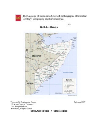
  • 1. The Geology of Somalia: a Selected Bibliography of Somalian Geology, Geography and Earth Science. AD By R. Lee Hadden Topographic Engineering Center February 2007 US Army Corps of Engineers 7701 Telegraph Road Alexandria, Virginia 22315 UNCLASSIFIED / UNLIMITED
  • 2. Bibliography of Liberian Earth Science R. L. Hadden 3/13/2007 2 REPORT DOCUMENTATION PAGE Public reporting burden for this collection of information is estimated to average 1 hour per response, including the time for reviewing instructions, searching existing data sources, gathering and maintaining the data needed, and completing and reviewing this collection of information. Send comments regarding this burden estimate or any other aspect of this collection of information, including suggestions for reducing this burden to Department of Defense, Washington Headquarters Services, Directorate for Information Operations and Reports (0704-0188), 1215 Jefferson Davis Highway, Suite 1204, Arlington, VA 22202-4302. Respondents should be aware that notwithstanding any other provision of law, no person shall be subject to any penalty for failing to comply with a collection of information if it does not display a currently valid OMB control number. PLEASE DO NOT RETURN YOUR FORM TO THE ABOVE ADDRESS. 1. REPORT DATE 02-2007 2. REPORT TYPE: Bibliography 4. TITLE AND SUBTITLE: The Geology of Somalia: a Selected Bibliography of Somalian Geology, Geography and Earth Science. 6. AUTHOR(S) HADDEN, Robert Lee 7. PERFORMING ORGANIZATION NAME(S) AND ADDRESS(ES) US Army Corps of Engineers Topographic Engineering Center ATTN CEERD TO I 7701 Telegraph Road Alexandria, VA 22315-3864 9. SPONSORING / MONITORING AGENCY NAME(S) AND ADDRESS(ES) Geospatial Information 7701 Telegraph Road Library (GIL) Alexandria, VA 22315-3864 12. DISTRIBUTION / AVAILABILITY STATEMENT Unclassified/Unlimited 13. SUPPLEMENTARY NOTES: 14. ABSTRACT This bibliography on the geographical, water and geological information of Somalia was begun to fill a request for current information on that war torn state. This bibliography brings together selected citations from a variety of different cartographic, geographical, geological and hydrological resources and a number of specialized library collections. Most of the citations have location information on where these items can be located and either used on site, or borrowed through inter-library loan, or where copies of the items can be purchased from the originating source, or through commercial document delivery services. 15. SUBJECT TERMS: Somalia. Agriculture. Climate. Drainage. Earth Sciences. Economy. Energy. Forests. Geology. Geography. Groundwater. Hydrology. Maps. Mining. Rivers. Soils. Surface-water. Terrain. Topography. Transportation. Vegetation Water Wells 16. SECURITY CLASSIFICATION OF: Unclassified 17. LIMITATION OF ABSTRACT 18. NUMBER a. REPORT b. ABSTRACT c. THIS PAGE Unlimited 404
  • 3. Somalian Earth Sciences Engineering Research and Development Center 1 Introduction This bibliography on the geology, geography and earth sciences of Somalia was gathered from a variety of different abstracting, bibliographical and cartographical resources. They include citations from agriculture, botany, engineering, geology, geography, medical, military science, soils, transportation and other subject resources. These citation resources are provided by a number of scientific societies, such as the American Geographical Society; from government resources, such as the Defense Technical Information Center; non-governmental organizations such as the United Nation’s Food and Agricultural Organization (FAO); and from commercial databanks such as GeoRef, WorldCat and GeoBase. Many unique citations were collected from the catalogs and resources of major research libraries, such as the Library of Congress and the US Geological Survey Library. Within this bibliography, the article retrieval information is given as much as possible. These include specific ISSN, ISBN, OCLC and Library of Congress numbers that allow the electronic borrowing or copying of these items through library networks. Alternately, the citations also include information on acquiring these items through document delivery companies and commercial services. Very often, scientific publications in less developed countries are not published in large numbers, and it is very difficult to retrieve reports or maps more than even a few years old. This bibliography is intended to be a resource for those scientific citations on Somalia that can still be retrieved. Within these citations are many variations in spelling and place names. Many scientific and cartographic investigations were done in Cushitic, European and Semitic languages, such as Arabic, English, French, Italian and Somali. Thus, the same name may be spelled differently according to the language(s) used. Variations on single and doubled consonants (geminated consonants) and single and doubled vowels (diphthongs) are common. Mogadisco, Mogadiscio, Mogadishu, Mogadischu and Muqdisho are all variations on the name of the capital city. The river Juba can be spelled Jubba, Juba, Giuba, etc., according to the language used, as can the port city of Chisimaio, Chisimayo, Kismayo, Kisimayo, Kisymao, etc. So any search for authors, place names and locations in this bibliography should take into account spelling variations. Abbreviations and links to resources used: (All links and URLs in this bibliography are current as of January 2007) AGI: American Geological Institute, Alexandria, VA. See: www.agiweb.org AGS: American Geographical Society Library, University of Wisconsin, Milwaukee Campus. See: http://www.amergeog.org AS&T: Applied Science & Technology from H.W. Wilson is a bibliographic database that indexes articles of at least one column in length. English-language periodicals published in the United States and elsewhere are covered; non-English language articles are included if English abstracts are provided. Periodical coverage includes trade and industrial publications, journals issued by professional and technical societies, and specialized subject periodicals, as well as special issues such as buyers' guides, directories, and conference proceedings. See: http://www.hwwilson.com/Databases/applieds.htm#Abstracts
  • 4. Somalian Earth Sciences Engineering Research and Development Center 2 ASFA: Aquatic Sciences and Fisheries Abstracts Input to ASFA is provided by a growing international network of information centers monitoring more than 5,000 serial publications, books, reports, conference proceedings, translations, and limited distribution literature. ASFA is a component of the Aquatic Sciences and Fisheries Information System (ASFIS), formed by four United Nations agency sponsors of ASFA and a network of international and national partners. Aquatic Sciences and Fisheries Abstracts are produced by CSA under contract to FAO. See: http://www.csa.com/ British Library: The British Library Document Supply Service can supply many of the article citations and reports given in this bibliography, especially those maps and other materials owned by the British Library. See: http://www.bl.uk/services/document/dsc.html CISTI: Canada Institute of Scientific and Technical Information. This is a Canadian document supply service for scientific and technical literature. “Through Global Service, CISTI can obtain any document for you, from anywhere in the world. Most documents are supplied within four weeks. You can specify the level of service you prefer at the time of ordering by choosing the appropriate line from the drop down menu on any of the CISTI order forms.” See: http://cisti-icist.nrc-cnrc.gc.ca/ CSA Technology Research Database: This comprehensive database provides a single mega-file of all the unique records available through its 3 components: the CSA Materials Research Database with METADEX, CSA High Technology Research Database with Aerospace, and the CSA Engineering Research Database. The database content represents the most comprehensive and current coverage of the relevant serial and non-serial literature available. Sources covered include over 4,000 periodicals, conference proceedings, technical reports, trade journal/newsletter items, patents, books, and press releases. See: http://www.csa.com/ DTIC: Defense Technical Information Center, Alexandria, VA. See: www.dtic.mil ESPM: The CSA Environmental Sciences and Pollution Management database offers access to the international literature in the environmental sciences. Abstracts and citations are drawn from over 6000 serials including scientific journals, conference proceedings, reports, monographs, books and government publications. See: http://www.csa.com/ FAO: Food and Agriculture Organization Library, United Nations, Rome, Italy. See: www.fao.org GeoBase: GEOBASE is a unique multidisciplinary database supplying bibliographic information and abstracts for development studies, the Earth sciences, ecology, geomechanics, human geography, and oceanography. The database provides current coverage of almost 2,000 international journals, including both peer-reviewed titles and trade publications, and provides archival coverage of several thousand additional journal titles and books. GEOBASE is unequalled in its coverage of international literature of the core scientific and technical periodicals. Papers are selected, read, and classified using a unique classification scheme that is versatile and updated annually to adapt coverage to current research trends. The material covered includes refereed scientific papers; trade journal and magazine articles, product reviews, directories and any other relevant material. GEOBASE has a unique coverage of non- English language and less readily available publications including books, conference
  • 5. Somalian Earth Sciences Engineering Research and Development Center 3 proceedings and reports, making this the best resource available for multidisciplinary searches of international literature. The content crosses over subject, language, and cultural boundaries, providing a unique research tool to users. All material in GEOBASE is also available as print in the following Elsevier/Geo Abstracts journals: Geographical Abstracts, Physical Geography, Human Geography, Geological Abstracts, Ecological Abstracts, International Development Abstracts and Oceanographic Literature Review, Geomechanics Abstracts. See: www.elsevier.com GeoRef: American Geological Institute, Alexandria, VA. The American Geological Institute not only identified materials for the abstracting database, GeoRef, but also locates and supplies materials as a document delivery service. See: www.agiweb.org ISBN: International Standard Book Number. This unique number can be used to identify and locate library holdings of a particular book or report title. See: http://www.isbn.org/standards/home/index.asp ISSN: International Standard Serial Number. This unique number can be used to locate libraries which have subscriptions to this journal, magazine or serial. See: http://www.issn.org/ Library of Congress Control Number – LCCN: This is a unique number applied by the Library of Congress to identify individual publications. This number can be used to identify copies of this item in libraries held in the US and abroad. See: http://www.loc.gov/marc/lccn_structure.html LC or LOC: Library of Congress, Geography and Map Division, Washington, DC. The Geography and Map Division has the largest collection in the world, with 5.4 million maps, 75,000 atlases, 500 globes, 3,000 three-dimensional objects and thousands of digital files. Recently, the Library of Congress has digitally scanned and mounted its 10,000th map online. See: http://www.loc.gov/rr/geogmap/ Linda Hall Library: “Our Document Delivery Services Department allows students, researchers, and businesses to request copies of journal articles, conference proceedings, historical documents, or many other documents housed at the Linda Hall Library. We are committed to filling every in-scope, properly cited request within 24-48 hours. Requests are processed during the local working hours of 8 am – 5 pm, U. S. Central Time, Monday through Friday. Our fee is a cost recovery fee intended to support a strong collection and dedicated services.” See: http://www.lhl.lib.mo.us/services/document_delivery/index.shtml Northwestern University Transportation Library: The Transportation Library was founded in 1958 to support the curricula and research programs of the Transportation Center and the Center for Public Safety of Northwestern University, including the School of Police Staff and Command. Containing over 400,000 items, the Transportation Library of Northwestern University is one of the largest transportation information centers in the world, encompassing information on all transportation modalities, including: air, rail, highway, pipeline, water, urban transport and logistics. Its collection of environmental impact statements is one of the most complete in the world. See: http://www.library.northwestern.edu/transportation/ NTIS: National Technical Information Service, Alexandria, VA. See: www.ntis.gov OA: Oceanic Abstracts. For over 32 years, Oceanic Abstracts from Cambridge Scientific Abstracts has been focused exclusively on worldwide technical literature
  • 6. Somalian Earth Sciences Engineering Research and Development Center 4 pertaining to the marine and brackish-water environment. The journal has long been recognized as a leading source of information on topics relating to oceans. It focuses on and is totally comprehensive in its coverage of marine biology and physical oceanography, fisheries, aquaculture, non-living resources, meteorology and geology, plus environmental, technological, and legislative topics. See: http://www.csa.com/factsheets/oceanic-set-c.php OCLC: Founded in 1967, OCLC Online Computer Library Center is a nonprofit, membership, computer library service and research organization dedicated to the public purposes of furthering access to the world's information and reducing information costs. More than 41,555 libraries in 112 countries and territories around the world use OCLC services to locate, acquire, catalog, lend and preserve library materials. Researchers, students, faculty, scholars, professional librarians and other information seekers use OCLC services to obtain bibliographic, abstract and full-text information when and where they need it. See: http://www.oclc.org/ SWRA: Selected Water Resources Abstracts (1967-94). SWRA provides more than 271,138 abstracts compiled by the Water Resources Scientific Information Center (WRSIC) of the USGS. SWRA provides thorough coverage of worldwide technical literature across the life, physical, and social-science aspects of water resources as well as U.S. Government documents produced by the USGS's many research facilities. Records are drawn from journals, monographs, conference proceedings, reports, court cases, and other federal and state publications. SWRA, and now Water Resources Abstracts, are your best sources for issues pertaining to groundwater, water quality, water planning, and water law and rights. TRIS: TRIS is a bibliographic database funded by sponsors of the Transportation Research Board (TRB), primarily the state departments of transportation and selected federal transportation agencies. TRIS Online is hosted by the National Transportation Library under a cooperative agreement between the Bureau of Transportation Statistics and TRB. See: http://ntlsearch.bts.gov/tris/index.do UN: United Nations Library, New York, NY. See: www.un.org USGS: US Geological Survey Library, Reston, VA. See: www.usgs.gov/library University of Texas at Austin. Perry-Castañeda Library Map Collection: “Many of these maps have been scanned and are available for downloading and other uses.” See: http://www.lib.utexas.edu/maps/ WorldCat: Among other things, this a free database from OCLC showing local library holdings of desired publications. See: http://www.worldcat.org/ Acknowledgements The author also wants to acknowledge the help of Mr. Abdirahman S. Ali, a native of Somalia, for his help in resolving some of the multi-lingual questions in this bibliography and for his help in interpreting the cultural geography of Somalia. Mr. Matt Marks and Mr. Willie Sayyad of Refworks.com has kindly provided the bibliographer with a temporary subscription to their reference management software, and this bibliography would have been much more difficult to produce without this valuable resource. Refworks.com allowed the bibliographer to place the paper and electronic citations from very different resources and different libraries into one large file, and to allow for the automatic formatting and preparation of the bibliography. “RefWorks
  • 7. Somalian Earth Sciences Engineering Research and Development Center 5 supports hundreds of online databases and output styles covering a broad range of subject areas. RefWorks collaborates with some of the world's most prestigious online information service providers, including CSA Illumina, BioOne, EBSCOhost, Elsevier, H.W. Wilson, ISI Web of Science, OCLC, Ovid and ProQuest, to name a few.” Their support for this project is gratefully acknowledged. See: http://www.refworks.com/
  • 8. Somalian Earth Sciences Engineering Research and Development Center 6 Somalia1 Somalia (“Soomaaliya” in the Somali language2 ; “As-Suumaal” in Arabic), formerly known as the Somali Democratic Republic, is a coastal nation at the “Horn of Africa” in East Africa. Somalia is shaped at an angle somewhat like the number “7”, and this country is also called “The Horn of Africa” due to its shape somewhat like the horn of a rhinoceros. Somalia has about 637,540-637,657 square kilometers (estimates vary), of which only 10,320 km² is covered with water, and the country is slightly smaller in land area than the state of Texas. Inland, Somalia has borders 58 kilometers long with the country of Djibouti to the north; Ethiopia shares a border 1,626 km long with Somalia in the north and west, and in the south and west, Kenya shares a border with Somalia of some 682 km. Seaward, the country lies on the coast of the Gulf of Aden and the Indian Ocean, and has a coastline of some 3,025 km. Somalia occupies a strategic location on Horn of Africa along southern approaches to Bab el Mandeb and sea route through the Red Sea and the Suez Canal. Somalia's long coastline has been of strategic and tactical importance chiefly in permitting trade with the Middle East and the rest of East Africa. The exploitation of the shore and the continental shelf for fishing and other purposes had barely begun by the early 1990s. Sovereignty was claimed over territorial waters up to 200 nautical miles. A generation ago, Somalia had an estimated population of around 8,591,000 people. However, population estimates are very difficult to verify because of the political situation and the mostly nomadic nature of the Somalis. The last accurate census was taken almost a generation ago in 1975. Currently, Somalia is believed to be one of the fastest growing countries in Africa and the world. Recent population estimates from 2005 range greatly between 15 and 25 million inhabitants. About 60% of all Somalis are nomadic or semi-nomadic pastoralists who raise cattle, camels, sheep, and goats. About 25% of the populations are settled farmers who live mainly in the fertile agricultural region between the Juba and Shebelle rivers in southern Somalia. The remainder of the population (15%-20%) is urban. Because of the wars and conflict, Somalia has a large dispersed community, one of the largest of the whole continent. There are over a million Somalis living outside of Africa. This “Diaspora” adds stress to the society, since the Somali clan structure is extremely important to their identity and way of life. Breaking the clan cohesion by distance or displaced refugees induces stress on both the refugees and the family members left behind. The US Department of State says on their website: “The status of expatriate Somalis has been an important foreign and domestic issue. The Somali- populated region of the Horn of Africa stretches from the Gulf of Tadjoura in modern- day Djibouti through Dire Dawa, Ethiopia, and down to the coastal regions of southern Kenya. Unlike many countries in Africa, the Somali nation extends beyond its national 1 This review of Somalia has been taken from a wide number of open source information, including the US Department of State; the CIA Factbook; the American University’s Foreign Area Study, “Somalia, A Country Study”; the US Geological Survey’s commodities reports, geological maps and other data; and data acquired from various general reference sources such as soil maps, regional encyclopedias, geographical gazetters and geological dictionaries. 2 “Soomaal” in Somali means “to milk,” as in “to milk a goat or to milk a camel.”
  • 9. Somalian Earth Sciences Engineering Research and Development Center 7 borders. Since gaining independence in 1960, the goal of Somali nationalism, also known as Pan-Somalism, has been the unification of all Somali populations, forming a Greater Somalia. This issue has been a major cause of past crises between Somalia and its neighbors--Ethiopia, Kenya, and Djibouti.”3 Ethnic groups in the country include the Bajuni people who live in the coastal settlements and islands south of Kismayo and are of East African Swahili origin. The Bajuni people in Somalia speak Kibajuni and the Bravanese people speak Chimwiini. Both of these languages are dialects of Swahili. The Bravanese live in Brawa and are believed to be of mixed Arab, Portuguese and other descent. The Benadiri (Reer Hamar), are an urban people of East African Swahili origin who live in cities in the “gobolka Benadir” coastal region. The Bantu are agricultural workers who live along the Juba River. Several thousand Arabs also live in Somalia, along with some hundreds of Indians and Pakistanis. A small population of people of Italian descent, which dated back to Somalia's colonial era, began to emigrate following independence, and by the outbreak of war most Italian Somalis had left the country. Nearly all the inhabitants speak Somali, the official language of the country. The Somali language is based on various dialects from the Mudug province. The Somali language was not used extensively for writing until 1973, when a standard orthography using the Latin alphabet was decreed by the Supreme Revolutionary Council (SRC). Somali is now the language of instruction in schools, although there are few schools operating today. Arabic, English, and Italian languages are also used extensively. Maay, a language closely related to Somali, is spoken by the Rahanweyn. Politically, Somalia is divided into 18 regions (singular “gobolka”; plural is “gobollada”), and subdivided into districts. The regions are: Awdal; Bakool (Bakol); Banaadir (Benadir); Bari; Bay; Galguduud (Galgudud); Gedo; Hiiraan (Hiran); Jubbada Dhexe (Middle Jubba); Jubbada Hoose (Lower Jubba); Mudug; Nugaal (Nugal); Sanaag; Shabeellaha Dhexe (Middle Shabelle); Shabeellaha Hoose (Lower Shabelle); Sool; Togdheer (Togder) and Woqooyi Galbeed. The northwestern area has declared its independence as the "Republic of Somaliland"; the northeastern region of Puntland is a semi-autonomous state; and the remaining southern portion is riddled with the struggles of rival factions. In May of 1991, the major northern Somaliland clan, the “Isaqs,”declared an independent Republic of Somaliland (Somali: Soomaaliland), that now includes the administrative regions of Awdal, Woqooyi Galbeed, Togdheer, Sanaag, and Sool. Although not recognized by any other government, this entity has maintained a stable existence, aided by the overwhelming dominance of a ruling clan and economic infrastructure left behind by British, Russian, and American military assistance programs. According to the US Department of State, “The self-declared "Republic of Somaliland" 3 See: http://www.state.gov/r/pa/ei/bgn/2863.htm, “US Department of State, Background Note: Somalia,” accessed January 10, 2007.
  • 10. Somalian Earth Sciences Engineering Research and Development Center 8 consists of a regional authority based in the city of Hargeisa, including a President, Vice President, parliament, and cabinet officials.”4 Somaliland now covers roughly the region of the former British Somaliland protectorate, an area of about 137,600 square kilometers (53,128 sq mi), which was also briefly an independent country for about five days in 1960. Somaliland is bordered by Ethiopia on the south, Djibouti on the west, the Gulf of Aden on the north, and the autonomous region Puntland in Somalia on the east. The capital of Somaliland is Hargeisa. The majority of the people are Sunni Moslems, and Somali and Arabic are the languages used mostly, with English taught in the schools. Yet another secession from Somalia took place in the northeastern region. The regions of Bari, Nugaal, and northern Mudug now comprise a neighboring self-declared autonomous state of Puntland. Puntland is centered on the capital, Garowe, in the Nugaal Gobolka. Puntland has also made strides toward reconstructing a legitimate, representative government, but has suffered some civil strife. Puntland disputes its border with Somaliland as it also claims portions of eastern Sool and Sanaag. In 1998 Puntland seceded and declared itself to be an autonomous state. This semi-secession is apparently an attempt to reconstitute Somalia as a federation of semi- autonomous states. Unlike neighboring Somaliland, Puntland does not seek outright independence from Somalia. The self-proclaimed state took the name “Puntland” after declaring "temporary" independence in 1998, with the intention that it would participate in any Somali reconciliation to form a new central government. The name is derived from the “Land of Punt” mentioned by ancient Egyptian sources, which is believed by some to have existed in what is now Somalia. A third secession occurred in 1998 with the declaration of the state of Jubaland. The territory of Jubaland is now encompassed by the state of Southwestern Somalia and its status is unclear. Jubaland (Somali: Jubbaland) or Juba Valley (Somali: Dooxada Jubba), formerly Trans-Juba (Italian: Oltre Giuba), is the southwestern most part of Somalia, on the far side of the Juba River (thus "Trans"-Juba), bordering on Kenya. It has a total area of 87,000 km² (33,000 sq mi), and the main city is Kismayo, on the coast near the mouth of the Juba. The area was mainly inhabited by the Ogaden nomads sub clan with other Dir and Hawiye clans Jubaland is divided among the administrative regions of Gedo, Middle Juba, and Lower Juba and is technically part of the Transitional Government of Somalia. Despite this, until recently the actual administration of Jubaland was carried out by the Juba Valley Alliance led by Barre Adan Shire Hiiraale, also known as "Barre Hiiraale". A fourth self-proclaimed entity led by the Rahanweyn Resistance Army (RRA) was set up in 1999. This "temporary" secession was reasserted in 2002, leading to de facto autonomy of Southwestern Somalia. The RRA had originally set up an autonomous administration over the Bay and Bakool regions of south and central Somalia in 1999. The central and southern areas of Somalia are flat, with an average altitude of less than 180 metres (600 ft). South and west of the central area, extending to the Shabeelle River, lays a plateau whose maximum elevation is 685 meters (2,250 feet). The southwestern part of Somalia is largely savanna, or grassland. Only about 13 percent of 4 See also: http://www.state.gov/r/pa/ei/bgn/2863.htm The self-declared "Republic of Somaliland" consists of a regional authority based in the city of Hargeisa, including a President, Vice President, parliament, and cabinet officials.
  • 11. Somalian Earth Sciences Engineering Research and Development Center 9 the country is suitable for farming. The region between the Juba and Shabeelle Rivers is low agricultural land, and the area that extends southwest of the Jubba River to Kenya is low pastureland. The Jubba and Shabeelle Rivers originate in Ethiopia and flow toward the Indian Ocean. They provide water for irrigation but the rivers are not navigable by commercial vessels. The Shabeelle, with a total length of 2,011 kilometers (1,250 miles), dries up before reaching the ocean, but it is still the longest river in the country. Most of Somalia's food crops are grown in the fertile region in the south between Somalia's two permanent rivers, the Juba and the Webi Shabeelle. The amount of water in both rivers is highly variable, depending on rainfall. In periods of heavy rainfall there are also a number of seasonal streams, none of which can be used for irrigation or as dependable sources of drinking water. Despite its lengthy shoreline, Somalia has only one natural harbor, Berbera. There is also a limited area around Baidoa that receives an average of 500–600 mm of rainfall each year. At present there are still many species of wildlife found throughout the country, especially in the far southern part of the nation: small antelopes, a large variety of birds, foxes, hyenas, leopards, lions, ostriches and warthogs. Unfortunately, many of the large game mammals have been nearly wiped out: the giraffes, the hippopotami, the oryx, the rhinoceri, zebras, and, above all, the elephants. The elephants are slaughtered chiefly by ivory poachers. Some measures to protect the endangered animals have recently been taken by creating a national wildlife reserve in the lower Shabeelle swamp region. Soils The types of soil vary according to climate and parent rock. The arid regions of northeastern Somalia have mainly thin and infertile desert soils. The limestone plateaus of the interfluvial area have fertile, dark gray to brown, calcareous residual soils that provide good conditions for rain-fed agriculture. The most fertile soils in Somalia are found on the alluvial plains of the Jubba and Shabeelle rivers. These deep vertisols (black cotton soils) have a high water-retention capacity and are mainly used for irrigation agriculture. Irrigated land in Somalia is between 1,800 km² and 2,000 sq km², according to 1993 estimates. There are also large areas of dark cracking clays (vertisols) in the southern part of Somalia that appear to have a higher water-holding capacity than the generally sandy soils found elsewhere. According to both the FAO and USDA soil taxonomy, a vertisol is a soil in which there is a high content of expansive clay known as montmorillonite. This soil forms deep cracks in drier seasons or years. Alternate shrinking and swelling of the soil causes self-mulching, where the soil material consistently mixes itself, causing vertisols to have an extremely deep A horizon and with no B horizon. (A soil with no B horizon is called an A/C soil). This heaving of the underlying material to the surface often creates microrelief known as “gilgai”. Vertisols typically form from highly basic rocks such as basalt in climates that are seasonally humid or subject to erratic droughts and floods. Depending on the parent material and the climate, they can range from grey or red to the more familiar deep black. Vertisols are found between 50° N and 45° S of the equator. In their natural state,
  • 12. Somalian Earth Sciences Engineering Research and Development Center 10 vertisols are covered with grassland or grassy woodland. The heavy texture and unstable behavior prevents forest from growing. The shrinking and swelling of vertisols can damage buildings and roads, leading to extensive subsidence. Vertisols are generally used for grazing of cattle or sheep. It is not unknown for livestock to be injured through falling into cracks in dry periods. However, the shrink-swell activity allows rapid recovery from compaction. When irrigation is available, crops such as cotton, wheat, sorghum and rice can be grown. Vertisols are especially suitable for rice because they are almost impermeable when saturated. Rainfed farming is very difficult because vertisols can be worked only under a very narrow range of moisture conditions: they are very hard when dry and very sticky when wet. The Somali farmers have developed their own system of making a checker-board of small ridges to retain the limited rainfall. Sorghum is grown in the basins that are formed, and in a year of average or above-average rainfall a reasonable crop can be harvested. Where they are well maintained, these basins probably also help to prevent soil erosion, but the crop-failure rate in seasons of below average rainfall can be high. One way in which the cultivators have attempted to respond to this crop uncertainty is by ratooning5 their first “gu” rainy season sorghum crop in the hope that the re-growth may produce some grain in the second “dayr” rains. Yields obtained by this method appear to be generally low, and it may also contribute to the carry over of moth stemborers such as Busseola fusca6 , Chilo partellus7 and Sesamia calamistis8 , that often cause severe damage to the crop. The cultivators usually try to plant a second crop during the second rainy period, the “dayr”, but the yields are usually low and the crop may fail as often as once in every 3 years. In 1986, for example, much of this area did not receive any rain at all in the second rainy season, so that all crops failed and severe hardship was caused to many people in early 1987. Population pressure is increasing on the better soil regions, and deficiencies of phosphate are widespread. Some of these soils have a high phosphate-fixation capacity, so that heavy and uneconomic broadcast applications were sometimes found to be necessary to increase yields. Recently, it has been found that good responses can be obtained from small phosphate applications placed near the seed at the time of planting. Few other crops except sorghum are grown, although some cowpeas may be planted in pure stands or intercropped, and a little maize, some groundnuts, watermelon, sesame, and tomato are sometimes grown in low-lying areas. Attempts have been made to introduce cotton with some success in limited areas. 5 Ratoon: A shoot sprouting from a plant base, as in the banana, pineapple, or sugar cane. 6 Busseola fusca is indigenous to Africa and is present in high and mid altitude areas (3500 ft and above sea level). Adult moths lay eggs on maize plants, larvae emerge and after feeding on leaves for two to three days enter inside the maize stems. Busseola fusca lays its eggs between the stem and the leafsheaths 7 Chilo partellus accidentally came to Africa from Asia in the 1930s. Chilo partellus is present on low and mid-altitude areas (zero to 4000 ft above sea level). Chilo partells lays its eggs on plant surface in form of egg batches. 8 The Sesamia calamistis, aka “Pink Stalk Borer” or “Pink Maize Borer”, is indigenous to Africa, occurring in savanna areas with a distinct dry season. Host plants include a wide variety of native grass species but also include cultivated grasses such as sugarcane, wheat and maize.
  • 13. Somalian Earth Sciences Engineering Research and Development Center 11 As elsewhere in the arid and subarid zones, the most widespread agricultural activity in Somalia is livestock keeping. Many of these stocks belong to nomadic herdsmen, who often move to and from the Ogaden area of Ethiopia or other areas with their herds, depending on the availability of grazing and water supplies. However, although some Somalis have cultivated sorghum for many years, many relied mainly on their livestock for their food supplies. In recent years, in suitable growing areas, an increasing number have taken to both growing some sorghum while also maintaining their livestock, which are taken to the traditional seasonal grazing areas by some of the young men of the family. Animal traction is used by some farmers, but this is not widespread. Manure is not generally used to fertilize the soil. The two important rivers in the south of the country, the Shebelle and the Juba, are being increasingly used for irrigation, particularly of maize and sorghum. There are also limited areas of plantation crops, principally bananas for export, sugar cane, and some citrus and other crops. Terrain, Vegetation, and Drainage Somalia's terrain consists mainly of plateaus, plains, and highlands. In the far north, however, the rugged east-west ranges of the Karkaar Mountains lie at varying distances from the Gulf of Aden coast. “Somalia consists of the eastern fringe of the Ethiopian plateau, consisting of a series of tablelands sloping to the southeast, the natural continuation of the great highlands that rise to the east of the Gall-Danakil tectonic trench. The mountains along the Coast of Aden are an extension of the raised rim forming the interface between the highlands and the Danakil depression, and contain the country’s highest elevations… …which drop down to the sea in steep cliffs all the way to rocky Ras Asir. From the mountainous rim, the highlands slope away toward the southeast, merging into the plateaus of Ogaden in Ethiopia and Mijertins regions, which in turn descend to the vast peneplain of Mudug and the coastal plain of Benadir, surrounded by long chains of sand dunes that block the passage of the Webi Shabelle, Somalia’s largest river, as it flows to the ocean. Geologically, these lowlands constitute an ancient substructure of crystalline rocks that, as they sank, were invaded by the sea and blanketed with sediments of Cenozoic and Recent age, which were then overlain by alluvial deposits caused by surface erosion. Somalia can therefore be divided into two major natural regions: the north, characterized by highly incised highlands sloping toward the ocean; and the south, where the low tablelands fall away to the wide coastal plains.”9 The far northern part of Somalia consists of hills and low mountains, which reach to about 8,000 feet (2,440 meters) in height. The northern region is somewhat mountainous, with plateaus reaching between 900 and 2,100 meters (3,000 and 7,000 feet). The highest point in the country, Mount Shimbiris, is at an elevation of 2,450 meters (8,000 feet). To the northeast there is an extremely dry, dissected plateau that reaches a maximum elevation of nearly 2,450 meters (8,000 feet). The weather is hot throughout the year, except at the higher elevations in the north. Rainfall is sparse, and most of Somalia has a semiarid-to- arid environment suitable only for the nomadic pastoralism practiced by well over half the population. Only in limited areas of moderate rainfall in the northwest, and particularly in the 9 World Geographical Encyclopedia. 1994. Volume I “Africa”. Milan. Page 114.
  • 14. Somalian Earth Sciences Engineering Research and Development Center 12 southwest, where the country's two perennial rivers are found, is agriculture practiced to any great extent. Somalia has problems with recurring droughts; frequent dust storms over the eastern plains in summer; floods during rainy season. It also has famine; the use of contaminated water contributes to human health problems; deforestation; overgrazing; soil erosion and desertification. Owing to inappropriate land use, the original vegetation cover, especially in northern Somalia, has been heavily degraded and in various places has been entirely destroyed. This progressive destruction of plant life also has impaired animal habitats and reduced forage, affecting not only Somalia's greatest resource, its livestock (chiefly goats, sheep, camels, and cattle), but also the country’s wildlife. Most of Somalia consists of dry savanna, suitable only for limited pasturage and occasional cultivation. A good deal of Somalia is arid and able to sustain only limited numbers of people and animals. The long coastline has a number of ports and some fishing villages but is for the most part uninhabitable. A coastal plain on the Gulf of Aden is backed by the mountains of the Karkaar Range. The tallest peak is Shimber Beris (Surad Ad; 2,408 m/7,900 ft). Below the mountains is a plateau region averaging 915 m (3,000 ft) in elevation, the western part of which stretches into the Ogaden of Ethiopia, which is considered the Somali "heartland." Physiographically, Somalia is a land of limited contrast. In the north, a maritime plain parallels the Gulf of Aden coast, varying in width from roughly twelve kilometers in the west to as little as two kilometers in the east. Scrub-covered, semiarid, and generally drab, this plain, known as the “guban” or “scrub land”, is crossed by broad, shallow watercourses that are beds of dry sand except in the rainy seasons. When the rains arrive, the vegetation, which is a combination of low bushes and grass clumps, is quickly renewed, and for a time the guban provides some grazing for nomad livestock. Inland from the gulf coast, the plain rises to the precipitous northward-facing cliffs of the dissected highlands. These form the rugged Karkaar mountain ranges that extend from the northwestern border with Ethiopia eastward to the tip of the Horn of Africa, where they end in sheer cliffs at Caseyr. The general elevation along the crest of these mountains averages about 1,800 meters above sea level south of the port town of Berbera, and eastward from that area it continues at 1,800 to 2,100 meters almost to Caseyr. The country's highest point, Shimber Berris, which rises to 2,407 meters, is located near the town of Erigavo. Southward the mountains descend, often in scarped ledges, to an elevated plateau devoid of perennial rivers. This region of broken mountain terrain, shallow plateau valleys, and usually dry watercourses is known to the Somalis as the “Ogo.” In the Ogo's especially arid eastern part, the plateau is broken by several isolated mountain ranges, and gradually slopes toward the Indian Ocean and in central Somalia constitutes the Mudug Plain. A major feature of this eastern section is the long and broad Nugaal Valley, with its extensive network of intermittent seasonal watercourses. The eastern area's population consists mainly of pastoral nomads. In a zone of low and erratic rainfall, this region was a major disaster area during the great drought of 1974 and early 1975. The western part of the Ogo plateau region is crossed by numerous shallow valleys and dry watercourses. Annual rainfall is greater than in the east, and there are flat areas of arable land that provide a home for dry land cultivators. Most important, the
  • 15. Somalian Earth Sciences Engineering Research and Development Center 13 western area has permanent wells to which the predominantly nomadic population returns during the dry seasons. The western plateau slopes gently southward and merges into an area known as the Haud, a broad, undulating terrain that constitutes some of the best grazing lands for Somali nomads, despite the lack of appreciable rainfall more than half the year. Enhancing the value of the Haud are the natural depressions that during periods of rain become temporary lakes and ponds. The Haud10 zone continues for more than sixty kilometers into Ethiopia, and the vast Somali Plateau, which lies between the northern Somali mountains and the highlands of southeast Ethiopia, extends south and eastward through Ethiopia into central and southwest Somalia. The portion of the Haud lying within Ethiopia was the subject of an agreement made during the colonial era permitting nomads from British Somaliland to pasture their herds there. After Somali independence in 1960, it became the subject of Somali claims and a source of considerable regional strife. Southwestern Somalia is dominated by the country's only two permanent rivers, the Jubba and the Shabeelle (Shabele). With their sources in the Ethiopian highlands, these rivers flow in a generally southerly direction, cutting wide valleys in the Somali Plateau as it descends toward the sea; the plateau's elevation falls off rapidly in this area. The adjacent coastal zone, which includes the lower reaches of the rivers and extends from the Mudug Plain to the Kenyan border, averages 180 meters above sea level. The Jubba River enters the Indian Ocean at Chisimayu (Kismaayo). Although the Shabeelle River at one time apparently also reached the sea near Merca, its course is thought to have changed in prehistoric times. The Shabeelle now turns southwestward near Balcad (about thirty kilometers north of Mogadishu) and parallels the coast for more than eighty-five kilometers. The river is perennial only to a point southwest of Mogadishu; thereafter it consists of swampy areas and dry reaches and is finally lost in the sand east of Jilib, not far from the Jubba River. During the flood seasons, the Shabeelle River may fill its bed to a point near Jilib and occasionally may even break through to the Jubba River farther south. Favorable rainfall and soil conditions make the entire riverine region a fertile agricultural area and the center of the country's largest sedentary population. In most of northern, northeastern, and north-central Somalia, where rainfall is low, the vegetation consists of scattered low trees, including various acacias, and widely scattered patches of grass. This vegetation gives way to a combination of low bushes and grass clumps in the highly arid areas of the northeast and along the Gulf of Aden. A broad plateau encompassing the northern city of Hargeysa, which receives comparatively heavy rainfall, is covered naturally by woodland (much of which has been degraded by overgrazing) and in places by extensive grasslands. Parts of this area have been under cultivation since the 1930s, producing sorghum and corn; in the 1990s it constituted the only significant region of sedentary cultivation outside southwestern Somalia. The Haud south of Hargeysa is covered mostly by a semi-arid woodland of scattered trees, mainly acacias, underlain by grasses that include species especially favored by livestock as forage. As the Haud merges into the Mudug Plain in central Somalia, the aridity increases and the vegetation takes on a sub-desert character. Farther 10 Merriam-Webster’s Geographical Dictionary: Haud or Hawd, a region in SE Ethiopia and SW Somalia; a semi-desert plateau that also has grassy plains.
  • 16. Somalian Earth Sciences Engineering Research and Development Center 14 southward the terrain gradually changes to semiarid woodlands and grasslands as the annual precipitation increases. Along the Indian Ocean from Mereeg, about 150 kilometers northeast of Mogadishu, southwestward to near Chisimayu (Kismaayo) lies a stretch of coastal sand dunes. This area is covered with scattered scrub and grassy clumps. Overgrazing, particularly in the area between Mogadishu and Chisimayu, has resulted in the destruction of the protective vegetation cover and the gradual movement of the once- stationary dunes inland. Beginning in the early 1970s, efforts were made to stabilize these dunes by replanting. Land Estimates vary, but from about 46 to 56 percent of Somalia's land area can be considered permanent pasture. About 14 percent of the land area is classified as forest. Approximately 13 percent of the land is suitable for cultivation, but most of that area would require additional investments in wells and transportation for it to be usable. The remaining land is not economically feasible for exploitation. In the highlands around Hargeysa, relatively high rainfall has raised the organic content in the sandy calcareous soils characteristic of the northern plains, and this soil has supported some dry farming. South of Hargeysa begins the Haud, whose red calcareous soils continue into the Ethiopian Ogaden. This soil supports vegetation ideal for camel grazing. To the east of the Haud is the Mudug Plain, leading to the Indian Ocean coast; this region, too, supports a pastoral economy. The area between the Jubba and Shabeelle rivers has soils varying from reddish to dark clays, with some alluvial deposits and fine black soil. This is the area of plantation agriculture and subsistence agro-pastoralism. Practices concerning land rights varied from rural to urban areas. In pre-colonial times, traditional claims and inter-clan bargaining were used to establish land rights. A small market for land, especially in the plantation areas of the south, developed in the colonial period and into the first decade of Somalia’s independence. The socialist regime sought to block land sales and tried to lease all privately owned land to cooperatives as concessions. Despite the government's efforts, a de facto land market developed in urban areas; in the bush, the traditional rights of clans were maintained. The Siad Barre regime also took action regarding the water system. In northern Somalia from 1988 to 1991, the government destroyed almost all pumping systems in municipal areas controlled by the Somali National Movement, or failing that, stole the equipment. In rural areas, the government poisoned the wells by either inserting animal carcasses or engine blocks that leaked battery acid. As a result, northern Somalis had to rely on older gravity water systems, use poor quality water, or buy expensive water. Following the declaration of the independent Republic of Somaliland in the north in May 1991, the government of the republic began ongoing efforts to reconstruct the water system. In the south, in the late 1980s onward, as a result of war damage and anarchy, the water situation in the towns tended to resemble that in the north. Few pumping systems were operational in early 1992. Conditions in rural areas varied. Many villages had at least one borehole from which poor quality water could be obtained in buckets; pumps generally were nonfunctioning. Somalis who lived near the Jubba or Shabeelle rivers could obtain their water directly from the river.
  • 17. Somalian Earth Sciences Engineering Research and Development Center 15 Climate Due to Somalia's location on the equator, there is relatively little seasonal variation in climate. The weather is hot throughout the year, with mean maximum temperatures of 30–40° C (86–104° F) except at higher elevations and along the Indian Ocean coast. Mean daily minimums usually vary from about 15°C to 30°C (60°F-85°F). Somalia has some of the highest mean annual temperatures in the world. At Berbera on the northern coast the afternoon high averages more than 100° F (38° C) from June through September. Temperature maxima are even higher inland, but along the coast of the Indian Ocean temperatures are considerably lower because of a cold offshore current. The average afternoon high at Mogadishu, for example, ranges from 83° F (28° C) in July to 90° F (32° C) in April. Northern Somalia experiences the greatest temperature extremes, with readings ranging from below freezing in the highlands in December to more than 45° C in July in the coastal plain skirting the Gulf of Aden. The north's relative humidity ranges from about 40 percent in mid-afternoon to 85 percent at night, varying somewhat with the season. Along the coast and in lowland areas it is very humid. During the colder months, December to February, visibility at higher elevations is often restricted by fog. In summation, major climatic factors are a year-round hot climate, seasonal monsoon winds, and irregular rainfall with recurring droughts. Climate is the primary factor in much of Somali life. For the large nomadic population, the timing and amount of rainfall are crucial determinants of the adequacy of grazing and the prospects of relative prosperity. During droughts such as occurred during 1974-75 and 1984-85, widespread starvation can occur. There are some indications that the climate has become drier in the last century and that the increase in the number of people and animals has put a growing burden on water and vegetation. Unlike typical climates at this latitude, conditions in Somalia range from arid in the northeastern and central regions to semiarid in the northwest and south. Long-term mean annual rainfall is less than 4 inches (100 millimeters) in the northeast and approximately 8 to 12 inches in the central plateaus. The southwest and northwest receive an average of 20 to 24 inches a year. While the coastal areas experience hot, humid, and unpleasant weather year-round, the interior is most often dry and hot. The problem in the dry land areas is that neither rainy season is sufficiently reliable in quantity or distribution to produce a crop regularly, so that production is uncertain at the best of times. The climatic year in Somalia comprises of four seasons. The “gu,” or main rainy season, lasts from April to June. The second rainy season, the “day” or “dayr”, lasts from October to December. Each rainy season is followed by a dry season: the main one (jilaal) lasts from December to March and the second dry season, the “hagaa” or “xagaa”, lasts from June to September. The gu rains, the Southwest monsoons, begin in April and last until June, producing a fresh supply of pasture and for a brief period turning the desert into a flowering garden. Lush vegetation covers most of the land, especially the central grazing plateau where grass grows tall. Milk and meat abound, water is plentiful, and animals do not require much care. The clans, reprieved from four months' drought, assemble to engage alternately in banter and poetic exchange or in a new cycle of hereditary feuds. They also offer sacrifices to Allah and to the founding clan ancestors, whose blessings
  • 18. Somalian Earth Sciences Engineering Research and Development Center 16 they seek. Numerous social functions occur: marriages are contracted, outstanding disputes are settled or exacerbated, and a person's age is calculated in terms of the number of gus he or she has lived. The monsoon season lasts from May until October, and is torrid in the north and hot in the south, with irregular rainfall. The gu season is followed by the “hagaa” or “xagaa” drought (July-September) and the hagaa by the day rains (October-November). The southwest monsoon, a sea breeze, makes the period from about May to October the mildest season at Mogadishu. The southwest monsoons blow parallel to the coast and brings in maritime air masses, but quickly loses its moisture and brings little rain. During the second dry season, showers fall in the coastal zone. The periods that intervene between the two monsoons (October through November and March through May) are hot and humid, and are called "tangambili" by the Somalians. The second rainy season, called the “dayr,” extends from October to December. Next is the second dry season, the jiilaal, which lasts from December through March. This is the harshest season for the pastoralists and their herds. From December until February is also the northeast monsoon season, with moderate temperatures in north and very hot temperatures in the south. Temperatures in the south are less extreme, ranging from about 20° C to 40° C. The December-February period of the northeast monsoon is also relatively mild, although prevailing climatic conditions in Mogadishu are rarely pleasant. The dry but cool winter monsoon blows from the Asian continent, gets weaker as it moves south, and often is imperceptible in Mogadishu. The hottest months are February through April. Coastal readings are usually five to ten degrees cooler than those inland. The coastal zone's relative humidity usually remains about 70 percent even during the dry seasons. Most of the country receives less than 500 millimeters of rain annually, and a large area encompassing the northeast and much of northern Somalia receives as little as 50 to 150 millimeters. Certain higher areas in the north, however, record more than 500 millimeters a year, as do some coastal sites. The southwest receives 330 to 500 millimeters. Generally, rainfall takes the form of showers or localized torrential rains and is extremely variable. Forestry There is little forestland, much of that diminishing. Nearly 14 percent of Somalia's land area was covered by forest in 1991. Frankincense and myrrh, both forest products, generated some foreign exchange. In 1988, myrrh exports alone were valued at almost 253 million shillings. A government parastatal (a semi-autonomous, quasi- governmental, state-owned enterprise) in 1991 no longer had monopoly rights on the sale of frankincense and myrrh, but data on sales since privatization were not available. In accordance with rainfall distribution, southern and northwestern Somalia has a relatively dense thornbush savanna, with various succulents and species of acacia. By contrast, the high plateaus of northern Somalia have wide, grassy plains, with mainly low formations of thorny shrubs and scattered grass tussocks in the remainder of the region. Northeastern Somalia and large parts of the northern coastal plain, on the other hand, are almost devoid of vegetation. Exceptions to this are the wadi areas and the moist zones of the northern coastal mountains, where the frankincense tree (Boswellia) grows. The
  • 19. Somalian Earth Sciences Engineering Research and Development Center 17 myrrh tree (Commiphora) thrives in the border areas of southern and central Somalia. More efficient and careful handling of Boswellia, Commiphora, and other resin-exuding trees could increase yields of aromatic gums. Savanna trees had been Somalia's principal source of fuel, but desertification had rapidly eroded this fuel source, especially because refugees from the Ogaden War had foraged the bush in the vicinity of refugee camps for fuel. The acacia species of the thorny savanna in southern Somalia supply good timber and are the major source of charcoal, but charcoal production has long exceeded ecologically acceptable limits. The government's 1988 development report stated that its sand dune stabilization project on the southern coast remained active: 265 hectares of a planned 336 hectares had been treated. Furthermore, thirty-nine range reserve sites and thirty-six forestry plantation sites had been established. Forestry amounted to about 6 percent of the Gross Domestic Product. As elevations and rainfall increase in the maritime ranges of the north, the vegetation becomes denser. Aloes are common, and on the higher plateau areas of the Ogo are woodlands. At a few places above 1,500 meters, the remnants of juniper forests (protected by the state) and areas of candelabra euphorbia (a chandelier-type cactus) occur. In the more arid highlands of the northeast, boswellia and commiphora trees are sources, respectively, of the frankincense and myrrh for which Somalia has been known since ancient times. The region encompassing the Shabeelle and Jubba rivers is relatively well watered and constitutes the country's most arable zone. The lowland between the rivers supports rich pasturage. It features arid to sub-arid savanna, open woodland, and thickets that include frequently abundant underlying grasses. There are areas of grassland, and in the far southwest, near the Kenyan border, some dry evergreen forests are found. Other vegetation includes plants and grasses found in the swamps into which the Shabeelle River empties most of the year and in other large swamps in the course of the lower Jubba River. Mangrove forests are found at points along the coast, particularly from Chisimayu to near the Kenyan border. Uncontrolled exploitation appears to have caused some damage to forests in that area. Other mangrove forests are located near Mogadishu and at a number of places along the northeastern and northern coasts. Transportation Inadequate transport facilities are a considerable impediment to Somalia's economic development. In 1988 the total expenditure for transportation and communications was $57.8 million. Nearly 55 percent of this amount was for new infrastructure; 28 percent was for rehabilitation and maintenance of existing infrastructure. This activity must be understood in the context of the ongoing civil war in Somalia; much of the infrastructure particularly bridges in the north, either had deteriorated or been destroyed, as a result of the fighting. As of early 1992, no systematic study existed of the infrastructural costs of the ongoing civil war. At independence, Somalia inherited a poorly developed transportation system consisting of a few paved roads in the more populated areas in the south and northwest, four undeveloped ports equipped only with lighterage facilities, and a handful of usable airstrips. During the next three decades, some improvement was made with the help of substantial foreign aid. By 1990 all-weather roads connected most of the important towns
  • 20. Somalian Earth Sciences Engineering Research and Development Center 18 and linked the northern and southern parts of the country. Three ports had been substantially improved, eight airports had paved runways, and regular domestic air service also was available. But in early 1992, the country still lacked the necessary highway infrastructure to open up undeveloped areas or to link isolated regions, and shipping had come to a virtual halt because of the security situation. Roads and Railroads There are no railways in Somalia; internal transportation is by truck and bus. The national road system nominally comprises 22,100 kilometers (13,702 mi.) of roads that include about 2,600 kilometers (1,612 mi.) of all-weather roads, although most roads have received little maintenance for years and have seriously deteriorated. In 1990 Somalia had more than 21,000 kilometers of roads, of which about 2,600 kilometers were paved, 2,900 kilometers were gravel, and the remainder was improved and unimproved dirt roads. The country's principal highway was a 1,200-kilometer two-lane paved road that ran from Chisimayu in the south through Mogadishu to Hargeysa in the north. North of Mogadishu, this route ran inland, roughly paralleling the border with Ethiopia; a 100- kilometer spur ran to the Gulf of Aden at Berbera. By early 1992 much of this road, especially the northern part between Hargeysa and Berbera, was relatively unsafe because of land mines. Somalia's 1988 plan provided for another connection from this main route to Boosaaso on the Gulf of Aden. Somalia had only one paved road that extended from north of Mogadishu to Ethopia; all other links to neighboring countries were dirt trails that are impassable in rainy weather. Only about 1,800 miles of the paved roads are passable year-round, and in the rainy seasons most rural settlements are not accessible by motor vehicle. Buses, trucks, and minibuses are the main means of transport for the population. In rural areas camels, cattle, and donkeys are still used for personal transportation and as pack animals. Motor vehicles registered in 1995 numbered only 24,000. Currently, there are no operating railways in Somalia; the railroad between Jawhar and Mogadishu has been closed since 1988. Ports and Airports Four ports handled almost all of Somalia's foreign trade. Berbera, Mogadishu, and Chisimayu were deepwater ports protected by breakwaters. Merca, just south of Mogadishu, was a lighterage port that required ships to anchor offshore in open roadsteads while loading and unloading. Mogadishu was the principal port of entry for most general cargo. Berbera received general cargo for the northern part of the country and handled much of the nation's livestock exports. United States aid enabled the doubling of the berths at the port of Barkera and the deepening of the harbor, completed in 1985. Maydh, northwest of Erigaro, was the only other and much smaller northern port. Chisimayu's main function was the export of bananas and meat; the meat was processed and packed at the port. The United States also financed the development of Chisimayu port in the latter half of the 1980s. Merca was an export point for bananas. In 1986 the Somali Ports Authority launched a modernization project for all ports, with concentration on Mogadishu. Ports and terminals are located in Boosaaso, Berbera, Chisimayu (Kismaayo), Merca and Mogadishu. The three larger cities, Mogadishu, Berbera, and Kismaayo, also have deep-water harbors, but dangerous coral reefs keep coastal traffic to a minimum.
  • 21. Somalian Earth Sciences Engineering Research and Development Center 19 There are no commercial water transport facilities. The ports of Mogadishu, Chisimayu, and Berbera are served by vessels from many parts of the world. The major airfields are in Mogadishu and Berbera. Mogadishu International Airport was the nation's principal airfield. In the 1980s, the runway was extended to 4,500 meters, and is one of Africa's longest runways. The runway was built with the United States’ financial aid. The airport was further expanded in 1989 by Italy's contribution from its emergency aid fund for Africa. Only Mogadishu’s airport offered international flights. Somali Airlines, the nation's flag carrier, was partially owned by Alitalia, the Italian national airline. Somali Airlines in 1989 replaced its fleet of five aging 707 airplanes with one Airbus 310, making it a one-plane international airline. In 1990 domestic service linked Mogadishu with Berbera and six other Somali cities; flights were scheduled at least once a week. As of April 1992, Somali Airlines had no scheduled flights, domestic or international, and no other regular flights existed. According to statistics from 2005, there are 64 airports in Somalia. Of these, 6 are paved, and 58 are not. Of the paved airports, only 4 have runways in excess of 3,000 meters; of the unpaved airports, only 4 are over 3,000 meters, and 6 more are less than 914 meters. During peacetime, the state-owned Somali Airlines operated national routes as well as on international routes to Kenya, Arabia, and Europe. Mogadishu, Berbera, and Kismaayo; all have airports with runways long enough for major aircraft takeoff and landing. In 1989, before the collapse of the government, the national airline had only one airplane. According to a World Bank report, the "private airline business in Somalia is now thriving with more than five carriers and price wars between the companies." The owner of Daallo Airlines says, "Sometimes it's difficult without a government and sometimes it's a plus, but corruption is not a problem, because there is no government."11 Economy Somalia's economic fortunes are driven by its deep political divisions. Economic life continues, in part because much activity is local and relatively easily protected. Agriculture is the most important sector, with livestock normally accounting for about 40% of Gross Domestic Product (GDP) and about 65% of export earnings, but Saudi Arabia's ban on Somali livestock, due to Rift Valley Fever12 concerns, has severely hampered the sector. Nomads and semi-nomads, who are dependent upon livestock for their livelihood, make up a large portion of the population. Somalia’s agricultural products include bananas, sorghum, corn, coconuts, rice, sugarcane, mangoes, sesame seeds, beans; cattle, sheep, goats and fish. Livestock, hides, fish, charcoal, and bananas are Somalia's principal exports, while sugar, sorghum, corn, 11 Africa Open for Business, World Bank, March 18, 2005. 12 According to the World Health Organization, “The virus, which causes Rift Valley Fever, is a member of the Phlebovirus genus, one of the five genera in the family Bunyaviridae. Since 1930, when the virus was first isolated during an investigation into an epidemic amongst sheep on a farm in the Rift Valley of Kenya, there have been outbreaks in sub-Saharan and North Africa. In 1997-98, there was a major outbreak in Kenya and Somalia. In September 2000, RVF was for the first time reported outside of the African Continent. Cases were confirmed in Saudi Arabia and Yemen. This virgin-soil epidemic in the Arabian Peninsula raises the threat of expansion into other parts of Asia and Europe.” See: http://www.who.int/mediacentre/factsheets/fs207/en/
  • 22. Somalian Earth Sciences Engineering Research and Development Center 20 qat, and machined goods are the principal imports. Somalia’s industries include a few light industries, including sugar refining, textiles and wireless communication. However, the small industrial sector, based mostly on the processing of agricultural products, has largely been looted and sold as scrap metal. Despite the seeming anarchy, Somalia's service sector has managed to survive and grow. The ongoing civil disturbances and clan rivalries, however, have interfered with any broad-based economic development and international aid arrangements. Somalia's arrears to the IMF continued to grow in 2005. Statistics on Somalia's GDP, growth, per capita income, and inflation should be viewed skeptically. In late December 2004, a major tsunami caused an estimated 150 deaths and resulted in destruction of property in coastal areas. Before the start of civil war in the early 1990s, the manufacturing sector was beginning to develop. However, all industries suffered major losses during the civil war. In 2000 industry and manufacturing accounted for only 10% of GDP. Industries mainly serve the domestic market and, to a lesser extent, provide some of the needs of Somalia's agricultural exports, such as the manufacture of crates for packing bananas. The most important industries were petroleum refining (as of 2000 shut down), the state-owned sugar plants at Jowhar and Gelib, an oilseed-crushing mill, and a soap factory. Other industries manufactured corrugated iron, paint, cigarettes and matches, aluminum utensils, cardboard boxes and polyethylene bags, and textiles. A cement plant at Berbera was completed in 1985. The fish- and meat-canning export industries operate below capacity. Textiles are produced at the SOMALTEX plant, which supplies virtually the entire domestic market. Most major enterprises were government-owned, but private plants produce food, beverages, chemicals, clothing, and footwear. There are also plants for milk processing, vegetable and fruit canning, and wheat flour and pasta manufacturing, as well as several grain mills. The country's first pharmaceuticals factory, near Mogadishu, opened in 1986. Local craft industries produce sandals and other leather products, cotton cloth, pottery, baskets, and clay or meerschaum vessels. Since the collapse of the state, Somalia has transformed from what Mohamed Siad Barre referred to as "scientific socialism" to a free market economy. It has long been one of the world's poorest and least developed countries and has relatively few natural resources. Somalia's poverty was even further aggravated by the hostilities of the civil war started in 1991. Agriculture is the most important sector, with livestock accounting for about 40% of GDP and about 65% of export earnings. Somalia continues to have one of the highest child mortality rates in the world, with 10% of children dying at birth and 25% of those surviving birth dying before age five. The international aid group, Medecins Sans Frontieres (Doctors Without Borders) has further stated that the level of daily violence due to the lack of government is "catastrophic." There are some signs of growth in Somalia. The CIA Factbook says: "Despite the seeming anarchy, Somalia's service sector has managed to survive and grow. Mogadishu's main market offers a variety of goods from food to the newest electronic gadgets. Hotels continue to operate, and militias provide security." Infrastructure, such as roads are as numerous as those in neighboring countries but of much lower quality. A World Bank report states that the private sector has found it too hard to build roads due to
  • 23. Somalian Earth Sciences Engineering Research and Development Center 21 high transaction costs and the fact that those who pay road fees are not the only ones using the road, presenting a problem with recuperation of investment. The thriving telecommunications industry is private, offering wireless service and internet cafés. Competing phone companies have agreed on interconnection standards, which were brokered by the United Nations funded Somali Telecom Association. Electricity is furnished by entrepreneurs, who have purchased generators and divided cities into manageable sectors. The private sector also supplies clean water. However, a statistic from 2000 indicated that only 21% of the population had access to safe drinking water at that time. The main problem affecting economic growth is the lack of stability, or the perception of it. For businesses to operate, it is necessary to provide some level of security and internationally recognized governments are widely perceived as being more reliable in this than the traditional tribal leadership that currently holds sway in Somalia. However, investors are feeling more comfortable lately; for example, a Coca-Cola bottling plant opened in Mogadishu in 2004. Remittance services has become a large industry in Somalia. Successful people from the world-wide diaspora who fled because of the war contribute to the economy around $2 billion annually. In the absence of a formal banking sector, money exchange services have sprouted throughout the country, handling between $500 million and $1 billion in remittances annually. Wireless communications has also become a giant economic force in Somalia. Because of the war, nobody really knows the size of the economy or how much it is growing. Somalia's economy is based on agriculture; however, the main economic activity is not crop farming but livestock raising. Between 1969 and the early 1980s, the military government imposed a system of “Scientific Socialism,” which featured the nationalization of banks, insurance firms, oil companies, and all large industrial firms. This “Scientific Socailism” also included the setting up of state-owned enterprises, farms, and trading companies, and the organizing of state-controlled cooperatives. In the end, this experiment weakened the Somalian economy considerably, and since the collapse of the military regime the economy has suffered even more as a result of civil war. Generally speaking, at the present, the Somalian economy cannot survive without foreign aid. Somalia's most valuable resources are the natural pastures that cover most of the country. Another resource that has scarcely been exploited is the abundant fish life in the coastal waters, still unpolluted by industrial waste. A potential source of hydroelectricity is the Jubba River. By far the most important sector of the economy is agriculture, with livestock raising surpassing crop growing fourfold in value and earning about 90 percent of Somalia's foreign exchange. Agriculture in Somalia can be divided into three subsectors. The first is nomadic pastoralism, which is practiced outside the cultivation areas. This sector, which raises goats, sheep, camels, and cattle, has become increasingly market- oriented. The second sector is the traditional, chiefly subsistence, agriculture practiced by small farmers. This traditional sector takes two forms: rain-fed farming in the south and northwest, which raises sorghum, often with considerable livestock; and small irrigated farms along the rivers, which produce corn (maize), sesame, cowpeas, and, near towns, vegetables and fruits. The third sector consists of market-oriented farming on medium-
  • 24. Somalian Earth Sciences Engineering Research and Development Center 22 and large-scale irrigated plantations along the lower Jubba and Shabeelle rivers. Here the major crops are bananas, sugarcane, rice, cotton, vegetables, grapefruit, mangoes, papayas, and other fruits. In the small fishing sector, tunny and mackerel are caught and canned in the north, sharks are often caught and sold dried by artisanal inshore fishers, and, in southern Somalia, choice fish and shellfish are processed for export. A small fishing industry exists in the north where tuna, shark, and other warm-water fish are caught, although fishing production is seriously affected by poaching. In the late 1980s, industry was responsible for just under 10 percent of Somalia's gross domestic product. Mogadishu was the chief industrial center, with bottling plants, factories producing spaghetti, cigarettes, matches, and fishing boats, a petroleum refinery, a small tractor assembly workshop, and small enterprises producing construction materials. In Kismaayo there were a meat-tinning factory, a tannery, and a modern fish factory. There were two sugar refineries, one near Jilib on the lower reach of the Jubba and one at Jawhar (Giohar) on the middle reach of the Shabeelle. Even before the destruction caused by Somalia's civil wars of the 1980s and '90s, the productivity of Somalian factories was very low. Often entire works did not operate at full capacity or produced nothing at all over long periods. The few existing power stations, located at Mogadishu, Hargeysa (Hargeisa), and Kismaayo, were often out of order, resulting in frequent power cuts with adverse effects on factory production. (Rural areas have no power plants at all.) A significant portion of commodities necessary for daily life is produced by small workshops in the informal sector. Somalia has a large trade deficit. Its chief export commodities are livestock (to Arab countries, mainly Saudi Arabia) and bananas (to Italy and Arab countries). Other, much less important exports are hides and skins, fish, and frankincense and myrrh. Almost everything is imported, even food for an urban population no longer accustomed to the traditional diet. Besides the official market, there is also a flourishing black market, by means of which tens of thousands of Somali workers in Arab countries provide commodities missing on the Somali market while avoiding the duties levied on imports. Since wages in Somalia are very low, almost every family is directly or indirectly involved in informal trading. Energy Somalia relied principally on domestic wood and charcoal and on imported petroleum to meet its energy needs. Attempts to harness the power of the Jubba River at the proposed Baardheere Dam had not come to fruition as of early 1992. Electrical utilities had been state owned since 1970, when foreign-owned enterprises were nationalized. Throughout the country, about eighty different oil-fired thermal and diesel power plants relied on imported petroleum. With aid from Finland, new plants were constructed in the Chisimayu and Baidoa areas in the mid-1980s. Somalia relied on foreign donors, first the Soviet Union and then Saudi Arabia, to meet its petroleum needs. In the late 1970s, Iraq helped Somalia build a refinery at Jasiira, northeast of Baraawe, that had a capacity of 10,000 barrels a day. But when the Iran-Iraq War broke out in 1980, deliveries were suspended, and Somalia again required refined oil imports. As of mid-1989, Somalia's domestic requirements were again being
  • 25. Somalian Earth Sciences Engineering Research and Development Center 23 met by this refinery, but deliveries of Iraqi crude oil were erratic. In May 1989, Somalia signed an agreement with the Industrial Export, Import, and Foreign Trade Company of Romania by which the company was to construct an oil refinery on the outskirts of Mogadishu. The project was to cost US$500 million and result in a refining capacity of 200,000 barrels per day. Because of subsequent events in Romania and Somalia, the refinery project had not materialized as of early 1992. Throughout the 1980s, various international oil companies explored for oil and natural gas deposits in Somalia. In October 1991, the World Bank and the UN Development Programme announced the results of its hydrocarbon study in the countries bordering the Red Sea and the Gulf of Aden. The study indicated the potential for oil and gas in northern Somalia was good. However, exploitable oil and natural gas have not yet been found. In view of the civil war in Somalia following the fall of Siad Barre, however, various foreign oil exploration plans were canceled. There is some evidence that both oil and natural gas are present, and the now- defunct transitional government installed in 2000 and two of the breakaway republics signed exploration agreements with foreign oil companies. But exploration and extraction are likely to be difficult and expensive for the foreseeable future. The oil refinery at Mogadishu, with a production capacity of 10,000 barrels per day, has been out of operation since 1991. There is one natural gas field, but exploration and exploitation of oil and natural gas has been suspended since political conflict began. A successful innovation was the completion of a wind energy utilization project. Four wind turbines, each rated at 50 kilowatts, were embedded in the Mogadishu electrical grid. In 1988 these turbines produced 699,420 kilowatt hours of energy. Total electric energy produced in 1988, the latest year for which figures were available in early 1992, was 257 million kilowatt hours. Five self-contained wind energy conversion systems in rural centers also were planned, but as of May 1992 there was no information that these had been built. Mining The local geology suggests the presence of valuable mineral deposits, but both quantity and quality are too low for mining to be commercially worthwhile. No commercially exploitable quantities of minerals have been found in Somalia, with the possible exception of uranium (for which at this time there is no market). However, as of 1992, only a few significant mining sites had been located, and mineral extraction played a very minor role in the economy. Natural resources in Somalia include uranium and largely unexploited reserves of bauxite, coal, copper, guano, gypsum, iron ore, phosphate, salt, tin, uranium, natural gas and possibly some oil reserves. Tin was commercially mined by the British in Somalia before World War II. Sea salt is collected at several sites on the coast. The deposits of the clay mineral sepiolite, or meerschaum, in south-central Somalia are among the largest known reserves in the world. The Somali minerals sector, which was not a significant economic force before the 1991 overthrow of the government, failed to expand in the ensuing years of political and economic instability. In 2003, small quantities of gypsum, marine salt, and sepiolite (meerschaum) were exploited, and the country also presumably produced clays, sand and gravel, crushed and dimension stone, and limestone (for lime manufacture and agriculture). Officially reported mineral and trade data have been unavailable owing to
  • 26. Somalian Earth Sciences Engineering Research and Development Center 24 lack of a central government from 1991 to 2000, and because of the secession of Somaliland and Puntland. In 2003, Somalia's output of gypsum, marine salt and sepiolite were estimated at 1,500 metric tons, 1,000 metric tons and 6 metric tons, respectively. The civil war forced the closure of Somalia's cement plant and oil refinery (a leading industry), and halted exploration for natural gas and other resources. There were unexploited deposits of anhydrite, bauxite, columbite, feldspar, natural gas, iron ore, kaolin, quartz, silica sand, tantalum, thorium, tin, and uranium. The mining outlook shows little change for the short run. Recent discoveries of amethyst, aquamarine, emerald, garnet, opal, ruby, and sapphires indicate a possible source of gemstones. But current mining of the gemstones in Somaliland has been limited by a lack of modern equipment, civil strife, and damage to the infrastructure. An EU-funded non-governmental organization was working with Somaliland's government to exploit these gemstone resources. History From their connection with the Ethiopian hinterland, their proximity to Arabia, and their export of precious gums, ostrich feathers, ghee (clarified butter), and other animal products as well as slaves from farther inland, the northern and eastern Somali coasts have for centuries been open to the outside world. This area probably formed part of Punt, “the land of aromatics and incense,” mentioned in ancient Egyptian writings. Between the 7th and 10th centuries, immigrant Muslim Arabs and Persians developed a series of trading posts along the Gulf of Aden and Indian Ocean coasts. Many of the early Arab geographers mentioned these trading posts and the sultanates that grew out of them, but they rarely described the interior of the country in detail. Intensive European exploration really began only after the occupation of Aden by the British in 1839 and the ensuing scramble for Somali possessions by Britain, France, and Italy. In 1854, while Richard Burton was exploring the country to the northwest in the course of his famous journey from Berbera to Harer, his colleague, John Hanning Speke, was making his way along the Makhir coast in the northeast. This region had previously been visited by Charles Guillain, captain of the brig Ducouedid, between 1846 and 1848. Guillain also sailed down the Indian Ocean coast and went ashore at Mogadishu, Marka, and Baraawe, penetrating some distance inland and collecting valuable geographic and ethnographic information. In 1865 the German explorer Karl Klaus von der Decken sailed up the Jubba River as far as Baardheere in the small steamship Welf, which foundered in rapids above the town. Decken was killed by a Somali, but much valuable information collected by his expedition survived. In 1883 a party of Englishmen, F.L. and W.D. James, G.P.V. Aylmer, and E. Lort-Phillips, penetrated from Berbera as far as the Shabeelle, and between 1886 and 1892 H.G.C. and E.J.E. Swayne surveyed the country between the coast and the Shabeelle and also reached farther east toward the Nugaal valley. During 1894–95, A. Donaldson-Smith explored the headwaters of the Shabeelle in Ethiopia, reached Lake Rudolf, and eventually descended the Tana River to the Kenyan coast.
  • 27. Somalian Earth Sciences Engineering Research and Development Center 25 In 1891 the Italian Luigi Robecchi-Bricchetti trekked from Mogadishu to Hobyo and then crossed the Ogaden to Berbera. About the same time, further explorations were made by another Italian, Captain Vittorio Bottego. In the 20th century several extensive surveys were made, especially in the British protectorate, by J.A. Hunt between 1944 and 1950, and much of the country was mapped by aerial survey. During World War II the British protectorate evacuated their European citizens in 1940. But the British Protectorate was recaptured along with Italian Somalia in 1941, at the same time when Ethiopia also was liberated. Just before and during World War II, a number of maps were made by the British, French, US and Italian forces. Many of these maps and geological surveys, now de-classified, are now available for public use from the British Library and the Library of Congress. With the exception of French Somaliland, all the Somali territories were united under one British military administration. In 1948 the protectorate reverted to the Colonial Office; the Ogaden and the Hawd regions were gradually surrendered to Ethiopia; and by 1950 the Italians had returned to southern Somalia with a mandate of 10 years to prepare the country for independence under a United Nations trusteeship. Taking advantage of the modest progress that the British military administration had effected, the Italians rapidly pursued social and political advancement, although commercial development and infrastructure improvement was much more difficult. The independence of the British Somaliland Protectorate from the United Kingdom was proclaimed on June 26, 1960. A few days later, on July 1, 1960, Italian Somalia followed suit, and the two territories were unified as the Somali Republic. The government was formed by Abdullahi Issa. Aden Abdullah Osman Daar was appointed as President and Abdirashid Ali Shermarke as Prime Minister. Later, in 1967, Mohammed Ibrahim Egal became Prime Minister in the government appointed by Abdirishid Ali shermarke. Egal was later chosen as President of the self-declared independent Somaliland. He died in a hospital in Pretoria on May 3, 2002. The politics of the new republic were conditioned by clan allegiances, but the first major problems arose from the last-minute marriage between the former Italian trust territory and the former British protectorate. Urgent improvements in communication between the two areas were necessary, as were readjustments in their legal and judicial systems. The first independent government was formed by a coalition of the southern- based Somali Youth League (SYL) and the northern-based Somali National League (SNL). While modest developments were pursued internally with the help of mainly Western aid, foreign policy was dominated by the Somali unification issue and by the campaign for self-determination of adjoining Somali communities in the Ogaden, French Somaliland, and northern Kenya. The Somalian government strongly supported the Kenyan Somali community's aim of self-determination (and union with Somalia); when this failed in the spring of 1963, after a commission of inquiry endorsed Somali aspirations, Somalia broke off diplomatic relations with Britain, and a Somali guerrilla war broke out in northern Kenya, paralyzing the region until 1967. By the end of 1963 a Somali uprising in the Ogaden led to a brief confrontation between Ethiopian and Somalian forces. Since the United States and the West provided military support to Ethiopia and Kenya, Somalia turned to the Soviet Union for military aid. Nevertheless,
  • 28. Somalian Earth Sciences Engineering Research and Development Center 26 the republic maintained a generally neutral but pro-Western stance, and, indeed, a new government formed in June 1967 under the premiership of Maxamed Xaaji Ibrahiim Cigaal (Muhammad Haji Ibrahim Egal) embarked on a policy of détente with Kenya and Ethiopia, muting the Pan-Somali campaign. In March 1969 more than 1,000 candidates representing 64 parties (mostly clan- based) contested the 123 seats in the National Assembly. After these chaotic elections, all the deputies (with one exception) joined the SYL, which became increasingly authoritarian. The assassination of President Cabdirashiid Cali Sherma'arke (Abdirashid Ali Shermarke) on October 15, 1969, provoked a government crisis, of which the military took advantage to stage a coup on October 21. The overthrow of Cigaal brought to power as head of state and president of a new Supreme Revolutionary Council the commander of the army, Major General Maxamed Siyaad Barre (Muhammed Siad Barre). At first the new regime concentrated on consolidating its power internally. Siyaad quickly adopted “Scientific Socialism,” which, he claimed, was fully compatible with his countrymen's traditional devotion to Islam. Leading a predominantly military administration, Siyaad declared a campaign to liberate the country from poverty, disease, and ignorance. The president was soon hailed as the “Father” of the people (their “Mother” was the “Revolution,” as the coup was titled). Relations with socialist countries (especially the Soviet Union and China) were so greatly strengthened at the expense of Western connections that, at the height of Soviet influence, slogans proclaiming a trinity of “Comrade Marx, Comrade Lenin, and Comrade Siyaad” decorated official Orientation Centres throughout the land. Siyaad's authoritarian rule was reinforced by a national network of vigilantes called Victory Pioneers, by a National Security Service headed by his son-in-law, and by National Security Courts notorious for ruthless sentencing. Rural society was integrated into this totalitarian structure through regional committees on which clan elders (now renamed “peace-seekers”) were placed under the authority of a chairman, who was invariably an official of the state apparatus. Clan loyalties were officially outlawed, and clan-inspired behavior became a criminal offense. Of the government's many crash programs designed to transform society, the most successful were mass literacy campaigns in 1973 and 1974, which made Somali a written language (in Latin characters) for the first time. After 1974, Siyaad Barre turned his attention to external affairs. Somalia joined the Arab League, gaining much-needed petrodollar aid and access to political support from those Persian Gulf states to which Somali labor and livestock were exported at a growing rate. Following Haile Selassie's overthrow in September 1974, Ethiopia began to fall apart, and guerrilla fighters of the Western Somali Liberation Front (WSLF) in the Ogaden pressed Siyaad (whose mother was an Ogaadeen) for support. When in June 1977 France granted independence to Djibouti (under a Somali president), the WSLF, backed by Somalia, immediately launched a series of fierce attacks on Ethiopian garrisons. By September 1977 Somalia had largely conquered the Ogaden region and the war was at the gates of Harer. Then the Soviet Union turned to fill the superpower vacuum left in Ethiopia by the gradual withdrawal of the United States. In the spring of 1978, with the support of Soviet equipment and Cuban soldiers, Ethiopia re-conquered the Ogaden, and hundreds of thousands of Somali refugees poured into Somalia. In late 1969, a military government assumed power following the assassination of Shermarke, who had been chosen, and served as, President from 1967–1969. Mohamed
  • 29. Somalian Earth Sciences Engineering Research and Development Center 27 Siad Barre, a General in the armed forces became the President in 1969 following a coup d'état. The revolutionary army leaders, headed by Major General Mohamed Siyad Barre, who came from the majority tribe in Somalia, established large-scale public works programs. They also successfully implemented an urban and rural literacy campaign, in which they helped to dramatically increase the literacy rate from a mere 5% to 55% by the mid-1980s. In the meantime, Barre assassinated a major figure in his cabinet, Major General Gabiere, and two other officials. Intermittent civil war has been a fact of life in Somalia since 1977. In 1991, first insurgent forces led by Abdullahi Yusuf Ahmed, leader of the (SSDF), and President Ali Mahdi Mohamed officially unrecognised, ousted Siad Barre's government. Turmoil, factional fighting, and anarchy have followed in the years since. The same year, the northern portion of the country declared its independence as Somaliland; although de facto independent and relatively stable compared to the tumultuous south, it has not been recognized by any foreign government. Many years of conflict, severe drought, and famine have left Somalia in a continuing state of crisis. Hundreds of thousands of Somali have been displaced by warfare and civil unrest. Chronic food shortages have led to high rates of malnutrition in many parts of the country. Much of Somalia is without adequate water supplies or sanitation. Cholera, measles, tuberculosis, and malaria are widespread. The absence of health or welfare infrastructure in the country, which are largely destroyed after years of conflict, has left international relief organizations struggling to provide essential services normally offered by the government. However, their efforts are hindered by continuing violence, and most Somali have little or no access to health care. Conditions in the Republic of Somaliland and Puntland are somewhat better than in the rest of the country but still fall short of ideal. Because of the overall level of stability enjoyed by the two self-governing regions, they have been able to rebuild much of their health care infrastructure. Somalia was also one of the many countries affected by the tsunami which struck the Indian Ocean coast following the 2004 Indian Ocean earthquake, destroying entire villages and killing an estimated 300 people.
  • 30. Somalian Earth Sciences Engineering Research and Development Center 28
  • 31. A Abbate, E. 1985. “Costituzione Geologica Del Bacino dell'Uebi Scebeli in Relazione Al Contenuto Salino Delle Acque Superficali e Sotterranee.” Translated title: “Geological Constitution of Scebeli River Basin in Connection to the Saline Contents of the Surface Water and Ground Water.” Somalia: Universita Nazionale Somala, Facolt Agraria, Mogadishu, Somalia. Descriptors: Africa; agriculture; East Africa; ground water; saline composition; Scebeli River basin; Somali Republic; surface water; water resources. Database: GeoRef. Accession Number: 1996-040304. Abbate, E., Abdi Salah, H., Bruni, P. and Sagri, M. 1993. Pre- and Synrift Sedimentation in a Tertiary Basin along the Gulf of Aden (Daban Basin, Northern Somalia). Firenze; Istituto Agronomico L'Oltremar; 1993. Relazioni E Monografie Agrarie Subtropicali E Tropicali Nuova Serie113 A, pages: 211-240. International Meeting; 1st- 1987 Nov: Mogadishu. Notes: Geology of Somalia and surrounding regions: Geology and mineral resources of Somalia and surrounding regions. OCLC Accession Number: 34175029. Abbate, E. Abdi, Saleh H. Bruni, P. and Sagrim, M. 1987. Geology of the Daban Basin; Excursion B, Guidebook. Somalia: Universita Nazionale Somala, Mogadishu, Somalia. Descriptors: Africa; areal geology; Daban Basin; East Africa; guidebook; northern Somalia; Somali Republic. Notes: Guidebook for GeoSom 87, Nov. 23-30, 1987. Database: GeoRef. Accession Number: 1996-040305. Abbate, E. Bigazzi, G. Norelli, P. and Quercioli, C. 1993. Fission-Track Ages and the Uplift of the Northern Somali Plateau. Firenze; Istituto Agronomico L'Oltremar; 1993. Relazioni E Monografie Agrarie Subtropicali E Tropicali Nuova Serie113 A, pages: 369-378. International Meeting; 1st- 1987 Nov: Mogadishu. Notes: Geology of Somalia and surrounding regions: Geology and mineral resources of Somalia and surrounding regions. OCLC Accession Number: 34175029. Abbate, E. Bruni, P. Fazzuoli, M. and Sagri, M. 1987. The Continental Margin of Northern Somalia and the Evolution of the Gulf of Aden; GeoSom 87; International Meeting; Geology of Somalia and Surrounding Regions; Abstracts. Somalia: Somali Natl. Univ., Mogadishu, Somalia. GeoSom 87; Geology of Somalia and Surrounding Regions, Mogadishu. Somalia Conference: Nov. 23-30, 1987. Descriptors: Africa; Arabian Plate; Arabian Sea; Cenozoic; continental margin; East Africa; en echelon faults; evolution; faults; Gulf of Aden; Indian Ocean; intrusions; magnetic anomalies; Miocene; Neogene; Nubian Plate; Oligocene; Paleogene; plate tectonics; reactivation; rifting; sea- floor spreading; Somali Republic; structural geology; tectonics; tectonophysics; Tertiary; upper Miocene. OCLC Accession Number: 34175029. Abbate, E. Dal Piaz, G. V. and Del Moro, A., et al. 1987. Review of Late Proterozoic-Cambrian Evolution of Northeastern Somali Continental Crust; GeoSom 87; International Meeting; Geology of Somalia and Surrounding Regions; Abstracts. Somalia: Somali Natl. Univ., Mogadishu, Somalia. GeoSom 87; Geology of Somalia and Surrounding Regions, Mogadishu. Somalia Conference: Nov. 23-30, 1987. Descriptors: Africa; age; areal geology; Basaso; Cambrian; clastic rocks; correlation; Crinozoa; East Africa; Echinodermata; facies; greenschist facies; Heis; Inda Ad Complex; intrusions; Invertebrata; Mait; Mait Complex; metamorphic rocks; metasedimentary rocks; molasse; Neoproterozoic; northeastern Somali Republic; Paleozoic; Pan-African Orogeny; passive margins; plate tectonics; Porifera; Precambrian; Proterozoic; review; sedimentary rocks;