Fairfax County Flood Mitigation Study Assesses Options for Tripps Run
•Download as PPTX, PDF•
1 like•1,340 views

This document summarizes a study of flood mitigation scenarios for Tripps Run at Barrett Road in Fairfax County, VA. Four scenarios were analyzed: 1) raising a bridge, 2) stream enhancements without property acquisition, 3) acquiring 9 properties for floodplain restoration, and 4) acquiring 16 properties for restoration. Scenario 3 provided the best balance of benefits, reducing flood levels by up to 4.6 feet, removing 13 structures from the floodplain, and costing an estimated $12.7 million. The consultants recommended pursuing additional information to support a decision on implementing Scenario 3.

Recommended
Recommended
More Related Content
What's hot
What's hot (20)
Similar to Fairfax County Flood Mitigation Study Assesses Options for Tripps Run
Similar to Fairfax County Flood Mitigation Study Assesses Options for Tripps Run (20)
More from Fairfax County
More from Fairfax County (20)
Recently uploaded
Recently uploaded (20)
Fairfax County Flood Mitigation Study Assesses Options for Tripps Run
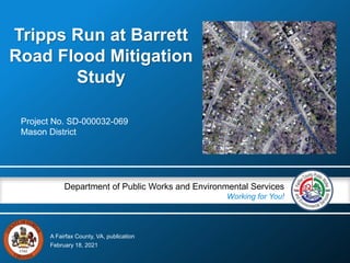
- 1. A Fairfax County, VA, publication Department of Public Works and Environmental Services Working for You! Tripps Run at Barrett Road Flood Mitigation Study Project No. SD-000032-069 Mason District February 18, 2021
- 2. Tripps Run at Barrett Road Stormwater Planning Division Study Objectives 2 Assess the feasibility of various flood mitigation scenarios; Develop corresponding environmental corridor and restorative stream enhancement design features; Quantify the associated flood reduction benefits; and Develop planning level cost estimates.
- 3. Tripps Run at Barrett Road Tripps Run – Existing Conditions 3 Stormwater Planning Division Portions of the channel have been straightened since 1947 Channel armor (riprap) in bed and along banks 35 ft concrete trapezoidal channel upstream of Annandale Rd Lack of vegetation (fences and backyards) Poor access to floodplain
- 4. Tripps Run at Barrett Road Stormwater Planning Division Stantec Study Scope 4 Background Information and Field Visit SCENARIO 1 - Raise the Holloway Road bridge above the 1%-annual-chance water surface elevation (WSE) SCENARIO 2 - Restorative stream enhancements without any property acquisition SCENARIO 3 - Acquire 9 properties and create an environmental corridor with restorative stream enhancements SCENARIO 4 - Acquire 16 properties and create an environmental corridor with restorative stream enhancements Analysis of Scenarios Floodplain Modeling and Mapping Technical Memorandum Report with Planning Level Cost Estimates
- 5. Tripps Run at Barrett Road Location Map 5 Annandale Road Sleepy Hollow Road Holloway Road Dashiell Road Barrett Road
- 6. Tripps Run at Barrett Road Stormwater Planning Division Existing Conditions 6 Existing Conditions FEMA Model from 2017, with refinements • Additional cross-sections • Incorporation of obstructions, restrictions, and encroachments seen in field • Channel roughness updates as seen in field Results Backwater from both Sleepy Hollow Road bridge and Holloway Road bridge 1%-Annual-Chance WSEs 4 to 5 feet higher than some house elevations
- 7. Tripps Run at Barrett Road Stormwater Planning Division Floodplain Mapping – Existing Conditions 7
- 8. Tripps Run at Barrett Road Stormwater Planning Division S1 – Elevating Holloway Road Bridge 8 Scenario 1 Results Max 1%-Annual-Chance WSE decrease: 0.4 ft (just upstream of former bridge location) Bridge would need to be elevated an additional 7.1 feet => Not feasible Raise Holloway Road Bridge above 1%-Annual-Chance WSE No change to number of structures within the mapped 1%-Annual-Chance floodplain boundary
- 9. Tripps Run at Barrett Road Stormwater Planning Division S2 – Stream Enhancements, No Property Acquisition 9 Scenario 2 Results Max 1%-Annual-Chance WSE decrease: 0.8 ft (just upstream of Dashiell Road) WSE at Holloway Road Bridge: no change WSE at downstream end of project: no change No property acquisition No additional easements Stream enhancements Grading within existing County easements and property
- 10. Tripps Run at Barrett Road Stormwater Planning Division Floodplain Mapping – Scenario 2, Stream Enhancements 10
- 11. Tripps Run at Barrett Road Stormwater Planning Division Environmental Corridor – Scenario 3 & 4 11 Demolish bridge at Holloway Road Improved floodplain connectivity Create passive recreation area for the community Grading floodplain and overflow channel Revegetate with native species Add riffles and grade control features to stream
- 12. Tripps Run at Barrett Road Stormwater Planning Division 12 Scenario 3 Acquired Properties Scenario 3
- 13. Tripps Run at Barrett Road Stormwater Planning Division S3 – Environmental Corridor, Acquire 9 Properties 13 Scenario 3 Results Max 1%-Annual-Chance WSE decrease: 4.6 ft (just upstream of Cofer Road) WSE decrease at former Holloway Rd Bridge: 2.8 ft WSE decrease just upstream of Dashiell Road: 2.8 ft 9 properties acquired Environmental stream corridor Stream enhancements Overbank channel
- 14. Tripps Run at Barrett Road Stormwater Planning Division Scenario 3 & 4 - Concept 14 Walking Path Acquired Properties Stabilized Stream with Enhancements Holloway Bridge Removed Environmental Corridor w/Overflow Channel Holloway Road Floodplain Grading
- 15. Tripps Run at Barrett Road Stormwater Planning Division Floodplain Mapping – Scenario 3, Acquire 9 Properties 15 *Structures acquired are not included in the count of structures removed from floodplain.
- 16. Tripps Run at Barrett Road Stormwater Planning Division 16 Scenario 4 Acquired Properties Scenario 4
- 17. Tripps Run at Barrett Road Stormwater Planning Division S4 – Environmental Corridor, Acquire 16 Properties 17 Scenario 4 Results Max 1%-Annual-Chance WSE decrease: 4.7 ft (just downstream of Dashiell Road) WSE decrease at former Holloway Road Bridge: 2.8 ft As compared to Scenario 3, more significant WSE reductions are seen in locations north of Cofer Road 16 properties acquired Environmental stream corridor Stream enhancements Overbank channel
- 18. Tripps Run at Barrett Road Stormwater Planning Division Scenario 4 - Concept 18 Environmental Corridor w/Overflow Channel Acquired Properties Walking Path Stabilized Stream with Enhancements Floodplain Grading
- 19. Tripps Run at Barrett Road Stormwater Planning Division Floodplain Mapping – Scenario 4 Acquire 16 Properties 19 * *Structures acquired are not included in the count of structures removed from floodplain.
- 20. Stormwater Planning Division Rendering 20 Existing Conditions at Holloway Rd and Barrett Rd 6640, 6642, 6644,6646 6648, 6650 6652, 6654, and 6656 Barrett Road
- 21. Stormwater Planning Division Rendering 21 Proposed Scenario 3 and 4 Rendering at Holloway
- 22. Tripps Run at Barrett Road Stormwater Planning Division Comparison 22 Scenario Stream Function Enhancement Max Decrease 1%-Annual- Chance WSEL Acquisitions Residential Structures No Longer within 1%-Annual- Chance FP Residential Structures Remaining in 1%-Annual- Chance FP Planning Level Costs Scenario 2 Low 0.8 ft None 2 60 $1.6 M Scenario 3 Moderate 4.6 ft 9 properties 13 40 $12.7 M Scenario 4 High 4.7 ft 16 properties 17 29 $18.4 M Consultant Recommendation • Scenario 3 appears to optimize benefits, consistent with stated project goals. • Commonly understood that more information can support more informed decision- making. Recommendation on additional information to collect.
- 23. Additional Information For additional information, please contact www.fairfaxcounty.gov/publicworks Tripps Run at Barrett Road Stormwater Planning Division Joni Calmbacher, Project Manager 23 703-324-2183 Joni.Calmbacher@fairfaxcounty.gov