Ground Penetrating Radar Scanning An Introduction to the Technology and its Applications
•
0 likes•2 views

Ground Penetrating Radar Scanning An Introduction to the Technology and its Applications

Recommended
Recommended
More Related Content
Similar to Ground Penetrating Radar Scanning An Introduction to the Technology and its Applications
Similar to Ground Penetrating Radar Scanning An Introduction to the Technology and its Applications (20)
More from Tec
More from Tec (20)
Recently uploaded
Recently uploaded (20)
Ground Penetrating Radar Scanning An Introduction to the Technology and its Applications
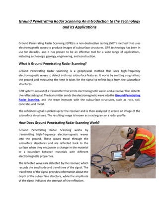
- 1. Ground Penetrating Radar Scanning An Introduction to the Technology and its Applications Ground Penetrating Radar Scanning (GPR) is a non-destructive testing (NDT) method that uses electromagnetic waves to produce images of subsurface structures. GPR technology has been in use for decades, and it has proven to be an effective tool for a wide range of applications, including archeology, geology, engineering, and construction. What is Ground Penetrating Radar Scanning? Ground Penetrating Radar Scanning is a geophysical method that uses high-frequency electromagnetic waves to detect and map subsurface features. It works by emitting a signal into the ground and measuring the time it takes for the signal to reflect back from the subsurface structures. GPR systems consist of a transmitter that emits electromagnetic waves and a receiver that detects the reflected signal. The transmitter sends the electromagnetic wave into the Ground Penetrating Radar Scanning, and the wave interacts with the subsurface structures, such as rock, soil, concrete, and metal. The reflected signal is picked up by the receiver and is then analyzed to create an image of the subsurface structures. The resulting image is known as a radargram or a radar profile. How Does Ground Penetrating Radar Scanning Work? Ground Penetrating Radar Scanning works by transmitting high-frequency electromagnetic waves into the ground. These waves travel through the subsurface structures and are reflected back to the surface when they encounter a change in the material or a boundary between materials with different electromagnetic properties. The reflected waves are detected by the receiver, which records the amplitude and travel time of the signal. The travel time of the signal provides information about the depth of the subsurface structure, while the amplitude of the signal indicates the strength of the reflection.
- 2. GPR systems use different frequencies of electromagnetic waves depending on the application. Lower frequencies can penetrate deeper into the ground but have lower resolution, while higher frequencies have higher resolution but cannot penetrate as deeply. Applications of Ground Penetrating Radar Scanning: Ground Penetrating Radar Scanning has a wide range of applications in various fields. Some of the most common applications are: • Archeology GPR technology is widely used in archeology to map and identify buried structures, artifacts, and features. GPR can help archeologists to locate buried structures and determine their size, shape, and depth. It can also help to identify the presence of underground cavities, tombs, and tunnels. • Geology GPR technology is used in geology to study subsurface structures, such as soil layers, rock formations, and mineral deposits. GPR can help geologists to identify the structure of the subsurface and determine the depth and thickness of the different layers. • Environmental Studies GPR technology is used in environmental studies to study the subsurface structures, such as groundwater, soil contamination, and underground storage tanks. GPR can help environmentalists to locate and map subsurface contamination, determine the extent of contamination, and assess the risk to human health. • Civil Engineering GPR technology is used in civil engineering to study the subsurface structures, such as roads, bridges, tunnels, and buildings. GPR can help engineers to locate and map the subsurface utilities, such as water pipes, gas lines, and electrical cables. It can also help to determine the thickness and condition of the concrete and rebar in buildings and bridges. • Construction GPR technology is used in construction to study the subsurface structures, such as soil layers, rock formations, and utilities. GPR can help construction workers to locate and map subsurface utilities, such as water pipes, gas lines, and electrical cables, before digging. This can help to avoid damage to the utilities, which can be costly and potentially dangerous.
- 3. GPR can also be used to determine the strength and thickness of concrete slabs and walls. This information can be crucial for construction workers, as it can help them to determine if the structure can support the intended load. • Forensics GPR technology is used in forensics to locate buried objects, such as bodies, weapons, and evidence. GPR can help forensic investigators to identify burial sites and determine the size, shape, and depth of the buried objects. This information can be crucial for solving crimes and bringing justice to victims and their families. Benefits of Ground Penetrating Radar Scanning: Ground Penetrating Radar Scanning offers several benefits compared to other NDT methods and traditional excavation methods. Some of the benefits are: • Non-Destructive Testing GPR technology is a non-destructive testing method, which means that it does not damage the subsurface structures. This is in contrast to traditional excavation methods, which can cause damage to the structures and the environment. • Fast and Efficient GPR technology is fast and efficient, which means that it can save time and money compared to traditional excavation methods. GPR can provide a quick and accurate image of the subsurface structures, which can help engineers, archeologists, and environmentalists to make informed decisions. • Safe GPR technology is safe for the environment and the workers, as it does not produce any harmful chemicals or radiation. This makes it a safe and sustainable alternative to other NDT methods and traditional excavation methods. • High Resolution GPR technology offers high-resolution images of the subsurface structures, which means that it can provide detailed information about the structure, size, and shape of the subsurface objects. This is in contrast to other NDT methods, such as X-ray and ultrasonic testing, which have lower resolution. Limitations of Ground Penetrating Radar Scanning:
- 4. Ground Penetrating Radar also has some limitations that should be considered when using the technology. Some of the limitations are: • Limited Depth GPR technology has limited depth penetration, which means that it cannot detect objects that are too deep in the ground. The depth penetration depends on the frequency of the electromagnetic waves, and higher frequencies offer lower penetration depth. • Limited Resolution GPR technology has limited resolution at higher depths, which means that the image quality decreases as the depth increases. This is because electromagnetic waves lose energy as they travel through the ground, which reduces the strength of the reflected signal. • Limited Accuracy GPR technology has limited accuracy when it comes to identifying subsurface structures. This is because electromagnetic waves can be reflected by multiple layers or objects, which can create noise and interfere with the accuracy of the image. Conclusion: Ground Penetrating Radar Scanning is a powerful NDT method that offers a wide range of applications in various fields, such as archeology, geology, environmental studies, civil engineering, construction, and forensics. GPR technology is non-destructive, fast, efficient, safe, and offers high-resolution images of subsurface structures. However, GPR technology also has some limitations, such as limited depth, limited resolution, and limited accuracy. These limitations should be considered when using the technology, and other NDT methods or traditional excavation methods should be used if necessary.