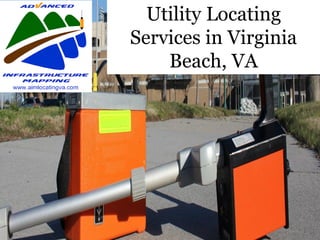
Utility Locating Services in Virginia Beach, VA
•
0 likes•56 views

Advanced Infrastructure Mapping, LLC is an established SUBSURFACE UTILITY ENGINEERING firm, based in the Mid-Atlantic. Our vast knowledge of underground utility investigations help us to provide our customers with the most accurate utility information possible. Each one of our Team Project Managers has 25 to 30 years of underground utility investigation experience. With our dedicated commitment to quality, we can provide Private Utility Locating, Designating, Air/Vacuum Excavation, and Ground Penetrating Radar. AIM follows the strictest Data Collection Guidelines, found in CI/ASCE 38-02. We guarantee you will be more than satisfied with the services provided by Advanced Infrastructure Mapping, LLC

Recommended
More Related Content
What's hot
What's hot (8)
Similar to Utility Locating Services in Virginia Beach, VA
Similar to Utility Locating Services in Virginia Beach, VA (20)
More from Advanced Infrastructure Mapping, LLC
More from Advanced Infrastructure Mapping, LLC (15)
Recently uploaded
Recently uploaded (20)
Utility Locating Services in Virginia Beach, VA
- 1. Utility Locating Services in Virginia Beach, VA
- 2. What is Utility Locating? Utility locating is the process of identifying and labeling public utility mains that are underground. These mains may include lines for telecommunication, electricity distribution, natural gas, cable television, fiber optics, traffic lights, street lights, storm drains, water mains, and wastewater pipes. In some locations, major oil and gas pipelines, national defense communication lines, mass transit, rail and road tunnels also compete for space underground.
- 3. Public utility systems are often run underground; some by the very nature of their function, others for convenience or aesthetics. Before digging, local governments often require that the underground systems' locations be denoted and approved, if it is to be in the public right-of-way.
- 4. DEVICES USED IN UTILITY LOCATING
- 5. Ground Penetrating Radar (GPR) is a large device that looks like a grass mower and is similarly pushed along the surface of the ground. It sends radio waves that penetrate down into the ground as it runs laterally the surface. When these waves come across a foreign object or change in the dielectric property of the material, the waves bounce off to the GPR device. Ground Penetrating Radar
- 6. Any disturbance in the radio waves appears on the screen of the GPR device. A proficient technician can interpret the information to designate the type of underground feature.
- 7. GPR is used frequently to locate objects such as plastic, concrete, buried manholes, pull boxes, valve assemblies, underground storage tanks, changes in soil, and other things that cannot be located using other methods. GPR is a required tool to detect the presence of non-metallic utilities and objects
- 9. Electromagnetic Scanning (EM) is a device that uses a transmitter and receiver to locate metallic utility lines. The transmitter is attached directly to a utility line through its surface feature. It will then send electrical currents down the utility line that can be traced by the receiver. The receiver is used to identify the peaks of the Electromagnetic fields generated from the electrical current. This is how most underground utility lines are located. EM can only be used to locate metallic utility lines. Electromagnetic Scanning
- 10. A Split Box, another Electromagnetic scanner, is a handheld device that has a transmitter on one end, a receiver on the other, and is connected together by a long pole. The device is carried along the surface of the ground and detects metallic objects present under the ground. In addition to detecting utilities, the split box is required for locating abandoned utilities, underground storage tanks, buried manholes, and other metallic objects. Not all utility locating companies use this device. Not using this device exposes the customer to unnecessary risks. Split Box
- 11. A Concrete Scanner is a smaller, handheld Ground Penetrating Radar (GPR) device that is primarily used for concrete scans. The technician uses it by running it along the surface of the concrete. Using the same technology as GPR, the concrete scanner sends high frequency radio waves into the concrete, which bounce off of any changes in dielectric properties within the concrete slab. It can be used to locate conduits, rebar, wire mesh, and other objects embedded within the concrete slab. Concrete Scanner
- 12. This device is a copper wire that is reinforced with fiberglass material. The reel is approximately 150 feet long. The duct rodder is used to find non- metallic utilities that are accessible from the ground surface. The wire within the duct rodder can carry a current, which means that it can be hooked up to the Electromagnetic transmitter device to send a signal down the utility through the duct rodder. Duct Rodder
- 13. After inserting the duct rodder and connecting the transmitter to the copper wire, the EM receiver can then be used to locate the electromagnetic fields emitted off of the duct rodder, and in turn locate the utility.
- 14. Duct Rodder
- 15. A sonde is a small device that acts as a miniature transmitter. It is primarily used to pinpoint blockages or to locate unusually deep utilities. When the sonde is sent down a utility line, it sends off high powered signals as it travels through the line. These signals can then be picked up on the surface of the ground, locating where the sonde is in the utility. Sonde
- 16. A sonde is typically sent through a utility line attached to the end of a duct rodder, however they are also built into the head of a CCTV push camera or robotic crawler. Sondes come in varying strengths. The deeper the utility, the stronger the sonde device needed. The signal has to be strong enough to penetrate the soil and reach the surface of the ground in order to be detected.
- 17. Sonde
- 18. A rebar locator or detector is used primarily for locating rebar and reinforcement in concrete. Using electromagnetic technology, the rebar locator produces a magnetic field which the steel rebar responds to. A rebar locator can locate the location, direction, and approximate depth of reinforcement in concrete. Rebar Locator
- 19. A concrete thickness gauge is a non destructive technique used to measure the thickness and integrity of concrete slabs. It can also be used to detect voids, cracks, and other defects in concrete. Concrete Depth Gauge
- 20. WE ARE ADVANCED INFRASTRUCTURE MAPPING. We have been in the Utility Locating business for 27+ years. We provide Underground Utility Locating and Mapping services for clients such as Engineering Companies, Surveying Companies, Construction Companies, Municipalities, and as simple as a single homeowner in Virginia Beach, VA . Underground Utility Services
- 21. Contact Us Call us at: 757-785-5177 Mail us at: info@aimlocatingva.com Visit us at: http://www.aimlocatingva.com/