SlideShare a Scribd company logo
1 of 15
eCognition Developer
● Is Designed to improve, accelarate and automate the interpretation of geospatial data
● Is a development environment for object-based image analysis used for the automatic analysis of
remote sensing data
● Enable users to design feature extraction and / or change detection solutions to transform geospatial
data to geo information
● Is A software to analyse raster, vector and point cloud data
● can be applied for all common remote sensing tasks such as vegetation mapping, feature extraction,
change detection and object recognition
What is Feature Extraction?
● Is the process to
represent raw image ( or
transforming the input
data) in a reduced form
(or a set of features) to
facilitate decision making
such as pattern detection,
classification or
recognition.
● is a process for extracting
relevant information from
an image
How eCognition Developer works?
It is an Object based image Analysis (OBIA).
In GeOBIA or Geographic OBIA, pixels are grouped in homogeneous objects associated by statistic
(spatial, spectral and texture) which can be used to classify them (characterization, segmentation and
classification)
Image Segmentation
- Develop set of rules
- Combine, modify and calibrate
rules set
- Process Data
- Execute and monitor analysis
- Review, edit and export
results
How eCognition Developer works?
Practical case : Let's Start with eCognition Developer
eCognition Workflow
Application: Create a new project
2. Template editor and select samples data
Generate template and search the sample correlation of each layer
3. Test template : Template Editor
A. Select the region
B. Take the Layer with which you want to
test your Thereshold cofficient
C. Update the template and execute the
test
D. Check for correct and false template
E. Go to select sample to update sample
data
4. Create a new process
5. The template matching
A. Select the folder
containing the test
layer
B. Update the
threshold value
C. Take ‘template
matching’
algorithm
D. Execute the test
6. Vector Layer Mixing
In vector layer mixing
select show
7. Update Process tree
Reduce Thereshold value
accordingly and reexecute the
process
Visualy see the update (or go
back to vector layer mixing and
select ‘show’ with the color you
want )
Feature extraction with eCognition developer

More Related Content

What's hot

Remote Sensing:. Image Filtering
Remote Sensing:. Image FilteringRemote Sensing:. Image Filtering
Remote Sensing:. Image Filtering
Kamlesh Kumar
 
Remote sensing: Accuracy Assesment
Remote sensing: Accuracy AssesmentRemote sensing: Accuracy Assesment
Remote sensing: Accuracy Assesment
Kamlesh Kumar
 
WEB GIS AND WEB MAP.pptx
WEB GIS AND WEB MAP.pptxWEB GIS AND WEB MAP.pptx
WEB GIS AND WEB MAP.pptx
Asim Pt
 
Remote Sensing: Image Classification
Remote Sensing: Image ClassificationRemote Sensing: Image Classification
Remote Sensing: Image Classification
Kamlesh Kumar
 
Introduction to WebGIS- Esri norsk BK 2014
Introduction to WebGIS- Esri norsk BK 2014Introduction to WebGIS- Esri norsk BK 2014
Introduction to WebGIS- Esri norsk BK 2014
Geodata AS
 

What's hot (20)

Remote Sensing:. Image Filtering
Remote Sensing:. Image FilteringRemote Sensing:. Image Filtering
Remote Sensing:. Image Filtering
 
DATA in GIS and DATA Query
DATA in GIS and DATA QueryDATA in GIS and DATA Query
DATA in GIS and DATA Query
 
Digital Image Classification.pptx
Digital Image Classification.pptxDigital Image Classification.pptx
Digital Image Classification.pptx
 
Application of Basic Remote Sensing in Geology
Application of Basic Remote Sensing in GeologyApplication of Basic Remote Sensing in Geology
Application of Basic Remote Sensing in Geology
 
Data input and transformation
Data input and transformationData input and transformation
Data input and transformation
 
Spatial Data Model
Spatial Data ModelSpatial Data Model
Spatial Data Model
 
QGIS Tutorial 2
QGIS Tutorial 2QGIS Tutorial 2
QGIS Tutorial 2
 
Remote sensing: Accuracy Assesment
Remote sensing: Accuracy AssesmentRemote sensing: Accuracy Assesment
Remote sensing: Accuracy Assesment
 
GIS - Topology
GIS - Topology GIS - Topology
GIS - Topology
 
Image classification
Image classificationImage classification
Image classification
 
07 Image classification.pptx
07 Image classification.pptx07 Image classification.pptx
07 Image classification.pptx
 
GEOPROCESSING IN QGIS
GEOPROCESSING IN QGISGEOPROCESSING IN QGIS
GEOPROCESSING IN QGIS
 
Arc Geographic Information System (GIS) Digital Elevation Models (DEM).
Arc Geographic Information System (GIS) Digital Elevation Models (DEM).Arc Geographic Information System (GIS) Digital Elevation Models (DEM).
Arc Geographic Information System (GIS) Digital Elevation Models (DEM).
 
Functions of GIS
Functions of GISFunctions of GIS
Functions of GIS
 
GIS
GISGIS
GIS
 
Digital image processing 1
Digital  image processing 1Digital  image processing 1
Digital image processing 1
 
WEB GIS AND WEB MAP.pptx
WEB GIS AND WEB MAP.pptxWEB GIS AND WEB MAP.pptx
WEB GIS AND WEB MAP.pptx
 
Digital image classification
Digital image classificationDigital image classification
Digital image classification
 
Remote Sensing: Image Classification
Remote Sensing: Image ClassificationRemote Sensing: Image Classification
Remote Sensing: Image Classification
 
Introduction to WebGIS- Esri norsk BK 2014
Introduction to WebGIS- Esri norsk BK 2014Introduction to WebGIS- Esri norsk BK 2014
Introduction to WebGIS- Esri norsk BK 2014
 

Similar to Feature extraction with eCognition developer

OBJECT DETECTION, EXTRACTION AND CLASSIFICATION USING IMAGE PROCESSING TECHNIQUE
OBJECT DETECTION, EXTRACTION AND CLASSIFICATION USING IMAGE PROCESSING TECHNIQUEOBJECT DETECTION, EXTRACTION AND CLASSIFICATION USING IMAGE PROCESSING TECHNIQUE
OBJECT DETECTION, EXTRACTION AND CLASSIFICATION USING IMAGE PROCESSING TECHNIQUE
Journal For Research
 
School of Computing, Science & EngineeringAssessment Briefin.docx
School of Computing, Science & EngineeringAssessment Briefin.docxSchool of Computing, Science & EngineeringAssessment Briefin.docx
School of Computing, Science & EngineeringAssessment Briefin.docx
anhlodge
 
AN INTEGRATED APPROACH TO CONTENT BASED IMAGE RETRIEVAL by Madhu
AN INTEGRATED APPROACH TO CONTENT BASED IMAGERETRIEVAL by MadhuAN INTEGRATED APPROACH TO CONTENT BASED IMAGERETRIEVAL by Madhu
AN INTEGRATED APPROACH TO CONTENT BASED IMAGE RETRIEVAL by Madhu
Madhu Rock
 
Erdas Imagine Tool Geographic imaging professionals use specialized software.pdf
Erdas Imagine Tool Geographic imaging professionals use specialized software.pdfErdas Imagine Tool Geographic imaging professionals use specialized software.pdf
Erdas Imagine Tool Geographic imaging professionals use specialized software.pdf
bkbk37
 

Similar to Feature extraction with eCognition developer (20)

Object Based Image Analysis
Object Based Image Analysis Object Based Image Analysis
Object Based Image Analysis
 
OBJECT DETECTION, EXTRACTION AND CLASSIFICATION USING IMAGE PROCESSING TECHNIQUE
OBJECT DETECTION, EXTRACTION AND CLASSIFICATION USING IMAGE PROCESSING TECHNIQUEOBJECT DETECTION, EXTRACTION AND CLASSIFICATION USING IMAGE PROCESSING TECHNIQUE
OBJECT DETECTION, EXTRACTION AND CLASSIFICATION USING IMAGE PROCESSING TECHNIQUE
 
The Visualization Pipeline
The Visualization PipelineThe Visualization Pipeline
The Visualization Pipeline
 
School of Computing, Science & EngineeringAssessment Briefin.docx
School of Computing, Science & EngineeringAssessment Briefin.docxSchool of Computing, Science & EngineeringAssessment Briefin.docx
School of Computing, Science & EngineeringAssessment Briefin.docx
 
Automated features extraction from satellite images.
Automated features extraction from satellite images.Automated features extraction from satellite images.
Automated features extraction from satellite images.
 
Image Features Matching and Classification Using Machine Learning
Image Features Matching and Classification Using Machine LearningImage Features Matching and Classification Using Machine Learning
Image Features Matching and Classification Using Machine Learning
 
AN INTEGRATED APPROACH TO CONTENT BASED IMAGE RETRIEVAL by Madhu
AN INTEGRATED APPROACH TO CONTENT BASED IMAGERETRIEVAL by MadhuAN INTEGRATED APPROACH TO CONTENT BASED IMAGERETRIEVAL by Madhu
AN INTEGRATED APPROACH TO CONTENT BASED IMAGE RETRIEVAL by Madhu
 
Introduction to Machine Learning with SciKit-Learn
Introduction to Machine Learning with SciKit-LearnIntroduction to Machine Learning with SciKit-Learn
Introduction to Machine Learning with SciKit-Learn
 
Erdas Imagine Tool Geographic imaging professionals use specialized software.pdf
Erdas Imagine Tool Geographic imaging professionals use specialized software.pdfErdas Imagine Tool Geographic imaging professionals use specialized software.pdf
Erdas Imagine Tool Geographic imaging professionals use specialized software.pdf
 
IRJET- A Plant Identification and Recommendation System
IRJET- A Plant Identification and Recommendation SystemIRJET- A Plant Identification and Recommendation System
IRJET- A Plant Identification and Recommendation System
 
Improved Weighted Least Square Filter Based Pan Sharpening using Fuzzy Logic
Improved Weighted Least Square Filter Based Pan Sharpening using Fuzzy LogicImproved Weighted Least Square Filter Based Pan Sharpening using Fuzzy Logic
Improved Weighted Least Square Filter Based Pan Sharpening using Fuzzy Logic
 
introduction to Statistical Theory.pptx
 introduction to Statistical Theory.pptx introduction to Statistical Theory.pptx
introduction to Statistical Theory.pptx
 
Visualizing Model Selection with Scikit-Yellowbrick: An Introduction to Devel...
Visualizing Model Selection with Scikit-Yellowbrick: An Introduction to Devel...Visualizing Model Selection with Scikit-Yellowbrick: An Introduction to Devel...
Visualizing Model Selection with Scikit-Yellowbrick: An Introduction to Devel...
 
GY7705 Remote Sensing.docx
GY7705 Remote Sensing.docxGY7705 Remote Sensing.docx
GY7705 Remote Sensing.docx
 
What’s New in eCognition 8.9
What’s New in eCognition 8.9What’s New in eCognition 8.9
What’s New in eCognition 8.9
 
Web Image Retrieval Using Visual Dictionary
Web Image Retrieval Using Visual DictionaryWeb Image Retrieval Using Visual Dictionary
Web Image Retrieval Using Visual Dictionary
 
Web Image Retrieval Using Visual Dictionary
Web Image Retrieval Using Visual DictionaryWeb Image Retrieval Using Visual Dictionary
Web Image Retrieval Using Visual Dictionary
 
Project 6
Project 6Project 6
Project 6
 
IRJET- Saliency based Image Co-Segmentation
IRJET- Saliency based Image Co-SegmentationIRJET- Saliency based Image Co-Segmentation
IRJET- Saliency based Image Co-Segmentation
 
IRJET - Face Recognition based Attendance System
IRJET -  	  Face Recognition based Attendance SystemIRJET -  	  Face Recognition based Attendance System
IRJET - Face Recognition based Attendance System
 

Recently uploaded

Spellings Wk 3 English CAPS CARES Please Practise
Spellings Wk 3 English CAPS CARES Please PractiseSpellings Wk 3 English CAPS CARES Please Practise
Spellings Wk 3 English CAPS CARES Please Practise
AnaAcapella
 

Recently uploaded (20)

Python Notes for mca i year students osmania university.docx
Python Notes for mca i year students osmania university.docxPython Notes for mca i year students osmania university.docx
Python Notes for mca i year students osmania university.docx
 
Holdier Curriculum Vitae (April 2024).pdf
Holdier Curriculum Vitae (April 2024).pdfHoldier Curriculum Vitae (April 2024).pdf
Holdier Curriculum Vitae (April 2024).pdf
 
Micro-Scholarship, What it is, How can it help me.pdf
Micro-Scholarship, What it is, How can it help me.pdfMicro-Scholarship, What it is, How can it help me.pdf
Micro-Scholarship, What it is, How can it help me.pdf
 
REMIFENTANIL: An Ultra short acting opioid.pptx
REMIFENTANIL: An Ultra short acting opioid.pptxREMIFENTANIL: An Ultra short acting opioid.pptx
REMIFENTANIL: An Ultra short acting opioid.pptx
 
Sociology 101 Demonstration of Learning Exhibit
Sociology 101 Demonstration of Learning ExhibitSociology 101 Demonstration of Learning Exhibit
Sociology 101 Demonstration of Learning Exhibit
 
Wellbeing inclusion and digital dystopias.pptx
Wellbeing inclusion and digital dystopias.pptxWellbeing inclusion and digital dystopias.pptx
Wellbeing inclusion and digital dystopias.pptx
 
Application orientated numerical on hev.ppt
Application orientated numerical on hev.pptApplication orientated numerical on hev.ppt
Application orientated numerical on hev.ppt
 
ICT Role in 21st Century Education & its Challenges.pptx
ICT Role in 21st Century Education & its Challenges.pptxICT Role in 21st Century Education & its Challenges.pptx
ICT Role in 21st Century Education & its Challenges.pptx
 
SOC 101 Demonstration of Learning Presentation
SOC 101 Demonstration of Learning PresentationSOC 101 Demonstration of Learning Presentation
SOC 101 Demonstration of Learning Presentation
 
HMCS Max Bernays Pre-Deployment Brief (May 2024).pptx
HMCS Max Bernays Pre-Deployment Brief (May 2024).pptxHMCS Max Bernays Pre-Deployment Brief (May 2024).pptx
HMCS Max Bernays Pre-Deployment Brief (May 2024).pptx
 
Spellings Wk 3 English CAPS CARES Please Practise
Spellings Wk 3 English CAPS CARES Please PractiseSpellings Wk 3 English CAPS CARES Please Practise
Spellings Wk 3 English CAPS CARES Please Practise
 
Beyond_Borders_Understanding_Anime_and_Manga_Fandom_A_Comprehensive_Audience_...
Beyond_Borders_Understanding_Anime_and_Manga_Fandom_A_Comprehensive_Audience_...Beyond_Borders_Understanding_Anime_and_Manga_Fandom_A_Comprehensive_Audience_...
Beyond_Borders_Understanding_Anime_and_Manga_Fandom_A_Comprehensive_Audience_...
 
Single or Multiple melodic lines structure
Single or Multiple melodic lines structureSingle or Multiple melodic lines structure
Single or Multiple melodic lines structure
 
2024-NATIONAL-LEARNING-CAMP-AND-OTHER.pptx
2024-NATIONAL-LEARNING-CAMP-AND-OTHER.pptx2024-NATIONAL-LEARNING-CAMP-AND-OTHER.pptx
2024-NATIONAL-LEARNING-CAMP-AND-OTHER.pptx
 
Introduction to Nonprofit Accounting: The Basics
Introduction to Nonprofit Accounting: The BasicsIntroduction to Nonprofit Accounting: The Basics
Introduction to Nonprofit Accounting: The Basics
 
Fostering Friendships - Enhancing Social Bonds in the Classroom
Fostering Friendships - Enhancing Social Bonds  in the ClassroomFostering Friendships - Enhancing Social Bonds  in the Classroom
Fostering Friendships - Enhancing Social Bonds in the Classroom
 
SKILL OF INTRODUCING THE LESSON MICRO SKILLS.pptx
SKILL OF INTRODUCING THE LESSON MICRO SKILLS.pptxSKILL OF INTRODUCING THE LESSON MICRO SKILLS.pptx
SKILL OF INTRODUCING THE LESSON MICRO SKILLS.pptx
 
How to Create and Manage Wizard in Odoo 17
How to Create and Manage Wizard in Odoo 17How to Create and Manage Wizard in Odoo 17
How to Create and Manage Wizard in Odoo 17
 
HMCS Vancouver Pre-Deployment Brief - May 2024 (Web Version).pptx
HMCS Vancouver Pre-Deployment Brief - May 2024 (Web Version).pptxHMCS Vancouver Pre-Deployment Brief - May 2024 (Web Version).pptx
HMCS Vancouver Pre-Deployment Brief - May 2024 (Web Version).pptx
 
How to setup Pycharm environment for Odoo 17.pptx
How to setup Pycharm environment for Odoo 17.pptxHow to setup Pycharm environment for Odoo 17.pptx
How to setup Pycharm environment for Odoo 17.pptx
 

Feature extraction with eCognition developer

  • 1.
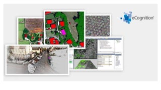
  • 2. eCognition Developer ● Is Designed to improve, accelarate and automate the interpretation of geospatial data ● Is a development environment for object-based image analysis used for the automatic analysis of remote sensing data ● Enable users to design feature extraction and / or change detection solutions to transform geospatial data to geo information ● Is A software to analyse raster, vector and point cloud data ● can be applied for all common remote sensing tasks such as vegetation mapping, feature extraction, change detection and object recognition
  • 3. What is Feature Extraction? ● Is the process to represent raw image ( or transforming the input data) in a reduced form (or a set of features) to facilitate decision making such as pattern detection, classification or recognition. ● is a process for extracting relevant information from an image
  • 4. How eCognition Developer works? It is an Object based image Analysis (OBIA). In GeOBIA or Geographic OBIA, pixels are grouped in homogeneous objects associated by statistic (spatial, spectral and texture) which can be used to classify them (characterization, segmentation and classification) Image Segmentation
  • 5. - Develop set of rules - Combine, modify and calibrate rules set - Process Data - Execute and monitor analysis - Review, edit and export results How eCognition Developer works?
  • 6. Practical case : Let's Start with eCognition Developer
  • 8. Application: Create a new project
  • 9. 2. Template editor and select samples data Generate template and search the sample correlation of each layer
  • 10. 3. Test template : Template Editor A. Select the region B. Take the Layer with which you want to test your Thereshold cofficient C. Update the template and execute the test D. Check for correct and false template E. Go to select sample to update sample data
  • 11. 4. Create a new process
  • 12. 5. The template matching A. Select the folder containing the test layer B. Update the threshold value C. Take ‘template matching’ algorithm D. Execute the test
  • 13. 6. Vector Layer Mixing In vector layer mixing select show
  • 14. 7. Update Process tree Reduce Thereshold value accordingly and reexecute the process Visualy see the update (or go back to vector layer mixing and select ‘show’ with the color you want )

Editor's Notes

  1. It is a feature extraction technique, more recent than traditional pixel based image analysis (supervised, unsupervised classification) and is based on informations of set of similar pixels (image object)
  2. Source : http://geotronics.es/files/03_Whats%20New%20in%20eCognition%209%200%20-%20vGeobia.pdf