
Recommended
Recommended
More Related Content
Similar to ICC2017 UUUI sessions 5604-2
Similar to ICC2017 UUUI sessions 5604-2 (20)
More from UUUI ICA
More from UUUI ICA (14)
Recently uploaded
Recently uploaded (20)
ICC2017 UUUI sessions 5604-2
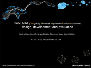
- 1. Faculty of Geo-Information Science and Earth Observation (ITC) GeoFARA (Geography Fieldwork Augmented Reality Application): design, development and evaluation Xiaoling Wang, Corné P.J.M. van Elzakker, Menno-Jan Kraak, Barend Köbben ICC 2017, 5 July, 2017 | Washington, DC, USA
- 2. Faculty of Geo-Information Science and Earth Observation (ITC) GeoFARA (Geography Fieldwork Augmented Reality Application): design, development and evaluation Xiaoling Wang, Corné P.J.M. van Elzakker, Menno-Jan Kraak, Barend Köbben
- 3. What is AR (Augmented Reality)? Physical real-world environment Augmented reality Augmentation Reality= + Device generated contextual data Augmentation Reality camera GPS compass accelerometer wireless connectivity 3
- 4. What is GeoFARA? Enschede, the textile industry Augmented reality Augmentation Reality= + Mobile phone generated Geo-Information This research: AR on smartphones used outdoor in an educational geography fieldwork scenario. 4 GeoFARA
- 5. Methodology User-Centered Design (ISO9241-210, 2010 - the iterative process of UCD) 5
- 6. Methodology- User-Centered Design of GeoFARA 6 1.Analyzing context of use and user requirements 2.Conceptual design and prototype development 3.Usability evaluation
- 7. Methods and results of Stage 1- analyzing context of use and user requirements for GeoFARA • GeoFARA is needed and necessary; • Potential users are interested; • Earlier user requirements in current practices; • In-depth and concrete user requirements; • …… GeoFARA 7 Methods Context of use analysis Online survey Existing mobile AR application analysis Evaluation of the usage of an existing application Observation, survey, interview during actual educational fieldworks Use cases and task analysis Scenario of use and persona
- 8. User requirements results of user interface of GeoFARA 8
- 9. Stage 2 – Conceptual design and prototyping GeoFARA Results Producing design solutions Conceptual design and prototype development of GeoFARA 9
- 10. 10 Methods of conceptual designing and prototyping GeoFARA Methods Purposes Scenario-based design To specify concrete functionalities for GeoFARA, and design contents, interfaces of GeoFARA Rapid prototyping To visually demonstrate how GeoFARA looks like Working interface prototyping To produce an operational prototype of GeoFARA for evaluation Design guidelines and standards To ensure the consistency of the design of GeoFARA within mobile Android applications GeoFARA
- 11. 11 The conceptual designing and prototype of GeoFARA
- 12. 12 The working interface prototype of GeoFARA (1/3) Functionalities of GeoFARA 1.Log in/out 2.Switch between AR view and map view 3.Take field note/photo/video 4.Augment each POI with images, old maps, texts… in AR view 5.Navigate with in map view 6.Upload POIs from a web page ……
- 13. 13 The working interface prototype of GeoFARA (2/3) Log in/out Switch between AR view and map view Take field note/photo/video Navigate within map view
- 14. 14 The working interface prototype of GeoFARA (3/3) Upload POIs from a web page
- 16. 16 Stage 3 - Evaluating usability of GeoFARA (A conceptual model of user-mobile device context-aware interactions, Li and Willis 2006) • Mobile application usability: the extent to which a mobile application can be used by specified users (with various modalities of mobility) to achieve specified goals with effectiveness, efficiency, and satisfaction in a specified user context. • GeoFARA’s usability—the extent to which GeoFARA can be used by students (when visiting the fieldwork area) to achieve spatial cognition with effectiveness, efficiency, and satisfaction.
- 17. 17 Methods Purposes Online survey To recruit representative users Clickstream/Log capture To capture the user’s finger-touch on the phone screen (touch heat map) Mobile eye tracking To record the user’s eye movements among GeoFARA and environment Thinking aloud To obtain the user’s simultaneous ongoing thoughts Camera/video studies To record the user’s behavior and the whole process User observation To observation the user’s behavior Task analysis To evaluate GeoFARA’s effectiveness, and efficiency Post-task survey, interview To collect the user’s overall experience towards GeoFARA Methods of evaluating usability of GeoFARA
- 18. 18 Mobile eye tracking system
- 19. 19 Upcoming work • Piolet test • Improve the usability evaluation setup • Real field evaluation the usability of GeoFARA • Improve the design of GeoFARA • Deploy GeoFARA
- 20. 20 Feedback?
- 21. 21 Thank you for your attention! x.wang-5@utwente.nl Chapter 2 Learning Geography with Visual Tools in Geography fieldwork Chapter 3 Research Methodology: The User-Centered Design Chapter 4 Context of Use and User Requirements Analysis towards GeoFARA • Paper: Wang, X., van Elzakker C.P.J.M., & Kraak M.J. (2016). User requirements analysis for a mobile augmented reality tool supporting geography fieldwork. In G.Gartner, M. Jobst, H. Huang (Eds.), Progress in Cartography: EuroCarto 2015. Chapter 5 Conceptual Design and Prototype Development of GeoFARA • Paper: Conceptual design of a mobile fieldwork application – GeoFARA (to be submitted). Chapter 6 Evaluation the Usability of GeoFARA