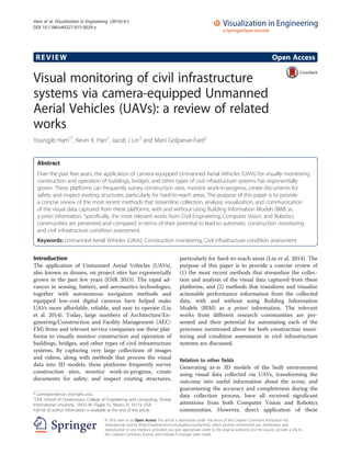
2. methods for construction monitoring and civil infra-
structure condition assessment purposes is challenging
due to (1) the enormous amounts of visual data that
need to be frequently captured and rapidly processed
(e.g. more than thousands of images are collected per
flight on a construction site, which results in 3D point
clouds with more than hundred million points); and (2)
a large number of civil infrastructure elements that
needs to be detected and characterized that all of these
elements and their relevant visual data need to be
analyzed in less than a few hours to be meaningful for
real-time project controls. In construction and civil
infrastructure domains, BIM can provide strong a priori
information about geometry and appearance of scenes.
Therefore, collection of visual data, and detection and
analysis of individual elements would be simpler prob-
lems compared to the generic problems encountered in
Computer Vision and Robotics fields. This makes the
problem domain of UAV-driven construction monitoring
and civil infrastructure condition assessment interesting,
as it can lead to domain-specific findings which can be
generalized to solve the generic problems. Such prob-
lems being closely related to several research fields en-
courage interdisciplinary and multi-disciplinary efforts,
and it is our hope that this paper contributes to
highlighting such open areas of research.
Organization of this paper
This paper starts with problem statements on (1) collec-
tion of visual data via UAVs, (2) synthesizing and pro-
cessing the visual data into actionable performance
information, and (3) visualizing and communicating the
outcome with practitioners involved in the project
(Section 2). The subsequent sections review the most
relevant works on each procedure and present the open
areas of research. Section 6 concludes the paper.
Review
UAV-driven visual monitoring for construction and civil
infrastructure systems
The goal of a UAV-driven visual performance monitoring
procedure is to (1) collect images or videos from the most
informative views on a project site, (2) analyze them with
or without a priori BIM to reason about performance de-
viations during construction (e.g. progress and quality), (3)
monitor ongoing operations for productivity and safety,
(4) characterize the as-is conditions of existing civil infra-
structure systems, and (5) quickly and frequently visualize
and communicate the most updated state of work-in-
progress with onsite and offsite project participants. Figure 1
illustrates an example of next generation construction site
where camera-equipped UAVs autonomously monitor the
construction performance. The following sections describe
the most recent research in each procedure, their chal-
lenges, and future direction for research.
Collecting informative visual data
Providing accurate performance information about the
state of construction or existing conditions of civil infra-
structures requires UAVs to collect visual data in form of
images and videos (e.g., digital: RGB; thermal: T; depth: D;
digital + depth: RGB + D) from the most relevant locations
and views on a project site. To streamline this process,
research in UAV-driven visual data collection need to
address the following challenges: (1) autonomous or semi-
autonomous path planning, navigation, and take-off and
landing procedures; (2) characterization of the criteria ne-
cessary for data collection, including the configurations
among the images to guarantee complete as-built
Steel Column (IFCColumn)
Length: x
OuterSurfaceArea: Y
ConnectedTo: Elements z, r
Schedule: install on day 10
Installedby: MobileCrane
Progress Status: On-schedule
Quality: According to Specs
MobileCrane
Type: CompactMobileCrane 7.7t, 10m
Activity: Hoisting
Location: <x,y,z>
Installation Productivity: xxx tons/day
Operation Status: Safe
1. Camera-equipped UAVs flying
around to capture images and videos
from most informative views on a site
Ironworker
Activity: Welding
Location: <x,y,z>
Installation Productivity: xxx tons/day
Operation Status: Safe
4. Project personnel to access
3D integrated information
models on commodity
smartphone/tablets and
conduct field-reporting
3. UAVs monitoring ongoing
operations for safety
4. Monitoring productivity of
ongoing operations
Proximity between telehandler
& worker A is xxx
Operation Status: Safe
2. Document completed
work and current quality
Fig. 1 A vision for the next generation construction site where camera-equipped UAVs autonomously monitor work-in-progress for improving
safety, quality, and productivity
Ham et al. Visualization in Engineering (2016) 4:1 Page 2 of 8
3. information; and (3) identification of the most informative
views for data collection (e.g., canonical view, top down
view, etc. for appearance-based recognition of work-in-
progress as in (Han et al. 2015)). Table 1 categorizes prior
works based on their level of autonomy and with respect
to their specific applications.
UAV-driven data collection in practice still relies on
experienced pilots navigating the UAVs on and
around project sites although there have been recent
efforts on Simultaneous Localization and Mapping
(SLAM) techniques by the research community.
Recent studies (Fernandez Galarreta et al. 2015; Kerle
2999; Zollmann et al. 2014) and commercial systems
(DJI 2015) provide autonomous navigation and data
collection capabilities using GPS waypoints and pre-
determined flight path. These methods are beneficial
in land surveying or monitoring low-structures with
large footprint. Nevertheless, a GPS-driven flight
planning method that builds on existing maps has the
following limitations (Lin, Han, Fukuchi et al. 2015a):
(1) does not account for dynamics on a construction
site and their impact on safety (e.g. the location and
orientation of temporary resources such as cranes);
(2) can be negatively affected by loss/interference in
GPS signal at interiors or due to shadowing effects
caused by nearby buildings or other structures in
densely populated metropolitan areas and high-rise
buildings; and (3) can be subject to navigational haz-
ards due to the loss of calibration on magnetometer
sensors in proximity to structural and non-structural
steel components. In the meantime, research on
SLAM techniques for UAVs and ground robots has
been mainstream in the Robotics community. Using
high resolution laser scanners (Zhang & Singh, S.
“LOAM: Lidar Odometry and Mapping in Real-time.”
Proc., Robotics: Science and Systems Conference (RSS
2014), monocular cameras (Blo, x, sch, M et al. 2010;
Lui et al. 2015), and RGB-D cameras (Loianno et al.
2015), these techniques generate 3D maps of un-
known scenes and localize the robot in that environ-
ment. The latest efforts such as (Michael et al. 2014)
have focused on experimenting a variant of SLAM
using RGD-B for scanning post-disaster buildings, yet
there is almost little to no work reported on actively
testing these algorithms for producing 3D maps on
civil infrastructure systems for construction monitor-
ing or condition assessment purposes. Also, methods
that account for evolving structures (i.e. large num-
bers of shoring and frames in room partitions) and
dynamic objects (i.e. equipment and human) are not
reported in the literature.
As can be seen from the literature, research is mainly
focused on challenge 1, and challenge 2 and 3 still lacks
investigation in terms of the number of studies con-
ducted. For example, identifying the most informative
views for observing different tasks with or without BIM,
and collecting visual data to monitor locations, activities
of equipment, and craft workers on a jobsite are not well
studied. There is an opportunity for leveraging a priori
information about geometry and appearance of a site via
BIM. When integrated with schedules, BIM can also re-
port on the most likely locations for expected changes
on the site to steer data collection. A BIM-driven data
collection method has potential to overcome some of
these challenges mentioned above such as collision
avoidance with structures. Together with 4D (3D + time)
point clouds, BIM definitely has potential to minimize
many technical challenges facing fully autonomous navi-
gation and data collection for the built environment.
Visual data analytics
The analytics of visual data has been a research subject
for more than a decade. Many image processing, com-
puter vision, and geometrical processing techniques are
developed that can (1) generate semantically-rich 3D
models from collections of overlapping images; (2)
manually, semi-automatically, or automatically conduct
progress monitoring, surveying, safety inspection, quality
monitoring and activity analysis during construction,
and (3) streamline condition assessment in existing
buildings and infrastructure systems. (Cho et al. 2015;
Pătrăucean et al. 2015; Son et al. 2015; Teizer 2015; Yang
et al. 2015) provide thorough reviews of these tech-
niques. These all methods can be applied to visual data
Table 1 The level of autonomy in UAV-based visual data collection for construction performance monitoring and civil infrastructure
condition assessment
Autonomy Sensor A Priori Literature
Autonomous Camera None (ARIA (Team 2015; Fernandez Galarreta et al. 2015; Kerle 2999; Qin 2014; Siebert & Teizer 2014;
Yamamoto et al. 2014; Zhang & Elaksher 2012; Zollmann et al. 2014))
RGB-D None (Michael et al. 2014)
Semi-autonomous Camera None (Dobson et al. 2013; Eschmann 2999; Fiorillo et al. 2012; Gao et al. 2011; Kluckner et al. 2011;
Matsuoka et al. 2012; Wefelscheid et al. 2011; Zollmann et al. 2012)
Manual Camera Model-driven (Han et al. 2015; Lin, Han, Fukuchi et al. 2015a; Lin, Han & Golparvar-Fard 2015)
None (Gheisari et al. 2014; Irizarry et al. 2012; Oskouie et al. 2015; Vetrivel 2999; Wen et al. 2014; Xie et al.
2012; Ye et al. 2014)
Ham et al. Visualization in Engineering (2016) 4:1 Page 3 of 8
4. collected from UAVs, yet only a few studies have vali-
dated them in such contexts. Tables 2 and 3 summarize
the most recent literature from the last few years that
focus on methods that are exclusively developed or
applied to images and videos from UAVs.
Figure 2 categorizes these methods based on their level
of automation and with respect to specific applications.
As seen, prior works are mainly based on image-based
3D reconstruction procedures to analyze unordered and
uncalibrated image collections. While these methods
generally work better on ordered and sequential images,
yet without a rigid control on the location and viewpoint
of the captured images with respect to onsite construc-
tion elements, the visual content of the images may not
be most suitable for certain applications. For example,
for appearance-based construction progress monitoring,
leveraging material recognition techniques such as Han
et al. (Han et al. 2015) benefits from images that are
taken in a canonical view to identify the most updated
status of construction for onsite elements. This requires
research that identifies the most informative views, and
then techniques that can leverage such information as a
priori information for data collection. In addition, a
detailed assessment of work-in-progress, quality, and
existing conditions requires the analysis of geometry,
appearance, and interconnectivity among the construc-
tion elements. It also requires techniques for as-built
and as-damaged information modeling; nevertheless,
techniques that address these issues are not well studied.
Ongoing efforts such as the Flying Superintendents
project at the University of Illinois (Lin, Han &
Golparvar-Fard 2015), and the ARIA project at Carne-
gie Melon University (ARIA (Team 2015)) are geared
towards providing specific frameworks together with
methods for construction monitoring and civil infra-
structure condition assessment to address some of
these gaps-in-knowledge.
Information visualization
Achieving effective flow of information both to and from
project sites and conducting actionable analytics for
construction monitoring and condition assessment re-
quire intuitive visualization of the information produced
throughout the process on top of the UAV visual data -
Table 2 UAV-driven methods for construction and building performance monitoring
Application Data Analytics Integration
with BIM
Literature
Progress monitoring • BIM-assisted image-based
3D & 4D reconstruction
• Leveraging spatial and temporal information
in 4D BIM for monitoring work-in-progress
Y (Lin, Han, Fukuchi et al.
2015a)
• Appearance-based reasoning about progress
deviations
Y (Han et al. 2015)
• Image-based 3D & 4D
reconstruction
• Measuring mass excavation Y (Lin, Han & Golparvar-
Fard 2015)
• Surface reconstructed• Multi-sensors fusion
(GPS, IMU, vision-based panoramic tracker)
for data registration in mobile AR system
Y (Zollmann et al. 2014)
• Surface reconstructed• 4D visualization with
multiple levels of detail
Y (Zollmann et al. 2012)
• Geometry-based change detection. N (Kluckner et al. 2011)
Site monitoring • Integrating aerial images and virtual rendering scenes (3D models) for a
WLAN-based AR system
Y (Wen et al. 2014)
Building inspection • Image-based 3D reconstruction and meshing N (Wefelscheid et al. 2011)
• 3D mapping of earthquake damages buildings using RGB-D sensors and
3D rotating laser scanners
N (Michael et al. 2014)
• Image stitching for large façade reconstruction• Edge detection for identifying
cracks on building façades
N (Eschmann 2999)
Building measurement • Image-based 3D reconstruction using a four-camera system mounted on the
UAV
• Extracting roof contours
Y (Xie et al. 2012)
Surveying • Image-based 3D reconstruction
• Geo-referencing by using time-stamped GPS Data or PhotoScan software
• 3D mapping for monitoring earthmoving
N (Siebert & Teizer 2014)
• Image-based 3D reconstruction• Image segmentation and Orthophoto
mapping
N (Fiorillo et al. 2012)
Safety inspection • Visual inspection for counting hardhats in images under different environmental
conditions
N (Gheisari et al. 2014;
Irizarry et al. 2012)
Ham et al. Visualization in Engineering (2016) 4:1 Page 4 of 8
5. Fig. 2 The level of automation in UAV-based visual analytics for construction performance monitoring and civil infrastructure condition assessment
Table 3 UAV-driven methods for civil infrastructure condition assessment
Application Data Analytics Literature
Structural damage assessment • Image-based 3D reconstruction• Image segmentation and object
classification for damage feature extraction
(Fernandez Galarreta et al.
2015); (Kerle 2999)
• Machine learning-based classification of damaged buildings using
feature sets obtained from feature extraction and transformation in
images
(Ye et al. 2014)
Infrastructure inspection • Image-based 3D reconstruction• Geometrical feature recognition
and classification for planning laser scans
(Oskouie et al. 2015)
• Creating comprehensive, high-resolution, semantically rich 3D
models of infrastructure
(ARIA (Team 2015))
Urban monitoring • Image-based 3D reconstruction for inferring geometric characteristics
of buildings
• Segmentation using geometric features obtained from 3D point cloud
along with radiometric features
(Vetrivel 2999)
• 4D image registration for change detection
• Orthophoto mapping and multi-primitive image segmentation for
object-based decision tree analysis
(Qin 2014)
Road Assessment • Image-based 3D reconstruction • Feature extraction through image filtering (Dobson et al. 2013)
• Analyzing the size and dimension of road
surface distresses
• Feature extraction and Orthophoto mapping
(Zhang & Elaksher 2012)
Surveying • Image-based 3D reconstruction• Surveying post-disaster sites (Yamamoto et al. 2014)
Solar power plant investigations • Leveraging aerial triangulation using ImageStation Automatic Triangulation
(ISAT) software
(Matsuoka et al. 2012)
Geo-hazard investigations • Orthophoto mapping and visual interpretation to inspect geologic hazards
along oil and gas pipelines
(Gao et al. 2011)
Ham et al. Visualization in Engineering (2016) 4:1 Page 5 of 8
6. images and point clouds. While attention to visual sens-
ing and analytics has been the mainstream of the litera-
ture, less work is conducted on interactive visualization.
A recent work by (Zollmann et al. 2014) introduces an
interactive multi-layer 4D visualization of information
captured and analyzed through a UAV-driven procedure
in form of mobile augmented reality. Their system, simi-
lar to (Karsch 2999) overlays color-coded 3D construc-
tion progress information on the physical world and
adopts filtering methods to avoid information clutter
and issues associated with displaying detailed augmented
information. Other recent examples by (Han et al. 2015;
Lin, Han, Fukuchi et al. 2015a) introduce web-based
tools with scalable system architectures for visualizing
and manipulating large scale 4D point cloud data, large
collections of images, 4D BIM, and other project
information. These methods account for level of details
in data representation and dynamically consider the lim-
ited computational power and connection bandwidth for
visualizing data on commodity smartphones. Since BIM
is hosted on the server side of their system architecture,
these tools can support pull and push of the geometry
and other semantic information from BIM. This pro-
vides access to the most updated information and does
not require storing BIM locally on the client device
(Fig. 3). More research is still needed to map, visualize,
and explore modalities of user interaction with
operation-level construction performance data (e.g. loca-
tions and activities of workers and equipment) and con-
dition assessment information (e.g. the location and
characteristics of defects) through these models, both on
and off site.
Fig. 3 Web-based visualization and navigation of the state of work-in-progress on construction sites using UAV-collected images, 4D point clouds,
and 4D BIM: a image-based 3D point cloud models; b a nested octree structure for mapping and interactions with point cloud data; c the location
and orientation of images taken via the UAV are mapped in 3D using pyramids as camera frusta; d texture mapping onto the frontal part
of the camera frusta, allowing the users to interact with both images and point cloud data; e conducting linear, area-based, volumetric,
and angular measurements; f color-coding changes on the construction site via point cloud data; g 4D BIM superimposed on the point
cloud data wherein a location at risk (i.e. a lower reliability in achieving smooth flow of operations w.r.t. the 2-week look ahead schedule)
is highlighted in yellow; and h 4D BIM is superimposed on the point cloud model and performance deviations are color-coded. All images are from
the ongoing Flying Superintendents project at University of Illinois at Urbana-Champaign
Ham et al. Visualization in Engineering (2016) 4:1 Page 6 of 8
7. Conclusions
While the application of camera-equipped UAVs provides
an unprecedented mechanism for inexpensive, easy, and
quick documentation of the as-built data, there are still
numerous open problems for further research. Neverthe-
less, given the editorial limitations on the scope, this paper
only reviews the most recent and relevant UAV-driven re-
search on automating construction monitoring and civil
infrastructure condition assessment. It presents high level
gaps-in-knowledge and opportunities for further research
on data collection, analytics, and visualization techniques.
Conducting interdisciplinary and multi-disciplinary re-
search to address such technical challenges can make an
impact on enhancing the current practices of project con-
trols and condition assessment in the AEC/FM industry.
It is our hope that this manuscript can highlight some of
the emerging opportunities for multi-disciplinary and
interdisciplinary research on autonomous vision-based
systems for construction performance monitoring and
condition assessment purposes.
Competing interests
The authors declare that they have no competing interests.
Authors’ contributions
YH, KH, JL, and MGF carried out the literature review, explore gaps-in-
knowledge in underlying theories and practices, and drafted the manuscript.
YH led the entire processes of this study and MGF edited the manuscript. All
authors read and approved the final manuscript.
Acknowledgement
This material is in part based upon work supported by the National Science
Foundation under Grants #1427111 and #1446765. Any opinions, findings,
and conclusions or recommendations expressed in this material are those of
the author(s) and do not necessarily reflect the views of the National Science
Foundation.
Author details
1
OHL School of Construction, College of Engineering and Computing, Florida
International University, 10555 W. Flagler St., Miami, FL 33174, USA.
2
Department of Civil and Environmental Engineering, and Department of
Computer Science, University of Illinois at Urbana-Champaign, 205 N.
Mathews Ave., Urbana, IL 61801, USA. 3
Department of Civil and
Environmental Engineering, University of Illinois at Urbana-Champaign,
205 N. Mathews Ave., Urbana, IL 61801, USA.
Received: 3 September 2015 Accepted: 7 December 2015
References
ARIA Team (2015). "The Aerial Robotic Infrastructure Analyst (ARIA) project."
<http://aria.ri.cmu.edu/>.
Blo, x, sch, M, Weiss, S, Scaramuzza, D, and Siegwart, R. “Vision based MAV
navigation in unknown and unstructured environments.” Proc., Robotics and
Automation (ICRA), 2010 IEEE International Conference on, Piscataway, NJ. 21-28.
Cho, YK, Ham, Y, & Golpavar-Fard, M. (2015). 3D as-is building energy modeling
and diagnostics: A review of the state-of-the-art. Advanced Engineering
Informatics, 29(2), 184–195.
DJI (2015). “DJI Pilot version 1.2.0.”, <http://www.dji.com/product/phantom-3/
pilot-app>.
Dobson, RJ., Brooks, C, Roussi, C, and Colling, T. “Developing an unpaved road
assessment system for practical deployment with high-resolution optical
data collection using a helicopter UAV.” Proc., Unmanned Aircraft Systems
(ICUAS), 2013 International Conference on, Piscataway, NJ. 235-243.
ENR (2015). “Drones: A Gateway Technology to Full Site Automation.”
Eschmann, C, Kuo, C-M, Kuo, C-H, and Boller, C. “Unmanned aircraft systems for
remote building inspection and monitoring.” Proc., 6th European workshop
on structural health monitoring.
Fernandez Galarreta, J, Kerle, N, & Gerke, M. (2015). UAV-based urban structural
damage assessment using object-based image analysis and semantic
reasoning. Natural Hazards and Earth System Sciences, 15(6), 1087–1101.
Fiorillo, F, Jiménez, B., Remondino, F, & Barba, S. (2012). 3D surveying and
modeling of the archaeological area of Paestum, Italy. Virtual Archaeol
Rev, 4, 55–60.
Gao, J, Yan, Y, and Wang, C. “Research on the Application of UAV Remote
Sensing in Geologic Hazards Investigation for Oil and Gas Pipelines.”
Proc., ICPTT 2011, Beijing, China. 381-390.
Gheisari, M, Irizarry, J, and Walker, B. “UAS4SAFETY: The Potential of Unmanned
Aerial Systems for Construction Safety Applications.” Proc., Construction
Research Congress 2014, Reston, VA. 1801-1810.
Han, K, Lin, J, and Golparvar-Fard, M. “A Formalism for Utilization of Autonomous
Vision-Based Systems and Integrated Project Models for Construction
Progress Monitoring.” Proc., 2015 Conference on Autonomous and Robotic
Construction of Infrastructure.
Irizarry, J, Gheisari, M, & Walker, B. (2012). Usability Assessment of Drone
Technology as Safety Inspection Tools. Journal of Information Technology in
Construction, 17, 194–212.
Karsch, K., Golparvar-Fard, M., and Forsyth, D. “ConstructAide: Analyzing and
visualizing construction sites through photographs and building models.”
Proc., ACM Transactions on Graphics.
Kerle, N, Fernandez Galarreta, J, and Gerke, M. “Urban structural damage
assessment with oblique UAV imagery, object-based image analysis
and semantic reasoning.” Proc., 35th Asian conference on remote
sensing.
Kluckner, S, Birchbauer, J-A, Windisch, C, Hoppe, C, Irschara, A, Wendel, A,
Zollmann, S, Reitmayr, G, and Bischof, H. “AVSS 2011 demo session:
Construction site monitoring from highly-overlapping MAV images.”
Proc., Advanced Video and Signal-Based Surveillance (AVSS), 2011 8th IEEE
International Conference on, Piscataway, NJ. 531-532.
Lin, J, Han, K, Fukuchi, Y, Eda, M, and Golparvar-Fard, M (2015a). “Model based
Monitoring of work in progress via Images Taken by Camera equipped UAV
and BIM.” Proc., 2015 International Conference on Civil and Building Engineering
Informatics.
Lin, J, Han, K, & Golparvar-Fard, M. (2015). 2015. Proc, Computing in Civil
Engineering, 2015, Reston, VA. 156–164.
Liu, P, Chen, AY, Huang, YN, Han, JY, Lai, JS, Kang, SC, et al. (2014). A
Review of Rotorcraft Unmanned Aerial Vehicle (UAV) Developments and
Applications in Civil Engineering. Smart Structures and Systems. Smart
Structures and Systems, 13(6), 1065–1094.
Loianno, G, Thomas, J, and Kumar, V. “Cooperative localization and mapping of
MAVs using RGB-D sensors.” Proc., Robotics and Automation (ICRA), 2015 IEEE
International Conference on, Piscataway, NJ. 4021-4028.
Lui, V, and Drummond, T. “Image based optimisation without global consistency
for constant time monocular visual SLAM.” Proc., Robotics and Automation
(ICRA), 2015 IEEE International Conference on, Piscataway, NJ. 5799-5806.
Matsuoka, R, Nagusa, I, Yasuhara, H, Mori, M, Katayama, T, Yachi, N, et al. (2012).
Measurement of large-scale solar power plant by using images acquired by
non-metric digital camera on board UAV. ISPRS - International Archives of the
Photogrammetry, Remote Sensing and Spatial Information Sciences, XXXIX-B1,
435–440.
Michael, N, Shen, S, Mohta, K, Kumar, V, Nagatani, K, Okada, Y, Kiribayashi, S,
Otake, K, Yoshida, K, Ohno, K, Takeuchi, E, and Tadokoro, S. (2014).
“Collaborative Mapping of an Earthquake Damaged Building via Ground and
Aerial Robots.” Field and Service Robotics, K. Yoshida, and S. Tadokoro, eds.,
Toronto, Canada: Springer Berlin Heidelberg, 33-47.
Oskouie, P, Becerik-Gerber, B, & Soibelman, L. (2015). A Data Quality-Driven
Framework for Asset Condition Assessment Using LiDAR and Image Data.
Computing in Civil Engineering, 2015, 240–248.
Pătrăucean, V, Armeni, I, Nahangi, M, Yeung, J, Brilakis, I, & Haas, C. (2015). State of
research in automatic as-built modelling. Advanced Engineering Informatics,
29(2), 162–171.
Qin, R. (2014). An Object-Based Hierarchical Method for Change Detection using
georeferenced UAV images. Remote Sensing, 6, 7911–7932.
Siebert, S, & Teizer, J. (2014). Mobile 3D mapping for surveying earthwork
projects using an Unmanned Aerial Vehicle (UAV) system. Automation in
Construction, 41, 1–14.
Ham et al. Visualization in Engineering (2016) 4:1 Page 7 of 8
8. Son, H, Bosché, F, & Kim, C. (2015). As-built data acquisition and its use in
production monitoring and automated layout of civil infrastructure: A survey.
Advanced Engineering Informatics, 29(2), 172–183.
Teizer, J. (2015). Status quo and open challenges in vision-based sensing and
tracking of temporary resources on infrastructure construction sites.
Advanced Engineering Informatics, 29(2), 225–238.
Vetrivel, A, Gerke, M, Kerle, N, and Vosselman, G. “Segmentation of UAV based
images incorporating 3D point cloud information.” Proc., PIA15 + HRIGI15:
Joint ISPRS conference
Wefelscheid, C, Hansch, R, & Hellwich, O. (2011). Three-dimensional building
reconstruction using images obtained by unmanned aerial vehicles. ISPRS –
Int Arch Photogramm Remote Sens Spatial Inform Sci, XXXVIII-1/C22, 183–188.
Wen, M-C, and Kang, S-C. “Augmented Reality and Unmanned Aerial Vehicle
Assist in Construction Management.” Proc., Computing in Civil and Building
Engineering (2014), Reston, VA. 1570-1577.
Xie, F, Lin, Z, Gui, D, & Lin, H. (2012). Study on construction of 3D building based
on UAV images. ISPRS – Int Arch Photogramm Remote Sens Spatial Inform Sci,
XXXIX-B1, 469–473.
Yamamoto, T, Kusumoto, H, and Banjo, K. “Data Collection System for a
Rapid Recovery Work: Using Digital Photogrammetry and a Small
Unmanned Aerial Vehicle (UAV).” Proc., Computing in Civil and Building
Engineering (2014), Reston, VA. 875-882.
Yang, J, Park, M-W, Vela, P A, & Golparvar-Fard, M (2015). Construction
performance monitoring via still images, time-lapse photos, and video
streams: Now, tomorrow, and the future. Advanced Engineering Informatics,
29(2), 211–224.
Ye, S, Nourzad, S, Pradhan, A, Bartoli, I, and Kontsos, A. “Automated Detection
of Damaged Areas after Hurricane Sandy using Aerial Color Images.”
Proc., Computing in Civil and Building Engineering (2014), Reston, VA.
1796-1803.
Zhang, C, & Elaksher, A. (2012). An Unmanned Aerial Vehicle-Based Imaging
System for 3D Measurement of Unpaved Road Surface Distresses1.
Computer-Aided Civil and Infrastructure Engineering, 27(2), 118–129.
Zhang, J, and Singh, S. “LOAM: Lidar Odometry and Mapping in Real-time.” Proc.,
Robotics: Science and Systems Conference (RSS 2014).
Zollmann, S, Kalkofen, D, Hoppe, C, Kluckner, S, Bischof, H, and Reitmayr, G.
“Interactive 4D Overview and Detail Visualization in Augmented Reality.”
Proc., IEEE International Symposium on Mixed and Augmented Reality
(2012).
Zollmann, S, Hoppe, C, Kluckner, S, Poglitsch, C, Bischof, H, & Reitmayr, G. (2014).
Augmented Reality for Construction Site Monitoring and Documentation.
Proceedings Of the IEEE, 102(2), 137–154.
Submit your manuscript to a
journal and benefit from:
7 Convenient online submission
7 Rigorous peer review
7 Immediate publication on acceptance
7 Open access: articles freely available online
7 High visibility within the field
7 Retaining the copyright to your article
Submit your next manuscript at 7 springeropen.com
Ham et al. Visualization in Engineering (2016) 4:1 Page 8 of 8