
Recommended
More Related Content
What's hot
What's hot (20)
Similar to Sub soil exploration
Similar to Sub soil exploration (20)
Recently uploaded
Recently uploaded (20)
Sub soil exploration
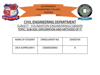
- 1. CIVIL ENGINEERING DEPARTMENT SUBJECT : FOUNDATION ENGINEERING(2180609) TOPIC: SUB-SOIL EXPLORATION AND METHODS OF IT. NAME OF STUDENT ENROLLMENT NO. SEMESTER ZALA SURPALSINH I 150600106063 8 GOVERNMENT ENGINEERING COLLEGE, GODHRA
- 2. SOURCES FOR THIS TOPIC • IS : 1892-1979(Indian Standard CODE OF PRACTICE FOR SUBSURFACE INVESTIGATION FOR FOUNDATIONS) • SOURCE USED TO MAKE THIS PPT a. Book : foundation engineering (ATUL PRAKASHAN) b. Google
- 3. INTRODUCTION • DEFINITION: SITE INVESTIGATION: Procedure of obtaining information about surface & sub-surface conditions at the site of proposed construction. • Cost of site investigation & sub-soil exploration will be less than 1% of the total cost of the entire project.
- 4. STEPS FOR SOIL EXPLORATION 1. Planning of a programme of soil exploration. 2. Collection of soil samples. 3. Conducting in-situ tests. e.g. standard penetration test. 4. Collection of ground water sample. 5. Conducting tests on soil and water samples. 6. Preparation of drawing chart. 7. Analysis of data collected. 8. Preparation of site investigation report.
- 5. OBJECTIVES OF EXPLORATION • To select foundation for given structure. • To select construction techniques. • To determine safe depth of foundation. • To determine bearing capacity of soil. • To investigate safety of existing structures and suggests remedial measures.
- 6. PLANNING A SUB-SOIL EXPLORATION PROGRAMME • TWO IMPORTANT ASPECTS OF PLANNING 1. Depth of exploration 2. Lateral extent of explanations.
- 7. 1.Depth of exploration • It depends upon a. Type of structure b. intensity of loading c. shape and disposition of loaded area d. soil profile e. Physical properties of soil
- 8. • The depth of foundation should be at least equal to to the significant depth. • DEFINITION : significant depth : The depth upto which the stress increament due to superimposed loads can produce significant settlement and shear stress is known as the significant depth.
- 9. Sr.No. Types of foundation Depth of exploration 1 Isolated spread footings 1.5B, B= Width 2 Raft footings 1.5B 3 Pile foundation 1.5B, B= Width of pile group 4 Adjacent footings with clear spacing less than twice the width 1.5L L= Length of footing 5 Road cuts Equal to the bottom width of the cut 6 Fill 2m below the ground level or equal to height of the fill whichever is higher.
- 10. 2.Lateral extent of explorations UNIT NO OR SPACING OF BORE HOLES Small &less important buildings 1 at centre may suffice. Compact buildings ( covering an area of 0.4 hectares) At least 5 ( 1 at centre & 4 at corner). Large multistoreyed buildings At all important locations, spacing should be 10 to 30m. Highways Along centre line, spacing should be 150 to 300m. Concrete dams Spacing generally varies between 40 to 80m.
- 11. STAGES IN SUB-SOIL EXPLORATION Reconnaissance Preliminary explorations Detailed investigations
- 12. Reconnaissance • Geotechnical engineer makes a visit to the site for careful visual inspection. • Geotechnical engineer should study soil maps, aerial photographs of an existing buildings. • INFORMATION OBTAINED DURING THIS STAGE General topography of the site Type of vegetation at site Drainage pattern existing at site Location of high flood marks Evidence of landscape slides Settlement cracks in existing structures at site
- 13. Preliminary explorations • Tests are connected with cone penetratometers and sounding rods for strength and compressibility of soils. • Geophysical methods are used for locating boundaries of different strata. E.g.electrical resistivity method. AIM 1. To determine depth, thickness, composition of each soil stratum at the site. 2. To determine depth of bed rock and ground water table.
- 14. Detailed explorations AIM To determine engineering properties of soils in different strata. ACTIVITIES Extensive boring programme, sampling, testing of samples in laboratory. Field tests ( vane shear tests, plate load tests, permeability tests ) are conducted to determine properties of soil in natural state.
- 15. METHODS OF SUB-SOIL EXPLORATION Direct methods (IS 4453 : 2009) • Pits and trenches • Drifts and shafts Semi-direct methods • Borings Indirect methods • Sounding or penetration tests • Geophysical methods
- 16. PITS AND TRENCHES • Pits are dug manually but mechanical equipment may also be used. • Pits are normally of the shape of an inverted frustum of a pyramid. The top of the pit is usually a square of size 3 m x 3 m and its bottom is also a square of 1.2 m x1.2 m providing sufficient space.
- 17. DRIFTS AND SHAFTS • DEFINITION: DRIFTS: Horizontal tunnel made in the hill side to determine nature and structure of geological formation. • Drifts are also known as adits. • DEFINITION: SHAFTS: Large vertical holes made in the geological formation. • These may be rectangular or circular in section.
- 19. AUGER BORING • An auger is a tool used for drilling bore hole into the ground. Hand operated augers Mechanical augers Used for depths upto 6m. Used for depths upto 12m. Used in cohesive and soft soils. Used in cohesive, soft and gravelly soils. E.g. post hole auger, helical auger. E.g. power augers.
- 20. WASH BORING • Fast and simple method • Not used in gravel and boulders and rocky strata. 1. Short depth hole is drilled by auger 2. Casing pipe is pused into hole & driven with aid of power 3.Water jet pressure is forced through screw bit which loosens soil. 4. Resulting soil-water slurry come upwards.
- 21. PERCUSSION DRILLING • Used for making holes in rock formations. • Procedure: 1. Heavy drilling bit called ' churn bit' alternatively raised and dropped in the vertical hole. 2. material in the hole gets pulverized due to repeated blows. 3. water added to the hole to facilitate the breaking of stiff soil or rock. 4. Water forms slurry with pulverized material which removed by bailer at intervals.
- 22. ELECTRIC RESISTIVITY METHOD • Soil resistivity is a measure of how much the soil resists the flow of electricity. • Each soil has its own resistivity depending upon water content, compaction, and composition.
- 23. • A direct voltage is imposed between the two outer electrodes and the potential drop is measured between the inner electrodes. • The mean resistivity is given by the following formula: • where, p= mean resistivity ( ohm.cm ) , D= distance between electrodes ( cm ) E = potential drop between inner electrodes ( V ) I = current flowing between outer electrodes ( A)
- 24. Thank you