Downloaded 28 times


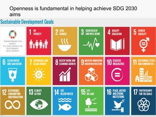


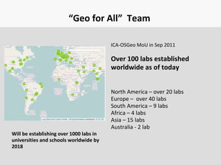


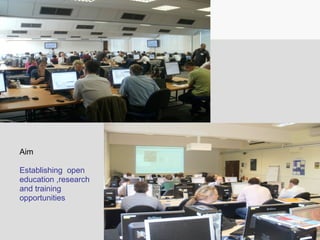


Open Geospatial Labs are being established worldwide as part of an agreement between the International Cartographic Association and the Open Source Geospatial Foundation to expand geospatial research and education globally. Openness through open source software, open data, and open educational resources is fundamental to helping achieve the UN's 2030 Sustainable Development Goals. The "Geo for All" initiative aims to establish over 1,000 open geospatial labs in universities and schools worldwide by 2018 to provide open education, research, and training opportunities through a global community of contributors from various sectors.


![[FOSS4G Korea 2014] Making Base Maps with Open Data](https://cdn.slidesharecdn.com/ss_thumbnails/makingbasemapswithopendataminpalee20140827-140828022647-phpapp02-thumbnail.jpg?width=640&height=640&fit=bounds)


