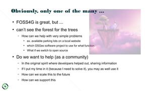
Download as ODP, PPTX


![23/07/18 44WVI Workshop
Evolution
● Combination of Hardware, Software and Integration
– Hardware migration to standard micro components
– Software migration to standard micro services
– Integration becomes the new challenge
– Software becomes relative important to support any system
● Our lives depend on software
● It's the software, Stupid¹
– Need to migrate to open source software²
– Licenses become more and more important[1] free interpretation of the quote of James Carville by Dirk Frigne
[2] http://www.techrepublic.com/article/how-open-source-software-could-save-your-life/](https://image.slidesharecdn.com/20180718-dirk-frigne-foss4g-europe-final-180723204954/85/20180718-dirk-frigne-foss4-g-europe-final-44-320.jpg)

![09/24/1609/24/16 © ir. Dirk Frigne, 2016 CC-BY-SA© ir. Dirk Frigne, 2016 CC-BY-SA 4747
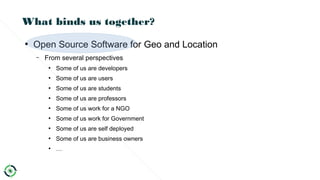
What is a Community[1]
?
•/K mju n ti/əˈ ː ɪ
1. a group of people living in the same place or having a particular characteristic
in common.
2. the condition of sharing or having certain attitudes and interests in common.
3. Ecology
•a group of interdependent plants or animals growing or living together in natural
conditions or occupying a specified habitat.
[1]Google: definition: community](https://image.slidesharecdn.com/20180718-dirk-frigne-foss4g-europe-final-180723204954/85/20180718-dirk-frigne-foss4-g-europe-final-47-320.jpg)
![09/24/1609/24/16 © ir. Dirk Frigne, 2016 CC-BY-SA© ir. Dirk Frigne, 2016 CC-BY-SA 4848
“It's all about the network”[1]
•/ net w rk/ˈ ˌ ə [2]
1. an arrangement of intersecting
horizontal and vertical lines.
2. a group or system of
interconnected people or things.
[1] Dirk Frigne, Vice president OSGeo, Keynote FOSS4G 2016 Bonn
[2] Google: definition: network](https://image.slidesharecdn.com/20180718-dirk-frigne-foss4g-europe-final-180723204954/85/20180718-dirk-frigne-foss4-g-europe-final-48-320.jpg)

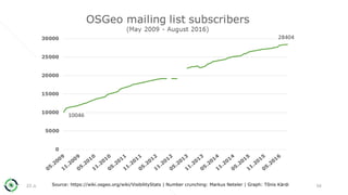
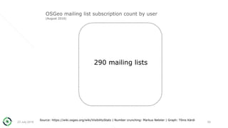
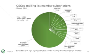


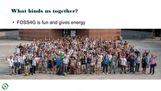
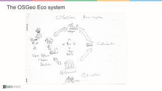
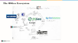
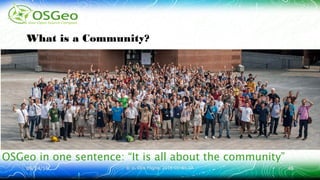
The document discusses the evolution and role of OSGeo in promoting open source geospatial software within Europe, highlighting its growth from local chapters to a large network. It emphasizes the importance of community engagement, collaboration, and the transition towards open source practices and standards. The future vision focuses on greater organization and participation in the OSGeo community, encouraging individuals to contribute in various capacities.


![[Presentation] Open COVID Pledge: Internationalization (CC Global Summit 2020...](https://cdn.slidesharecdn.com/ss_thumbnails/presentationocpinternationalizationccsummit2020ppt-201209204418-thumbnail.jpg?width=640&height=640&fit=bounds)


