SlideShare a Scribd company logo
1 of 8
Download to read offline
How to Study World Geography with
Maps for UPSC
- Srirams IAS
If you are preparing for UPSC Civil Services Prelims exam then you would know that
studying maps is an integral part of IAS preparation. Map related questions are asked
in Preliminary Exam and it is also very important in the optional subject paper of
Geography in UPSC Main Exam. In general you can expect 9 to 10 questions from the
Maps section in the Preliminary exam. We know that in earlier exams earlier you were
given blank maps and had to mark places etc on that map, but now you are not given
maps, only the questions contain names of places and you have to place them in the
correct order.
Therefore, your understanding and knowledge of maps should be clear. There is a
misconception among some UPSC aspirants that maps can be learned by rote parts
like other subjects. But this is wrong, we must understand that questions asked by
UPSC and how to tackle them require a strategic understanding of maps in a
candidate.
This article will give you some essential tips to solve the questions in the world map
section and you will know what to learn, how to learn and what you can expect from
this section.
Mountains and Continents
You must know about the mountains and continent of the world where they are
located. For example, a possible question might be "In which continent are the
Rocky Mountains located?" (The answer to which is North America). Similarly,
you should also study grasslands and deserts.
East Asia
China is very important in this area. Be aware of the Sea of Japan, the Yellow Sea, the
East China Sea, the South China Sea, which places are bound by their borders.
Important cities in China are Beijing, Shanghai, Harbin, Guangzhou, Hong Kong,
Zhengzhou and Chengdu.
Bangalore and Chengdu are being developed as Twin Towns or Sister Cities. Kolkata
and Kunming, a route has been planned between these two cities.
A possible question is also to arrange Kolkata, Dhaka, Naypyidaw and Kunming
in the East, West.
West Asia
This region is called West Asia from an Indian point of view, but to the west it is
known as the Middle East. You must be aware of the different seas like the Caspian
Sea and the Aral Sea.
Possible questions:
1. which countries border the Caspian Sea?
To which the answer is Russia, Kazakhstan, Turkmenistan, Iran and Azerbaijan.
2. In the middle of which country is the Aral Sea located?
The answer is Uzbekistan and Kazakhstan.
South Asia
View all SAARC countries (Afghanistan, Pakistan, India, Nepal, Bhutan, Bangladesh,
Sri Lanka and Maldives).
Arabian Peninsula
It is important with respect to UPSC exam because of the ongoing problem related to
ISIS in this area. Get information about all the countries and their capitals here.
Remember that you may also be asked to arrange all capitals from north to south, or
from east to west. Know all the capitals and their locations like Riyadh, Doha,
Amman, etc and this area is also an important point Red Sea.
Possible questions:
1. Which country is surrounded by the Red Sea?
The answer is Saudi Arabia, Egypt, Sudan, Eritrea, Djibouti, Somalia. Other
important areas here are the Gulf of Aden, the Gulf of Aqaba and the Gulf of
Suez.
Scandinavian Peninsula
Learn about the countries around it and the capitals of those countries, the Baltic Sea,
and the Kiel Canal.
Persian Gulf
Pay special attention to this area as questions related to Israel and Palestine can be
asked. Learn about areas of Palestine such as the Gaza Strip, the Golan Heights and
the West Bank.
It is advised to the candidates that you must be aware of all the relevant capitals from
North to South or East to West. Also, focus on the Black Sea region and learn about
important seas such as the Sea of Azov, the Sea of Marmara, and the Aegean Sea.
Possible question:
1. What are the countries that are bordered by Israel?
The answer is Egypt, Jordan, Syria and Lebanon.
2. Names of the countries around the Black Sea.
The answer is Russia, Ukraine, Romania, Bulgaria, Turkey and Georgia.
Crimea or Crimea is an important region, because Crimea has been important in
history and many countries and ethnicities have fought over its possession, as well as
keep information about Central Asian countries. Learn about the capitals of countries
like Tajikistan, Uzbekistan, Afghanistan and more.
South China Sea
The places here are China, Vietnam (Vietnam, Hainan), Malaysia and the Philippines.
China is involved in disputes with many countries here, the places which are in this
dispute are - Paracel), Scarborough Shoal and the Spratly Islands.
A possible question related to this may be "which island is in dispute between
China and the Philippines?"
Rivers in Southeast Asia: A possible question related to this could be "arrange
the rivers from west to east - Irrawaddy River, Salween River, Chao Phraya and
Mekong (Chao Phraya)" River and Mekong River).
Indonesia
Focus on Sumatra and Jakarta as Sumatra was a major epicenter of the 2004 tsunami.
Japan
The four major islands here are places to learn and remember - Hokkaido, Honshu,
Shikoku and Kyushu - Fukushima, Osaka, Hyogo, Kyoto (Kyoto), Hiroshima,
Nagasaki and Tokyo.
Australia
Its physical map is very important, such as - Great Dividing Range, Simpson Desert,
Great Barrier Reef, Great Victoria Desert, Arafura Sea, Timor Sea, Gulf of
Carpentaria, Bass Strait, Tasmania, Murray–Darling basin.
Possible question:
1. In which continent is the Great Dividing Range located?
2. Also arrange the major cities of Australia such as Sydney, Canberra, Perth,
Adelaide, Darwin, Brisbane and Melbourne from north to south.
New Zealand
The Cook Strait is located between and separates the North and South Islands of New
Zealand. Also learn about Mount Cook, the Southern Alps, and the cities
Christchurch, Dunedin, Napier, Hamilton, Auckland, and more.
Europe
Here Mediterranean Sea, Turkey, Greece ityaadi is an important part. In this possible
question you can be asked about the countries around the Mediterranean Sea like -
Morocco, Algeria, Tunisia, Libya, Egypt, Israel, Lebanon, Cyprus , Syria, Turkey,
Greece, Albania, Montenegro, Bosnia and Herzegovina, Croatia, Slovenia, Italy,
France and Spain.
Greece: Learn about the Aegean Sea, the Ionian Sea, the Mediterranean Sea, the Sea
of Crete, and the island group of Greece.
North America
Understand its physical map, Appalachian Mountains, Ozark Plateau, Edwards
Plateau, Rocky Mountains, Columbia Plateau, Sierra Nevada, Sonara Desert,
Colorado Plateau. Lakes include Lake Superior, Michigan, Huron, Lake Erie, Ontario,
etc. The places here should also be practiced in arranging them in the order they are
asked.
South America
This country is important so that one can ask "Which country borders both the Pacific
Ocean and the Gulf of Mexico?” to which the answer is Colombia.
1. Which country in South America does not share a border with Brazil? To
which the answer is Chile and Ecuador.
Know the capitals here and its physical map includes the Amazon Basin, the Brazilian
Highlands, the Brazilian Shield, the Pampas, the Patagonian Desert, the Andes
Mountains , Llanos, Campos and Llanos, Atacama Desert, Galápagos Islands, etc.
Africa
What are the countries in the western regions which are called Ivory Coast, Gold
Coast, Slave Coast of West Africa and Grain Coast. Study about the Red Sea region as
this region is important due to activities like piracy.
South Africa: Know which are the enclave countries? Which are - Swaziland and
Lesotho. Get to know important places in South Africa like Cape Town,
Johannesburg, Pretoria, Durban and Bloemfontein. Study important countries like
Angola, Namibia, Botswana, Zimbabwe, Zambia, Mozambique and more.
Its physical map includes the Sahara Desert, Congo Basin, Namib Desert, Kalahari
Desert, Lake Victoria, Lake Tanganyika, Atlas Range Mountains), the East African
Rift Valley, and rivers such as the Nile, Congo River, and Aswan Dam.
In order to score good marks in this section, the following are the important
things to remember:
 Know the physical composition and features of all the continents.
 Arrangement of important places and cities in order from north to south or east to
west.
 To have information about seas, lakes, deserts, mountain ranges etc.
Best Regards, Sriram's Team

More Related Content

Similar to Best Strategy to Study Maps for UPSC - Srirams IAS

Geography of the u.s 4 regions
Geography of the u.s  4 regionsGeography of the u.s  4 regions
Geography of the u.s 4 regionsTrinity Watkins
 
SIA, NORTH & SOUTH AMERICA: PHYSICAL AND CULTURAL
SIA, NORTH & SOUTH AMERICA: PHYSICAL AND CULTURALSIA, NORTH & SOUTH AMERICA: PHYSICAL AND CULTURAL
SIA, NORTH & SOUTH AMERICA: PHYSICAL AND CULTURALKayeClaireEstoconing
 
Famous tourist grade 10
Famous tourist grade 10Famous tourist grade 10
Famous tourist grade 10Rhon Rhonz
 
Ss7 g9 landforms of southern and eastern asia
Ss7 g9 landforms of southern and eastern asiaSs7 g9 landforms of southern and eastern asia
Ss7 g9 landforms of southern and eastern asiabhabyamy
 
أطلس العالم
أطلس العالمأطلس العالم
أطلس العالمMamdouh Sobhy
 
Our earth continents and ocean.pptx
Our earth continents and ocean.pptxOur earth continents and ocean.pptx
Our earth continents and ocean.pptxKavithaaKannan1
 
Manas Kushwaha.pdf
Manas Kushwaha.pdfManas Kushwaha.pdf
Manas Kushwaha.pdfManas350431
 
Water bodies
Water bodies Water bodies
Water bodies Akanksha
 
Notes on Indian Geography.pdf
Notes on Indian Geography.pdfNotes on Indian Geography.pdf
Notes on Indian Geography.pdfMithileshJha33
 
Science -south carolina landforms power point
Science -south carolina landforms power pointScience -south carolina landforms power point
Science -south carolina landforms power pointscrufman
 
Desert life in the middle east
Desert life in the middle eastDesert life in the middle east
Desert life in the middle eastjohnharrell
 
Social Science 3º Oxford Think, Do, Learn!
Social Science 3º Oxford Think, Do, Learn!Social Science 3º Oxford Think, Do, Learn!
Social Science 3º Oxford Think, Do, Learn!cristiheres
 
Ss3 m1 u02_presentation
Ss3 m1 u02_presentationSs3 m1 u02_presentation
Ss3 m1 u02_presentationdfr4591
 
ITFT- continents and oceans of world
ITFT- continents and oceans of worldITFT- continents and oceans of world
ITFT- continents and oceans of worldAruna Poddar
 
Continents & Oceans
Continents & OceansContinents & Oceans
Continents & Oceansrachelkcole
 

Similar to Best Strategy to Study Maps for UPSC - Srirams IAS (20)

Geography of the u.s 4 regions
Geography of the u.s  4 regionsGeography of the u.s  4 regions
Geography of the u.s 4 regions
 
SIA, NORTH & SOUTH AMERICA: PHYSICAL AND CULTURAL
SIA, NORTH & SOUTH AMERICA: PHYSICAL AND CULTURALSIA, NORTH & SOUTH AMERICA: PHYSICAL AND CULTURAL
SIA, NORTH & SOUTH AMERICA: PHYSICAL AND CULTURAL
 
Famous tourist grade 10
Famous tourist grade 10Famous tourist grade 10
Famous tourist grade 10
 
Ss7 g9 landforms of southern and eastern asia
Ss7 g9 landforms of southern and eastern asiaSs7 g9 landforms of southern and eastern asia
Ss7 g9 landforms of southern and eastern asia
 
أطلس العالم
أطلس العالمأطلس العالم
أطلس العالم
 
Our earth continents and ocean.pptx
Our earth continents and ocean.pptxOur earth continents and ocean.pptx
Our earth continents and ocean.pptx
 
Manas Kushwaha.pdf
Manas Kushwaha.pdfManas Kushwaha.pdf
Manas Kushwaha.pdf
 
Water bodies
Water bodies Water bodies
Water bodies
 
Regions
RegionsRegions
Regions
 
Geography Of Asia
Geography Of AsiaGeography Of Asia
Geography Of Asia
 
Geography of asia
Geography of asiaGeography of asia
Geography of asia
 
Notes on Indian Geography.pdf
Notes on Indian Geography.pdfNotes on Indian Geography.pdf
Notes on Indian Geography.pdf
 
Science -south carolina landforms power point
Science -south carolina landforms power pointScience -south carolina landforms power point
Science -south carolina landforms power point
 
Desert life in the middle east
Desert life in the middle eastDesert life in the middle east
Desert life in the middle east
 
Module 1 social sciences 3 rd
Module 1 social sciences 3 rdModule 1 social sciences 3 rd
Module 1 social sciences 3 rd
 
Social Science 3º Oxford Think, Do, Learn!
Social Science 3º Oxford Think, Do, Learn!Social Science 3º Oxford Think, Do, Learn!
Social Science 3º Oxford Think, Do, Learn!
 
Ss3 m1 u02_presentation
Ss3 m1 u02_presentationSs3 m1 u02_presentation
Ss3 m1 u02_presentation
 
ITFT- continents and oceans of world
ITFT- continents and oceans of worldITFT- continents and oceans of world
ITFT- continents and oceans of world
 
Continents & Oceans
Continents & OceansContinents & Oceans
Continents & Oceans
 
Asia.pptx
Asia.pptxAsia.pptx
Asia.pptx
 

Recently uploaded

Kisan Call Centre - To harness potential of ICT in Agriculture by answer farm...
Kisan Call Centre - To harness potential of ICT in Agriculture by answer farm...Kisan Call Centre - To harness potential of ICT in Agriculture by answer farm...
Kisan Call Centre - To harness potential of ICT in Agriculture by answer farm...Krashi Coaching
 
Employee wellbeing at the workplace.pptx
Employee wellbeing at the workplace.pptxEmployee wellbeing at the workplace.pptx
Employee wellbeing at the workplace.pptxNirmalaLoungPoorunde1
 
Measures of Central Tendency: Mean, Median and Mode
Measures of Central Tendency: Mean, Median and ModeMeasures of Central Tendency: Mean, Median and Mode
Measures of Central Tendency: Mean, Median and ModeThiyagu K
 
URLs and Routing in the Odoo 17 Website App
URLs and Routing in the Odoo 17 Website AppURLs and Routing in the Odoo 17 Website App
URLs and Routing in the Odoo 17 Website AppCeline George
 
Paris 2024 Olympic Geographies - an activity
Paris 2024 Olympic Geographies - an activityParis 2024 Olympic Geographies - an activity
Paris 2024 Olympic Geographies - an activityGeoBlogs
 
The basics of sentences session 2pptx copy.pptx
The basics of sentences session 2pptx copy.pptxThe basics of sentences session 2pptx copy.pptx
The basics of sentences session 2pptx copy.pptxheathfieldcps1
 
Advanced Views - Calendar View in Odoo 17
Advanced Views - Calendar View in Odoo 17Advanced Views - Calendar View in Odoo 17
Advanced Views - Calendar View in Odoo 17Celine George
 
Interactive Powerpoint_How to Master effective communication
Interactive Powerpoint_How to Master effective communicationInteractive Powerpoint_How to Master effective communication
Interactive Powerpoint_How to Master effective communicationnomboosow
 
Nutritional Needs Presentation - HLTH 104
Nutritional Needs Presentation - HLTH 104Nutritional Needs Presentation - HLTH 104
Nutritional Needs Presentation - HLTH 104misteraugie
 
Grant Readiness 101 TechSoup and Remy Consulting
Grant Readiness 101 TechSoup and Remy ConsultingGrant Readiness 101 TechSoup and Remy Consulting
Grant Readiness 101 TechSoup and Remy ConsultingTechSoup
 
Z Score,T Score, Percential Rank and Box Plot Graph
Z Score,T Score, Percential Rank and Box Plot GraphZ Score,T Score, Percential Rank and Box Plot Graph
Z Score,T Score, Percential Rank and Box Plot GraphThiyagu K
 
Call Girls in Dwarka Mor Delhi Contact Us 9654467111
Call Girls in Dwarka Mor Delhi Contact Us 9654467111Call Girls in Dwarka Mor Delhi Contact Us 9654467111
Call Girls in Dwarka Mor Delhi Contact Us 9654467111Sapana Sha
 
Accessible design: Minimum effort, maximum impact
Accessible design: Minimum effort, maximum impactAccessible design: Minimum effort, maximum impact
Accessible design: Minimum effort, maximum impactdawncurless
 
Presentation by Andreas Schleicher Tackling the School Absenteeism Crisis 30 ...
Presentation by Andreas Schleicher Tackling the School Absenteeism Crisis 30 ...Presentation by Andreas Schleicher Tackling the School Absenteeism Crisis 30 ...
Presentation by Andreas Schleicher Tackling the School Absenteeism Crisis 30 ...EduSkills OECD
 
mini mental status format.docx
mini    mental       status     format.docxmini    mental       status     format.docx
mini mental status format.docxPoojaSen20
 
Student login on Anyboli platform.helpin
Student login on Anyboli platform.helpinStudent login on Anyboli platform.helpin
Student login on Anyboli platform.helpinRaunakKeshri1
 
POINT- BIOCHEMISTRY SEM 2 ENZYMES UNIT 5.pptx
POINT- BIOCHEMISTRY SEM 2 ENZYMES UNIT 5.pptxPOINT- BIOCHEMISTRY SEM 2 ENZYMES UNIT 5.pptx
POINT- BIOCHEMISTRY SEM 2 ENZYMES UNIT 5.pptxSayali Powar
 
Beyond the EU: DORA and NIS 2 Directive's Global Impact
Beyond the EU: DORA and NIS 2 Directive's Global ImpactBeyond the EU: DORA and NIS 2 Directive's Global Impact
Beyond the EU: DORA and NIS 2 Directive's Global ImpactPECB
 

Recently uploaded (20)

Kisan Call Centre - To harness potential of ICT in Agriculture by answer farm...
Kisan Call Centre - To harness potential of ICT in Agriculture by answer farm...Kisan Call Centre - To harness potential of ICT in Agriculture by answer farm...
Kisan Call Centre - To harness potential of ICT in Agriculture by answer farm...
 
Employee wellbeing at the workplace.pptx
Employee wellbeing at the workplace.pptxEmployee wellbeing at the workplace.pptx
Employee wellbeing at the workplace.pptx
 
Measures of Central Tendency: Mean, Median and Mode
Measures of Central Tendency: Mean, Median and ModeMeasures of Central Tendency: Mean, Median and Mode
Measures of Central Tendency: Mean, Median and Mode
 
URLs and Routing in the Odoo 17 Website App
URLs and Routing in the Odoo 17 Website AppURLs and Routing in the Odoo 17 Website App
URLs and Routing in the Odoo 17 Website App
 
Paris 2024 Olympic Geographies - an activity
Paris 2024 Olympic Geographies - an activityParis 2024 Olympic Geographies - an activity
Paris 2024 Olympic Geographies - an activity
 
The basics of sentences session 2pptx copy.pptx
The basics of sentences session 2pptx copy.pptxThe basics of sentences session 2pptx copy.pptx
The basics of sentences session 2pptx copy.pptx
 
Advanced Views - Calendar View in Odoo 17
Advanced Views - Calendar View in Odoo 17Advanced Views - Calendar View in Odoo 17
Advanced Views - Calendar View in Odoo 17
 
Interactive Powerpoint_How to Master effective communication
Interactive Powerpoint_How to Master effective communicationInteractive Powerpoint_How to Master effective communication
Interactive Powerpoint_How to Master effective communication
 
INDIA QUIZ 2024 RLAC DELHI UNIVERSITY.pptx
INDIA QUIZ 2024 RLAC DELHI UNIVERSITY.pptxINDIA QUIZ 2024 RLAC DELHI UNIVERSITY.pptx
INDIA QUIZ 2024 RLAC DELHI UNIVERSITY.pptx
 
Nutritional Needs Presentation - HLTH 104
Nutritional Needs Presentation - HLTH 104Nutritional Needs Presentation - HLTH 104
Nutritional Needs Presentation - HLTH 104
 
TataKelola dan KamSiber Kecerdasan Buatan v022.pdf
TataKelola dan KamSiber Kecerdasan Buatan v022.pdfTataKelola dan KamSiber Kecerdasan Buatan v022.pdf
TataKelola dan KamSiber Kecerdasan Buatan v022.pdf
 
Grant Readiness 101 TechSoup and Remy Consulting
Grant Readiness 101 TechSoup and Remy ConsultingGrant Readiness 101 TechSoup and Remy Consulting
Grant Readiness 101 TechSoup and Remy Consulting
 
Z Score,T Score, Percential Rank and Box Plot Graph
Z Score,T Score, Percential Rank and Box Plot GraphZ Score,T Score, Percential Rank and Box Plot Graph
Z Score,T Score, Percential Rank and Box Plot Graph
 
Call Girls in Dwarka Mor Delhi Contact Us 9654467111
Call Girls in Dwarka Mor Delhi Contact Us 9654467111Call Girls in Dwarka Mor Delhi Contact Us 9654467111
Call Girls in Dwarka Mor Delhi Contact Us 9654467111
 
Accessible design: Minimum effort, maximum impact
Accessible design: Minimum effort, maximum impactAccessible design: Minimum effort, maximum impact
Accessible design: Minimum effort, maximum impact
 
Presentation by Andreas Schleicher Tackling the School Absenteeism Crisis 30 ...
Presentation by Andreas Schleicher Tackling the School Absenteeism Crisis 30 ...Presentation by Andreas Schleicher Tackling the School Absenteeism Crisis 30 ...
Presentation by Andreas Schleicher Tackling the School Absenteeism Crisis 30 ...
 
mini mental status format.docx
mini    mental       status     format.docxmini    mental       status     format.docx
mini mental status format.docx
 
Student login on Anyboli platform.helpin
Student login on Anyboli platform.helpinStudent login on Anyboli platform.helpin
Student login on Anyboli platform.helpin
 
POINT- BIOCHEMISTRY SEM 2 ENZYMES UNIT 5.pptx
POINT- BIOCHEMISTRY SEM 2 ENZYMES UNIT 5.pptxPOINT- BIOCHEMISTRY SEM 2 ENZYMES UNIT 5.pptx
POINT- BIOCHEMISTRY SEM 2 ENZYMES UNIT 5.pptx
 
Beyond the EU: DORA and NIS 2 Directive's Global Impact
Beyond the EU: DORA and NIS 2 Directive's Global ImpactBeyond the EU: DORA and NIS 2 Directive's Global Impact
Beyond the EU: DORA and NIS 2 Directive's Global Impact
 

Best Strategy to Study Maps for UPSC - Srirams IAS

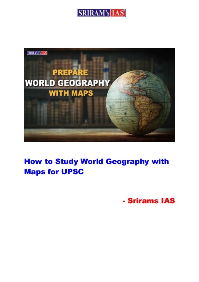
  • 1. How to Study World Geography with Maps for UPSC - Srirams IAS
  • 2. If you are preparing for UPSC Civil Services Prelims exam then you would know that studying maps is an integral part of IAS preparation. Map related questions are asked in Preliminary Exam and it is also very important in the optional subject paper of Geography in UPSC Main Exam. In general you can expect 9 to 10 questions from the Maps section in the Preliminary exam. We know that in earlier exams earlier you were given blank maps and had to mark places etc on that map, but now you are not given maps, only the questions contain names of places and you have to place them in the correct order. Therefore, your understanding and knowledge of maps should be clear. There is a misconception among some UPSC aspirants that maps can be learned by rote parts like other subjects. But this is wrong, we must understand that questions asked by UPSC and how to tackle them require a strategic understanding of maps in a candidate. This article will give you some essential tips to solve the questions in the world map section and you will know what to learn, how to learn and what you can expect from this section. Mountains and Continents You must know about the mountains and continent of the world where they are located. For example, a possible question might be "In which continent are the Rocky Mountains located?" (The answer to which is North America). Similarly, you should also study grasslands and deserts. East Asia China is very important in this area. Be aware of the Sea of Japan, the Yellow Sea, the East China Sea, the South China Sea, which places are bound by their borders. Important cities in China are Beijing, Shanghai, Harbin, Guangzhou, Hong Kong, Zhengzhou and Chengdu.
  • 3. Bangalore and Chengdu are being developed as Twin Towns or Sister Cities. Kolkata and Kunming, a route has been planned between these two cities. A possible question is also to arrange Kolkata, Dhaka, Naypyidaw and Kunming in the East, West. West Asia This region is called West Asia from an Indian point of view, but to the west it is known as the Middle East. You must be aware of the different seas like the Caspian Sea and the Aral Sea. Possible questions: 1. which countries border the Caspian Sea? To which the answer is Russia, Kazakhstan, Turkmenistan, Iran and Azerbaijan. 2. In the middle of which country is the Aral Sea located? The answer is Uzbekistan and Kazakhstan. South Asia View all SAARC countries (Afghanistan, Pakistan, India, Nepal, Bhutan, Bangladesh, Sri Lanka and Maldives). Arabian Peninsula It is important with respect to UPSC exam because of the ongoing problem related to ISIS in this area. Get information about all the countries and their capitals here. Remember that you may also be asked to arrange all capitals from north to south, or from east to west. Know all the capitals and their locations like Riyadh, Doha, Amman, etc and this area is also an important point Red Sea.
  • 4. Possible questions: 1. Which country is surrounded by the Red Sea? The answer is Saudi Arabia, Egypt, Sudan, Eritrea, Djibouti, Somalia. Other important areas here are the Gulf of Aden, the Gulf of Aqaba and the Gulf of Suez. Scandinavian Peninsula Learn about the countries around it and the capitals of those countries, the Baltic Sea, and the Kiel Canal. Persian Gulf Pay special attention to this area as questions related to Israel and Palestine can be asked. Learn about areas of Palestine such as the Gaza Strip, the Golan Heights and the West Bank. It is advised to the candidates that you must be aware of all the relevant capitals from North to South or East to West. Also, focus on the Black Sea region and learn about important seas such as the Sea of Azov, the Sea of Marmara, and the Aegean Sea. Possible question: 1. What are the countries that are bordered by Israel? The answer is Egypt, Jordan, Syria and Lebanon. 2. Names of the countries around the Black Sea. The answer is Russia, Ukraine, Romania, Bulgaria, Turkey and Georgia. Crimea or Crimea is an important region, because Crimea has been important in history and many countries and ethnicities have fought over its possession, as well as
  • 5. keep information about Central Asian countries. Learn about the capitals of countries like Tajikistan, Uzbekistan, Afghanistan and more. South China Sea The places here are China, Vietnam (Vietnam, Hainan), Malaysia and the Philippines. China is involved in disputes with many countries here, the places which are in this dispute are - Paracel), Scarborough Shoal and the Spratly Islands. A possible question related to this may be "which island is in dispute between China and the Philippines?" Rivers in Southeast Asia: A possible question related to this could be "arrange the rivers from west to east - Irrawaddy River, Salween River, Chao Phraya and Mekong (Chao Phraya)" River and Mekong River). Indonesia Focus on Sumatra and Jakarta as Sumatra was a major epicenter of the 2004 tsunami. Japan The four major islands here are places to learn and remember - Hokkaido, Honshu, Shikoku and Kyushu - Fukushima, Osaka, Hyogo, Kyoto (Kyoto), Hiroshima, Nagasaki and Tokyo. Australia Its physical map is very important, such as - Great Dividing Range, Simpson Desert, Great Barrier Reef, Great Victoria Desert, Arafura Sea, Timor Sea, Gulf of Carpentaria, Bass Strait, Tasmania, Murray–Darling basin.
  • 6. Possible question: 1. In which continent is the Great Dividing Range located? 2. Also arrange the major cities of Australia such as Sydney, Canberra, Perth, Adelaide, Darwin, Brisbane and Melbourne from north to south. New Zealand The Cook Strait is located between and separates the North and South Islands of New Zealand. Also learn about Mount Cook, the Southern Alps, and the cities Christchurch, Dunedin, Napier, Hamilton, Auckland, and more. Europe Here Mediterranean Sea, Turkey, Greece ityaadi is an important part. In this possible question you can be asked about the countries around the Mediterranean Sea like - Morocco, Algeria, Tunisia, Libya, Egypt, Israel, Lebanon, Cyprus , Syria, Turkey, Greece, Albania, Montenegro, Bosnia and Herzegovina, Croatia, Slovenia, Italy, France and Spain. Greece: Learn about the Aegean Sea, the Ionian Sea, the Mediterranean Sea, the Sea of Crete, and the island group of Greece. North America Understand its physical map, Appalachian Mountains, Ozark Plateau, Edwards Plateau, Rocky Mountains, Columbia Plateau, Sierra Nevada, Sonara Desert, Colorado Plateau. Lakes include Lake Superior, Michigan, Huron, Lake Erie, Ontario, etc. The places here should also be practiced in arranging them in the order they are asked.
  • 7. South America This country is important so that one can ask "Which country borders both the Pacific Ocean and the Gulf of Mexico?” to which the answer is Colombia. 1. Which country in South America does not share a border with Brazil? To which the answer is Chile and Ecuador. Know the capitals here and its physical map includes the Amazon Basin, the Brazilian Highlands, the Brazilian Shield, the Pampas, the Patagonian Desert, the Andes Mountains , Llanos, Campos and Llanos, Atacama Desert, Galápagos Islands, etc. Africa What are the countries in the western regions which are called Ivory Coast, Gold Coast, Slave Coast of West Africa and Grain Coast. Study about the Red Sea region as this region is important due to activities like piracy. South Africa: Know which are the enclave countries? Which are - Swaziland and Lesotho. Get to know important places in South Africa like Cape Town, Johannesburg, Pretoria, Durban and Bloemfontein. Study important countries like Angola, Namibia, Botswana, Zimbabwe, Zambia, Mozambique and more. Its physical map includes the Sahara Desert, Congo Basin, Namib Desert, Kalahari Desert, Lake Victoria, Lake Tanganyika, Atlas Range Mountains), the East African Rift Valley, and rivers such as the Nile, Congo River, and Aswan Dam. In order to score good marks in this section, the following are the important things to remember:  Know the physical composition and features of all the continents.
  • 8.  Arrangement of important places and cities in order from north to south or east to west.  To have information about seas, lakes, deserts, mountain ranges etc. Best Regards, Sriram's Team