
Recommended
More Related Content
What's hot
What's hot (20)
Similar to plate-tectonics-power-point.ppt
Similar to plate-tectonics-power-point.ppt (20)
Recently uploaded
Recently uploaded (20)
plate-tectonics-power-point.ppt
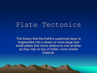
- 1. Plate Tectonics The theory that the Earth’s outermost layer is fragmented into a dozen or more large and small plates that move relative to one another as they ride on top of hotter, more mobile material.
- 2. Earth has 3 compositional layers – crust, mantle, core The major features on Earth’s surface are the result of processes in the upper few hundred kilometers Earth’s Interior USGS
- 3. Lithosphere •Rigid layer composed of crust & uppermost mantle •Divided into mobile tectonic plates Asthenosphere •Weaker layer found in upper part of mantle •Flows due to small proportion (1%) of melted minerals Two key mechanical layers in crust and upper mantle Earth’s Interior USGS
- 4. What Are Tectonic Plates? • A plate is a large, rigid slab of solid rock. – Plates are formed from the lithosphere: the crust and the upper part of the mantle. • The plates “float” on the slowly flowing asthenosphere: the lower part of the mantle. • The plates include both the land and ocean floor. • The Mohoriovicic discontinuity or Moho is the boundary between the crust and the mantle.
- 5. What Drives Plate Tectonics? • The slow movement of hot, softened mantle lies below rigid plates. • The hot, softened rock in the mantle moves in a circular manner in a convection flow – the heated, molten rock rises to the surface, spreads, and begins to cool, and then sinks back down to be reheated and rises again.
- 7. Movement of the Plates Over Time Permian 248 million years ago Triassic 206 million years ago Jurassic 206 million years ago Cretaceous 65 million years ago Present Day
- 9. What makes the plates move? Convection Currents in the mantle move the plates as the core heats the slowly-flowing asthenosphere (the elastic/plastic-like part of the mantle).
- 10. Plate Boundaries
- 12. Different Types of Boundaries • Convergent boundaries come together – Places where crust is destroyed as one plate dives under another • Divergent boundaries spread apart – Places where new crust is generated as the plates pull away from each other – New crust is created from magma pushing up from the mantle • Transform boundaries slide against each other – Places where crust is neither produced nor destroyed as the plates slide horizontally past each other
- 13. How is the rock pushed at convergent boundaries? A plate boundary where two plates move towards each other. Boundaries between two plates that are colliding This stress is called COMPRESSION
- 14. Convergent Boundaries • Places where plates crash (or crunch) together or subduct (one sinks under)
- 15. Oceanic-Continental Convergence • The oceanic plate subducts under the continental plate because it has lower density. • The oceanic Nazca Plate is being subducted under the continental part of the South American Plate. • The South American Plate is being lifted up, creating the Andes mountains. • Strong, destructive earthquakes and rapid uplift of mountain ranges are common in this region. • These earthquakes are often accompanied by uplift of the land by as much as a few meters. • Mount Saint Helens is along the subduction zone of the Juan de Fuca plate (an oceanic plate) and the North American plate (a continental plate). Oceanic – Continental Convergence
- 16. Oceanic-Oceanic Convergence • When two oceanic plates converge, one is usually subducted under the other. • An older oceanic plate is colder, therefore more dense and less buoyant, and will subduct under a younger, hotter, less dense, and more buoyant oceanic plate. • In the process, a trench is formed. – The deepest trenches in the oceans are along oceanic- oceanic subduction zones (i.e., the Marianas Trench in the Pacific, which is deeper than Mt. Everest is high). • Subduction in oceanic-oceanic plate convergence can result in the formation of volcanoes. • Examples of oceanic-oceanic convergence are the arcuate chains of islands in the southwest Pacific, Japan, and the Aleutian Islands. Oceanic – Oceanic Convergence
- 17. Continental-Continental Convergence Continental – Continental Convergence • When two continents meet head-on, neither is subducted because the continental rocks are relatively light and, like two colliding icebergs, resist downward motion. • Instead, the crust tends to buckle and be pushed upward or sideways. The collision between the Indian and Eurasian plates has pushed up the Himalayas and the Tibetan Plateau.
- 18. Continental-Continental Convergence • 50 million years ago, the Indian Plate collided into the Eurasian Plate. • After the collision, the slow continuous convergence of the two plates over millions of years pushed up the Himalaya and the Tibetan Plateau to their present heights. • The Himalaya form the highest continental mountains in the world.
- 19. What happens when the rock is squeezed from the Stress of Compression? • A REVERSE FAULT • Rock is forced upward as it is squeezed.
- 20. Helpful Hints… • Convergent = “Connecting” boundaries • May work like a trash compactor smashing rock. – Rock goes crunches up to make folded mountains. – Rock goes down “under” @ subduction zone.
- 21. Divergence • Divergent boundaries occur along spreading centers where plates are moving apart and new crust is created by magma pushing up from the mantle. • The Mid-Atlantic Ridge is a divergent boundary. • Sea-floor spreading over the past 100 to 200 million years has caused the Atlantic Ocean to grow from a tiny inlet of water between the continents of Europe, Africa, and the Americas into the ocean that exists today.
- 22. Divergent Boundaries A plate boundary where two plates move away from each other. RIFTING causes SEAFLOOR SPREADING
- 23. How is the rock pulled at Divergent Boundaries? Rock gets THIN in the middle as it is pulled apart. This STRESS is called
- 24. What happens when the rock SNAPS from the Stress of Tension? A Normal Fault (fault is a break in Earth’s crust) Rock drops down as it breaks
- 25. What happens next at Divergent Boundaries? • A geologic feature or event… May form RIFT VALLEYS on continents SEA-FLOOR SPREADING in the ocean
- 26. Helpful Hints… • Divergent is like “dissecting” or “dividing” • If you pull warm bubble gum or silly putty, it will thin in the middle until it is stressed so much that it breaks. • Happens on land & under H2O
- 27. Features of Divergent Boundaries • Mid-ocean ridges • rift valleys • fissure volcanoes
- 28. Transform • The zone between two plates that slide past one another is called a transform-fault boundary, or transform boundary. • These large faults connect two spreading centers or connect trenches. • Most transform faults are found on the ocean floor.
- 29. Transform • The San Andreas Fault is one of the few transform faults exposed on land. – It connects the East Pacific Rise, a divergent boundary to the south, with the Juan de Fuca Ridge, a divergent boundary to the north. – Most earthquakes in California are caused by the accumulation and release of strain as the two plates slide past each other.
- 30. Transform Boundaries A plate boundary where two plates move past each other in opposite direction.
- 31. How is the rock broken at Transform Boundaries? • Rock is pushed in two opposite directions (or sideways, but no rock is lost) • This stress is called SHEARING
- 32. What happens when the rock is sheared (or “cut”) from the Stress of Shearing? • A STRIKE-SLIP FAULT • Rocks on each side of the fault slip past each other as they break.
- 33. Helpful Hints… • Shearing means cutting (“Shears” are like scissors) • Transform boundaries run like trains going past each other in different directions & they shake the ground!
- 34. What happens next at Transform Boundaries? • May cause Earthquakes when the rock snaps from the pressure. • A famous fault @ a Transform Boundary is the San Andreas Fault in California.
- 35. Consequences of Plate Tectonics • Earthquakes and volcanic activity are linked to plate tectonic processes. • The Ring of Fire is the most seismically and volcanically active zone in the world.
- 36. Consequences of Plate Tectonics The San Andreas Fault – a transform fault Aerial view of the area around Thingvellir, Iceland, showing a fissure zone (in shadow) that is an on-land exposure of the Mid-Atlantic Ridge. Right of the fissure, the North American Plate is pulling westward away from the Eurasian Plate (left of fissure).
- 37. Consequences of Plate Tectonics The Aleutian Islands, an island arc The 1980 eruption of Mount Saint Helens
- 38. Consequences of Plate Tectonics The convergence of the Nazca and South American Plates has deformed and pushed up limestone strata to form towering peaks of the Andes, as seen here in the Pachapaqui mining area in Peru. Helicopter view (in February 1994) of the active lava lake within the summit crater of 'Erta 'Ale (Ethiopia), one of the active volcanoes in the East African Rift Zone.
- 39. Can you match the boundary name correctly with its diagram? A.____________ _ B.____________ _ C.____________ Plate Boundaries:
- 41. References • Understanding Plate Motions. USGS. http://pubs.usgs.gov/publications/text/unde rstanding.html • Plate Movement. OptIPuter Outreach. http://education.sdsc.edu/optiputer/teacher s/platemovement.html • Plate Tectonics. The Way the Earth Works. LHS GEMS, 2002.