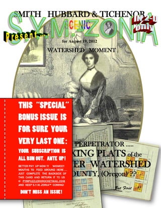
![From the desk of
Greetings, Players!! Welcome back ---
To yet another soul-stirring issue of S.Y.M.-Zonia ™ !
ABOUT Our COVER !
Wowee!!! On our cover this week, Players, we show a
scene which took place Wednesday, August 15, 2012,
inside the conference room at the offices of our
SPONSOR, Smith Hubbard & Tichenor, LLP – or,
SH&T, LLP, for short – conveniently located for all your
estate planning needs, at the corner of Fourth & Garrison
Sts. in the bucolic coastal town of Port Orford (Oregon),
where the unrivaled climate is said to be so healthful, and
so refreshing, so medicinal and bracing to the nerves, that
no medical doctor has ever been able to maintain himself in
practice there, treating illnesses, since no one ever gets
sick. Although there are occasional injuries from
Sasquatch ripping off the limbs of villagers, who may
carelessly forage for thimbleberries at the edge of the grim
forests that march down the mountainside, almost to the
very edge of the city.
And … guess who was in town this week! Guess who
dropped into the SH&T, LLP offices, on a … special call?
RUPERT ROGET (Ret.) -- REDUX !! Yes…
Depicted on our cover, therefore, are none other than the venerable Titular Leader of the Stephanie’s Youngster
Membership (S.Y.M.) herself, Ass. Dr. Stephanie Beckon, [You guessed right!! – Ed.] now interning as Archivist in
Training at the offices of SH&T, LLP, together – at last -- with S.Y.M.-Zonia™ Special
Consultant Mr. Rupert Roget, Surveyor of Coon County (Oregon), (Ret.) which neighbors
Curry County, in which Port Orford is situate, usually to the north. Although on some maps,
the “N” of “Coon” has undergone some “rotational work,” and thus appears to be an “S”.
Many of you will remember Rupert Roget, P.L.S., now retired from service to the
landholders – and all citizens – of Coon County. It was of course, Rupert Roget, who solved
one of interim editor Dromgoole’s earliest P.Y.M. ™ Puzzlers, Can YOU Identify the
Pillars of Atlas? (May 8, 2011) and provided the stunning photography which graced the
blockbuster, What Happened … at BLACK ROCK? (May 29, 2011) -- although he did so
under the alias “Robert Rogers” – in order to protect his professional identity. See at right,
for a couple brief moments of nostalgia, courtesy of the P.Y.M. ™ Puzzler. Rupert, who is
a specialist on the first Jackson County Surveyor Sewall Truax, has appeared in our pages
regularly since then, acting as Special Consultant on Surveys, as recently as the LOST
CITY S.Y.M.-Zonia™ of just a couple weeks ago, How Come the 1858 Oregon Territorial
Legislature Renamed Kerbeyville (Oregon) to Napoleon (Oregon)? (August 5, 2012). And
here he is again – IN PERSON -- and at last teamed up with Ass. Dr. Beckon!! Wowee!!
OKAY. WHERE WAS I? Oh—yes: on this strictly business visit, Ass. Dr. Beckon and
Surveyor R. Roget (Ret.) can be seen reviewing last week’s blockbuster issue, and
pondering material under preparation for the current issue [Yes – you’re holding it in your
hands!! – Ed.] of S.Y.M.-Zonia ™ -- in followup to that same last week’s issue, which
dared to broach a subject long considered TABOO among denizens of Southern Oregon-- an
area, with a few northern California counties, sometime defiantly known as Jefferson State.
AND – to what do I refer, Mr. Goldengate, You ask? What are they pondering, you ask?](data:image/gif;base64,R0lGODlhAQABAIAAAAAAAP///yH5BAEAAAAALAAAAAABAAEAAAIBRAA7)
Recommended
More Related Content
Similar to SYM-ZONIA -- WATERSHED MOMENT !!
Similar to SYM-ZONIA -- WATERSHED MOMENT !! (20)
More from Roch Steinbach
More from Roch Steinbach (20)
Recently uploaded
Recently uploaded (20)
SYM-ZONIA -- WATERSHED MOMENT !!
- 1. SMITH HUBBARD & TICHENOR GOLDENGATE’S for August 19, 2012 WATERSHED MOMENT WHO WAS the PERPETRATOR ….. of the PERPLEXING PLATS of the UMPQUA RIVER WATERSHED – of DOUGLAS COUNTY, (Oregon) ?? But First …!!
- 2. From the desk of Greetings, Players!! Welcome back --- To yet another soul-stirring issue of S.Y.M.-Zonia ™ ! ABOUT Our COVER ! Wowee!!! On our cover this week, Players, we show a scene which took place Wednesday, August 15, 2012, inside the conference room at the offices of our SPONSOR, Smith Hubbard & Tichenor, LLP – or, SH&T, LLP, for short – conveniently located for all your estate planning needs, at the corner of Fourth & Garrison Sts. in the bucolic coastal town of Port Orford (Oregon), where the unrivaled climate is said to be so healthful, and so refreshing, so medicinal and bracing to the nerves, that no medical doctor has ever been able to maintain himself in practice there, treating illnesses, since no one ever gets sick. Although there are occasional injuries from Sasquatch ripping off the limbs of villagers, who may carelessly forage for thimbleberries at the edge of the grim forests that march down the mountainside, almost to the very edge of the city. And … guess who was in town this week! Guess who dropped into the SH&T, LLP offices, on a … special call? RUPERT ROGET (Ret.) -- REDUX !! Yes… Depicted on our cover, therefore, are none other than the venerable Titular Leader of the Stephanie’s Youngster Membership (S.Y.M.) herself, Ass. Dr. Stephanie Beckon, [You guessed right!! – Ed.] now interning as Archivist in Training at the offices of SH&T, LLP, together – at last -- with S.Y.M.-Zonia™ Special Consultant Mr. Rupert Roget, Surveyor of Coon County (Oregon), (Ret.) which neighbors Curry County, in which Port Orford is situate, usually to the north. Although on some maps, the “N” of “Coon” has undergone some “rotational work,” and thus appears to be an “S”. Many of you will remember Rupert Roget, P.L.S., now retired from service to the landholders – and all citizens – of Coon County. It was of course, Rupert Roget, who solved one of interim editor Dromgoole’s earliest P.Y.M. ™ Puzzlers, Can YOU Identify the Pillars of Atlas? (May 8, 2011) and provided the stunning photography which graced the blockbuster, What Happened … at BLACK ROCK? (May 29, 2011) -- although he did so under the alias “Robert Rogers” – in order to protect his professional identity. See at right, for a couple brief moments of nostalgia, courtesy of the P.Y.M. ™ Puzzler. Rupert, who is a specialist on the first Jackson County Surveyor Sewall Truax, has appeared in our pages regularly since then, acting as Special Consultant on Surveys, as recently as the LOST CITY S.Y.M.-Zonia™ of just a couple weeks ago, How Come the 1858 Oregon Territorial Legislature Renamed Kerbeyville (Oregon) to Napoleon (Oregon)? (August 5, 2012). And here he is again – IN PERSON -- and at last teamed up with Ass. Dr. Beckon!! Wowee!! OKAY. WHERE WAS I? Oh—yes: on this strictly business visit, Ass. Dr. Beckon and Surveyor R. Roget (Ret.) can be seen reviewing last week’s blockbuster issue, and pondering material under preparation for the current issue [Yes – you’re holding it in your hands!! – Ed.] of S.Y.M.-Zonia ™ -- in followup to that same last week’s issue, which dared to broach a subject long considered TABOO among denizens of Southern Oregon-- an area, with a few northern California counties, sometime defiantly known as Jefferson State. AND – to what do I refer, Mr. Goldengate, You ask? What are they pondering, you ask?
- 3. Well, as you can see from her letter [Immediately below – Ed.] , which was written on the same day (viz., Wednesday, August 15 – the “highe seasoune” according to many well-regarded dead poets, and a WATERSHED memorial in history, say some ) that the lithograph was made, quite obviously the two wise ones are discussing D.W. RAN$M and the cartography of Myrtle Creek (Oregon), and – probably -- its implications for the interpretation of other PERPLEXING PLATS of the Umpqua River Watershed. Again, this may explain the pensive look on Rupert’s brow. However, for Ass Dr. Beckon, it also appears it may be a WATERSHED MOMENT… of a personal sort. For us, Players, it is that and more: because, as anticipated, Dr. Beckon’s letter gives us the hoped for solution, to Last Week’s issue of ….. WHO WAS D.W. RAN$M … and WHAT’S INDICATED by HIS ONLY KNOWN SURVEY .. .. .. of MYRTLE CREEK, (Oregon)? PLAYERS!! As you can see from Ass Dr. Beckon’s letter, the answer to last week’s issue on the wildly rotated cartography of D.W. RAN$M, is really quite simple, but, let’s face it – quite embarrassing. OK -- It’s humiliating. Moreso, perhaps, than the error of Asaph Petrocelli Dromgoole, [Yes!! -- No kidding!! It must now be told! – Ed.] when -- defying even the determination of the free trial download R.E.D. Alert Software -- he very brazenly mis- identified the painting, The Trapper’s Last Shot, as the work of John Mix Stanley, when in fact it is of course well known, to have been executed by William Tylee Ranney. [See various issues of the P.Y.M. ™ Puzzler, from back in Feb. of this year – Ed.] It was not a pretty situation.
- 4. In doing so, Dromgoole went at loggerheads with Ass. Dr. Beckon herself, who had written in with the “correct” answer – even before she was appointed Titular Leader – and in so doing, he, Dromgoole, humiliated himself, and, in turn, helped to elevate her to the status she now enjoys, taking on all comers, and eclipsing them behind “the immediate sparkles of her mind,” as she puts it. See the “Trappers Last Shot” Puzzlers – still largely confined to February, 2012 -- but having, in their implications, reverberations up to the present. Etc. AND SO, Players – do you think for a minute that I am going to make the SAME MISTAKE and cross her? Ass Dr. Beckon? Or challenge this solution? Especially after having expressly solicited her answer to last Week’s S.Y.M.-Zonia™ ?? Not quite. “Eat crow while it yet young and tender-- ” is the old Umpqua Indian saying. “Before it get gristly, lice-ridden and stank. Very stank.” AND SO … on to the question, WHO WAS D. W. RAN$M ... and WHAT’S INDICATED by HIS ONLY KNOWN SURVEY .. .. of MYRTLE CREEK, (Oregon)? PLAYERS: “We have our answer,” awkward though it may be; that he was a SALOONKEEPER and retailer of spirituous liquors, as they were then called, who kept a WATERING HOLE as it is sometimes called. And, as if it were necessary to place in BIG BLACK BOLD LETTERS the conclusion that Ass. Dr. Beckon has -- only with the greatest delicacy and discretion – left, by implication, to gradually register on our shell-shocked consciousness(es), well, let me spell it out for you: she means that D.W. RAN$M was INEBRIATED or INTOXICATED or perhaps DRUNK AS A SKUNK or otherwise UNDER THE INFLUENCE when he executed the specimen designated as the subject of last week’s number. Egad!!! I am crestfallen. It’s …. QUITE A SHOCKER. Good grief …. Quite a blow …. !!! Yes, Players. The idea is SUPPOSED TO BE, you know, that there’s a SECRET CODE in there somewhere – that was the answer I was looking for -- not just some physiological impairment brought on by overindulgence of intoxicants. He was snookered? Oh, help .. .. .. This is not what I was expecting from Ass. Dr. Beckon. Perhaps, it explains the apprehension seen creeping across the face of Rupert Roget (Ret.) as Ass Dr. Beckon points to the damning record unearthed from the SH&T, LLP archives . The surveying profession – disgraced!!! The Myrtle Creek (Oregon) plat – may represent a WATERSHED MOMENT, but of another kind!! It was drafted …. in a saloon! By a lush!! Incidentally, Ass. Dr. Beckon also sent this image of Mr. John Hall, one of the two town founders, Hall & Hamlin, named on the plat!!!! NOW, HOWEVER , we must move on.. .. ..
- 5. WHO WAS the PERPETRATOR of the PERPLEXING PLATS of the UMPQUA RIVER WATERSHED of DOUGLAS COUNTY, (Oregon) ?? CLICK-TO-ENLARGE !!! ACTUAL unretouched Plat of Applegate’s Addition to Yoncalla (Oregon) (1906) Weird, huh? WELL, as noted, the Boss’s SOLUTION as printed VERBATIM above, literally tea-totalled last week’s S.Y.M.- Zonia™ -- shattering all illusions that D. W. RAN$M was some kind of map-o-graphic mastermind, who was encoding secret information -- perhaps of an esoteric sort – within the humble parameters of the plat of Myrtle Creek (Oregon). Terrible. I had a lot riding on that one. Some side bets. Along with all that, my confidence is now shattered as well!!! Especially for the execution of THIS WEEK’S ISSUE -- the current one, you know – that you are holding in your hands, if you have an iPad: the long-planned followup to the RAN$M affair. NOW – with this disaster reverberating, as things stand, I can but feebly mimic the real S.Y.M-Zonia™ that I was going to run -- inasmuch as my judgement on the matter being asserted – the major premise, you know -- seems to have been substantially discredited. RAN$M was drunk! Or, his draftsman was. Horrors…. A sot. A SALOONKEEPER And it’s a family magazine!! WAIT !! What did I just say ….. HIS DRAFTSMAN? Or ….. “draughtsmen” -- if you like your vestigal unsounded consonants. Mmmmmm. AHAH!!! Perhaps it was not D.W. RAN$M who executed the plat, after all !!! Not the actual surveyor, who drew the map!!! But, instead – perhaps -- it was some mysterious unknown draftsman: an unknown artist at work, perhaps, in an unmarked, sparsely furnished, second-story office over the County Recorder’s suite, in Roseburg (Oregon): i.e., the County Seat of Douglas County (Oregon) …. where the plats had to be filed & recorded? Or perhaps in another nearby city, somewhere else in the Umpqua Basin. Like Oakand. Or Yoncalla? A sort of Walter Mitty, or a pioneer Bartleby, who took out advertisements in the Roseburg Express offering – for a modest fee -- his services as a draftsmen, for the laying out of town surveys into recordable plats !!! OF COURSE: a clerk at the County Recorder’s office, in Roseburg, who moonlighted as a mapmaker, from his offices upstairs. He could refer pioneer land claimants to himself, upstairs, and guarantee that the finished plat would be legally filed and recorded-- downstairs! The harried pioneer could get back to his Land Claim, and this …. this .. “Bartleby” of the Umpqua Basin -- sort of – would take care of everything!!! That HAD TO BE the answer …
- 6. The “BARTLEBY” of UMPQUA BASIN: So, the following IMAGERY, of these UMPQUA RIVER WATERSHED plats, I think show us, Players, that there was just such a “BARTLEBY” figure at work carefully encoding the secrets of some unidentified fraternity – from his second-story office over the County Clerk’s office. The work of a single draftsman, who – while in an UN- intoxicated and NON-tipsy state – either orignally RECORDED or later REWORKED the entire early collection of Douglas County (Oregon) town survey plats. Wowee!!! But who was this draftsman? Who was the perpetrator ? Let’s look first. As usual, time and space are limited – and so we can only peruse a small percentage of the perplexing work-product of the “Bartleby” of Umpqua Basin – as he has come to be known. [Players – for more on the masterpieces of the real Bartelby, go WAY BACK to the old P.Y.M.™ Puzzler, Just What was Bartleby the Scrivener Really Working on, Anyway? (May 15, 2011) and the now-priceless Solution Supplement thereto. See at left – Ed.] So, for instance, Players, we could begin by looking at the plat of Applegate’s Addition to Yoncalla (1906) which appears (above) on the preceding page, and is in many ways highly characteristic of the works of this … this B.o.U.B. – only missing a few of the major features of his work: like highly hachured rivers and creeks, which are – quite literally – streamlined -- as we shall see. And odd little compass arrows. Or below, the plat of Winchester (Oregon) (Recorded 1857) shows his fascination with colored patterning – something that was also evident in the Myrtle Creek (Oregon) plat from last week!!! Yes!! Absolutely: it’s the B.o.U.B.!! YOUR AD HERE. But Wait!!! There’s more ….
- 7. Players!!! An accomplished connuisseur [sic] of the best archival plats -- upon seeing this map – was heard to remark to himself –“What an incredible B.o.U.B.!” Do you see anything reflected in this Town Plat of … Looking Glass ? (Oregon) (Recorded, 1878.) ... or, in the checkerboard Plat of the grounds of the I.O.O.F Cemetary – Looking Glass, (Oregon) (Recorded, 1898) B.o.U.B. was HERE!
- 8. Gardiner (Oregon) from the Umpqua River … looks like the sawmill. Town Plat of Gardiner (Oregon) (Recorded 1880) -- with interesting “compass” motif worked into the lettering … Probably meaningless ..… Hmmmm. A “Compass” arrow? Nah …. But what about the loon, or cormorant, showing the direction of the riverfowl? I mean .. riverflow?
- 9. PLAYERS!!! The ambitious plat of the town of Dillard’s Station (Oregon) (Recorded, 1882) like Myrtle Creek (Oregon) appears to have anticipated the arrival of the Oregon & California Railway. See, Ass. Dr. Beckon’s letter, p. 3, above. The right-of-way here, however, is that of the Union Pacific. This time, the railroad finally came through – but not the town. Note that this plat – like most of the others -- shows the queer lettering of the mysterious “Bartleby” of Umpqua Basin and clearly anticipates the rise of the Art Nouveau stylistic, that was eventually to catch on in remote regions like Paris (France), and eventually … the world. These plats from Douglas County, show for a fact that the fad originated in the Umpqua River Watershed !!! Wowee!! Was it all the work of “Bartelby of Umpqua Basin”? Or some other master hand? You know the answer!!
- 10. Re-Survey Plat of Roseburg (Oregon) (Recorded 1878) Note the radical compass arrow: a hallmark of the B.o.U.B., as we saw in the Myrtle Creek (Oregon), plat. More on this … next week, perhaps??
- 11. Plat of Gabbert’s Addition to Myrtle Creek (Oregon) (Recorded 1878) Compass arrow means …. B.o.U.B. was HERE! The Myrtle Creek (Oregon) Grist Mill (& Electric Power Plant) (… and laundromat )
- 12. ANOTHER WATERSHED MOMENT …. ? PLAYERS!!! You know we only have so much space to admire these amzing plats. Yes – it’s almost time to go!!! BUT -- before I close this week’s issue of S.Y.M.-Zonia™ I’d like us all to share our own brief WATERSHED MOMENT together – inspired by the moment shared by Ass. Dr. Beckon, and Rupert Roget (Ret.) as they perused some of the Umpqua Basin material – which you now see before you…. !! So …. Douglas county is the one county in Oregon which exclsuviely encompasses an entire river watershed -- which, is, as you might guess, the Umpqua River Watershed, or … Drainage. The map below, gives a good idea as to the level of precision that was originally exercised by the Oregon and U.S. G.L.O.s, in laying out the boundaries of Douglas County, to encompass the Umpqua River Drainage. This is most noticeable along the sothern boundaries of Douglas County, which it shares with Josephine and Jackson Counties. Whereas, in many counties in Oregon and thoughout the U.S., river banks often serve as conveneint County Boundaries, here – it appears -- a most meticulous effort has been made, to make Douglas County coterminous with the Umpqua River Watershed, driving the county line up onto the summits of mountain ranges, on nearly all sides, except where the Umpqua River at its mouth, “disembogues” or empties into the Pacific Ocean. All the Umpqua River Watershed thus lies within the county -- all of it, that is, but a few small “humps,” and a rather large “hump” which corresponds to the Steamboat Creek watershed – a northeastern extremity of the Umpqua Watershed. This area – enlarged in the “inset” map – somehow escaped the careful surveyors of the Douglas County Line, and so this significant portion of the Umpqua River Watershed, lies in neighboring Lane County (Oregon) , and not in Douglas County (Oregon). And some other smaller humps lie in other neighboring counties …… like the little hump south of Crater Lake -- Ahhh… That was good. Special. I’m glad we were able to share this brief WATERSHED MOMENT together. And NOW, Players ..
- 13. Plat of Riddle (Oregon) (Recorded 1882) Crow’s “Barber & Bath” -- Riddle (Oregon) B.o.U.B. was HERE TIME to SAY …“GOODBYE!” The Riddle, Oregon Concert Band – -- w/ captive audience. YOU ARE LEAVING POPULATION 0