
Recommended
More Related Content
What's hot
Similar to SYM-ZONIA -- PARADIDDLE !!
Similar to SYM-ZONIA -- PARADIDDLE !! (20)
More from Roch Steinbach
More from Roch Steinbach (20)
Recently uploaded
Recently uploaded (20)
SYM-ZONIA -- PARADIDDLE !!
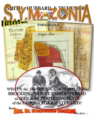
- 1. SMITH HUBBARD & TICHENOR GOLDENGATE’S for September 9, 2012 PARADIDDLE WHAT’S the SIGNIFICANCE of “BARTLEBY”’s BROODING “BURNT UMBER” PERIOD as SEEN in the PERPLEXING PLATS of the UMPQUA RIVER WATERSHED? With But first …
- 2. From the desk of The B.O.U.B. is Back … AGAIN!! ? PLAYERS – Yes!!! But – perhaps for the last time!! At least, for this year. For – well, as you know – there ARE other stories to tell … “Alas!”<sniff> I hear the cry …. BUT LOOK: Is it -- is it really the same Bartleby we all have come to know and respect – over the last few weeks? Is it the same mysterious mastermind? Is it the same Perpetrator of the Perplexing Plats of the Umpqua River Watershed? Remember the whimsical, cotton- candy-colored plats of the Umpqua River Watershed… ?? PLAYERS – it’s these plats that look like they were stapled to a phone pole in Haight- Ashbury!! Let’s face it -- like a Peter Max poster book … Many of these highly-colored works of this so-called “Bartleby” figure seem oh-so-summery, so happy-go-lucky, and almost Polyannish. Yes … they have even led to critical snickers over the acronym used as shorthand for his moniker – aka The B.O.U.B…. But we know, that wherever there are displays of such manic highs, there are by an operation, almost of a law of nature, ALWAYS corresponding psychic swings into countervailing lows. And indeed, in “Bartleby” there was – a darker side: a side not often considered either by his admirers or critics. But … maybe I’m getting ahead of the story. Let’s see…
- 3. ABOUT OUR COVER !!! Let’s take a look back, Players … REMEMBER last week? Deeply engaged in discourse on questions cartographical in nature, Ass. Dr. Stephanie Beckon and her “special friend” S.Y.M.- Zonia ™ Special Consultant Rupert Roget, P.L.S. Surveyor of Coon County (Ret.), had found themselves on stroll from the SH&T, LLP, offices at 4th & Garrison Street in Port Orford (Oregon), walking down ___ Street towards the Bay (sometimes formerly called Ewing Harbor) , and by some unspoken assent, had chosen a location, and perched themselves on some rocks at the edge of the surf, near the legendary Battle Rock … Thereafter, their conversation -- you may recall -- had focused on the question of a sort of parallax, said Ass. Dr. Beckon, created by the juxtaposition of TWO VARIANT COUNTIES vying for realization in the vicinity of the Umpqua River Watershed: FIRST: On the one hand, there is the real, mundane and tangible ACTUAL COUNTY, viz, Douglas County (Oregon) which, as was discussed a number of times [Yes, true – but, let me remind you, especially in the WATERSHED MOMENT issue, of two weeks back – Ed.] is – with some exceptions -- nearly an exact overlay of the hydrological drainage of the Umpqua River: that is virtually coterminous with the Umpqua River Watershed. This is the county you all see, touch and taste: the county that works, levies taxes, pays the sheriff, and provides sanitary services … SECOND: On the other hand, there is the OTHER otherwise UNKNOWN and UNDISCOVERED county: the lost county of BOHEMIA COUNTY: it is an entirely ideal and conceptual county – one never realized, and having, even in its planning, only abstract and ideal definitions derived, not from a real drainage basin, but from the G.L.O. survey grid. Nevertheless, Bohemia County selected as its County Seat, the town of DRAIN, (Oregon): the one town in Douglas County that is functionally critical to Douglas County, given its nature as a Watershed County: and in so doing Bohemia County threw a rubber-ducky into the plumbing of Douglas County, threatening its very identity, threatening to co-opt it’s plug: Leaving one county in Oregon which is almost by definition, a drainage - now WITHOUT ITS DRAIN!!! Criminently!! You’re right: things couldn’t get much worse, or have gotten. You can see why there was such resistance to the plan of the Bohemians!! Well-intentioned perhaps, but blinded by their own agenda, they completely failed to recognize the necessities of the larger comitatus [That’s Latin (possessive or genitive) for “county” – Ed.] For the Bohemians would have left the Douglas County citizenry at large, to be submerged in their unique, relentless hydrographic materiality. Glub, glub, glub. “Where’s the DRAIN!!!?”
- 4. And that was the gnarly parallax … Well, you get the idea!! But – what next…?? Well, that’s about the time that Ass. Dr. Beckon and Rupert Roget – the two of them -- rolled it up and headed in, carrying their intense cartographic dialogue up the cliff to the Whale-of-a-Tale Coffee Bar and Disco, in Port Orford, (Oregon), where as it turned out, it was even harder to overhear their conversation because of the Beach Boys playing on the juke-box that qualifies the joint as a “disco” in this small town …. “Help Me Rhonda,” “Surfin’ U.S.A.,” and etc. That was all that could be heard. And so, they were seen wandering back via ___ Street, to SH&T, LLP -- where they re-opened the firm archives again, and pulled a few portfolios … PLAYERS!!! See Ass. Dr. Beckon’s letter – below!! So, my own take on this parallax, and my own proposal for its resolution, is this: that the tension created by the juxtaposition of Bohemia County, with Drain as it’s County Seat, and Douglas County, being a uniquely “watershed county”… is to focus our attention on the actual, physical “drain” city of the real Watershed County – and this is, of course, the city of Gardiner (Oregon), at the mouth of the Umpqua river: the point at and past which the entire drainage of Douglas County must finally pass. It’s simple!!! Or …. So I thought … It was so obvious – to me -- that it was almost as if the B.O.U.B. had created a pair of plats for Gardiner: Like this: A PAIR OF WHATS ?? – But, why Gardiner? Aside from being the “drain” for the real hydrographical Douglas County and for Umpqua County (Oregon) that had preceded it -- what could possibly be of interest in this other isolated, windswept coastal hamlet ??? I mean, what with Ass. Dr. Beckon re-locating her … self to Port Orford, I had thought that THAT fishing village alone would be central to the story -- the unparalleled Nonpariel of Oregon History, so to speak … But was “Bartleby” suggesting something else? I mean, what with the Bohemian Parallax, and now the Paraplats – wait: I made that up: forget that – the focus was shifting to Gardiner…. But … WHY?
- 5. PORT OF GARDINER ONE POSSIBLE ANSWER, Players, was that Gardiner (Oregon), as the functional and actual “City of Drain” of the Umpqua River Watershed, was also the port into or through which all shipping and commerce was obliged to pass…. And so, the early American settlers into Oregon, had not only established Gardiner (Oregon), the town, but – wisely – had also established there a United States Custom House, for the Oregon Territory, District of Umpqua regulation of shipping and commerce: namely for controlling of imports and exports, through the registering of vessels, and the manifesting of their cargoes and passengers … AHAH!! There were extensive Gardiner Custom House records laying about here, in D-37, in some of these bags of papers that had survived Dromgoole’s arson of his rooms – that is, Unit 11, Motel 6, Belmont (California) …. GARDINER had to be the answer … BUT … well, you know: two heads are better than one… And Ass. Dr. Beckon and Rupert Roget, between themselves, had a pair of them: and so had initially reached the same conclusion as I did – I mean, about Gardiner -- AND THEN, spurred on by the questioning mind of Mr. Roget, and sensing another parallax – they had already advanced from the singular resolution of the Bohemian parallax – viz., Gardiner (Oregon) – to some other undisclosed parallax… YES: you guessed it: yes -- a new parallel parallax, making for … YES!! a pair of parallaxes!! And need I say, Players … …. Wowee ….!! SO, the letter that Ass Dr. Beckon sent in this week was NOT, as I had expected, on Gardiner as the unique resolution to the parallax problem… NO: it was not. Instead, based upon some undisclosed data, known only to herself and Rupert Roget, her letter addressed development at the mouth – the drain – of a … parallel or neighboring watershed – to the south: namely that of the Coos River, which drain into the Pacific Ocean though Coos Bay, in Coos – or, sometimes, Coon – County…….. Got it? No? Okay… Ass. Dr. Beckon figured I might get us all sidetracked …. Here’s the letter she sent:
- 9. PLAYERS!!! Ass. Dr. Beckon’s report makes the proposition of Pacific Slope townsite development sound stressful …. Like a real challenge … But, to apply this lesson, if possible, to this elusive “Bartleby” figure? Well: he, it appears, was only working in his office, on the drafting and layout of the town plats – and not responsible – at least, not in the same way – for the promotion and development of these towns in the Umpqua River Watershed… He wasn’t taking any risks, was he? He had no stake in the outcome of the developments he platted. So why does he too, seem to be … disturbed … brooding? At least on some of his plats? This issue of S.Y.M-Zonia ™ intends to get to the bottom of that question. THUS, WITHOUT FURTHER ADO…
- 10. WHAT’S the SIGNIFICANCE of “BARTLEBY”’s BROODING “BURNT UMBER” PERIOD as SEEN in the PERPLEXING PLATS of the UMPQUA RIVER WATERSHED? These then are the plats of “Bartleby”’s brooding and dark period: by most critics known -- for their general cast --as his “Burnt Umber” works …. Players – I know it’s hard, but compare these plats to the ditzy almost psychedelic “Peter Max” works – some shown on page 2 -- with which we first came to know “Bartleby” – who(m)ever he was – over the last few weeks, and YOU’LL SEE that either he was having a really bad day, or a mood swing, or else something terrible had taken possession of his psyche: some dark awareness that had overtaken his whole being … BUT WHAT?
- 11. Among the Perplexing Plats of the dark side of “Bartelby” there are three actual town plats – namely, of Stearn’s Addition to Oakland – Amended Plat (1894) the original plat of South Drain (1889), and the Third Brookside Addition to Roseburg (1892). All are shown above. There may be others, but these appear to be most representative … We learned from Ass Dr. Beckon’s letter, that development – and non-development — of such cities could disturb the psyche of the developer to a great degree – even leading him to the State asylum!!! Understood. This might explain the three “burnt umber” town plats. However, PLAYERS …. IN ADDITION to these brooding town plats, there is a singularity: not a town plat, but a subdivision map for the Clayton Donation Land Claim, or Clayton Tract, located on some arable land in T. 24 S. R. 7 W., W.M., -- deep down the Umpqua River canyon, near the middle of no-where: about 15 miles from the open valleys to the south, near the Umpqua Post Office, and another 23 miles from where the river emerges from its canyon, as it nears the rolling lowlands and plains around Elkton . At this point along its (really remarkable) course to the Pacific, the Umpqua makes one of a number of “easy” 180° turns, and here, the resulting area, almost encompassed, holds the alluvial deposits of millennia. Some good farmland …. [ Start a Gargle Earth or Gargle Map search at “Umpqua, Oregon,” and move down the river valley, northward. – Ed] Bartleby’s map of the Clayton Tract shows a dense layering of paint, carefully – though not evenly or smoothly – applied. In addition, his brushstrokes are quite evident, and reveal again, a sort of brooding meditative disquiet, as if in coloring in the parcels of the subdivision, he had noticed something; and his mind had become focused in or absorbed entirely by it. And he just kept painting and painting, almost as if his brush itself, were trying to recreate on paper, the pattern of deposition of silts and sediments that make up the river valley at this bend … But why?
- 12. AHAH!! [ And Here’s A Hint!!! -- Ed.] The map above is a portion of the old USGS Tyee Quad, and shows the Clayton Tract subdivision, at T. 24 S. R. 7 W., W.M., as executed by “Bartleby,” but now repositioned – superimposed – upon the stretch of the Umpqua River, depicted on the topographical map. PLAYERS – Do you notice anything? Hmmm? NO? Well… look again. And then, take a look at the DATE of this issue of S.Y.M.-Zonia™ -- and then think back to a certain P.Y.M. ™ Puzzler of about – oh, say… ONE YEAR AGO. Remember Dromgoole’s disastrous P.Y.M.G.C.P.? And the vehicular flash mob that … literally … ensued? (Did you save your back issues? I sure hope so !!! ) One more hint: DROMGOOLE LIED. Yes. We know: Me and Suzy Cue. Because … we were there … BUT, YOU ARE NOW LEAVING POPULATION 0