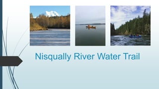
Nisqually River Water Trail Plan
•Download as PPTX, PDF•
1 like•79 views

Water Trail Plan presented for approval by Nisqually River Council on 2/16/18

Recommended
Recommended
More Related Content
What's hot
What's hot (12)
Similar to Nisqually River Water Trail Plan
Similar to Nisqually River Water Trail Plan (20)
More from Nisqually River Council
More from Nisqually River Council (20)
Recently uploaded
Recently uploaded (20)
Nisqually River Water Trail Plan
- 1. Nisqually River Water Trail
- 2. Purpose/Vision Vision: The Nisqually River Water Trail provides high quality non- motorized public recreation opportunities that are aligned with efforts to protect areas of cultural importance and the natural environment, including threatened and endangered species habitat and protected lands. Planning effort led by the Nisqually River Council with technical assistance from the National Park Service’s Rivers Trails and Conservation Assistance Program (RTCA). Guided by an Advisory Committee
- 4. Goals Provide ample public access opportunities to the Nisqually River from La Grande Dam to the Nisqually Estuary Create minimal impact on salmon habitat, private lands, or sensitive ecosystems Provide interpretation opportunities for users to learn about the cultural importance and natural history of the area Recognize the personal responsibility of users, including exercising skill- based judgement and Leave No Trace principles
- 5. Advisory Committee Accomplishments 7 meetings developed vision, goals, and recommendations 4 river floats & field visits to developed/potential access sites Participated in a Focus Group Workshop to identify areas of high value or importance Special thanks to: Ed Kenney, for showing the core planning team several additional access points Thomas O’Keefe for providing boats/gear for all river floats, for photographs of the river and for review of maps Chuck Young for writing sections of the Concept Plan, writing segments for the website, and for reviewing maps Rebecca Post, for providing boats/gear for all river floats, hosting a river clean up, and for review of maps
- 6. Public Outreach Media releases press release, newsletter article, blog post, Facebook 4 Open Houses & 2 Informational Booths Eatonville Yelm Nisqually Indian Tribe – Open House & booth at community dinner Nisqually Watershed Festival – informational booth Online Survey 146 Responses Public Comment on draft Plan
- 7. Concept Plan Completed and adopted by September 2017 Contains 1-year workplan for implementation Short-term, Mid-term and Long-term recommendations for improvement Available online: watertrail.nisquallyriver.org
- 10. Implementation
- 11. Initial Outreach Development of informational website: watertrail.nisquallyriver.org Safety information Access sites/reach descriptions Focus on McKenna Park to Luhr Beach Downloadable maps Reach by reach descriptions Reviewed by local recreationists Printable in black & white and color Logo Design Selected local artist, working on design development
- 12. Implementation Forum Convened by the Nisqually River Council Plan to meet on an annual basis Guide implementation & pursue opportunities as they arise Ideal make-up: Land managers [including agencies, non-profits, etc] Recreationists Nisqually Indian Tribe Emergency response personnel Natural resource managers Others?
- 13. Next Steps Identify funding source(s) to support Implementation Forum & priority actions Convene annual Implementation Forum We’d like to hear from you…
- 14. Action # of stars Volunteers/Partners Host clean-up/stewardship events along the river and at access sites to remove trash and other debris. 5 Track user data by reach 5 WDFW Develop and install water trail signs to increase awareness of the water trail and safety information at existing access sites from McKenna to Luhr Beach. 4 WDFW, Centralia Power Continue conversations with Nisqually State Park and the Nisqually Indian Tribe on access to the Nisqually through the State Park. 4 American Whitewater, Chuck Young Support efforts to extend the Yelm-Tenino Trail to the Nisqually River and beyond. Pursue opportunities to construct additional access site and/or day- use area at the intersection of the Yelm-Tenino Trail and Nisqually River. 4 Nisqually Land Trust, Anne Wahrmund Begin conversations with Weyerhaeuser to determine feasibility of increased access through their property. 3 Improve 6th Ave access site to make the take-out safer. 3 WDFW Create an interactive map of the water trail. 2 American Whitewater
- 15. Action # of stars Volunteers/Partners Share information on the development of the water trail and available resources including safety information on the website and maps with local public safety agencies, river user groups and businesses catering to local river users. 2 Identify and pursue funding sources to support implementation. 1 Work with emergency responders and land managers to identify and map emergency landings and places for emergency providers to access the river. 1 Nisqually Land Trust, Chuck Young Improve ramp through widening at Nisqually Park/Yelm Powerhouse. 1 Develop outreach tools telling the cultural and ecological stories of the area. Begin conversations with JBLM to determine locations suited/appropriate for stretching, lunch spots, etc. Encourage commercial guided trips on the river.
- 16. Thank you! Contact: Justin Hall Justin@nisquallyriver.org or 360.438.8715
Editor's Notes
- JUSTIN: Introduce project, highlight that this is the final advisory committee meeting before shifting to implementation
- JUSTIN: It’s been a while since we met as a group, so I wanted to take the time to refresh your memories on the project vision and the leadership involved with the development of this concept plan. Project led by the NRC with assistance from the RTCA.
- JUSTIN: This project began in 2015. The planning phase will be completed by September of this year, and implementation will begin after that. During the two years of the project, the Advisory Committee and Core Planning Team worked to develop a vision, identify issues, develop a workplan, conduct site inventory and river floats, host public meetings/workshops, and draft a concept plan. This final year of planning has largely been spend conducting public meetings, gathering comment on the draft plan, and beginning intitial implementation, which we will talk about shortly.
- JUSTIN: Again, as a reminder, here are the main goals we jointly developed to guide the planning process and development of the concept plan. First and foremost, we wanted to evaluate opportunities to increase recreation access to the Nisqually River. Secondly, it was important to minimize negative impacts on cultural and natural resources; one of the highlights of the Nisqually River is its relatively untouched nature. By continuing to protect those resources, we can maintain a pristine river experience. Third, we examined opportunities to provide interpretation and educational opportunities for users. Finally, it was a goal for us to provide information for people to exercise skills based judgement and Leave No Trace principles.
- SUSAN: Highlight the work of the Advisory Committee over the last 3 years, including meetings, river floats, field visits and helping develop the plan/initial outreach products
- SUSAN: Soliciting community input and feedback was an important part of the planning process. We used a variety of techniques to conduct outreach, including online and print media formats, open houses, informational booths at community events, an online survey and public comment.
- SUSAN: Note that plan underwent public comment and received comment from members of the AC.
- SUSAN/STEPH: Allow time for questions on previous section before starting this one, as it is a separate part of the agenda.
- STEPH: Switch view to website & highlight information shown [Morgan can give brief overview of website if feasible] and show map(s). If feedback is offered, that’s great, but this is more of a chance to show off some of the work. Inform AC that these maps have all been reviewed by recreationists and/or managers of the areas in question.
- JUSTIN: Shift to a discussion about what the river trail process will look like as we move forward NRC plans to convene annual implementation forum to guide implementation and pursue opportunities. No funding yet identified.
- SUSAN: Introduce the priority action exercise.