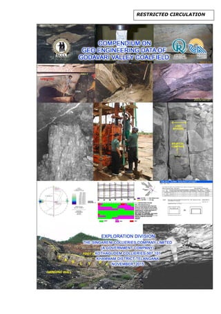
SlideShare a Scribd company logo
1 of 50
Download to read offline
RESTRICTED CIRCULATION
PREFACE
1. In the process of Exploration, Physico Mechanical Properties (PMP)
data is generated both by SCCL lab and outside labs viz.
CIMFR,NIRM,NIT,IIT,NGRI etc. The data thus generated is compiled.
Subsequently Geotechnical Logs are prepared. Till 31-03-2015, from
about 600 Boreholes, PMP data was generated. Out of which, GT logs
were prepared for 472 Boreholes.
2. Initially RMR studies were given on contractual basis to NIRM for 10
mines with a total charge of Rs.2 lakhs during 1993. Since 1994,
Exploration Division has taken up these studies on it's own and as on
date (31-03-2015), 480 RMR reports are submitted.
3. NIRM and CIMFR were charging heavily for consultation services and
keeping the economics and time in view, Management decided to
utilize the services of Exploration Division to evaluate the Cavability
Index of the strata overlying working section. Subsequently,
Exploration Division has submitted more than 60 reports as on 31-03-
2015.
4. Geotechnical mapping is taken up by Exploration Division since 1990,
unlike CIL, providing more useful data and facilitating the mine
management to take decision in creating better working conditions. As
on 31-03-2015, more than 130 Geotechnical Mapping reports have
been submitted.
5. CSIRO/Australia, CIMFR, NIRM, ISM, Anna University etc. are also
keen about the Geotechnical Mapping reports of Exploration Division to
help in their studies.
6. Practical solutions to the mine issues have been demonstrated through
technical reports and technical papers over the years which shows the
expertise on Geotechnical aspects of both underground and opencast
coalmines. Exploration Division submitted more than one hundred and
thirty technical reports of different mines. Further, published more than
fifty technical papers in the proceedings of International
Seminars/Symposiums/Conferences and International & Indian
Journals.
7. The contribution in establishing Stress field through mapping technique
and validation with test data were exemplary. Based on these studies,
Stress field of Godavari Valley Coalfield was derived and an article was
published in the Proceedings of 23rd
World Mining Congress held in
Montreal, Canada during August, 2013.
8. SCCL is proposing some new mining blocks in the Godavari Valley
Coalfield (GVCF) with status document with roof hazard zonation maps
vis-à-vis stress field, for safe and economic mine design. Hence it is
essential to understand the stress conditions prevailing in the mine
blocks and also for the proposed mining areas for preparation of stress
map vis-a-vis roof hazard maps which depicts the stress provinces for
ii
the entire coalfield including the underground mines. Director General
of Mine Safety is directing coal industries to determine in-situ stress for
all longwall workings. To fulfill the requirement using the in-house
expertise in Geotechnical studies and as it's endeavor, S&T Project
proposal "Assessment of horizontal stress fields in deeper horizons
and development of roof hazards maps of coal resources in SCCL
command area" is initiated with an objective to devise/formulate
suitable support systems for working the coal mining blocks of SCCL.
9. After establishing the Stress field and preparation of suitable Support
design in SCCL, guidelines will be prepared so that these
investigations will be useful for the other coalfields in India for support
design.
10.During Co-ordination of several International and Indian Consulting
agencies viz. CSIRO/Australia, CIMFR, NIRM, Anna University, ISM
etc. additional data generated in Rock Mechanics, reports submitted by
the subject Experts are also compiled and incorporated in the
Compendium.
K.K.SHARMA Dr.D.N.SHARMA
General Manager Dy General Manager (Geology)
Exploration Division Exploration Division
iii
FOREWORD
,
A. Manohar Rao
Director (Planning & Projects)
Geotechnical (Geo-Engineering) Studies is a budding branch of Mining
Engineering and Geoscience which in today's context has been gaining wide
attention, momentum and acceptance by the Mining Fraternity. Exploration
Division, SCCL is pioneering in the area of Geo-Engineering Studies by taking
up various aspects of this Science.
As a part of updating the approach and it's application of Geotechnical
studies, keeping in view the exploitation of deeper blocks and for the ease in
Mine Planning, S & T Project titled " Assessment of horizontal stress fields in
deeper horizons and development of roof hazard maps of coal resources in SCCL
command area" is initiated and approved by the MoC. Final outcome of this
project will be immensely useful not only to SCCL but also to the Indian Coal
mining Industry.
The approach of compiling the Geotechnical data generated since 1980 and
converting the huge data into digital form to prepare the "COMPENDIUM ON
GEO-ENGINEERING DATA OF GODAVARI VALLEY COALFIELD" is
appreciated. It is sure that this Compendium will enable augmentation of
excavation design, planning and the scientific principles that govern such
concepts which would further cause for improved recovery of coal with safety
imperatives duly in place. This Compendium will be extensively useful to the
Mine Management to find the solutions to improve the working conditions. The
efforts put by the Exploration Division in this regard is appreciated and it
requires to be up kept dated at regular intervals.
Kothagudem,
Date. 7th November 2015
iv
K.J.Amarnath
Chief General Manager (CP&P)
In the present scenario of rapidly expanding mining activity with new
technologies in both underground and opencast mines in The Singareni
Collieries Co Ltd, the need for generation of Geo-Engineering data is
recognised as a scientific approach in designing configuration of Mines. The
major premise on which this compendium was conceptualised is to offer an
exposition of academic and reference value to the Mining Industry.
"Geo-Engineering Studies" being important and specialized field in the Coal
Mining Industry, the Exploration Division of SCCL with experienced
Geologists is able to meet the requirements of the Mines to address the geo-
mining issues. Unlike CIL & CMPDIL, SCCL has taken keen interest in
conducting the RMR, Geotechnical mapping of both Underground and
Opencast Mines etc. and are accepted with appreciation by DGMS. Before
referring any problem to the Scientific bodies like CIMFR, NIRM etc., basic
Geotechnical Data and in-house studies are taken up. The data of different
Mines of SCCL thus generated helps in resolving the issues.
Compilation of such huge Geotechnical Data in digital form and bringing out a
"COMPENDIUM ON GEO-ENGINEERING DATA OF GODAVARI VALLEY
COALFIELD" and making it accessible to the different users viz. R&D Dept.,
Project Planning Dept., Safety Dept, Mine Management etc. is sincerely
appreciated.
Kothagudem,
Date. 7th November 2015
v
ACKNOWLEDGEMENTS
We are thankful to Sri. A. Manohar Rao, Director(P&P) and Sri.K J Amarnath,
CGM(CP&P) for the continuous support received in accomplishing this target
of converting the huge Geotechnical data into soft form, so as to enter into
the SIDEx format and bringing the Compendium on Geo-engineering data in
SIDEx. We also convey our thanks to GM(IT) and Sr.Programmer who
helped in formating SIDEx-"Geo-Engineering" for data entry. Thanks are also
due to GM(HRD) for kindly accepting to upload the Technical papers of Geo-
Engineering studies published by Exploration Division in "Developing the
Knowledge Treasure on various topics and uploading the same in SCCL
website".
We thank the respective Regional-In-Charges of Exploration Division of
KGM,RGM and BPA and their team of Geologists for the keen interest taken
in submission of required Geo-Engineering Data of the respective Regions, in
the desired formats. Also thanks are due to team of Geologists of ICRIS
Project, Exploration Division/Corporate, for their tireless efforts in bringing out
the "COMPENDIUM ON GEO-ENGINEERING DATA OF GODAVARI
VALLEY COALFIELD". Special thanks are due to Area CGM/GM. Thanks
are due to all colleagues who directly or indirectly helped in this herculean
task for the benefit of the Mining Industry as a whole.
vi
Contents
Subject Page No.
i Preface i
ii Foreword iii
iii Acknowledgements v
I Object 1
II Introduction 1
III Geology and coalbelts of Godavari Valley
Coalfield
2
IV Compendium on Geo-engineering data 3
IV.1 SIDEX 5
IV.2 Pre-mine development 6
IV.2.1 General 6
IV.2.2 Physico-Mechanical Properties (PMP) 8
IV.2.3 Caving Index 14
IV.2.3.1 Strata overlying I seam (BH.No.M-768NW) 15
IV.2.4 Geo-Engineering chapter of Geological report 17
IV.3 In-Mine Development 17
IV.3.1 Underground Mine 17
IV.3.1.1 Rock Mass Rating (RMR) 17
IV.3.1.2 Stress field determination 19
IV.3.1.3 Stress determination through testing 19
IV.3.1.4 Stress Mapping Technique 19
IV.3.1.5 Hazard Map 21
IV.3.2 Opencast Mine 22
IV.3.2.1 OB and Coal bench mapping 22
IV.3.2.2 Drilling of additional Boreholes and PMP 22
IV.3.2.3 Kinematic analysis 23
V S&T Projects 23
V.1 "Geomechanical classification of coal measure roof
rocks vis-a-vis roof support", CIMFR,March,1986
23
V.2 "Investigation of Cavability of overlying strata and
development of guidelines for estimation of support
capacity for longwall faces" Project No:MT-
151,December,2010.by CIMFR,NIRM & ISM.
24
V.3 "Development of software for prediction of subsidence by
3D numerical modeling for SCCL mines, Anna
University, Chennai.
24
V.4 "Development of the art facilities for in-situ stress
measurements by hydrofracture method in porous and
fractured rock mass."
24
V.5 “Development of Hydraulic Mining Technology for
extraction of Steeply Dipping coal seams"
25
V.6 "Assessment of horizontal stress fields in deeper
horizons and development of roof hazards
maps of coal resources in SCCL command area."
25
VI Seminars/Symposiums/Workshops and
Recommendations of Proceedings
26
VI.1 Publications in standard referred Journals 27
VI.2 List of Papers published in Proceedings of
Conferences/ Symposiums /Seminars etc.
29
VII Field Photos 33
1
I OBJECT
The Singareni Collieries Company Ltd is conducting coal mining operations in
Godavari coalfields and is catering to the needs of coal for thermal plants for a large
part of south India. With the technology update, it is looking to achieve higher
production to cater to the demand for growing power requirements. Keeping the
demand for increased coal production, it is inevitable to introduce new technologies
with machine mining viz. High capacity longwalls, Continuous Miner, Highwall Mining
etc., in the Singareni Collieries Co Ltd. It is becoming essential, to frequently feed the
needy Geotechnical data to the concerned users viz. Project Planning Dept, R&D
Dept, GM’s, Mines, outside agencies, and Foreign experts. To promptly furnish such
an accurate and brief information, becomes difficult in the absence of the availability of
such a data at a single source. To meet this requirement, it has been planned to
compile the data being generated on Geo-Engineering/Geotechnical Studies for
different Mines/blocks and finally bring it in the form of “Compendium on Geo-
Engineering data of Godavari Valley Coalfield”.
II INTRODUCTION
Geotechnical science is “The application of geological sciences to engineering practice
for the purpose of assuring that the geologic factors affecting the location, design,
construction, operation and maintenance of engineering works are recognized and
adequately provided for." Geo-engineering deals with the proper assessment and
suitable/practical solution to the geological problems encountered during the planning,
design and maintenance of engineering structures. The geological factors contributing
for the unstable roof conditions constitute a major area of scientific study known as
“Geo-engineering”. Investigation on various Geo-engineering factors causing roof
failures in coal mines will greatly help in forecasting and recognizing potential
hazardous areas to take precautionary measures before such conditions are
encountered.
Editorial of Coal Mining Technology & Management (CMT&M), Vol 4, No.4,April 1999,
published by Indian Institute of Coal Management (IICM), Ranchi reads as follows-
".....Within India also, the performance of the longwall faces in CIL mines has been rather poor
compared to those operated by Singareni Collieries Co.Ltd(SCCL). Longwall faces in CIL
mines contributed only 2.86% of the underground production of coal in 1996-97 where as in
SCCL mines this figure was as high as 17.3%.Mechanised longwall mining was introduced in
SCCL mines in 1983 and in the first ten years on average of one new longwall set was
introduced every two years and more recently at the rate of one new set every year. In IX Plan
period, the share of coal from longwall mining in SCCL is started to go up to 23.2% of the
underground production. The first two mechanised longwall packages in SCCL were
introduced in GDK 7/9 mine in Ramagundam and VK 7 mine in Kothagudem Coalfields in
1983 and 1985 respectively. Since then longwall mining has been introduced in various other
mines in Ramagundam, Kothagudem and Yellandu Coalfields and there are plans to extend
the technology to the remaining coalfields of SCCL. The longwall packages of different kinds
have been tried in various conditions of coal and stone roof, in virgin ground and above goaf of
a lower seam, with varying face lengths and extraction thicknesses, in varying gradients and
with different support densities. Many instances of severe roof problem, formation of cavities
and closure of supports were faced but the determination of the SCCL management and the
discipline of the work force have helped in overcoming the problems. In this issue of CMT&M
we publish an article on geo-mining condition of VK-7 incline where a number of longwall
panels have been worked with varied degrees of success."
2
An attempt was made to classify roof falls, assigning different geological causes in
India. Unfortunately no systematic documentation of geological causes of roof falls
were maintained. About 2607 roof falls were studied where geological factors
contribute 18%, while for the remaining 82% of accidents, no geological reasons were
attributed. The geological causes of roof falls in order of prominence are hidden slips,
bedding planes fractures/joints etc. A detailed geological examination and
documentation are required to have data base.
III GEOLOGY AND COALBELTS OF GODAVARI VALLEY COALFIELD
The stratigraphic sequence of the Godavari valley covers the entire span of Gondwana
Super group from the Lower Permian to Lower Cretaceous. The Gondwana sequence
is divided into upper and lower groups. It unconformably overlies the Pakhal and
Sullavai formations and at places directly on Achaean basement. The lower
Gondwana sequence occurs mostly along the southern, western peripheral parts of
the basin and also at few places on the eastern margin as well defined outliers and
rarely as structural inliers. Talchir and Barakar formations are generally exposed as
isolated patches along the western margin. The continuity of Barakar coal measures
is broken and missing at places due to major faulting and therefore different coal
bearing areas occur as isolated pockets which are generally treated as separate
coalbelts.
Fig-1. Geological map of Godavari Valley Coalfield.
3
Barakar coal resources are confined to a few well marked / identified belts, in turn with
tectonic geomorphic setting (Fig-1). For the convenience of description, these are
divided into 11 important coal belts as listed below.
1. Meripalli-Kaghaznagar
2. Dorli-Belampalli
3. Somagudem – Indaram
4a. Chinnur
4b. Chandrupalli-Mahadevpur
5. Ramagundam
6. Mulug
7a. Lingala –Koyagudem
7b. Anisettipalli-Manubothulagudem-Bugga
8. Kothagudem
9. Manuguru-Cherla
10. Yellandu
11. South of Kothagudem (Sattupalli)
IV COMPENDIUM ON GEO-ENGINEERING DATA
In the Singareni Collieries Company Limited (SCCL), Geo-engineering studies are
under taken to address geotechnical problems of both opencast and underground
mines. In this context, the application of these studies are broadly divided into “Pre-
mine” and “In-mine” (Fig-2).
4
Fig-2. Flow chart of Geo Engineering studies carried in SCCL.
GEO ENGINEERING
STUDIES
PRE-MINE IN-MINE
Underground Mine Mapping
Micro logging, lithological
characters, contact details, Joints,
Slicken sides, fractures etc.
Core photographs
PMP
Sampling for Physico
Mechanical Properties viz.
Density, Compressive Strength,
Geotechnical logs
Assessment of Cavability
Index
Geo-engineering
Chapter for
Geological Report
Opencast Mine
Generation of data on Joints,
Fractures, faults/slips, Cleats,
sedimentary structures, layer
thickness etc..
RMR
Stress field
determination
Roof Hazard
map
Generation of data on Joints,
Fractures, faults/slips, Cleats,
sedimentary structures etc..
OB & Coal bench Mapping
Drilling of BH's - Sampling for Physico
Mechanical Properties viz. Density,
Compressive Strength, Youngs
Modulus, etc.
Kinematic analysis
Prediction of Stability of
benches
Underground Mine
5
IV.1 SIDEx - GEO ENGINEERING
SIDEx is web based in-house package on company intranet to make the borehole
data processing and Exploration Division data storage in a simplified form. It is
designed to have a centralised data source on SCCL exploration blocks/ mines,
which is readily accessible for searching / querying / analysing by different users.
It contains online selection of predefined codes to eliminate typographical mistakes
in data processing. The validation is being carried out at data entry level by the
package itself. Various calculated fields of CEMPGEODOC get filled automatically
with inbuilt cross checks to eliminate numerical mistakes. Thus several steps of
CEMPGEODOC for verification / corrections of entered data are avoided.
Final 22F format file get generated automatically at a click for CAD outputs of plans
and input files for Minex Geomodel. Operational information on borehole is also
preserved. Additional data on length of pieces for RQD is also stored. Results of
analytical tests and Geo-engineering data can be uploaded for easy reference.
The URL to access the SIDEx is http://webhyd.scclmines.com/SIDEx. Home Page
of SIDEx is shown in Fig-3.
Fig-3. Home Page of SIDEx.
The various tabs on the left side is designed to store the general information and
technical data/papers for ready reckoning. Different Geo-Engineering fields looks are
shown in Fig-4. Through this window, Coal belts, Coal Mining Zones, Block, Block
Location Plan, Boreholes having PMP data, Geotechnical logs available, Descriptive
logs of PMP BH's, Block wise Summary of PMP data etc. can be accessed.
6
Fig-4. Different fields of Geo-Engineering studies.
PMP data- Descriptive logs, GT Logs, location plans of PMP BH's, Summary
statements of PMP data., RMR reports, Caving Index, Geo-engineering
mapping reports and published technical papers on Geo-engineering by
Exploration Division are uploaded into SIDEX. The details are furnished
hereunder-
PMPREGION LOCATION
PLANS GT LOGS LAB DATA
RMR
REPORTS
CAVING
INDEX
GT REPORTS
BPA 48 208 215 245 07 6
RGM 38 199 194 155 22 53
KGM 48 176 192 030 12 18
TOTAL 134 583 601 430 41 77
IV.2 PRE-MINE DEVELOPMENT
IV.2.1 GENERAL
At the Exploration stage itself, Geo-engineering data is generated and grouped under
"Pre-Mine Development". The data thus generated is documented as Geo-
engineering Chapter of the Geological Report (GR).
During Exploration, boreholes are identified for Physico Mechanical Properties (PMP).
In such identified BH's, care is taken for core recovery, Micro logging with a special
reference to lithological characters, contact details, Joints, Slickenside, fractures, RQD
etc. as shown in Table-1.
7
Table-1. Descriptive litholog with Micrologging data of borehole core samples.
8
After carrying out Micro logging of all coring boreholes (including PMP BH's), core
photographs are taken (Fig-5). These Core photographs are used for sampling,
preparation of Composite logs and to review, whenever any need arises. Such Core
Photographs taken are also uploaded in SIDEX for ready reference.
Fig-5. Core photographs of Borehole core samples
IV.2.2. PHYSICO MECHANICAL PROPERTIES (PMP)
Strength properties of rocks have a direct bearing on strata control. The
Physico-mechanical properties of rocks depend on mineral composition,
structure, textural features, etc. Roof-falls in underground coal mines occur
because of the low strength of roof strata. The strength of rock diminishes
as a result of swelling and slaking of clay minerals and weathering of shale
and clay bands. To avoid roof-falls it is, therefore, essential to know the
Physico-mechanical properties of rocks.
The strata mostly fail in compression, tension, shear and bending around
excavations and in structures. It is necessary to observe the type of failure
in order to take precautionary measure. For example, roof fails in the
middle of the gallery owing to development of tensile cracks; the
precautionary measure for such a case is to have closely spaced channels
supported with roof bolts and rigid props.
As on 31-03-2015, cumulative of 715 borehole core samples were referred and test
results of 700 boreholes were received for Physico-Mechanical properties data to
assess the strength of roof rocks (Fig-6).Block wise, location of PMP BH's are
depicted as shown in Fig-7.
9
Fig-7. Borehole location plan of PMP BH's with a distinct colour
In the SCCL Rock Mechanics laboratory, only Compressive strength, Tensile strength
and Slake Durability tests are conducted and remaining tests viz. Impact Strength,
Young's Modulus, Shear Strength, Protodyaknov Index are derived empirically. Based
on the need, some borehole core samples are referred to outside laboratories viz.
CIMFR,NIRM,NGRI,NIT/Warangal etc. to obtain other tests viz. Triaxial, Young's
Modulus, Poisson ratio, Direct Shear tests, 'P' wave & 'S' wave velocity, Porosity, etc.
10
Apart from this, complete borehole core samples for some of the Major Projects viz.
Adriyala High capacity longwall, KTK High capacity longwall, Shanthi Khani longwall
etc. are preserved and will be used to refer for any physical verification till the end of
that Project.
Before and after conducting PMP tests, photographs are taken for the samples to
incorporate in the laboratory reports. All such laboratory reports are uploaded in the
SIDEx(Fig-8). It is also intended to upload the photographs of core samples taken by
laboratories into the SIDEx as apart of the data base.
Fig-8. Samples before testing for UCS Samples after testing for UCS
PMP data thus submitted by the laboratories are entered in the prescribed formats and
uploaded in to the SIDEx. The out put of the data Format is shown in Table-2.
Table-2. PMP test data submitted by the Laboratory.
11
The generated PMP data is plotted against graphic litholog and a Geotechnical log is
generated by the developed program with the In-house expertise of the Exploration
Division (Fig-9). About 472 Geotechnical Logs are uploaded in the SIDEx. It helps to
understand and visualise the strength behavior of both overlying and underlying strata
of individual coal seam.
Fig-9. Geotechnical log.
12
Table-3
Classifications of different Physico-Mechanical Properties
UCS (MPa) SLAKE DURABILITY
Range Classification
0.25-1 Extremely weak
1-5 Weak
5-25 Medium Strong
25-50 Strong
50-100 Very Strong
100-250 Very Strong
>250 Extremely Strong
ROCK QUALITY DESIGNATION ANGLE OF INTERNAL FRICTION
(DEGREES)
Range Classification
<25 Very Poor
25-50 Poor
50-75 Fair
75-90 Good
90-100 Very Good
PMP data thus generated for each block is considered to assess the stability of roof
and floor strata of workable coal seams. Summary statement of all PMP BH's of
individual block is generated to find the Minimum and Maximum range of each
parameter of particular strata. The Summary Statement of Geotechnical testing data
for each block is prepared eg. Table-4.
Range Classification
0.25-1 Extremely weak
1-5 Weak
5-25 Medium Strong
25-50 Strong
50-100 Very Strong
100-250 Very Strong
>250 Extremely Strong
Range Classification
<15 Very Poor
15-25 Poor
25-35 Fair
35-45 Good
>45 Very Good
13
Table-4
Summarised statement of Geotechnical testing data of Roof and floor strata
of coal seams.
(BH.Nos:593A, 617, 704,715, 1119, 1196/1196A, 1198A, 1199,
1200/1200A, 1203, 1205/ 1205D/1205R,1210, 1220 and 1222).
STRATA
PARAMETER
S

Roof of I
Seam
Parting
between
I & II
Seams
Parting
betwee
n II &
III
Seams
Parting
between
III &
IV
Seams
Floor of
IV Seam
Density
(gm/cc)
1.48-2.67 0.54-2.59 1.38-
2.67
1.36-
2.47
1.35-2.47
Porosity (%) 0.69-21.38 1.55-
23.45
1.23-
1.84
2.20-
10.7
6.79-
11.23
Primary wave
Velocity Dry
(m/sec)
1120.80-
5174.45
1755.56-
3907.29
1241.90
-
2958.60
1106.14
-
3197.76
1932.90-
3366.24
Secondary
wave
Velocity
Dry(m/day)
688.37-
2285.59
1087.95-
2266.06
579.87-
2112.88
328.35-
1756.55
1063.34-
2853.23
Tensile
strength
(kg/cm2
)
2.57-
409.30
2.96-
208.10
5.01-
432.90
5.79-
536.00
6.61-
330.60
Compressive
strength dry
(kg/cm2
)
19.90-
739.30
56.10-
793.20
43.40-
963.40
80.50-
536.00
73.00-
330.60
Young’s
Modulus
x105
(kg/cm2
)
0.08-1.96 0.17-1.15 0.08-
1.41
0.14-
0.85
0.23-0.87
Shear
strength
(kg/cm2
)
6.77-88.03 11.47-
125.16
10.75-
124.88
17.41-
61.85
16.97-
88.24
Impact
Strength
Index
45.62-
55.86
46.64-
54.38
46.40-
55.66
47.19-
52.70
46.92-
50.13
Protodyaknov
Index
0.07-2.62 0.15-2.21 0.10-
2.56
0.27-
1.74
0.21-1.04
Poison Ratio
(Loading)
0.02-0.45 0.01-0.44 0.01-
0.45
0.04-
0.38
0.01-0.38
Poison Ratio
(Unloading)
0.02-12.93 0.02-5.25 0.03-
11.46
0.17-
7.81
0.10-
12.40
14
IV.2.3 CAVING INDEX
Caving behavior of roof rocks is the most important aspect especially where
longwall is proposed. The success of longwall mining, to a large extent
depends on the Cavability of roof strata. The estimation of Cavability of
overlying rocks is the first step of estimating the support capacity. CIMFR,
Dhanbad has developed a new method for the Cavability of roof rocks,
through S&T project, involving three factors i.e. Compressive strength (Sc
– kg /cm2), Average length of core (l-cm) and thickness of bed (t– m). S&T
project titled "Investigation of Cavability of overlying strata and
development guidelines for estimation of support capacity for longwall
faces", Project No. MT-151 was taken up by CIMFR, Dhanbad wherein
CIMFR,NIRM and ISM are implementing agencies. Whereas, SCCL, SECL,
ECL, BCL and CMPDIL are sub-implementing agencies.
As per the new method, the caving behavior of different beds of overlying
roof depends on the thickness of bed, strength and massiveness. The
following empirical relationship expresses the relation between Caving
Index No. ‘I’ with different factors mentioned above. The roof
categorization on the basis of maximum caving index number of the
strongest bed has been given in Table-5.
5
5.0
tL
I
n
c

Where σc= Weighted mean Compressive Strength of the bed,
(kg/cm2)
L = Average length of core, (cm)
t = Thickness of bed, m
n = Constant depending upon the massiveness of
the overlying strata i.e. represented by RQD.
15
Table-5
Roof Classification based on Cavability Index
Category Nature of Caving
Rage of
Cavability
Index
Main fall span,
Sm, m
Weighting
Dynamism
Category-I
Easily cavable
(EC)
I < 2000 Sm < 35 ---
Category-II
Moderately
cavable (MC)
2000 ≤ I <
5000
35 ≤ Sm < 55 ---
Category-III
Cavable with
difficulty (CD)
5000 ≤ I <
10000
55 ≤ Sm < 80
May/may
not be
Category-IV
Cavable with
substantial
difficulty(CSD)
10000 ≤ I <
14000
80 ≤ Sm < 95
May/may
not be
Category-V
Cavable with
extreme
difficulty(CED)
14000 Sm  95
Using the above methodology, Cavability Index of roof of all workable coal
seams were calculated and incorporated in the respective Geological
Reports(GR).
In case of ongoing mines, as and when required, Caving Index is calculated
and submitted to the concerned mines. All such Caving Index Reports are
uploaded in the SIDEX. A Model of the Caving Index study conducted for
one of the workable coal seams is described in the following paras.
IV.2.3.1 STRATA OVERLYING I SEAM (BH.NO.M-768 NW of BHPL SB-I)
Physico Mechanical Properties data of BH.NO.-M-768NW of BHPL SB-I, is
provided as an example to determine the Cavability Index of roof strata of I
Seam. Within about 29.10m of roof strata, four beds are identified. Bed
No's.-1, 3 and 4 are categorised as "Easily cavable" with Cavability Index
varying from 1151 to 1960. Bed No 2 is classified as "Moderately cavable"
with Caving Index is 3441. Details of all these beds viz. thickness, RQD,
Avg.length of core, Weighted mean Compressive strength and Cavability
Index are provided in Table-6. The data is depicted in Fig-10.
16
Table-6
DETAILS OF COMPRESSIVE STRENGTH (Sc), AVERAGE LENGTH OF CORE (L)
AND CAVING INDEX NUMBER (I) OF STRATA OVERLYING I SEAM (BH.NO.768NW)
Depth from
Surface ( m)
Height above
coal seam, (m)
Thickness
ofBed,t
(m)
RQD,%
Avg.Core
Length,
L(cm)
Weighted
Mean
Comp.Str.,
c,kg/cm2
Cavability
Index,I
BED
NO.
From To
Rock Bed Characteristics
From To
Bed-4
219.30 219.60 FG SANDSTONE
24.65 29.10 4.45 65 12.61 131 1156
Bed-3
223.75 224.19 MG SANDSTONE MICACIOUS
16.40 24.65 8.25 50 7.81 170 1151
Bed-2 232.00
233.00
M-Cg SANDSTONE,
FRACTURE HIGH ANGLE,
MEDIUM STRONG 11.82 16.40 4.58 94 22.09 196 3441
Bed-1 236.58 238.00
M-Cg SANDSTONE,
MASSIVE,MEDIUM STRONG 0.00 11.82 11.82 61 11.44 153 1960
248.40 252.40 COAL - I SEAM
Fig-10. Graphical representation of Caving of overlying strata.
17
IV.2.4 GEO-ENGINEERING CHAPTER OF GEOLOGICAL REPORT
"GEO-ENGINEERING CHAPTER" is part of Geological Report of virgin blocks. In this
Chapter, all Geo-Engineering data generated during Exploration stage as mentioned
in the Paragraphs IV.2.0 to IV.2.3.1 are provided. It helps in mine planning in the
design of layout.
IV.3 IN-MINE DEVELOPMENT
During the Mine Development stage, Geo-engineering data is generated and grouped
under "In-Mine Development". The data thus generated is documented in the form of
a Report and submitted to the concerned. On many occasions, DGMS inquired about
Mapping Report and keeping in view of the importance, both in Underground and
Opencast mines, detailed investigations are taken up.
IV.3.1. UNDERGROUND MINE
As and when required, detailed underground Geotechnical mapping is carried out.
During mapping, data is generated on Joints, Fractures, faults/slips, Cleats,
sedimentary structures, layer thickness etc. Based on the findings, the reasons for roof
rock instability and remedial measures are suggested. Whenever any underground
mine problem is referred to Research Institutions viz. CIMFR,NIRM,ISM etc. these
underground mapping reports of the respective areas are requisitioned. These
mapping reports are used to derive RMR, Stress orientation and accordingly advised
to re-orient the galleries with encourasing results, etc.
In Adriyala Longwall Project, since beginning of the preparation of Longwall panels,
continuous mapping is carried out and reports are submitted to the concerned at
regular intervals. This mapping data is validated with the Geological Hazard map
prepared at the Exploration stage.
Such all mapping reports (more than seventy seven reports) of different mines are
uploaded into the SIDEX to refer and make use, whenever adjacent workings need
mapping data. In some of the cases, considering the mapping data, galleries are re-
oriented and achieved the improvement in working conditions. About 79 Geotechnical
mapping reports are uploaded in SIDEx.
IV.3.1.1 ROCK MASS RATING
For estimation of support requirement in Indian underground coal mines, the then
Central Mining Research Institute (CMRI) ie presently known as Central Institute of
Mining and Fuel Research (CIMFR), Dhanbad has developed a CMRI Geomechanics
Classification System (CMRI report, 1987) through S&T Project.
Subsequently, Director General of Mines Safety, Dhanbad by Order No.60(4)88-
Genl/3903 dtd.12-12-1988 constituted an “Expert Group” known as “PAUL
COMMITTEE” Chaired by Sri.K.Paul, DyDG and representatives of all Indian coal
companies (Sri.C.S.Panjkar,GM, represented the SCCL) and CIMFR. The committee
decided to implement the RMR classification in all Indian coal mines. This approach
has been successfully applied in all coal mines in India. It presently forms the prime
basis for stability of supports in underground coal mine roadways in the country.
18
Initially, NIRM conducted RMR studies in 10 mines and trained geologists during 1993.
Since 1993-94 to 2014-15, total 470 RMR reports were generated departmentally (Fig-
11). CMRI, Nagpur has developed a software during 2002, for RMR studies known as
CMRI_ROCK. Geologists of Exploration Division, had long discussions with
Dr.A.K.Raina, Scientist, CIMFR, Nagpur for improvement of the software.
Subsequently, SCCL purchased three licenses for three Regions and using it
extensively to submit the RMR Report to the concerned mine authorities to obtain the
approval of SSR from the DGMS. A model RMR statement is furnished in Table-7.
RMR data generated as on 31-3-2014, is uploaded into the SIDEX.
43
130
5 5 3 7
18 23
12
30
44
29
20 21
7 8 10
19
18
7
4
7
0
20
40
60
80
100
120
140
No.ofReports
1993-94
1994-95
1995-96
1996-97
1997-98
1998-99
1999-00
2000-01
2001-02
2002-03
2003-04
2004-05
2005-06
2006-07
2007-08
2008-09
2009-10
2010-11
2011-12
2012-13
2013-14
2014-15Year
STATUS OF RMR REPORTS
Fig-11 Status of RMR reports submitted.
Table-7. RMR Statement
19
IV.3.1.2 STRESSFIELD DETERMINATION
Stress field of different blocks/mines are determined both by testing and mapping
techniques. Details are furnished in the following paragraphs.
IV.3.1.3 STRESS DETERMINATION THROUGH TESTING
Using the Hydrofracturing technique, stress magnitude and stress orientation were
determined both from the Surface Exploration BH"s and in the underground mine
workings. In July 2001, in-situ stress measurements were taken through hydro fracturing
tests in underground workings of the III seam of KTK-5 Incline by the National Institute of
Rock Mechanics.In 2004, in-situ stress measurement was conducted by Central Mining
Research Station (CMRI) in the ShanthiKhani mine in underground workings in association
with MeSy India Ltd. SCCL is the first coal company in India to conduct in-situ stress
measurement at several horizons through a surface borehole in the GDK-8A incline by
CMRI. Subsequently, hydro fracturing tests were conducted in the Adriyala shaft block,
KTK LW block and BHPL shaft block of SCCL. All these test results are computed by
conducting Hydrofracturing test. However for the first time, Over coring method is
conducted in the KTK LW by NIRM and the results are awaited. The details of all above
tests of the blocks/mines are summarized and furnished in Table-8.
IV.3.1.4 STRESS MAPPING TECHNIQUE
The stress mapping technique is extensively used in many countries to avoid heavy
expenditure on conducting in-situ stress measurements. Procedures have been developed
to estimate the orientation of the maximum principal stress (1). Features such as roof
“guttering” or roof “pots” are mapped along with structural discontinuities (i.e., fault, slip,
joint, cleat) in underground workings and the stress direction is inferred from their
orientation and severity (Fig -12).
Fig-12. Relationship between stress orientation and joints
Stress direction of various mines are provided in Table-8 and all these reports are
uploaded into SIDEx. Using this mapping technique, Principal Stress direction is derived for
some of the underground mines (Table-9). This data is validated with Hydrofracturing test
data.
20
Table-8 .Results of stress measurement tests carried out in Godavari Valley coalfield
* Results computed from Hydrofracturing test. @ Results computed from Overcoring tests.
Table -9. Stress measurements through underground mapping carried out in Godavari Valley coalfield
Direction Magnitude (MPa)Mine/block Coal seam Depth (m)
Major principal stress
(H)
Minor principal stress
(h)
Major principal stress
(H)
Minor principal stress
(h)
ShanthiKhani* Salarjung 395 N18E N72W 4.08 2.04
ShanthiKhani*
Salarjung
II(bottom)
476 N-S E-W 10 5.8
GDK-8A* I 140 N15E N75W 5.30 3.298
ADRIYALA* I,II.III and IV 522 N24 ± 14E N66±14W 3.13 2.05
N7+14E N83+14W 1.7 1.4
KTK LW* I,II,III and IV 328
N (153 ± 20) N(243+20) 5.9 3.4
223 N50E N40W 8.62 4.31
KTK-5* III
246 N50E N40W 9.52 3.81
BHPL SB* I,II,III and IV 428 N11+10E N79+14W 3.2 2.0
Hydro-
fracturing*
N 30E N60W 6.59 3.65
KTK LW
Overcoring@
200
Roof of II
seam N 30E N60W 6.8 3.1
Direction Magnitude (Mpa)Mine Seam Depth (m)
Major -principal stress
(H)
Minor principal stress
(h)
Major -principal stress
(H)
Minor principal stress
(h)
VK-7 Queen
Seam
250 N55°E N35°W
Queen
Seam
340 N45°E N45°WPadmavathi
Khani King Seam 380 N45°E N45°W 7.15 3.68
Goleti-1. Middle
Seam
230 N5°E N85°W
GDK-11A I Seam 260 N35°W N65°E 4.6 2.6
GDK-10A I Seam 300 N5–15°E N75°–85°W
21
IV.3.1.5 HAZARD MAP
Hazard map is prepared in consideration of the Geotechnical data generated during
Exploration stage, to forecast the behavior of Gate roads of Longwall Panels. Hazard maps
are prepared for High Capacity longwall panels of Adriyala (Fig-13), Kakatiya Longwall
Projects and GDK-11 CM Panel. For Shanthi Khani mine, Hazard map is under finalisation
for the proposed Longwall panels of II Seam.
Geotechnical Hazard map is a tool for anticipating the mining conditions during progress of
the workings. Hazard map is prepared using different parameters viz. Underground
geotechnical mapping data, generation of coal seam structure, geological cross sections, floor
contour map, depth cover map and Iso parting map by using Geo Model, Physico Mechanical
Properties (PMP) of roof and floor strata, Rock Mass Rating (RMR), Caving Index and Stress
orientation of the study area. Similar Geotechnical Hazard map was prepared for Adriyala LW
Panel-1 at Exploration stage. Subsequently, during drivage of Gate roadways and Face,
continuous Geotechnical mapping was carried out and validated the Hazard map. Further, it
was validated while retreat of LW Panel. This helped in understanding the strata behaviour
both in the Panel preparation & retreat and found to be very useful. Hence mine authorities
requested to prepare a similar Hazard map for Longwall Panel-2 and the work is already taken
up.
Fig-13. Geotechnical Hazard map of Longwall Panel-1, Adriyala Block
In Adriyala Project, during the preparation of longwall Panel-1, simultaneous Geotechnical
mapping was carried out in Maingate (MG), Tailgate(TG) and Face. In the initial stages while
driving TG when a major roof fall occurred between 250m to 305m distance during Feb 2011,
the mapping data of the roof fall area was validated with that of the Hazard map and found that
the “BAD” condition anticipated turned into “UGLY”. Further, Hazard map is validated with the
complete mapping data to forecast working condition of Panel, since already retreat is started
(Fig-14).
Validation of Mapping data indicates that, the Hazard map prepared at the Exploration stage is
further updated with the very detailed mapping covering complete gate roads and to increase
the level of confidence. As it is seen in Fig-14 , both TG & MG have a different starting and
ending points when compared with Hazard map (prior to validation) and hence there is a shift
in Face Dip and Stop Line (after validation). In general, except in few areas, Hazard map has
given a fair idea to anticipate and understand the conditions of TG & MG. However in few
locations, “GOOD” conditions turned into “BAD” conditions and vice versa.
22
Fig-14. Geotechnical map after validation of TG&MG
IV.3.2 OPENCAST MINE
IV.3.2.1 OB AND COAL BENCH MAPPING
As and when required, detailed Geotechnical mapping is carried out in the Opencast
mines. During mapping, data is generated on Joints, Fractures, faults/slips, Cleats,
sedimentary structures etc. Based on the findings, the reasons for the slope instability
and remedial measures are suggested. Whenever any Opencast mine problem is
referred to Research Institutions viz. CIMFR,NIRM,ISM etc. these mapping reports of
the respective areas are requisitioned.
All such mapping reports of different mines are uploaded into the SIDEX to refer and
make use of whenever adjacent workings need mapping data.
IV.3.2.2. DRILLING OF ADDITIONAL BOREHOLES AND PMP TESTS
The Singareni Collieries Co Ltd (SCCL) entered into a collaborative research project
with CSIRO, Australia, for the data review and detailed site characterisation studies at
the Open Cast field sites. It includes a number of advanced geotechnical
investigations and slope stability analysis and design studies for both overburden
dumps and deep opencast coal mines. The studies helps to develop a fundamental
understanding of the mechanisms of slope failure in overburden dumps and deep
opencast mines in the prevailing geological conditions in order to optimise opencast
mining layouts and designs in coal mining conditions. These studies help to develop
skills and technology required for supporting large opencast mines in Indian conditions
for optimal design of overburden dumps and deep opencast mines up to 400 m in
depth in the Godavari Valley Coalfield.
Under the Sight Characterisation study, CSIRO recommended to take up additional
boreholes to carryout various Soil Mechanics and Rock Mechanics tests for the
"Stability of Internal dump", "Stability of dump under formation" and "Stability of Pit
slope". Accordingly additional boreholes were drilled and generated the needy data for
both RG OC-II and PK OC-II mines. The detailed methodology was followed in
identifying the borehole core samples for various tests carried out by different
laboratories viz. SCCL, National Institute of Rock Mechanics (NIRM) etc. An extensive
and commendable geotechnical testing program has been initiated by SCCL and
23
provided the data to the CSIRO for Modelling and suggestions and recommendations.
Data of all these additional Boreholes are also uploaded in the SIDEx.
IV.3.2.3. KINEMATIC ANALYSIS
A block of rock is potential for planar failure if its plane (having direction as j, dip j
and angle of internal friction ) makes an angle with respect to the open surface (slope
or side wall, having direction s and dip s ), as follows:
j  s  20o
and  < j < s
The same conditions are applicable for wedge failure of blocks, where the intersection
of two or more planes (with i and i in place of j, dip j) makes an angle with
respect to the open surface as above. Toppling failure is possible if :
j >= 70o
< s
and j  s  30o
Stereonet can be used to check the above conditions by plotting the plane of the open
surface (slope or wall of the opening) as a great circle, angle of internal friction as a
circle (with the angle counted from the centre), and the planes of the rock blocks or the
intersection of the blocks as great circles or poles. The critical zone is the area where
the friction angle is higher than the slope (or wall) angle ( > s), and is shaded on the
overlay. All the points of the planes or their intersections falling within this zone are
considered as potential for failure.
The average orientations of the discontinuity sets determined from the geotechnical
mapping were analysed to assess kinematically possible failure modes involving
structural discontinuities. The above basic concepts of kinematic analysis for plane
failure were used. The two conditions must be represented on a stereo net in the form
a crescent shaped critical zone. Dip vectors which daylight the critical zone dip more
steeply than the friction angle but less steeply than the slope face. The most
vulnerable area within the critical zone occurs within + 20 degrees of the slope face dip
direction. First time of it's kind, studies were taken up for PK OC . Similar studies are
taken up for RG OC-II mine.
V S&T PROJECTS
V.1 "Geomechanical classification of coal measure roof rocks vis-a-vis roof support",
CIMFR,March,1986.
This S&T Project was funded from Coal S&T grant of department of coal, Ministry of Energy,
GOI. Project duration was April,1981 to March,1986. During the implementation of the Project,
some of the underground mines of SCCL were covered and involved Geologists in data
generation.
To reduce the incidence of accidents due to fall of roof, sixth conference on Safety in mines
recommended inter alia the formulation of support plans for each mine taking into account the
local Geological conditions, Physico-Mechanical Properties of roof strata, method of work,
mechanization, past experiences etc. thus, enabling the mining industry in drawing up the
support plans properly and scientifically. DGMS by Order NO.60(4)88-Genl/3903 dtd.12-12-
24
1988, constituted an Expert group. The Expert Group in it's first meeting co-opted
Sri.C.S.Panajkar, GM, SCCL as member.
Taking advantage of the S&T Project, the Expert Group implemented RMR in Indian
Coalmines.
V.2 "Investigation of Cavability of overlying strata and development of guidelines for
estimation of support capacity for longwall faces" Project No:MT-
151,December,2010.by CIMFR,NIRM & ISM.
During implementation of this Project, all relevant Geo-engineering data of SCCL underground
mines was made available to CIMFR. The methodology developed to assess the Caving
behavior of overlying strata through this Project is effectively implemented in SCCL. In all
GR's, in the Geo-engineering Chapter, it is incorporated.
V.3 "Development of software for prediction of subsidence by 3D numerical modeling
for SCCL mines, Anna University, Chennai.
As a part of the Project, all desired relevant Geo-engineering data of Longwall panels
pertaining to PVK, VK-7,JK-5,GDK-7,9,10A & 11 Incl were provided. It helps in development
of user interface software for prediction of subsidence parameters by 3D Numerical Modelling
technique.
V.4 Development of state of the art facilities for in-situ stress measurement by
Hydrofracture method in porous and fractured rock mass
NIRM got approval of above S&T Project by Ministry of Mines,GOI with an objective to
develop a proper methodology for Hydrofracture stress measurements in porous and fractured
rocks. It is a simple and economical compared to existing methodology being practiced for the
measurement of In-situ stress. The Project will address the limitations in Hydrofracture stress
measurements in porous rocks and give solutions. It involves three phases, in the first phase
water is used to measure the magnitude and direction of stress. In the second phase, viscous
liquid ie servo hydraulic oil is used at the same site/hole at different zones to measure the
change in magnitude and direction to prove the possibility of conducting the hydrofrac test at
porous rocks. In the third phase, in-situ stress will be measured by Overcoring method to find
the authenticity and correct the results, as the overcoring can give exact results irrespective of
the strata whether it is porous or not. It gives the equation/ratio/authenticity of the hydrofrac
test.
SCCL agreed to take up these tests in Shanthi Khani and KLP. Though tests couldn't be
conducted in Shanthi Khani, tests were successfully conducted in KLP mine. Results and
Report of KLP mine are submitted by NIRM. Based on the results, it is inferred that the
average horizontal orientation of the cracks obtained at site shows reasonable agreement with
the orientation of the major secondary principal stress component in the horizontal plane
obtained from overcoring. The results are reproduced below-
Method of tests H (MPa) h (MPa) V(MPa) Orientation
Hydraulic
Fracturing
6.59 3.65 7.31 N 30
Over coring 6.8 3.1 6.2 N 30
25
V.5 “Development of Hydraulic Mining Technology for extraction of Steeply Dipping
coal seams"
This S&T Project proposal is initiated to work with CIMFR. The main objectives of the project
is “Development of Hydraulic Mining Technology for extraction of Steeply Dipping coal seams
of Singareni Collieries Company Limited" which includes
Phase-I
 Design of Water Jet Monitor with High Pressure Pump and Nozzle suitable for cutting of
SCCL coal seam in different mines.
 Cutting experimentation over different sample blocks first in the Laboratory (prototype)
then in the open pit before finally implementing in the mine.
Phase-II
 Design of suitable method of depillaring pattern for Hydro monitor
 During introduction of HMT in developed pillars, suitable size of working roadways and its
inclination in pillars have to be designed. These working roadways in pillars have to be
made by drilling & blasting with SDL or LHD.
 Design of coal transportation system and positioning of flumes for coal slurry transportation
from the dip most point to the surface using the designed transportation system.
 Coal preparation for consumer use
 Scientific study and monitoring of strata behaviour during application of HMT in the SCCL
proposed mine.
Exploration Division is coordinating with the CIMFR and Expert of New Zealand in generating
all needy Geotechnical data of the identified mines/ coal seams.
V.6 Assessment of horizontal stress fields in deeper horizons and development
of roof hazards maps of coal resources in SCCL command area.
The proposal of S&T Project titled " Assessment of horizontal stress fields in deeper
horizons and development of roof hazard maps of coal resources in SCCL command area"
was initiated by the Exploration Division. In the 12th meeting of Technical Sub-Committee
of Standing Scientific Research Committee (SSRC) held on 26-11-2014 at New Delhi and
49th Meeting of Standing Scientific Research Committee (SSRC) held on 16-02-2015 at
New Delhi, the proposal is approved. The Singareni Collieries Co Ltd is the Implementing
agency with Sri.A.Manohar Rao, Director(P&P) as Project Co-Ordinator, CGM(CP&P),
GM(R&D) and GM(Exploration) as Project Co-Investigators and Dr.D.N.Sharma,DGM(G)
being Project Leader. NIRM is the sub-implementing agency with Dr.V.Venkateswarlu,
Director as Project Co-Ordinator and Dr.D S Subrahmanyam being Project leader. The
project is deemed to have come into effect from 24th March 2015.To work effectively and
complete the project within the stipulated time of three years, initiated action viz.
procurement of equipment, identification Tests sites etc. as per the schedule.
The unfavorable orientation of the mine roadways with respect to high in-situ horizontal
stress direction is suspected to be the cause of the roof falls. It is also observed that these
roof falls do not occur throughout the mines at the same level though there is no change
in the orientations of these roadways. The reason for such observation may be (a) due to
favorable orientation of the roadways with respect to the maximum horizontal stress
direction, or (b) reorientation of the horizontal stress due to the influence of discontinuities
like major faults. Hence the knowledge of in-situ stresses is indispensable for safety
and suitable support system for coal mines in general and Singareni collieries in
specific owing to the specific structural/ geological setup.
26
Probable outcome of the Project is-
Stress measurements will be conducted in virgin areas of the proposed future mining
blocks and in the Basement rocks on either side of the Graben structure for evaluation
of principal stress magnitudes and directions at different areas.
Subsequently, through Lineament analysis of the area under investigation, Stress
direction will be derived. Further, in some the underground mines, detailed
underground Geotechnical mapping will be carried out to assess the Stress
orientation. Accordingly, Roof Hazard maps will be prepared using the above Stress
data. Based on this information, correlation between geological structures and
measured stresses will be made to devise a suitable support system and recommend
the most favourable orientation of the galleries, lay and disposition of workings in the
areas of SCCL.
With the outcome of the Project, the Indian Coal mining industry will be benefited in
using the above data in new mines and ongoing mines. Status of the work and
outcome of the Project will be uploaded into SIDEx for the benefit of all mine
authorities of SCCL.
VI SEMINARS/ SYMPOSIUMS/ WORKSHOPS AND RECOMMENDATIONS OF
PROCEEDINGS
From acquiring basic data of Geo-engineering, in tune with the requirements of the
high cost machine mining practices, improvements were brought with the following
measures in view of sharing the available knowledge in this field for the mining
industry to minimize the accidents and maximize the productivity -
 The activities, capabilities were demonstrated through scientific articles in the
news paper, radio talk, TV Programme etc.
 Presented a TV program, first time of its kind in the history of Singareni
Collieries Company Limited, on “Geo-engineering Studies” in Doordarshan
National Channel in UGC program for 30 minutes. This helped to bring the
awareness among the coal miners.
 In different scientific forums viz. Seminars, Symposiums, Workshops,
Conferences etc. presented the work carried out through technical papers. It
helped a large, in exchanging views with subject experts to bring the
improvement in this area of specialisation.
 Through communication of some technical papers to the International
Journals/Conferences helped in improving the confidence levels.
 The Singareni Collieries along with Directorate General of Mines Safety,
organized a National Conference on Strata Control in Coal Mines (NCSCCM-
2001) in 2001. Based on the active participation taken in exhibiting the activities
of Engineering Geological studies in the stall and discussions had on the
presentations of papers lead to make recommendations in the proceedings vide
Lr.No.CRP/130/2001/1374, dtd 7.12.2001 as re-produced below –
27
3 (a) Geotechnical map for each mine should be prepared and updated.
RMR has to be re-evaluated at an interval of 0.50 kms. in all
directions; or whenever there is a change in the geological conditions
(b) Geotechnical cells should be established for each area for taking
care of strata management in their respective mines
4 (a) Cavability of roof rock should be considered while designing the
extraction method. A light drilling machine to be designed for long
hole drilling
 In another Seminar on underground mine mechanization, dated 19-20 Jan
2001,Dhanbad, based on the paper presentation, similar recommendations
were made.
 The in-house expertise developed in this field, helped the Management of
SCCL in saving huge amount. In turn, under Business Development, industries
are approaching for conducting training programs. Further, when the scientific
studies were awarded to outside agencies including foreign collaborations,
these studies were requisitioned.
VI.1 PUBLICATIONS IN STANDARD REFERRED JOURNALS
GM(HRD) requested Vide lr.No.CRP/HRD/2014/KM/750. dtd.12-04-2014 with a
Subject on "Developing the Knowledge Treasure on various topics and
uploading the same in SCCL website for sharing of knowledge by the
employees" to share important/informative developments in the respective discipline.
Hence, soft copies of all these papers were uploaded by HRD Dept. in
scclmines.com Intranet. The following listed Technical Papers were published in the
area of "Geo-Engineering studies" by Exploration Division. The URL to access the
Technical Papers is-
http://webhyd.scclmines.com/webhrd/webhrd.asp#tab4
1. Chandra D. and Sharma D.N.(1987) "The Role of Weathering on Roof
Instability in Venkatesh Khani-7 Incline of Godavari Valley Coalfield", Journal
of Mines, Metals & Fuels. Vol. XXXV, No.7; pp-320-322.
2. Sharma D.N.(1988) "Anticipating Coal Mine Roof conditions with reference to
geological factors in the Venkatesh Khani- 7 Incline of Godavari Valley
Coalfield", The Mining Engineer (U.K.): Vol.147, No.321, pp.553-555.
3. Sharma D.N., and Chandra D.(1988) "Analysis of Structural discontinuities
and their bearing on roof falls in Venkatesh Khani-7 Incline of Singareni
Collieries, India", Mining Science and Technology (Netherlands), pp.237-241.
4. Sharma.D.N.(1988) "Analysis of Strength Properties - An approach for
determination of unstable roof conditions in the Venkatesh Khani-7 Incline
of Kothagudem Coalbelt", Current Science, Vol.57, No.17, pp.942-944.
28
5. Sharma D.N., (1990)"Statistical Approach for the Geological Causes of Roof
falls in Indian Coal Mines", The Indian Mining & Engineering Journal,
Vol.XXIX, No.12, pp.41-42.
6. Ramana Murthy B.V. and Sharma D.N., (1994) "The Role of Geotechnical
studies for Longwall Panel Design - A Case Study of GDK- 11A Mine, SCCL"
Proc. National Seminar on Exploration Technology for Modern Coal Mines"
organized by Central Mine Planning and Design Institute Ltd., Ranchi, pp.IV-
11 to IV-17.
7. Sharma D.N., (1995) "Geo-Engineering Studies for Modern Mechanized Coal
Mines - A Study from Godavari Valley Coalfield", J1. Minetech, Vol-16 No. 3 &
4, pp.43-47.
8. Sharma,D.N.(1995) "A Study on strata control in the preparation of Longwall
Panel." Indian Mining & Engineering Journal. Vol. 34 No.11 pp.37-38.
9. Sharma,D.N.(1996)"A Study of Coal Cleat Pattern in Godavari Valley
Coalfield, India.” Indian Journal of Geology ,Vol 68,No.3,pp 185 -192.
10.Sharma, D.N.,(1997):”Exploration strategy for changing trends in coal mining
methods”. Coal Mining Technology & Management,Vol-2,No-10,October
1997,pp 2-8.
11.Sharma, D.N.(1999) "On Geo-Mining conditions of VK-7 Incline., Godavari
Valley Coalfield - A Review”, Coal Mining Technology & Management, Vol.4,
No.4, pp-3 – 7.
12.Sharma,D.N.(2005) “ Geotechnical mapping as a tool in the assessment of
strata control problems in PK-2 underground coal mine-A case study “ paper
submitted to Jl. Engineering Geology, Lucknow. Jl Engineering
Geology,Lucknow,Vol-XXXII,No’s-1-4,pp 23-30
13.Sharma,D.N., (2006):Geotechnical Investigations in the first Continuous Miner
area of Singareni Collieries.Jl.Min,Met & Fuel,Vol-54,Nos 4&5,April-May
2006,pp 97-101.
14.Sharma,D.N.(2006) “A Geotechnical Approach to assess roof rock instability in
Underground coal Mine” .Jl Rock Mechanics and Tunneling Technology, Vol-
12,No-1,Jan 2006,pp 41-52.
15.Sharma,D.N; Shivanarayana,U and Pankaj Kulshrestha (2006)“Stress mapping
in preferred orientation of Galleries in underground coal mines” . Jl Rock
Mechanics and Tunneling Technology, Vol-12,No-2,July 2006,pp 147-156.
16.Sharma.D.N.(2010).”Geo-engineering studies taken up in aid of roof control in
SCCL mines.” Short Article of MGMI News letter of Annual Issue, Kolkatta. Vol-
37,No-2,Jul-Sept 2011,pp 58-61.
29
17.Sharma,D.N and Joshua Jaidev (2011).” Geotechnical mapping in an active
mine to forecast the roof strata behavior in it’s virgin extension block”.
Jl.Engg.Geol.Vol. XXXVII,No’s.1-4, pp 179-187.
18.Babu Rao,Y.S and Sharma,D.N. (2011) "Physico-Mechanical Properties of Coal
Measures and Coal Seams for High Capacity Longwall" ,Jl.Engg.Geol.Vol.
XXXVII,No’s.1-4, pp 261-270.
19.Manohar Rao,A and Sharma,D.N.(2014) "Stress Orientation in the Godavari
Gondwana Graben, India", Journal of Rock Mechanics & Tunnelling
Technology, 20 (2) 2014 pp 109-119.
20.Sharma,D.N.,Vinaykumar,R and Rajendar,G (2015): Assessment of slope
stability with structural Mapping in RG OC-II, SCCL. ISRM(India) Journal,
Volume 4,No. 1, pp 15-21.
21.Sharma,D.N. and Veera Reddy.B.,(2015): Changing trends in Geotechnical
studies for Longwall panels in different generations at SCCL.Mining Engineers
Jl.Vol-17,NO-4, Nov 2015, PP 18-21.
VI.2 LIST OF PAPERS PUBLISHED IN PROCEEDINGS OF CONFERENCES
/SYMPOSIA/ SEMINARS, ETC.
Sl.No Names of the
authors
Tittle of the Paper Proceedings Volume, year
and page
1 Babu Rao Y.S.
Sharma D.N
Modern Technologies in
Coal Exploration in
Singareni Collieries.
Proceedings- National
Seminar on 'Sustainable
Development on the Indian
Mining Industry in the
context of the New Economic
and Mineral Policies,
organized by Institution of
Engineers (India),
Hyderabad, 1994,pp.35-37.
2 Ramana Murty B.V.
Sharma, D.N
Geo-technical Studies in
aid of strata assessment
and selection of alignment
of Galleries (Tunnels) in
Coal Mines.
Proceedings- Indian Geo-
technical Conference on
Developments in Geo-
technical Engineering,
organized by Warangal local
Chapter of Indian
Geotechnical Society, REC,
Warangal, 1994, pp.437-440
3 Basavachary M.,
Babu Rao, Y.S.
Sharma, D.N.
Geological Factors
affecting stability of slopes
in opencast mines.
Proceedings- National
Conference on Ground
Control in Mining. Banaras
Hindu University,
Varanasi.,1996,pp-474-490
4 Benjamin, M.K
Sharma, D.N
Coal reserves in Godavari
Valley Coalfield and its
utility/significance.
Proceedings-National
Workshop on growth of
Indian Mineral Industry
challenges and opportunities,
30
Nagpur ,1997, pp-138-152.
5 Babu Rao,Y.S.,
Sharma .D.N
Exploration methodology for
coal mine planning in a
complex geological
structure – A case study of
Hemachandrapuram block.
Proceedings of National
Seminar on recent advances
in Geology of Coal and
Lignite basins of India,
Special Publication 54,
Geological Survey of India,
Calcutta, 1997,pp.21-30.
6 Babu Rao, YS
Sharma, D.N
CBM Exploration prospects
in Godavari Valley Coalfield.
Proceedings-Coal Bed
Methane – Prospects and
Potentialities Proc.Vol.
Int.Sem,SAAEG, 1999,pp
57-62.
7 Sharma, D.N An appraisal of Geo-
engineering conditions while
working Longwall Panel
under Goaf of mined-out
Longwall Panel – A Case
study from Singareni
Collieries.
Proceedings- International
Conference on Rock
Engineering Techniques for
site characterisation,
Bangalore, 1999,pp447-454.
8 Sharma, D.N “Geo-engineering
investigations for designing
support system of BG pane.
Proceedings- National
Seminar on Underground
Mine Mechanization at ISM,
Dhanbad, 2001,pp-41-49.
9 Sharma,D.N An appraisal of Geo-
engineering studies in aid of
roof control in coal mines.
Proceedings National
Conference on Strata Control
in Coal Mines, SCCL,
Ramagundam.2001, ,pp 68-
88.
10 Basavachary,M;
Krishnaiah,N
Sharma,D.N
Developmental Exploration
Vis-à-vis Detailed
Exploration in Godavari
Valley Coalfield.
Proceedings- National
Seminar on Modern trends in
Geo-Scientific Techniques,
Organized by CMPDIL ,
Ranch,2002
11 M.BasavaChary,
Babu Rao, Y.S,
Sharma, D.N,
Gurumurthy,S
Srinivasa Rao,B
Geotechnical studies in the
proposed water dams site
area in I seam workings of
Vakilpalli Block-A,
Ramagundam Coalbelt.
Proceedings- 3 rd National
Seminar on Rock excavation
techniques, Nagpur, 2005,pp
169-172.
12 Basavachary,M.,
Babu Rao,Y.S.,
Premchandar,L
Sharma,D.N
Status of CBMInvestigations
in Godavari Valley Coalfield,
Andhra Pradesh.
Proceedings-.All India
Seminar on Trends in Coal
Mining CBM, Insitu Coal
Gasification and Oil from
Coal, New Delhi,2005,pp26-
32
13 Sharma,D.N. ”The importance of Stress
studies in underground coal
mines-A Review”
Souvenir 40th Annual Safety
week-2005,The Singareni
Collieries Co Ltd and
Directorate General of Mines
Safety,pp43-51.
31
14 Sharma,D.N. ”Assessment of Cavability
of Strata overlying coal
seams”,
Souvenir 40th Annual Safety
week-2005,The Singareni
Collieries Co Ltd and
Directorate General of Mines
Safety,pp52-63.
15 Basavachary,M.,
Sharma,D.N
Stress studies in the
godavari valley coalfield
Proceedings of Conference-
“Frontier Area in Geological
and Technological Aspects
of Fossil Fuel and Mineral
Resources(GTIFM-2006),
2nd-4th
Nov,2006,ISM,Dhanbad
16 Sharma,D.N Geo engineering and it’s
role in global warming.
Proceedings-National
Seminar on ‘Environment
Management-Present and
Future Scenario’, Organised
by Singareni Degree
College, Kothagudem,
2010,pp-54-55.
17 Babu Rao,Y.S.,
Sharma,D.N
Geotechnical Investigations
for High capacity Longwall
in deep seated coal
deposits of Singareni
Collieries
Proceedings-“Meeting Rock
Mechanics Challenges of
deep underground
mining,22-24
April,2010,Dhanbad. Pp 106-
122.
18 Babu Rao,Y.S.,
Sharma,D.N
Physico mechanical
properties of coal measures
And coal seams for high
capacity longwall
‘International Conference on
Underground Space
Technology’ (ICUST-
2011),Organised by Indian
Society of Engineering
Geology, National Institute of
Rock Mechanics and
International Association for
Engineering Geology at
Bangalore.pp 10-11.
Technical Papers ,2011, LT
08-01 to 08-14
19 Sharma.D.N,
Joshuva Jaidev,K
Geotechnical mapping in an
active mine to forecast the
roof strata behavior in it’s
Virgin extension block.
‘International Conference on
Underground Space
Technology’ (ICUST-
2011),Organised by Indian
Society of Engineering
Geology, National Institute of
Rock Mechanics and
International Association for
Engineering Geology at
Bangalore. pp 10-11.
Technical Papers ,2011, SC-
07-1 to SC-07-16.
32
20 Sharma,D.N,
B.Veera Raju and
B.Raju
Generation of
Comprehensive
Geotechnical data for
Shanthi Khani block,
Belampall.
Proceedings- Workshop on
Godavari Basin- Organised
by GSI and SCCL,2011.
21 Manohar Rao,A,
Sharma,D.N and
Raj Kumar,K.
Strata Control Problems
with Continuous Miner
workings in GDK-11 Incl,
Ramagundam-A case
study.
Proceedings-Workshop on
Godavari Basin- Organised
by GSI and SCCL,2011.
22 Babu Rao,Y.S,
Sharma,D.N, Fazal
Hussain and
Srinivas,D
Determination of Stressfield
of PVK-5 Shaft,
Kothagudem through
Geotechnical mapping.
Proceedings-Workshop on
Godavari Basin- Organised
by GSI and SCCL,2011
23 Jayanthu,S,
Raju,B,
Sharma,D.N and
Babu Rao,Y.S
Strata control problems in
coal mines vis-à-vis
Geological features.
Proceedings-Workshop on
Godavari Basin- Organised
by GSI and SCCL,2011.
24 Kushwaha, A.,
Sharma, D. N.,
Tewari,S.,
Bhattacharjee, R.
and Sinha, A.
Evaluation of roadway in-
stability in the presence of
stress anisotropy in
underground coal mines.
ARMA 2012, (American
Rock Mechanics
Association)
46th US Rock Mechanics /
Geomechanics Symposium
held in Chicago, IL, USA, 24-
27 June,2012.
25 Manohar Rao.A
and Sharma,D.N.
Stress Regime of the
Godavari Valley Coalfield,
India.
Proceedings-23rd World
Mining Congress, Montreal,
Canada.
26 Manohar Rao.A
and Sharma,D.N.
Stress direction- A preferred
orientation for the success
of Continuous Miner Panel
in GDK-11 Incl., SCCL.
Innovative Practices in Rock
Mechanics (IPRM-2014),
Bangalore, February 6-7,
2014
27 Sharma,D.N,
VinayKumar,R and
Rajendar,G
Structural mapping for the
assessment of slope
stability in RG OC-II,
Singareni collieries.
International Symposium
"ROCK INDIA 2014-Present
Technology and Future
Challenges"and Workshop
on "Open Pit Mining", 20-22
August 2014, New Delhi,
India.
28 Sharma.D.N,
O.Gopal,
D.Srinivas
Assessment of Slope
Stability in Opencast
Coal mine through
Structural mapping,
Manuguru, Singareni
Collieries.
International Conference
on "Engineering Geology
in New Millennium
(EGNM-2015)" organised
by Indian Society of
Engineering Geology,
New Delhi, India. 27-29
Oct,2015.
33
34
Roof fall in Splay sequence resulting into failure of roof bolts
"Cut and Fill" structure
Laminated sandstone with carbonaceous streaks forming roof of working gallery
35
Due to side spalling and stresses from the overlying barrier goaf of III seam, Coal pillar in IV
seam is de-stabilised resulting into widening of galleries
Joint set exposed with aperture and Joint spacing in the OB bench
Fault intersected in the Dip gallery
36
Geotechnical Hazard Map for longwall Panel
Stereonet plotting to anticipate stability of benches
Output of "CMRI_ROCK CoalRMR" software of Rock Mass Rating (RMR)
37
Face cleat and Butt cleat exposed in Coal seam
"Crevasse Splay" in the roof strata
Cross stratification with carbonaceous streak in roof sandstone
38
Roof guttering in the Gallery
In situ stress measurements through Hydrofracturing test set up at the Drill site
In situ stress measurements through Over coring technique
39
Joint pattern in Metamorphic rock in RG OC-II
Major boundary fault exposed in RG OC-II
Exposed roof section showing causes of roof failure viz. thin Carbonaceous bands and cross
stratification
40
Sandstone Dyke in coal pillar
Separation of roof layers along Plant fossils as exposed
Slickensides exposed along fault plane
41
Universal Testing Machine (UTM)
Pointload Testing Machine

More Related Content

What's hot

Expo Presentation Poster FINAL
Expo Presentation Poster FINALExpo Presentation Poster FINAL
Expo Presentation Poster FINALBenjamin Kramka
 
SURVEY CAMPING THEORY REPORT
SURVEY CAMPING THEORY REPORT SURVEY CAMPING THEORY REPORT
SURVEY CAMPING THEORY REPORT Sabin Acharya
 
Final project for East West Gas Pipeline and Effective GIS Implementation
Final project for East West Gas Pipeline and Effective GIS ImplementationFinal project for East West Gas Pipeline and Effective GIS Implementation
Final project for East West Gas Pipeline and Effective GIS ImplementationSoumik Chakraborty
 

What's hot (7)

AFF Full New Template CV.Revision F
AFF Full New Template CV.Revision FAFF Full New Template CV.Revision F
AFF Full New Template CV.Revision F
 
Expo Presentation Poster FINAL
Expo Presentation Poster FINALExpo Presentation Poster FINAL
Expo Presentation Poster FINAL
 
SURVEY CAMPING THEORY REPORT
SURVEY CAMPING THEORY REPORT SURVEY CAMPING THEORY REPORT
SURVEY CAMPING THEORY REPORT
 
RESUME SAMI RASSAS
RESUME SAMI RASSASRESUME SAMI RASSAS
RESUME SAMI RASSAS
 
Geoff Smith CV full
Geoff Smith CV fullGeoff Smith CV full
Geoff Smith CV full
 
Final project for East West Gas Pipeline and Effective GIS Implementation
Final project for East West Gas Pipeline and Effective GIS ImplementationFinal project for East West Gas Pipeline and Effective GIS Implementation
Final project for East West Gas Pipeline and Effective GIS Implementation
 
Geodex Report March 1 2009
Geodex Report March 1 2009Geodex Report March 1 2009
Geodex Report March 1 2009
 

Viewers also liked

Underground coal mining in india
Underground coal mining in indiaUnderground coal mining in india
Underground coal mining in indiaMD.Suresh Kumar
 
Phyllis Robinson's Speech to the 1959 AAAA Annual Meeting
Phyllis Robinson's Speech to the 1959 AAAA Annual MeetingPhyllis Robinson's Speech to the 1959 AAAA Annual Meeting
Phyllis Robinson's Speech to the 1959 AAAA Annual MeetingDan Ng
 
The liar
The liarThe liar
The liar87honey
 
МагIарулазул маргьу
МагIарулазул маргьуМагIарулазул маргьу
МагIарулазул маргьуŞamil Tzva
 
Complotten bij de vleet
Complotten bij de vleetComplotten bij de vleet
Complotten bij de vleetMaarten Koller
 
Real Estate Market Report for The Woodlands, Tx
Real Estate Market Report for The Woodlands, TxReal Estate Market Report for The Woodlands, Tx
Real Estate Market Report for The Woodlands, TxTanya Lavoie Bugbee
 
First nations fire protection strategy
First nations fire protection strategyFirst nations fire protection strategy
First nations fire protection strategyBill Layton
 
Putting an End to "Organizational ADD"
Putting an End to "Organizational ADD"Putting an End to "Organizational ADD"
Putting an End to "Organizational ADD"TKMG, Inc.
 
Brand equity: what's price got to do with it?
Brand equity: what's price got to do with it?Brand equity: what's price got to do with it?
Brand equity: what's price got to do with it?Kantar
 
The milky way’s neighborhood
The milky way’s neighborhoodThe milky way’s neighborhood
The milky way’s neighborhoodBryan Nozaleda
 

Viewers also liked (20)

Underground coal mining in india
Underground coal mining in indiaUnderground coal mining in india
Underground coal mining in india
 
Source Code of Dart
Source Code of DartSource Code of Dart
Source Code of Dart
 
Phyllis Robinson's Speech to the 1959 AAAA Annual Meeting
Phyllis Robinson's Speech to the 1959 AAAA Annual MeetingPhyllis Robinson's Speech to the 1959 AAAA Annual Meeting
Phyllis Robinson's Speech to the 1959 AAAA Annual Meeting
 
The liar
The liarThe liar
The liar
 
SIF l Industrial
SIF l Industrial SIF l Industrial
SIF l Industrial
 
МагIарулазул маргьу
МагIарулазул маргьуМагIарулазул маргьу
МагIарулазул маргьу
 
Complotten bij de vleet
Complotten bij de vleetComplotten bij de vleet
Complotten bij de vleet
 
Real Estate Market Report for The Woodlands, Tx
Real Estate Market Report for The Woodlands, TxReal Estate Market Report for The Woodlands, Tx
Real Estate Market Report for The Woodlands, Tx
 
Infocat 11 2011
Infocat 11 2011Infocat 11 2011
Infocat 11 2011
 
The milky way
The milky wayThe milky way
The milky way
 
Motivasi dan soft skills
Motivasi dan soft skillsMotivasi dan soft skills
Motivasi dan soft skills
 
First nations fire protection strategy
First nations fire protection strategyFirst nations fire protection strategy
First nations fire protection strategy
 
Putting an End to "Organizational ADD"
Putting an End to "Organizational ADD"Putting an End to "Organizational ADD"
Putting an End to "Organizational ADD"
 
Cultura de Massas no Século XX.
Cultura de Massas no Século XX. Cultura de Massas no Século XX.
Cultura de Massas no Século XX.
 
Las Vegas
Las VegasLas Vegas
Las Vegas
 
Conquest of paradise
Conquest of paradiseConquest of paradise
Conquest of paradise
 
374 10
374 10374 10
374 10
 
Carnaval Venialbo
Carnaval VenialboCarnaval Venialbo
Carnaval Venialbo
 
Brand equity: what's price got to do with it?
Brand equity: what's price got to do with it?Brand equity: what's price got to do with it?
Brand equity: what's price got to do with it?
 
The milky way’s neighborhood
The milky way’s neighborhoodThe milky way’s neighborhood
The milky way’s neighborhood
 

Similar to FINAL COMPENDIUM.compressed (2)

Project Route Map - OMC South Kaliapani Chromite UG Mine
Project Route Map - OMC South Kaliapani Chromite UG MineProject Route Map - OMC South Kaliapani Chromite UG Mine
Project Route Map - OMC South Kaliapani Chromite UG MineTapas Das
 
M TECH GEOMATICS COURSE BROCHURE
M TECH GEOMATICS COURSE BROCHUREM TECH GEOMATICS COURSE BROCHURE
M TECH GEOMATICS COURSE BROCHURESiddharth Chaudhary
 
Stope Optimization in Metal Mines
Stope Optimization in Metal MinesStope Optimization in Metal Mines
Stope Optimization in Metal MinesAnurag Jha
 
Sontaneous Heating Characteristics of Coal
Sontaneous Heating Characteristics of CoalSontaneous Heating Characteristics of Coal
Sontaneous Heating Characteristics of CoalAnurag Jha
 
underground_4-page_12142015_LR
underground_4-page_12142015_LRunderground_4-page_12142015_LR
underground_4-page_12142015_LRAnne Fellini
 
RESUME Senior Geotechnical & Material NATM Tunnel Engineer 21032015
RESUME Senior Geotechnical & Material NATM Tunnel Engineer 21032015RESUME Senior Geotechnical & Material NATM Tunnel Engineer 21032015
RESUME Senior Geotechnical & Material NATM Tunnel Engineer 21032015Mohd Murtaza
 
Summer training report_Samiur Rahman Khan_Geologist
Summer training report_Samiur Rahman Khan_GeologistSummer training report_Samiur Rahman Khan_Geologist
Summer training report_Samiur Rahman Khan_GeologistSamiur Khan
 
A critical review of indian underground thick coal seam mining technologie...
A   critical review  of indian underground thick coal seam mining technologie...A   critical review  of indian underground thick coal seam mining technologie...
A critical review of indian underground thick coal seam mining technologie...nasina balasubrahmayam
 
Cogburn binder no1 project_summary
Cogburn binder no1 project_summaryCogburn binder no1 project_summary
Cogburn binder no1 project_summaryJohn Chapman
 
DESIGN OF SUPPORT SYSTEM IN BORD AND PILLAR MINE
DESIGN OF SUPPORT SYSTEM IN BORD AND PILLAR MINEDESIGN OF SUPPORT SYSTEM IN BORD AND PILLAR MINE
DESIGN OF SUPPORT SYSTEM IN BORD AND PILLAR MINEAnurag Jha
 
Ministry of-mines-and-steel-devt
Ministry of-mines-and-steel-devtMinistry of-mines-and-steel-devt
Ministry of-mines-and-steel-devtLanre Bankole
 
Minerals Sector Presentation - 12th Plan (2012 - 2017)
Minerals Sector Presentation - 12th Plan (2012 - 2017)Minerals Sector Presentation - 12th Plan (2012 - 2017)
Minerals Sector Presentation - 12th Plan (2012 - 2017)NITI Aayog
 
Goliat Field Trip
Goliat Field TripGoliat Field Trip
Goliat Field TripEni
 
group 1 final.docx
group 1 final.docxgroup 1 final.docx
group 1 final.docxSudipBalLama
 
AN INVESTIGATION ON SEISMIC STABILITY OF MINE OVERBURDEN DUMP SLOPE
AN INVESTIGATION ON SEISMIC STABILITY OF MINE OVERBURDEN DUMP SLOPEAN INVESTIGATION ON SEISMIC STABILITY OF MINE OVERBURDEN DUMP SLOPE
AN INVESTIGATION ON SEISMIC STABILITY OF MINE OVERBURDEN DUMP SLOPEIRJET Journal
 

Similar to FINAL COMPENDIUM.compressed (2) (20)

Project Route Map - OMC South Kaliapani Chromite UG Mine
Project Route Map - OMC South Kaliapani Chromite UG MineProject Route Map - OMC South Kaliapani Chromite UG Mine
Project Route Map - OMC South Kaliapani Chromite UG Mine
 
DGH Report
DGH ReportDGH Report
DGH Report
 
M TECH GEOMATICS COURSE BROCHURE
M TECH GEOMATICS COURSE BROCHUREM TECH GEOMATICS COURSE BROCHURE
M TECH GEOMATICS COURSE BROCHURE
 
Stope Optimization in Metal Mines
Stope Optimization in Metal MinesStope Optimization in Metal Mines
Stope Optimization in Metal Mines
 
Sontaneous Heating Characteristics of Coal
Sontaneous Heating Characteristics of CoalSontaneous Heating Characteristics of Coal
Sontaneous Heating Characteristics of Coal
 
underground_4-page_12142015_LR
underground_4-page_12142015_LRunderground_4-page_12142015_LR
underground_4-page_12142015_LR
 
Cgwb
CgwbCgwb
Cgwb
 
RESUME Senior Geotechnical & Material NATM Tunnel Engineer 21032015
RESUME Senior Geotechnical & Material NATM Tunnel Engineer 21032015RESUME Senior Geotechnical & Material NATM Tunnel Engineer 21032015
RESUME Senior Geotechnical & Material NATM Tunnel Engineer 21032015
 
Summer training report_Samiur Rahman Khan_Geologist
Summer training report_Samiur Rahman Khan_GeologistSummer training report_Samiur Rahman Khan_Geologist
Summer training report_Samiur Rahman Khan_Geologist
 
A critical review of indian underground thick coal seam mining technologie...
A   critical review  of indian underground thick coal seam mining technologie...A   critical review  of indian underground thick coal seam mining technologie...
A critical review of indian underground thick coal seam mining technologie...
 
Cogburn binder no1 project_summary
Cogburn binder no1 project_summaryCogburn binder no1 project_summary
Cogburn binder no1 project_summary
 
DESIGN OF SUPPORT SYSTEM IN BORD AND PILLAR MINE
DESIGN OF SUPPORT SYSTEM IN BORD AND PILLAR MINEDESIGN OF SUPPORT SYSTEM IN BORD AND PILLAR MINE
DESIGN OF SUPPORT SYSTEM IN BORD AND PILLAR MINE
 
Ministry of-mines-and-steel-devt
Ministry of-mines-and-steel-devtMinistry of-mines-and-steel-devt
Ministry of-mines-and-steel-devt
 
Minerals Sector Presentation - 12th Plan (2012 - 2017)
Minerals Sector Presentation - 12th Plan (2012 - 2017)Minerals Sector Presentation - 12th Plan (2012 - 2017)
Minerals Sector Presentation - 12th Plan (2012 - 2017)
 
CV_Hazwan Updated
CV_Hazwan UpdatedCV_Hazwan Updated
CV_Hazwan Updated
 
Nid9
Nid9Nid9
Nid9
 
Soil nailing
Soil nailingSoil nailing
Soil nailing
 
Goliat Field Trip
Goliat Field TripGoliat Field Trip
Goliat Field Trip
 
group 1 final.docx
group 1 final.docxgroup 1 final.docx
group 1 final.docx
 
AN INVESTIGATION ON SEISMIC STABILITY OF MINE OVERBURDEN DUMP SLOPE
AN INVESTIGATION ON SEISMIC STABILITY OF MINE OVERBURDEN DUMP SLOPEAN INVESTIGATION ON SEISMIC STABILITY OF MINE OVERBURDEN DUMP SLOPE
AN INVESTIGATION ON SEISMIC STABILITY OF MINE OVERBURDEN DUMP SLOPE
 

More from Narasimha Sharma

More from Narasimha Sharma (7)

Lr from TATA Steel
Lr from TATA SteelLr from TATA Steel
Lr from TATA Steel
 
TATA STEEL FEED BACK
TATA STEEL FEED BACKTATA STEEL FEED BACK
TATA STEEL FEED BACK
 
Tata steel feed back
Tata steel feed backTata steel feed back
Tata steel feed back
 
Tata steel feed back
Tata steel feed backTata steel feed back
Tata steel feed back
 
Invitatation_GeoEngineerig studies
Invitatation_GeoEngineerig studiesInvitatation_GeoEngineerig studies
Invitatation_GeoEngineerig studies
 
PVK 17062011
PVK 17062011PVK 17062011
PVK 17062011
 
Dr.Deepak Reference
Dr.Deepak ReferenceDr.Deepak Reference
Dr.Deepak Reference
 

FINAL COMPENDIUM.compressed (2)

  • 2.
  • 3.
  • 4. PREFACE 1. In the process of Exploration, Physico Mechanical Properties (PMP) data is generated both by SCCL lab and outside labs viz. CIMFR,NIRM,NIT,IIT,NGRI etc. The data thus generated is compiled. Subsequently Geotechnical Logs are prepared. Till 31-03-2015, from about 600 Boreholes, PMP data was generated. Out of which, GT logs were prepared for 472 Boreholes. 2. Initially RMR studies were given on contractual basis to NIRM for 10 mines with a total charge of Rs.2 lakhs during 1993. Since 1994, Exploration Division has taken up these studies on it's own and as on date (31-03-2015), 480 RMR reports are submitted. 3. NIRM and CIMFR were charging heavily for consultation services and keeping the economics and time in view, Management decided to utilize the services of Exploration Division to evaluate the Cavability Index of the strata overlying working section. Subsequently, Exploration Division has submitted more than 60 reports as on 31-03- 2015. 4. Geotechnical mapping is taken up by Exploration Division since 1990, unlike CIL, providing more useful data and facilitating the mine management to take decision in creating better working conditions. As on 31-03-2015, more than 130 Geotechnical Mapping reports have been submitted. 5. CSIRO/Australia, CIMFR, NIRM, ISM, Anna University etc. are also keen about the Geotechnical Mapping reports of Exploration Division to help in their studies. 6. Practical solutions to the mine issues have been demonstrated through technical reports and technical papers over the years which shows the expertise on Geotechnical aspects of both underground and opencast coalmines. Exploration Division submitted more than one hundred and thirty technical reports of different mines. Further, published more than fifty technical papers in the proceedings of International Seminars/Symposiums/Conferences and International & Indian Journals. 7. The contribution in establishing Stress field through mapping technique and validation with test data were exemplary. Based on these studies, Stress field of Godavari Valley Coalfield was derived and an article was published in the Proceedings of 23rd World Mining Congress held in Montreal, Canada during August, 2013. 8. SCCL is proposing some new mining blocks in the Godavari Valley Coalfield (GVCF) with status document with roof hazard zonation maps vis-à-vis stress field, for safe and economic mine design. Hence it is essential to understand the stress conditions prevailing in the mine blocks and also for the proposed mining areas for preparation of stress map vis-a-vis roof hazard maps which depicts the stress provinces for
  • 5. ii the entire coalfield including the underground mines. Director General of Mine Safety is directing coal industries to determine in-situ stress for all longwall workings. To fulfill the requirement using the in-house expertise in Geotechnical studies and as it's endeavor, S&T Project proposal "Assessment of horizontal stress fields in deeper horizons and development of roof hazards maps of coal resources in SCCL command area" is initiated with an objective to devise/formulate suitable support systems for working the coal mining blocks of SCCL. 9. After establishing the Stress field and preparation of suitable Support design in SCCL, guidelines will be prepared so that these investigations will be useful for the other coalfields in India for support design. 10.During Co-ordination of several International and Indian Consulting agencies viz. CSIRO/Australia, CIMFR, NIRM, Anna University, ISM etc. additional data generated in Rock Mechanics, reports submitted by the subject Experts are also compiled and incorporated in the Compendium. K.K.SHARMA Dr.D.N.SHARMA General Manager Dy General Manager (Geology) Exploration Division Exploration Division
  • 6. iii FOREWORD , A. Manohar Rao Director (Planning & Projects) Geotechnical (Geo-Engineering) Studies is a budding branch of Mining Engineering and Geoscience which in today's context has been gaining wide attention, momentum and acceptance by the Mining Fraternity. Exploration Division, SCCL is pioneering in the area of Geo-Engineering Studies by taking up various aspects of this Science. As a part of updating the approach and it's application of Geotechnical studies, keeping in view the exploitation of deeper blocks and for the ease in Mine Planning, S & T Project titled " Assessment of horizontal stress fields in deeper horizons and development of roof hazard maps of coal resources in SCCL command area" is initiated and approved by the MoC. Final outcome of this project will be immensely useful not only to SCCL but also to the Indian Coal mining Industry. The approach of compiling the Geotechnical data generated since 1980 and converting the huge data into digital form to prepare the "COMPENDIUM ON GEO-ENGINEERING DATA OF GODAVARI VALLEY COALFIELD" is appreciated. It is sure that this Compendium will enable augmentation of excavation design, planning and the scientific principles that govern such concepts which would further cause for improved recovery of coal with safety imperatives duly in place. This Compendium will be extensively useful to the Mine Management to find the solutions to improve the working conditions. The efforts put by the Exploration Division in this regard is appreciated and it requires to be up kept dated at regular intervals. Kothagudem, Date. 7th November 2015
  • 7. iv K.J.Amarnath Chief General Manager (CP&P) In the present scenario of rapidly expanding mining activity with new technologies in both underground and opencast mines in The Singareni Collieries Co Ltd, the need for generation of Geo-Engineering data is recognised as a scientific approach in designing configuration of Mines. The major premise on which this compendium was conceptualised is to offer an exposition of academic and reference value to the Mining Industry. "Geo-Engineering Studies" being important and specialized field in the Coal Mining Industry, the Exploration Division of SCCL with experienced Geologists is able to meet the requirements of the Mines to address the geo- mining issues. Unlike CIL & CMPDIL, SCCL has taken keen interest in conducting the RMR, Geotechnical mapping of both Underground and Opencast Mines etc. and are accepted with appreciation by DGMS. Before referring any problem to the Scientific bodies like CIMFR, NIRM etc., basic Geotechnical Data and in-house studies are taken up. The data of different Mines of SCCL thus generated helps in resolving the issues. Compilation of such huge Geotechnical Data in digital form and bringing out a "COMPENDIUM ON GEO-ENGINEERING DATA OF GODAVARI VALLEY COALFIELD" and making it accessible to the different users viz. R&D Dept., Project Planning Dept., Safety Dept, Mine Management etc. is sincerely appreciated. Kothagudem, Date. 7th November 2015
  • 8. v ACKNOWLEDGEMENTS We are thankful to Sri. A. Manohar Rao, Director(P&P) and Sri.K J Amarnath, CGM(CP&P) for the continuous support received in accomplishing this target of converting the huge Geotechnical data into soft form, so as to enter into the SIDEx format and bringing the Compendium on Geo-engineering data in SIDEx. We also convey our thanks to GM(IT) and Sr.Programmer who helped in formating SIDEx-"Geo-Engineering" for data entry. Thanks are also due to GM(HRD) for kindly accepting to upload the Technical papers of Geo- Engineering studies published by Exploration Division in "Developing the Knowledge Treasure on various topics and uploading the same in SCCL website". We thank the respective Regional-In-Charges of Exploration Division of KGM,RGM and BPA and their team of Geologists for the keen interest taken in submission of required Geo-Engineering Data of the respective Regions, in the desired formats. Also thanks are due to team of Geologists of ICRIS Project, Exploration Division/Corporate, for their tireless efforts in bringing out the "COMPENDIUM ON GEO-ENGINEERING DATA OF GODAVARI VALLEY COALFIELD". Special thanks are due to Area CGM/GM. Thanks are due to all colleagues who directly or indirectly helped in this herculean task for the benefit of the Mining Industry as a whole.
  • 9. vi Contents Subject Page No. i Preface i ii Foreword iii iii Acknowledgements v I Object 1 II Introduction 1 III Geology and coalbelts of Godavari Valley Coalfield 2 IV Compendium on Geo-engineering data 3 IV.1 SIDEX 5 IV.2 Pre-mine development 6 IV.2.1 General 6 IV.2.2 Physico-Mechanical Properties (PMP) 8 IV.2.3 Caving Index 14 IV.2.3.1 Strata overlying I seam (BH.No.M-768NW) 15 IV.2.4 Geo-Engineering chapter of Geological report 17 IV.3 In-Mine Development 17 IV.3.1 Underground Mine 17 IV.3.1.1 Rock Mass Rating (RMR) 17 IV.3.1.2 Stress field determination 19 IV.3.1.3 Stress determination through testing 19 IV.3.1.4 Stress Mapping Technique 19 IV.3.1.5 Hazard Map 21 IV.3.2 Opencast Mine 22 IV.3.2.1 OB and Coal bench mapping 22 IV.3.2.2 Drilling of additional Boreholes and PMP 22 IV.3.2.3 Kinematic analysis 23 V S&T Projects 23 V.1 "Geomechanical classification of coal measure roof rocks vis-a-vis roof support", CIMFR,March,1986 23 V.2 "Investigation of Cavability of overlying strata and development of guidelines for estimation of support capacity for longwall faces" Project No:MT- 151,December,2010.by CIMFR,NIRM & ISM. 24 V.3 "Development of software for prediction of subsidence by 3D numerical modeling for SCCL mines, Anna University, Chennai. 24 V.4 "Development of the art facilities for in-situ stress measurements by hydrofracture method in porous and fractured rock mass." 24 V.5 “Development of Hydraulic Mining Technology for extraction of Steeply Dipping coal seams" 25 V.6 "Assessment of horizontal stress fields in deeper horizons and development of roof hazards maps of coal resources in SCCL command area." 25 VI Seminars/Symposiums/Workshops and Recommendations of Proceedings 26 VI.1 Publications in standard referred Journals 27 VI.2 List of Papers published in Proceedings of Conferences/ Symposiums /Seminars etc. 29 VII Field Photos 33
  • 10. 1 I OBJECT The Singareni Collieries Company Ltd is conducting coal mining operations in Godavari coalfields and is catering to the needs of coal for thermal plants for a large part of south India. With the technology update, it is looking to achieve higher production to cater to the demand for growing power requirements. Keeping the demand for increased coal production, it is inevitable to introduce new technologies with machine mining viz. High capacity longwalls, Continuous Miner, Highwall Mining etc., in the Singareni Collieries Co Ltd. It is becoming essential, to frequently feed the needy Geotechnical data to the concerned users viz. Project Planning Dept, R&D Dept, GM’s, Mines, outside agencies, and Foreign experts. To promptly furnish such an accurate and brief information, becomes difficult in the absence of the availability of such a data at a single source. To meet this requirement, it has been planned to compile the data being generated on Geo-Engineering/Geotechnical Studies for different Mines/blocks and finally bring it in the form of “Compendium on Geo- Engineering data of Godavari Valley Coalfield”. II INTRODUCTION Geotechnical science is “The application of geological sciences to engineering practice for the purpose of assuring that the geologic factors affecting the location, design, construction, operation and maintenance of engineering works are recognized and adequately provided for." Geo-engineering deals with the proper assessment and suitable/practical solution to the geological problems encountered during the planning, design and maintenance of engineering structures. The geological factors contributing for the unstable roof conditions constitute a major area of scientific study known as “Geo-engineering”. Investigation on various Geo-engineering factors causing roof failures in coal mines will greatly help in forecasting and recognizing potential hazardous areas to take precautionary measures before such conditions are encountered. Editorial of Coal Mining Technology & Management (CMT&M), Vol 4, No.4,April 1999, published by Indian Institute of Coal Management (IICM), Ranchi reads as follows- ".....Within India also, the performance of the longwall faces in CIL mines has been rather poor compared to those operated by Singareni Collieries Co.Ltd(SCCL). Longwall faces in CIL mines contributed only 2.86% of the underground production of coal in 1996-97 where as in SCCL mines this figure was as high as 17.3%.Mechanised longwall mining was introduced in SCCL mines in 1983 and in the first ten years on average of one new longwall set was introduced every two years and more recently at the rate of one new set every year. In IX Plan period, the share of coal from longwall mining in SCCL is started to go up to 23.2% of the underground production. The first two mechanised longwall packages in SCCL were introduced in GDK 7/9 mine in Ramagundam and VK 7 mine in Kothagudem Coalfields in 1983 and 1985 respectively. Since then longwall mining has been introduced in various other mines in Ramagundam, Kothagudem and Yellandu Coalfields and there are plans to extend the technology to the remaining coalfields of SCCL. The longwall packages of different kinds have been tried in various conditions of coal and stone roof, in virgin ground and above goaf of a lower seam, with varying face lengths and extraction thicknesses, in varying gradients and with different support densities. Many instances of severe roof problem, formation of cavities and closure of supports were faced but the determination of the SCCL management and the discipline of the work force have helped in overcoming the problems. In this issue of CMT&M we publish an article on geo-mining condition of VK-7 incline where a number of longwall panels have been worked with varied degrees of success."
  • 11. 2 An attempt was made to classify roof falls, assigning different geological causes in India. Unfortunately no systematic documentation of geological causes of roof falls were maintained. About 2607 roof falls were studied where geological factors contribute 18%, while for the remaining 82% of accidents, no geological reasons were attributed. The geological causes of roof falls in order of prominence are hidden slips, bedding planes fractures/joints etc. A detailed geological examination and documentation are required to have data base. III GEOLOGY AND COALBELTS OF GODAVARI VALLEY COALFIELD The stratigraphic sequence of the Godavari valley covers the entire span of Gondwana Super group from the Lower Permian to Lower Cretaceous. The Gondwana sequence is divided into upper and lower groups. It unconformably overlies the Pakhal and Sullavai formations and at places directly on Achaean basement. The lower Gondwana sequence occurs mostly along the southern, western peripheral parts of the basin and also at few places on the eastern margin as well defined outliers and rarely as structural inliers. Talchir and Barakar formations are generally exposed as isolated patches along the western margin. The continuity of Barakar coal measures is broken and missing at places due to major faulting and therefore different coal bearing areas occur as isolated pockets which are generally treated as separate coalbelts. Fig-1. Geological map of Godavari Valley Coalfield.
  • 12. 3 Barakar coal resources are confined to a few well marked / identified belts, in turn with tectonic geomorphic setting (Fig-1). For the convenience of description, these are divided into 11 important coal belts as listed below. 1. Meripalli-Kaghaznagar 2. Dorli-Belampalli 3. Somagudem – Indaram 4a. Chinnur 4b. Chandrupalli-Mahadevpur 5. Ramagundam 6. Mulug 7a. Lingala –Koyagudem 7b. Anisettipalli-Manubothulagudem-Bugga 8. Kothagudem 9. Manuguru-Cherla 10. Yellandu 11. South of Kothagudem (Sattupalli) IV COMPENDIUM ON GEO-ENGINEERING DATA In the Singareni Collieries Company Limited (SCCL), Geo-engineering studies are under taken to address geotechnical problems of both opencast and underground mines. In this context, the application of these studies are broadly divided into “Pre- mine” and “In-mine” (Fig-2).
  • 13. 4 Fig-2. Flow chart of Geo Engineering studies carried in SCCL. GEO ENGINEERING STUDIES PRE-MINE IN-MINE Underground Mine Mapping Micro logging, lithological characters, contact details, Joints, Slicken sides, fractures etc. Core photographs PMP Sampling for Physico Mechanical Properties viz. Density, Compressive Strength, Geotechnical logs Assessment of Cavability Index Geo-engineering Chapter for Geological Report Opencast Mine Generation of data on Joints, Fractures, faults/slips, Cleats, sedimentary structures, layer thickness etc.. RMR Stress field determination Roof Hazard map Generation of data on Joints, Fractures, faults/slips, Cleats, sedimentary structures etc.. OB & Coal bench Mapping Drilling of BH's - Sampling for Physico Mechanical Properties viz. Density, Compressive Strength, Youngs Modulus, etc. Kinematic analysis Prediction of Stability of benches Underground Mine
  • 14. 5 IV.1 SIDEx - GEO ENGINEERING SIDEx is web based in-house package on company intranet to make the borehole data processing and Exploration Division data storage in a simplified form. It is designed to have a centralised data source on SCCL exploration blocks/ mines, which is readily accessible for searching / querying / analysing by different users. It contains online selection of predefined codes to eliminate typographical mistakes in data processing. The validation is being carried out at data entry level by the package itself. Various calculated fields of CEMPGEODOC get filled automatically with inbuilt cross checks to eliminate numerical mistakes. Thus several steps of CEMPGEODOC for verification / corrections of entered data are avoided. Final 22F format file get generated automatically at a click for CAD outputs of plans and input files for Minex Geomodel. Operational information on borehole is also preserved. Additional data on length of pieces for RQD is also stored. Results of analytical tests and Geo-engineering data can be uploaded for easy reference. The URL to access the SIDEx is http://webhyd.scclmines.com/SIDEx. Home Page of SIDEx is shown in Fig-3. Fig-3. Home Page of SIDEx. The various tabs on the left side is designed to store the general information and technical data/papers for ready reckoning. Different Geo-Engineering fields looks are shown in Fig-4. Through this window, Coal belts, Coal Mining Zones, Block, Block Location Plan, Boreholes having PMP data, Geotechnical logs available, Descriptive logs of PMP BH's, Block wise Summary of PMP data etc. can be accessed.
  • 15. 6 Fig-4. Different fields of Geo-Engineering studies. PMP data- Descriptive logs, GT Logs, location plans of PMP BH's, Summary statements of PMP data., RMR reports, Caving Index, Geo-engineering mapping reports and published technical papers on Geo-engineering by Exploration Division are uploaded into SIDEX. The details are furnished hereunder- PMPREGION LOCATION PLANS GT LOGS LAB DATA RMR REPORTS CAVING INDEX GT REPORTS BPA 48 208 215 245 07 6 RGM 38 199 194 155 22 53 KGM 48 176 192 030 12 18 TOTAL 134 583 601 430 41 77 IV.2 PRE-MINE DEVELOPMENT IV.2.1 GENERAL At the Exploration stage itself, Geo-engineering data is generated and grouped under "Pre-Mine Development". The data thus generated is documented as Geo- engineering Chapter of the Geological Report (GR). During Exploration, boreholes are identified for Physico Mechanical Properties (PMP). In such identified BH's, care is taken for core recovery, Micro logging with a special reference to lithological characters, contact details, Joints, Slickenside, fractures, RQD etc. as shown in Table-1.
  • 16. 7 Table-1. Descriptive litholog with Micrologging data of borehole core samples.
  • 17. 8 After carrying out Micro logging of all coring boreholes (including PMP BH's), core photographs are taken (Fig-5). These Core photographs are used for sampling, preparation of Composite logs and to review, whenever any need arises. Such Core Photographs taken are also uploaded in SIDEX for ready reference. Fig-5. Core photographs of Borehole core samples IV.2.2. PHYSICO MECHANICAL PROPERTIES (PMP) Strength properties of rocks have a direct bearing on strata control. The Physico-mechanical properties of rocks depend on mineral composition, structure, textural features, etc. Roof-falls in underground coal mines occur because of the low strength of roof strata. The strength of rock diminishes as a result of swelling and slaking of clay minerals and weathering of shale and clay bands. To avoid roof-falls it is, therefore, essential to know the Physico-mechanical properties of rocks. The strata mostly fail in compression, tension, shear and bending around excavations and in structures. It is necessary to observe the type of failure in order to take precautionary measure. For example, roof fails in the middle of the gallery owing to development of tensile cracks; the precautionary measure for such a case is to have closely spaced channels supported with roof bolts and rigid props. As on 31-03-2015, cumulative of 715 borehole core samples were referred and test results of 700 boreholes were received for Physico-Mechanical properties data to assess the strength of roof rocks (Fig-6).Block wise, location of PMP BH's are depicted as shown in Fig-7.
  • 18. 9 Fig-7. Borehole location plan of PMP BH's with a distinct colour In the SCCL Rock Mechanics laboratory, only Compressive strength, Tensile strength and Slake Durability tests are conducted and remaining tests viz. Impact Strength, Young's Modulus, Shear Strength, Protodyaknov Index are derived empirically. Based on the need, some borehole core samples are referred to outside laboratories viz. CIMFR,NIRM,NGRI,NIT/Warangal etc. to obtain other tests viz. Triaxial, Young's Modulus, Poisson ratio, Direct Shear tests, 'P' wave & 'S' wave velocity, Porosity, etc.
  • 19. 10 Apart from this, complete borehole core samples for some of the Major Projects viz. Adriyala High capacity longwall, KTK High capacity longwall, Shanthi Khani longwall etc. are preserved and will be used to refer for any physical verification till the end of that Project. Before and after conducting PMP tests, photographs are taken for the samples to incorporate in the laboratory reports. All such laboratory reports are uploaded in the SIDEx(Fig-8). It is also intended to upload the photographs of core samples taken by laboratories into the SIDEx as apart of the data base. Fig-8. Samples before testing for UCS Samples after testing for UCS PMP data thus submitted by the laboratories are entered in the prescribed formats and uploaded in to the SIDEx. The out put of the data Format is shown in Table-2. Table-2. PMP test data submitted by the Laboratory.
  • 20. 11 The generated PMP data is plotted against graphic litholog and a Geotechnical log is generated by the developed program with the In-house expertise of the Exploration Division (Fig-9). About 472 Geotechnical Logs are uploaded in the SIDEx. It helps to understand and visualise the strength behavior of both overlying and underlying strata of individual coal seam. Fig-9. Geotechnical log.
  • 21. 12 Table-3 Classifications of different Physico-Mechanical Properties UCS (MPa) SLAKE DURABILITY Range Classification 0.25-1 Extremely weak 1-5 Weak 5-25 Medium Strong 25-50 Strong 50-100 Very Strong 100-250 Very Strong >250 Extremely Strong ROCK QUALITY DESIGNATION ANGLE OF INTERNAL FRICTION (DEGREES) Range Classification <25 Very Poor 25-50 Poor 50-75 Fair 75-90 Good 90-100 Very Good PMP data thus generated for each block is considered to assess the stability of roof and floor strata of workable coal seams. Summary statement of all PMP BH's of individual block is generated to find the Minimum and Maximum range of each parameter of particular strata. The Summary Statement of Geotechnical testing data for each block is prepared eg. Table-4. Range Classification 0.25-1 Extremely weak 1-5 Weak 5-25 Medium Strong 25-50 Strong 50-100 Very Strong 100-250 Very Strong >250 Extremely Strong Range Classification <15 Very Poor 15-25 Poor 25-35 Fair 35-45 Good >45 Very Good
  • 22. 13 Table-4 Summarised statement of Geotechnical testing data of Roof and floor strata of coal seams. (BH.Nos:593A, 617, 704,715, 1119, 1196/1196A, 1198A, 1199, 1200/1200A, 1203, 1205/ 1205D/1205R,1210, 1220 and 1222). STRATA PARAMETER S  Roof of I Seam Parting between I & II Seams Parting betwee n II & III Seams Parting between III & IV Seams Floor of IV Seam Density (gm/cc) 1.48-2.67 0.54-2.59 1.38- 2.67 1.36- 2.47 1.35-2.47 Porosity (%) 0.69-21.38 1.55- 23.45 1.23- 1.84 2.20- 10.7 6.79- 11.23 Primary wave Velocity Dry (m/sec) 1120.80- 5174.45 1755.56- 3907.29 1241.90 - 2958.60 1106.14 - 3197.76 1932.90- 3366.24 Secondary wave Velocity Dry(m/day) 688.37- 2285.59 1087.95- 2266.06 579.87- 2112.88 328.35- 1756.55 1063.34- 2853.23 Tensile strength (kg/cm2 ) 2.57- 409.30 2.96- 208.10 5.01- 432.90 5.79- 536.00 6.61- 330.60 Compressive strength dry (kg/cm2 ) 19.90- 739.30 56.10- 793.20 43.40- 963.40 80.50- 536.00 73.00- 330.60 Young’s Modulus x105 (kg/cm2 ) 0.08-1.96 0.17-1.15 0.08- 1.41 0.14- 0.85 0.23-0.87 Shear strength (kg/cm2 ) 6.77-88.03 11.47- 125.16 10.75- 124.88 17.41- 61.85 16.97- 88.24 Impact Strength Index 45.62- 55.86 46.64- 54.38 46.40- 55.66 47.19- 52.70 46.92- 50.13 Protodyaknov Index 0.07-2.62 0.15-2.21 0.10- 2.56 0.27- 1.74 0.21-1.04 Poison Ratio (Loading) 0.02-0.45 0.01-0.44 0.01- 0.45 0.04- 0.38 0.01-0.38 Poison Ratio (Unloading) 0.02-12.93 0.02-5.25 0.03- 11.46 0.17- 7.81 0.10- 12.40
  • 23. 14 IV.2.3 CAVING INDEX Caving behavior of roof rocks is the most important aspect especially where longwall is proposed. The success of longwall mining, to a large extent depends on the Cavability of roof strata. The estimation of Cavability of overlying rocks is the first step of estimating the support capacity. CIMFR, Dhanbad has developed a new method for the Cavability of roof rocks, through S&T project, involving three factors i.e. Compressive strength (Sc – kg /cm2), Average length of core (l-cm) and thickness of bed (t– m). S&T project titled "Investigation of Cavability of overlying strata and development guidelines for estimation of support capacity for longwall faces", Project No. MT-151 was taken up by CIMFR, Dhanbad wherein CIMFR,NIRM and ISM are implementing agencies. Whereas, SCCL, SECL, ECL, BCL and CMPDIL are sub-implementing agencies. As per the new method, the caving behavior of different beds of overlying roof depends on the thickness of bed, strength and massiveness. The following empirical relationship expresses the relation between Caving Index No. ‘I’ with different factors mentioned above. The roof categorization on the basis of maximum caving index number of the strongest bed has been given in Table-5. 5 5.0 tL I n c  Where σc= Weighted mean Compressive Strength of the bed, (kg/cm2) L = Average length of core, (cm) t = Thickness of bed, m n = Constant depending upon the massiveness of the overlying strata i.e. represented by RQD.
  • 24. 15 Table-5 Roof Classification based on Cavability Index Category Nature of Caving Rage of Cavability Index Main fall span, Sm, m Weighting Dynamism Category-I Easily cavable (EC) I < 2000 Sm < 35 --- Category-II Moderately cavable (MC) 2000 ≤ I < 5000 35 ≤ Sm < 55 --- Category-III Cavable with difficulty (CD) 5000 ≤ I < 10000 55 ≤ Sm < 80 May/may not be Category-IV Cavable with substantial difficulty(CSD) 10000 ≤ I < 14000 80 ≤ Sm < 95 May/may not be Category-V Cavable with extreme difficulty(CED) 14000 Sm  95 Using the above methodology, Cavability Index of roof of all workable coal seams were calculated and incorporated in the respective Geological Reports(GR). In case of ongoing mines, as and when required, Caving Index is calculated and submitted to the concerned mines. All such Caving Index Reports are uploaded in the SIDEX. A Model of the Caving Index study conducted for one of the workable coal seams is described in the following paras. IV.2.3.1 STRATA OVERLYING I SEAM (BH.NO.M-768 NW of BHPL SB-I) Physico Mechanical Properties data of BH.NO.-M-768NW of BHPL SB-I, is provided as an example to determine the Cavability Index of roof strata of I Seam. Within about 29.10m of roof strata, four beds are identified. Bed No's.-1, 3 and 4 are categorised as "Easily cavable" with Cavability Index varying from 1151 to 1960. Bed No 2 is classified as "Moderately cavable" with Caving Index is 3441. Details of all these beds viz. thickness, RQD, Avg.length of core, Weighted mean Compressive strength and Cavability Index are provided in Table-6. The data is depicted in Fig-10.
  • 25. 16 Table-6 DETAILS OF COMPRESSIVE STRENGTH (Sc), AVERAGE LENGTH OF CORE (L) AND CAVING INDEX NUMBER (I) OF STRATA OVERLYING I SEAM (BH.NO.768NW) Depth from Surface ( m) Height above coal seam, (m) Thickness ofBed,t (m) RQD,% Avg.Core Length, L(cm) Weighted Mean Comp.Str., c,kg/cm2 Cavability Index,I BED NO. From To Rock Bed Characteristics From To Bed-4 219.30 219.60 FG SANDSTONE 24.65 29.10 4.45 65 12.61 131 1156 Bed-3 223.75 224.19 MG SANDSTONE MICACIOUS 16.40 24.65 8.25 50 7.81 170 1151 Bed-2 232.00 233.00 M-Cg SANDSTONE, FRACTURE HIGH ANGLE, MEDIUM STRONG 11.82 16.40 4.58 94 22.09 196 3441 Bed-1 236.58 238.00 M-Cg SANDSTONE, MASSIVE,MEDIUM STRONG 0.00 11.82 11.82 61 11.44 153 1960 248.40 252.40 COAL - I SEAM Fig-10. Graphical representation of Caving of overlying strata.
  • 26. 17 IV.2.4 GEO-ENGINEERING CHAPTER OF GEOLOGICAL REPORT "GEO-ENGINEERING CHAPTER" is part of Geological Report of virgin blocks. In this Chapter, all Geo-Engineering data generated during Exploration stage as mentioned in the Paragraphs IV.2.0 to IV.2.3.1 are provided. It helps in mine planning in the design of layout. IV.3 IN-MINE DEVELOPMENT During the Mine Development stage, Geo-engineering data is generated and grouped under "In-Mine Development". The data thus generated is documented in the form of a Report and submitted to the concerned. On many occasions, DGMS inquired about Mapping Report and keeping in view of the importance, both in Underground and Opencast mines, detailed investigations are taken up. IV.3.1. UNDERGROUND MINE As and when required, detailed underground Geotechnical mapping is carried out. During mapping, data is generated on Joints, Fractures, faults/slips, Cleats, sedimentary structures, layer thickness etc. Based on the findings, the reasons for roof rock instability and remedial measures are suggested. Whenever any underground mine problem is referred to Research Institutions viz. CIMFR,NIRM,ISM etc. these underground mapping reports of the respective areas are requisitioned. These mapping reports are used to derive RMR, Stress orientation and accordingly advised to re-orient the galleries with encourasing results, etc. In Adriyala Longwall Project, since beginning of the preparation of Longwall panels, continuous mapping is carried out and reports are submitted to the concerned at regular intervals. This mapping data is validated with the Geological Hazard map prepared at the Exploration stage. Such all mapping reports (more than seventy seven reports) of different mines are uploaded into the SIDEX to refer and make use, whenever adjacent workings need mapping data. In some of the cases, considering the mapping data, galleries are re- oriented and achieved the improvement in working conditions. About 79 Geotechnical mapping reports are uploaded in SIDEx. IV.3.1.1 ROCK MASS RATING For estimation of support requirement in Indian underground coal mines, the then Central Mining Research Institute (CMRI) ie presently known as Central Institute of Mining and Fuel Research (CIMFR), Dhanbad has developed a CMRI Geomechanics Classification System (CMRI report, 1987) through S&T Project. Subsequently, Director General of Mines Safety, Dhanbad by Order No.60(4)88- Genl/3903 dtd.12-12-1988 constituted an “Expert Group” known as “PAUL COMMITTEE” Chaired by Sri.K.Paul, DyDG and representatives of all Indian coal companies (Sri.C.S.Panjkar,GM, represented the SCCL) and CIMFR. The committee decided to implement the RMR classification in all Indian coal mines. This approach has been successfully applied in all coal mines in India. It presently forms the prime basis for stability of supports in underground coal mine roadways in the country.
  • 27. 18 Initially, NIRM conducted RMR studies in 10 mines and trained geologists during 1993. Since 1993-94 to 2014-15, total 470 RMR reports were generated departmentally (Fig- 11). CMRI, Nagpur has developed a software during 2002, for RMR studies known as CMRI_ROCK. Geologists of Exploration Division, had long discussions with Dr.A.K.Raina, Scientist, CIMFR, Nagpur for improvement of the software. Subsequently, SCCL purchased three licenses for three Regions and using it extensively to submit the RMR Report to the concerned mine authorities to obtain the approval of SSR from the DGMS. A model RMR statement is furnished in Table-7. RMR data generated as on 31-3-2014, is uploaded into the SIDEX. 43 130 5 5 3 7 18 23 12 30 44 29 20 21 7 8 10 19 18 7 4 7 0 20 40 60 80 100 120 140 No.ofReports 1993-94 1994-95 1995-96 1996-97 1997-98 1998-99 1999-00 2000-01 2001-02 2002-03 2003-04 2004-05 2005-06 2006-07 2007-08 2008-09 2009-10 2010-11 2011-12 2012-13 2013-14 2014-15Year STATUS OF RMR REPORTS Fig-11 Status of RMR reports submitted. Table-7. RMR Statement
  • 28. 19 IV.3.1.2 STRESSFIELD DETERMINATION Stress field of different blocks/mines are determined both by testing and mapping techniques. Details are furnished in the following paragraphs. IV.3.1.3 STRESS DETERMINATION THROUGH TESTING Using the Hydrofracturing technique, stress magnitude and stress orientation were determined both from the Surface Exploration BH"s and in the underground mine workings. In July 2001, in-situ stress measurements were taken through hydro fracturing tests in underground workings of the III seam of KTK-5 Incline by the National Institute of Rock Mechanics.In 2004, in-situ stress measurement was conducted by Central Mining Research Station (CMRI) in the ShanthiKhani mine in underground workings in association with MeSy India Ltd. SCCL is the first coal company in India to conduct in-situ stress measurement at several horizons through a surface borehole in the GDK-8A incline by CMRI. Subsequently, hydro fracturing tests were conducted in the Adriyala shaft block, KTK LW block and BHPL shaft block of SCCL. All these test results are computed by conducting Hydrofracturing test. However for the first time, Over coring method is conducted in the KTK LW by NIRM and the results are awaited. The details of all above tests of the blocks/mines are summarized and furnished in Table-8. IV.3.1.4 STRESS MAPPING TECHNIQUE The stress mapping technique is extensively used in many countries to avoid heavy expenditure on conducting in-situ stress measurements. Procedures have been developed to estimate the orientation of the maximum principal stress (1). Features such as roof “guttering” or roof “pots” are mapped along with structural discontinuities (i.e., fault, slip, joint, cleat) in underground workings and the stress direction is inferred from their orientation and severity (Fig -12). Fig-12. Relationship between stress orientation and joints Stress direction of various mines are provided in Table-8 and all these reports are uploaded into SIDEx. Using this mapping technique, Principal Stress direction is derived for some of the underground mines (Table-9). This data is validated with Hydrofracturing test data.
  • 29. 20 Table-8 .Results of stress measurement tests carried out in Godavari Valley coalfield * Results computed from Hydrofracturing test. @ Results computed from Overcoring tests. Table -9. Stress measurements through underground mapping carried out in Godavari Valley coalfield Direction Magnitude (MPa)Mine/block Coal seam Depth (m) Major principal stress (H) Minor principal stress (h) Major principal stress (H) Minor principal stress (h) ShanthiKhani* Salarjung 395 N18E N72W 4.08 2.04 ShanthiKhani* Salarjung II(bottom) 476 N-S E-W 10 5.8 GDK-8A* I 140 N15E N75W 5.30 3.298 ADRIYALA* I,II.III and IV 522 N24 ± 14E N66±14W 3.13 2.05 N7+14E N83+14W 1.7 1.4 KTK LW* I,II,III and IV 328 N (153 ± 20) N(243+20) 5.9 3.4 223 N50E N40W 8.62 4.31 KTK-5* III 246 N50E N40W 9.52 3.81 BHPL SB* I,II,III and IV 428 N11+10E N79+14W 3.2 2.0 Hydro- fracturing* N 30E N60W 6.59 3.65 KTK LW Overcoring@ 200 Roof of II seam N 30E N60W 6.8 3.1 Direction Magnitude (Mpa)Mine Seam Depth (m) Major -principal stress (H) Minor principal stress (h) Major -principal stress (H) Minor principal stress (h) VK-7 Queen Seam 250 N55°E N35°W Queen Seam 340 N45°E N45°WPadmavathi Khani King Seam 380 N45°E N45°W 7.15 3.68 Goleti-1. Middle Seam 230 N5°E N85°W GDK-11A I Seam 260 N35°W N65°E 4.6 2.6 GDK-10A I Seam 300 N5–15°E N75°–85°W
  • 30. 21 IV.3.1.5 HAZARD MAP Hazard map is prepared in consideration of the Geotechnical data generated during Exploration stage, to forecast the behavior of Gate roads of Longwall Panels. Hazard maps are prepared for High Capacity longwall panels of Adriyala (Fig-13), Kakatiya Longwall Projects and GDK-11 CM Panel. For Shanthi Khani mine, Hazard map is under finalisation for the proposed Longwall panels of II Seam. Geotechnical Hazard map is a tool for anticipating the mining conditions during progress of the workings. Hazard map is prepared using different parameters viz. Underground geotechnical mapping data, generation of coal seam structure, geological cross sections, floor contour map, depth cover map and Iso parting map by using Geo Model, Physico Mechanical Properties (PMP) of roof and floor strata, Rock Mass Rating (RMR), Caving Index and Stress orientation of the study area. Similar Geotechnical Hazard map was prepared for Adriyala LW Panel-1 at Exploration stage. Subsequently, during drivage of Gate roadways and Face, continuous Geotechnical mapping was carried out and validated the Hazard map. Further, it was validated while retreat of LW Panel. This helped in understanding the strata behaviour both in the Panel preparation & retreat and found to be very useful. Hence mine authorities requested to prepare a similar Hazard map for Longwall Panel-2 and the work is already taken up. Fig-13. Geotechnical Hazard map of Longwall Panel-1, Adriyala Block In Adriyala Project, during the preparation of longwall Panel-1, simultaneous Geotechnical mapping was carried out in Maingate (MG), Tailgate(TG) and Face. In the initial stages while driving TG when a major roof fall occurred between 250m to 305m distance during Feb 2011, the mapping data of the roof fall area was validated with that of the Hazard map and found that the “BAD” condition anticipated turned into “UGLY”. Further, Hazard map is validated with the complete mapping data to forecast working condition of Panel, since already retreat is started (Fig-14). Validation of Mapping data indicates that, the Hazard map prepared at the Exploration stage is further updated with the very detailed mapping covering complete gate roads and to increase the level of confidence. As it is seen in Fig-14 , both TG & MG have a different starting and ending points when compared with Hazard map (prior to validation) and hence there is a shift in Face Dip and Stop Line (after validation). In general, except in few areas, Hazard map has given a fair idea to anticipate and understand the conditions of TG & MG. However in few locations, “GOOD” conditions turned into “BAD” conditions and vice versa.
  • 31. 22 Fig-14. Geotechnical map after validation of TG&MG IV.3.2 OPENCAST MINE IV.3.2.1 OB AND COAL BENCH MAPPING As and when required, detailed Geotechnical mapping is carried out in the Opencast mines. During mapping, data is generated on Joints, Fractures, faults/slips, Cleats, sedimentary structures etc. Based on the findings, the reasons for the slope instability and remedial measures are suggested. Whenever any Opencast mine problem is referred to Research Institutions viz. CIMFR,NIRM,ISM etc. these mapping reports of the respective areas are requisitioned. All such mapping reports of different mines are uploaded into the SIDEX to refer and make use of whenever adjacent workings need mapping data. IV.3.2.2. DRILLING OF ADDITIONAL BOREHOLES AND PMP TESTS The Singareni Collieries Co Ltd (SCCL) entered into a collaborative research project with CSIRO, Australia, for the data review and detailed site characterisation studies at the Open Cast field sites. It includes a number of advanced geotechnical investigations and slope stability analysis and design studies for both overburden dumps and deep opencast coal mines. The studies helps to develop a fundamental understanding of the mechanisms of slope failure in overburden dumps and deep opencast mines in the prevailing geological conditions in order to optimise opencast mining layouts and designs in coal mining conditions. These studies help to develop skills and technology required for supporting large opencast mines in Indian conditions for optimal design of overburden dumps and deep opencast mines up to 400 m in depth in the Godavari Valley Coalfield. Under the Sight Characterisation study, CSIRO recommended to take up additional boreholes to carryout various Soil Mechanics and Rock Mechanics tests for the "Stability of Internal dump", "Stability of dump under formation" and "Stability of Pit slope". Accordingly additional boreholes were drilled and generated the needy data for both RG OC-II and PK OC-II mines. The detailed methodology was followed in identifying the borehole core samples for various tests carried out by different laboratories viz. SCCL, National Institute of Rock Mechanics (NIRM) etc. An extensive and commendable geotechnical testing program has been initiated by SCCL and
  • 32. 23 provided the data to the CSIRO for Modelling and suggestions and recommendations. Data of all these additional Boreholes are also uploaded in the SIDEx. IV.3.2.3. KINEMATIC ANALYSIS A block of rock is potential for planar failure if its plane (having direction as j, dip j and angle of internal friction ) makes an angle with respect to the open surface (slope or side wall, having direction s and dip s ), as follows: j  s  20o and  < j < s The same conditions are applicable for wedge failure of blocks, where the intersection of two or more planes (with i and i in place of j, dip j) makes an angle with respect to the open surface as above. Toppling failure is possible if : j >= 70o < s and j  s  30o Stereonet can be used to check the above conditions by plotting the plane of the open surface (slope or wall of the opening) as a great circle, angle of internal friction as a circle (with the angle counted from the centre), and the planes of the rock blocks or the intersection of the blocks as great circles or poles. The critical zone is the area where the friction angle is higher than the slope (or wall) angle ( > s), and is shaded on the overlay. All the points of the planes or their intersections falling within this zone are considered as potential for failure. The average orientations of the discontinuity sets determined from the geotechnical mapping were analysed to assess kinematically possible failure modes involving structural discontinuities. The above basic concepts of kinematic analysis for plane failure were used. The two conditions must be represented on a stereo net in the form a crescent shaped critical zone. Dip vectors which daylight the critical zone dip more steeply than the friction angle but less steeply than the slope face. The most vulnerable area within the critical zone occurs within + 20 degrees of the slope face dip direction. First time of it's kind, studies were taken up for PK OC . Similar studies are taken up for RG OC-II mine. V S&T PROJECTS V.1 "Geomechanical classification of coal measure roof rocks vis-a-vis roof support", CIMFR,March,1986. This S&T Project was funded from Coal S&T grant of department of coal, Ministry of Energy, GOI. Project duration was April,1981 to March,1986. During the implementation of the Project, some of the underground mines of SCCL were covered and involved Geologists in data generation. To reduce the incidence of accidents due to fall of roof, sixth conference on Safety in mines recommended inter alia the formulation of support plans for each mine taking into account the local Geological conditions, Physico-Mechanical Properties of roof strata, method of work, mechanization, past experiences etc. thus, enabling the mining industry in drawing up the support plans properly and scientifically. DGMS by Order NO.60(4)88-Genl/3903 dtd.12-12-
  • 33. 24 1988, constituted an Expert group. The Expert Group in it's first meeting co-opted Sri.C.S.Panajkar, GM, SCCL as member. Taking advantage of the S&T Project, the Expert Group implemented RMR in Indian Coalmines. V.2 "Investigation of Cavability of overlying strata and development of guidelines for estimation of support capacity for longwall faces" Project No:MT- 151,December,2010.by CIMFR,NIRM & ISM. During implementation of this Project, all relevant Geo-engineering data of SCCL underground mines was made available to CIMFR. The methodology developed to assess the Caving behavior of overlying strata through this Project is effectively implemented in SCCL. In all GR's, in the Geo-engineering Chapter, it is incorporated. V.3 "Development of software for prediction of subsidence by 3D numerical modeling for SCCL mines, Anna University, Chennai. As a part of the Project, all desired relevant Geo-engineering data of Longwall panels pertaining to PVK, VK-7,JK-5,GDK-7,9,10A & 11 Incl were provided. It helps in development of user interface software for prediction of subsidence parameters by 3D Numerical Modelling technique. V.4 Development of state of the art facilities for in-situ stress measurement by Hydrofracture method in porous and fractured rock mass NIRM got approval of above S&T Project by Ministry of Mines,GOI with an objective to develop a proper methodology for Hydrofracture stress measurements in porous and fractured rocks. It is a simple and economical compared to existing methodology being practiced for the measurement of In-situ stress. The Project will address the limitations in Hydrofracture stress measurements in porous rocks and give solutions. It involves three phases, in the first phase water is used to measure the magnitude and direction of stress. In the second phase, viscous liquid ie servo hydraulic oil is used at the same site/hole at different zones to measure the change in magnitude and direction to prove the possibility of conducting the hydrofrac test at porous rocks. In the third phase, in-situ stress will be measured by Overcoring method to find the authenticity and correct the results, as the overcoring can give exact results irrespective of the strata whether it is porous or not. It gives the equation/ratio/authenticity of the hydrofrac test. SCCL agreed to take up these tests in Shanthi Khani and KLP. Though tests couldn't be conducted in Shanthi Khani, tests were successfully conducted in KLP mine. Results and Report of KLP mine are submitted by NIRM. Based on the results, it is inferred that the average horizontal orientation of the cracks obtained at site shows reasonable agreement with the orientation of the major secondary principal stress component in the horizontal plane obtained from overcoring. The results are reproduced below- Method of tests H (MPa) h (MPa) V(MPa) Orientation Hydraulic Fracturing 6.59 3.65 7.31 N 30 Over coring 6.8 3.1 6.2 N 30
  • 34. 25 V.5 “Development of Hydraulic Mining Technology for extraction of Steeply Dipping coal seams" This S&T Project proposal is initiated to work with CIMFR. The main objectives of the project is “Development of Hydraulic Mining Technology for extraction of Steeply Dipping coal seams of Singareni Collieries Company Limited" which includes Phase-I  Design of Water Jet Monitor with High Pressure Pump and Nozzle suitable for cutting of SCCL coal seam in different mines.  Cutting experimentation over different sample blocks first in the Laboratory (prototype) then in the open pit before finally implementing in the mine. Phase-II  Design of suitable method of depillaring pattern for Hydro monitor  During introduction of HMT in developed pillars, suitable size of working roadways and its inclination in pillars have to be designed. These working roadways in pillars have to be made by drilling & blasting with SDL or LHD.  Design of coal transportation system and positioning of flumes for coal slurry transportation from the dip most point to the surface using the designed transportation system.  Coal preparation for consumer use  Scientific study and monitoring of strata behaviour during application of HMT in the SCCL proposed mine. Exploration Division is coordinating with the CIMFR and Expert of New Zealand in generating all needy Geotechnical data of the identified mines/ coal seams. V.6 Assessment of horizontal stress fields in deeper horizons and development of roof hazards maps of coal resources in SCCL command area. The proposal of S&T Project titled " Assessment of horizontal stress fields in deeper horizons and development of roof hazard maps of coal resources in SCCL command area" was initiated by the Exploration Division. In the 12th meeting of Technical Sub-Committee of Standing Scientific Research Committee (SSRC) held on 26-11-2014 at New Delhi and 49th Meeting of Standing Scientific Research Committee (SSRC) held on 16-02-2015 at New Delhi, the proposal is approved. The Singareni Collieries Co Ltd is the Implementing agency with Sri.A.Manohar Rao, Director(P&P) as Project Co-Ordinator, CGM(CP&P), GM(R&D) and GM(Exploration) as Project Co-Investigators and Dr.D.N.Sharma,DGM(G) being Project Leader. NIRM is the sub-implementing agency with Dr.V.Venkateswarlu, Director as Project Co-Ordinator and Dr.D S Subrahmanyam being Project leader. The project is deemed to have come into effect from 24th March 2015.To work effectively and complete the project within the stipulated time of three years, initiated action viz. procurement of equipment, identification Tests sites etc. as per the schedule. The unfavorable orientation of the mine roadways with respect to high in-situ horizontal stress direction is suspected to be the cause of the roof falls. It is also observed that these roof falls do not occur throughout the mines at the same level though there is no change in the orientations of these roadways. The reason for such observation may be (a) due to favorable orientation of the roadways with respect to the maximum horizontal stress direction, or (b) reorientation of the horizontal stress due to the influence of discontinuities like major faults. Hence the knowledge of in-situ stresses is indispensable for safety and suitable support system for coal mines in general and Singareni collieries in specific owing to the specific structural/ geological setup.
  • 35. 26 Probable outcome of the Project is- Stress measurements will be conducted in virgin areas of the proposed future mining blocks and in the Basement rocks on either side of the Graben structure for evaluation of principal stress magnitudes and directions at different areas. Subsequently, through Lineament analysis of the area under investigation, Stress direction will be derived. Further, in some the underground mines, detailed underground Geotechnical mapping will be carried out to assess the Stress orientation. Accordingly, Roof Hazard maps will be prepared using the above Stress data. Based on this information, correlation between geological structures and measured stresses will be made to devise a suitable support system and recommend the most favourable orientation of the galleries, lay and disposition of workings in the areas of SCCL. With the outcome of the Project, the Indian Coal mining industry will be benefited in using the above data in new mines and ongoing mines. Status of the work and outcome of the Project will be uploaded into SIDEx for the benefit of all mine authorities of SCCL. VI SEMINARS/ SYMPOSIUMS/ WORKSHOPS AND RECOMMENDATIONS OF PROCEEDINGS From acquiring basic data of Geo-engineering, in tune with the requirements of the high cost machine mining practices, improvements were brought with the following measures in view of sharing the available knowledge in this field for the mining industry to minimize the accidents and maximize the productivity -  The activities, capabilities were demonstrated through scientific articles in the news paper, radio talk, TV Programme etc.  Presented a TV program, first time of its kind in the history of Singareni Collieries Company Limited, on “Geo-engineering Studies” in Doordarshan National Channel in UGC program for 30 minutes. This helped to bring the awareness among the coal miners.  In different scientific forums viz. Seminars, Symposiums, Workshops, Conferences etc. presented the work carried out through technical papers. It helped a large, in exchanging views with subject experts to bring the improvement in this area of specialisation.  Through communication of some technical papers to the International Journals/Conferences helped in improving the confidence levels.  The Singareni Collieries along with Directorate General of Mines Safety, organized a National Conference on Strata Control in Coal Mines (NCSCCM- 2001) in 2001. Based on the active participation taken in exhibiting the activities of Engineering Geological studies in the stall and discussions had on the presentations of papers lead to make recommendations in the proceedings vide Lr.No.CRP/130/2001/1374, dtd 7.12.2001 as re-produced below –
  • 36. 27 3 (a) Geotechnical map for each mine should be prepared and updated. RMR has to be re-evaluated at an interval of 0.50 kms. in all directions; or whenever there is a change in the geological conditions (b) Geotechnical cells should be established for each area for taking care of strata management in their respective mines 4 (a) Cavability of roof rock should be considered while designing the extraction method. A light drilling machine to be designed for long hole drilling  In another Seminar on underground mine mechanization, dated 19-20 Jan 2001,Dhanbad, based on the paper presentation, similar recommendations were made.  The in-house expertise developed in this field, helped the Management of SCCL in saving huge amount. In turn, under Business Development, industries are approaching for conducting training programs. Further, when the scientific studies were awarded to outside agencies including foreign collaborations, these studies were requisitioned. VI.1 PUBLICATIONS IN STANDARD REFERRED JOURNALS GM(HRD) requested Vide lr.No.CRP/HRD/2014/KM/750. dtd.12-04-2014 with a Subject on "Developing the Knowledge Treasure on various topics and uploading the same in SCCL website for sharing of knowledge by the employees" to share important/informative developments in the respective discipline. Hence, soft copies of all these papers were uploaded by HRD Dept. in scclmines.com Intranet. The following listed Technical Papers were published in the area of "Geo-Engineering studies" by Exploration Division. The URL to access the Technical Papers is- http://webhyd.scclmines.com/webhrd/webhrd.asp#tab4 1. Chandra D. and Sharma D.N.(1987) "The Role of Weathering on Roof Instability in Venkatesh Khani-7 Incline of Godavari Valley Coalfield", Journal of Mines, Metals & Fuels. Vol. XXXV, No.7; pp-320-322. 2. Sharma D.N.(1988) "Anticipating Coal Mine Roof conditions with reference to geological factors in the Venkatesh Khani- 7 Incline of Godavari Valley Coalfield", The Mining Engineer (U.K.): Vol.147, No.321, pp.553-555. 3. Sharma D.N., and Chandra D.(1988) "Analysis of Structural discontinuities and their bearing on roof falls in Venkatesh Khani-7 Incline of Singareni Collieries, India", Mining Science and Technology (Netherlands), pp.237-241. 4. Sharma.D.N.(1988) "Analysis of Strength Properties - An approach for determination of unstable roof conditions in the Venkatesh Khani-7 Incline of Kothagudem Coalbelt", Current Science, Vol.57, No.17, pp.942-944.
  • 37. 28 5. Sharma D.N., (1990)"Statistical Approach for the Geological Causes of Roof falls in Indian Coal Mines", The Indian Mining & Engineering Journal, Vol.XXIX, No.12, pp.41-42. 6. Ramana Murthy B.V. and Sharma D.N., (1994) "The Role of Geotechnical studies for Longwall Panel Design - A Case Study of GDK- 11A Mine, SCCL" Proc. National Seminar on Exploration Technology for Modern Coal Mines" organized by Central Mine Planning and Design Institute Ltd., Ranchi, pp.IV- 11 to IV-17. 7. Sharma D.N., (1995) "Geo-Engineering Studies for Modern Mechanized Coal Mines - A Study from Godavari Valley Coalfield", J1. Minetech, Vol-16 No. 3 & 4, pp.43-47. 8. Sharma,D.N.(1995) "A Study on strata control in the preparation of Longwall Panel." Indian Mining & Engineering Journal. Vol. 34 No.11 pp.37-38. 9. Sharma,D.N.(1996)"A Study of Coal Cleat Pattern in Godavari Valley Coalfield, India.” Indian Journal of Geology ,Vol 68,No.3,pp 185 -192. 10.Sharma, D.N.,(1997):”Exploration strategy for changing trends in coal mining methods”. Coal Mining Technology & Management,Vol-2,No-10,October 1997,pp 2-8. 11.Sharma, D.N.(1999) "On Geo-Mining conditions of VK-7 Incline., Godavari Valley Coalfield - A Review”, Coal Mining Technology & Management, Vol.4, No.4, pp-3 – 7. 12.Sharma,D.N.(2005) “ Geotechnical mapping as a tool in the assessment of strata control problems in PK-2 underground coal mine-A case study “ paper submitted to Jl. Engineering Geology, Lucknow. Jl Engineering Geology,Lucknow,Vol-XXXII,No’s-1-4,pp 23-30 13.Sharma,D.N., (2006):Geotechnical Investigations in the first Continuous Miner area of Singareni Collieries.Jl.Min,Met & Fuel,Vol-54,Nos 4&5,April-May 2006,pp 97-101. 14.Sharma,D.N.(2006) “A Geotechnical Approach to assess roof rock instability in Underground coal Mine” .Jl Rock Mechanics and Tunneling Technology, Vol- 12,No-1,Jan 2006,pp 41-52. 15.Sharma,D.N; Shivanarayana,U and Pankaj Kulshrestha (2006)“Stress mapping in preferred orientation of Galleries in underground coal mines” . Jl Rock Mechanics and Tunneling Technology, Vol-12,No-2,July 2006,pp 147-156. 16.Sharma.D.N.(2010).”Geo-engineering studies taken up in aid of roof control in SCCL mines.” Short Article of MGMI News letter of Annual Issue, Kolkatta. Vol- 37,No-2,Jul-Sept 2011,pp 58-61.
  • 38. 29 17.Sharma,D.N and Joshua Jaidev (2011).” Geotechnical mapping in an active mine to forecast the roof strata behavior in it’s virgin extension block”. Jl.Engg.Geol.Vol. XXXVII,No’s.1-4, pp 179-187. 18.Babu Rao,Y.S and Sharma,D.N. (2011) "Physico-Mechanical Properties of Coal Measures and Coal Seams for High Capacity Longwall" ,Jl.Engg.Geol.Vol. XXXVII,No’s.1-4, pp 261-270. 19.Manohar Rao,A and Sharma,D.N.(2014) "Stress Orientation in the Godavari Gondwana Graben, India", Journal of Rock Mechanics & Tunnelling Technology, 20 (2) 2014 pp 109-119. 20.Sharma,D.N.,Vinaykumar,R and Rajendar,G (2015): Assessment of slope stability with structural Mapping in RG OC-II, SCCL. ISRM(India) Journal, Volume 4,No. 1, pp 15-21. 21.Sharma,D.N. and Veera Reddy.B.,(2015): Changing trends in Geotechnical studies for Longwall panels in different generations at SCCL.Mining Engineers Jl.Vol-17,NO-4, Nov 2015, PP 18-21. VI.2 LIST OF PAPERS PUBLISHED IN PROCEEDINGS OF CONFERENCES /SYMPOSIA/ SEMINARS, ETC. Sl.No Names of the authors Tittle of the Paper Proceedings Volume, year and page 1 Babu Rao Y.S. Sharma D.N Modern Technologies in Coal Exploration in Singareni Collieries. Proceedings- National Seminar on 'Sustainable Development on the Indian Mining Industry in the context of the New Economic and Mineral Policies, organized by Institution of Engineers (India), Hyderabad, 1994,pp.35-37. 2 Ramana Murty B.V. Sharma, D.N Geo-technical Studies in aid of strata assessment and selection of alignment of Galleries (Tunnels) in Coal Mines. Proceedings- Indian Geo- technical Conference on Developments in Geo- technical Engineering, organized by Warangal local Chapter of Indian Geotechnical Society, REC, Warangal, 1994, pp.437-440 3 Basavachary M., Babu Rao, Y.S. Sharma, D.N. Geological Factors affecting stability of slopes in opencast mines. Proceedings- National Conference on Ground Control in Mining. Banaras Hindu University, Varanasi.,1996,pp-474-490 4 Benjamin, M.K Sharma, D.N Coal reserves in Godavari Valley Coalfield and its utility/significance. Proceedings-National Workshop on growth of Indian Mineral Industry challenges and opportunities,
  • 39. 30 Nagpur ,1997, pp-138-152. 5 Babu Rao,Y.S., Sharma .D.N Exploration methodology for coal mine planning in a complex geological structure – A case study of Hemachandrapuram block. Proceedings of National Seminar on recent advances in Geology of Coal and Lignite basins of India, Special Publication 54, Geological Survey of India, Calcutta, 1997,pp.21-30. 6 Babu Rao, YS Sharma, D.N CBM Exploration prospects in Godavari Valley Coalfield. Proceedings-Coal Bed Methane – Prospects and Potentialities Proc.Vol. Int.Sem,SAAEG, 1999,pp 57-62. 7 Sharma, D.N An appraisal of Geo- engineering conditions while working Longwall Panel under Goaf of mined-out Longwall Panel – A Case study from Singareni Collieries. Proceedings- International Conference on Rock Engineering Techniques for site characterisation, Bangalore, 1999,pp447-454. 8 Sharma, D.N “Geo-engineering investigations for designing support system of BG pane. Proceedings- National Seminar on Underground Mine Mechanization at ISM, Dhanbad, 2001,pp-41-49. 9 Sharma,D.N An appraisal of Geo- engineering studies in aid of roof control in coal mines. Proceedings National Conference on Strata Control in Coal Mines, SCCL, Ramagundam.2001, ,pp 68- 88. 10 Basavachary,M; Krishnaiah,N Sharma,D.N Developmental Exploration Vis-à-vis Detailed Exploration in Godavari Valley Coalfield. Proceedings- National Seminar on Modern trends in Geo-Scientific Techniques, Organized by CMPDIL , Ranch,2002 11 M.BasavaChary, Babu Rao, Y.S, Sharma, D.N, Gurumurthy,S Srinivasa Rao,B Geotechnical studies in the proposed water dams site area in I seam workings of Vakilpalli Block-A, Ramagundam Coalbelt. Proceedings- 3 rd National Seminar on Rock excavation techniques, Nagpur, 2005,pp 169-172. 12 Basavachary,M., Babu Rao,Y.S., Premchandar,L Sharma,D.N Status of CBMInvestigations in Godavari Valley Coalfield, Andhra Pradesh. Proceedings-.All India Seminar on Trends in Coal Mining CBM, Insitu Coal Gasification and Oil from Coal, New Delhi,2005,pp26- 32 13 Sharma,D.N. ”The importance of Stress studies in underground coal mines-A Review” Souvenir 40th Annual Safety week-2005,The Singareni Collieries Co Ltd and Directorate General of Mines Safety,pp43-51.
  • 40. 31 14 Sharma,D.N. ”Assessment of Cavability of Strata overlying coal seams”, Souvenir 40th Annual Safety week-2005,The Singareni Collieries Co Ltd and Directorate General of Mines Safety,pp52-63. 15 Basavachary,M., Sharma,D.N Stress studies in the godavari valley coalfield Proceedings of Conference- “Frontier Area in Geological and Technological Aspects of Fossil Fuel and Mineral Resources(GTIFM-2006), 2nd-4th Nov,2006,ISM,Dhanbad 16 Sharma,D.N Geo engineering and it’s role in global warming. Proceedings-National Seminar on ‘Environment Management-Present and Future Scenario’, Organised by Singareni Degree College, Kothagudem, 2010,pp-54-55. 17 Babu Rao,Y.S., Sharma,D.N Geotechnical Investigations for High capacity Longwall in deep seated coal deposits of Singareni Collieries Proceedings-“Meeting Rock Mechanics Challenges of deep underground mining,22-24 April,2010,Dhanbad. Pp 106- 122. 18 Babu Rao,Y.S., Sharma,D.N Physico mechanical properties of coal measures And coal seams for high capacity longwall ‘International Conference on Underground Space Technology’ (ICUST- 2011),Organised by Indian Society of Engineering Geology, National Institute of Rock Mechanics and International Association for Engineering Geology at Bangalore.pp 10-11. Technical Papers ,2011, LT 08-01 to 08-14 19 Sharma.D.N, Joshuva Jaidev,K Geotechnical mapping in an active mine to forecast the roof strata behavior in it’s Virgin extension block. ‘International Conference on Underground Space Technology’ (ICUST- 2011),Organised by Indian Society of Engineering Geology, National Institute of Rock Mechanics and International Association for Engineering Geology at Bangalore. pp 10-11. Technical Papers ,2011, SC- 07-1 to SC-07-16.
  • 41. 32 20 Sharma,D.N, B.Veera Raju and B.Raju Generation of Comprehensive Geotechnical data for Shanthi Khani block, Belampall. Proceedings- Workshop on Godavari Basin- Organised by GSI and SCCL,2011. 21 Manohar Rao,A, Sharma,D.N and Raj Kumar,K. Strata Control Problems with Continuous Miner workings in GDK-11 Incl, Ramagundam-A case study. Proceedings-Workshop on Godavari Basin- Organised by GSI and SCCL,2011. 22 Babu Rao,Y.S, Sharma,D.N, Fazal Hussain and Srinivas,D Determination of Stressfield of PVK-5 Shaft, Kothagudem through Geotechnical mapping. Proceedings-Workshop on Godavari Basin- Organised by GSI and SCCL,2011 23 Jayanthu,S, Raju,B, Sharma,D.N and Babu Rao,Y.S Strata control problems in coal mines vis-à-vis Geological features. Proceedings-Workshop on Godavari Basin- Organised by GSI and SCCL,2011. 24 Kushwaha, A., Sharma, D. N., Tewari,S., Bhattacharjee, R. and Sinha, A. Evaluation of roadway in- stability in the presence of stress anisotropy in underground coal mines. ARMA 2012, (American Rock Mechanics Association) 46th US Rock Mechanics / Geomechanics Symposium held in Chicago, IL, USA, 24- 27 June,2012. 25 Manohar Rao.A and Sharma,D.N. Stress Regime of the Godavari Valley Coalfield, India. Proceedings-23rd World Mining Congress, Montreal, Canada. 26 Manohar Rao.A and Sharma,D.N. Stress direction- A preferred orientation for the success of Continuous Miner Panel in GDK-11 Incl., SCCL. Innovative Practices in Rock Mechanics (IPRM-2014), Bangalore, February 6-7, 2014 27 Sharma,D.N, VinayKumar,R and Rajendar,G Structural mapping for the assessment of slope stability in RG OC-II, Singareni collieries. International Symposium "ROCK INDIA 2014-Present Technology and Future Challenges"and Workshop on "Open Pit Mining", 20-22 August 2014, New Delhi, India. 28 Sharma.D.N, O.Gopal, D.Srinivas Assessment of Slope Stability in Opencast Coal mine through Structural mapping, Manuguru, Singareni Collieries. International Conference on "Engineering Geology in New Millennium (EGNM-2015)" organised by Indian Society of Engineering Geology, New Delhi, India. 27-29 Oct,2015.
  • 42. 33
  • 43. 34 Roof fall in Splay sequence resulting into failure of roof bolts "Cut and Fill" structure Laminated sandstone with carbonaceous streaks forming roof of working gallery
  • 44. 35 Due to side spalling and stresses from the overlying barrier goaf of III seam, Coal pillar in IV seam is de-stabilised resulting into widening of galleries Joint set exposed with aperture and Joint spacing in the OB bench Fault intersected in the Dip gallery
  • 45. 36 Geotechnical Hazard Map for longwall Panel Stereonet plotting to anticipate stability of benches Output of "CMRI_ROCK CoalRMR" software of Rock Mass Rating (RMR)
  • 46. 37 Face cleat and Butt cleat exposed in Coal seam "Crevasse Splay" in the roof strata Cross stratification with carbonaceous streak in roof sandstone
  • 47. 38 Roof guttering in the Gallery In situ stress measurements through Hydrofracturing test set up at the Drill site In situ stress measurements through Over coring technique
  • 48. 39 Joint pattern in Metamorphic rock in RG OC-II Major boundary fault exposed in RG OC-II Exposed roof section showing causes of roof failure viz. thin Carbonaceous bands and cross stratification
  • 49. 40 Sandstone Dyke in coal pillar Separation of roof layers along Plant fossils as exposed Slickensides exposed along fault plane
  • 50. 41 Universal Testing Machine (UTM) Pointload Testing Machine