SlideShare a Scribd company logo
1 of 15
Download to read offline
M.Tech (Geomatics)
1
Indian School of Mines Dhanbad
Course Brochure
M.Tech (Geomatics)
M.Tech (Geomatics)
2
ABOUT M.TECH GEOMATICS
In view of importance of the subject vis-à-vis the needs of qualified surveyors in
mining and allied industry, a new M. Tech Programme in Geomatics with special
emphasis on Mine Surveying has been introduced for the first time in the country in the
Department of Mining Engineering at Indian School of Mines, Dhanbad.
The students for this programme are selected on the basis of GATE scores and
personal interview of the candidates having basic qualification of B.Tech/B.E./4- year
B.Sc. (Engineering) in Mining /Environmental/ Civil/ Geomatics/ Geo Informatics/ Geo
Sciences/Remote Sensing/Computer Science/IT
or M.Sc. in M. Sc. Tech (Applied Geology/Applied Geophysics/with 60% marks in
Mathematics at Graduate level/ M. Sc. in Geospatial Sciences /GIS/Geo-informations.
The Course covers both traditional as well as advanced surveying and attaches special
emphasis on Mine Surveying (Course structure and syllabus are enclosed). This is a
two years full time course with four semesters out of which the first two semesters are
devoted to class work with practicals including summer training and the other two
semesters are earmarked for thesis work.
The Course is also approved by DGMS. M. Tech (Geomatics) degree holder
of this institute will be granted Mine Surveyor Certificate of Competency subject
to having one year of experience. Notification to this effect has already been
made by the office of the Directorate General of Mines Safety, Dhanbad, vide
letter No. Exam/Misc/204 dated 12.01.2012 of the Secretary, Board of Mining
Examination & Director of Mines Safety (Exam).
Indian School of Mines is having excellent infrastructure on Mine Surveying and
students of this course are provided with hands on training in the use of modern state-
of-the-art survey instruments including various softwares used in Mine Surveying.
M.Tech (Geomatics)
3
Major emphasis is given to the various methods & instrumentations as required
for surveying in Mines (both Opencast & Underground The course contents are mainly
oriented at applications of innovative technologies in Mine Surveying for both Opencast
and in Underground.
Main area of coverage in the course
Mine Surveying:
◦ Methods
◦ Instrumentations
◦ Land acquisitions
◦ Preparation of plans, sections etc.: Computerized & manual as per
statuary requirements
◦ Documentation of land holdings
◦ Study of land use pattern, land cover in an area, change in land use
pattern due to mining activities
◦ Measurement of stockpile, calculation of OB removed, coal extracted etc.
Digitization of old map
Remote Sensing & GIS tools and Techniques
Preparation of Computer Aided Plans & Section including GIS based maps
Preparation of Mine Information Systems using GIS
Application of information Technology in Mine Surveying
Photogrammetry and Remote Sensing
Apart from the theoretical and practical inputs given in class, the students are also
exposed to real life assignments in the field survey as a part of their course
curriculum. Each student is required to carry out one industrial project of 3 months
as a part of training programme. Individual student is also assigned a one year
duration project preferably field orientated based on the company’s need which the
student apply his theoretical and practical knowledge.
M.Tech (Geomatics)
4
COURSE STRUCTURE OF M.TECH (GEOMATICS)
I - SEMESTER
Sl.
No.
Course
Number
Name of the Course Contact
Hours*
Credit
Hours
L T P
1. MEC-51171 Topographical Surveying and Photogrammetry 3 1 0 7
2. MEC-51271 Topographical Surveying and Photogrammetry
Practical
0 0 2 2
3. MEC-51172 Geodesy, Cartography and Field Astronomy 3 1 0 7
4. MEC-51173 Engineering Surveying 3 0 0 6
5. MEC-51174 Elements of Mining Technology 3 0 0 6
6. AMC-51101 Advanced Numerical Methods and Applied Statistics 4 0 0 8
7. AMC-51201 Advanced Numerical Methods and Applied Statistics
Practical
0 0 2 2
8. MEC-51075 Seminar 0 0 0 (2)
9. MEC-51576 Composite Viva-voce 0 0 0 (3)
Total 16 2 4 38+(5)
II - SEMESTER
Sl.
No.
Course
Number
Name of the Course Contact
Hours*
Credit
Hours
L T P
1. MEC-52171 Geodetic Surveying and GPS 3 1 0 7
2. MEC-52172 Remote Sensing and Image Processing 3 0 0 6
3. MEC-52173 Mine Surveying 3 2 0 8
4. MEC-52273 Mine Surveying and GPS Practical 0 0 2 2
5. MEC-52174 Map Projection and GIS 3 0 0 6
6. MEC-52101 Computer Aided Mine Planning and Design 3 0 0 6
7. MEC-52075 Term Paper 0 0 0 (2)
8. MEC-52976 Survey camp 0 0 0 (10)
Total 15-3 - 2 35+(12)
* L: Lecture; T: Tutorial; P: Practical
M.Tech (Geomatics)
5
III - SEMESTER
Sl.
No.
Course
Number
Name of the Course Contact
Hours*
Credit
Hours
L T P
1. MEC-53071 Industrial training/ minor projects 0 0 0 5
2. MEC-53472 Seminar/ viva voce on industrial training 0 0 0 5
3. MEC-53873 Dissertation (Interim) 0 0 0 15
4. MEC-53874 Seminar and Viva voce on dissertation 0 0 0 10
5. MEC-53075 Evaluation of teaching assignment/ lab
development work
0 0 0 5
Total 0 0 0 40
* L: Lecture; T: Tutorial; P: Practical
IV - SEMESTER
Sl.
No.
Course
Number
Name of the Course Contact
Hours*
Credit
Hours
L T P
1. MEC-54871 Dissertation 0 0 0 20
2. MEC-54872 Seminar on dissertation 0 0 0 5
3. MEC-54873 Viva-voce on dissertation 0 0 0 10
4. MEC-54874 Evaluation of teaching assignment/ lab.
development work
0 0 0 5
Total 0 0 0 40
* L: Lecture; T: Tutorial; P: Practical
M.Tech (Geomatics)
6
ABOUT MINE SURVEYING & GEOMATICS SECTION
The Mine Surveying section has a legacy of 87 years establishment with the founding of
the institute. The Section houses state-of-the-art surveying instruments along with the
conventional surveying instruments being used in Engineering and Mine Surveying. The
Mine Surveying section has so far undertaken more than 100 consultancy projects in
the area of Mine Surveying and solved the real life problems of Mining Industry. It has
also completed several R&D projects in the area of Mine Surveying. The section regularly
conducts short term and long term courses for the mine surveying executives and trains
them in the area of application of conventional and cutting edge technologies in mine
surveying. It’s 6 week long Intensive Course on ‘Advances in Mine Surveying
Technology’ is well recognized by DGMS and for promotion of Coal India Surveyors
from E2 to E3, it is prerequisite that they should undergo such courses being offered by
Mine Surveying section of the Department.
Facilities in the Mine Surveying & Geomatics Lab
◦ Electronic total station, for all types of spot surveying with high speed and
accuracy.
◦ Gyro theodolite, for determination of True North.
◦ Laser eyepiece, for correlation survey.
◦ Micro-optic theodolite, precise levels and other instruments, for all types of
surveying and levelling.
◦ Global Positioning System (GPS).
◦ Mine surveying computation laboratory forms a part of the Survey Laboratory.
◦ Digitizer and plotter for development of survey plans.
◦ GIS and Mine Planning Software, for extracting and processing the information
from mine plans and to update them with the latest information.
M.Tech (Geomatics)
7
Significant Contributions
A. R&D & Consultancy
o Surveying and resource modeling including volumetric assessment, check
surveying and correlation using laser and Gyro Technologies
o Subsidence modelling
o Development of a Mine Information System MIS for Mines
o Mapping of land subsidence in Jharia Coalfield using InSAR technique and
GPS measurements
o Slope stability analysis and design
o GIS based Land Information System including digitization of mine plans
(surface & Underground)
o Periodical updation of plans and sections and volumetric assessment of coal
and OB for large opencast projects
B. Capacity Building in the following areas:
6 weeks training programme on Advances in Mine Surveying Technology
Digitization and Mapping
M.Tech (Geomatics)
8
Modern Surveying Techniques
Total Station & GPS
GIS & Remote Sensing
The major areas in which Mine surveying can contribute further in making work place
safe for the miners:
Industrial Consultancy
Application of advanced surveying techniques for preparation of digital mine
plans, quick updation of Mine plans & sections, 3D visualization of mine
(Underground & opencast) , check surveying and correlation of underground
mines
Undertaking control surveys during the rehabilitation of abandoned mine dumps
and small scale mining operations
Gyro stabilised vertical opening inspection and surveying system
GIS based Land Information System including digitization of mine plans (surface
& Underground)
R&D
Mapping of land subsidence due to underground mining activity using DInSAR
technique
Integrated system for detection of illegal mining activities and pilferage of coal
Continuous monitoring of movement of opencast dumps and development of
early warning system for possible slope failure
Application of laser scanning and radar technologies for monitoring mine safety
and activity (UG and Opencast)
Training
Digitization and Mapping
Advances in Mine Surveying Technologies
Application of GIS & Remote Sensing in Mine Safety & Disaster Management
M.Tech (Geomatics)
9
SYLLABUS
M.TECH. (GEOMATICS)
I SEMESTER
MEC-51171 TOPOGRAPHICAL SURVEYING &
PHOTOGRAMMETRY
L T P
3 1 0
Topographical Surveying : Linear and angular measurements, distance and angle measuring
instruments, chain and tape, theodolites – construction and working, adjustment of traverse,
plane triangulation, ordinary and trigonometrical levelling, tacheometric surveying, plane-table
surveying, contours and contouring, topographical maps. Precise linear measurements; EDMs;
precise angular measurements; electronic theodolites, total stations, precise level and precise
leveling.
Photogrammetry: Aerial and terrestrial photogrammetry; principles of photogrammetry; stereoscopic
vision classification of photographs, flight planning; elementary method of mapping; measuring heights
using parallax bar; stereoplotters, photomaps; mosaics and ortho-photographs; digital photogrammetry.
MEC-51271 TOPOGRAPHICAL SURVEYING AND
PHOTOGRAMMETRY PRACTICAL
L T P
0 0 2
Contouring and detailed surveying with Total Station; Downloading the field data of total station
and plotting the details; Setting out curves in the field; Setting out alignments and grades;. Areas
and volume calculations.
Determination of scale and flying height of an aerial photograph, base lining of a pair of photographs,
marking principle point, photo coordinate measurement, determination of height using parallax bar,
MEC-51172 GEODESY CARTOGRAPHY AND FIELD
ASTRONOMY
L T P
3 1 0
Geodesy: shape of the earth, geoid, spheroid and ellipsoid of revolution, use of gravity in
geodesy, coordinate system, geodetic reference systems, calculations on the ellipsoid,
astronomical and geodetic coordinates, orthometric, dynamic and normal heights, geo-potential
number.
Cartography: Justification for cartography, conventional plotting and drawing of plans, conventional
symbols; computer aided-cartography; digitization techniques; point data; line data; Raster scan
digitizing, Raster and Vector digitization; contouring from Grid data,
M.Tech (Geomatics)
10
Field Astronomy: Celestial sphere, meridians and vertical circles various astronomical coordinate
systems; Time, sidereal and solar time, conversion of time from one to another system; Determination of
azimuth, latitude and time from astronomical observations.
MEC-51173 ENGINEERING SURVEYING L T P
3 0 0
Engineering Surveying: Route surveying: setting out curves, simple, compound and spiral curves, super
elevation, vertical curves, route and terrain cross-sections; Mass-haul diagrams, calculation of areas and
volumes, Surveys for buildings, highways bridges and culverts, Surveys for Irrigation projects –
command area, canals and dams; Setting out for location, alignment and grades, Surveying for highways
and streets, rail-roads sewers, pipelines and tunnels etc. Monitoring of displacements on structures.
Applications of computers in engineering surveying.
MEC-51174 ELEMENTS OF MINING TECHNOLOGY L T P
3 0 0
Introduction to surface mining, Surface mining terms and their meanings/definitions, concept of
stripping, ratio and break-even stripping ratio, determination of quarriable limits, classification of
surface mining systems based on geology of deposit and based on mechanization adopted, unit
operations and associated equipment, applicability of simper, shovel-dumper and Dragline,
drilling and blasting operations.
Introduction to underground coal mining, underground coal mining terms and their explanations,
broad classification of underground coal mining methods, Board and Pillar method – general
description Panel system of mining and its advantages & disadvantages, determination of size of
panel, Development by SDL/LHD, Rib & Slice method of depillaring in one lift with caving in
flat/moderately inclined seams.
Longwall method – general description and application, introduction to Longwall advancing and
Longwall retreating method and their advantages and disadvantages, factors governing length of
panel and length of Longwall face, Introduction of PSLW technology with shearer.
Introduction to underground metal mining, deposits amenable to underground metal mining,
modes of entry to underground mineral deposits, mine development: drifting, raising and
winging, classification of underground metal mining methods, different stoping methods:
general description, applicability and operations involved.
M.Tech (Geomatics)
11
AMC-51101 ADVANCED NUMERICAL METHODS AND
APPLIED STATISTICS
L T P
4 1 0
Section A: Advanced Numerical Methods:
Review of solution of system of linear simultaneous equation. Solution of tridiagonal system, III
conditioned system and iterative method to improve accuracy of an III conditioned system. Evaluation of
double and triple integrals by numerical method and its application, solution of non-linear simultaneous
equations, numerical solution of integral equations, Advanced method of interpolation, Spline
interpolation, Numerical solution of simultaneous first order ordinary differential equations (ODE) and
higher order ODE. Initial and Boundary value problems, Numerical solution of partial differential
equations: Laplace and Poisson equation, Head conduction and wave equations, writing computer
programs of the above methods in F-77.
Section B: Applied Statistics:
Review of binomial, negative binomial, Poisson, normal and log normal distributions. Tests of
significance for mean, variance, correlation and regression coefficients. χ2
-test for goodness of fit,
attributes and contingency table, F-test, test of proportions, tests of significance under large sample
approximations.
Non-parametric tests: Wald-Wolfowitz run test, test of randomness, median test, sign test, Mann-
Whiteney Wilcoxon U-test.
Time series analysis, introduction to reliability and life testing experiments in engineering problems.
One way and two way analysis of variance, Completely Randomized Design (CRD), Randomized Block
Design (RBD), Latin Square Design (LSD).
AMC-51201 ADVANCED NUMERICAL METHODS AND APPLIED
STATISTICS PRACTICAL
L T P
0 0 2
Numerical Methods:
Solution of tridiagonal system, solution of simultaneous non-linear equations by iteration and Newton
Raphson methods. Solution of simultaneous first order ODE. high order ODE by Range-Kutta and
Miline's methods, Solution of Laplace and Poisson equations, Solution of heat conduction equations and
Solution of wave equations.
Applied Statistics:
Practical based on tests of significance for one & two populations case, practical based on non-parametric
tests, practical based on time series, practical based on reliability and life-testing experiments, practical
based on CRD, RBD & LSD
M.Tech (Geomatics)
12
II SEMESTER
MEC-52171 GEODETIC SURVEYING & GPS L T P
3 1 0
Geodetic surveying : Triangulation and precise traversing; baseline measurement; precise geodetic
theodolites; geodetic observations, Laplace’s stations; trilateration; geodetic calculations and geodetic
adjustments; Theory of Errors and Adjustments : mistakes and errors, systematic and accidental errors,
theory of errors, indices of precision, accuracy & precision principles of least squares, normal equations,
most probable value, error analysis and error ellipses, adjustments for traverse, triangulation and levelling
network.
Concept of GPS: Three segments principle of GPS measurements, satellite signals, sources of errors,
differential GPS, the GPS instrument; Modes of observations; transformation from one system to another
system of coordinates, post processing of data and various applications of GPS.
MEC-52172 REMOTE SENSING & IMAGE PROCESSING L T P
3 0 0
Remote Sensing : Electromagnetic radiations, reflectance and absorption; thermal emission, interaction of
EMR with atmosphere, atmospheric windows, interacting EMR with earth’s surface, sensors and
platforms, PAN, multi and hyper spectral sensors, sensor characteristics, application of remote sensing to
various engineering areas.
Image Processing: Visual image analysis, image interpretation, elements, keys and aids, basic
instrumentation, visual analysis of data in visible, infer-red, thermal and microwave regions. Various data
products and their uses, digital image formats, data processing, initial data statistics, histogram and scatter
plot. Pre-processing of data, atmospheric, atmospheric and geometric corrections. Image enhancement,
contrast stretching, histogram techniques, noise removal, low pass, medium pass, high pass and other
filters. Basic concepts of digital image analysis, arithmetical operators.
MEC-52173 MINE SURVEYING L T P
3 2 0
Underground mining conditions, underground traversing and underground levelling, survey
requirements in underground mines; correlation surveys in adit and shaft mines; use of gyro-
theodolite and laser in mine orientation survey, shaft levelling (depth measurement), plotting of
profiles and sections, Stope surveying; control of alignment and gradient; surveying operations
in opencast mines, calculation of overburden and ore production. Borehole survey, Dip and strike
problems out crop problems, Legislation concerning Mine Plans and sections. Duties and
responsibility of Mine Surveyor. Geological map reading. Development sampling, Channel
averaging, Block averaging, Stope sampling, Averaging of stope face boundaries. Valuation of
block reef tonnages, milling widths; ore-reserve plans.
M.Tech (Geomatics)
13
MEC-52273 MINE SURVEYING & GPS PRACTICAL L T P
0 0 2
Correlation survey, Subsidence monitoring, Nadir-plummet, Auxiliary Telescope, Triangulation
survey, base-line measurements; Total Station; GPS, static, rapid static, kinematic and stop& go
modes; Down loading and processing the GPS data; Precise leveling, monitoring of small ground
movements.
MEC-52174 MAP PROJECTIONS & GIS L T P
3 0 0
Map Projections: Concept of map projections; classification of map projections; conical, polyconic,
conformal, Cassini, mercator and universal traverse mercator projections (UTM), scale factors,
calculations on projections, state plane coordinates (national grid), coal grid for mining areas,
transformation of coordinates.
GIS: Concepts and terminology, essential components, data acquisition, raster and vector data,
topology and spatial relationships, data storage verification and editing, database construction,
database structure, hierarchical data, network systems, relational database, data manipulation and
analysis. Spatial and mathematical operations in GIS, overlay, query based, buffers, spatial
analysis, various GIS packages and their salient features.
MEC-52101 COMPUTER AIDED MINE PLANNING AND
DESIGN
L T P
3 0 0
Applications of CAD systems in mine design, Surface modeling concepts, Introduction to Mine
planning software, Understanding data representation and processing tools, String file handling,
External data import, Database management and Geological modeling, Reduction of data into
presentable form, Drill hole visualization, Creation of Digital Terrain Models, DTM Volume
calculations, Contouring, Auto-plotting, Sectioning a DTM, Compositing, Variogram modeling
and Resource estimation using Mine Planning Software, Block modeling, Pit design and
optimization, Computer aided Drilling and Blast simulation, Computer aided underground mine
design.
Admission Procedure
Admission to the course is made based on the GATE score obtained by the
students through central counseling by the institute
M.Tech (Geomatics)
14
Eligibility Criteria
B. Tech/B.E./4-Year B.Sc. (Engineering) in Mining/Environmental/Civil/
Geomatics/ Geo Informatics/ Geo Sciences/Remote Sensing/Computer
Science/IT
OR
M. Sc. Tech (Applied Geology/Applied Geophysics/with 60% marks in
Mathematics at Graduate level
OR
M. Sc. in Geospatial Sciences /GIS/Geo-informations
For Further Details Please Contact
Dr. Dheeraj Kumar | M.Tech, Ph.D. (IIT KGP)
Member of ISRM, SAIMM, MGMI
Associate Professor
In-Charge, Mine Surveying & Geomatics Section
& Course Coordinator, M.Tech (Geomatics)
Department of Mining Engineering
Indian School of Mines
Dhanbad, Jharkhand - 826004
Phone No: + 91 + 326 + 2235486 (O) | Fax : 2296563
Mobile : +91 94317 111 99
Email: dheeraj@dkumar.org | web: www.dkumar.org
M.Tech (Geomatics)
15

More Related Content

Similar to M TECH GEOMATICS COURSE BROCHURE

PetroSync - Advanced Seismic Data Acquisition and Processing
PetroSync - Advanced Seismic Data Acquisition and ProcessingPetroSync - Advanced Seismic Data Acquisition and Processing
PetroSync - Advanced Seismic Data Acquisition and ProcessingPetroSync
 
Himanshu choudhary report
Himanshu choudhary reportHimanshu choudhary report
Himanshu choudhary reportakshay814788
 
The Evolution of Traditional Urban Survey using Applicable Surveying Techniques
The Evolution of Traditional Urban Survey using Applicable Surveying TechniquesThe Evolution of Traditional Urban Survey using Applicable Surveying Techniques
The Evolution of Traditional Urban Survey using Applicable Surveying TechniquesIJMER
 
Major project report of diploma civil engineering at mamts gothatar to jorpat...
Major project report of diploma civil engineering at mamts gothatar to jorpat...Major project report of diploma civil engineering at mamts gothatar to jorpat...
Major project report of diploma civil engineering at mamts gothatar to jorpat...Suman Jyoti
 
Project Route Map - OMC South Kaliapani Chromite UG Mine
Project Route Map - OMC South Kaliapani Chromite UG MineProject Route Map - OMC South Kaliapani Chromite UG Mine
Project Route Map - OMC South Kaliapani Chromite UG MineTapas Das
 
ST4211_NUMERICAL-AND-INITE-ELEMENT-ANALYSIS-LABORATORY.pdf
ST4211_NUMERICAL-AND-INITE-ELEMENT-ANALYSIS-LABORATORY.pdfST4211_NUMERICAL-AND-INITE-ELEMENT-ANALYSIS-LABORATORY.pdf
ST4211_NUMERICAL-AND-INITE-ELEMENT-ANALYSIS-LABORATORY.pdfVICTORYSUBIKSHI
 
B.E.Mech R2021 Syllabus.pdf
B.E.Mech R2021 Syllabus.pdfB.E.Mech R2021 Syllabus.pdf
B.E.Mech R2021 Syllabus.pdfBeemkumarN
 
Building and Construction Authority GeoSS Seminar 2010
Building and Construction Authority GeoSS Seminar 2010Building and Construction Authority GeoSS Seminar 2010
Building and Construction Authority GeoSS Seminar 2010RekaNext Capital
 
Conceptual and geometric design of tunnel and quantity estimation
Conceptual and geometric design of tunnel and quantity estimationConceptual and geometric design of tunnel and quantity estimation
Conceptual and geometric design of tunnel and quantity estimationAtiqa khan
 
Reverse engeenering ikf presentation
Reverse engeenering ikf presentationReverse engeenering ikf presentation
Reverse engeenering ikf presentationjuanvidal71
 
SURVEY CAMPING THEORY REPORT
SURVEY CAMPING THEORY REPORT SURVEY CAMPING THEORY REPORT
SURVEY CAMPING THEORY REPORT Sabin Acharya
 

Similar to M TECH GEOMATICS COURSE BROCHURE (20)

PetroSync - Advanced Seismic Data Acquisition and Processing
PetroSync - Advanced Seismic Data Acquisition and ProcessingPetroSync - Advanced Seismic Data Acquisition and Processing
PetroSync - Advanced Seismic Data Acquisition and Processing
 
Himanshu choudhary report
Himanshu choudhary reportHimanshu choudhary report
Himanshu choudhary report
 
Challenges for Geotechnical Engineering Education
Challenges for Geotechnical Engineering EducationChallenges for Geotechnical Engineering Education
Challenges for Geotechnical Engineering Education
 
The Evolution of Traditional Urban Survey using Applicable Surveying Techniques
The Evolution of Traditional Urban Survey using Applicable Surveying TechniquesThe Evolution of Traditional Urban Survey using Applicable Surveying Techniques
The Evolution of Traditional Urban Survey using Applicable Surveying Techniques
 
Major project report of diploma civil engineering at mamts gothatar to jorpat...
Major project report of diploma civil engineering at mamts gothatar to jorpat...Major project report of diploma civil engineering at mamts gothatar to jorpat...
Major project report of diploma civil engineering at mamts gothatar to jorpat...
 
Project Route Map - OMC South Kaliapani Chromite UG Mine
Project Route Map - OMC South Kaliapani Chromite UG MineProject Route Map - OMC South Kaliapani Chromite UG Mine
Project Route Map - OMC South Kaliapani Chromite UG Mine
 
HaithaM Al-Arabi Resume
HaithaM Al-Arabi ResumeHaithaM Al-Arabi Resume
HaithaM Al-Arabi Resume
 
DST, Summer School.pdf
DST, Summer School.pdfDST, Summer School.pdf
DST, Summer School.pdf
 
ST4211_NUMERICAL-AND-INITE-ELEMENT-ANALYSIS-LABORATORY.pdf
ST4211_NUMERICAL-AND-INITE-ELEMENT-ANALYSIS-LABORATORY.pdfST4211_NUMERICAL-AND-INITE-ELEMENT-ANALYSIS-LABORATORY.pdf
ST4211_NUMERICAL-AND-INITE-ELEMENT-ANALYSIS-LABORATORY.pdf
 
CV
CVCV
CV
 
B.E.Mech R2021 Syllabus.pdf
B.E.Mech R2021 Syllabus.pdfB.E.Mech R2021 Syllabus.pdf
B.E.Mech R2021 Syllabus.pdf
 
Building and Construction Authority GeoSS Seminar 2010
Building and Construction Authority GeoSS Seminar 2010Building and Construction Authority GeoSS Seminar 2010
Building and Construction Authority GeoSS Seminar 2010
 
Brochure
BrochureBrochure
Brochure
 
Final syllabus
Final syllabusFinal syllabus
Final syllabus
 
Conceptual and geometric design of tunnel and quantity estimation
Conceptual and geometric design of tunnel and quantity estimationConceptual and geometric design of tunnel and quantity estimation
Conceptual and geometric design of tunnel and quantity estimation
 
What do I do
What do I doWhat do I do
What do I do
 
Reverse engeenering ikf presentation
Reverse engeenering ikf presentationReverse engeenering ikf presentation
Reverse engeenering ikf presentation
 
Edu cave brouchure 2022
Edu cave brouchure 2022Edu cave brouchure 2022
Edu cave brouchure 2022
 
SURVEY CAMPING THEORY REPORT
SURVEY CAMPING THEORY REPORT SURVEY CAMPING THEORY REPORT
SURVEY CAMPING THEORY REPORT
 
SmartGeo - G. Satta
SmartGeo - G. SattaSmartGeo - G. Satta
SmartGeo - G. Satta
 

M TECH GEOMATICS COURSE BROCHURE

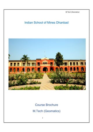
  • 1. M.Tech (Geomatics) 1 Indian School of Mines Dhanbad Course Brochure M.Tech (Geomatics)
  • 2. M.Tech (Geomatics) 2 ABOUT M.TECH GEOMATICS In view of importance of the subject vis-à-vis the needs of qualified surveyors in mining and allied industry, a new M. Tech Programme in Geomatics with special emphasis on Mine Surveying has been introduced for the first time in the country in the Department of Mining Engineering at Indian School of Mines, Dhanbad. The students for this programme are selected on the basis of GATE scores and personal interview of the candidates having basic qualification of B.Tech/B.E./4- year B.Sc. (Engineering) in Mining /Environmental/ Civil/ Geomatics/ Geo Informatics/ Geo Sciences/Remote Sensing/Computer Science/IT or M.Sc. in M. Sc. Tech (Applied Geology/Applied Geophysics/with 60% marks in Mathematics at Graduate level/ M. Sc. in Geospatial Sciences /GIS/Geo-informations. The Course covers both traditional as well as advanced surveying and attaches special emphasis on Mine Surveying (Course structure and syllabus are enclosed). This is a two years full time course with four semesters out of which the first two semesters are devoted to class work with practicals including summer training and the other two semesters are earmarked for thesis work. The Course is also approved by DGMS. M. Tech (Geomatics) degree holder of this institute will be granted Mine Surveyor Certificate of Competency subject to having one year of experience. Notification to this effect has already been made by the office of the Directorate General of Mines Safety, Dhanbad, vide letter No. Exam/Misc/204 dated 12.01.2012 of the Secretary, Board of Mining Examination & Director of Mines Safety (Exam). Indian School of Mines is having excellent infrastructure on Mine Surveying and students of this course are provided with hands on training in the use of modern state- of-the-art survey instruments including various softwares used in Mine Surveying.
  • 3. M.Tech (Geomatics) 3 Major emphasis is given to the various methods & instrumentations as required for surveying in Mines (both Opencast & Underground The course contents are mainly oriented at applications of innovative technologies in Mine Surveying for both Opencast and in Underground. Main area of coverage in the course Mine Surveying: ◦ Methods ◦ Instrumentations ◦ Land acquisitions ◦ Preparation of plans, sections etc.: Computerized & manual as per statuary requirements ◦ Documentation of land holdings ◦ Study of land use pattern, land cover in an area, change in land use pattern due to mining activities ◦ Measurement of stockpile, calculation of OB removed, coal extracted etc. Digitization of old map Remote Sensing & GIS tools and Techniques Preparation of Computer Aided Plans & Section including GIS based maps Preparation of Mine Information Systems using GIS Application of information Technology in Mine Surveying Photogrammetry and Remote Sensing Apart from the theoretical and practical inputs given in class, the students are also exposed to real life assignments in the field survey as a part of their course curriculum. Each student is required to carry out one industrial project of 3 months as a part of training programme. Individual student is also assigned a one year duration project preferably field orientated based on the company’s need which the student apply his theoretical and practical knowledge.
  • 4. M.Tech (Geomatics) 4 COURSE STRUCTURE OF M.TECH (GEOMATICS) I - SEMESTER Sl. No. Course Number Name of the Course Contact Hours* Credit Hours L T P 1. MEC-51171 Topographical Surveying and Photogrammetry 3 1 0 7 2. MEC-51271 Topographical Surveying and Photogrammetry Practical 0 0 2 2 3. MEC-51172 Geodesy, Cartography and Field Astronomy 3 1 0 7 4. MEC-51173 Engineering Surveying 3 0 0 6 5. MEC-51174 Elements of Mining Technology 3 0 0 6 6. AMC-51101 Advanced Numerical Methods and Applied Statistics 4 0 0 8 7. AMC-51201 Advanced Numerical Methods and Applied Statistics Practical 0 0 2 2 8. MEC-51075 Seminar 0 0 0 (2) 9. MEC-51576 Composite Viva-voce 0 0 0 (3) Total 16 2 4 38+(5) II - SEMESTER Sl. No. Course Number Name of the Course Contact Hours* Credit Hours L T P 1. MEC-52171 Geodetic Surveying and GPS 3 1 0 7 2. MEC-52172 Remote Sensing and Image Processing 3 0 0 6 3. MEC-52173 Mine Surveying 3 2 0 8 4. MEC-52273 Mine Surveying and GPS Practical 0 0 2 2 5. MEC-52174 Map Projection and GIS 3 0 0 6 6. MEC-52101 Computer Aided Mine Planning and Design 3 0 0 6 7. MEC-52075 Term Paper 0 0 0 (2) 8. MEC-52976 Survey camp 0 0 0 (10) Total 15-3 - 2 35+(12) * L: Lecture; T: Tutorial; P: Practical
  • 5. M.Tech (Geomatics) 5 III - SEMESTER Sl. No. Course Number Name of the Course Contact Hours* Credit Hours L T P 1. MEC-53071 Industrial training/ minor projects 0 0 0 5 2. MEC-53472 Seminar/ viva voce on industrial training 0 0 0 5 3. MEC-53873 Dissertation (Interim) 0 0 0 15 4. MEC-53874 Seminar and Viva voce on dissertation 0 0 0 10 5. MEC-53075 Evaluation of teaching assignment/ lab development work 0 0 0 5 Total 0 0 0 40 * L: Lecture; T: Tutorial; P: Practical IV - SEMESTER Sl. No. Course Number Name of the Course Contact Hours* Credit Hours L T P 1. MEC-54871 Dissertation 0 0 0 20 2. MEC-54872 Seminar on dissertation 0 0 0 5 3. MEC-54873 Viva-voce on dissertation 0 0 0 10 4. MEC-54874 Evaluation of teaching assignment/ lab. development work 0 0 0 5 Total 0 0 0 40 * L: Lecture; T: Tutorial; P: Practical
  • 6. M.Tech (Geomatics) 6 ABOUT MINE SURVEYING & GEOMATICS SECTION The Mine Surveying section has a legacy of 87 years establishment with the founding of the institute. The Section houses state-of-the-art surveying instruments along with the conventional surveying instruments being used in Engineering and Mine Surveying. The Mine Surveying section has so far undertaken more than 100 consultancy projects in the area of Mine Surveying and solved the real life problems of Mining Industry. It has also completed several R&D projects in the area of Mine Surveying. The section regularly conducts short term and long term courses for the mine surveying executives and trains them in the area of application of conventional and cutting edge technologies in mine surveying. It’s 6 week long Intensive Course on ‘Advances in Mine Surveying Technology’ is well recognized by DGMS and for promotion of Coal India Surveyors from E2 to E3, it is prerequisite that they should undergo such courses being offered by Mine Surveying section of the Department. Facilities in the Mine Surveying & Geomatics Lab ◦ Electronic total station, for all types of spot surveying with high speed and accuracy. ◦ Gyro theodolite, for determination of True North. ◦ Laser eyepiece, for correlation survey. ◦ Micro-optic theodolite, precise levels and other instruments, for all types of surveying and levelling. ◦ Global Positioning System (GPS). ◦ Mine surveying computation laboratory forms a part of the Survey Laboratory. ◦ Digitizer and plotter for development of survey plans. ◦ GIS and Mine Planning Software, for extracting and processing the information from mine plans and to update them with the latest information.
  • 7. M.Tech (Geomatics) 7 Significant Contributions A. R&D & Consultancy o Surveying and resource modeling including volumetric assessment, check surveying and correlation using laser and Gyro Technologies o Subsidence modelling o Development of a Mine Information System MIS for Mines o Mapping of land subsidence in Jharia Coalfield using InSAR technique and GPS measurements o Slope stability analysis and design o GIS based Land Information System including digitization of mine plans (surface & Underground) o Periodical updation of plans and sections and volumetric assessment of coal and OB for large opencast projects B. Capacity Building in the following areas: 6 weeks training programme on Advances in Mine Surveying Technology Digitization and Mapping
  • 8. M.Tech (Geomatics) 8 Modern Surveying Techniques Total Station & GPS GIS & Remote Sensing The major areas in which Mine surveying can contribute further in making work place safe for the miners: Industrial Consultancy Application of advanced surveying techniques for preparation of digital mine plans, quick updation of Mine plans & sections, 3D visualization of mine (Underground & opencast) , check surveying and correlation of underground mines Undertaking control surveys during the rehabilitation of abandoned mine dumps and small scale mining operations Gyro stabilised vertical opening inspection and surveying system GIS based Land Information System including digitization of mine plans (surface & Underground) R&D Mapping of land subsidence due to underground mining activity using DInSAR technique Integrated system for detection of illegal mining activities and pilferage of coal Continuous monitoring of movement of opencast dumps and development of early warning system for possible slope failure Application of laser scanning and radar technologies for monitoring mine safety and activity (UG and Opencast) Training Digitization and Mapping Advances in Mine Surveying Technologies Application of GIS & Remote Sensing in Mine Safety & Disaster Management
  • 9. M.Tech (Geomatics) 9 SYLLABUS M.TECH. (GEOMATICS) I SEMESTER MEC-51171 TOPOGRAPHICAL SURVEYING & PHOTOGRAMMETRY L T P 3 1 0 Topographical Surveying : Linear and angular measurements, distance and angle measuring instruments, chain and tape, theodolites – construction and working, adjustment of traverse, plane triangulation, ordinary and trigonometrical levelling, tacheometric surveying, plane-table surveying, contours and contouring, topographical maps. Precise linear measurements; EDMs; precise angular measurements; electronic theodolites, total stations, precise level and precise leveling. Photogrammetry: Aerial and terrestrial photogrammetry; principles of photogrammetry; stereoscopic vision classification of photographs, flight planning; elementary method of mapping; measuring heights using parallax bar; stereoplotters, photomaps; mosaics and ortho-photographs; digital photogrammetry. MEC-51271 TOPOGRAPHICAL SURVEYING AND PHOTOGRAMMETRY PRACTICAL L T P 0 0 2 Contouring and detailed surveying with Total Station; Downloading the field data of total station and plotting the details; Setting out curves in the field; Setting out alignments and grades;. Areas and volume calculations. Determination of scale and flying height of an aerial photograph, base lining of a pair of photographs, marking principle point, photo coordinate measurement, determination of height using parallax bar, MEC-51172 GEODESY CARTOGRAPHY AND FIELD ASTRONOMY L T P 3 1 0 Geodesy: shape of the earth, geoid, spheroid and ellipsoid of revolution, use of gravity in geodesy, coordinate system, geodetic reference systems, calculations on the ellipsoid, astronomical and geodetic coordinates, orthometric, dynamic and normal heights, geo-potential number. Cartography: Justification for cartography, conventional plotting and drawing of plans, conventional symbols; computer aided-cartography; digitization techniques; point data; line data; Raster scan digitizing, Raster and Vector digitization; contouring from Grid data,
  • 10. M.Tech (Geomatics) 10 Field Astronomy: Celestial sphere, meridians and vertical circles various astronomical coordinate systems; Time, sidereal and solar time, conversion of time from one to another system; Determination of azimuth, latitude and time from astronomical observations. MEC-51173 ENGINEERING SURVEYING L T P 3 0 0 Engineering Surveying: Route surveying: setting out curves, simple, compound and spiral curves, super elevation, vertical curves, route and terrain cross-sections; Mass-haul diagrams, calculation of areas and volumes, Surveys for buildings, highways bridges and culverts, Surveys for Irrigation projects – command area, canals and dams; Setting out for location, alignment and grades, Surveying for highways and streets, rail-roads sewers, pipelines and tunnels etc. Monitoring of displacements on structures. Applications of computers in engineering surveying. MEC-51174 ELEMENTS OF MINING TECHNOLOGY L T P 3 0 0 Introduction to surface mining, Surface mining terms and their meanings/definitions, concept of stripping, ratio and break-even stripping ratio, determination of quarriable limits, classification of surface mining systems based on geology of deposit and based on mechanization adopted, unit operations and associated equipment, applicability of simper, shovel-dumper and Dragline, drilling and blasting operations. Introduction to underground coal mining, underground coal mining terms and their explanations, broad classification of underground coal mining methods, Board and Pillar method – general description Panel system of mining and its advantages & disadvantages, determination of size of panel, Development by SDL/LHD, Rib & Slice method of depillaring in one lift with caving in flat/moderately inclined seams. Longwall method – general description and application, introduction to Longwall advancing and Longwall retreating method and their advantages and disadvantages, factors governing length of panel and length of Longwall face, Introduction of PSLW technology with shearer. Introduction to underground metal mining, deposits amenable to underground metal mining, modes of entry to underground mineral deposits, mine development: drifting, raising and winging, classification of underground metal mining methods, different stoping methods: general description, applicability and operations involved.
  • 11. M.Tech (Geomatics) 11 AMC-51101 ADVANCED NUMERICAL METHODS AND APPLIED STATISTICS L T P 4 1 0 Section A: Advanced Numerical Methods: Review of solution of system of linear simultaneous equation. Solution of tridiagonal system, III conditioned system and iterative method to improve accuracy of an III conditioned system. Evaluation of double and triple integrals by numerical method and its application, solution of non-linear simultaneous equations, numerical solution of integral equations, Advanced method of interpolation, Spline interpolation, Numerical solution of simultaneous first order ordinary differential equations (ODE) and higher order ODE. Initial and Boundary value problems, Numerical solution of partial differential equations: Laplace and Poisson equation, Head conduction and wave equations, writing computer programs of the above methods in F-77. Section B: Applied Statistics: Review of binomial, negative binomial, Poisson, normal and log normal distributions. Tests of significance for mean, variance, correlation and regression coefficients. χ2 -test for goodness of fit, attributes and contingency table, F-test, test of proportions, tests of significance under large sample approximations. Non-parametric tests: Wald-Wolfowitz run test, test of randomness, median test, sign test, Mann- Whiteney Wilcoxon U-test. Time series analysis, introduction to reliability and life testing experiments in engineering problems. One way and two way analysis of variance, Completely Randomized Design (CRD), Randomized Block Design (RBD), Latin Square Design (LSD). AMC-51201 ADVANCED NUMERICAL METHODS AND APPLIED STATISTICS PRACTICAL L T P 0 0 2 Numerical Methods: Solution of tridiagonal system, solution of simultaneous non-linear equations by iteration and Newton Raphson methods. Solution of simultaneous first order ODE. high order ODE by Range-Kutta and Miline's methods, Solution of Laplace and Poisson equations, Solution of heat conduction equations and Solution of wave equations. Applied Statistics: Practical based on tests of significance for one & two populations case, practical based on non-parametric tests, practical based on time series, practical based on reliability and life-testing experiments, practical based on CRD, RBD & LSD
  • 12. M.Tech (Geomatics) 12 II SEMESTER MEC-52171 GEODETIC SURVEYING & GPS L T P 3 1 0 Geodetic surveying : Triangulation and precise traversing; baseline measurement; precise geodetic theodolites; geodetic observations, Laplace’s stations; trilateration; geodetic calculations and geodetic adjustments; Theory of Errors and Adjustments : mistakes and errors, systematic and accidental errors, theory of errors, indices of precision, accuracy & precision principles of least squares, normal equations, most probable value, error analysis and error ellipses, adjustments for traverse, triangulation and levelling network. Concept of GPS: Three segments principle of GPS measurements, satellite signals, sources of errors, differential GPS, the GPS instrument; Modes of observations; transformation from one system to another system of coordinates, post processing of data and various applications of GPS. MEC-52172 REMOTE SENSING & IMAGE PROCESSING L T P 3 0 0 Remote Sensing : Electromagnetic radiations, reflectance and absorption; thermal emission, interaction of EMR with atmosphere, atmospheric windows, interacting EMR with earth’s surface, sensors and platforms, PAN, multi and hyper spectral sensors, sensor characteristics, application of remote sensing to various engineering areas. Image Processing: Visual image analysis, image interpretation, elements, keys and aids, basic instrumentation, visual analysis of data in visible, infer-red, thermal and microwave regions. Various data products and their uses, digital image formats, data processing, initial data statistics, histogram and scatter plot. Pre-processing of data, atmospheric, atmospheric and geometric corrections. Image enhancement, contrast stretching, histogram techniques, noise removal, low pass, medium pass, high pass and other filters. Basic concepts of digital image analysis, arithmetical operators. MEC-52173 MINE SURVEYING L T P 3 2 0 Underground mining conditions, underground traversing and underground levelling, survey requirements in underground mines; correlation surveys in adit and shaft mines; use of gyro- theodolite and laser in mine orientation survey, shaft levelling (depth measurement), plotting of profiles and sections, Stope surveying; control of alignment and gradient; surveying operations in opencast mines, calculation of overburden and ore production. Borehole survey, Dip and strike problems out crop problems, Legislation concerning Mine Plans and sections. Duties and responsibility of Mine Surveyor. Geological map reading. Development sampling, Channel averaging, Block averaging, Stope sampling, Averaging of stope face boundaries. Valuation of block reef tonnages, milling widths; ore-reserve plans.
  • 13. M.Tech (Geomatics) 13 MEC-52273 MINE SURVEYING & GPS PRACTICAL L T P 0 0 2 Correlation survey, Subsidence monitoring, Nadir-plummet, Auxiliary Telescope, Triangulation survey, base-line measurements; Total Station; GPS, static, rapid static, kinematic and stop& go modes; Down loading and processing the GPS data; Precise leveling, monitoring of small ground movements. MEC-52174 MAP PROJECTIONS & GIS L T P 3 0 0 Map Projections: Concept of map projections; classification of map projections; conical, polyconic, conformal, Cassini, mercator and universal traverse mercator projections (UTM), scale factors, calculations on projections, state plane coordinates (national grid), coal grid for mining areas, transformation of coordinates. GIS: Concepts and terminology, essential components, data acquisition, raster and vector data, topology and spatial relationships, data storage verification and editing, database construction, database structure, hierarchical data, network systems, relational database, data manipulation and analysis. Spatial and mathematical operations in GIS, overlay, query based, buffers, spatial analysis, various GIS packages and their salient features. MEC-52101 COMPUTER AIDED MINE PLANNING AND DESIGN L T P 3 0 0 Applications of CAD systems in mine design, Surface modeling concepts, Introduction to Mine planning software, Understanding data representation and processing tools, String file handling, External data import, Database management and Geological modeling, Reduction of data into presentable form, Drill hole visualization, Creation of Digital Terrain Models, DTM Volume calculations, Contouring, Auto-plotting, Sectioning a DTM, Compositing, Variogram modeling and Resource estimation using Mine Planning Software, Block modeling, Pit design and optimization, Computer aided Drilling and Blast simulation, Computer aided underground mine design. Admission Procedure Admission to the course is made based on the GATE score obtained by the students through central counseling by the institute
  • 14. M.Tech (Geomatics) 14 Eligibility Criteria B. Tech/B.E./4-Year B.Sc. (Engineering) in Mining/Environmental/Civil/ Geomatics/ Geo Informatics/ Geo Sciences/Remote Sensing/Computer Science/IT OR M. Sc. Tech (Applied Geology/Applied Geophysics/with 60% marks in Mathematics at Graduate level OR M. Sc. in Geospatial Sciences /GIS/Geo-informations For Further Details Please Contact Dr. Dheeraj Kumar | M.Tech, Ph.D. (IIT KGP) Member of ISRM, SAIMM, MGMI Associate Professor In-Charge, Mine Surveying & Geomatics Section & Course Coordinator, M.Tech (Geomatics) Department of Mining Engineering Indian School of Mines Dhanbad, Jharkhand - 826004 Phone No: + 91 + 326 + 2235486 (O) | Fax : 2296563 Mobile : +91 94317 111 99 Email: dheeraj@dkumar.org | web: www.dkumar.org