Coastal_Urban_Conservation_Yasiel_Figueroa_Sanchez_2022.07.18.pptx
•Download as PPTX, PDF•
0 likes•6 views

Our nation’s coasts are home to almost 40% of the U.S. population and many of our urban communities. Continued population growth along the coasts, and urbanization pose challenges and opportunities for coastal and urban conservation. Learn how the University of Puerto Rico and the nonprofit organization, Protectores de Cuencas are restoring and conserving coastal ecosystems for resilient communities in Puerto Rico while helping the next generation gain valuable skills and certification in ecological restoration.

Recommended
Recommended
More Related Content
Similar to Coastal_Urban_Conservation_Yasiel_Figueroa_Sanchez_2022.07.18.pptx
Similar to Coastal_Urban_Conservation_Yasiel_Figueroa_Sanchez_2022.07.18.pptx (20)
More from National Association of Conservation Districts
More from National Association of Conservation Districts (20)
Recently uploaded
Recently uploaded (20)
Coastal_Urban_Conservation_Yasiel_Figueroa_Sanchez_2022.07.18.pptx
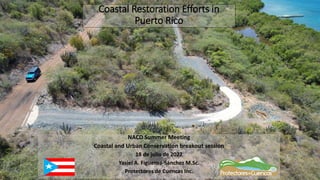
- 1. Coastal Restoration Efforts in Puerto Rico NACD Summer Meeting Coastal and Urban Conservation breakout session 18 de julio de 2022 Yasiel A. Figueroa-Sánchez M.Sc. Protectores de Cuencas Inc.
- 2. Who we are? • Non-profit, non-governmental and community- based organization. • Dedicated to establishing conservation projects using an integrated watershed management approach. • Offices in Yauco • Founded in January 2012
- 3. RESOURCES AND CAPACITY • HACH 2100Q Portable Turbidimeter • HACH SL1000 Portable Nutrient Multiparameter • YSI Multiparameter • HANA Ammonia Medium Range Portable Photometer - HI96715 • IDEXX Quanti-Tray System for bacteria Restoration Equipment • More than 60,000 plants produced yearly • Restoration Projects across the Island Native Plants Nursery • 12 4x4 Pick up trucks • 6 4x4 6m Dump Trucks • 1 4x4 Service Truck • 2 20m Dump Trucks • 2 Backhoes • 2 Crawler Dozers • 2 Compacting Rollers • 2 Skid Steer • 6 water trucks • 6 trailers • Hydromulcher • 2 Mini excavators • 1 Mid Excavator • 2 Boats Monitoring Equipment • 8 Technical Personnel • 30 General Labor experts in BMP and Green Infrastructure Staff:
- 5. Northern mountains Guanajib o valley Southern slopes The watershed as a planification unit • The hydrographic basin connects our resources without considering administrative limits. • Actions carried out in one locality affect downstream localities.
- 6. Integrated Watershed Management Define geographic area Integrate stakeholders Assess watershed Identify and prioritize problems and opportunities Propose proyects and solutions Implement Measure success Adapt The watershed management plan cycle
- 8. Wetland hydrological connectivity PROJECTS BY PDC • Permeable parking • Wooden boardwalk • Green infrastructure • Green infrastructure • Dirt road stabilization • Coastal reforestation La Jungla Papayo Coastal Lagoon Tres Palmas Marine Reserve, Steps Beach Jobos Bay El Yunque Northeastern Ecological Corridor • Restoration • Trail rehabilitation • Erosion and sediment reduction • Dirt road stabilization • Coral nurseries and outplanting • Wetland restoration • Shoreline stabilization Hacienda Candelaria • Dirt road stabilization • Sediment detention ponds • Rainfall-runoff research
- 9. Guánica Bay Watershed • Located in southwestern Puerto Rico • Spans eight municipalities • Seven subwatersheds of which four where artificially added as part of the Southwest Project in 1950’s. • 89 miles² originally to approximately 143 miles² (91,417 acres). • Five reservoirs and irrigation channels system • One main river (Río Loco), two main tributaries
- 10. Nutrient Reduction in Guanica Bay
- 12. Treatment Wetlands in Guánica
- 13. La Jungla Guánica Dry Forest
- 23. Wetland Restoration in the Jobos Bay Natural Reserve for Estuarine Research
- 24. Jobos Bay National Estuarine Research Reserve
- 26. Solid waste removal and soil regrading
- 28. Delimitation of critical habitat areas and delineate pedestrian access
- 29. Reforestation
- 31. Culebra Island
- 36. Fulladoza Bay in Culebra
- 39. Adaptation
- 40. Adaptation
- 41. Road Stabilization in Puerto Del Manglar, Culebra
Editor's Notes
- Implementation oriented organization
- 1 municipio con Rio 2 Landscapes 3 Topografia Regiones
- Summary of the nine minimum elements to be included in section 319-funded watershed plans for threatened or impaired waters a. Identify causes and sources of pollution b. Estimate pollutant loading into the watershed and the expected load reductions c. Describe management measures that will achieve load reductions and targeted critical areas d. Estimate amounts of technical and financial assistance and the relevant authorities needed to implement the plan e. Develop an information/education component f. Develop a project schedule g. Describe the interim, measurable milestones h. Identify indicators to measure progress i. Develop a monitoring component
- Las implementaciones que hacemos se agrupan en 4 categorías.