Presentation - Lund 2013 GIS workshop
•
1 like•111 views

Workshop I gave at the University of Lund in 2013

Recommended
Recommended
More Related Content
Similar to Presentation - Lund 2013 GIS workshop
Similar to Presentation - Lund 2013 GIS workshop (20)
Recently uploaded
Recently uploaded (20)
Presentation - Lund 2013 GIS workshop
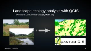
- 1. Workshop – Lund 2013 1 Landscape ecology analysis with QGIS Workshop at Lund University (2013) by Martin Jung
- 2. Workshop – Lund 2013 2 About me ● Currently master student in Biology at the University of Copenhagen ● BSc thesis about plant-pollinator networks in Białowieza ● Interested in Ecology, Conservation and species distributions
- 3. Workshop – Lund 2013 3 Visit my homepage for news about conservation, ecology and QGIS → http://conservationecology.wordpress.com/ QGIS and me ● Primary GIS system since 2008 ● Contributed a new plugin called LecoS to the QGIS community ● Since 2012 support of QGIS- users on gis.stackexchange
- 4. Workshop – Lund 2013 4 Roadplan for today ● Introduction in QGIS, install of QGIS and dependencies ● Get familiar with basic Raster and Vector layer processing (introduction of common plugins) ● … Short break somewhere here ... ● Landscape Analysis with QGIS ● Map presentation ● Advanced QGIS techniques examples + Questions :)
- 5. Workshop – Lund 2013 5 What is GIS? A geographic information system (GIS) is a system designed to capture, store, manipulate, analyze, manage, and present types of geographical data. Wikipedia.com
- 6. Workshop – Lund 2013 6 Open Source GIS solutions ● QGIS started in 2002 as an Open Source project ● Primarily intended as interface for Geo-databases (POSTGIS) ● Increasing popularity since the last years
- 7. Workshop – Lund 2013 7 Functionalities ● Support for multiple file-formats ● Basic Vector processing ● Raster modifications ● Access to databases (POSTGIS, MySQL, Spatiallite,… ) ● Web-support (WMS,WFS,Webserver,...) ● Easily extendable ????
- 8. Workshop – Lund 2013 8 (Dis)Advantages of QGIS ● Pro – Open Source – Easy access to other Open Source Software (R, GRASS, Python, ...) – Runs on all mayor OS – Easy extendable through plugins – Very active global community ● Contra – Missing features (cross- dependencies) – Bugs, Errors, Instability – ( Layout capabilities )
- 9. Workshop – Lund 2013 9 Lets get started
- 10. Workshop – Lund 2013 10 http://www.qgis.org
- 11. Workshop – Lund 2013 11 QGIS 1.9 Master http://tinyurl.com/QGIS-Install Workshop-Files http://tinyurl.com/Lund-Fileshttp://tinyurl.com/Lund-Files
- 12. Workshop – Lund 2013 12 Now install ... ● Make some room on your computer (at least 1 GB !) ● Install the current Development Version ( QGIS 1.9 ) on your computer (see provided folder) Important! – Make sure the libraries python-scipy and python-numpy are checked
- 13. Workshop – Lund 2013 13 ● Select “Advanced Install” ● “Install from local Folder” ● Mark the following (or all) – Qgis-dev – Python-numpy – Python-scipy – qgis-grass-plugin – grass64 How to install (WIN) Install from local folder
- 14. Workshop – Lund 2013 14 … and start QGIS 1.9 dev.
- 15. Workshop – Lund 2013 15 GIS data Source: maprabu.blogspot.com Format: *.shp, *.csv, *.gpx, *.kml, ... Format: *.tif, *.vrt, *.hdr, *.asc, ...
- 16. Workshop – Lund 2013 16 Example Data set ● CORINE 2006 Landcover grid ● Naturalearth (National Boundaries) www.naturalearthdata.com ● GMTED 2010 DEM ● Artdatabanken (through GBIF) www.artdatabanken.se
- 17. Workshop – Lund 2013 17 Load in: CORINE (g100_06.tif) ● Zoom in / Zoom out ● Explore Properties ● Enable correct styles ● Look into Layer CRS ● Disable the layer Tasks
- 18. Workshop – Lund 2013 18 Load in: State provinces (NE_Provinces.zip) ● Look into Attribute table ● Identify & remove Antarctica ● Color provinces according to size (Graduated) ● Label the provinces ● Select provinces in Sweden ● Subset/reproject to a Lambert Azimutal Projection Tasks
- 19. Workshop – Lund 2013 19 ● Calculate the mean (+SD) province area (in km²) in Sweden Final task
- 20. Workshop – Lund 2013 20 Sweden 21,246,594,670.1467 km²
- 21. Workshop – Lund 2013 21 QGIS and Plugins Must have: ● SEXTANTE, Openlayers Plugin, Points2One, MMQGIS, Point Sampling Tool, Color Ramp Manager, LecoS, ...
- 22. Workshop – Lund 2013 22 Short Break Kort paus Kurze Pause
- 23. Workshop – Lund 2013 23 The genus Lycaena Common Copper (Lycaena phlaeas) Purple-edged Copper (Lycaena hippothoe) Scarce Copper (Lycaena virgaureae)
- 24. Workshop – Lund 2013 24 Research questions 1) Where can those Lycaena species be found in Skane? (what is the most abundant landcover-type on the landscape scale?) And does it differ among the species? 2) Is there a different response among the species to landscape heterogeneity? 3) Does one of the Coppers in Skane prefer higher elevations compared to the other Coppers? 4) Is there a correlation between the number of Lycaena sp. occurences and greater distance from forests?
- 25. Workshop – Lund 2013 25 Landscape analysis preparation – (1) Raster
- 26. Workshop – Lund 2013 26 Landscape analysis preparation – (2) species data ● Enable “Add Delimited text layer”-plugin in the plugin options ● Add GBIF-Lycaena.csv as vector layer
- 27. Workshop – Lund 2013 27 Landscape analysis preparation – (3) Data processing ● Remove all points outside Skane ● Check for and remove unsure determinations (? in name) ● Apply a circular buffer of 1000m around each point ● Display the result categorized with different colors
- 28. Workshop – Lund 2013 28 Research Question 1.) ● Crop your CORINE dataset with your buffered Occurrences (overlapping buffers are not correctly cropped. Use UnionUnion first) ● Use “LecoS – Land cover statistics” to compute the “Landscape proportion” of each land cover class ● Then calculate the area in m² per buffer for the most abundant (Using “LecoS – Polygon overlay”) ● Use “Groupstats” to get the mean/median values per species
- 29. Workshop – Lund 2013 29 Results Question 1.) Results Top 3: 12 (non irrigated arable land) →35 % 24 (coniferous forest) → 22 % 23 (broad-leaved forest)→ 13 % Total Landcover of non-irrigated arable land Species | Landcover Median Lycaena hippothoe 695037.9779805 m² Lycaena phlaeas 910049.726564 m² Lycaena virgaureae 710038.797649 m²
- 30. Workshop – Lund 2013 30 Research Question 2.) ● Use “LecoS – Polygon overlay” to compute the Shannon diversity index for each buffer ● Use “Groupstats” to display results
- 31. Workshop – Lund 2013 31 Results Question 2.) Average
- 32. Workshop – Lund 2013 32 Research Question 3.) Use the DEM and try it out :)
- 33. Workshop – Lund 2013 33 Results Question 3.) Average
- 34. Workshop – Lund 2013 34 Research Question 4.) ● Combine all types of forested lands into a single raster class (QGIS Rastercalculator) ● Then use the Proximity tool in the Raster menu ● Use the Save-As function (rightclick raster) to correctly set a nodata- value ● Create a Vector-grid (5 km rectangles) and count the number of Lycaena occ. inside. ● Use LecoS to extract the median values inside the grid A bit more difficult
- 35. Workshop – Lund 2013 35 Results question 4.) Spearman's rank correlation rho data: layer[[y]] and layer[[x]] S = 4172666, p-value = 0.5529 alternative hypothesis: true rho is not equal to 0 sample estimates: rho 0.03462806
- 36. Workshop – Lund 2013 36 Here could be another break
- 37. Workshop – Lund 2013 37 Map Presentation
- 38. Workshop – Lund 2013 38 Advanced Landscape Analysis Techniques The landscape modifier
- 39. Workshop – Lund 2013 39 Advanced Landscape Analysis Techniques
- 40. Workshop – Lund 2013 40 Sextante Modeller Theoretical Idea: → Create random points inside Skane → Apply a buffer → Calculate number of occurrences inside buffer Batchrun for occurrence probability ?
- 41. Workshop – Lund 2013 41 Sextante R commands Command Function ##[datagis]=group Sets the group to “datagis” ##layer = vector or raster Specifies the input layer to use ##distance=number 100 Sets a number field with default 100 ##title=string France Get text input. Default is “France” ##field=field layer Select a field from the vector layer “layer” hist(layer[[field]]) R-command: Histogram for fields from layer ##showplots Has to be set in order to see plot outputs >t.test(layer[[field]]) Console output with a “>” before command ##output=output vector File output as vector or raster
- 42. Workshop – Lund 2013 42 Example Script ##[Own Scripts]=group ##showplots ##layer=vector ##y=field layer ##x=field layer library("car") plot(as.numeric( layer[[y]] )~as.numeric( layer[[x]] ),pch=19,bty="l",ylab=paste( y ),xlab=paste( x ) ) fit = lm( layer[[y]]~layer[[x]] ) regLine(fit,col="blue",lwd=2)
- 43. Workshop – Lund 2013 43 Hydrological Analysis ● Using DEMs and hydrographic information ● What can be calculated: – Watershed basins – (Potential) Wetness – Way of travel, Flood risks – Potential location of aquifers ... Potential Wetness based on Topography
- 44. Workshop – Lund 2013 44 Image Classification
- 45. Workshop – Lund 2013 45 Home-range estimation ● Possible through plugin Animove (currently broken) ● Interface to R and package adehabitat ● Alternative in SAGA and Grass
- 46. Workshop – Lund 2013 46 Additional examples, help and tutorials ● http://www.gistutor.com/ ● http://qgis.spatialthoughts.com/ ● Youtube → search QGIS ● http://gis.stackexchange.com ● QGIS-user mailing list → http://lists.osgeo.org/listinfo/qgis-user
- 47. Workshop – Lund 2013 47 Thanks for your attention and good luck with your projects!