
Recommended
More Related Content
What's hot
What's hot (20)
Similar to Flood Control Manual: Guide for Nepal Projects
Similar to Flood Control Manual: Guide for Nepal Projects (20)
Recently uploaded
Recently uploaded (20)
Flood Control Manual: Guide for Nepal Projects
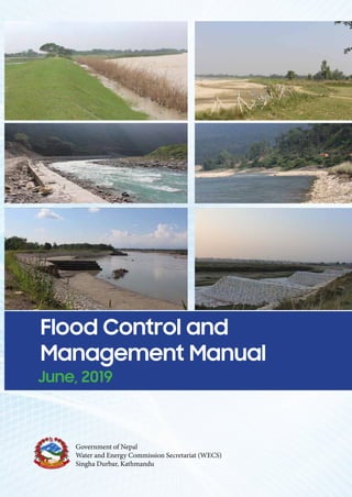
- 1. Flood Control and Management Manu June, 2019 Funded By: Prepared By: Project Engineering Consultancy and Research Pvt. Ltd Mid-Baneshwor – 31, Kathmandu, Nepal Phone No.: 014465084; Email: precar2005@gmail.com SAP Water and Energy Developers’ Pvt. Ltd Government of Nepal Water and Energy Commission Secretariat (WECS) Singha Durbar, Kathmandu Flood Control and Management Manual June, 2019 Funded By: Prepared By: Project Engineering Consultancy and Research Pvt. Ltd Mid-Baneshwor – 31, Kathmandu, Nepal Phone No.: 014465084; Email: precar2005@gmail.com SAP Water and Energy Developers’ Pvt. Ltd Government of Nepal Water and Energy Commission Secretariat (WECS) Singha Durbar, Kathmandu Flood Control and Management Manual June, 2019 Funded By: Prepared By: Project Engineering Consultancy and Research Pvt. Ltd Mid-Baneshwor – 31, Kathmandu, Nepal Phone No.: 014465084; Email: precar2005@gmail.com SAP Water and Energy Developers’ Pvt. Ltd Baneshwor – 31, Kathmandu, Nepal Phone No.: 014479537Email: sapwaterandenergy@gmail.com Government of Nepal Water and Energy Commission Secretariat (WECS) Singha Durbar, Kathmandu Flood Control and Management Manu June, 2019 Funded By: Prepared By: Project Engineering Consultancy and Research Pvt. Ltd Mid-Baneshwor – 31, Kathmandu, Nepal Phone No.: 014465084; Email: precar2005@gmail.com SAP Water and Energy Developers’ Pvt. Ltd Government of Nepal Water and Energy Commission Secretariat (WECS) Singha Durbar, Kathmandu Flood Control and Management Manual Flood Control and Management Manual June, 2019 June, 2019 Government of Nepal Water and Energy Commission Secretariat (WECS) Singha Durbar, Kathmandu Prepared By: Project Engineering Consultancy and Research Pvt. Ltd Mid-Baneshwor – 31, Kathmandu, Nepal Phone No.: 014465084 Email: precar2005@gmail.com SAP Water and Energy Developers’ Pvt. Ltd Baneshwor – 31, Kathmandu, Nepal Phone No.: 014479537 Email: sapwaterandenergy@gmail.com
- 2. Flood Control and Management Manual ACKNOWLEDGEMENT WECS A ACKNOWLEDGEMENT The Joint Venture of PRECAR (P) Ltd. and SAP (P) Ltd. would like to express their sincere gratitude to the Water and Energy Commission Secretariat (WECS) for entrusting the responsibility of Preparing River Training Manual for Nepal. We would like to express our sincere thanks to all the officers of DWIDM Division Offices, Irrigation Project Offices and People‘s Embankment Program Offices for their cooperation, support, providing data and information, guiding in the fields, and supporting in logistics. Thanks are also due to the beneficiaries of all the case study sites, who were very helpful and informative during the fieldwork and interaction meetings. The Consultants are also thankful to the staff of PRECAR and SAP, whose tireless efforts were instrumental for the timely completion of this Flood Control and Management Manual. PRECAR (P) Ltd and SAP (P) Ltd Kathmandu, Nepal June, 2019
- 3. Flood Control and Management Manual FOREWORD WECS B FOREWORD Nepal has more than 6,000 rivers and rivulets flowing through a tectonically unstable geology. Seventy five to eighty percent of the annual rainfall occurs during the four months of monsoon (June-September) greatly increasing the flow in these rivers. Poor geological formation in one hand and increased flow on the other hand has made the situation even more vulnerable for the people living nearby these rivers. Every year, during the monsoon season, most of the rivers pose great threat to such people and sometimes cause widespread damage to the life and property. The problems are not the same everywhere. In the hills, these rivers erode their banks triggering massive landslides at some places. In the plains there are three types of problems (i) River bank erosion causing damage to a vast area of agricultural lands and settlements. (ii) Flooding caused by overbank flow causing widespread inundation in the nearby settlement and (iii) Combination of (i) and (ii) both. Experience has shown that flood and riverbank erosion are two dominating factors restricting the development in these flood plains. The cause for both is largely beyond human influence and man can only mitigate their negative effects. People, who are engaged in the field of river training and river management, need to have thorough knowledge of river behavior and on its basis professional acumen to devise solutions to control the rivers. These solutions also need to be economical and sustainable, in terms of both initial investment and recurring maintenance cost. Water and Emery Commission Secretariat has made an effort to prepare a manual for the professionals, who are engaged in the field of river training. Considering the new organizational set up of the government viz. federal, provincial and local, this manual will serve as a standard National Manual of the subject and thus greatly help maintain uniformity in planning, design and implementation of works across all government and other agencies involved in river training related works. WECS would like to thank all those who have worked hard to prepare this manual and hope that this manual would become a ready reference for all those working in the field of river training and river management. We also seek comments and suggestions from academia and practicing engineers in order to update the Manual in coming years. Secretary WECS
- 4. Flood Control and Management Manual ACRONYMS WECS C ACRONYMS AAB AAD ASTM B|C BS : : : : : Average Annual Benefit Average Annual Damage American Society for Testing and Materials Benefit Cost Ratio British Standards CNDRC : Central Natural Disaster Relief Committee DHM : Department of Hydrology and Meteorology DoFSC EIA : : Department of Forest and Soil Conservation Environmental Impact Assessment EIRR EN EPR : : : Economic Internal Rate of Return European Norm Environment Protection Regulation Fr GLOF : : Froude number Glacier Lake Outburst Flood GON GVSF GVUSF HEC-RAS HFL HGL IEE : : : : : : : Government of Nepal Gradually Varied Steady Flow Gradually Varied Unsteady Flow Hydrologic Engineering Center - River Analysis System High Flood Level Hydraulic Gradient Line Initial Environmental Examination IS ISO : : Indian Standards International Organization for Standardization JICA : Japan International Cooperation Agency MBT MCT MFT : : : Main Boundary Thrust Main Central Thrust Main Frontal Thrust MWL : Mean Water Level NPW : Net Present Worth NRCS NS : : Natural Resources Conservation Service Nepal Standards Re : Reynolds number SCF SCS STD SWG THZ : : : : : : Standard Conversion Factor Soil Conservation Service South Tibetan Detachment Standard Wire Gauge Tethys Himalayan Zone UDFCD USBR VAT : : : Urban Drainage and Flood Control District United States Bureau of Reclamation Value Added Tax WECS : Water and Energy Commission Secretariat WRI : Water Resources and Irrigation
- 5. Flood Control and Management Manual TABLE OF CONTENTS WECS D TABLE OF CONTENTS ACKNOWLEDGEMENT.................................................................................................................................................................................. A FOREWORD ................................................................................................................................................................................................... B ACRONYMS.................................................................................................................................................................................................... C TABLE OF CONTENTS .................................................................................................................................................................................. D LIST OF FIGURES .......................................................................................................................................................................................... H LIST OF TABLES..............................................................................................................................................................................................I LIST OF APPENDICES....................................................................................................................................................................................J 1 INTRODUCTION ............................................................................................................................................................. 1-1 1.1 BACKGROUND ................................................................................................................................................................................. 1-1 1.2 ASSUMPTIONS AND LIMITATIONS OF THE MANUAL................................................................................................................................. 1-1 1.3 LAYOUT OF THE MANUAL................................................................................................................................................................... 1-2 2 PLANNING, SURVEY AND DESIGN FOR FLOOD CONTROL PROJECTS ................................................................. 2-1 2.1 NECESSITY OF FLOOD CONTROL AND RIVER BANK EROSION CONTROL PLAN .................................................................................................. 2-1 2.2 DIFFERENT PHASES OF FLOOD CONTROL PLAN ........................................................................................................................................ 2-1 2.2.1 Master Plan .........................................................................................................................................................................2-1 2.2.2 Feasibility Study ..................................................................................................................................................................2-2 2.2.3 Flood Control Project Implementation Plan /Detailed Engineering Design and Implementation............................................2-2 2.2.4 Plan revision in course of implementation............................................................................................................................2-2 2.3 SEQUENTIAL STEPS IN FLOOD CONTROL PLANNING: .................................................................................................................................. 2-3 2.4 SURVEY AND INVESTIGATION FOR ACQUIRING DATA ................................................................................................................................. 2-3 2.4.1 Topographical Survey..........................................................................................................................................................2-3 2.4.2 Control Survey.....................................................................................................................................................................2-4 2.4.3 River Profile Survey.............................................................................................................................................................2-4 2.4.3.1 Cross Section Survey...................................................................................................................................................... 2-4 2.4.3.2 Longitudinal Section Survey: ......................................................................................................................................... 2-5 2.4.4 Material Survey...................................................................................................................................................................2-6 2.4.5 Hydrological Survey:............................................................................................................................................................2-7 2.4.6 Environmental Study...........................................................................................................................................................2-7 2.4.7 Social Impact Assessment .................................................................................................................................................2-8 2.4.8 Historical data/information on flood damage .....................................................................................................................2-8 2.4.9 Post-Construction Survey ....................................................................................................................................................2-8 2.4.10 Layout master Plan..............................................................................................................................................................2-9 3 HYDROLOGICAL ASSESSMENT .................................................................................................................................. 3-1 3.1 BACKGROUND ................................................................................................................................................................................. 3-1 3.2 DESIGN FLOOD RETURN PERIOD ........................................................................................................................................................... 3-1 3.3 CALCULATION OF DESIGN FLOOD .......................................................................................................................................................... 3-2 3.3.1 For gauged rivers ................................................................................................................................................................3-2 3.3.2 F or ungauged rivers............................................................................................................................................................3-2 3.3.2.1 Method of Transposition:.............................................................................................................................................. 3-2 3.3.2.2 Empirical Methods: ....................................................................................................................................................... 3-3 3.3.2.3 Flood Marks-based Method .......................................................................................................................................... 3-5 3.3.2.4 Hydrologic Modeling ..................................................................................................................................................... 3-6 3.4 FIXING DESIGN DISCHARGE ................................................................................................................................................................ 3-7 4 RIVER MORPHOLOGICAL STUDY................................................................................................................................ 4-1 4.1 GENERAL GEOLOGY OF NEPAL............................................................................................................................................................. 4-1 4.2 RIVER BEHAVIOR.............................................................................................................................................................................. 4-1 4.2.1 River Channel Patterns........................................................................................................................................................4-1 4.2.2 Bed forms............................................................................................................................................................................4-3 4.3 CHANNEL GEOMETRY........................................................................................................................................................................ 4-3 4.3.1 Theoretical Equations..........................................................................................................................................................4-4 4.3.2 Empirical Equations.............................................................................................................................................................4-4 4.4 CLASSIFICATION OF RIVER ................................................................................................................................................................... 4-4 4.5 INSTABILITY OF RIVERS....................................................................................................................................................................... 4-5 5 RIVER HYDRAULICS ..................................................................................................................................................... 5-1 5.1 RIVER HYDRAULICS........................................................................................................................................................................... 5-1 5.2 TYPES OF FLOWS.............................................................................................................................................................................. 5-1 5.2.1 Steady flow vs unsteady flow:..............................................................................................................................................5-1 5.2.2 Uniform flow vs non-uniform flow:........................................................................................................................................5-1 5.2.3 Gradually varied flow ...........................................................................................................................................................5-1 5.2.4 Rapidly varied flow:..............................................................................................................................................................5-1 5.3 FLOW REGIMES ............................................................................................................................................................................... 5-1
- 6. Flood Control and Management Manual TABLE OF CONTENTS WECS E 5.4 METHODS FOR FLOOD ROUTING .......................................................................................................................................................... 5-2 5.5 METHODS OF HYDRAULIC ANALYSIS ..................................................................................................................................................... 5-2 6 DESIGN CRITERIA AND PROCEDURES ...................................................................................................................... 6-1 6.1 STRUCTURAL MEASURES FOR RIVER CONTROL ........................................................................................................................................ 6-1 6.2 DESIGN CRITERIA ............................................................................................................................................................................. 6-1 6.2.1 Design Discharge ................................................................................................................................................................6-1 6.2.2 Flow Velocity .......................................................................................................................................................................6-1 6.2.3 High Flood Level..................................................................................................................................................................6-2 6.2.4 Manning Roughness Coefficient ..........................................................................................................................................6-2 6.2.5 Waterway ............................................................................................................................................................................6-2 6.2.6 Scour Magnitude .................................................................................................................................................................6-3 6.2.7 Sediment .............................................................................................................................................................................6-4 6.3 DESIGN OF FLOOD EMBANKMENT ........................................................................................................................................................ 6-4 6.3.1 Alignment and Spacing........................................................................................................................................................6-4 6.3.2 Length of the embankment: .................................................................................................................................................6-5 6.3.3 Height..................................................................................................................................................................................6-5 6.3.3.1 Design High Flood Level................................................................................................................................................. 6-5 6.3.3.2 Free board..................................................................................................................................................................... 6-5 6.3.4 Top Width............................................................................................................................................................................6-5 6.3.5 Hydraulic Gradient...............................................................................................................................................................6-5 6.3.6 Side Slope...........................................................................................................................................................................6-5 6.3.7 Slope Surface Protection Works ..........................................................................................................................................6-6 6.3.8 Borrow Areas.......................................................................................................................................................................6-6 6.3.9 Drainage..............................................................................................................................................................................6-7 6.3.10 Safety Measures in Design..................................................................................................................................................6-7 6.3.11 Anti-flood Sluices.................................................................................................................................................................6-7 6.3.12 Stability Analysis for High Embankments.............................................................................................................................6-7 6.3.13 Bank Protection Works ........................................................................................................................................................6-9 6.4 DESIGN OF REVETMENT..................................................................................................................................................................... 6-9 6.4.1 Design Criteria for Revetment............................................................................................................................................6-10 6.4.1.1 Location and Alignment............................................................................................................................................... 6-11 6.4.1.2 Design Height .............................................................................................................................................................. 6-11 6.4.1.3 Segment Length........................................................................................................................................................... 6-11 6.4.2 Loose Stone Pitching.........................................................................................................................................................6-11 6.4.2.1 Size of Stone................................................................................................................................................................ 6-11 6.4.2.2 Thickness of Pitching stone ......................................................................................................................................... 6-12 6.4.3 Gabion revetment..............................................................................................................................................................6-13 6.4.4 Filter ..................................................................................................................................................................................6-13 6.4.5 Pilarczyk’s Current Attack Equation ...................................................................................................................................6-13 6.4.6 Toe Protection ...................................................................................................................................................................6-15 6.5 ANTI-FLOOD SLUICE ....................................................................................................................................................................... 6-15 6.5.1 Fixation of FSL at Outfall ...................................................................................................................................................6-16 6.5.2 Capacity /design discharge................................................................................................................................................6-16 6.5.2.1 Runoff Estimation from bunded areas ........................................................................................................................ 6-16 6.5.3 Design Considerations:......................................................................................................................................................6-17 6.6 DESIGN OF FLOOD WALLS................................................................................................................................................................. 6-18 6.6.1 Lateral and Vertical forces .................................................................................................................................................6-18 6.6.2 Flood wall Design ..............................................................................................................................................................6-20 6.6.2.1 General Dimensioning of Wall Geometry.................................................................................................................... 6-20 6.6.2.2 Design Steps ................................................................................................................................................................ 6-21 6.6.2.3 Combination of Loads.................................................................................................................................................. 6-22 6.6.2.4 Factor of safety against Sliding.................................................................................................................................... 6-22 6.6.2.5 Factor of safety against over turning........................................................................................................................... 6-22 6.6.2.6 Eccentricity of resultant forces:................................................................................................................................... 6-23 6.6.2.7 Minimum and maximum Pressure at the Toe and Heel.............................................................................................. 6-23 6.6.2.8 Steps in Design of Reinforced Section of a Cantilever Wall......................................................................................... 6-23 6.7 DESIGN OF SPURS (GROYNES) AND STUDS ........................................................................................................................................... 6-24 6.7.1 Function:............................................................................................................................................................................6-24 6.7.2 Design Approach for Spurs................................................................................................................................................6-24 6.7.3 Classification of Spurs .......................................................................................................................................................6-24 6.7.4 General Features...............................................................................................................................................................6-25 6.7.4.1 Location and Length: ................................................................................................................................................... 6-25 6.7.4.2 Orientation:................................................................................................................................................................. 6-25 6.7.4.3 Spur Height.................................................................................................................................................................. 6-25 6.7.4.4 Spacing: ....................................................................................................................................................................... 6-26 6.7.4.5 Spur Crest Profile......................................................................................................................................................... 6-26 6.7.4.6 Channel bed and bank embedment ............................................................................................................................ 6-26 6.7.5 Design of Impermeable Spurs............................................................................................................................................6-26 6.7.5.1 Top width: ................................................................................................................................................................... 6-26 6.7.5.2 Side Slopes: ................................................................................................................................................................. 6-26 6.7.5.3 Size and weight of stone for pitching: ......................................................................................................................... 6-26
- 7. Flood Control and Management Manual TABLE OF CONTENTS WECS F 6.7.5.4 Thickness of Pitching: .................................................................................................................................................. 6-26 6.7.5.5 Launching apron.......................................................................................................................................................... 6-26 6.7.6 Sloping Spurs ....................................................................................................................................................................6-27 6.8 BED CONTROL STRUCTURES.............................................................................................................................................................. 6-29 6.8.1 Design of Check dams.......................................................................................................................................................6-29 6.8.1.1 Spacing ........................................................................................................................................................................ 6-29 6.8.1.2 Design Runoff Estimation ............................................................................................................................................ 6-30 6.8.1.3 Foundation depth........................................................................................................................................................ 6-30 6.8.1.4 Scour depth ................................................................................................................................................................. 6-30 6.8.1.5 Structural stability of Check dam................................................................................................................................. 6-31 6.8.2 Sabo Dam .........................................................................................................................................................................6-31 6.8.2.1 Design Procedure: ....................................................................................................................................................... 6-31 6.8.2.2 Design considerations ................................................................................................................................................. 6-31 6.8.2.3 Design parameters of the debris flow ......................................................................................................................... 6-32 6.8.2.4 Designing the open section ......................................................................................................................................... 6-32 6.8.2.5 Design of the dam body and foundation..................................................................................................................... 6-32 6.8.2.6 Sub-sabo dam.............................................................................................................................................................. 6-32 6.8.3 Sills / Bed bars...................................................................................................................................................................6-32 6.8.3.1 Height.......................................................................................................................................................................... 6-32 6.9 DESIGN OF STABLE CHANNEL ............................................................................................................................................................. 6-33 6.9.1 Channel lining....................................................................................................................................................................6-33 6.9.2 Design of rigid boundary channels.....................................................................................................................................6-33 6.9.3 Design of Non-Scouring Erodible Boundary Channels .......................................................................................................6-34 6.9.4 Alluvial Channels:..............................................................................................................................................................6-34 6.9.5 Design of an Artificial Cut-off .............................................................................................................................................6-35 6.10 GUIDELINES FOR FLOOD CUSHION IN MULTIPURPOSE RESERVOIR PROJECTS;.................................................................................................. 6-36 6.10.1 General Definition of storage zones in Reservoirs .............................................................................................................6-36 6.10.2 Retarding Basin or Detention Dam.....................................................................................................................................6-37 6.10.3 Basis for Fixation of Flood Storage Level or MWL of Dams ...............................................................................................6-37 6.11 DESIGN OF GUIDE BANKS................................................................................................................................................................. 6-38 6.11.1 General Principles .............................................................................................................................................................6-38 6.11.2 Width between guide Bunds ..............................................................................................................................................6-39 6.11.3 Length of Guide Bunds ......................................................................................................................................................6-39 6.11.3.1 Upstream Length .................................................................................................................................................... 6-39 6.11.3.2 Downstream Length................................................................................................................................................ 6-40 6.11.3.3 Curved head and tail of Guide Bunds...................................................................................................................... 6-40 6.11.4 Sweep Angle of Guide Bund..............................................................................................................................................6-40 6.11.5 Design considerations .......................................................................................................................................................6-40 6.11.5.1 Material................................................................................................................................................................... 6-40 6.11.5.2 Top width of guide bund......................................................................................................................................... 6-40 6.11.5.3 Side slopes of guide bund ....................................................................................................................................... 6-41 6.11.5.4 Free board for Guide Bund ..................................................................................................................................... 6-41 6.11.5.5 Stone for pitching.................................................................................................................................................... 6-41 6.11.5.6 Provision of filter..................................................................................................................................................... 6-41 6.11.5.7 Launching Apron (Toe Protection) .......................................................................................................................... 6-41 6.11.5.8 Afflux Bund.............................................................................................................................................................. 6-42 6.12 SUBMERGED VANES ........................................................................................................................................................................ 6-42 7 CONSTRUCTION MATERIALS AND TECHNOLOGY ................................................................................................... 7-1 7.1 LOCAL AND COMMUNITY INVOLVED CONSTRUCTION METHOD AND MATERIALS ............................................................................................. 7-1 7.2 MODERN AND AGENCY INVOLVED CONSTRUCTION METHOD AND MATERIALS ............................................................................................... 7-2 7.2.1 Gabions or gabion mattresses .............................................................................................................................................7-2 7.2.2 Methods of Gabion Construction:.........................................................................................................................................7-3 7.2.3 Concrete Blocks ..................................................................................................................................................................7-5 7.2.3.1 Design Procedure for Concrete Blocks .......................................................................................................................... 7-5 7.2.4 Geosynthetics......................................................................................................................................................................7-6 7.2.4.1 Geotextiles .................................................................................................................................................................... 7-6 7.2.5 Porcupines ..........................................................................................................................................................................7-9 7.3 EMERGENCY CONSTRUCTION MATERIALS AND TECHNIQUES ...................................................................................................................... 7-11 7.3.1 Soil And Sand Bags...........................................................................................................................................................7-11 7.3.2 Methods of Sand Bagging..................................................................................................................................................7-11 7.3.2.1 Filling Sandbags ........................................................................................................................................................... 7-11 7.3.2.2 Placing Sandbags ......................................................................................................................................................... 7-12 7.3.3 Nylon boxes and old tires...................................................................................................................................................7-12 7.3.4 Permeable spurs ...............................................................................................................................................................7-12 7.3.5 Bamboo Piling for Fencing.................................................................................................................................................7-13 7.3.6 Multi-tier Jack Jetty............................................................................................................................................................7-13 7.3.7 Tube wall Flood Barrier......................................................................................................................................................7-14 7.3.8 Water-Gate Self-Inflating Barrier........................................................................................................................................7-14 7.3.9 Wood & Boulders for Bank Protection................................................................................................................................7-15 8 BIOENGINEERING WORK ............................................................................................................................................. 8-1
- 8. Flood Control and Management Manual TABLE OF CONTENTS WECS G 8.1 BIOENGINEERING TECHNIQUES ............................................................................................................................................................ 8-1 8.1.1 Bush-mattress construction with wood pegs ........................................................................................................................8-1 8.1.2 Wattle fences (wicker) .........................................................................................................................................................8-1 8.1.3 Log Brush Barrier ................................................................................................................................................................8-2 8.1.4 Fascines (bush wattles).......................................................................................................................................................8-2 8.1.5 Vegetated gabions...............................................................................................................................................................8-2 8.2 VEGETATION FOR BANK / SLOPE PROTECTION......................................................................................................................................... 8-3 8.2.1 Sod facing (turfing) ..............................................................................................................................................................8-3 8.2.2 Vetiver.................................................................................................................................................................................8-3 8.3 MAINTENANCE OF VEGETATION .......................................................................................................................................................... 8-4 8.3.1 Initial Care ...........................................................................................................................................................................8-4 8.3.1.1 Fertilization.................................................................................................................................................................... 8-4 8.3.1.2 Irrigation........................................................................................................................................................................ 8-4 8.3.1.3 Soil cultivation and soil improvement........................................................................................................................... 8-4 8.3.1.4 Care for trees and bushes.............................................................................................................................................. 8-4 9 FLOODPLAIN MANAGEMENT....................................................................................................................................... 9-1 9.1 NON STRUCTURAL METHODS FOR FLOODPLAIN MANAGEMENT.................................................................................................................. 9-1 9.1.1 General ...............................................................................................................................................................................9-1 9.1.2 Enforcement of Floodplain Zoning regulation.......................................................................................................................9-1 9.1.3 Flood Plain Zoning...............................................................................................................................................................9-1 9.1.4 Pre-Requisites For The Enforcement Of Floodplain Zoning .................................................................................................9-2 9.1.5 Regulation of Land Use in Flood Prone Areas .....................................................................................................................9-2 9.1.6 Categorization and Prioritization of Structures in Flood Plains Zoning.................................................................................9-2 9.1.7 Disaster insurance / relief Fund ...........................................................................................................................................9-3 9.1.8 The Tax adjustment.............................................................................................................................................................9-3 9.1.9 Flood Forecasting and Early Warning System .....................................................................................................................9-3 9.1.10 Frequency of Flood Warnings..............................................................................................................................................9-4 9.1.11 Devising Public Awareness..................................................................................................................................................9-4 9.1.12 Combination of structural and Non Structural Methods ........................................................................................................9-5 9.1.12.1 Flood fighting ............................................................................................................................................................ 9-5 9.1.12.2 Flood Proofing........................................................................................................................................................... 9-5 10 EMERGENCY FLOOD MANAGEMENT ................................................................................................................... 10-1 10.1 EXISTING PRACTICES ....................................................................................................................................................................... 10-1 10.2 PREPAREDNESS FOR FLOOD DISASTER ................................................................................................................................................. 10-1 10.3 RESPONSE, EVACUATION AND RELIEF OPERATION.................................................................................................................................. 10-2 10.3.1 Emergency Response: ......................................................................................................................................................10-2 10.3.2 Post Event Response ........................................................................................................................................................10-3 10.3.3 Evacuation.........................................................................................................................................................................10-3 10.3.4 Relief And Recovery Measures..........................................................................................................................................10-3 10.4 REPAIR AND MAINTENANCE OF FLOOD CONTROL STRUCTURES ................................................................................................................. 10-4 10.4.1 Routine Inspection and Testing..........................................................................................................................................10-4 10.4.2 Routine Maintenance Measure ..........................................................................................................................................10-4 10.4.2.1 Maintenance of Embankment for Rise of River Bed: .............................................................................................. 10-5 10.4.3 Non-Routine Maintenance .................................................................................................................................................10-5 10.4.4 Aesthetic treatment maintenance.......................................................................................................................................10-5 10.4.5 Emergency Maintenance ...................................................................................................................................................10-5 10.4.6 Training Function and Training Responsibilities.................................................................................................................10-5 10.5 FLOOD FIGHTING ........................................................................................................................................................................... 10-6 10.5.1 Preparedness for Flood Fighting........................................................................................................................................10-6 10.5.2 Flood Fighting Measures: ..................................................................................................................................................10-6 10.5.2.1 Ring Bund for Sand Boiling...................................................................................................................................... 10-6 10.5.2.2 Closer ring Bund for Checking Embankment Breach............................................................................................... 10-7 10.5.2.3 Embankment Overtopping:..................................................................................................................................... 10-7 10.5.2.4 Embankment Toe failure by Scouring River Bed..................................................................................................... 10-8 11 EVALUATION............................................................................................................................................................ 11-1 11.1 COST ESTIMATION.......................................................................................................................................................................... 11-1 11.2 BENEFITS ASSESSMENT.................................................................................................................................................................... 11-1 11.2.1 Estimation of Flood Damages............................................................................................................................................11-2 11.2.2 Summarized Steps to Estimate Damages Avoided (Benefits) ............................................................................................11-3 11.3 ECONOMIC ANALYSIS ...................................................................................................................................................................... 11-4 11.3.1 Assumptions......................................................................................................................................................................11-4 11.3.2 Discounting........................................................................................................................................................................11-4 11.3.3 Standard Conversion Factor..............................................................................................................................................11-5 11.4 ECONOMIC INDICATORS................................................................................................................................................................... 11-5 11.4.1 Net Present Worth (NPW)..................................................................................................................................................11-6 11.4.2 Economic Internal Rate of Return (EIRR) ..........................................................................................................................11-6 11.4.3 Benefit Cost Ratio (B/C).....................................................................................................................................................11-6 11.4.4 Decision Criteria ................................................................................................................................................................11-6 11.5 SENSITIVITY ANALYSIS ...................................................................................................................................................................... 11-7 REFERENCES ............................................................................................................................................................................ I
- 9. Flood Control and Management Manual TABLE OF CONTENTS WECS H LIST OF FIGURES Figure 2-1: Typical Cross Section of River..............................................................................................................................2-5 Figure 2-2 : Typical L- Section of a river plotted after feasibility stage survey......................................................................2-6 Figure 3-1: Schematic diagram of possible water levels on a river channel. ..........................................................................3-1 Figure 3-2: Different methods for assessment of design flood...............................................................................................3-2 Figure 3-3: Specific discharge at different return periods.......................................................................................................3-4 Figure 4-1: Straight river reach...............................................................................................................................................4-1 Figure 4-2: Braided Rivers with gravel bars............................................................................................................................4-1 Figure 4-3 : Circular shape of a meander curve......................................................................................................................4-2 Figure 4-4: Sinusoidal Shape of a meander curve ...................................................................................................................4-2 Figure 4-5 : Meander Characteristics ......................................................................................................................................4-2 Figure 4-6: Meandering River..................................................................................................................................................4-3 Figure 4-7 : Different Types of Bed Forms...............................................................................................................................4-3 Figure 6-1: Definition sketch for calculation of scour depth for gravel bed river & alluvial river bed ...................................6-3 Figure 6-2 Typical Cross Section of a homogeneous Embankment.......................................................................................6-6 Figure 6-3 Typical Cross Section of a Zoned Embankment......................................................................................................6-6 Figure 6-4: Flow Chart for Design of an Embankment ..................................................................................................6-9 Figure 6-5: Components of Revetment .................................................................................................................................6-10 Figure 6-6: Images of typical flood sluices (ungated ) in Karnali embankment and gated flap valve in Kamala Embankment................ 6-16 Figure 6-7: Types of Flood walls ...........................................................................................................................................6-18 Figure 6-8: Typical Loads or Forces acting on Flood Walls....................................................................................................6-18 Figure 6-9: Typical Section of Retaining wall / Flood wall ....................................................................................................6-20 Figure 6-10: Loading on Cantilever Wall with shear key .......................................................................................................6-21 Figure 6-11: Typical Layout of Spurs in group .......................................................................................................................6-24 Figure 6-12: Definition sketch Types and orientation of spurs ............................................................................................6-25 Figure : 6-13: Definition sketch of orientation of spurs ........................................................................................................6-25 Figure 6-14: Plan showing Value of Multiplying factor, Maximum scour for spurs and Cross Sections ...............................6-27 Figure 6-15: Typical Studs for bank protection .....................................................................................................................6-27 Figure 6-16: Typical Sloping Spur ..........................................................................................................................................6-28 Figure 6-17: Check Dam to control erosion and Gully Plugging (Source ICIMOD Resource Manual) ...................................6-29 Figure 6-18: Check Dam Layout to control steep streams or torrents .................................................................................6-30 Figure 6-19: Sabo Dam (Debris Arresting Dam)....................................................................................................................6-31 Figure 6-20: Typical Ground sill/bed bar ..............................................................................................................................6-33 Figure 6-21:ForcesTable acting on a particle resting on slopping side of a channel.............................................................6-34 Figure 6-22: Cutoff Channel ..................................................................................................................................................6-35 Figure 6-23: Schematic Diagram of Multipurpose Reservoir showing different Storage Zones ...........................................6-36 Figure 6-24: Flood Control by Retarding Basin ..................................................................................................................6-37 Figure 6-25: Typical Design Inflow Outflow Hydrographs & Reservoir Level Curve..............................................................6-38 Figure 6-26 :Straight Guide Bank; Elliptical Guide Bank........................................................................................................6-39 Figure 6-27: Typical Layout of Guide Bank ............................................................................................................................6-40 Figure 6-28: Typical Details of Guide Bank............................................................................................................................6-42 Figure 6-29: Bank profile after implementing the submerged vanes ...................................................................................6-43 Figure 7-1: A gabion Box and hexagonal double twist mesh ..................................................................................................7-2 Figure 7-2: Laying Geotextile filters and Gabions before filling stones...................................................................................7-4 Figure 7-3: Concrete Dolos and Interlocking Blocks as Revetment.........................................................................................7-5 Figure 7-4: Geotextile as filter.................................................................................................................................................7-7 Figure 7-5: Geo bags................................................................................................................................................................7-8 Figure 7-6: Geo tubes..............................................................................................................................................................7-8 Figure 7-7: Bamboo Porcupine as Damper for Bank Protection ...........................................................................................7-10 Figure 7-8: RCC Porcupine.....................................................................................................................................................7-10 Figure 7-9: Stacking Sand Bags for Construction of a Bund(left, a) Lapping of Sand Bags (right top, b) and Placing of Sand Bags (c)..... 7-11 Figure 7-10 Sand Bags Wall Used for River Training Works ..................................................................................................7-12 Figure 7-11 Rubber Tires filled up and used for river protection..........................................................................................7-12 Figure 7-12 Bamboo screen and Permeable Spur.................................................................................................................7-13 Figure 7-13 : Bamboo Fencing...............................................................................................................................................7-13 Figure 7-14: Multi-tier Jack Jetty...........................................................................................................................................7-14 Figure 7-15: Tube wall Flood Barrier and Water Gate Self Inflating Barrier .........................................................................7-14 Figure 8-1: Bush-Mattress with wood pegs.............................................................................................................................8-1
- 10. Flood Control and Management Manual TABLE OF CONTENTS WECS I Figure 8-2: wattle fences.........................................................................................................................................................8-1 Figure 8-3: Log brush barrier...................................................................................................................................................8-2 Figure 8-4: Fascines (bush wattles)...................................................................................................................................8-2 Figure 8-5: Vegetated gabions ................................................................................................................................................8-2 Figure 8-6: Sod Facing (Turfing)...............................................................................................................................................8-3 Figure: 8-7 : Vetiver for Slope Stabilization (Slope > 80 0 ).......................................................................................................8-3 Figure 9-1: Definition Sketch of Flood Plain ...........................................................................................................................9-1 Figure 10-1: Flow Chart of Emergency Flood Management Activities .................................................................................10-1 Figure 10-2: Heightening of Embankment ............................................................................................................................10-5 Figure 10-3: Boil Sack Ring ....................................................................................................................................................10-7 Figure 10-4: Typical Closer Ring bund ..................................................................................................................................10-7 Figure 10-5: Definition Sketch of Windrow Riprap................................................................................................................10-8 Figure 11-1: Flood depth - frequency Relationship...............................................................................................................11-2 Figure 11-2: Flow - Frequency Relationship .........................................................................................................................11-2 Figure 11-3: Damage-Frequency Relationship ......................................................................................................................11-3 Figure 11-4: Damage-frequency relationship........................................................................................................................11-3 Figure 11-5: Damage frequency curves with and without project........................................................................................11-3 LIST OF TABLES Table 2-1: Survey and Investigation Requirement : ................................................................................................................2-3 Table 2-2: Topographic Survey Requirement and Map Scales................................................................................................2-3 Table 2-3: Details of Modified Universal Transverse Mercator System ..................................................................................2-4 Table 2-4: Cross Section Interval for Different Level of Survey...............................................................................................2-4 Table 2-5: Scales of Cross Section Profile................................................................................................................................2-5 Table 2-6 Interval of point Measurement during Feasibility & Detailed design Surveys ........................................................2-5 Table 2-7 Longitudinal river profile survey method and plot scales .......................................................................................2-5 Table 2-8: River bed and Bank Material Survey ......................................................................................................................2-6 Table 2-9: Hydrological Survey................................................................................................................................................2-7 Table 2-10: Environmental study ............................................................................................................................................2-8 Table 2-11: Social Impact Assessment ....................................................................................................................................2-8 Table 2-12: Historical Data Collection ....................................................................................................................................2-8 Table 3-1: Recommended design flood return periods for various River training mmeasures .............................................3-1 Table 3-2: Values of Standard Normal Variety for various Return Periods.............................................................................3-5 Table 3-3 : Guidelines for runoff coefficient ..........................................................................................................................3-5 Table 3-4: Roughness coefficient of common channel conditions..........................................................................................3-6 Table 4-1 : Classification of River.............................................................................................................................................4-4 Table 5-1: General Guidelines for Typical Methods of Analysis for Various Hydraulic components ......................................5-2 Table 5-2: Numerical tools ......................................................................................................................................................5-3 Table 6-1: Common River Training and Riverbank Erosion Control Measures .......................................................................6-1 Table 6-2: Design Velocities at different location of River Training Measures .......................................................................6-2 Table 6-3: Lacey’s Coefficient for different channel conditions..............................................................................................6-2 Table 6-4: Recommended multiplying factors (Z) at different locations of the river training structures ...............................6-3 Table 6-5: Approximate Seepage gradient of Embankment Material.....................................................................................6-5 Table 6-6: Maximum Side Slope of Embankments..................................................................................................................6-5 Table 6-7: Recommended distance and depth of borrow pits from Embankment toe ..........................................................6-6 Table 6-8: Design criteria of Revetment................................................................................................................................6-10 Table 6-9: Angle of Repose of Different Materials................................................................................................................6-11 Table 6-10: Stability factors (Sf) of revetment stones in flow conditions .............................................................................6-12 Table 6-11: Lateral Forces imposed by soil, water and earthquake and moment about toe of the wall .............................6-18 Table 6-12: Specific Weight of Different materials ...............................................................................................................6-19 Table 6-13: Typical Value of Angle of friction of foundation soil ..........................................................................................6-19 Table 6-14: Allowable bearing Capacity of different soils:...................................................................................................6-23 Table 6-15: Spur Height.........................................................................................................................................................6-25 Table 6-16: Spur Spacing .......................................................................................................................................................6-26 Table 6-17: Multiplying Factor (F) for maximum depth of scour ..........................................................................................6-26 Table 6-18: Channel width discharge relation......................................................................................................................6-33 Table 6-19 :Recommended approximate width – depth ration for stable channels ............................................................6-35 Table 6-20: Scour Factor.......................................................................................................................................................6-41
- 11. Flood Control and Management Manual TABLE OF CONTENTS WECS J Table 7-1: General Specifications of Local & Community Involved Construction Materials ...................................................7-1 Table 7-2: General Specifications 0f Gabions..........................................................................................................................7-2 Table 7-3: Mesh and Box Characteristics for Gabions (Manually woven)...............................................................................7-3 Table 7-4: Mesh and Box Characteristics for Gabions (Mechanically woven - Hexagonal Mesh)...........................................7-3 Table 7-5: Various Uses and Specifications of Geotextile Filter, Geobags and Geotubes.......................................................7-7 Table 7-6: Reference Properties of Geo-textile as filter..........................................................................................................7-7 Table 7-7: Reference Properties Of Non Oven Geotextiles Used For Bags .............................................................................7-8 Table 7-8: Properties Of Sand Bagging Materials For Emergency Uses ................................................................................7-11 Table 7-9: In stream Wood Structures ..................................................................................................................................7-15 Table 8-1: Properties of Vetiver as erosion control plant .......................................................................................................8-3 Table 9-1: Floodplain Zoning Criteria ......................................................................................................................................9-2 Table 9-2: Land use Policy for Flood Plain Management ........................................................................................................9-2 Table 11-1: Calculation of Discount Factors for discount rates 10% and 12% .....................................................................11-5 Table 11-2: Standard Conversion Factors..............................................................................................................................11-5 Table 11-3: Decision Criteria .................................................................................................................................................11-6 LIST OF APPENDICES Appendix: 1 : Review of Master Plans and Design Reports in the Context of Nepal and South Asia Appendix: 2 : Peak Discharge Calculations Appendix: 3 : Design Examples Appendix: 4 : Benefit Calculation (Damage Assessment) Appendix: 5 : Economic Evaluation Appendix: 6 : Assessment of Case Studies Appendix: 7 : Charts and Tables for Design Parameters
- 12. Flood Control and Management Manual INTRODUCTION WECS 1-1 1 INTRODUCTION 1.1 BACKGROUND Floods occur in rivers when runoff volume exceeds the channel‘s carrying capacity and it overtops riverbanks inundating adjacent lowlands, eroding banks and depositing abraded material downstream. Rugged topography, fragile and young geology and monsoon climate system all contribute to higher rates of runoff, erosion and sedimentation in the river systems that induce various flood related damages with immense cost to the nation. Every year flood disasters occur in the country, in mountains and Terai alike, causing widespread loss of life and property. Floods damage infrastructure, agricultural lands and even urban areas. The government spends scarce resources in trying to limit such damages, repair damaged infrastructure and attempting to enhance safety from floods as well as for emergency relief to its flood affected population. Nepal‘s efforts in flood control has not at all been adequate to address the problems of flood disasters, but the limited works we do have been doing suffers from multiple aspects. Often the works done are not only isolated and incongruous but also suffer from technical issues failing to meet the desired objectives. Many of the works completed till date are either inadequate or overly designed. Flood control or river training works are carried out by a number of different agencies and the communities in the nation, each varying in scale and detail with differing levels of interventions. These interventions are neither well-engineered nor optimized suitably. Most of the efforts have been piecemeal distributed works done in haste in response to public pressures or as emergency measures without holistically analyzing the problem and optimizing available solutions. There exist no unifying standards of practice in planning, designing and implementing these works such that the design itself becomes questionable failing to meet the required objectives. Rivers naturally change their profile and morphology in conformity with their energy potential, flow resistance and stream bed/bank materials. Stream bed and bank erosion may be the predominant problems in the steep rivers in the mountain and hill areas, where as bank erosion, overtopping and inundation become pertinent in wider valleys and the plains of Terai. Problems are location specific and determined by the unique characteristics of the river, its stage, up-stream hydrology and overall geology. This is further compounded by anthropogenic socio- economic and environmental settings. A careful analysis of these factors, and an understanding of interplay of them, is required for a successful planning, design and implementation of flood control works. This requires a trained professional to plan and design any major river training or flood control measures. Ad hoc interventions can aggravate situations or induce damage in downstream sections. Capacity development of multiple institutions and setting-up of procedural frameworks for flood control works is therefore a requirement in this sector. Furthermore, recent State restructuring from a unitary system to a federal one has created a situation where government agencies at the Center, State and Local levels all have specific rights to develop and manage water resources, which includes activities related to river training and flood control as well. The capabilities of these different hierarchy of agencies need to be enabled to perform mandated tasks of flood control and it is desirable to have a single reference source to standardize the planning, investigation, design and implementation of river training works. It is imperative for the Federal Government to prepare and adopt standards effective for the whole country. In this context, the Water and Energy Commission Secretariat (WECS) has prepared this manual for flood control and management. This manual has been prepared with the necessary technical expertise, encompassing various literatures, regular consultations with executing agencies, group of experts following the terms of references for the manual development as defined by the WECS. The document attempts to include the current best practices applicable for the country and draws from lessons learnt from previous success and failure stories – summarizing case studies from 16 river training works carried out in the past by different agencies in Nepal. 1.2 ASSUMPTIONS AND LIMITATIONS OF THE MANUAL The following Assumptions have been made in the Manual: (a) This manual has been prepared as a reference document for flood control works. The terms river bank erosion control and river training works or flood control works are used interchangeably and are considered in general to be the same in the document as is current practice in the region. (b) Any planning and design is dependent upon the quality and availability of data inputs. It is assumed that the data are available from reliable sources and these correctly represent the variables sought. The
- 13. Flood Control and Management Manual INTRODUCTION WECS 1-2 historic rainfall data and river flow discharge data shall be obtained from the Department of Hydrology and Meteorology under the Ministry of Energy, Water Resources and Irrigation. (c) For the flood flow estimation of an ungauged river, a catchment area/discharge relation or empirical formula have been used. The selection of high flood discharge as derived from different methods shall be made judiciously. (d) The manual is mainly concerned with the flood control and associated aspects of bank or river bed erosion, overtopping and inundation. River training in this report limits the scope to these aspects and does not include other aspects of channel depth control for navigation purposes. (e) The user of this manual shall be the qualified engineers with bachelor degree involved in the field of river training and river management in government and private sectors. Others may use these to be aware of the practices and familiarize themselves, but shall not be designing and implementing structures in the rivers. This Manual has following Limitations, hence, needs to be taken account while referring to: (a) The consultant was commissioned to prepare Flood Control and Management Manual to be referred for managing flood problems in Nepal. This manual should not be relied on or used in circumstances other than those for which it has been originally prepared and for which the consultant was commissioned. (b) It has been prepared by referring various codes and specifications. While using this manual, the user is required to update as per future revisions/amendments made in these codes and specifications (c) It should not be used as a text book; the contents herein are advisory information valid in general situations, prepared from publicly available information and expert opinions. Specific conditions may require special considerations and the Consultant is not liable for any losses or penalties arising from use of this manual. (d) The manual is not a standalone document and shall comply with all current government directives and regulatory instruments issued by the government. (e) It is understood that the rivers are natural systems with intrinsic potentials that erode banks and deposit materials attaining a temporary equilibrium for a particular stage of flow. All attempts to train the rivers are only reducing the risks and providing protection to a certain acceptable probability of failure. 1.3 LAYOUT OF THE MANUAL This Manual is structured into eleven chapters with seven appendices. The first chapter is the Introduction which briefly describes the background information as well as the assumptions and limitation of the document. The Chapters are arranged in normal in sequential order of implementing river training works. Chapter Two provides the information on survey and investigations required for designing river training works. Chapter Three deals with the important aspect of determining the design discharge for the works to be designed. It describes the hydrological assessment of catchments focusing mainly on methods of estimation of peak flood of different probabilities or return periods. Chapter Four provides discussions on geo-morphological characteristics of rivers that define the types of problems to be encountered. Chapter Five explains basic concepts of River Hydraulics essential for the flood protection works. Chapter Six focuses on design criteria and procedures for designing the common structural items in river training such as embankments, revetments, spurs, flood walls, guide bunds, etc. Chapter Seven introduces the construction materials and technology for different flood control and river training works. Availability of suitable materials and technology are important parameters that define the design of the flood protection system. Chapter Eight deals with bio-engineering works and techniques applied for stability of river banks/slopes. Chapter Nine focuses on flood plain management and introduces concepts on reducing risks and minimizing loss. Chapter Ten provides discussions on emergency flood management. The Manual concludes with discussion on evaluation of flood control/ River training project in Chapter Eleven. These should provide feedback to the designers to improve upon their future design and remedial works. The appendices to this manual describe other directly pertinent information required for the design works. A review of master plans and design reports prepared in the past in Nepal, and experiences in river training and flood management works of the South Asia region is presented in the Appendix-1. Various calculations and design examples are presented in Appendix 2, 3, 4 and 5. Assessment of case studies conducted during field visits under this manual preparation works is given in Appendix-6. Appendix-7 includes important Tables and Charts containing values of different design parameters required in the design and calculation.
- 14. Flood Control and Management Manual PLANNING, SURVEY AND DESING FOR FLOOD CONTROL PROJECTS WECS 2-1 2 PLANNING, SURVEY AND DESIGN FOR FLOOD CONTROL PROJECTS 2.1 NECESSITY OF FLOOD CONTROL AND RIVER BANK EROSION CONTROL PLAN Any intervention on a river is bound to have an effect on another location or reach of the river. So all flood protection works need to be holistically assessed on its impacts on the river basin level. Plans and designs are to be formulated through a series of studies to determine the best solution for a river engineering problem. Project planning is conducted in three phases as listed below (except under emergency conditions) to ensure that the best solution is determined. The best solution is the one with the least cost, minimum adverse environmental impact and most acceptable to the public. In reality, the efforts are often determined by the availability of funds. 2.2 DIFFERENT PHASES OF FLOOD CONTROL PLAN i. Master Plan ii. Feasibility (Pre- feasibility and Feasibility based on importance) iii. Flood Control Project Implementation Plan A fourth phase is also be added to include revisions during implementation or after implementation of subprojects as newer information emerge or due to the changes in socio-economic environment over time. Generally, there is no defined linkage between different phases of flood control plan for minor and/or isolated river control works. However, flood control of medium and large rivers of significant importance have linkage between these phases of flood control plan. The Master Plan for the flood control of a river is prepared first on the basis of which pre-feasibility and feasibility study of a particular priority stretch is conducted which is followed by detailed engineering design for project implementation. The implementation plan may be revised as required during or even after implementation. 2.2.1 Master Plan Master Plan is a comprehensive plan of a particular activity designed to guide the future actions of development in a region or a community. The Master Plan typically covers a period from 15 to 25 years. In terms of river training or flood control, it represents a vision for the future, with long-range goals and objectives for all activities that affect flood control including outlay of funds and resources. Master plans are necessary for problematic streams or rivers where major multi-year projects are undertaken. Preparation of Master Plan involves the following activities and outcomes. a) Topographical map of the area with delineation of the river basin or basins with tabulation of catchment characteristics such as area, land use, vegetation cover, drainage length, slopes etc. b) Basic hydrological information on rainfall amounts and distribution over the area, discharge of rivers including sediments and basic geology of the area. c) Land use maps, population and facilities in project area including projected future scenarios in the affected areas. d) Identification of river engineering problems or risks at different reaches of the river under study, including identification of constraints such as narrow areas, wide low flood plains, flood prone and erosion sensitive areas, confluences, etc. e) Identification of possible solutions for the river engineering problem. f) Determination of existing discharge or conveyance capacity at different reaches of the river. g) Statement of national or regional/local development goals, strategies, policies and priorities. h) Preparation of a checklist for preliminary environmental study for alternative river training proposals including checklists for socio-economic and environmental analysis for alternative projects. i) Assessment of design discharge at different reaches of the river under consideration. j) Presentation of typical designs for major flood mitigation measures. k) Listing of rough estimates of projects considering their scope, scale and typical cost rates. l) Prioritization of the projects of flood mitigation works for feasibility study based on primary assessment of economic, environmental and social parameters. The criteria for prioritization shall be the most feasible ones subject to constraints of economic returns, availability of funds, environmental impacts and public acceptance. m) Presentation of a conceptual plan for flood mitigation to cope with river basin's flood and sediment
- 15. Flood Control and Management Manual PLANNING, SURVEY AND DESING FOR FLOOD CONTROL PROJECTS WECS 2-2 disasters. Long term, generally 15 to 20 years, plan is formulated for identified projects in the Master Plan to achieve optimum benefits in consideration of integrated river basin plan. n) Presentation of an action plan which incorporates major flood mitigation activities to be performed by the target years, estimated budget to be allocated to accomplish the targeted activities by the target year; and maintenance of previously completed activities. 2.2.2 Feasibility Study From the list of projects or activities proposed in the Master Plan, projects for implementation in the medium term plan period is selected from a priority list formed within the framework of socio-economic and environmental importance. Feasibility study of each selected project is done in more detail to define the individual works, cost estimates and evaluate the financial attractiveness of the projects. Economic feasibility is also ascertained by quantifying and superposing socio-economic costs and benefits. Economic methods of assessments are described further in this manual in Chapter 11. In an effort to ensure transparency in project selection, it is essential that a project ranking or selection criteria is developed initially. The ranking criteria shall include economic feasibility criteria and incorporating suitable indices for national or regional development goals and objectives. The study output includes details of technical, economic, implementation schedule, operation and maintenance etc. including detailed analyses. The feasibility study will state the overall viability of the project determining whether it is to be included in the basket of projects for implementation or not. It will also define the implementation period and the resources required so that governmental budgeting and interagency collaboration is arranged for a successful project implementation. 2.2.3 Flood Control Project Implementation Plan /Detailed Engineering Design and Implementation An implementation plan is formulated for a short immediate term or plan period of 5 to 10 years for the recommended projects from feasibility study based on economic returns, social and environmentally viability. The projects which are in lower priority are shifted to next phase for implementation. Flood Control Project Implementation Plan shall include the following activities: a) Detailed survey, validation and updating of previous studies. b) Preparation of maps, river profiles and cross sections c) Preparation of structural and hydraulic design of river training structures and maps showing quarry areas, burrow pits and disposal areas also. d) Detailed cost estimates of all components, supervision and monitoring. e) Assessments of benefit and losses or damages. f) Preparation of Environment/Social Management Plan, including environmental assessments or examinations that are required by law and for obtaining necessary permits. g) Action plans for formation of user groups, steering committees etc. representing various stakeholders and agencies involved. h) Project Operation and Maintenance Plan i) Project Monitoring and Evaluation 2.2.4 Plan revision in course of implementation All designs and plans should allow flexibilities for improving the outcomes and service delivery. The implementation of each flood control project may affect other areas of the river basin and the implementation of entire works specified in the plan. The scope of works and design parameters of each project may change over time within the plan period due to the following reasons. a) Lack of sufficient budget to accomplish the planned activities b) Emergence of newer concepts, technology, materials or revelation of new information that requires the design and to be revised and the works altered. c) Impact of ongoing flood control works in river morphology or other natural events that alter the river regime and which was not envisaged during design d) Impact of other development activities within the river basin or realignments of socio-political targets and objectives. The original implementation plan should be readjusted, as required, and updates prepared. The changes in layout of works, design of structures, cross sections, L sections, etc. shall be indicated in the planning maps
- 16. Flood Control and Management Manual PLANNING, SURVEY AND DESING FOR FLOOD CONTROL PROJECTS WECS 2-3 and other relevant documents. 2.3 SEQUENTIAL STEPS IN FLOOD CONTROL PLANNING: The following list shows the steps to be carried out in sequence for flood control planning. It is important to obtain participation of the local population in all stages of planning as this promotes social acceptance of the development activities contributing to better implementation, timely completion and ultimate sustainability. i.Survey and investigation for acquiring data (see Table 2.2 for details): a.Topographical Data b.Historical and present river information c.Historical and present hydrological and meteorological data d.Geological information including data on availability of raw materials e.Data on environmental scenario including relevant socio-cultural settings ii.Data analysis and fixation of design parameters iii.Formulation of alternative plans, their cost benefit analyses and associated environmental impacts iv.Evaluation of alternative plans v.Formulation of optimum plan 2.4 SURVEY AND INVESTIGATION FOR ACQUIRING DATA The level and standards of surveying and investigation should be set appropriate to the stage of project development. Table 2.1 specifies the survey and investigation requirements for river training projects at different stages of project development. Table 2-1: Survey and Investigation Requirement : Master Plan Feasibility Detailed Layout and Design Verify the coordinates of the key locations and validate the existing maps; Carry out surveying for preparation of representative cross sections; and Carry out representative bed sediment analysis Establish control points/ benchmarks Carry out following survey for collection of relevant information: i.Topographical survey, river profile survey, location of bridges and other structures; ii.River bed material survey; iii.Hydrological survey; iv. Environmental socio–economic baseline data collection; v.Flood damage assessment Topographical survey for site plan River profile survey for construction site; River bed material / sediment survey Quarry survey and plan Soil investigation/ geotechnical investigation 2.4.1 Topographical Survey Topographical map scales required for different stages of the project development is specified in Table 2-2. Table 2-2: Topographic Survey Requirement and Map Scales Master Plan Feasibility Study Detailed Layout and Design i.Available topographic maps in the Survey Department, Nepal (1:25,000 or 1:50,000) or available maps of larger scales from other source ii.Land use map iii.Available flood hazard maps iv.Geological map v.Other related maps and remote sensing data if required i.In steep terrain scale shall be 1:5,000 to 1:10,000; with contour intervals of 2.50m to 1.00m as appropriate, based on field survey or aerial photographs ii.In urban areas map scale should be 1: 1000 to 1:500. iii.Make use of all available maps, aerial photographs, satellite images, section / profiles and maps prepared during Master Plan if fulfills the above requirement. iv.Flood hazard maps in the same scale (as given in i & ii) i.Structural site plan shall be with a scale of 1:100 to 1:500 and contour interval of 0.25m for flat terrain to 1m in steep terrain condition ii.All structural design area should be covered by the site plan. iii.The width of survey area shall be extended at least 20 m beyond the outside of both banks (this shall be increased when it is necessary to determine the ground elevation of main flood prone area)