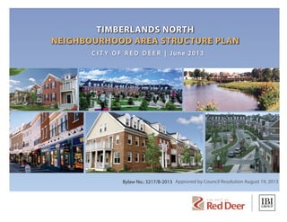
1. Bylaw No.: 3217/B-2013
C I T Y O F R E D D E E R | June 2013
Approved by Council Resolution August 19, 2013
2. a TIMBERLANDS NORTH
NEIGHBOURHOOD AREA STRUCTURE PLAN
TABLE OF CONTENTS1.0 INTRODUCTION ............................................................................... 1
1.1 BACKGROUND...........................................................................................................1
1.2 PURPOSE......................................................................................................................1
1.3 DEFINITION OF PLAN AREA.................................................................................1
2.0 PLAN VISION...................................................................................... 5
2.1 STRATEGIC DIRECTION ..........................................................................................5
2.2 TIMBERLANDS NORTH COMMUNITY VISION ...............................................5
2.3 NEIGHBOURHOOD PLANNING PRINCIPLES..................................................6
3.0 LAND USE CONCEPT ...................................................................... 9
3.1 INTRODUCTION........................................................................................................9
3.2 PLAN OVERVIEW.......................................................................................................9
3.3 GENERAL POLICIES..................................................................................................9
4.0 COMMERCIAL .................................................................................12
4.1 MIXED USE COMMERCIAL..................................................................................12
4.2 ARTERIAL COMMERCIAL.....................................................................................13
4.3 LIVE-WORK................................................................................................................14
4.4 EMS BUILDING ........................................................................................................14
5.0 RESIDENTIAL...................................................................................15
5.1 SINGLE DETACHED RESIDENTIAL DISTRICT................................................15
5.2 TOWN HOUSES........................................................................................................15
5.3 WIDE-SHALLOW HOMES ....................................................................................16
5.4 CARRIAGE HOMES .................................................................................................17
5.5 LIVE-WORK HOMES ..............................................................................................18
5.6 MULTI-FAMILY RESIDENTIAL..............................................................................19
5.7 MIXED USE HOMES................................................................................................20
6.0 OPEN SPACE SYSTEM...................................................................21
6.1 CENTRAL PARK ........................................................................................................21
6.2 GREENWAY................................................................................................................21
6.3 PUBLIC UTILITY LOT – STORM PONDS ..........................................................22
3. a TIMBERLANDS NORTH
NEIGHBOURHOOD AREA STRUCTURE PLAN
TABLE OF CONTENTS
7.0 URBAN DESIGN ..............................................................................23
7.1 SITE DESIGN..............................................................................................................23
7.2 BUILT FORM..............................................................................................................23
7.2.1 Commercial..............................................................................................................23
7.3 COMMERCIAL-RESIDENTIAL INTERFACE......................................................24
7.3.1 Residential................................................................................................................24
7.3.2 Large Residential or Commercial Buildings..................................................24
7.4 PUBLIC REALM.........................................................................................................25
7.4.1 Streetscape Design................................................................................................25
7.4.2 Signage......................................................................................................................25
7.4.3 Street Furniture.......................................................................................................26
7.4.4 Community Entries................................................................................................26
8.0 TRANSPORTATION AND UTILITY SYSTEMS ..........................27
8.1 OVERVIEW.................................................................................................................27
8.2 STREET TYPOLOGY ................................................................................................27
8.3 UTILITIES....................................................................................................................27
8.4 LOW IMPACT DEVELOPMENT (LID).................................................................28
8.5 STREET CROSS SECTIONS...................................................................................30
8.5.1 Divided Entry Collector with Separate Sidewalk (A-1) ............................31
8.5.2 Divided Entry Collector with Separate Sidewalk and
Greenway (A-2) .......................................................................................................32
8.5.3 Collector with Separate Sidewalk (B-1)..........................................................33
8.5.4 Collector with Separate Sidewalk and Greenway (B-2)............................34
8.5.5 Collector with Separate Sidewalk and Utility Corridor
Greenway (B-3)........................................................................................................35
8.5.6 Local Residential Street - Separate Sidewalk – Laned
Residential (C-1)......................................................................................................36
8.5.7 Local Residential Street - Separate Sidewalk – Front
Drive Residential (C-2)..........................................................................................37
8.5.8 Lanes...........................................................................................................................38
4. a TIMBERLANDS NORTH
NEIGHBOURHOOD AREA STRUCTURE PLAN
TABLE OF CONTENTS
8.6 PEDESTRIAN AND BICYCLE NETWORK..........................................................39
8.7 PARKING, LOADING AND TRAFFIC CALMING.............................................39
8.8 PUBLIC TRANSIT......................................................................................................39
9.0 ENGINEERING SERVICES..............................................................40
9.1 STORMWATER MANAGEMENT..........................................................................40
9.2 SANITARY SEWER SERVICING............................................................................40
9.3 WATER DISTRIBUTION..........................................................................................40
9.4 POWER DISTRIBUTION.........................................................................................44
9.5 SHALLOW UTILITIES..............................................................................................44
9.6 ATCO PIPELINES HIGH PRESSURE GAS LINE
(ROW 2271KS)..........................................................................................................44
10.0 IMPLEMENTATION .....................................................................45
10.1 DEVELOPMENT STAGING....................................................................................45
10.2 RE-DISTRICTING AND SUBDIVISION...............................................................45
10.3 PLAN AMENDMENTS............................................................................................45
10.3.1 Exceptions ................................................................................................................45
10.4 SITE DESIGN REVIEW.............................................................................................45
5. a TIMBERLANDS NORTH
NEIGHBOURHOOD AREA STRUCTURE PLAN
FIGURE 1.1 - SITE LOCATION ......................................................................................................2
FIGURE 1.2 - AERIAL PHOTO.......................................................................................................3
FIGURE 1.3 - SUBAREA BOUNDARIES FOR TIMBERLANDS NASP................................4
FIGURE 3.1 - TIMBERLANDS LAND USE CONCEPT PLAN............................................. 10
FIGURE 3.2 - POTENTIAL LAND USE STATISTICS ............................................................. 11
FIGURE 9.1 - MAJOR DRAINAGE AND OVERALL STORM SYSTEM............................ 41
FIGURE 9.2 - OVERALL CONCEPTUAL SANITARY SEWER SYSTEM ........................... 42
FIGURE 9.3 - OVERALL WATER DISTRIBUTION SYSTEM................................................ 43
FIGURES
6. a 1TIMBERLANDS NORTH
NEIGHBOURHOOD AREA STRUCTURE PLAN
1.0 INTRODUCTION
1.1 BACKGROUND
The Timberlands Town Centre Neighbourhood
Area Structure Plan was originally approved by City
Council in July of 2007. The original concept was
for a mix of commercial and residential usage and
encompassed the entire quarter section. Over the
course of the last number of years, the southern
residential (single-family and multi-family) areas
have been developed, however the Town Centre and
Main Street District in the northern portion remain
undeveloped.
Since the NASP was originally adopted, the Town
Centre concept has changed in part on account of
the June, 2010 Commercial Market Opportunities
Study. The proposed Land Use Plan for Timberlands
North reflects a new vision and leadership role for
the City. The plan is seen as one that challenges the
local land development planning conventions and
starts to implement some of the new ideas being
developed as part of the City’s design charter.
As the southern portion of the original Timberlands
Town Centre Neighbourhood Area Structure Plan is
currently mostly developed, the Timberlands North
Neighbourhood Area Structure Plan is concerned
with the undeveloped northern portion of the lands.
The Timberlands North Neighbourhood Area
Structure Plan (NASP) has been prepared by IBI
Group, on behalf of The City of Red Deer.
1.2 PURPOSE
The purpose of this Neighbourhood Area Structure
Plan (NASP) is to describe the land use framework
and development principles for approximately 36.78
hectares (90.89 acres) of land identified in Figure
1.3. This land was first contemplated in the East
Hill Major Area Structure Plan (MASP) as one of a
number of neighbourhood units accommodating
future growth in east Red Deer.
The City’s commitment within the Timberlands North
NASP is to develop an area that reflects a unique
image and character with walkable streets and solid
integration of commercial, residential, and civic
opportunities. In order to achieve this, the NASP
contains a land use concept which will guide area
development and set the expectations for future area
development.
The Neighbourhood Area Structure Plan will
establish a framework for the subdivision, servicing,
and development of the Timberlands North area.
The NASP identifies:
• the size and location of various land uses;
• the alignment of collector and local road-
ways and lanes;
• the neighbourhood open space system of
parks, pathways and public utility lots;
• the location and range of commercial forms;
• the location and range of residential forms;
• the location of community facilities;
• servicing concepts for storm sewer, water and
sanitary;
• the development staging sequence; and
• potential densities.
1.3 DEFINITION OF PLAN AREA
The Timberlands North Neighbourhood Area
Structure Plan is comprised of the north portion of
Northwest Quarter of Section 23, Township 38,
Range 27 West of the Fourth Meridian and includes
approximately 36.78 hectares (90.89 acres). As
shown in Figure 1.1, Figure 1.2 and Figure 1.3,
the NASP is defined by the following boundaries:
• 67 Street (Township Road 384) to the north;
• agricultural land to the east;
• existing residential development to the south;
and
• 30 Avenue to the west.
As you can see in the aerial photo, Figure 1.2, there
are no significant natural features in Timberlands
North and there are no ecological connections to
preserve.
The Timberlands North NASP constitutes a logical
planning unit with respect to identifiable plan
boundaries and servicing considerations and is
consistent with the East Hills Major Area
Structure Plan and the Municipal Development Plan.
9. 4
a TIMBERLANDS NORTH
NEIGHBOURHOOD AREA STRUCTURE PLAN
Figure 1.3 - SUBAREA BOUNDARIES
FOR TIMBERLANDS NASP
Scale 1:4000
Boundary North Subareas
Boundary South Subareas
30AV
67 ST
TIMBERLANDS NORTH
TIMBERLANDS SOUTH
PLAN NAME CHANGE
(NO CHANGES TO POLICIES
OR LAND USE PROPOSED)
10. a 5TIMBERLANDS NORTH
NEIGHBOURHOOD AREA STRUCTURE PLAN
2.0 PLAN VISION
2.1 STRATEGIC DIRECTION
The plan vision for Timberlands North is rooted in
Red Deer City Council’s Strategic Direction,
2012 – 2014. The purpose of the Strategic
Direction is to guide Administration in creating
organizational change, operational strategy and
work plans to enable the community’s vision to
unfold. The Strategic Direction expresses Council’s
understanding of the community vision.
As it relates to community design, the Strategic
Direction is to“design and plan our community to
reflect our character and values. Specifically, our
City’s planning and urban design has resulted in
a welcoming, more walkable and environmentally
sustainable community which accurately reflects our
character and values. It provides housing options,
pedestrian routes, and allows for alternate forms
of transportation and deliberate connections to our
parks, trails and well-designed public spaces where
people can meet and interact and feel a sense
of belonging”.
2.2 TIMBERLANDS NORTH
COMMUNITY VISION
Timberlands North is a new pedestrian friendly
neighbourhood in Red Deer. Timberlands North is
well connected, visually appealing,
environmentally sustainable and has a diversity
of housing types and commercial opportunities.
Timberlands North provides a mix of local
amenities that can be accessed through a variety of
alternative modes of transportation.
Timberlands North will be the first community
designed to respond to City Council’s vision as set
out in the Strategic Direction. Timberlands
North is a City development which will set a high
precedent for the development industry by designing
a neighbourhood that embraces innovative
design, has a variety of housing forms and targets
a range of market segments. The intent of the
Timberlands North vision is to outline a
framework that will foster creativity and
encourage innovation.
11. 6
a TIMBERLANDS NORTH
NEIGHBOURHOOD AREA STRUCTURE PLAN
2.3 NEIGHBOURHOOD
PLANNING PRINCIPLES
City of Red Deer Administration subsequently
translated Council’s Strategic Direction for
Community Design into a set of Neighbourhood
Planning Principles to help inform the land use
concept plan and associated policies. The
Neighbourhood Planning Principles are Natural
Areas, Mixed Land Uses, Multi-Modal Choice,
Compact Urban Form and Density, Integrated Parks
and Community Spaces, Housing Opportunity and
Choice, Resilient and Low Impact Neighbourhoods,
Safe and Secure Neighbourhoods and Unique
Neighbourhoods. The principles are more
thoroughly described in the East Hill Major Area
Structure Plan.
Unique Neighbourhoods
Integrated Parks and Community Spaces
12. a 7TIMBERLANDS NORTH
NEIGHBOURHOOD AREA STRUCTURE PLAN
Mixed Land Uses
Compact Urban Form and Density
Multi-Modal Choice
Resilient and Low
Impact Neighbourhoods
14. a 9TIMBERLANDS NORTH
NEIGHBOURHOOD AREA STRUCTURE PLAN
3.0 LAND USE CONCEPT
3.1 INTRODUCTION
The following section is devoted to a description
of the Land Use Concept Plan for the Timberlands
North area and follows from the Vision, Strategic
Direction and Neighbourhood Planning Principles
articulated in Section 2. Development within the
Timberlands North area will generally conform to the
Land Use Concept illustrated in Figure 3.1.
3.2 PLAN OVERVIEW
The plan is based on a modified grid street pattern
allowing for enhanced connections and promoting
walkability throughout the neighbourhood.
Commercial and mixed use commercial, along
with higher density residential are located on the
periphery of the neighbourhood adjacent to 67th
Street and 30th Avenue. The mixed use commercial
along 30th Avenue constitutes an extension of the
Clearview Market commercial activities located to
the west.
Access to the neighbourhood is derived from two
divided collectors off of 67th Street to the north
and off of 30th Avenue to the west. Additional
right-in/right-out connections may also be provided
to the commercial and multi-family residential
sites off of 30th Avenue and 67th Street. There
is no direct vehicular access to the Timberlands
South neighbourhood, however, there are multiple
enhanced pedestrian connections. The plan allows
for up to three new potential connections to future
development to the east.
A diversity of housing forms have been organized
into comprehensively planned neighbourhoods
based on walkable blocks, containing both laned
and laneless residential products. A central park
feature provides the primary community amenity,
gathering, and passive recreational space. In
addition, pocket parks and green linkages provide
neighbourhood focal points. Boulevarded and
tree-lined streets with houses oriented close to the
street create pedestrian-friendly, safe, connected
neighbourhoods throughout. Potential land use
statistics are described in Figure 3.2.
3.3 GENERAL POLICIES
1. Land use redesignations shall be consistent with
the general land use classifications identified in
Figure 3.1.
2. Auto oriented uses such as automobile service
centres, drive-through businesses and service
stations are preferred to be located within the
arterial commercial district but may be located
within the Mixed Use district if developed in
conjunction with a grocery store.
3. All new development must abide by the built
form and urban design requirements (also refer
to current standards ) of this plan to ensure a
pedestrian-friendlystreetenvironmentiscreated.
4. New development shall achieve a high standard
of architectural design and detailing.
5. Universal accessibility for all is a fundamental
element of this neighbourhood.
15. 10
a TIMBERLANDS NORTH
NEIGHBOURHOOD AREA STRUCTURE PLAN
Figure 3.1 - TIMBERLANDS LAND USE
CONCEPT PLAN
0 10 25 50 100 200m
CC
CC
CC
C
CC
C
CC
C
CC
C C
C C
67th Street
30thAvenue
C
Land Uses (LUB District)
Collector w/Greenway
Collector
Local Residential 2
LocalResidential2
LocalResidential2
LocalResidential2
LocalResidential1
LocalResidential1
LocalResidential2
Collectorw/Greenway&ur/w
Divided
CollectorEntry
Divided Collector w/
Entry Greenway
June 18, 2013
Local Residential 2
Local Residential 1
Local Residential 1
LocalResidential2
Single Detached Residential - Carriage Homes (R1C)*
Single Detached Residential - Wide Shallows (R1WS)*
Single Detached Residential (R-1)
Town House Residential (R2T)*
Multi-Functional Greenway Connections
Pedestrian Friendly Streets & Pathway Connections
Multi-Family Residential (R3)
Live-Work (RLW)*
Mixed Use - Commercial, Residential (C5)*
Arterial Commercial (C4)
Park Space / Municipal Reserve (P1)
PUL/ Open Space Connections (P1)
Proposed Bus Stop Location
Carriage Homes - Mandatory at key corner locations
PUL/ Stormwater Management (P1)
Transitional Lots -Town House or Carriage Home(RLW)*
*Denotes a new land use district, which will need
to be considered.
Emergency Services (PS) / Alternate Arterial Commercial (C4)
FileLocation:J:33851_NeghAreStrPl5.9Drawings59plan33851-cp-6.dwgLastSaved:June20,2013,bytmoodie
N
16. a 11TIMBERLANDS NORTH
NEIGHBOURHOOD AREA STRUCTURE PLAN Figure 3.2 - POTENTIAL LAND USE STATISTICS
Land Use Allocation
Gross Plan Area 36.78
Gross Plan Area minus
Environmental Reserve 0
Major Roads (arterials and expressways) 0
Arterial Commercial 1.9
District Commercial 4.8 100
Industrial Uses 0
High Schools & Sportsfields additional to MR 0
Special land use sites as determined by The City - EMS Site 0.47
Constructed Wetlands 0
Developable Plan Area 29.61 100%
Single Detached Residential (R1) 3.76 13% 90
Single Detached Wide Shallow Residential (R1WS) 2.47 8% 56
Single Detached Carriage Home Residential (R1C) 3.45 12% 106
Total Single Detached Residential 9.68 33% 252
Townhouse Residential 4.41 15% 123
Multi-Family Residential (R3) 2.31 8% 208
Live-Work (RLW) 0.34 1% 12
Transitional Lots- Townhouse or Carriage Home (RLW) 0.25 1% 8
Total Townhouse/Multifamily Residential 7.31 25% 351
Total Residential in Base Scenario 16.99 57% 603
Social Use
Temporary Care/Day Care/Assisted Living Facility (TDA) NA NA NA
Place of Worship Site NA NA NA
Land Use Category/Component Area (ha)
% of Net
Developable
Area
# of Dwelling
Units
Developable Plan Area is made up as follows:
Total residential in the base scenario is made up as follows:
Open Space
Municipal Reserve (MR) (Note 6) 1.21 4.1%
Public Utility Lot (PUL) 2.47 8.3%
Total Open Space 3.68 12.4%
Transportation
Collector Roadways 4.79 16.2%
Local Roadways 3.65 12.3%
Lanes 0.46 1.6%
Total Road Right-of-Ways 8.9 30.1%
Road and PUL dedication as % of: (Gross Area - ER) 11.37 30.9%
Other Uses
Emergency Services Site (ES) 0.47
Institutional Service Facility (PS) NA
Table 2: Density and Housing Mix
Density
Scenario 1 (Base Scenario)- Total residential excluding
commercial mixed use
603 29.61 20.4
Scenario 2- Total residential including commercial mixed use. 703 34.41 20.4
Table 3: Dedicated Park and Trails Space
Municipal Reserve Space
Municipal Reserve Area (Ha) 1.21 6.33 7.5
% of Developable Area 4.1% 23% 13.3%
Timberlands
North
Timberlands
South
Timberlands
Total
Density
Dwelling
Units (du)
Area (ha)
Density
(du/ha)
Municipal Reserve
17. 12
a TIMBERLANDS NORTH
NEIGHBOURHOOD AREA STRUCTURE PLAN
4.0 COMMERCIAL
4.1 MIXED USE COMMERCIAL
The Timberlands North mixed use commercial,
constituting some 4.81 hectares (11.88 acres), is
located on the western portion of the site, bordering
either side of the entry greenway from 30th Avenue.
Portions of the mixed use commercial area face the
community on the western-most interior collector
greenway street. Mixed use commercial buildings
combine living alternatives with commercial uses that
serve the entire community. Essentially, this portion
of the community will allow for the intensification
of retail uses along the Gateway collector and the
interior collector/greenway street adjacent to the
town houses, live-work, single detached residential
and carriage homes. These areas are suitable for
street-oriented retail incorporating residential uses
above. If greater than two storeys, step-backs of
upper floors will be required.
Mixed use buildings frame the major gateway (on
the east-west collector) into Timberlands North and
those buildings facing the collectors will be required
to have active street faces built close to the property
lines and allow room for restaurants and patios
adjacent to public sidewalks. On site parking stalls
will not be allowed in front of buildings facing the
greenway collector or the interior (north-south)
collector. Buildings facing 30th Avenue will be
purely retail; housing units are not permitted above
the retail facing 30th Avenue. These buildings,
while not required to have more than a single
occupied storey, shall read as two storey structures.
If an occupied second storey is proposed, potential
second floor uses will include commercial service
facilities or health and medical services.
Stand-alone retail/commercial developments are
preferred on those parcels facing 30th Avenue. A
mix of uses – preferably organized vertically – is
encouraged. Pedestrian linkages to surrounding trails
or greenway connections are to be integral to the
development of these sites. Refer also to Section 5.7
Mixed Use Homes.
This is an example of a 1 storey commercial use
building designed to look like a 2 storey building.
18. a 13TIMBERLANDS NORTH
NEIGHBOURHOOD AREA STRUCTURE PLAN
4.2 ARTERIAL COMMERCIAL
Arterial Commercial is located on the northern
portion of the site on the south side of 67th Street,
and on the east side of the main northern divided
entry into the community. This portion of the
community will allow for auto-related retail uses
along 67th Street, easily accessible by the broader
Red Deer Community. This area is suitable for
auto-oriented retail, single storey strip or pad
configurations. Buildings in this area will have their
primary building face oriented to 67th Street and will
have a moderate set back from the front property
line. Landscaping shall occupy the set-back area
between the building front and the property line.
The setback area may contain low monument signs,
access walks from the front sidewalk and drive lanes
where drive-throughs are permitted.
When developing sites adjacent to residential uses
the building should be located closer to the street so
that the parking is less dominant and is allowed only
behind the buildings. This parking shall be screened
from the adjacent residential community by a low,
landscaped berm between the parking area and
the collector street. Primary access to the Arterial
Commercial will be from the east-west residential
collector street.
Arterial Commercial buildings will be limited to a
maximum of three storeys. Housing units are not
allowed on upper floors of the Arterial Commercial
buildings. A higher design standard for both the
building architecture and the landscape architecture
would be applied to these sites to create a‘prestige’
arterial commercial area. Loading bays and service
areas would not be exposed to view from public streets
and the rear portions of the Arterial Commercial
area facing the community to the south should be
designed with“four sided”architectural treatment
effectively eliminating blank“rear”walls facing the
residential community. Stand-alone retail/commercial
developments are encouraged in this designation.
19. 14
a TIMBERLANDS NORTH
NEIGHBOURHOOD AREA STRUCTURE PLAN
4.3 LIVE-WORK
Over the past decade, the concept for living and
working at home has evolved into a particular
building type which has been integrated into a
variety of settings, both urban and suburban.
Providing the opportunity for a housing unit to
contain a separate, distinctive workspace, easily
accessible from the dwelling, this live-work
configuration presents a commercial street level use
connected to the dwelling above. This configuration
accommodates a number of uses including office,
retail, and commercial services at the street level and
is often located within or just on the edge of a purely
residential area. Boutique or unique small scale
community oriented uses are to be encouraged. The
building design should emphasize the individuality of
the units or unique nature of each storefront.
In the case of Timberlands North, the live-work units
provide a transition from the mixed use commercial
area to the residential area along the main east-
west arterial at the main entrance to the community.
A portion of the area designated on the plan for
Town Homes or Carriage Homes will be considered
an alternate zone (whichever is the adjacent use)
allowing for additional live-work units subject to
market demand.
In addition to street-oriented parking to serve the
live-work units, a parking area is proposed to be
located immediately to the rear of the south bank of
live-work product. Refer also to Section 5.5 Live-
Work Homes.
4.4 EMS BUILDING
An EMS (Emergency Services) Building site is
proposed in the concept plan, dedicated to a
community-level emergency service team and
equipment. Owing to its location on the plan, at the
north entry to the community, it is anticipated that
the architecture of this facility will be distinctive and
play a role in the overall identity of the community.
Characteristic to buildings of this type might be
a clock tower, or in the case of a fire station, a
hose-drying tower that is designed as an identifiable
feature of the building and thus, for the community.
The orientation of the building depends upon its
function and the type of services provided. Any
building should be situated on the site to provide
optimal operation for the function, but should also
relate to the contextual configuration of adjacent
structures. Set-backs should conform to surrounding
building set-backs, parking should be situated so
as not to impact the adjacent residential areas, and
site access should be such that the entry drive is not
restricted and so that emergency vehicle traffic does
not adversely impact the adjacent residences.
Mackenzie Towne Fire Station
20. a 15TIMBERLANDS NORTH
NEIGHBOURHOOD AREA STRUCTURE PLAN
5.0 RESIDENTIAL
Timberlands North has been designed as a mixed
use, mixed residential community affording a variety
of product choices to the Red Deer market. From
the higher density multi-family units on the western
edge of the community to the single-family detached
neighbourhood on the eastern edge, the product mix
of Timberlands North offers a wide choice in housing
type, size and configuration. While this mix of unit
types addresses different housing market segments,
it also affects the overall character and design of the
community. A well-planned development considers
all the aspects of an inclusive community such as:
• a variety of housing;
• affordability;
• incorporating live/work/play;
• ensuring visual appeal; and
• improvingconnectivity,notonlywithcommercial
areas, but each individual neighbourhood.
Mixing housing types throughout the community
avoids a certain monotony found in subdivisions and
neighbourhoods where only one type of dwelling
unit is built. In many cases, throughout Timberlands
North, units served by a rear lane offer an
enhanced pedestrian environment with a streetscape
uninterrupted by driveways and curb-cuts. The
range of unit types from attached town houses to
detached single-family dwellings creates a varied
landscape and street frontage changing from one
portion of the community to the other. Sidewalks
and pedestrian connections through larger blocks
offer interesting pedestrian experiences in each
neighbourhood of the community.
The following product types are mixed throughout
the community offering each neighbourhood
variety, interest, and streetscapes with an enhanced
pedestrian experience:
• Single Detached Residential
• Town houses
• Wide-Shallow Homes
• Carriage Homes
• Live-Work Homes
• Multi-Family Residential
• Homes integrated with Commercial
Modifications to current land use districts and
new land use districts have been created to
accommodate products as described.
5.1 SINGLE DETACHED
RESIDENTIAL DISTRICT
Located at the eastern portion of the community,
south of the Arterial Commercial and north of the
wide-shallow units, the single detached residential
neighbourhood offers single-family units on
economically sized lots on local residential streets.
An additional block of this type of residential single
detached product is also offered in the western
portion of the plan area. These units are generally
two storeys with a garage accessed from the street.
The main portion of the house is set back a short
distance from the front sidewalk (maximum 3 metres)
and the garage is set back from the front plane of
the main house by a minimum of 3 metres. The
front driveway accommodates the depth of a single
auto and is a minimum of 6 metres deep between
the sidewalk and the garage door. Shared or paired
driveways in laneless product are encouraged.
The orientation of these single detached units affords
each with the ability to optimize solar water heating
and the use of photovoltaics. The front face of the
house faces the sidewalk and street offering an
opportunity for an entry porch.
5.2 TOWN HOUSES
Town houses in Timberlands North are located in
proximity to the commercial/mixed uses areas on the
plan, affording easy access to commercial services and
transit. Town houses usually consist of multiple floors
and have their own ground floor access in an attached
configuration providing an“urban”streetscape. The
front door is sometimes elevated from the street and
accessed by a“stoop”- a small staircase ending in
a landing at the entrance of the unit. The units are
built close to the sidewalk. Town houses can be a
maximum of two and a half storeys and will often have
a cohesive design across the units, or alternatively,
provide for individual expression of each unit through
the architectural detailing. Stacked town houses, where
units are located horizontally one on top of the other, is
also an option to be considered.
Each unit has a small rear yard between the main
building and the detached garage. The garage is
accessed from a rear lane or private driveway providing
an uninterrupted streetscape at the front of the town
houses. When facing an arterial street, noise attenuation
mitigation measures will be required and, if possible,
should be accommodated within the building.
In reference to the Town House site south of the central
east / west collector the following will apply:
1) There will be no homes which front onto the
existing rear lane or Municipal Reserve to the south of
the site.
2) There will be no vehicle access to or from the
existing rear lane or Municipal Reserve to the south of
the site.
3) Along the south property line of the site, there
will be enhanced landscaping including solid
impermeable fencing.
21. 16
a TIMBERLANDS NORTH
NEIGHBOURHOOD AREA STRUCTURE PLAN
4) Vehicular acces to the site will be from the
central east / west collector and access points
will be limited in order to maintain streetscape
continuity.
5) Windows and balconies shall respect privacy
of neighbours by minimizing direct views into
existing neighbouring windows and yards.
6) At the deepest portion of the site, along the
south property line abutting the dwellings existing
as of July 2013 on Turner Crescent cul de sac,
there will be a minimum building setback of at
least 12 meters. No structure, including accessory
buildings, will be closer than 12metres from the
south property line.
5.3 WIDE-SHALLOW HOMES
The wide-shallow homes are a product that offers
a shallower depth of lot than the single detached
residential type and allows for more attractive
design possibilities. Garages are integrated and
set back from the front plane of the house, keeping
the garage from being the focal point of the front
facade of the house. Homes can incorporate large
porches (at least 1.8m deep) and are built closer to
the street affording“eyes on the street”and a greater
sense of community security. The home owner also
benefits from more usable backyard space providing
a peaceful and private refuge. Inside the house,
shorter hallways allow for less wasted interior space,
larger living areas and bigger windows.
The wide-shallow home is two storeys across the
22. a 17TIMBERLANDS NORTH
NEIGHBOURHOOD AREA STRUCTURE PLAN
width of the house. With the use of dormers, bays and gable
ends, the front elevation of the house will present a lively,
articulated elevation to the street. Garage doors should
make use of panels and windows so as not to present a flat,
blank wall to the street front. Porches will be encouraged
and designed using balusters, columns, handrails and other
residential detailing on the primary side facing the street.
Corner units should be designed so that architectural detailing
wraps all sides of the dwelling that face a public street.
5.4 CARRIAGE HOMES
The Timberlands North carriage home product is a unique
approach to provide flexible living space for a single-family
detached product. Carriage homes are located in the western
portion of the community. They also front onto a pair of small
parkettes in the Central portion of the community. Carriage
homes have a detached garage served from the rear lane.
The garage has an accessory dwelling unit situated on the
second storey and accessed from the outside. The carriage
homes are situated on economically-sized lots, which allow
the main dwelling to be two and half storeys and the front face
of the main house is set back a short distance from the front
sidewalk. The primary dwelling of the carriage homes can
accommodate a front porch and present a finely-detailed front
elevation to the street. Each home will have a small private
rear yard between the main house and the detached garage.
The rear detached garages of various sizes can provide space
UR/W
Stairs up to
Carriage Home
Garage/
Carriage Home
Above
Primary
Residence
CarriageHome
Parking
SIDEWALK
ROAD
LANE
1.21
12.00
3.00
6.29
1.509.00
2.00
1.50
1.50
LANE
SCALE nts
Potential Block Layout-
to accommodate additional
parking for carriage homes
off the lane Notes: images are examples only
ur/w = utility right of way
23. 18
a TIMBERLANDS NORTH
NEIGHBOURHOOD AREA STRUCTURE PLAN
above to create a carriage house as a separate
residential unit. The carriage homes will be required
to provide an off-street parking space for the carriage
house unit. Corner units should be designed so that
architectural detailing wraps all sides of the dwelling
that face a public street. Carriage homes will be
required at all corner locations designated within the
plan area. Some carriage homes will front onto park
spaces. These park fronting homes will be accessed
from a rear street built for vehicle traffic. Pedestrians
will access these homes from the park at the front.
5.5 LIVE-WORK HOMES
Adjacent to the commercial and mixed use center,
the live-work units provide a transition from the
mixed use commercial area to the residential
area along the main east-west arterial at the main
entrance to the community. A portion of the
area designated on the plan for town houses and
carriage homes will be considered flexible zone areas
allowing for live-work units if there is additional
market for live-work product types.
Live-work units can be up to three storeys and
provide for dwelling units above a street-level space
that can be used for commercial purposes. The live-
work unit has an interior stair that provides access to
and from the dwelling, but the street level space is
designed for commerce.
The configuration of the live-work product is that
of a multi-family building or, preferably, a town
house style building with individual entries to each
24. a 19TIMBERLANDS NORTH
NEIGHBOURHOOD AREA STRUCTURE PLAN
unit, either through or beside the commercial
space or through a rear entry. The building can
present a contiguous, multi-family design, or a town
house style design where each unit is defined by
particular design details. Each live-work unit may be
condominiumized as a stand alone unit.
The building is built to the sidewalk and the
streetscape is more commercial in nature. Building
design should take advantage of corner locations.
Refer also to Section 4.3 Live-work.
5.6 MULTI-FAMILY RESIDENTIAL
Located in the heart of the activity at Timberlands
North, in the northwest corner of the site, are
the higher density, multi-family buildings. Taking
advantage of the location, this neighbourhood will
be made up of multiple buildings, up to four storeys,
with underground and some surface parking. The
buildings will be multi-unit buildings accessed
through central lobbies and interior corridors. Units
will be in a mix of configurations with balconies
or patios (at ground level), and preferably with full
service amenities including fitness and recreation
rooms. Outdoor amenity areas as well as the
provision of both outdoor and interior bicycle
parking/storage will be required for multi-family
developments.
Multi-unit residential projects should incorporate play
areas for children that have surveillance from ground
oriented as well as upper story units. Integrate
spaces that would allow for community gardens
within parks adjacent to, or directly within multi-
family developments.
Pedestrians will be accommodated with a clearly
marked sidewalk and path system linking all parts
of the complex, the interior community streets and
the adjacent commercial areas. Vehicular access to
the buildings will be at porte-cocheres (porch-like
structures at an entrance through which a vehicle
can pass in order for the occupants to alight under
protective cover) on the surface, and clearly marked
and unobtrusive garage entries on the flankages of
the buildings.
25. 20
a TIMBERLANDS NORTH
NEIGHBOURHOOD AREA STRUCTURE PLAN
The design of the multi-unit buildings will be
in keeping with the residential character of the
community and will have a scale and detail that will
make this development a compatible neighbour to the
smaller-scaled residences across the street. Building
setbacks will vary depending upon the characteristics
of the ground floor units. Where ground floor units
have direct access, they will likely be located closer
to the street. Where ground floor units have interior
access and a patio, setbacks from the street will be
greater.
5.7 MIXED USE HOMES
Mixed use homes are situated in the commercial
heart and the activity center of the community. These
mixed use homes are built on the upper storeys of the
commercial and retail buildings that bracket the main
west entry to the community. These housing units will
be limited to those buildings facing the entry greenway
and the north-south collector street and greenway.
As in the higher density multi-family configurations, the
mixed use homes will be accessed through centralized
lobbies and interior corridors. The elevator lobbies
will also access the below grade parking. The units
themselves will be in the one, two and three bedroom
configuration and will have balconies overlooking the
street or the plaza areas fronting the ground-level retail.
The mixed use commercial development will
incorporate architectural design that enhances the
area, is compatible with the over-all character of
Timberlands North and connects itself visually and
physically with the community.
Residential and commercial entrances should be
differentiated architecturally in mixed-use buildings to
avoid confusion. Commercial entries tend to be public,
and residential entries tend to be private, and should
therefore be designed accordingly.
Refer also to Section 4.1 Mixed-use Commercial.
26. a 21TIMBERLANDS NORTH
NEIGHBOURHOOD AREA STRUCTURE PLAN
6.0 OPEN SPACE SYSTEM
Parks and open spaces are key public realm components, providing valuable spaces for outdoor activity and
leisure as well as social interaction and community participation. The Timberlands North Area Structure Plan
incorporates a variety of parks and open space features which will accommodate both active and passive
pursuits of future residents. Connectivity is a key feature of the Timberlands North plan and pedestrian-
enhanced sidewalks (tree-lined boulevards) provide multiple linkages to the various features, the adjacent
school/library/park site and the larger regional network. Universal accessibility for all should guide the
development of all open space facilities.
6.1 CENTRAL PARK
A central park system of provides a community
amenity, gathering and recreational space focused
on a program of passive/aesthetic pursuits including,
but not limited to, education/interpretation,
sculpture, public art, neighbourhood orchard and/or
community gardens.
6.2 GREENWAY
A 3.0 metre (9.84 feet) wide multi-use trail/
pathway is located along the south side of the
east-west collector roadway in the extreme southern
portion of the plan area. This shared pathway will
accommodate pedestrians, cyclists and rollerbladers
and connect to the larger regional system. The
right-of-way will accommodate a double row of tree
plantings to enhance the visual aesthetic and micro
climatic attribute. A series of greenway linkages
are also included at strategic locations throughout
the community. Where these greenways intersect
with a road there will be traffic calming measures
implemented in order to improve pedestrian safety.
27. 22
a TIMBERLANDS NORTH
NEIGHBOURHOOD AREA STRUCTURE PLAN
6.3 PUBLIC UTILITY LOT –
STORM PONDS
Two stormwater management facilities have been
constructed along the western boundary of the
property adjacent to 30th Avenue. There is an
opportunity to creatively integrate these facilities into
the residential and mixed use areas immediately to
the east, thus creating interesting gathering places
within the plan and creating opportunities for
social interaction. The facilities could be enhanced
with permanent water features to help mask the
road noise and provide for a much more dynamic
attribute and community amenity. The edges of
the storm ponds should be partially naturalized to
improve the the amenity and ecological function of
the ponds.
If The City redesigns the ponds, the following
should be considered to creatively integrate with the
adjacent mixed use and residential developments:
• Parks and open space for year-round use;
• Publicly-owned parks should be designed to
standards maintainable within the City’s budget;
• Unique design elements such as water features
(e.g., fountains) or structures (e.g., gazebos and
artwork) are encouraged. Urban agriculture
and educational opportunities should also be
considered;
• Modifications to the storm pond design to
enhance water treatment and create a higher
quality amenity space for the neighbourhood
will be at the Developer’s cost; and
• If the pond configuration (slope) is changed, an
update to the storm model/pond design will be
required along with a new submission to Alberta
Environment.
28. a 23TIMBERLANDS NORTH
NEIGHBOURHOOD AREA STRUCTURE PLAN
7.0 URBAN DESIGN
7.1 SITE DESIGN
All buildings in the Timberlands North community
should foster a vital and active pedestrian-oriented
street life. They should relate well to the street and to
each other, provide opportunities to maintain views
and sunlight penetration to streets and open spaces,
create attractive rooflines, and minimize shadowing.
Residential and commercial buildings should front
onto streets and/or public spaces and are strongly
encouraged to be located adjacent to the sidewalk
to create a uniform“streetwall”.
Buildings should frame streets and spaces through
height and massing, forming inviting“urban
rooms”where the public life of the neighbourhood
thrives. While architectural variety is encouraged,
the overall effect of individual buildings should be
diverse yet harmonious, resulting in an inviting urban
environment.
7.2 BUILT FORM
Timberlands North will accommodate a variety of
building typologies including various forms of mixed
used mid-rise, low-rise residential and low-rise
accessory suites.
Signature buildings are encouraged at the key entry
points to the community and are expected to feature
design excellence reinforcing the entry experience as
well as adding to the superior architectural qualities
of Timberlands North. Architectural Controls,
established by the Developer will be used to achieve
the following standards.
7.2.1 Commercial
Signature buildings at key entry points to community.
1. New development will contribute to the creation
of pedestrian-oriented streetfronts through the
following:
• within the commercial mixed use district,
locating active uses at-grade along all major
pedestrian frontages;
• aligning buildings to relate directly to the
primary pedestrian frontage with lobbies
and building entries oriented toward the
sidewalks;
• modulating building faces in width, height,
and finishing materials to visually break
up large building walls. The inclusion of
smaller commercial retail units (CRUs) into
the building façades of large retail tenants is
encouraged;
• building façades at-grade should have
transparent glazing (doors and windows);
and
• providing canopies or other forms of shelter
for pedestrians and bicycle parking.
2. Buildings situated in landmark locations should
feature exceptional signature architectural
design and be oriented in a manner that
emphasizes their landmark character and
enhances the entry points to the community.
3. The area between the maximum building
setback and the property line should be
occupied by building entryways, outdoor seating
areas for restaurants, seasonal display, bicycle
parking and/or street furniture.
4. Individual storefronts that are greater than
30 metres in width should provide multiple
entrances at the street level, which may include
incorporating separate individual retail units that
have entrances oriented to the street.
5. The primary entrance of a building should be
located along the pedestrian street and not
an internal parking lot. Where entry from
29. 24
a TIMBERLANDS NORTH
NEIGHBOURHOOD AREA STRUCTURE PLAN
be minimized through the following measures:
• Highly efficient irrigation systems including drip
irrigation and soil moisture sensors;
• The capture and use of rainwater using rain
barrels, cisterns and ponds;
• The use of drought tolerant landscaping.
7.3 COMMERCIAL-RESIDENTIAL
INTERFACE
The interface between the residential
neighbourhoods and the commercial areas in
Timberlands North must be designed in such a way
that visual and functional conflicts are eliminated or
minimized. Building façades that interface with the
smaller-scaled residential buildings shall incorporate
design elements that reduce the impacts of large
buildings masses. The following design elements
should be included:
• architectural detailing that establishes a
vertical rhythm;
• landscape elements that soften the
appearance of the façade and reinforce a
vertical rhythm;
• use of transparent glazing at the ground level
storey; and
• pedestrian-scale lighting.
7.3.1 Residential
The interface of all types of residential to the
public street is important. The following should be
considered when designing:
1. All at-grade residential units that front a public
sidewalk or a publicly accessible private
sidewalk require individual, primary entrances
(e.g., front doors) providing direct access to and
a parking lot is required, that entry should
be designed similar to the main entry on the
pedestrian street.
6. Landscaping, with a focus on naturescaping,
should be incorporated into new developments
to ensure proper integration, protection from
the elements and comfortable pedestrian routes.
7. All parking should be restricted to on-street, at
the rear of the building or below grade. Parking
may be permitted in front of buildings facing
30th avenue only on the mixed use site at the
southwest corner of the plan area. Large surface
parking areas should be avoided and should be
broken into smaller ones.
8. Lighting plans should be required at the
development permit stage to ensure minimal
infringementonabuttingresidential/commercial
properties or dark sky principles.
9. In general, CPTED principles should be applied
to all site designs.
10. Entry-ways to buildings should relate to the
sidewalk or property line to emphasize the
building entrance and provide“punctuation”
in the overall street-scape treatment and
architectural concept for the building.
11. In larger projects, preferred parking should be
provided for very small vehicles (smart cars),
and alternative fuelled vehicles (hybrids, electric
vehicles, biodiesel etc.).
12. Use of building materials with recycled content
is encouraged.
13. Use local and regional building materials where
these are available.
14. Provide recycling facilities within the unit and/
or building. Provide composting facilities on site
where practical.
15. The use of potable water for outdoor use should
from a public sidewalk.
2. All at-grade residential units should be designed
to provide visual privacy from any public or
internal sidewalk without the need for high or
non-transparent privacy fences or walls that
detract from the active street edge.
3. All new residential units should be provided with
private outdoor amenity space, either exclusive
to an individual unit or as a common amenity
available to all units.
4. Sound attenuation studies may be required at
the development permit stage to determine
mitigation methods when developments are
abutting arterial streets.
7.3.2 Large Residential or Commercial
Buildings
1. Upper storey building elements including
penthouse floors and mechanical rooms, should
be treated with expressive architectural forms to
contribute to a distinctive skyline.
2. Tall building elements and massing should
be organized in a way that maintains sunlight
access, indirect daytime lighting and sky
exposure through the majority of the day.
3. Shadow studies may be required at the
development permit stage to determine
shadow impacts on surrounding residential
neighbourhoods.
4. Building step backs, articulation, creative use of
colours, materials and textures are encouraged.
5. Incorporation of green roofs and other green
building technologies are encouraged.
Buildings that can meet Built Green standards or
30. a 25TIMBERLANDS NORTH
NEIGHBOURHOOD AREA STRUCTURE PLAN
LEEDTM
certification requirements (or equivalent) is
highly desirable.
7.4 PUBLIC REALM
The urban design and public realm policy for Timberlands
North is focused on place-making and pedestrianization,
but also on the need to create safe and secure
neighbourhoods and environments that respond to
climatic factors to optimize comfort. The intent is to
create the type of public realm that encourages walking
and attracts visitors to the area by virtue of creating
people-friendly streets and sidewalks, urban parks and
lively public spaces. Urban design and public realm
policies are intended to both complete and complement
those initiatives.
7.4.1 Streetscape Design
Streets are an essential part of the public realm within the
Timberlands North neighbourhoods. Lively streetscapes
comprised of a variety of design elements are key to
a pleasurable pedestrian experience. Streetscapes are
the total result of many smaller components – streets,
sidewalks, building frontages and other elements.
Collectively, these design elements are the physical
infrastructure of place-making through the pedestrian
realm. In addition, one of the most important elements of
creating attractive streetscapes is the presence of street
trees and therefore it is essential that tree planting be
conducted properly, paying attention to soil and moisture
volume for root system, so that they can thrive over many
years. The following should be considered in the design of
the public realm:
1. Universal accessibility for all is a fundamental
element of this neighbourhood.
2. Street furniture, lighting, signage, and landscaping
should be oriented towards the pedestrian.
3. Employ canopies, awnings, and similar
pedestrian sheltering treatments along retail
street fronts.
4. Minimize disruptions to the pedestrian network
from curb cuts, parking access, or above-ground
utilities.
5. The planting of deciduous street trees is
encouraged wherever possible, closely planted
between pedestrians and vehicles.
6. Naturalization of boulevards is encouraged.
7. Driveway crossings are to be paired or shared
and aligned to allow space for tree planting.
8. Facilities for street trees are to be sustainable
and allow trees to achieve a 25 year lifespan
in sidewalk plantings and 50 years in tree
lawns. Designs must include sufficient root and
branching space and should include a means of
supplying supplementary water, fertilizer, and
air as well as protection against snow clearing
and de-icing activities. Design should also
accommodate removal of stumps and planting
of replacement trees. Facilities should function
12 months of the year, 24 hours a day.
7.4.2 Signage
1. The size of signage should be scaled and
oriented to the pedestrian. Signs that are scaled
to the automobile should be restricted to 30th
Avenue and 67th Street frontages.
2. Fascia signs may be permitted on building
façades that interface with 30th Avenue and
67th Street and may be scaled for automobile
traffic. Free-standing signs relating to the auto-
oriented uses in the Arterial Commercial zone
may be permitted to locate along 67th Street
corridor provided they are limited in number
and designed comprehensively with the
adjacent development.
3. Retail frontages are encouraged to
employ blade signage oriented towards
pedestrians.
4. Signs should be architecturally compatible
with the building they are attached to
through materials, colour, scale, and
character and conform to the following
design principles:
• signs should not obscure architectural
features;
• sign design should be integrated with
the design of the building; and
• use illumination only when necessary
and minimize overspill lighting that
affects neighbouring residential
developments.
31. 26
a TIMBERLANDS NORTH
NEIGHBOURHOOD AREA STRUCTURE PLAN
5. The placement of Idle Free Zone signage is
encouraged.
6. All signs must comply with the current City of
Red Deer Land Use Bylaw.
7.4.3 Street Furniture
Street furniture or park furniture for Timberlands
North could be the same, or similar quality to that
used in downtown Red Deer.
1. This furniture should be selected on the basis
of durability and design compatibility with the
architecture of the community.
2. All street furniture should be consistently used
throughout the community including the mixed
use commercial area, parks, pocket parks and on
the 30th Avenue and 67th Street interfaces.
3. Attractive, pedestrian scaled light fixtures
(utilizing LED lamp) should be used in local
residential streets and parks.
4. Larger scaled lighting fixtures found in parking
lots and along collector roads, should be the
same design motif as pedestrian scaled lighting.
5. All lighting should be designed so that light
pollution is minimized in the residential
neighbourhoods including the mixed use
residential area.
6. Iconic banners at entry areas and central park
feature should be consistent with urban design
elements/streetfurniturethroughoutcommunity.
7. Lighting plans are recommended at the
Development Permit stage in relation to
commercial, mixed use and multi-family uses to
ensure the goals of dark skies/reducing night
Street furniture or park furniture could be the same, or
similar quality, to that used in downtown Red Deer.
Attractive pedestrian scale light fixtures, with LED lamps,
should be used in streets and parks.
pollution are considered.
8. In the selection of street furniture, green
(environmental) standards should be explored,
along with considerations for long-term
maintenance and replacement protocols.
7.4.4 Community Entries
Community entry signage should be located at the
two primary entry points to the community from 30th
Avenue and 67 Street.
The two proposed entry features should be coor-
dinated in their design. The entry sign at 67 Street
could take the form of a wall, incorporate public art
and be located at the terminus of the entry road in
the small park area. The entry signage feature at 30
Avenue should be located near the intersection on
the lands used for storm water management.
32. a 27TIMBERLANDS NORTH
NEIGHBOURHOOD AREA STRUCTURE PLAN
8.0 TRANSPORTATION
AND UTILITY
SYSTEMS
The vision of Timberlands North NASP is based on
an interpretation of City Council’s Strategic Vision
and Design Charter. Neighbourhood Planning
and Design Standards and Engineering Design
Guidelines are yet to be revised to reflect the new
Strategic Vision. Timberlands North will be used to
test different servicing concepts and inform revisions
to existing Standards and Guidelines. Therefore,
unique to the Timberlands North NASP, the Transpor-
tation and Utility Systems are displayed as concept
only and will be subject to change during the course
of Timberlands North detailed design development.
This will require further consultation with impacted
City departments and updating of City Standards
and Guidelines. It is expected that there will be resul-
tant modifications to the right of ways, easements,
alignments and apertures but the overall vision of the
neighbourhood will be maintained.
8.1 OVERVIEW
The Timberlands North neighbourhood strives for
a balance between vehicular and non-vehicular
mobility choices while placing greater emphasis on
human scale, pedestrian mobility, and safety; all to
foster a healthier, more complete and sustainable
neighbourhood. The circulation network will cater
to a more compact urban form and more innovative
and diverse housing choices.
This is to be achieved through:
• Greater connectivity and network options;
• Strategic traffic calming;
• Reduced carriageways;
• Reduced road right of ways;
• Enhanced boulevards for vegetation,
bio-swales, and trees;
• More generous sidewalks separated from the
carriageway by the boulevard;
• Minimizing building setbacks to frame the
street edge; and
• Greater attention to the function, form, and
the interface with uses adjacent the roadway
to create a safe, stimulating, and enjoyable
walking experience.
8.2 STREET TYPOLOGY
The Timberlands North NASP introduces a series
of interconnected street typologies to create a
memorable and enjoyable pedestrian realm without
compromising the functional aspects of vehicular
mobility, emergency access, or site servicing.
Movement patterns such as travelling in and out,
through, and within the neighbourhood via transit,
private vehicle, bicycle, or walking are all important
options that were considered.
In addition, key infrastructure components
compete for space within the public road right
of ways and these elements have been properly
considered to ensure they can be accommodated
along with the contextual issues that will allow for
creative adaptation. For example, in certain street
typologies, the integration of innovative storm water
management techniques such as bio-swales or
absorbent landscapes (Low Impact Development
(LID)) in the boulevards are introduced as an option
where practical and economically sensible.
A select set of street profiles have been proposed
specific to the Timberlands North Concept Plan.
These street typologies not only account for the
intended capacity of the roadways, but also the
types of uses that may front onto them. These street
profiles offer an innovative and context - sensitive
approach to complete streets design.
8.3 UTILITIES
Unique to the Timberlands North NASP, front street
servicing of lots with deep municipal services is
being utilized in some areas that would not normally
be supported by the City. Rear lane servicing with
deep municipal services is the preferred method
due to settlement and management of ongoing
maintenance issues. However, in order to facilitate
better neighborhoods, including different housing
types, improved pedestrian realms, low impact
developments, etc., front street servicing will be
permitted in a limited number of additional areas.
This may result in additional maintenance costs to
the City. Deep and shallow utilities will generally
continue to be located in rear lanes, consistent with
general practice. However, the street profiles for
Timberlands North also facilitiate placement of deep
and shallow utilities within the frontage road, where
no lanes are provided. A detailed Servicing Study will
determine the precise location of utilities.
8.4 LOW IMPACT DEVELOPMENT
(LID)
LID employs a variety of practical techniques to
manage stormwater runoff close to its source, where
rain falls (ie. Source Control Practices –SCP). LID
designs focus on implementing better site design
practices and site-specific stormwater control options
such as green roofs, bio-swales, stormwater capture
and re-use, pervious materials, and landscape
designs that increase the absorption and filtering of
rainwater.
33. 28
a TIMBERLANDS NORTH
NEIGHBOURHOOD AREA STRUCTURE PLAN
LID is not a land-use control strategy. It is an
ecosystem-based approach in which water is the
central focus for the design and construction of the
built environment so that it can function sustainably
as part of the ecosystem.
Implementing LID techniques can promote the
recharging of aquifers, the protection of riparian
areas and wetlands, and the maintenance or
improvement of the aquatic health of our water
bodies. Aesthetics of the built environment can be
improved, enhancing the overall quality of life we all
seek in our communities.
For Timberlands North, all forms of LID techniques
are encouraged on individual sites. Furthermore,
as part of the leadership vision the City of Red Deer
has for Timberlands North, LID techniques in the
form of bio-swales/absorbent landscapes are being
considered for integration within the proposed street
designs and public right of way. A number of street
typologies have been proposed to accommodate
bio-swales. In addition to enhanced aesthetic
value, volume and water quality benefits, the bio-
swales may also offer reductions in the size and
amount of storm piping and down-stream storage
infrastructure.
The detailed Servicing Study will determine where
and how LID techniques are implemented. The
details provided below are for illustration purposes
only and final details are to be developed during the
course of more detailed design.
Bio-swales are recommended where they can be
applied and function effectively, such as along longer
street runs and where the boulevards are wider and
require minimal driveway interruptions. Flankage
locations are also appropriate for bio-swales.
LID or bio-swale options are not limited to existing
design solutions or the concepts provided in
this document for illustration purposes. Further
innovation and creative use of materials, techniques,
and products are encouraged to facilitate the
integration of LID techniques and/or bio-swales with
in the road profiles in Timberlands North.
34. a 29TIMBERLANDS NORTH
NEIGHBOURHOOD AREA STRUCTURE PLAN
1.25m WIDE SIDEWALK
DRIVEWAYDRIVEWAY
PROPERTY LINE
600mm WIDE GRAVEL/RIVER
ROCK
VEGETATION BUFFER FOR
PROTECTION FROM SALT SPRAY
AND SEDIMENT DISPOSAL.
BIOSWALE DEPTH TO
RANGE BETWEEN
200-350mm
SEE ATTACHED PLANT
LIST FOR DETAILED
INFORMATION ON
NATIVE PLANT MATERIAL
FILTER MEDIA TO RANGE BETWEEN
800mm - 1000mm IN DEPTH WHEN
PLANTING TREES WITHIN SWALE. SOIL
TO CONSIST OF A COMBINATION OF
ORGANIC COMPOST AND GROWING
MEDIA (SEE SPECIFICATIONS).
STREET LIGHT WITH 150mm FOUNDATION
SITUATED IN COMPACTED SUBGRADE.
INORGANIC GRAVEL/ RIVER
STONE MULCH (20mm-40mm DIA.)
50mm-75mm DEEP.
LOW POINT OF SWALE (600mm
WIDE) - MAIN DRAINAGE
CORRIDOR DIRECTLY ABOVE
DRAINAGE RESERVOIR AND
DRAINAGE PIPE. DRAINAGE PIPE
AND RESERVOIR TO BEND
AROUND STREET LIGHT
FOUNDATION.
DRAINAGE PIPE CONTIUNUES UNDER
DRIVEWAY CONNECTING SWALES AS
ONE LINEAR STORM WATER SYSTEM
SEE ATTACHED PLANT
LIST FOR DETAILED
INFORMATION ON
NATIVE PLANT MATERIAL
300mm DRAINAGE
ROCK/GRAVEL
RESERVOIR (SEE
SPECIFICATIONS).
200mm DIA. PVC, SDR 35
DRAINAGE PIPE WITH
FILTERSOCK AND CLEAN OUT /
OBSERVATION POINTS (MIN 0.5%
SLOPE) TO BEND AROUND LIGHT
POLE AND REMAIN IN A 600mm
STRIP OF FILTER MEDIUM.
EXISTING SUBGRADE (FILL) TO
BE TESTED FOR INFILTRATION
RATE AND SCARIFIED TO
DEPTH OF 200mm PRIOR TO
LAYING ROCK/GRAVEL
RESERVOIR.
600mm WIDE 20mm-50mm
GRAVEL /RIVER ROCK
VEGETATION BUFFER
INORGANIC GRAVEL/ RIVER
STONE MULCH (20mm-40mm DIA.)
AT STREET LIGHT LOCATIONS,
BIO-SWALE ENDS, HOWEVER
DRAINAGE PIPE IS
CONTINUED WITHIN A 600mm
DRAINAGE RESERVOIR
AROUND POLE FOUNDATION
CONNECTING BIO-SWALES TO
LINEAR DRAINAGE SYSTEM.
FILTER MEDIUM TO CONSIST OF A
COMBINATION OF ORGANIC
COMPOST AND GROWING MEDIA
(SEE SPECIFICATIONS).
BIO-SWALE IS TO JOG A 1.5m
DIA. AROUND STANARD LIGHT
POLE. POLE IS TO BE LOCATED
ON A 1.2m DEEP x 300mm WIDE
CONCRETE PILE WITHIN
COMPACTED SOIL.
PL
300mm
1.25m
600mm
2.10m
0.75m buffer
1.5m600mm
1m
300mm
DETAIL OF EXHIBIT 5A: BIO-SWALE DETAIL DETAIL OF EXHIBIT 5B: BIO-SWALE CROSS SECTION AT STREET LIGHT LOCATIONS
FOR DETAILS OF EXHIBIT 5B: NORMAL BIO-SWALE CROSS SECTION AT NON STREET LIGHT LOCATIONS, PLEASE REFER TO EXHIBIT 6C
1.25m WIDE SIDEWALK
DRIVEWAY
DRIVEWAY
PROPERTY LINE
600mm WIDE
GRAVEL/RIVER ROCK
VEGETATION BUFFER FOR
PROTECTION FROM SALT
SPRAY AND SEDIMENT
DISPOSAL.
BIOSWALE DEPTH TO
RANGE BETWEEN
200-350mm
SEE ATTACHED PLANT
LIST FOR DETAILED
INFORMATION ON
NATIVE PLANT MATERIAL
FILTER MEDIA TO RANGE BETWEEN
800mm - 1000mm IN DEPTH WHEN
PLANTING TREES WITHIN SWALE. SOIL
TO CONSIST OF A COMBINATION OF
ORGANIC COMPOST AND GROWING
MEDIA (SEE SPECIFICATIONS).
INORGANIC GRAVEL/ RIVER
STONE MULCH (20mm-40mm DIA.)
50mm-75mm DEEP.
LOW POINT OF SWALE (600mm WIDE) - MAIN DRAINAGE
CORRIDOR DIRECTLY ABOVE DRAINAGE RESERVOIR
AND DRAINAGE PIPE.
DRAINAGE PIPE CONTIUNUES UNDER
DRIVEWAY CONNECTING SWALES AS
ONE LINEAR STORM WATER SYSTEM
SEE ATTACHED PLANT
LIST FOR DETAILED
INFORMATION ON
NATIVE PLANT MATERIAL
600mm WIDE
GRAVEL/RIVER
ROCK
VEGETATION
BUFFER
BIOSWALE DEPTH TO
RANGE BETWEEN
200-350mm
FILTER MEDIA TO RANGE BETWEEN
800mm - 1000mm IN DEPTH WHEN
PLANTING TREES WITHIN SWALE. SOIL
TO CONSIST OF A COMBINATION OF
ORGANIC COMPOST AND GROWING
MEDIA (SEE SPECIFICATIONS).
GEOTEXTILE (TO BE SPECIFIED
BY GEOTECHNICAL ENGINEER).
300mm DRAINAGE ROCK/GRAVEL
RESERVOIR (SEE SPECIFICATIONS).
200mm DIA. PVC, SDR 35 DRAINAGE PIPE WITH
FILTERSOCK AND CLEAN OUT / OBSERVATION POINTS
(MIN 0.5% SLOPE)
EXISTING SUBGRADE (FILL) TO BE
TESTED FOR INFILTRATION RATE AND
SCARIFIED TO DEPTH OF 200mm
PRIOR TO LAYING ROCK/GRAVEL
RESERVOIR.
3:1 SLOPE
PL
1.25m
600mm
2.1m
600mm
880mm
300mm
1m
250mm
DETAIL OF EXHIBIT 6A: BIO-SWALE DETAIL DETAIL OF EXHIBIT 6B: BIO-SWALE CROSS SECTION (LOCATIONS WITHOUT STREET LIGHT)
Proposed Street Section -
Collector
Proposed Street Section - Undivided
Primary Collector 14m Carriageway
Note: In streets where bio-swales are not feasible,
traditional storm piping will be required.
35. 30
a TIMBERLANDS NORTH
NEIGHBOURHOOD AREA STRUCTURE PLAN
0 10 25 50 100 200m
Collector w/Greenway
Collector
Local Residential
LocalResidential2
LocalResidential2
LocalResidential
ResidentialParkCouplet
LocalResidential2
Collectorw/Greenway&ur/w
Divided
CollectorEntry
Divided Collector w/ Entry
Greenway
June 18, 2013
Local Residential
Local Residential
Local Residential
N
A-1
B-1
C-1
C-2
C-2
C-1
B-3
B-2A-2
C-2
C-1
C-2
E
C-1
C-2
Key map for street profiles
8.5 STREET CROSS SECTIONS
A series of cross sections have been provided
to illustrate, in practical terms, the intent and
land use considerations relevant to the street
designs. Exact servicing design is still required
at the detail design stage and may require
minor modifications to these cross sections.
36. a 31TIMBERLANDS NORTH
NEIGHBOURHOOD AREA STRUCTURE PLAN
8.5.1 Divided Entry Collector with
Separate Sidewalk (A-1)
Features: R/W 30m
Carriageway remains unchanged;
2.0m wide separate sidewalks on
both sides;
Street trees within both boulevards
and median;
Offers opportunity to integrate LID
within the boulevard, where adjacent
land use context is appropriate.
Intent: To provide major vehicular and
pedestrian gateway into the community
with commercial and mixed use
frontage close to the street.
8.5.1 Divided Entry Collector with
Separate Sidewalk (A-1)
Features: R/W 30m
B.O.C. B.O.C.
37. 32
a TIMBERLANDS NORTH
NEIGHBOURHOOD AREA STRUCTURE PLAN
8.5.2 Divided Entry Collector with Separate Sidewalk and
Greenway (A-2)
Features: R/W 32.35m
Carriageway remains unchanged;
3.0m wide multi-use pathway on one side and 2.0m wide
separate sidewalks on the other side;
Street trees within both boulevards and median;
Greenway framed by trees on both sides of
3.0m pathway;
Offers opportunity to integrate LID within the boulevard,
where adjacent land use context is appropriate. Existing
sanitary located in the middle of the ROW may influence
the ability to plant trees resulting in a change to the type
of planting within the median.
Intent: To provide major vehicular and
pedestrian gateway into the community
with commercial and mixed use
frontage close to the street and to
accommodate an enhanced multi-use
pathway (with cycling route) connection
on one side of the street.
38. a 33TIMBERLANDS NORTH
NEIGHBOURHOOD AREA STRUCTURE PLAN
8.5.3 Collector with Separate Sidewalk (B-1)
Features: R/W 22.0m
Carriageway 11.5m back of curb (B.O.C.) to B.O.C.;
2.0m wide separate sidewalks on the both sides;
Street trees within both boulevards;
Offers opportunity to integrate LID within the
boulevard, where adjacent land use context is
appropriate.
Intent: To provide vehicular and pedestrian movement
through and within the community with
commercial and residential frontages close to
the street.
39. 34
a TIMBERLANDS NORTH
NEIGHBOURHOOD AREA STRUCTURE PLAN
8.5.4 Collector with Separate Sidewalk and Greenway
(B-2)
Features: R/W 24.35m;
Carriageway 11.5 B.O.C. to B.O.C.;
3.0m wide multi-use pathway on one side and
2.0m wide separate sidewalks on the other side;
Street trees within both boulevards;
Greenway framed by trees on both sides of 3.0m
pathway;
Offers opportunity to integrate LID within the
boulevard, where adjacent land use context is
appropriate (i.e., not appropriate for front drive
residential areas).
Intent: To provide vehicular and pedestrian movement
through and within the
community with commercial/
mixed use and residential
frontage close to the street,
while also accommodating an
enhanced multi-use pathway
(with cycling route) connection
on one side of the street.
40. a 35TIMBERLANDS NORTH
NEIGHBOURHOOD AREA STRUCTURE PLAN
Intent: To provide vehicular and pedestrian
movement through and within the
community with commercial/mixed
use and residential frontage close to
the street, while also accommodating
an enhanced multi-use pathway (with
cycling route) connection on one side
of the street. Minor adjustments to this
cross section may be required when the
detailed servicing study is completed.
Intent: To provide vehicular and pedestrian
8.5.5 Collector with Separate Sidewalk and Utility
Corridor Greenway (B-3)
Features: Carriageway integrates gas line R/W;
Carriageway 11.5m B.O.C. to B.O.C.;
3.0m wide multi-use pathway on one side
integrated with utility R/W and 2.0m wide
separate sidewalks on the other side;
Street trees within both boulevards;
Offers opportunity to integrate LID within
the boulevard, where adjacent land use
context is appropriate.
41. 36
a TIMBERLANDS NORTH
NEIGHBOURHOOD AREA STRUCTURE PLAN
8.5.6 Local Residential Street - Separate Sidewalk
– Laned Residential (C-1)
Features: R/W 18.5m;
Carriageway 10.0m B.O.C. to B.O.C.;
1.5m wide separate sidewalks on the both
sides;
Street trees within both boulevards;
Offers opportunity to integrate LID within
the boulevard, where adjacent land use
context is appropriate. Some locations
may require a cross section that is a
combination of C-1 and C-2 where one
side of the street has lanes and the other
side has no lanes.
Intent: To provide local residential vehicular
and pedestrian movement within the
community with residential frontage
close to the street and rear lanes.
8.5.6 Local Residential Street - Separate Sidewalk
– Laned Residential (C-1)
Features: R/W 18.5m;
Carriageway 10.0m B.O.C. to B.O.C.;
42. a 37TIMBERLANDS NORTH
NEIGHBOURHOOD AREA STRUCTURE PLAN
8.5.7 Local Residential Street - Separate Sidewalk –
Front Drive Residential (C-2)
Features: R/W 18.0m;
Carriageway 9.5m B.O.C. to B.O.C.;
1.5m wide separate sidewalks on the
both sides;
Street trees within both boulevards;
Does not offer the opportunity to integrate LID
within the boulevard.
Intent: To provide local residential vehicular and
pedestrian movement within the community
with residential frontage close to the street
with front garages/driveways and no rear
lanes. Special garage and frontage setbacks
apply. If required, at detailed design stage,
parking may be eliminated to accommodate
emergency access.
43. 38
a TIMBERLANDS NORTH
NEIGHBOURHOOD AREA STRUCTURE PLAN
8.5.8 Lanes
Features: Rolled curbed to define asphalt lane;
Explore opportunities to house shallow
utilities in lane R/W if deep services are in
frontage road.
Intent: Clean, well defined rear lanes to create a
more visually appealing lane environment
more conducive to walking and access to
carriage homes/garage suites.
Lane Treatment - Design Elements: Garbage collection
route with narrow pavement width, Asphalt paving.
Lane Treatment - Design Elements: Garage with
“Carriage Homes”, Asphalt paving.
Lane Treatment - Design Elements: Asphalt paving.
44. a 39TIMBERLANDS NORTH
NEIGHBOURHOOD AREA STRUCTURE PLAN
8.6 PEDESTRIAN AND BICYCLE NET-
WORK
Timberlands North is designed on a grid network
and affords the greatest number of linkage options
for both vehicles and pedestrians. All streets are
designed to accommodate separate sidewalks on
both sides and will therefore optimize the pedestrian
network options across the entire plan area. This
will provide connections to park spaces within the
plan area as well as link to pathway systems adjacent
to the community and become an extension of the
City’s greater regional pathway system.
Bicycle routes have been earmarked on two main
corridors, one north-south and the other east-west.
The bicycle routes are integrated into the multi-use
pathway or greenway on the collector roads and will
provide safe and efficient cycling connections across
and beyond the plan area.
8.7 PARKING, LOADING AND
TRAFFIC CALMING
On-street parking and loading areas are
accommodated on most street types except the
divided collector roads as they serve as primary entry
links to move residents and visitors in and out of
the community efficiently. However, once within the
community, traffic will be dispersed through the grid
system and speed is to be mitigated to safer levels
and on-street parking serves as a form of traffic
calming by pinching the free flow thoroughfare.
Cars parked on the street also act as a buffer
between moving traffic and pedestrians on the
sidewalk. Therefore, on street parking and loading
areas are to be a standard element on all streets,
aside from the divided entry streets.
Furthermore, the street design accommodates the
unobstructed ability of emergency apparatus to turn
into, move down and set up in a street with parked
cars. Parking within 7.5m of intersections will be
restricted. The use of bump outs at intersection
locations is one tool to restrict parking near
intersections and protect vehicle accessibility into
a street. This option will also reduce the crossing
distance for pedestrians at intersections or at mid-
block locations.
8.8 PUBLIC TRANSIT
Integrated within the east-west collector along the
southern portion that runs through the plan area, a
public transit route and associated bus stops have
been proposed and will effectively place every site
within the plan area within 500m (5 to 7 minute)
walking distance to a transit stop.
45. 40
a TIMBERLANDS NORTH
NEIGHBOURHOOD AREA STRUCTURE PLAN
9.0 ENGINEERING SERVICES
9.1 STORMWATER
MANAGEMENT
Two combined stormwater management facilities
(SWMF) have been completed for Timberlands
North and are located near the northwest corner of
the development. They will control stormwater from
both the major and minor storm system for the entire
development as well as major/minor stormwater
from ±10 ha of NE ¼ Sec. 23 and a small part (±1
ha) of the Laebon Lands in the northwest corner of
SW ¼ Sec. 23. The SWMFs are constructed wetland
facilities that are sized to accommodate stormwater
detention for a 1:100 year storm event. The location
of these facilities is identified in Figure 9.1, and may
be integrated with the adjacent Commercial and
Residential area.
All storm sewers within the development will be
sized to accommodate a 1 in 5 year stormwater
event with stormwater being conveyed on the streets
or within bioswales within the boulevards to the
stormwater management facilities during large
stormwater events.
All stormwater in the development area will
discharge into an existing trunk main located at
the intersection of 30 Avenue and the proposed
commercial collector located 400 m south of
67 Street.
All stormwater facilities and storm sewers will be
designed in accordance with The City of Red Deer
Engineering Design Guidelines and will become the
responsibility of The City of Red Deer to maintain
after the applicable maintenance period.
The major drainage and overall storm system with
Timberlands North are shown on Figure 9.1.
9.2 SANITARY SEWER SERVICING
The proposed development will be serviced from the
existing Waskasoo Regional Sanitary Sewer Main,
located within the 30 Avenue and 67 Street rights-
of-way. The section of main from 58 Street to the
connection to the City trunk sanitary main in 40
Avenue north of the Red Deer River was oversized to
accommodate flows from the adjacent lands.
The sanitary trunk mains for Section 23 will connect
to this main at the intersection of 30 Avenue and 67
Street. Provisions will be made to allow a portion of
the flow to be diverted north into the new Northland
Drive sanitary trunk main when the east half of
Section 23 develops. The overall conceptual sanitary
sewer system for Timberlands North is shown
on Figure 9.2.
The majority of the sanitary pipes will be 200mm
in diameter, except for the sanitary mains, which
will be between 250 to 300 mm in diameter. In
most instances the sanitary lines will be located in
the lanes except in cases where there is no lane to
service from.
All sanitary sewer facilities will be designed in
accordance with The City of Red Deer Engineering
Design Guidelines and will become the responsibility
of the City to maintain after the applicable
maintenance period.
9.3 WATER DISTRIBUTION
The overall water distribution system needed to
service Timberlands North is shown on Figure 9.3.
The water trunk is to be located along the south
collector road to the west collector road, then north
to 67th street where it will tie into a future water
trunk along 67th street to a new reservoir east of
20th avenue.
Water mains will be sized at the detailed design and
servicing study stage.
All water main facilities will be designed in accordance
with The City of Red Deer Engineering Design Guidelines
and will become the responsibility of The City of Red Deer
to maintain after the applicable maintenance period.
* Servicing Studies to be updated as determined by the
City of Red Deer.
9.4 POWER DISTRIBUTION
The City of Red Deer EL&P Department has advised that
they will service this development from their existing
overhead power line located parallel to the west bound-
ary of 30th avenue and from a future overhead power
line to be located within the new south boulevard of the
proposed 67th street right of way.
Currently, the Fortis lines on 55 Street and 30 Avenue
service many Fortis customers outside of The City of Red
Deer. Fortis has expressed interest in keeping these lines
until all of the land occupied by Fortis customers has been
annexed by The City of Red Deer.
9.5 SHALLOW UTILITIES
Gas, telephone and cable television services will be
provided by the following companies:
• ATCO Gas (Natural Gas)
• Telus Communications (Telephone)
• Shaw Cable (Cable Television)
ATCO Gas will service this development by constructing
a large diameter medium pressure gas main along the
existing high-pressure gas main right-of-way from Rollis
Street to 55 Street. A new alignment will be required to
extend this main north to service the Timberlands North
development area.
46. a 41TIMBERLANDS NORTH
NEIGHBOURHOOD AREA STRUCTURE PLAN
Figure 9.1 - MAJOR DRAINAGE AND
OVERALL STORM SYSTEM
0 10 25 50 100 200m
CB6
CB7
CB8
CB10
CB9
CB5
CB6
CB4
CB3
CB52
CB66
CB46
CB
53
CB33
CB1
2
CB7
CB14
CB15
CB28
CB25
CB24
CB31
CB34
CB41
CB42
CB26
CB27
CB5
0
CB17
CB1
8
CB1
6
CB38
CB49
CB51
CB52
CB21
CB22
CB8
CB29
CB30
CB19
CB20
CB1
0
CB11
CB35
CB13
CB39
CB40
CB43
CB48
CB47
CB46
CB45
CB37
CB54
CB36
CB44
CB9
CB32
CB2
3
CB68
CB66
CB
57
CB
58
CB59
CB69
CB70
CB
72
CB
71CB5
6
CB55
CB67
CB107
CB106
J:33851_NeghAreStrPl5.9 Drawings59plan33851-cp-6.dwg
Site Boundary
Existing Storm Lines
Proposed Storm Trunk*
Major Overland Drainage Direction
SWM Facility
*Bio-swales may be integrated within street boulevards / Right of ways, where feasable.
Locations Shown are Conceptual Only
N
47. 42
a TIMBERLANDS NORTH
NEIGHBOURHOOD AREA STRUCTURE PLAN
Figure 9.2 - OVERALL CONCEPTUAL
SANITARY SEWER SYSTEM
0 10 25 50 100 200m
J:33851_NeghAreStrPl5.9 Drawings59plan33851-cp-6.dwg
Site Boundary
Existing Sanitary Lines
Proposed Sanitary Lines*
*Locations Shown are Conceptual Only
Proposed Sanitary Trunk*
NServices
48. a 43TIMBERLANDS NORTH
NEIGHBOURHOOD AREA STRUCTURE PLAN
Figure 9.3 - OVERALL WATER
DISTRIBUTION SYSTEM
0 10 25 50 100 200m
882.05
883.31
V6
V1A
V11
C
V13A
V12
V3
V11D
V17C
V21B
V21C
V22
V7D
V8
V9B
V17B
V16
V15D
V15C
V18
V4
V9C
V19
V20
V14
V7A
V13C
V5
V10
V23
V27B
V27C
V24B
V1B
V24C
V27D
250x1
50
TEE
250
x20
0
TEE
250
TEE
250
TEE
250x150 TEE
400x150TEE
400x150TEE 400x200TEE
200TEE200TEE
200x1
50
TEE
200x150 TEE
200x150
TEE
200TEE
200TEE
200x150TEE
250x200 TEE
200x150 TEE
200x150 TEE
200x150 TEE
250x150
TEE
250x150
TEE
200TEE
150 TEE
250TEE250x200
TEE
200x150TEE200x1
200TEE
250TEE
250x
200
CRO
SS
400x250CROSS
200CROSS
22.5
22.5
90
90
11.25
90
22.5
45 & 11.25
11.25
22.5
90
45
45
5
5
5
11.25
11.25
11.25
90
5
5&5
5
5
90
511.25
90
11.25
22.5
45&5
22.5
90
11.25
11.25
90
11.25
5
11.25
5
5
11.25
90
90
90
11.25
5
5
5
H6
H1
H3(srv)
H15
H5
H16
H17H18
H19
H2
H4
H8
H9
H14
H7
H10
H20
H21
H22
H23
H24
H26
J:33851_NeghAreStrPl5.9 Drawings59plan33851-cp-6.dwg
Site Boundary
Existing Water Lines
Proposed Water Mains*
*Locations Shown are Conceptual Only
N
49. 44
a TIMBERLANDS NORTH
NEIGHBOURHOOD AREA STRUCTURE PLAN
Shaw Cable does not have any facilities in the
immediate vicinity to service the Timberlands North
development area. A fibre optics cable will need to
be constructed east along 67 Street from the Gaetz
Avenue/67 Street intersection or north along 30
Avenue from the Ross Street/30 Avenue intersection.
The shallow utility alignments will be established
during preparation of the detailed servicing study for
the Timberlands North lands.
In addition to the Telus and Shaw communications
networks, The City of Red Deer has
partnered with the Alberta Government (Bell West)
to provide Supernet fibre optics service to all
schools and City owned facilities within the City.
Provisions should also be made for the
extension of the“Supernet/City of Red Deer Rednet”
fibre optics network.
9.6 ATCO PIPELINES HIGH PRESSURE
GAS LINE (ROW 2271KS)
An existing high pressure gas line extends north /
south through the proposed development. In the
southern portion of the Plan it has been located
within an existing linear park. In the northern portion
of the plan, this gas line will be integrated within the
road right of way, along the west side (commercial
and multi-family residential frontage) and form part
of the north-south green way connection.
50. a 45TIMBERLANDS NORTH
NEIGHBOURHOOD AREA STRUCTURE PLAN
10.0 IMPLEMENTATION
10.1 DEVELOPMENT STAGING
Infrastructure servicing will be extended into
these lands from the west. Currently, The City
of Red Deer is anticipating construction for
the entire Timberlands North area in a single
construction season. Thereafter, it is anticipated
that development will proceed in a general easterly
direction along the major arterial/collector and then
northwards towards 67th Street. There should be
a conscious attempt to minimize the gap-toothed
appearance associated with non-contiguous
development, notwithstanding market demand for
specific product types.
10.2 RE-DISTRICTING AND
SUBDIVISION
Re-districting and subdivision applications, to
conform to the land use designations described in
the NASP, will be undertaken as necessary. Guided
by The City of Red Deer MDP, the East Hill MASP,
and the Timberlands North NASP, re-districting
and subdivisions will be required to adhere to The
City of Red Deer Land Use Bylaw and informational
requirements necessary for each application.
10.3 PLAN AMENDMENTS
An amendment to the adopted NASP is required for
any significant changes to the plan, such as:
• Major shift in the location of community
facilities;
• Major shift between general land use catego-
ries (e.g., residential to industrial);
• Major shift in infrastructure design or layout,
excepting the addition or deletion of lanes
(e.g., roads, sanitary services);
• Change in other documents affecting plan-
ning and land use in the area (such as a
major amendment to the MASP) will require
an amendment to the NASP.;
• The access points of the collector roadways
onto adjacent arterial roadways as proposed
are fixed and cannot be changed without a
plan amendment, because this may affect
landowners in existing subdivisions.
10.3.1 Exceptions
• Provided the intent of the Timberlands North
NASP is maintained, a minor adjustment to
proposed land use boundaries or roadway
alignments, including the addition or
deletion of lanes which have been reviewed
and accepted as appropriate by The City,
or Public Utility Lots, may be made where
necessary without an amendment.
• No amendments to the servicing concepts
are required to reflect changes determined
as a result of more detailed work.
• No amendments to the overall development
sequence are required as long as the overall
intent is being maintained.
• Minor adjustments to the road cross sections
will not require an amendment.
10.4 SITE DESIGN REVIEW
The site design for all parcels within this NASP area
shall be reviewed and compliance demonstrated with
the policies of this plan.