Mapping GIS to Enterprise Architecture and Analytics
gis-flyer-high-res
1. 13477 Prospect Road +Suite 210
+Strongsville, OH 44149
+1.440.941.SEMS
www.semsassociates.com
GIS Services sems+associates
integrity +value +innovation
Do you know where you are and where you want to go?
In order to analyze data most effectively, businesses and individuals can
use a geographical information system (GIS). A GIS is used to collect,
store, manage and analyze geographical data in order for users to
improve their decision-making by understanding their group's needs
and making the best use of their resources. We have the tools and
techniques to help you understand which GIS products and services will
be able to help your business solve these often complex problems.
With GIS technology, we can help you solve problems and
reduce costs in:
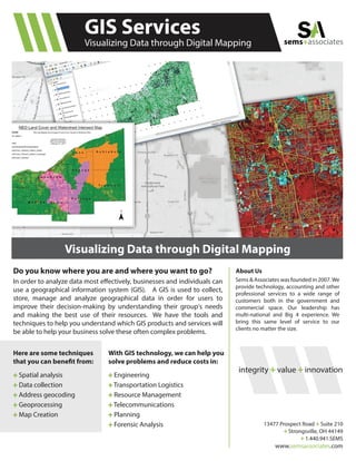
Visualizing Data through Digital Mapping
+ Spatial analysis
+ Data collection
+ Address geocoding
+ Geoprocessing
+ Map Creation
Here are some techniques
that you can benefit from:
+ Engineering
+ Transportation Logistics
+ Resource Management
+ Telecommunications
+ Planning
+ Forensic Analysis
With GIS technology, we can help you
solve problems and reduce costs in:
Sems & Associates was founded in 2007.We
provide technology, accounting and other
professional services to a wide range of
customers both in the government and
commercial space. Our leadership has
multi-national and Big 4 experience. We
bring this same level of service to our
clients no matter the size.
About Us
Visualizing Data through Digital Mapping