1. Prepared for Kestrel Land Trust, Winding River Land Conservancy, and The Mt. Tom Advocacy Group
The Conway School // Winter 2016 // Tia Novak and Kelly Corbin
3. MT. TOM ECOLOGICAL ASSESSMENT
Prepared for Kestrel Land Trust, Winding River Land Conservancy,
and The Mt. Tom Advocacy Group
The Conway School Winter 2016
Kelly Corbin • Tia Novak
4. 4
ACKNOWLEDGMENTS
Thank you to Mark Wamsley of Kestrel Land Trust, Mary Lou Splain and Rosemary Arnold of Winding River Land
Conservancy, and Bill Finn of Mt. Tom Advocacy Group, Kate Cholakis, Mollie Babize, CJ Lammers, Bill Lattrell,
Rachel Loeffler, and Glenn Motzkin for their expertise and guidance.
5. Mt. Tom Ecological Assessment Executive Summary
People use the range for a variety of recreational purposes,
all of which come at a certain environmental cost to the
mountain. Higher-use areas are greatly impacted, with
eroded trails and fragmented habitat. Visitors often park
their vehicles outside of the reservation in order to access
a particular area or to continue their hike past the time
the reservation gates are locked. These parking practices
often encroach on habitat and on private homeowners’
properties, plus they are often in unsafe locations. In order
to improve human access and experience, additional
maintained parking areas, access via public transportation,
and increased pedestrian visibility on major roads is
needed.
Humans and wildlife both experience barriers on the east
side of the range. Abandoned buildings, unused roads,
and an old trap rock quarry interrupt the landscape. Few
species find adequate habitat there and few hikers feel
comfortable exploring this part of the range.
The Mt. Tom range is a wonderful part of life in the
Pioneer Valley and keeping it that way requires a focus
on improving how humans and wildlife connect to the
range. The diverse group of primary land owners need
to join together to draft a common land management
plan that transcends property boundaries. Areas where
humans connect to the range must be made safer and
more environmentally sound. The details of how different
species move both within and beyond the range need
to be studied and that knowledge used to inform
conservation decisions. Local human communities should
be encouraged to use the range responsibly and share
their knowledge about how to do so with others, especially
youth.
With the strong support of Kestrel Land Trust, Winding
River Land Conservancy, The Mt. Tom Advocacy Group,
and many other significant stakeholders, this project
demonstrates the many connections between Mt. Tom and
the larger region. The resulting study recommends steps
to strengthen existing connections and to bring potential
connections into reality. As more and more decisions are
made for the range’s future based on this understanding
of connectivity, overall ecosystem health will improve. Mt.
Tom has many stakeholders—from large landowners to
the smallest salamander—and all benefit from a mountain
range that is connected and protected.
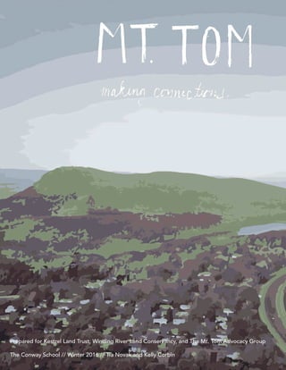
Visible for miles around, the Mt. Tom range rises 1,200
feet above the floor of the Connecticut River Valley.
Known and beloved for its steep basalt cliffs, miles of
trails, rare plant and animal species, and history of human
activity, Mt. Tom represents many of the reasons people
feel a deep connection to the region.
The Mt. Tom range has been the focus of many ecological
studies, conservation efforts, and outdoor pastimes over
the last century. Smith College and other institutions have
long brought students here to explore the rich flora and
fauna. Conservation-based groups have worked tirelessly
to protect the many species on the range identified by the
Natural Heritage and Endangered Species Program. Tram
cars and carriages once brought visitors to hotels on Mt.
Tom and Mt. Nonotuck for a breath of fresh air and to take
in the spectacular views of the Connecticut River Valley.
Skiers once made turns down the eastern slopes. Today,
hiking and natural history groups travel for miles to witness
the natural splendor of the range.
Although people connect to the range from miles around
and wildlife traverse the broad fabric of habitats on its
heights, many consider Mt. Tom an island. Previous
conservation plans use this language frequently, as do
people who visit the mountain on a regular basis. In
December 2015, Kestrel Land Trust, Winding River Land
Conservancy, and The Mt. Tom Advocacy Group hired
the Conway School to assess, document, and celebrate
Mt. Tom’s connectedness—not its isolation—in a way that
could enrich and energize efforts to protect the mountain
and its surroundings. This account of those human and
ecological connections is intended to help all those who
have a stake in the mountain understand its larger role
in the landscape so that they can play a greater role in
assuring its future.
In order to overcome the perception of disconnection,
the Conway team assessed many aspects of connectivity.
The resulting report seeks to answer the questions “Why
is connectivity important?”, “Where are the areas of
connection and disconnection on the range?”, and “How
can that connectivity be improved?” In order to reach
those answers, the Conway team performed an extensive
study of the ecology and human use of the Mt. Tom range.
Mt. Tom is a highly varied landscape that supports an
astonishing diversity of plants and animals, many of them
of special concern in the state of Massachusetts. The rare
and endangered plant and animal species on the Mt. Tom
range pose unique stewardship challenges, which are
often linked to levels of awareness in the general visitor
population. Some of the habitats that support these
species are found on areas of the range that are heavily
used and not well protected by conservation policies.
EXECUTIVE SUMMARY
7. CONTENTS
EXECUTIVE SUMMARY
INTRODUCTION
Client Goals and Requests......................................................................................
Site Orientation.......................................................................................................
History of Human Use on Mt. Tom.........................................................................
Land Ownership......................................................................................................
Public Engagement................................................................................................
WHY CONNECTIVITY MATTERS
Context...................................................................................................................
Geologic History.....................................................................................................
Watershed and Water Flow....................................................................................
The Barnes Aquifer................................................................................................
Vernal Pools............................................................................................................
Vegetation..............................................................................................................
Ecosystem Services..........................................................................................
Biodiversity
Wildlife..............................................................................................................
ClimateChange................................................................................................
Ecological Disturbance...........................................................................................
Cultural Services.....................................................................................................
Visitors................................................................................................................
Types of Human Use........................................................................................
Benefits For Humans........................................................................................
WHERE CONNECTIVITY MATTERS
Ecological Connectivity
Terrestrial Wildlife Movement.........................................................................
Access and Corridors.......................................................................................
Barriers to Access and Movement..................................................................
Human Connectivity
Areas of Highest Use.......................................................................................
Parking and Public Transportation..................................................................
Barriers to Human Access and Movement.....................................................
Humans and Ecological Connectivity: Barriers........................................................
Potential Connectivity
Regional Corridors...........................................................................................
Easthampton.....................................................................................................
Holyoke..............................................................................................................
IMPROVING CONNECTIVITY
Broad Recommendations.....................................................................................
Protect and Improve Wildlife Corridors .................................................................
Coordinate Land Management and Communication Among Owners...................
Case Study: Conservation Aggregations....................................................
Ensure Human Access While Mitigating Environmental Impact.............................
Case Study: Quarry Reclamation................................................................
Encourage Good Stewardship Through Use and Education..................................
APPENDICES
A: Detailed Recommendations..............................................................................
B: Citations.............................................................................................................
C: Map Data Attributions.......................................................................................
D: Participating Stakeholders.................................................................................
1
2
4
6
8
12
14
16
17
18
20
22
23
24
25
26
27
28
29
32
33
34
35
36
37
38
39
40
41
44
45
47
49
50
52
53
56
60
62
65
9. 1Mt. Tom Ecological Assessment Client Goals
CLIENT GOALS AND REQUESTS
In the fall of 2015, a client team comprised of Kestrel Land Trust, Winding
River Land Conservancy, and The Mt. Tom Advocacy Group collaborated
on a proposal for a project with The Conway School to help establish the
Mt. Tom range as an integral part of a larger network of wildlife habitat
and recreational opportunities. Although the range is known and loved by
many, there is little public awareness of the range as a functional whole. How
different land owners manage their parcels, how trail networks lead from one
section to the next, and how wildlife moves inside and outside the range—
information about these topics and others resides in many different places,
making it hard for any one person or organization to understand the full
scope of ecological processes and human use on the range.
Client requests include the following:
• Identify linkages between the Mt. Tom range and human and wildlife
populations
• Recognize ecosystem services provided by the range and the need
to link those services to the surrounding landscape
• Identify existing barriers and threats to both human and wildlife
connectivity within the range
• Identify examples of places where human access and other natural/
human factors threaten to degrade water resources or other
ecosystem services
• Explore recommendations on how to further protect and enhance
human and wildlife connectivity
The client team represents years of experience in conservation work related
to the Pioneer Valley region and the Mt. Tom range. Kestrel Land Trust
undertook a significant project in 2014 to protect land around the Holyoke
Range to preserve ecosystem health and connectivity there. Winding
River Land Conservancy has been instrumental in conserving land in towns
located to the west of Mt. Tom. The Mt. Tom Advocacy Group is the primary
volunteer stewardship organization working on the range.
This project encompasses many acres, many topics, and many voices. Much
work has been done to research the ecology of the Mt. Tom range, but many
studies are dated and require new data collection, such as accurate wildlife
population data for the range. This data gap, along with limitations due to
time and the project’s scope, sets the stage for more detailed studies.
The Mt. Tom range has been millions of years in the making but recent
changes have presented new challenges to its plant and wildlife populations
and to the people who frequent it. Ownership of some parcels is still in
negotiation. A new communications tower on the ridgeline has been
erected and plans are in the works to dismantle the wind turbine. The 2014
microburst, which leveled thousands of trees with tornado-strength winds
on the west side of the range, reminded everyone that natural processes
have no regard for parcel boundaries. Climate change pushes the habitats
for many plants and animals further north each year. The goal of the Mt. Tom
Ecological Assessment is to offer a new vision for the entire range, one that
connects the different parts of the range, coordinates land management,
and ensures good stewardship so that humans and wildlife can continue to
benefit from services offered by the range and cope with all the challenges it
faces.
Through analyzing areas of access for
both humans and wildlife, and evaluating
barriers and threats to connectivity, the Mt.
Tom Ecological Assessment will identify
opportunities to enhance connectivity.
Areas of
access for both
humans
and wildlife
Barriers
and threats to
connectivity for
humans and
wildlife
Opportunities
to enhance access
and
connectivity
SiteAnalysis
Recommendations
Opposite page: Endangered species on Mt. Tom
share their habitat with several communication
towers.
10. Mt. Tom Ecological Assessment Site Orientation
OVERVIEW
The Mt. Tom range is located in the
cities of Holyoke and Easthampton,
in western Massachusetts. Other
nearby population centers include
Springfield and Northampton.
The Mt. Tom range is part of the
Metacomet Range, which extends
from southern Connecticut to the
southern borders of Vermont and
New Hampshire. Because Mt. Tom
is part of a larger mountain range, it
does not have exact boundaries. For
the purposes of this plan, Mt. Tom is
defined as an approximately 3,000
acre area, bordered by Route 141
along its western edge and Route 91
along that range’s eastern edge.
The Mt. Tom Ecological Assessment
focuses on connectivity; other
surrounding areas are considered as
influencing or being influenced by
the Mt. Tom range.
ECOREGION
Mt. Tom is part of the Connecticut
River Valley ecoregion, an area
identified by rich soils, a milder
climate than surrounding regions,
and rolling topography. Forests
are composed of oaks, hickories,
maples, beeches, and birches. Mt.
Tom’s ridgeline rises above the
valley, surrounded by working farms,
small towns, and several colleges
and universities.
The combination of rich ecology
and a human community with strong
ties to the land creates a unique
role for Mt. Tom. The Mt. Tom range
is visible for miles around, both by
human visitors and migratory birds.
The mountain offers refuge for many,
22
SITE ORIENTATION
m0 10 20 30 405
Miles
from plants and animals not found
anywhere else in the state, to people
seeking a rest from their busy lives.
MT.TOM AND “THE RANGE”
The Mt. Tom range trends north-
south. While the mountain has no
distinct summit, the Holyoke Gas
and Electric property that is home to
the communication towers is widely
referred to as the summit of Mt.
Tom. Although there are other peaks
on the range (Mt. Nonotuck, Goat
Peak, and East Mountain) the entire
range is typically referred to as “Mt.
Tom”. In this report, the entire Mt.
Tom range will be referred to as “Mt.
Tom” as well as “the range.”
Holyoke
Easthampton
Springfield
Northampton
Mt. Tom
LEGEND
Connecticut River Valley Ecoregion
Mt. Tom Study Area
11. 3Mt. Tom Ecological Assessment Site Orientation
GENERAL LANDSCAPE PATTERNS ON AND AROUND THE MT.TOM RANGE
Examining general landscape
patterns on and around the range
begins to capture the larger context
of the landscape. The boundaries
shown are intentionally vague, so as
to show patterns rather than legal
parcels.
Much of the range is land that is
permanently conserved, but there
are many surrounding areas that
are vulnerable to development.
Development encroaches from
all sides. Some of the rural and
agricultural lands adjacent to
the range are protected under
Massachusetts Chapter 61 or other
conservation restrictions but these
parcels are not necessarily adjacent
to each other. Other conserved
parcels need to be connected to
the range. Land owned by utility
companies offers some measure
of protection but is not legally
conserved in perpetuity.
SITE ORIENTATION
LEGEND
Agricultural land/low-density
residential development
Conserved in perpetuity, public
access permitted
Urban development
Rural residential development and
conserved lands
Utility owned land, public access
permitted
Landscape patterns on and around Mt. Tom include
conservation areas, residential areas, and urban
areas.
12. 4 Mt. Tom Ecological Assessment History of Human Use
RobertSchwobeCollection
mttomrange.org
HISTORY OF HUMAN USE
RobertSchwobeCollection 1500 acres acquired
on Mt. Tom range,
becomes state
reservation
1902
Eyrie House built on
Mt. Nonotuck
1861
Mountain Park built as
amusement park.
Mt. Tom Summit House opens,
accessed by trolleys
1897
KRobertSchwobeCollection
RobertSchwobeCollection
Mt. Tom has been a cultural
landmark in the Pioneer Valley for
hundreds of years. The range owes
its name to Rowland Thomas, a
surveyor working in Springfield,
Massachusetts during the mid-
1600s. Long before Mr. Thomas
arrived, the range was well-traveled
by the Pocumtuck and Norwottuck
Native Americans, who knew the
Mt. Tom area as Pascommuck. Many
of the trails currently traversing
the ridgeline are ancient Native
American footpaths.
A contentious relationship ensued
over ownership between the Native
Americans and the early settlers of
Easthampton and Holyoke. Mt. Tom
has continued its tumultuous and
ever-evolving existence in the region.
Ownership and use grew out of a
pastoral colonial past into logging
and mining uses. Commercial and
recreational pursuits, including
hotels, an amusement park, and a ski
area, have also found a place on the
range.
Mt. Tom continues to evolve in
ownership and use. Its value as intact
forest habitat was recognized back
in 1902, when the initial footprint
of the reservation was acquired.
Conservation efforts on the range
continue today to protect this
resource in perpetuity.
1946
A B-17 military transport
plane crashes into the
east side of Mt. Tom,
killing the 25 men aboard
13. 5Mt. Tom Ecological Assessment History of Human Use
BillFinn
Mt. Tom Ski Area opens
on the east side of the
range
1962
Mt. Tom Ski Area closes,
buildings and slopes
abandoned
1998
Mt. Tom Partners buy former
ski area, quarry remains under
private ownership
2002
Mountain Park closes, rides
are dismantled and sold
1987
University of Massachusetts
builds a wind turbine on the Mt.
Tom ridgeline
1994
T.Novak
KellyCorbin
New
EnglandSkiHistory
JayDucharme
14. 6
OVERVIEW
The area of the range examined
in this study totals around 3,000
acres, which is divided among
different owners. These owners
are a mixture of public and private
entities, conservation organizations,
utility companies, and businesses.
The Department of Conservation &
Recreation (DCR)owns the largest
portion of the range, totaling
approximately 1,800 acres. Much
of the exposed ridgeline is on
Holyoke Gas & Electric property.
Most properties are open to the
public, but Mountain Park, the
quarry, and the areas surrounding it
are not open. Ecosystems traverse
property boundaries, but different
owners have different priorities,
management strategies, and
resources. Conservation is not the
top priority for all owners.
SHIFTING OWNERSHIP
In 2002, the Mt. Tom Partners
purchased a 396-acre section on
the east side of the range. The
Partners—DCR, The Trustees, Boys
& Girls Club of Greater Holyoke,
and U.S. Fish and Wildlife Service
(USFWS)—divided this section into
parcels managed by each partner.
DCR extended the reservation to the
south, The Trustees purchased Little
Tom Mountain, USFWS owns the old
ski slopes, and the Boys & Girls Club
bought the ski buildings and the
land around them.
THE QUARRY
DCR intended to purchase the
quarry parcel, located just to the
north of the ski buildings, but this
transaction never took place. This
area has potential for recreation and
habitat but due to the safety hazards
of the quarry and various financial
concerns, the Boys & Girls Club was
unable to move forward with their
plans to create a summer camp
on their property. A lack of visible
management on these parcels has
led to vandalism and misuse of the
ski area buildings. These areas feel
unsafe to many people.
CHALLENGES TO CONNECTIVITY
These highly disturbed parcels
present significant challenges to
connectivity—vegetation cannot
grow in developed areas and most
wildlife cannot find suitable habitat.
These areas feel unsafe and off limits
to human visitors. Reestablishing
connectivity through this area will
take a strong, collaborative effort
from all landowners on the range, as
well as input and assistance from the
public.
LAND OWNERSHIP ON MT. TOM
T. Novak
Mt. Tom Ecological Assessment Land Ownership
Bray Lake is on DCR property but the water that flows into it passes through land owned by Mount Tom Rock,
LLC and The Trustees before reaching the lake. The lake drains out through DCR and Holyoke Country Club
property.
15. 7Mt. Tom Ecological Assessment Land Ownership
LAND OWNERSHIP ON MT. TOM
There are a significant number of
different landowners on the Mt.
Tom range. DCR holds the largest
parcel (around 1,800 acres) and the
smallest is held by the Massachusetts
Department of Fisheries and Wildlife
(14 acres). Two utility companies
(HG&E and Holyoke Water Works)
own land on the range and allow
public access to their properties. The
“summit area” of Mt. Tom is actually
on HG&E property and is the site
of many communication towers.
Mountain Park is privately owned by
a local entrepreneur and is used as
an occasional concert venue in the
summer.
Given the number of different organizations
involved in this project, it is useful to refer to them
in groups. References to “Clients”, “Mt. Tom
Partners”, and “primary landowners” will be made
throughout this project.
The varied ownership on the Mt. Tom range
represents many different land uses and priorities.
These differences can complicate connectivity for
both humans and wildlife.
CLIENTS:
- Kestrel Land Trust
- Winding River Land Conservancy
- Mt.Tom Advocacy Group
MT.TOM PARTNERS:
- Department of Conservation & Recreation
- The Trustees
- US Fish and Wildlife Service
- Boys & Girls Club of Greater Holyoke
PRIMARY LANDOWNERS:
- Department of Conservation & Recreation
- The Trustees
- USFWS
- Boys & Girls Club of Greater Holyoke
- Holyoke Gas & Electric
- Mountain Park
- Wyckoff Country Club
- Holyoke Country Club
- Holyoke Water Works
- MA Department of Fisheries and Wildlife
- Mount Tom Rock, LLC
0 0.25 0.5 0.75 1
Miles
U.S. FISH &
WILDLIFE
HOLYOKE
GAS &
ELECTRIC
MT. TOM
ROCK LLC. DCR
THE
TRUSTEES
MOUNTAIN
PARK
HOLYOKE
BOYS AND
GIRLS CLUB
HOLY-
OKE WATER
WORKS
MASS
FISHERIES
AND
WILDLIFE
16. 8 Mt. Tom Ecological Assessment Public Engagement
PUBLIC ENGAGEMENT
Kelly Corbin
Kelly Corbin
OVERVIEW
Many voices contributed to this
project. In January, the Conway
team met with some of the primary
landowners on Mt. Tom, plus staff
members from local conservation-
based groups. In March, the team
met with community members
who use the range frequently for
recreation.
STAKEHOLDERS
The first meeting focused on
eliciting feedback from conservation
professionals, including landowners
on the range. Representatives from
DCR, The Trustees, and USFWS
attended. Clients were also present,
as were representatives from other
local land trusts, Massachusetts
Audubon, the Appalachian Mountain
Club (who hold an easement on the
New England Trail), the Cities of
Holyoke and Easthampton, and the
Pioneer Valley Planning Commission.
USER GROUPS
The second meeting invited
members of user groups, who
serve as eyes and ears on Mt. Tom
due to how much time they spend
there. Residents from Holyoke,
Southampton, Easthampton, and
other towns were present, as well as
representatives from Pioneer Valley
Hiking Club, Wilbraham Hiking Club,
birding clubs, and Holyoke Parks and
Recreation.
FEEDBACK
Both meetings focused on eliciting
feedback on why Mt. Tom is such
a vital part of this region, barriers
for humans and wildlife, and
ways in which the range benefits
people. Despite the differences in
Members of user groups provided feedback on the benefits they receive from Mt. Tom and
the barriers they experience when trying to access it.
Some of the primary landowners on the range met with staff of various local conservation-
based groups to map out where wildlife access the range and the barriers they encounter.
backgrounds and experiences, there
was remarkable overlap among
participants at both meetings (see
diagram, p. 9).
17. FEEDBACK SUMMARY
The feedback received from
landowners, clients, conservation
groups, hikers, birders, and many
other community members who
value Mt. Tom shows consistent
themes around access and
connectivity. This consistency
confirms that the benefits identified
should be supported and the barriers
named need to be addressed.
9Mt. Tom Ecological Assessment Public Engagement 9
PUBLIC ENGAGEMENT
Connection
to nature,
opportunities for
solitude, refuge
Unique habitat
for many rare and
endangered species
Year-round
recreation
opportunities
Habitat
degradation
by human use &
invasive species
Connection to
some areas not
possible or not safe
Inadequate
staffing leads to
improper use
BENEFITS
BARRIERS
SHARED VALUES
Both stakeholders and user groups
were asked to talk about why they
believe Mt. Tom is such a valuable
resource. Common ground was
evident in the responses of both
stakeholders and user groups. Each
group valued the plant and wildlife
diversity and the human history on
the range. The range’s opportunities
for recreation, education, and
community engagement were
described by stakeholders and user
groups as extremely valuable.
Participants from both meetings saw
protecting forest and other habitat
as a critical concern.
18. 10
“[Mt. Tom]...is a blessing, and the single best reason to live
here. I try to hike it once a week.”
-Community member
19. 11Mt. Tom Ecological Assessment Why Connectivity Matters
John Muir famously said, “When we try to pick out anything by
itself, we find it hitched to everything else in the Universe.” Mt.
Tom demonstrates these interconnections in many ways. Water
falling on the rocky slope habitats eventually makes its way
into the freshwater habitat of the Connecticut River. The basalt
quarry once mined for the trap rock used to build roads leading
to Mt. Tom now limits human activity there. Trails built for hikers
are often used by deer and other mammals to move about
the range. These relationships demonstrate that being hitched
together is simply the way of things. Connection is the letter
and the law of nature.
In ecology, “connectivity” refers to the degree to which
a landscape allows or blocks movement. Areas with high
connectivity permit wildlife to move freely and ecosystem
processes to function. Those processes—seed dispersal,
pollination, predator-prey relationships, energy flows—
rely on high connectivity between areas of diverse natural
communities. Low connectivity areas have many barriers, such
as roads and development, that hinder wildlife movement
and overall ecosystem function. This plan applies the concept
of connectivity to analysis of human communities as well in
order to determine how easily people can access and move
throughout the Mt. Tom range.
This section presents information about why connectivity
matters, both to ecosystem health and human well-being.
Site analyses including geologic history, water, vegetation,
biodiversity, ecological disturbance, human access, and others
build a strong case to protect existing connectivity and improve
it where it is lacking.
WHY CONNECTIVITY MATTERS
20. “Mt. Tom is an island…” This phrase
appears in conservation planning
documents, informational websites
for the public, and in conversation
about the range. The range’s
location within a loop created by
Routes I-91, 141, and 5, as well as
East Street, combined with how
it dramatically rises above the
landscape, can give the impression
12
CONTEXT
Mt. Tom Ecological Assessment Context
that the range is an isolated
fragment of nature.
The Mt. Tom range, however, is
deeply embedded in a larger social
and ecologic landscape. How would
management, stewardship, and
understanding of the range change if
the focus shifted to the connections
the range has to that landscape and
its human and wild inhabitants?
Rt. 141
“Island” has another meaning for
many people in regards to Mt. Tom.
The range serves as an oasis—a
natural refuge in the midst of
development. Humans and wildlife
value the range for this reason
but must still overcome barriers to
reaching that oasis or to move from
it to another area of open space
nearby. Connecting these oases
together is vital conservation work.
The Mt. Tom Range is bordered by major roads,
which can make the area seem isolated from
surrounding lands.
CONN
E
C
TICUT
Rt. I-91
Rt. 5
East St.
21. 13Mt. Tom Ecological Assessment Context
CONTEXT
Quabbin Reservoir
Mt. Holyoke Range
Mt. Tom
Mt. Greylock
A perceptual shift to seeing the
Mt. Tom range’s connections to the
greater region reveals opportunities
to improve connectivity and access
for both humans and wildlife.
Collaboration already exists among
many of the major landowners.
Through framing the range as
connected, these landowners can
partner on management practices
that respect and encourage
ecosystem processes. A connected
landscape allows wildlife easy
movement within the range as well
as to and from it. People will be able
to experience more of the range,
distributing their impact rather than
concentrating it. A connected Mt.
Tom fits like a puzzle piece into the
Pioneer Valley, linking conservation
areas in all directions.
Priority Natural Community
Critical Natural Landscape
Potential Corridors
LEGEND
22. Mt. Tom Ecological Assessment Geologic History14
GEOLOGIC HISTORY
The Mt. Tom range is home to
a variety of plant and animal
species rarely found elsewhere in
Massachusetts. What makes the
range such a unique place that it
can host this diversity? The answer
requires a look back in time.
ROCK FORMATION
Around 200 million years ago, North
America and Africa pulled apart,
creating a layer of basalt rock in the
Connecticut River Valley. Layers of
sedimentary and basalt rock formed,
all of which was then uplifted and
tilted. The sedimentary rock eroded,
leaving the exposed basalt ridge of
the Mt. Tom range.
SOIL CREATION
Although these events took place
millions of years ago, they have
profound implications for what Mt.
Tom looks like today. The basalt
bedrock gives rise to calcium-rich
soils, a condition preferred by many
plant species. Searcy, et al., 2003,
found greater species richness for
trees and herbaceous plants on
basalt than on similarly located
sedimentary rock-based soils. Other
soils on the range contain different
nutrients, fostering different plant
and animal communities. Greater
diversity in plant species leads
to a greater diversity of animal
species. Calcium and other nutrients
flow downhill, enriching soils in
connecting areas below.
AQUIFERS
More recently in geologic history, the
Barnes Aquifer formed to the west
of the Mt. Tom range. Sediments
deposited during the melting of the
Laurentide ice sheet 15,000 years
BEDROCK MAP OF THE MT.TOM RANGE
The bedrock map of the range shows a
ridge of basalt running approximately
north-south throughout the range and
well beyond it. This ridge is clearly
visible on the range’s west side.
Surrounding rock types are primarily
sedimentary in origin.
LEGEND
Mt. Tom Study Area
Basalt
Sedimentary Rock
calcpelite
pelitic rock
mafic rock
Mt. Tom range
sulfidic schists
ago created the aquifer (see page 17
for more information).
23. Mt. Tom Ecological Assessment Geologic History 15
The basalt bedrock that makes up
Mt. Tom and the larger Metacomet
ridges has not only provided
spectacular views of the Pioneer
Valley but has also been used as
raw building material. The Mt.
Tom Quarry was mined for its
basalt starting around 1900, which
was then broken down into trap
rock and used in road building.
Concerns about the environmental
impact of the quarry began in
the 1990s, and the quarry ceased
operations in 2012. The parcel
was intended to be sold to the
DCR at that time but the sale is
currently held up due to unresolved
drainage problems.
BillFinn
KellyCorbin
GEOLOGIC HISTORY
HIstoricPittsburgimagecollection
Mt. Tom’s basalt bedrock outcrops serve primarily
recreational purposes for people today, but have
played a role in the economic output of the Pioneer
Valley for many years.
24. 16 Mt. Tom Ecological Assessment Watershed and Water Flow
WATERSHED AND WATER FLOW
When rain hits Mt. Tom, it may flow toward the Manhan River to the west, the
Connecticut River to the east, or the Whiting Street Reservoir to the south.
The Mt. Tom range lies within the
Connecticut River watershed. Water
flowing from the mountain eventually
reaches the Connecticut River, making
its way to the Long Island Sound and
into the Atlantic. This connection
places Mt. Tom within a larger
ecological context and indicates that
factors affecting water quality on the
range have an impact far downstream.
WATER FLOW
Water flows from the Mt. Tom range
to several other important hydrologic
features in the area. Water flowing
east from the range enters the
Connecticut River. Water moving
down the south slopes and to the east
HOLYOKE RANGE
CONNECT
IC
U
T
RIV
ER
WHITING ST.
RESERVOIR
enters the Whiting Street Reservoir,
an emergency surface water supply
area for Holyoke, which then connects
to the river. As water flows from the
range to the west, it may enter the
Manhan River and eventually, the
Connecticut River. Some of the water
flow to the west also seeps into the
ground, helping recharge the Barnes
and Great Brook aquifers.
CONNECTICUT
MANHAN RIVER
Water falling on the range mostly enters
the Connecticut River watershed, and
to a lesser extent, the Westfield River
watershed.
WESTFIELD
MT.TOM
RANGE
25. 17Mt. Tom Ecological Assessment The Barnes Aquifer
The over 2,000 acres of forested
and conserved land on the Mt. Tom
range offer important protections for
water quality in the region. In a 2004
report, the American Water Works
Association declared that conserving
forests is critical to protecting
drinking water (Ernst et al., 2004).
The Trust for Public Land found that
a 10% increase in forest cover led to
a 20% reduction in costs associated
with water treatment.
THE BARNES AQUIFER
The Barnes Aquifer lies to the west
of the Mt. Tom range and provides
four towns (Easthampton, Holyoke,
Southampton, and Westfield) with
drinking water. It is the sole source
aquifer for Easthampton, meaning
that the town receives over 50%
of its drinking water from the
Barnes. Mt. Tom’s forested land
cover ensures cleaner runoff that
may recharge the aquifer. The high
level of water quality in the area
was proven in 2015, when the City
of Easthampton won an award for
having the best-tasting water in the
United States (NRWA News, 2015).
WATER QUALITY
While surrounding towns have
enjoyed high water quality due in
part to Mt. Tom, human activity on
the range can compromise that
quality. Erosion is a major issue on
the range, contributing runoff high
in sediment. People create erosion
when they park off the road in order
to access the range. High impact
areas such as the trails up to the
summit from the south also show
significant erosion, sending that
material downslope into the vernal
pools that lie at the bottom.
THE BARNES AQUIFER
LOCATION OF THE BARNES AQUIFER IN RELATION TO THE MT.TOM RANGE
The Barnes Aquifer, in green, is a sole source aquifer
that underlies Easthampton and receives recharge
from the Mt. Tom range.
Easthampton Open Space and Recreation Plan
MT. TOM
RANGE
26. Mt. Tom Ecological Assessment Vernal Pools18
VERNAL POOLS
D R Y P H A S E
W E T P H A S E
Water resources on Mt. Tom offer
benefits to wildlife communities as
well as humans.
VERNAL POOLS
Vernal pools are shallow
topographic depressions that are
seasonally filled with water. Due
to their seasonal lack of water,
they cannot support fish, making
them refuges for species such as
frogs and salamanders to breed.
Vernal pools and their associated
upland forests are critical sources of
wildlife diversity in Massachusetts.
Climatic changes associated
with each season cause dramatic
changes in vernal pools. Vernal
pools tend to collect water during
winter snow melt and spring rains,
fluctuating in volume from season
to season. During particularly dry
years, vernal pools may not fill at
all.
EasternpaintedturtleLindaHenderson
JeffersonsalamanderVTBiologyTechnicalNote
WoodfrogMichaelZahniser
As vernal pools fill with water, they provide breeding habitat for many amphibians
and feeding grounds for birds and mammals.
27. 19Mt. Tom Ecological Assessment Vernal Pools
VERNAL POOLS
The Mt. Tom range is home to
some of the most diverse and
productive vernal pools in the state
of Massachusetts. These pools are
critical habitat to some of the state-
listed species that live on the range,
such as the marbled salamander
(DCR 2013). Salamanders, along
with other vernal pool creatures,
are sensitive to water quality and
require clean water in these pools.
It is also important that these
animals have access to nearby
intact habitats, as movement from
vernal pools to forested uplands is
a key factor in their reproductive
cycles. Many amphibian species
on the range breed in vernal pools
once spring nights have warmed
enough to allow their movement to
and from the pool. Being able to
connect to a number of pools helps
ensure genetic variability in their
populations (Shah, 2016).
CERTIFIED VERNAL POOLS
On the Mt. Tom State Reservation,
there are eight certified vernal
pools and 12 potential pools (DCR
2013). The Natural Heritage and
Endangered Species Program
(NHESP) uses volunteer data to
certify vernal pools, which then
creates a buffer zone up to 100
feet beyond the pool’s boundary.
Several more certified pools are
found on land owned by Holyoke
Gas & Electric, which does not have
the same level of legal protection
in perpetuity for natural resources
offered by other owners. While
official certification provides a vernal
pool and its immediate surroundings
a buffer zone of protection, it
is critical to ensure adequate
connectivity for the organisms
using vernal pools by protecting
WETLANDS AND VERNAL POOLS OF THE MT.TOM RANGE
Wetlands and vernal pools are critical habitat in
and around Mt. Tom. BioMap2 Core Habitat areas
are vital for the long-term survival of rare species.
NHESP certifies vernal pools as a way to protect
the rare and endangered species living in them.
Priority Natural Community Wetlands
Wetland Core
(least disturbance within undeveloped land)
BioMap2 Aquatic Core
BioMap2 Core Habitat
BioMap2 Critical Natural Landscape
NHESP Certified Vernal Pools
LEGEND
Easthampton
Holyoke
Mt.Tom
Range
Holyoke Range
I-91
RT. 5
the larger landscape. Pools listed
as “potential” need more data
collected to qualify for certification.
28. 20 Mt. Tom Ecological Assessment Vegetation
VEGETATION
This map of vegetation
communities on the Mt. Tom range
focuses on the properties bought
in 2002 by the Mt. Tom partners
(DCR, The Trustees, USFWS, and
the Boys & Girls Club). It also
shows vegetation communities
considered priorities by the
Natural Heritage and Endangered
Species Program that lie on
other parcels. Data at this level of
detail does not currently exist for
these communities in the rest of
the range. This map is used as a
proxy until that information can be
mapped.
THE NEED FOR MORE DATA
DCR does have more extensive
data on natural communities
for the nearby Holyoke Range;
amassing similar data for Mt. Tom
would provide information essential
to creating a comprehensive
management plan for the entire
range.
VEGETATION COMMUNITIES ON MT.TOM PARTNERS’ PROPERTIES
Oak forest
Northern hardwoods-
hemlock forest
Circumneutral talus slope
Data on natural vegetation communities
only exists for a portion of the Mt. Tom
range.
Northern hardwoods-
hemlock-oak transitional forest
Oak forest
Hickory-hop hornbeam forest
Non-woody old field
Red cedar-shrubby old field
LEGEND
Circumneutral talus slope
Circumneutral rocky summit/outcrop
Permanent pond/reservoir
Forested swamp/marsh wetland
Buildings/surroundings
Quarry
Roadside/disturbed place
29. 21Mt. Tom Ecological Assessment Vegetation
The natural plant communities
(groups of plants commonly found
growing together in particular
environments) found on Mt. Tom
show a broad range of the types of
vegetation found in Massachusetts.
Data provided by the Mt. Tom
Partners (DCR, The Trustees,
U.S. Fish and Wildlife) identifies
approximately 10 different natural
communities on the 396 acres shown
in the map at left. Research done on
the nearby Holyoke Range found 26
different natural communities; DCR is
confident a similar number exists on
the Mt. Tom range. Habitat diversity
supports animal diversity. The array
of natural communities found on
the range is another indicator of the
wildlife that potentially resides there.
The range is also home to many
transitional vegetation communities
(areas where one community blends
with another). These areas are known
for their species richness.
PRIORITY COMMUNITIES
Some of these communities,
such as the oak forest or northern
hardwoods-hemlock forest, are
relatively common across the state.
Others, such as the hickory-hop
hornbeam forest and circumneutral
talus slopes, are considered priority
habitat by the Natural Heritage
and Endangered Species Program
(NHESP). With few of these natural
communities left in the state, it is
critical to protect the ones that are
intact. Priority communities cross
property boundaries on Mt. Tom and
are sometimes found on land that is
not under conservation safeguards,
such as the rocky outcrop
communities on the summit of Mt.
Tom, which is owned by Holyoke Gas
& Electric.
INVASIVES ON MT.TOM
Invasive plants, such as pale
swallowwort, are often found in
disturbed and revegetated areas.
That pattern holds true on Mt. Tom.
The old ski slopes, now owned by
USFWS, have significant swallowwort
invasion, creating a seed source that
will affect neighboring properties. A
comprehensive land management
plan agreed upon by all landowners
will help coordinate management
of these invasive species and many
others.
VEGETATION
Pale swallowwort is a highly invasive relative of milkweeds. USFWS and The Trustees are
working to eradicate it from their properties on Mt. Tom but other communities likely exist
on different parcels, complicating the removal process.
30. 22 Mt. Tom Ecological Assessment Vegetation: Ecosystem Services
VEGETATION: ECOSYSTEM SERVICES
Vegetation can provide a number of
the critical ecosystem services shown
below. The Mt. Tom range, with
its large tract of intact and healthy
forest, improves air and water quality
for residents of the Pioneer Valley,
mitigates climate change, and offers
those residents a beautiful place to
explore.
Forest protects
water and air quality,
prevents erosion,
and regulates local
temperatures.
NicholasA.Tonelli
Diversity of
habitats supports a
diversity of wildlife.
GregSchechter
Forests offer
recreational
opportunities such as
hiking, wildlife viewing,
trail running, and nature
education.
BillFinn
Trees and other
plants sequester
carbon, helping to offset
the impact of climate
change.
Chensiyuan
31. 23Mt. Tom Ecological Assessment Biodiversity: Wildlife
BIODIVERSITY: WILDLIFE
Spotted salamander (Ambystoma maculatum)
Peregrine falcon (Falco peregrinus)
Timber rattlesnake (Crotalus horridus)
Despite being appreciated for its
beauty and rich cultural history,
few people are aware of Mt. Tom’s
rich ecological diversity. Mt. Tom is
home for many rare and endangered
animal species, including the
wood turtle, the peregrine falcon,
the timber rattlesnake, and the
spotted salamander. The diversity of
vegetative communities has created
an environment that facilitates
flourishing wildlife communities.
Although scientists understand the
value of biodiversity, diverse wildlife
communities do not always survive
challenging economic, political,
and cultural priorities. Often times,
people who question the relevance
of maintaining biodiversity argue that
far too many resources are being
spent on conservation. Although
it can be framed as a subjective,
emotional value, biodiversity is
rooted in genetic diversity, which
contributes to resilient ecosystems
(Shah, 2016) .
Refugio marnes
Wikimedia Commons
NHESP
32. BIODIVERSITY
ECOSYSTEM
SERVICES
HUMAN
WELLBEING
GENETIC
DIVERSITY
SPECIES
DIVERSITY
24 Mt. Tom Ecological Assessment Biodiversity: Climate Change
BIODIVERSITY: CLIMATE CHANGE
Preserving biodiversity is especially
important when considering an
uncertain environmental future
in the face of climate change.
Biodiversity is nature’s back-up
generator. A biodiverse ecosystem
is more resilient and more able to
bounce back from disturbances and
stressors such as climate variability.
Biodiversity creates redundancy in
an ecosystem, with several species
sharing overlapping niches. If one
species is lost, there are others to
fill the role it played. The ecosystem
can continue to provide ecosystem
services despite climate effects
(Shah, 2016).
THE EFFECTS OF CLIMATE CHANGE
Considering biodiversity in the
context of climate change is
important because its impacts
are so large and complex. Mt.
Tom experienced severe habitat
devastation, for both humans and
wildlife, during the October 2014
microburst. Such severe weather
events will continue to increase in
frequency due to climate change.
Average yearly temperatures
will continue to rise and winter
precipitation is predicted to increase.
Many species are shifting their
habitat ranges and behaviors in
response, moving further north
or to higher elevations, flowering
earlier, or altering the timing of their
migrations.
PROTECTING BIODIVERSITY
Biodiversity is important when
discussing Mt. Tom’s position as an
integral part of a larger network of
wildlife corridors. The range must
be an intact and protected part of
this network to support the needs of
plants and animals as they attempt
to respond to a changing climate.
Diverse ecosystems contain a full spectrum of organisms, from plants
to animals to fungi and more.
ECOSYSTEM
DIVERSITY
inforME.gov
33. 25Mt. Tom Ecological Assessment Ecological Disturbance
CAPS Landcover Data for the Mt. Tom and Mt. Holyoke Range. Areas in green represent
least disturbed areas, whereas areas in pink represent the most highly disturbed areas.
Brown lines represent roads. Wildlife is most likely to use green areas as corridors to
connect to Mt. Tom.
Protecting connectivity is key to
protecting biodiversity. Connectivity
ensures that species populations
do not become genetically isolated
due to barriers to movement or
migration. With adequate wildlife
corridors, species can disperse and
access other habitat areas. Species
from other nearby populations can
access the range. Areas with low
disturbance (shown in green on the
map above) offer the highest levels
of connectivity.
IDENTIFYING AREAS OF LOW DISTURBANCE
CAPS (Conservation Assessment
and Prioritization System) was
designed by the University of
Massachusetts to help regulators
identify important wildlife habitat
statewide. This information allows
conservation groups to prioritize
these areas for protection. The
scientists who developed CAPS use
information about disturbance levels
to indicate areas of high quality
habitat and connectivity.
HOW CAPS WORKS
CAPS uses a combination of data,
such as traffic on nearby roads
and locations of invasive plants, to
ECOLOGICAL DISTURBANCE
consider levels of disturbance (shown
in pink above) and connection in the
landscape. Using this information,
researchers are able to determine
the level of ecological integrity of
a given point within a landscape.
Points away from disturbed areas
have higher ecological integrity
than areas fragmented by roads and
development. The entire Mt. Tom
range shows these high levels (in
green above), indicating its value as
habitat for a diverse array of species.
Most disturbed
Least disturbed
LEGEND
Mt.Tom
Range
Mass Audubon
Arcadia Wildlife
Sanctuary
Holyoke Range
Nonotuck
Park
DISTURBED AND UNDISTURBED AREAS IN THE MT.TOM REGION
34. Mt. Tom Ecological Assessment Cultural Services26
Ecosystem services are often
understood as the things necessary
for physical survival, such as air,
water, food, and shelter. But cultural
services (the things that enrich
quality of life) are also included in
the definition of ecosystem services.
The Mt. Tom range provides many of
these services to its visitors.
CULTURAL SERVICES
SmithCollegeArchivesMassachusettsOfficeofTourismJohnPhelan
RECREATION AND
ADVENTURE
EDUCATION
HISTORICAL
SIGNIFICANCE
CULTURAL SERVICES OF MT.TOM
Whether people use the range to
connect with nature, to connect with
a hobby, or to connect with human
history, they all receive great cultural
benefits from their time on the
range.
35. 27Mt. Tom Ecological Assessment Visitors
VISITORS
a rural feel. Despite the differences
between the two towns in terms of
population size and median income,
residents of each benefit from the
refuge the range offers from daily
life.
ANNUALVISITOR DATA
DCR data shows that in 2015, an
estimated 77,135 visitors came to
the Mt. Tom State Reservation. Of
those,
25,311 paid to enter. This is a 21%
increase in paying visitors from
2012, when the reservation had
20,878 paying visitors. DCR only
collects visitor payments from May
to September, so this increase took
place entirely within a five-month
period.
The Mt. Tom range is a highly
visible feature of life in the Pioneer
Valley, and people connect to the
mountain from miles around. While
most picnickers, hikers, runners, and
other outdoor enthusiasts come
from adjacent towns such as Holyoke
and Easthampton, the range is a
destination people seek out even if
they live further afield. Hiking clubs
from the larger region regularly
travel to Mt. Tom for outings. The
annual fall hawk migration is a major
draw for birders.
NEARBYTOWNS
Most of the range lies within
Holyoke’s boundaries, with the
western edge in Easthampton.
Holyoke is larger and much more
urban, while Easthampton retains
Holyoke
Easthampton
Mt. Tom
EASTHAMPTON:
Population: 16,053 (2010)
Population density: 1,192 persons/square mile
Median age: 43
Median household income: $54,312
HOLYOKE:
Population: 39,878 (2010)
Population density: 1,872 persons/square mile
Median age: 35
Median household income: $33,242
VISITORS FROM AFAR
Social media websites such as Yelp!
and TripAdvisor have postings about
Mt. Tom from Oregon, California,
Texas, and many other states,
suggesting that visitors from far
away use these sites to continue
their connection to the range while
also helping others make similar
connections.
36. 28 Mt. Tom Ecological Assessment Types of Human Use
TYPES OF HUMAN USE
Mt. Tom offers many different
sanctioned recreational opportunities
year round. These opportunities
range from structured, facilitated
programs, such as ranger-led hikes,
to solo adventures.
HAPPY HIKERS
Out of all survey respondents, 90%
replied that hiking is their preferred
activity on Mt. Tom. The 25 miles of
trails found on DCR property offer an
array of challenges for visitors and
can connect to trails on The Trustees
property as well as to Whiting Street
Reservoir.
OTHER SANCTIONED ACTIVITIES
Birding is also very popular at Mt.
Tom. Enthusiasts travel for miles to
witness the annual hawk migration
from Goat Peak and Bray Tower.
Other common activities are
picnicking, trail running, fishing at
Bray Lake, and golfing on one of the
two courses on the range.
BillFinn
BillFinn
ShawnCarpenter
USFWS
Golf
Fishing
Trailraces
Winteractivities
Education
Hiking
Birding
USFWS
BillFinn
BillFinn
Hunting
Mountainbiking
ATVriding
USFWS
AndyArmstrong
ATVist
PROHIBITED ACTIVITIES
Other activities, such as hunting,
are not allowed on the range but
still occur. Debate as to the merit
and ecological impact of these
activities is ongoing. Some argue
that the increasing deer population
requires thinning but others question
the safety of hunting in such a
popular place. Mountain biking is
also controversial; there is debate
as to the impact it has on the trail
system. It may be possible to identify
areas of the range that would be
appropriate locations for these
activities to take place. ATV use on
the range is widely agreed upon to
be too damaging an activity to allow
on Mt. Tom.
37. 29
Exposure to the natural world,
through a wander in the woods or
a hike led by a naturalist, not only
helps people appreciate all other
ecosystem services but leads to the
desire to protect those services. The
Mt. Tom range offers many of these
cultural services.
OPPORTUNITIES FOR ALL
Recreational, educational, and
historical learning opportunities
abound on the Mt. Tom range. DCR
manages 25 miles of trails and the
long-distance New England Trail runs
along the ridgeline. People come
from all over New England to watch
hawks migrate along the basalt cliffs
and trail runners are drawn to the
technical terrain. DCR, The Trustees,
and many other organizations use
the range as inspiration for public
programs about the wealth of natural
resources on the mountain. The
range has also played a vital role
in the human history of the region.
The Eyrie and Summit Houses drew
visitors for miles around in the late
1800s and early 1900s. A memorial
to a B17 bomber that crashed into
the eastern slopes sits near the
summit and is a frequent destination
for visitors.
CONNECTION TO NATURE
A survey distributed to people
who visit Mt. Tom frequently found
that 81% of participants said that
connection to nature was most the
significant benefit they receive from
the range. A deep understanding
of their connection to the natural
world and how they benefit from
these ecosystem services allows
them to see themselves as part of
that world, rather than separate
from it. Frequent visitors to Mt. Tom
often cite cultural ecosystem services
as the foundation of their love for
the range, upon which they have
built a desire to see it protected for
generations to come.
Volunteer trail crews help maintain human recreational opportunities on Mt. Tom as well as
fostering a sense of stewardship and community among participants.
Mt. Tom Ecological Assessment Benefits for Humans
BENEFITS FOR HUMANS
Bill Finn
38. “It is a gem in our backyard.”
- Community member
39. 31
Connectivity is the currency of ecosystems. It keeps ecosystems
healthy and able to provide services to both humans and
wildlife. It is key to these ecosystems to look at where that
currency can be spent freely and where its flow is limited. How
do animals move from one pocket of habitat to another? Are
there barriers preventing people from accessing certain parts of
the range? Investigating where connectivity is open and where
it is blocked on Mt. Tom allows for a better understanding of
the overall health and patterns of use of the range.
In this section, the plan explores areas on the range and in the
greater region where connectivity is available and where it is
blocked. It examines limitations and points of access for both
humans and wildlife, then looks at overlaps in those areas.
WHERE CONNECTIVITY MATTERS
Mt. Tom Ecological Assessment Where Connectivity Matters
Opposite page: Perfoliate bellwort is just one of
the many beautiful wildflowers that bloom on Mt.
Tom each spring.
41. 33Mt. Tom Ecological Assessment Ecological Connectivity
ECOLOGICAL CONNECTIVITY: ACCESS AND CORRIDORS
Taking land use and the different
types of vegetation and wildlife
that live on the range into account,
some areas of existing and potential
connectivity emerge immediately
surrounding the range.
BIRDS
Mt. Tom is a well-known spot for
watching the annual fall hawk
migration. Kestrels, sharp-shinned
hawks, and northern harriers
frequently pass by the range en
route to their wintering grounds
in Central America. Many warbler
species find nesting habitat in the
interior forests. The range’s role in
bird migration earned it status as an
Important Bird Area (IBA) according
to the National Audubon Society.
AMPHIBIANS
The range is well-connected inside
of Routes 141 and 91, making
it easier for smaller animals like
amphibians to move from forested
uplands to the vernal pools they
need to breed.
MAMMALS
Mammals can also move relatively
freely inside the range. Leaving the
range and moving into forested
areas south of it requires crossing
Rt. 141, a lesser barrier than many
others surrounding Mt. Tom.
VEGETATION
There are fewer barriers to seed
dispersal and pollination within the
range than immediately outside of
it. Forest community types transition
from one to the next within intact
portions of the range, creating
habitat and protecting biodiversity.
Forest
Transitional; successional; open
Low density residential
Wetlands
Possible corridor
Orchard/pasture/cropland
Powerline/utility
Mining/waste disposal
Water
LEGEND
Different kinds of wildlife have different
needs in terms of connectivity. Birds have
no trouble traversing between the Mt. Tom
and Holyoke ranges. Terrestrial species need
safe corridors on the ground to allow them
passage from one habitat area to another.
Possible corridor to
Arcadia Wildlife
Sanctuary
ARCADIA WILDLIFE
SANCTUARY
CONNECTICUTRIVER
AREAS OF ECOLOGICAL CONNECTIVITY ON THE MT.TOM RANGE
Possible corridor to
East Mountain
Possible avian corridor
to Holyoke Range
42. 34 Mt. Tom Ecological Assessment Ecological Connectivity
ECOLOGICAL CONNECTIVITY: BARRIERS TO ACCESS AND MOVEMENT
BARRIERS TO ECOLOGICAL CONNECTIVITY ON THE MT.TOM RANGETerrestrial wildlife access to the
interior of Mt. Tom from exterior
areas is limited by busy state and
interstate highways; parking that
contributes to soil compaction,
erosion, and habitat encroachment;
overused trails; and human use.
These factors pose challenges for
vegetation as well.
MAJOR ROADS
Route I-91 is a major obstacle to
any non-avian animal attempting
to move between the range
and the Connecticut River. The
Massachusetts Department of
Transportation states that roads with
more than 10,000 vehicles per day
are nearly impenetrable to wildlife
crossing. An average of 50,000
vehicles travel the portion of Route
I-91 around Mt. Tom daily. There are
few over- or underpasses that permit
wildlife to safely cross the highway.
Roads fragment the forest, blocking
the spread of plants.
HUMAN USE
Heavy human use is also an
ecological barrier. Irresponsible
hikers stray off trails, creating
erosion and habitat fragmentation.
The communication towers on the
“summit area” have degraded
key habitat for several species of
concern.
New development disrupts healthy
ecosystems and is another reason
to extend conservation measures on
and around the range. Developed
areas pose obstacles for most animal
species. A herd of deer may be
brave enough to graze on a golf
course, but other species find an
open expanse too dangerous to risk.
Barrier to Access
Unofficial Parking
Obstructed Access
LEGEND
Developed and disturbed areas tend
to host many invasive plant species
that outcompete native ones.
Plants and terrestrial wildlife encounter
many barriers to dispersal and other
movement on and around the Mt. Tom
range.
CHRISTOPHERCLARKROAD
CONNECTICUTRIVER
Interstate 91/Route 5
separates Mt. Tom from
Connecticut River/
Mt. Holyoke
Heavy
human use
Heavy motor vehicle use
Development
Communication
towers
located in
critical wildlife
habitat
ARCADIA WILDLIFE
SANCTUARY
Interstate 91/Route 5
separates Mt. Tom from
Connecticut River/
Mt. Holyoke
Unsanctioned
parking
encroaches on
habitat, erosion,
soil compaction
43. 35Mt. Tom Ecological Assessment Human Connectivity
HUMAN CONNECTIVITY: AREAS OF HUMAN ACCESS AND BARRIERS
Certain areas on the range offer easy
access to human use, while others
are less accessible.
ACCESS
Visitor use on the range is highest
at the Visitor Center, the Bray Lake
area, the “summit area” of Mt. Tom,
and the Whiting Street Reservoir.
The Visitor Center and Bray Lake are
within the reservation boundaries,
the “summit area” is on land owned
by HG&E, and the reservoir belongs
to the City of Holyoke Water Works.
These areas are easy to drive or
hike to and offer enticing views, or
amenities such as restrooms or a
playground. Concentrating use in
these areas allows other hikers to
find solitude in quieter areas of the
range.
BARRIERS TO HUMAN USE
Heavy use of certain areas leads to
higher impact in those areas. There
are many social trails to the “summit
area” from Rt. 141 that have been
created over the years, leading to
erosion and habitat fragmentation.
Some people avoid these areas so as
to not add to the impact or because
they prefer less popular areas.
The east side parcels near the
quarry area owned by the Mt. Tom
Partners currently feel unsafe or off
limits to many visitors. The quarry
has 100-foot-high cliffs and frequent
rock fall. The old ski area buildings
on the Boys & Girls Club property
are in disrepair and have been
heavily vandalized. USFWS does not
encourage people to hike through
their parcels and The Trustees only
advises people to hike to Little
Mt. Tom by crossing through the
Reservation to the north. Making the
quarry area safer and establishing
more visible management will make
many more acres of land and trail
available to the public. Increasing
access here would connect this land
to the Reservation and allow visitors
to responsibly explore more of the
range.
DCR land
DCR trails
New England Trail
High Use Area
Limited Use Area
x
LEGEND
AREAS OF HIGHESTVISITOR USE ON THE MT.TOM RANGE
xx
xx
Visitor Center Bray Lake
Mt. Tom summit
Whiting St. Reservoir
X
Areas that receive the most visitors
experience heavier impact. An area with
limited use adds to the concentration of
visitors in other places.
Quarry area
x
44. 36 Mt. Tom Ecological Assessment Human Connectivity
HUMAN CONNECTIVITY: PARKING AND PUBLIC TRANSPORTATION
open to cars at 8am. In winter, the
gates are locked at 4pm. In spring,
gates are locked at 6pm and at 8pm
in summer. If a visitor’s car is still
inside after hours, they must call the
state police to open the gates.
Many hikers park outside the
Reservation so they can start their
hikes earlier, end later, or access
different parts of the range. DCR
maintains one parking area with
space for 5-6 cars outside of the
gates on Christopher Clark Road.
There are other entrances to the
park from both Easthampton and
Holyoke.
BARRIERS
The parking areas outside the
reservation are generally pull-offs
along Rt. 141 that encroach into
the forest. These spaces cause soil
compaction, leading to increased
stormwater runoff. Many of these
parking spots require visitors to
cross dangerous roads. People
park in neighborhoods on Chapin
Street, Underwood Avenue, and Old
Reservation Road in Easthampton,
creating conflicts with neighborhood
residents.
Survey respondents expressed a lack
of public transportation as a barrier
to access. Two Pioneer Valley Transit
Authority routes pass by the range,
Red 41 and Blue 48, but neither have
established stops near trailheads.
The roads running around the range
are generally unsafe for pedestrians
and cyclists. The Manhan Rail Trail
runs north of the reservation and
could be used to access trails at
Underwood Avenue but there is no
bike rack there for cyclists to use.
Parking and public transportation
are major challenges to the range.
Out of all survey respondents,
78% said they drive to the range.
While driving allows many people
access to the range, parking creates
environmental issues and is not
available or preferable for everyone.
ACCESS
Most parking spaces inside the
Reservation are located near Bray
Lake or the Visitor Center. Gates
PARKING AREAS AND BUS ROUTES
Old Reservation Road
Chapin Street
Underwood Avenue
Mountain Park Road
Rt. 141
Rt. 5
Official Parking, Limited Hours
Official Parking, Always Accessible
Unofficial Parking, Always Accessible
DCR Trail
New England Trail
DCR Land
Red 41 Bus Route
Blue 48 Bus Route
Manhan Rail Trail
LEGEND
45. 37Mt. Tom Ecological Assessment Human Connectivity
HUMAN CONNECTIVITY: BARRIERS TO ACCESS AND MOVEMENT
Getting to and from the Mt. Tom
range poses a challenge for several
different reasons. Limited hours,
parking issues, unsafe roads, lack of
public transportation, and certain
unsafe areas create barriers for many
people.
Many community members
surveyed said that they would use
the reservation more if the gates
opened earlier in the day and stayed
open later in the evening. Hikers
would also be more likely to park
inside the reservation rather than
on the pull-off areas, which would
reduce the negative impact these
unofficial parking areas have on the
environment.
Adding official stops along the two
bus routes running by Mt. Tom that
are near trailheads or other access
points would provide access to more
people. Creating ways to slow traffic
and draw attention to pedestrian
crossing areas would make walking
and biking to the range more
appealing for many people.
Safety issues also block some people
from using parts of the range. The
quarry on the east side is not safe
for people and many visitors feel
uneasy around the abandoned
buildings that were once used by
the ski area. These buildings are
now heavily vandalized and the site
of other reported illegal activity. A
visible management presence could
discourage inappropriate use and
allow more visitors to access this
area, dispersing use across more of
the range.
Heavy motor vehicle use
separates Manhan Rail
Trail from Mt. Tom
Humans are mostly limited to accessing
the range by private vehicle, and are
limited in where they can go on the range.
CONNECTICUTRIVER
Gates limit park hours to
work day
Quarry presents
high risk for
humans
Interstate
91, Route 5,
Christopher Clark
Road dangerous
for cyclists,
pedestrians
Unsanctioned parking
encroaches on
habitat, erosion, soil
compaction
High use/social trails
degrade habitat;
cause erosion, soil
compaction
Gates limit
park hours to
work day
ARCADIA
SANCTUARY
CHRISTOPHERCLARKROAD
Route 141 dangerous
for cyclists,
pedestrians
Barrier to Access
Gated Entrance
Unofficial Parking
Obstructed Access
LEGEND
BARRIERS TO HUMAN ACCESS ON THE MT.TOM RANGE
46. 38 Mt. Tom Ecological Assessment Human and Ecological Connectivity
HUMAN AND ECOLOGICAL CONNECTIVITY: BARRIERS
Interstate 91/
Route 5 separate
Mt. Tom from
Connecticut River/
Mt. Holyoke
Quarry presents
high risk for humans,
interrupts vegetative
communities
Interstate 91, Route 141,
Route 5, Christopher
Clark Road dangerous for
humans and wildlife
Unsanctioned
parking
encroaches on
habitat, erosion,
soil compaction
ARCADIA WILDLIFE
SANCTUARY
QUARRY
Development
separates Mt.
Tom from other
conservation areas
Heavy human use
Communication
towers
located in key
wildlife habitat
Heavy motor vehicle
use separates Manhan
Rail Trail from Mt. Tom,
presents danger for
wildlife
LEGEND
Unofficial Parking
Obstructed Access
Barrier to Access
Gated Entrance
Many barriers on the range affect
both humans and wildlife.
BARRIERS TO HUMAN AND ECOLOGICAL CONNECTIVITY ON MT.TOM
CONNECTICUTRIVER
CHRISTOPHERCLARKROAD
47. 39Mt. Tom Ecological Assessment Human and Ecological Connectivity
MT.TOM “SUMMIT”
The communication towers on the
“summit area” are located in an
area of critical wildlife habitat that
coincides with one of the most
scenic points on the range. Some
hikers choose not to spend time
there due to the development
and vandalism on the summit,
while populations of data-sensitive
species have been relocated to
accommodate the towers. These
towers also create areas that are
off-limits to humans. The wind
turbine owned by University
of Massachusetts is slated for
removal but other towers are still in
operation. As technology advances,
it may be possible to reduce the
footprint these towers require or
phase them out entirely.
THE QUARRYAREA
The purchase of the lands
surrounding the quarry by the Mt.
Tom Partners was a significant step in
reconnecting this area to the larger
landscape but many challenges to
access remain for both humans and
wildlife. The barren landscape offers
habitat for few species of plants and
animals. Safety concerns bar many
people from exploring this area.
Reclaiming the quarry, rehabilitating
or removing the old ski buildings,
and establishing a more visible
management presence can help
Many of the barriers to access
on the range affect both humans
and ecosystem health. Focusing
conservation efforts on these areas
can improve access and movement
for both human visitors and the
wildlife that utilizes the range for
habitat and dispersal.
BUSY ROADS
Although Mt. Tom is easily accessible
by car, Interstate 91, Route 141,
and Route 5 all create dangerous
conditions for cyclists, pedestrians,
and wildlife. I-91 and Route 5 form
barriers between the Connecticut
River and Mt. Tom. Wildlife cannot
access the river from the range as
the traffic volume on I-91 prohibits
wildlife movement across it. High
traffic speeds and low visibility create
dangerous conditions for pedestrians
and cyclists.
PARKING
A lack of adequate parking and early
closing hours on the Reservation
cause spill-over parking. Several of
these areas can be found along the
sides of Route 141. These unofficial
parking areas fragment the forest
and encroach on wildlife habitat.
Parking on the sides of the road
also creates erosion and leads to an
increase in sediment-laden runoff.
this area become an ecologically
significant area of the range once
again.
HEAVY HUMAN USE
The Mt. Tom range is a popular
destination for hikers, birders,
families, and more. Many of these
visitors concentrate their use of the
range to a small handful of sites
there, which in turn concentrates
environmental impact at those sites.
High levels of traffic on certain
trails has led to significant erosion,
creating safety issues and runoff.
Other visitors choose to avoid those
areas to seek out a more peaceful
experience. Areas of high human
use may also prevent wildlife from
accessing those areas.
Assessing areas that pose challenges
to both humans and wildlife shows
where to focus conservation and
recreation efforts. It is also critical
to determine the level of protection
on surrounding parcels to assess
whether people and animals can
safely move off the range to other
green spaces.
Infrastructure for communications towers
limit human use and degrades wildlife
habitat.
The steep quarry walls limit its use for
humans and wildlife.
Spill-over parking encroaches on forest
habitat and leads to dangerous road
crossings.
48. 40 Mt. Tom Ecological Assessment Potential Connectivity
POTENTIAL CONNECTIVITY: EASTHAMPTON
PROTECTED LAND IN EASTHAMPTON
Protected land can serve as potential
corridors for humans and ecological
processes. There are many ways in
which land may be protected, from
acquisition by a conservation-based
organization to a Conservation
Restriction in which land ownership
remains private but development is
prohibited. All of these vehicles for
conserving land ultimately serve the
same purpose—to maintain land
in a more natural state that allows
ecosystem services and processes to
flourish.
IDENTIFYING CONNECTIONS
In Easthampton, there are protected
lands in the southern part of town,
near the park boundary. These
parcels, however, are separated
by busy roads and are not always
directly abutting other conserved
areas. There is also a gap between
the Reservation and the protected
land in Arcadia Wildlife Sanctuary to
the north. Exploring opportunities
to conserve land in these areas will
lead to improved ecosystem health
and would provide new avenues for
humans to access the range.
Potential corridor to Arcadia
Wildlife Sanctuary
Mt. Tom State
Reservation
Protected land in Easthampton could be better
connected by expanding conservation efforts to
areas around the arrows.
Potential corridor to
Nonotuck Park
Potential corridor to
conserved lands
DCR Land
Chapter 61 Land
City of Easthampton
Conservation Restriction Land
Pascommuck Conservation Trust
Agricultural Land
Manhan Rail Trail
Potential corridors to conserved
lands
LEGEND
49. 41Mt. Tom Ecological Assessment Potential Connectivity
POTENTIAL CONNECTIVITY: HOLYOKE
In Holyoke, there is far more
protected land outside of the range
in the southwestern parts of the city
than in the more urban areas to the
southeast. Establishing protected
lands that link the range to the state-
and city-owned lands to the south
would create a substantial corridor
for wildlife to travel and a larger
zone of connectivity for ecosystem
services. To the east of the range,
there are few protected areas
and those that do exist are on the
other side of Rt. 91 from the range.
This stretch of highway creates a
nearly impenetrable barrier to any
type of connectivity. Investigating
wildlife passage structures would
help animals connect to the river
safely. Opportunities may exist for
additional land conservation in
these areas that would facilitate
connectivity for humans and wildlife.
PROTECTED LAND IN NORTH AND SOUTH HOLYOKE
Protected lands on the east
side of the Mt. Tom range
are cut off from the range
by I-91, which would require
wildlife passage structures
such as culverts to improve
connectivity.
Mt. Tom State
Reservation
State Owned Conservation
Land
Chapter 61 Land
City of Holyoke
Wetlands
Conservation Restriction
Land
I-91
Potential corridors to
conserved lands
LEGEND
NORTH HOLYOKE
There is a significant amount
of conserved land to the south
of Mt. Tom but increasing the
width of the corridors and
ensuring legal conservation
in perpetuity would better
protect ecosystem health and
resilience.
SOUTH HOLYOKE
Potential corridor to
conserved lands
51. 43Mt. Tom Ecological Assessment Improving Connectivity
Habitat fragmentation,dangerous road crossings, property
owners with different conservation priorities—these and other
barriers limit the Mt. Tom range from exhibiting its full potential
as a connected and healthy ecosystem. Humans and wildlife
experience the negative impacts of these barriers and do their
best to overcome them. Whether it’s a person exploring an area
technically off-limits or a deer attempting to cross a busy state
highway, people and animals are trying to access the range as well
as the larger landscape.
This plan examines why connectivity is important and where
barriers to connectivity occur to inform recommendations for
improving that connectivity for all Mt. Tom’s stakeholders, whether
they are furred or feathered, plant or animal, wild or not.
IMPROVING CONNECTIVITY
Opposite page: Many people use the Whiting
Street Reservoir in the southeastern part of the
range as a place to walk, run, or enjoy a quiet
moment in nature.
52. 44 Mt. Tom Ecological Assessment Recommendations
BROAD RECOMMENDATIONS
OVERVIEW
The clients for the Mt. Tom
Ecological Assessment are a
combination of area land trusts and
the Mt. Tom Advocacy Group. While
none of these groups owns land on
the range, all have a vested interest
in how it connects to local human
and wildlife communities. Kestrel
Land Trust played a significant role
in protecting lands abutting the
Holyoke range to the northeast,
ensuring linkages between the range
and nearby green spaces. Winding
River has a history of protecting
lands for the benefits of people
and wildlife. The Mt. Tom Advocacy
Group organizes stewardship efforts;
its members are often the first to
recognize issues that need to be
addressed, such as trail maintenance
or vandalism.
Recommendations are organized
into four primary categories: Protect
and Improve Wildlife Connectivity,
Coordinate Land Management and
Communication Among Owners,
Ensure Human Access While
Mitigating Environmental Impact,
and Encourage Good Stewardship of
Natural Resources Through Use and
Education. Each of these categories
is paired with a series of phased
recommendations.
The success of collaborative efforts
to improve connectivity hinges upon
the willingness of those connected
to the Mt. Tom range. Collaborations
between stakeholders will lead
to better decision-making about
conservation issues, increased
community involvement, and
improved resource-sharing among all
partners.
CLIENTS:
- Kestrel Land Trust
- Winding River Land Conservancy
- Mt.Tom Advocacy Group
MT.TOM PARTNERS:
- DCR
- The Trustees
- USFWS
- Boys & Girls Club of Greater Holyoke
PRIMARY LANDOWNERS:
- DCR
- The Trustees
- USFWS
- Boys & Girls Club of Greater Holyoke
- Holyoke Gas & Electric
- Mountain Park
- Wyckoff Country Club
- Holyoke Country Club
- Holyoke Water Works
- MA Department of Fisheries and Wildlife
- Mount Tom Rock, LLC
PROTECT AND
IMPROVE WILDLIFE
CONNECTIVITY
COORDINATE
LAND
MANAGEMENT AND
COMMUNICATION
AMONG OWNERS
ENSURE
HUMAN ACCESS
WHILE MITIGATING
ENVIRONMENTAL
IMPACT
ENCOURAGE
GOOD
STEWARDSHIP OF
NATURAL RESOURCES
THROUGH USE AND
EDUCATION
Through combining connectivity enhancement for both humans and wildlife, coordinated management strategies, and encouraging stewardship of natural resources, Mt.
Tom will benefit from better conservation decision making, shared expertise and resources, and increased community involvement.
53. 45Mt. Tom Ecological Assessment Recommendations
The Mt. Tom range offers a
significant amount of habitat for
wildlife. While the movement of
some wildlife is largely limited to the
range, many species need to move
from the range to other areas of
intact habitat. In addition to areas of
known connectivity, there are areas
of potential connectivity that need to
be improved and made accessible.
COMMUNITYAND CONNECTIVITY
The first step in protecting and
improving wildlife connectivity is to
develop a better understanding of
which species live on the range and
how they move to, from, and within
it. Hosting a BioBlitz on the range to
develop a detailed species inventory
for Mt. Tom could help to fill in
existing data gaps. BioBlitzes are 24-
hour events where teams of scientists
and community members work
together to identify as many species
as possible in a certain area. Further
analysis of the results should be
undertaken in partnership with area
colleges and universities. Citizen
science projects, such as the North
American Amphibian Monitoring
Program or FrogWatch USA, will
provide useful insights into vernal
pool populations and will lead to
additional pools being certified and
protected. These studies must be
connected to research already done
on the Holyoke Range and other
regional green spaces in order to
reveal larger patterns of connectivity
and movement.
In places where roads cut through
wetlands or vernal pools, such as
along Rt. 141, culverts or amphibian
tunnels should be explored. Many
social paths from Rt. 141 to the
ridgeline have developed over
the years, resulting in habitat
fragmentation that impacts wildlife
movement. The plan recommends
limiting the number of trails leading
to the summit and taking steps to
encourage users to stay on the New
England Trail or the old utility line
trail, such as creating barriers to old
social trails and installing interpretive
signs about the importance of
staying on the trail.
COLLABORATING WITH STAKEHOLDERS
Because many wildlife species do
not confine their movement to
the range, the plan recommends
working with abutting private
landowners to determine which
species are passing through their
properties and how to foster that
connectivity. Conversations with
these owners will lead to positive
changes in how they manage their
own properties, such as reducing
toxic chemical use on their lawns and
planting native plants that support
wildlife.
The plan also advocates that
additional conservation measures
be taken in several areas around
the range. Establishing connectivity
between Mt. Tom and Massachusetts
Audubon’s Arcadia Wildlife Sanctuary
in Easthampton will improve wildlife
mobility and ecosystem health for
both areas. Other areas to look at for
conservation purposes are between
Hendricks Street and Rt. 141 in
Easthampton and south of Rt. 141
in Holyoke. A stronger connection
between the range and the East
Mountain Wildlife Management Area
located there is needed.
PROTECT AND IMPROVE WILDLIFE CONNECTIVITY
Nonotuck Park is a nearby park in Easthampton that can serve as an ideal linkage for both
human and wildlife connectivity.
54. 46
PROTECT AND
IMPROVE WILDLIFE
CONNECTIVITY
PROTECT AND IMPROVE WILDLIFE CONNECTIVITY
Mt. Tom Ecological Assessment Recommendations
Many of Mt. Tom’s ponds and vernal pools are close to roadways and development.
In these ecologically sensitive areas, special considerations must be taken to conserve
the integrity of these water bodies for wildlife species and humans; vernal pools are
closely associated with aquifer recharge areas.
Within 2 years:
3-5 years:
6 years and beyond:
• Engage community and promote citizen science efforts while enhancing ecological integrity
• Develop stronger understanding of species richness and diversity on Mt. Tom
• Continue forest protection and management strategies to safeguard water quality for surrounding towns
• Certify potential vernal pools on range and in surrounding areas
• Confine trail use between Rt. 141 and Mt. Tom “summit area” to the NET and old utility line trail
• Identify and prioritize acquisition of conservation areas of high ecological integrity that show connections to the Mt. Tom
range
• Monitor recommended areas for opportunities to expand protection, through conservation restrictions, by acquisition,
Chapter 61, etc.
• Establish potential areas for wildlife culverts
• Continue collecting data on species distribution, health
• Continue seeking out opportunities to increase connectivity to Mt. Tom through a variety of conservation vehicles
• Create wildlife culverts on Route 5, Route 141, and Interstate 91 to enhance connectivity of terrestrial and aquatic animals
• Connect with abutting landowners to explore possibilities for enhancing wildlife connectivity through partnerships,
easements, and other alternatives to land acquisition
• Continue to monitor and update information on biodiversity and ecosystem health on the range
• Continue seeking out opportunities to increase connectivity to Mt. Tom through a variety of conservation vehicles
• Continue to work with abutting landowners to enhance wildlife connectivity for terrestrial, aquatic, avian,
and migratory species
55. 47Mt. Tom Ecological Assessment Recommendations
Ownership of large parcels of the
range is split among a variety of
groups, many but not all of which
prioritize conservation. Even
though the goals of several of these
organizations may be similar, each
acts on those goals somewhat
differently. The non-conservation-
based owners such as Mountain
Park and the golf courses have
different strategies around land
use and management that may
negatively affect ecosystem health.
Communication around these issues,
between landowners and with other
stakeholder organizations, needs to
be strengthened.
WORKING TOGETHER
The plan recommends that all
landowners meet regularly with the
goal of establishing a comprehensive
land use and management plan for
the range. This plan should address
management of ecosystem-scale
issues such as disturbance, invasive
species, water quality, and wildlife
migration.
Current meetings are mostly
reactive in nature. A plan that details
proactive, long-term strategies will
allow these meetings to not only
respond to immediate issues but
also manage the range for large-
scale changes over much longer
periods of time. The creation of a
conservation aggregation among
as many landowners as are willing
to join would greatly benefit
all stakeholders by formalizing
communications, as well as sharing
resources and information (see case
study on page 49).
This plan also calls for improved
communication about use and
management of the range, between
landowners and with groups such as
The Mt. Tom Advocacy Group and
land trusts. Including the Advocacy
Group into communications will
benefit all groups, as their members
spend many hours on the range and
are often aware of problems before
the landowners are.
Maintaining regular contact with
abutting landowners and land trusts
with easements on nearby lands
could be favorable for landowners in
the collaborative effort to maintain
connectivity to these parcels.
COORDINATE LAND MANAGEMENT AND COMMUNICATION AMONG OWNERS
Communication towers on the “summit” of Mt. Tom, which is owned by Holyoke Gas and
Electric. Few of the hikers that enjoy hiking to the “summit” realize this property is not part
of the State Reservation. The towers are located within rare and endangered species habitat.
56. 48 Mt. Tom Ecological Assessment Recommendations
PHASED RECOMMENDATIONS
COORDINATE
LAND MANAGE-
MENT AND COMMUNI-
CATION
AMONG OWNERS
Graffiti is a common problem throughout the Mt. Tom Range. A coordinated effort
by landowners to have more presence and visibility on the range could alleviate
this issue.
• Primary landowners meet on monthly basis to discuss Mt. Tom conservation.
• Examine opportunities for increased ecological connectivity on “summit” land not under conservation restrictions or held by
DCR
• Develop and agree on invasive species management plan as part of overall land use and management plan
• Form a “Friends of Mt. Tom” group to attend meetings, address stewardship issues on all parcels, and communicate with
landowners
3-5 years:
• Establish plan to enhance protection in areas that create barriers for both humans and wildlife
• Interested parties form conservation aggregation/resource conservation partnership as vehicle to pool resources and funding
sources
• Begin dialogue about selling carbon credits as revenue
• Friends of Mt. Tom group continues to expand membership and involvement
6 years and beyond:
• Continue regular meetings to address issues and resource conflicts
• Conduct ongoing reassessment and enhancement of established management plan
• Continue to monitor and manage invasive species on the range
• Sell carbon credits from intact forested lands to raise funds for continued conservation and land management projects
Within 2 years:
57. After over 150 years of reforestation
in New England, forest cover
decline is transforming and
fragmenting landscapes. Forest
previously owned by family and
industry is sold and divided
into smaller parcels, creating an
uncertain future for the integrity of
New England landscapes and the
communities these forested lands
support.
In an effort to mitigate the effects
of this fragmentation, researchers
at Harvard Forest created the
“Wildlands and Woodlands”
conservation vision. “Wildlands
and Woodlands” suggests many
approaches to forest conservation
in New England. Among the
suggested approaches, the concept
of conservation aggregation could
address the dilemma of fragmented
ownership on Mt. Tom.
Conservation aggregation refers
to the collaboration of multiple
landowners in a single region.
By partnering, members of the
conservation aggregation share
expertise, resources, and advance
conservation efforts across
multiple parcels. “Wildlands and
Woodlands” asserts that bundling
multiple projects into a single effort
results in expanded organizational
capacity, increased landowner
outreach, enhanced conservation
outcomes, reduced project
expenses, and improved fundraising
success.
Through aggregating, land trusts
can continue to work on the local
level with the added benefit of
centralized, coordinated staff.
This design could be a suitable
49Mt. Tom Ecological Assessment Recommendations
CASE STUDY: CONSERVATION AGGREGATIONS
model for Mt. Tom, which has
many different owners with varying
organizational responsibilities and
capacities.
The authors of “Wildlands and
Woodlands” believe that education
is more effective when landowners
are partners in collaborative efforts.
Mt. Tom has many different owners
and abutting landowners due to
the mountain’s position between
urban landscapes. A conservation
aggregation could make educating
all landowners about the need for
connectivity more effective.
By engaging landowners in a
collaborative effort, a conservation
aggregation creates improved
conservation outcomes. More intact
forest and wildlife corridors would
make Mt. Tom a better environment
for humans and wildlife alike,
as it would preserve ecological
integrity throughout the range and
surrounding lands.
None of these benefits are possible
without proper resources and
staff. The lack of management
presence on Mt. Tom is perceivable
– graffiti, littering, and vandalism
are prevalent on the mountain. A
conservation aggregation could
mitigate the issue of funding and
staff through sharing costs, legal
fees, and baseline documentation.
Conservation aggregations improve
the success rate of fundraising
by engaging donors across a
broader range of priorities through
the collective efforts of several
organizations.
A conservation aggregation
approach to Mt. Tom can bring
together diverse landowners
for common purposes. By
collaborating, landowners can
improve the ecological health of
the entire Mt. Tom range.
Pascommuck Conservation Trust maintains Brickyard Brook
Conservation Area, a popular hiking spot for Easthampton
residents. The conservation area is adjacent to Mountain View
Farm and Mt. Tom, making it an important location for human
and wildlife connectivity.
58. 50
Despite the high visibility of the Mt.
Tom range, there are many obstacles
that limit people’s ability to connect
to the range. Insufficient public
transportation, challenges around
parking, and unsafe roads all hinder
access. There are also challenges
to people’s ability to use the entire
range, with some areas feeling
unsafe or off-limits. Human use of
the range can also have a negative
environmental impact which must be
mitigated.
IMPROVING ACCESS
Additional stops on the Pioneer
Valley Transit Authority’s Blue 48 and
Red 41 routes would enable more
visitors to use the range without
needing a car. Increasing safe access
to the Manhan Rail Trail can also
allow more visitors to reach Mt.
plan also recommends working with
MassDOT to place traffic calming
devices, such as speed humps,
pedestrian crossing signs, or flashing
lights at crossings, to improve safety
as people cross Rt. 141 to connect to
the range.
This plan strongly suggests
reclaiming the quarry, an expensive
but necessary recommendation (see
case study on page 52).
Tom without driving. Providing bike
racks at trailheads, along with signs
reminding visitors that mountain
biking is prohibited on the range,
will meet the needs of human visitors
without compromising the trail
system.
The plan recommends that DCR
and other Mt. Tom Partners study
the development of additional,
maintained parking areas in areas
that would allow safe access to
different parts of the range. When
the Partners are ready to allow
visitors into the quarry area and
surrounding parcels, parking areas
can be added there as well. Green
infrastructure techniques should be
used in order to manage stormwater
runoff and prevent people from
parking further into the forest. The
ENSURE HUMAN ACCESS WHILE MITIGATING ENVIRONMENTAL
Mt. Tom Ecological Assessment Recommendations
Gravel trails like the one by Bray Lake help keep hikers on the path while mitigating trail
erosion and soil compaction caused by overuse and social trails.
59. 51
PHASED RECOMMENDATIONS
ENSURE
HUMAN ACCESS
WHILE MITIGATING
ENVIRONMENTAL
IMPACT
Mt. Tom Ecological Assessment Recommendations
3-5 years:
• Add pedestrian crossing signs, speed bumps, or other traffic calming devices on Rt. 141 to warn drivers
• Improve connectivity and access for cyclists
• Plan and build 1-2 additional maintained parking areas outside of gates incorporating green infrastructure techniques to
safeguard clean water
• Establish public transportation servicing Mt. Tom
• Begin consultation with environmental engineering firms on quarry stabilization and reclamation
6 years and beyond:
• Develop spur trail off Manhan Rail Trail leading to Mt. Tom access point in Easthampton
• Adjust PVTA service to Mt. Tom according to demand
• Finalize plans for quarry reclamation that enhances ecological integrity and facilitates recreation and education
• Begin work on quarry reclamation
• Begin discussions to protect and enhance pedestrian/bicyclist access
• Begin mediation and negotiation regarding the future of 1) the quarry owned by Mt. Tom Rock LLC., and 2) the future of the
Holyoke Boys and Girls Club (HBGC) property
• Identify potential areas for additional parking outside DCR gates
• Study green infrastructure techniques for parking areas
• Install bike racks and signs prohibiting bikes on trails at trailheads on Underwood Ave., Old Reservation Rd., and Chapin St.
Within 2 years:
Cars parked on Reservation Road on a Saturday afternoon. Cars encroach on
residential properties and wildlife habitat.
60. Mt. Tom Ecological Assessment Recommendations52
In Chicago, a 380-foot deep former
limestone quarry found a new life
as a 27-acre public park. The quarry
ceased operations in the 1970s and
was then used as a dump site for
clean construction debris for the next
30 years, when the city decided to
find a new purpose for this in-town
eyesore. The land was transferred
to the Chicago Park District, which
hosted a series of public meetings
to determine community needs for
the space. The city hired Site Design
Group to develop an environmentally
sustainable design on a $10 million
budget. After intensive reclamation
work the Palmisano Park opened to
the public in 2009.
The new park exemplifies Chicago’s
commitment to sustainability by
providing native habitat, such as
the hillside prairie, and filtering
stormwater through a tiered wetland.
Much of the original site was filled
in, with one corner of the quarry
left as a retention pond that is now
stocked for fishing. A catwalk leads
visitors down into the quarry and
the surrounding landscape has
been planted with a variety of native
vegetation. Visitors can wind their
way down into the quarry or walk up
a hill looking out toward Chicago’s
downtown. The park offers a refuge in
the city while also teaching residents
about native plants, stormwater
management, and historic uses of the
site.
Reclaiming the traprock quarry on Mt.
Tom is an exciting challenge. Turning
an area currently so uninviting to
humans and uninhabitable to most
wildlife offers many possibilities for
community participation, education,
and ecological restoration.
CASE STUDY: QUARRY RECLAMATION
StevenVance
SethAnderson
BethWalsh
61. Improved education of Mt. Tom’s stakeholders could encourage appropriate use of Mt. Tom’s resources. Dogs being off leash and dog
waste is a problem, but there are no signs or waste bags, and there are few available locations to dispose of waste properly.
53Mt. Tom Ecological Assessment Recommendations
The Mt. Tom range is a beloved
feature of life in the Pioneer Valley
and many residents access it
regularly for recreation, a connection
to nature, and to spend time with
their families. As the number of
people seeking outdoor experiences
increases, it becomes even more
important to ensure that these
visitors use the mountain in a way
that does not result in negative
environmental impacts. There are
many ways to increase stewardship
of the range through education and
use.
Early exposure to the natural world is
key to creating responsible stewards.
Partnering with local schools to
create outing clubs that visit the
range and other natural areas is an
excellent way to introduce youth to
Mt Tom. Stakeholders can also work
with groups such as the YMCA, Boys
& Girls Clubs, and Parks & Recreation
departments from surrounding
towns to bring more children to
the range for hikes and natural
history programs. Grant money
exists to support such partnerships
and should be investigated. It is
recommended that the amount of
public educational programs on Mt.
Tom offered is increased. The plan
also recommends the creation of an
environmental education internship
position to supplement the work
of the DCR interpretation staff
during the busy summer months.
As visitor numbers to the range
continue to increase, a proportional
increase in staffing on the range is
recommended.
Forming a “Friends of Mt. Tom”
volunteer group that works across
the range would also improve
stewardship. A more visible
stewardship presence can be
accomplished through a combination
of Friends group volunteers and staff
from land-owning organizations.
This presence is needed on the
quarry/Holyoke Boys & Girls Club
parcels to discourage vandalism and
other inappropriate uses of those
properties.
ENCOURAGE GOOD STEWARDSHIP THROUGH USE AND