
Recommended
Recommended
More Related Content
Similar to Tioman Lab Report Final
Similar to Tioman Lab Report Final (20)
Tioman Lab Report Final
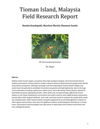
- 1. 1 Tioman Island, Malaysia Field Research Report Ramita Kondepudi, Sharlene Martin, Shannon Austin AP Environmental Science Ms. Began Abstract Without major human impact, ecosystems have high ecological integrity. AP Environmental Science students journeyed to Tioman Island to conduct research aimed at determining the quality of the island’s many diverse ecosystems. Although seemingly rural and undeveloped Tioman Island’s villages and resorts have the potential to annihilate the pristine ecosystems and high biodiversity. Due to the large tourist attractions including a golf course, airport, ferry, and scuba diving Tioman Island is exposed to potentially ecosystem degrading activities. Some of the sites surveyed already suffered the human impacts on the Island including the once pristine coral reefs turned to coral rubble by boats and anchors. Surveys taken of the tropical rainforest, coral reefs, and coast aimed to evaluate the quality of the water, soil, and food webs. While Tioman Island’s ecosystem appeared to be minimally affected in relation to other regions and countries, there was still significant evidence of anthropogenic disturbance in certain areas. Governments and local people must take action to help protect their pristine environment and rare, endangered species.
- 2. 2 1. Background/Aim 4 2. Biogeography of Pulau Tioman, Malaysia 6 3. Coral Reef Survey 8 a. Aim 8 b. Materials 8 c. Methods 8 d. Data and Observations 10 e. Results and Analysis 20 4. Coastal Ecosystems Survey 23 a. Aim 23 b. Materials 23 c. Methods 23 d. Data and Observations 25 e. Results and Analysis 28 5. Beach Profile 29 a. Aim 29 b. Materials 30 c. Method 30 d. Data and Observations 31 e. Results and Analysis 34 6. Rocky Shore Food Web 34 a. Aim 34 b. Materials 34 c. Methods 35 d. Data and Observations 35 e. Results and Analysis 36 7. Primary and Secondary Rainforest Surveys 38 a. Aim 38 b. Materials 38 c. Methods 39 d. Data and Observations 40 e. Results and Analysis 45 8. Soil Quality and Leaf Litter Analysis - Special Focus 45 a. Aim 45 b. Materials 45 c. Methods 46
- 3. 3 d. Data and Observations 50 e. Results and Analysis 57 9. Fresh Water Stream River Cross Section and River Velocity 58 a. Aim 58 b. Materials 58 c. Methods 58 d. Data and Observations 59 e. Results and Analysis 60 10. Macroinvertebrates Survey – Freshwater stream biotic index 61 a. Aim 61 b. Materials 62 c. Methods 62 d. Data and Observations 64 e. Results and Analysis 66 11. Mangroves 67 a. Aim 68 b. Materials and Equipment 68 c. Methods 71 d. Data and Observations 72 e. Results 72 12. Water Quality Index – Special Focus 73 a. Aim 73 b. Materials 73 c. Methods 75 d. Data, Observations, Analysis 77 13. Biodiversity and Real World Application 81 14. References 82
- 4. 4 Background The two AP Environmental Science classes went to Pulau Tioman, Malaysia to study how humans have impacted the island, conducting surveys of the coral reefs, coast, rocky shore, mangroves, tropical rainforest, and freshwater streams. Coral Reef Survey: Purpose: To evaluate the integrity of the coral reef ecosystem off of Tioman Island Objectives: To compare disturbed and pristine coral reef ecosystems To take a transect sampling of the ecosystem To observe the marine life in the ecosystem To determine the human impact on the ecosystem Calculations: Percentage cover: 𝑆𝑢𝑏𝑠𝑡𝑟𝑎𝑡𝑒 𝑇𝑜𝑡𝑎𝑙 𝑎𝑟𝑒𝑎 × 100 Coastal Ecosystems Survey: Purpose: To evaluate the integrity of the coastal ecosystems on Tioman Island Objectives: To compare disturbed and pristine coastal ecosystems To count and survey the different organisms living on the coast To understand the concepts of population density and frequency To learn about different sampling techniques To determine the human impact on the ecosystem Calculations: Population Density: 𝑚𝑒𝑎𝑛 𝑛𝑢𝑚𝑏𝑒𝑟 𝑜𝑓 𝑖𝑛𝑑𝑖𝑣𝑖𝑑𝑢𝑎𝑙𝑠 𝑐𝑜𝑢𝑛𝑡𝑒𝑑 𝑎𝑟𝑒𝑎 𝑜𝑓 𝑒𝑎𝑐ℎ 𝑞𝑢𝑎𝑑𝑟𝑎𝑡 Species Frequency: 𝑛𝑢𝑚𝑏𝑒𝑟 𝑜𝑓 𝑞𝑢𝑎𝑑𝑟𝑎𝑡𝑠 𝑤ℎ𝑒𝑟𝑒 𝑠𝑝𝑒𝑐𝑖𝑒𝑠 𝑖𝑠 𝑝𝑟𝑒𝑠𝑒𝑛𝑡 𝑡𝑜𝑡𝑎𝑙 𝑛𝑢𝑚𝑏𝑒𝑟 𝑜𝑓𝑞𝑢𝑎𝑑𝑟𝑎𝑡𝑠 × 100 Local Frequency: more than 50% in a quadrat’s sub square Beach Profile: Purpose: To study the morphology of a beach Objectives: To understand that beaches are subject to seasonal fluctuations To evaluate the impact of human actions on the profile To evaluate the impact of natural waves and tidal influence on the profile To learn to use a clinometer effectively Calculations: Change in height: (tan 𝐴) × 𝐵 o Where A is the gradient between intervals (degrees) o Where B is the length of the interval (meters)
- 5. 5 Rocky Shore Food web: Purpose: To construct a food web involving all organisms observed on the rocky shore Objectives: To understand the ecological relationships between organisms on the rocky shore To observe certain organisms in their natural habitat To observe these organisms’ responses to tide change To understand more about the trophic levels involved in a rocky shore food web Primary and Secondary Forest survey: Purpose: To survey and evaluate the human impact on primary and secondary forest survey sites Objectives: To evaluate the maturity of a forest To measure the height of trees and diameter of trees To apply different sampling techniques to the rainforest To appreciate and record the biodiversity of the tropical rainforest To learn to use tools specific to surveying, including clinometers and relascopes Calculations: Tree Height: 𝐵(tan 𝐴) − 𝐵 (tan 𝐶) o Where B is the angle of elevation from eye level o Where A is the angle of depression from the top of the tree o Where C is the approximate height of the tree Maturity Index: 𝑛𝑢𝑚𝑏𝑒𝑟 𝑜𝑓 outside trees 𝑛𝑢𝑚𝑏𝑒𝑟 𝑜𝑓 𝑖𝑛𝑠𝑖𝑑𝑒 𝑡𝑟𝑒𝑒𝑠 o “Outside” and “Inside” relative to the relascope Diameter at Breast Height (DBH): 𝐶𝑖𝑟𝑐𝑢𝑚𝑓𝑒𝑟𝑒𝑛𝑐𝑒 𝜋 Soil Quality and Leaf Litter Analysis Purpose: To investigate soil quality and its relation to human impact on the ecosystems it comes from Objectives: To evaluate the human impact on a particular ecosystem To understand the functioning of soil testing quality lab equipment To understand the multiple organisms that inhabit the forest soil Fresh Water Stream River Cross-Section and River Velocity Purpose: To investigate river velocity and the components of the river and its riparian area
- 6. 6 Objectives: To understand the different dimensions of a river To evaluate the human intrusion on the freshwater stream ecosystem To create a cross-sectional profile of the river To learn how to calculate the wetted perimeter of the river Macroinvertebrates survey Purpose: To investigate the macroinvertebrates living in the river and thus infer the quality of the river Objectives: To understand the importance of macroinvertebrates to a freshwater stream ecosystem To recognize the importance of water quality of the stream To understand the impact that riparian areas have on the stream Mangroves Purpose: To investigate the water and soil quality of a local mangrove, as well as understand the human impact on the ecosystem Objectives: To understand the importance of the mangroves as a whole ecosystem To evaluate the vulnerability of the mangroves to human intrusion To further apply water and soil quality measuring techniques To see the components of a mangrove tree, such as its knobby roots, live Water Quality Index Testing Purpose: To investigate the water quality from a number of ecosystems and thus understand the human impact on the environment Objectives: To understand the fragile balance of water quality in relation to the physicochemical parameters To understand the impact of poor water quality on organisms To calculate a final water quality index value Hands-on experiences, the field studies conducted on Tioman Island emphasized the important ecological roles of ecosystems and emphasized human impact on the environment. Data recorded and analysis of results will be discussed later in this report. Biogeography of Pulau Tioman, Malaysia 32 km off the coast of Malaysia, in the South China Sea, lies Tioman Island. Located near the Equator, at coordinate points 2o 49’ N 140o 11E, Tioman has a tropical rainforest climate. The climate is extremely hot and humid all year round with no winter or summer. Monsoon Season is between the
- 7. 7 Visual 2 This is the layout of Tioman Island which shows the different sites all around months of November and February. With the humidity at 89-92%, warm air, and heavy precipitation, Tioman Island can support high levels of biodiversity in its many different ecosystems. Visual 1 This is a climatogram for Malaysia, depicting average temperature and rainfall per month.
- 8. 8 Tioman Island contains many types of ecosystems. The primary forest in Tioman had tall, wide, spaced out trees, and a high canopy. In contrast, the secondary forest had slender, closely spaced, young and old trees, while there was no set canopy due to the different maturities of the trees. Yet, they both had many differences, they were found within relatively close proximity on Tioman Island. Similar to the rainforests the prominent differences between the undisturbed and disturbed ecosystems included bleached coral reefs, broken coral pieces, and less biodiversity in the disturbed areas. The coastal mangroves were covered in trash from the local villages that continually dump their wastes into the oceans or burn them. The trees looked to be in good condition and were held firmly in the ground by their roots. The eight main villages have a small population of 432 people, resulting in a minimum impact on the environment. Coral Reef Survey Aim “Photo Transects” were conducted to evaluate the quality of a coral reef ecosystem, using percentage cover as the basis of comparison between pristine and damaged coral reefs. The photos acted as quadrats, from which students retrospectively sampled after the photo was taken. Swimming strokes and direction were standardized, providing a means of systematic sampling that prevented bias in data collection. Materials The following materials were used in conducting the coral reef survey: 1 underwater camera Snorkeling material Methods Pictures of the survey site were taken, and the photo number and name of the survey site were recorded. A point in the distance was chosen to maintain constant direction as the swimming began. A photo with an open palm was taken, indicating the beginning of a transect. Every two breast strokes, another photo was taken. It was ensured that a constant distance above the reef was maintained throughout the transect; this was done by following the reef crest. At the end of the transect, a photo of a closed fist was taken. Finally, after the transect was finished, the photos were divided into subsections, each analyzed to estimate the percentage cover or frequency as necessary.
- 9. 9 Visual 3 The beginning of the transect photos symbolized by the open hand Visual 4 The end of the transect photos symbolized by the closed fist
- 10. 10 Data and Observations Undisturbed Coral Reef Visual 5 Transect photo, undisturbed coral reef #1: 30% coverage of coral
- 11. 11 Visual 6 Transect photo, undisturbed coral reef #2: 40% coverage of coral Visual 7 Transect photo, undisturbed coral reef #3: 45% coverage of coral
- 12. 12 Visual 8 Transect photo, undisturbed coral reef #4: 30% coverage of coral Visual 9 Transect photo, undisturbed coral reef #5: 30% coverage of coral
- 13. 13 Visual 10 Transect photo, undisturbed coral reef #6: 20% coverage of coral Visual 11 Transect photo, undisturbed coral reef #7: 90% coverage of coral
- 14. 14 Visual 12 Transect photo, undisturbed coral reef #8: 70% coverage of coral Visual 13 Transect photo, undisturbed coral reef #9: 80% coverage of coral
- 15. 15 Visual 14 Transect photo, undisturbed coral reef #10:85 % coverage of coral Disturbed Coral Reefs Visual 15 Transect photo, disturbed coral reef #1: 15% coverage of coral
- 16. 16 Visual 16 Transect photo, disturbed coral reef #2: 5% coverage of coral Visual 17 Transect photo, disturbed coral reef #3: 5% coverage of coral
- 17. 17 Visual 18 Transect photo, disturbed coral reef #4: 15% coverage of coral Visual 19 Transect photo, disturbed coral reef #5: 30% coverage of coral
- 18. 18 Visual 20 Transect photo, disturbed coral reef #6: 5% coverage of coral Visual 21 Transect photo, disturbed coral reef #7: 0% coverage of coral
- 19. 19 Visual 22 Transect photo, disturbed coral reef #8: 5% coverage of coral Visual 23 Transect photo, disturbed coral reef #9: 15% coverage of coral
- 20. 20 Transect photo Percentage coverage 1 30 2 40 3 45 4 30 5 30 6 20 7 90 8 70 9 80 10 85 Average 52 Percent coverage of live corals at undisturbed reefs Visual 24 Transect photo, disturbed coral reef #10: 5% coverage of coral Results and Analysis
- 21. 21 Transect photo Percentage coverage 1 15 2 5 3 5 4 15 5 30 6 5 7 5 8 0 9 15 10 5 Average 10 Percent coverage of live corals at disturbed reefs Visual 25 Tables and graphs summarizing the results of the coral reef survey
- 22. 22 According to the data the undisturbed coral reef looks to be in fair conditions, aside from the white edges on the purple- red tabletop coral. The white edges is a sign of the corals bleaching, this could be a result of high levels of salt in the water, temperatures outside of the tolerance zone, or even sunscreen from tourists. Although, exact data couldn’t be collected about the coral reef the photos do show us the integrity of the coral reef. The disturbed coral reef transects show how humans have destroyed the coral. Humans harm the reefs by, stepping on the coral, dumping garbage and harmful chemicals into the ocean, and mooring boats can break the coral if not done properly. However, since Tioman Island rely on tourism to make profits anchoring buoys have been installed to prevent damage to the coral reefs. These anchoring buoys consist of a cinder block or something stuck to the sea floor with a rope and buoy attached, when the boats need to moor they attach to the line connected to the weight. Thus preventing more damage done to the reef. Visual 26 This photo shows an anchor against the reef, and its chain is over the reef--it will drag back and forth, damaging the coral. This anchor is from a small kayak...imagining what the anchor of a larger boat might do! Visual 27 This is the proper way to anchor a boat.
- 23. 23 Coastal Ecosystems Survey Aim Organisms living in different zones in the intertidal area have adapted to live under varying environmental conditions. As abiotic conditions vary across the zones, the distribution and size of species also vary. Materials The following materials were used in conducting the coastal ecosystems survey: Two 50m tape measures One 0.5m X 0.5m quadrat square Visual 28 The materials used to conduct the coastal ecosystems survey - a quadrat and tape measure Methods At the survey site, a habitat observation and human impact assessment was conducted. The beach profile length was measured and a 50 meter transect line, with the 0 meter mark at the high tide area, was laid, towards the sea. The total length of the transect was divided into regular intervals, 5 meters in this case, to form an interrupted belt transect. At each quadrat, the substrate was recorded, forming the Point Intercept Transect method. Substrates found included coral rubble, turf algae, rock, or sand, abbreviated as CR, TA, RK, and SD respectively. The quadrat square was placed at the bottom left hand corner of the interval point and within it, the population density of sea cucumbers, percentage cover of padina, and the local frequency of sponge were measured and recorded.
- 24. 24 Visual 29 An example of padina found in the quadrat square. The percentage cover of the padina was determined by looking at each small square of the quadrat. If the padina covered at least 50% of the small square then the square was counted in the overall percentage Visual 30 The transect line used to conduct the survey
- 25. 25 Data and Observations Point Point Intercept Transect Density of sea cucumber (square meters) Percentage cover of padina (%) Local frequency of sponge (number per square meter) 44,21 TA/CR 0 0 0 49,49 SD/CR 0 4 0 29,39 SD/CR 0 1 0 44,30 SD/CR 0 0 0 48,49 CR/SD 1 7 0 6,17 CR/SD 0 0 0 34,32 CR/SD 0 7 0 29,16 SD/CR/TA 0 0 0 8,31 CR/SD 0 0 0 25,27 CR/SD 0 11 0 Pristine Coastal Environment - Random Sampling 1 Point Point Intercept Transect Density of sea cucumber (square meters) Percentage cover of padina (%) Local frequency of sponge (number per square meter) 45,04 SD 0 0 0 27,17 RK 0 0 0 36,14 RK 0 0 0 49,45 CR 0 0 0 22,15 TA 0 0 0 39,45 CR 0 0 0 03,43 TA 0 1 0 21,47 CR 0 1 0 45,26 CR 0 2 0 22,37 CR 0 3 0 Pristine Coastal Environment - Random Sampling 2
- 26. 26 Interval Point Intercept Transect Density of sea cucumber (square meters) Percentage cover of padina (%) Local frequency of sponge (number per square meter) 0 SD 0 0 0 5 SD 0 0 0 10 CR /SD 0 0 0 15 TA/SD 0 0 0 20 SD 0 0 0 25 RK/TA/SD 0 0 0 30 Other (Hermit crab)/SD/RK/TA 0 1 0 35 SD 0 0 0 40 SD/RK 0 4 0 45 SD/RK 0 2 0 50 SD 0 1 0 55 SD/RK 0 0 0 60 RK/TA 0 2 0 65 SD 0 0 0 70 SD 0 4 0 75 SD 0 2 0 80 SD 0 0 0 85 SD 0 2 0 90 SD 0 5 0 95 SD 0 2 0 100 SD 0 6 0 Disturbed Coastal Environment - Transect 1 Interval Point Intercept Transect Density of sea cucumber (square meters) Percentage cover of padina (%) Local frequency of sponge (number per square meter) 0 SD 0 0 0 5 SD 0 0 0 10 SD 0 0 0 15 RK 0 0 0 20 RK 0 0 0 25 RK 0 0 0 30 RK 0 0 0 35 SD 0 0 0 40 RK 0 0 0 45 RK 0 0 0 50 RK 0 1 0 55 CR 0 0 0 60 RK 0 0 0 65 SD 0 0 0 70 RK 0 1 0 75 RK 0 2 0 80 SD 0 1 0 85 SD 0 6 0 90 CR 0 2 0 95 RK 0 10 0 100 RK 0 18 0 Disturbed Coastal Environment - Transect 2
- 27. 27 Key to Point Intercept Transect: TA: Turf Algae CR: Coral Rubble SD: Sand RK: Rock Visual 31 The coral rubble found on the disturbed coast. The rubble is bits and pieces of dead coral and signifies poor health of the coral reefs. Visual 32 Sea cucumbers found in the coastal ecosystem
- 28. 28 Results and Analysis 0 0.2 0.4 0.6 0.8 1 1.2 1.4 1.6 1.8 2 Density of sea cucumber (square meters) Percentage cover of padina (%) Local frequency of sponge (number per square meter Average Random Sampling Findings of the Pristine Coastal Environment Visual 33 Graphic summaries of the Point Intercept Transect findings on the Coast
- 29. 29 The coastal ecosystems were found to be in reasonable condition. In the pristine environment, majority of the substrate that was surveyed was coral reef rubble, as oppose to the sand prevalent in the disturbed coastal section. The coral reef rubble may be the result of damaged coral washing up on shore during high tide, broken due to ship anchoring and recreational activities far out into the sea. Very little sea cucumbers were encountered, despite the high numbers present. The high density populations did not fall within the transects, therefore influencing the final coastal survey’s results. Padina was found numerous times, but no sponge was counted on both the disturbed and pristine coast. Human activity was evident on the disturbed coast. More sand implied that the area was used more for recreational, tourist purposes, especially since it was on the property of Melina Beach Resort. This may have impacted the numbers of organisms present on the coast. Tioman Island’s government must ensure that development for human purposes does not degrade the coastal environment, protecting the organisms that depend on the coast for survival. Beach Profile Aim Measuring beach profiles allowed students to survey the morphology of a beach. Over long periods of time in other studies, beach profiles have proved useful for measuring seasonal fluctuations of beach species as well as the comparison of beaches in different locations. (In background info or here?) Any coast is continually changing due to wave and tidal influences. The power of waves is a significant force that influences beach profile. The size and energy of a wave is dictated by the strength and duration of the wind that created them, and by the wave fetch (how far the wave has traveled). Waves can be categorized as either destructive (storm waves that tend to erode the coast) or constructive (calmer waves which tend to deposit material and therefore build up beaches). Longshore 0 0.2 0.4 0.6 0.8 1 1.2 1.4 1.6 1.8 density of sea cucumber (square meters) Percentage cover of padina (%) Local frequency of sponge (number per square meter Average Transect Findings of the Disturbed Coastal Environment Visual 34 Graphic representations of the transect results on the coast
- 30. 30 drift can occur where waves approach the coast at an angle, transporting material by human influence it can create splits, barriers and tidal inlets. Materials The following materials were used to conduct the beach profile: 1 clinometer 2 marked poles (preferably the same height) Beach Measuring tape Visual 35 An example of a clinometer used while surveying Method To begin, the measuring tape, starting from the high tide mark on the high shore, was rolled out towards the sea. The strip of beach being measured was divided into short, regular intervals. At both ends of the tape, long, vertical poles were placed and the person nearest to the low tide held the clinometer at the 1.4 meter mark. The angle of the clinometer was adjusted until it was directly focused on the 1.4 meter mark and the displayed value was recorded. This was repeated all the way throughout the beach to evaluate the entire profile of the beach. Differences in height between the two poles were then calculated.
- 31. 31 Data and Observations Visual 36 The results of the beach slope conducted by group A A Degree B (m) Change in height (m) 5 1 0.09 3 1 0.05 1 1 0.02 3 1 0.05 3 1 0.05 4 1 0.07 5 1 0.09 9 1 0.16 8 1 0.14 10 1 0.18 5 1 0.09 6 1 0.11 8 1 0.14 8 1 0.14 10 1 0.18 11 1 0.19 8 1 0.14 9 1 0.16 5 1 0.09 7 1 0.12 Disturbed Beach Slope A
- 32. 32 Visual 37 Graphic demonstrations of the beach slope results for group A Visual 38 The results of the beach slope conducted by group B A Degree B (m) Change in height (m) 3 1 0.05 13 1 0.23 10 1 0.18 9 1 0.16 6 1 0.11 4 1 0.07 5 1 0.09 9 1 0.16 2 1 0.03 1 1 0.02 4 1 0.07 7 1 0.12 6.5 1 0.114 6 1 0.11 11 1 0.19 9 1 0.16 8 1 0.14 9 1 0.16 9 1 0.16 7.5 1 0.13 Undisturbed Beach Slope B
- 33. 33 Visual 39 Graphic representations of the beach profile results of group B
- 34. 34 Visual 40 Where the beach profile was conducted Results and Analysis Based on the data groups A1and A2, collected on the disturbed site and the data from groups B3 and B4 on the undisturbed site have collected we have realized that the undisturbed beach has a fairly random slope. For example in Data Table 3 and Data Table 4 between the beginning our tape measurer to 18 meters, the change in height of the beach floor fluctuates randomly. An example of this would be in Data Table 2 at 2 meters the degree of the slope of the beach is at 3 degrees, at 3 meters the degree of the slope of the beach is at 1 degree, at 4 meters the degree of the slope of the beach is at 3 degrees. This experiment has its issues since how compact the soil is, can change the degree of the reading, because the poles can go in deeper with less compact soils than less compact soils. Rocky Shore Food Web Aim To explore the ecological relationships between organisms living on the rocky shore, a food web was constructed. The results were then analyzed to evaluate the sustainability of the community’s energy transfer system, in relation to the different trophic levels present and possible human intrusion. Materials The following materials were used in observing the organisms that play a role in the rocky shore food web as well as creating the food web: Notebook Mapping software – Bubbl.us
- 35. 35 Visual 41 The rocky shore where the survey was conducted Methods Each organism seen on the rocky shore while taking the coastal survey was recorded carefully in a notebook. After researching the ecological role and dietary habits of each of the organisms observed, a food web was created using an online mapping software. Data and Observations The following is a list of organisms observed on the rocky shore: Nudibranch Clam Algae Feather Duster Worm Christmas Tree Worm Sponges Goby shrimp Starfish Sea Urchin Sea Cucumbers Sea anemone Ghost crabs Padina Phytoplankton Humans Visual 42 A sea cucumber observed on the rocky shore
- 36. 36 Visual 43 Padina found growing on a rock at Melina Beach Visual 44 A crab, one of the many organisms found on Melina Beach Visual 45 A giant clam found on Melina Beach
- 37. 37 Results and Analysis The following key was used while constructing the food web according to trophic level: Arrows: energy transfer Yellow: sunlight Green: primary producers Orange: primary consumers Purple: secondary consumers Maroon: tertiary consumers Blue: detrivores Black: quaternary consumers The multiple trophic levels and complex relationship each organism has with the others are indicative of a healthy, highly biodiverse rocky shore ecosystem. Of the total twenty organisms observed and used in the construction of this food web, four were primary producers, six were primary consumers, six secondary consumers, one tertiary and quaternary consumer, as well as one detrivore. Visual 46 A constructed food web of all the organisms observed on the rocky shore, organized in terms of trophic level
- 38. 38 The different organisms found on the rocky shore, however, may not be limited to those highlighted here. Select areas of the shore were surveyed and therefore organisms only in these areas were recorded, leaving room for many other organisms that are not a part of this food web to take part in the ecological relationships. Given this data and food web, the high percentages of consumers as opposed to the relatively few primary producers may be a cause for concern. If over consumption of primary producers occurs or competition between consumers is very severe, leaving little for the primary consumers to feed on, the whole food web may collapse. Human intrusion may be attributed to significantly low numbers of producers, as humans may have picked them out or developments may have blocked sunlight or inhibited other environmental conditions allowing other primary producers to live. The human consumption of detrivores such as sea cucumbers may also destabilize the food web, preventing nutrients from being recycled rapidly, thus inhibiting the growth of primary producers. The sustainability of the food web may be at risk due to the high percentage of consumers present. Primary and Secondary Rainforest Surveys Aim Surveys of the primary and secondary rainforest were conducted to evaluate the integrity of the ecosystem. The sizes of tree trunks and height, along with maturity, seedling and sapling count, a reading of light intensity, and canopy closure were accounted for in the analysis of the integrity of the primary and secondary rainforest. Materials The following equipment was needed to conduct the rainforest surveys: Calipers Measuring tape Clinometer Transect line Relascope Notebook Visual 47 A relascope being used to determine the maturity index of the trees in the primary forest
- 39. 39 Methods Maturity: To conduct the maturity of the trees a relascope was held at eye level and one person would spin around slowly in a small circle 360 degrees, counting every single tree and determining if it was in between the two lines or outside the lines. Another person made tally marks whither the tree was inside or outside the lines. The maturity index of the trees was determined by dividing the number of trees outside the lines by the number of trees inside the lines. Visual 48 A demonstration of what the trees would look like inside versus outside of the lines Tree Height: The tree height was conducted by using a clinometer to record the angle to the top of the tree and to the bottom. A person would stand 10 meters away from the tree and point the clinometer at the top of the tree. The trigger would be released and when the disk stops moving release the trigger and record the angle to the top of the tree. Repeat to the base of the tree and record the angle to the bottom of the tree. Use basic trigonometry to determine the height of the tree. The formula used to determine the height of the tree. Tree height= (distance from the tree)(tan angle to the top of the tree)- (distance from the tree)(tan angle to the base of the tree) Diameter: To determine the diameter of the trees, a diameter tape at 1.3 meters above was held and wrapped around the tree. Seedling and Sapling Counts: A 5 meter by 5 meter quadrat was laid out using strings and stakes. Lay out a quadrat that is 5m by 5m using string and sticks. Count the number of seedling and saplings within the quadrat. A seedling is less than 1 meter high and saplings are between 1 and 6 meters high. Record how many are of each are in the quadrat. Light Intensity: The light meter was turned on, the cap was removed from the light sensor. After standing in the center of the quadrat, eyes were closed and the person in the middle counted to five. The first number seen when the eyes were again opened was recorded; this was repeated at each corner of the quadrat. Canopy Closure: The camera was squarely pointed upwards towards the canopy and a picture was taken. This was done in the center and at each corner of the quadrat.
- 40. 40 Visual 49 The transect line being laid out in the secondary forest Visual 50 Measuring the diameter of a tree with the diameter tape
- 41. 41 Data and Observations Tree # 1 2 3 4 5 6 7 8 9 10 Angle A 44 56 26 60 60 37 35 72 55 40 B(distance from tree) 10 10 10 10 10 10 10 10 10 10 Angle C -13 -9 -4 -8 -13 -12 -10 -15 -11 -12 Tree Height 11.97 16.41 5.58 18.73 19.63 9.66 8.77 33.46 16.23 10.52 Diameter(cm) 8.89 30.48 9.398 43.688 7.62 8.89 10.16 64.77 12.7 4.6 Circumference (feet) 11 37.7 11.62 54.04 9.42 11 12.57 80.11 15.71 14.45 Tree HeightandDiameterforPrimaryForest Team Light Intensity (lux) Maturity Index: Young (numbers of trees) Maturity Index: Mature (numbers of trees) A1 231.24 50 50 A2 133.5 40 20 B3 385.4 81% 19 B4 678.2 45 55 Average Light Intensity and Maturity in Primary Forest
- 42. 42 Visual 51 The canopy cover in the primary forest Tree # 1 2 3 4 5 6 7 8 9 10 Angle A 30 40 47 36 50 49 34 44 47 28 Angle B 10 10 10 10 7 9 5 5 10 10 Angle C -11 -15 -8 -7 -17 -11 -16 -12 -14 -10 Tree Height (m) 7.72 11.07 12.13 19.54 10.48 12.1 4.81 5.89 13.22 7.08 Diameter(cm) 2.86 5.65 6.57 1.87 5.65 11.23 2.79 11.46 32.05 27.04 Circumference (cm) 0.75 1.48 1.72 0.49 1.48 2.94 0.73 3 8.39 7.08 Tree Heightand DiameterforSecondary Forest Team Light Intensity (lux) Maturity Index: Young (numbers of trees) Maturity Index: Mature (numbers of trees) A1 283.12 93 7 A2 222.24 20 18 B3 50.6 56 44 B4 201.2 63 36 Average Light Intensity and Maturity in Secondary Forest
- 43. 43 Visual 52 The canopy cover in the secondary forest Visual 53 A pill bug found on the hike to the primary and secondary forest Visual 54 A caterpillar found in the forest
- 44. 44 Visual 55 A rare Trilobite beetle Visual 56 A mature tree in the primary rainforest Visual 57 A monitor lizard found on a popular beach where we had lunch
- 45. 45 Results and Analysis The purpose of the rainforest survey was to determine the integrity of the ecosystem. According to the overwhelming data, the main differences between the primary and secondary rainforests shows that the trees in the primary forest are both taller and thicker than the trees in the secondary rainforest. Indicating that the secondary forest had once been cut possibly for palm oil plantations. Consequently to groups A1 and A2, the light intensity for the secondary forest is lower than the primary forest for groups B3 and B4. This could be affected by the cloud cover during the period that the groups took their data since the data was taken at different time periods. Many of these sampling techniques are not very precise and this could lead to error. However, most of the data does correspond to theory, with the tree height, maturity, and diameter all being greater in the primary forest. Soil Quality and Leaf Litter Analysis - Special Focus Aim The aim of the soil quality data analysis was to determine the quality of the different rainforests and compare the secondary and primary rainforests. This was achieved by qualitatively and quantitatively sampling the two different forests. The tests included the ribbon test, moisture, organic matter, percolation rate, porosity, percent composition, texture, pH, phosphate, nitrate, potassium, leaf litter organisms, and humus. With these tests, the quality of the soil in primary and secondary forests was ascertained. Materials Soil Soil testing kit Nitrate testing kit Phosphate testing kit Potassium testing kit pH testing kit Humus 100 mL graduated cylinder 250mL beaker Drying oven Ring stand and burner Filter paper Ethanol Heat lamp Burlese funnel Hand lens Aluminum foil Porcelain crucible Ruler Hot plate Weighing scale
- 46. 46 Other materials and equipment Light intensity probe Thermometers Methods Soil testing: A large sample of soil from the mangroves was collected and any stones, roots, grass, or thatch were removed. Ambient temperature, light intensity, humidity, and images of the vicinity were recorded. General observations, including any remaining organic matter – worms, insects, plant roots – were recorded before testing occurred. Visual 58 A soil sample being collected using a soil corer Soil texture: Soil texture was evaluated qualitatively by taking a small, moist wad of soil and rubbing it against the thumb and forefinger. Gritty texture suggested a soil sample mainly constituted of sand, sticky implied clay, and neither sticky nor gritty was found to be silt. Long, unbroken ribbons of soil were made; if these stayed holding, it was confirmed that the sample was clay. Short ribbons were found to be silt or loam and no ribbons being able to be formed suggested sand or sandy loam. Pouring a certain volume of soil into a 100 mL empty graduated cylinder performed quantitative soil testing. Water was added until the meniscus reached the 100 mL mark and the waterlogged sample was shaken several times. Left alone for over 24 hours to settle, the soil sample’s different colored sections were measured. Particles on the bottom were measured to be large and dense, hence sand, while in the middle, silt was settled, and on the top, the fine clay particles were found. The percentage of silt, sand, and clay was measured of the sample and applied to a soil triangle to understand the type of soil. Using a soil testing kit, pH, phosphorus, nitrogen, potassium, and humus levels were ascertained from the physical sample.
- 47. 47 Visual 59 A soil triangle used to determine the classification based on the percentage of sand, silt, and clay Visual 60 Nitrogen testing kit for soil
- 48. 48 Soil moisture: Soil moisture was found by taking a series of steps to measure the amount of water in the sample. A small aluminum foil tray was formed and a small scoop of soil was placed onto it; masses were recorded before and after the soil was added. Over 24 hours, the soil sample was placed in a drying oven at a temperature of 90 to 95 degrees Celsius and at the end, the final mass was recorded again. The percentage of mass lost was found to be the soil moisture quantity. Percent Organic Matter: A cleaned, dry crucible was obtained and massed. It was filled with ¾ of soil and placed in a drying oven of 90 to 95 degrees Celsius to evaporate any water. Once this is finished, the final mass of the crucible and soil was recorded. The crucible was then placed on a ring stand in a fume hood, using an iron ring and pipe-stem triangle, and heated for 30 minutes. The mass of the crucible and soil was measured again. Soil porosity: To determine soil porosity, a 250 mL beaker was filled with dried soil to the 200 mL mark. Then a 100 mL graduated cylinder was filled to the 100 mL mark with water and the water was poured onto the surface of the soil until it became completely saturated. As water began to pool on the surface, the amount of water used was found to be the amount of pore space in the sample of soil. Soil dry percolation rate: To measure how fast water flowed through the dry soil, a small piece of filter paper was first placed in the neck of a 16-oz water bottle. This funneled section was set into the bottom part of the water bottle so that water draining through was collected. These steps were repeated for each sample of sand, clay, and soil. The percolation rate was recorded in cubic centimeters of water per surface area of sample per second. This was done by calculating the cross-sectional area of the funnel, pouring water onto the surface of each sample and recording the time it took for the water to hit the surface of the bottom. The final water volume and elapsed time was recorded. Counting macroinvertebrates: The top of a 2 liter clear soda bottle was cut 2 to 3 cm below where the sides become parallel. 20 to 25 mL of ethanol was placed in the bottom part of the bottle, while the funnel was placed on top. A section of wired mesh was placed in the neck of the funnel, then filled with soil and humus sample about 2 cm from the rim. A heat lamp about 10 cm away from the surface of the soil was placed to speed up the drying and help drive organisms to the bottom of the funnel. The organisms fell into the ethanol in preparation to be identified and counted. Visual 61 pH testing kit for soil
- 49. 49 Visual 62 A Burlese funnel with the light at top and ethanol- water mixture to petrify the organisms when they fall into the beaker Visual 63 Leaf litter in the secondary forest
- 50. 50 Site Gritty (sand) Sticky (clay) Neither (silt) Primary Rainforest A1 No No Yes Primary Rainforest A2 No No Yes Primary Rainforest B3 No Trace Trace Primary Rainforest B4 No No Yes Secondary Rainforest A1 No Trace Trace Secondary Rainforest A2 No No Yes Secondary Rainforest A3 No No Yes Secondary Rainforest A4 No Trace Trace Mangrove A1 Yes No Trace Mangrove A2 Yes No No Mangrove B3 Yes No No Mangrove B4 Yes No No Melina Beach Clay Sample A1 Trace No Trace Melina Beach Clay Sample A2 No Yes Trace Melina Beach Clay Sample A3 Yes Yes No Melina Beach Clay Sample A4 No Yes No Qualitative Soil Texture Visual 65 A summary of results from the qualitative soil tests Data and Observations % Mass Loss Primary Rainforest A1 2.56% Primary Rainforest A2 3.33% Primary Rainforest B3 1.79% Primary Rainforest B4 no data Secondary Rainforest A1 0.02% Secondary Rainforest A2 2.98% Secondary Rainforest A3 1.95% Secondary Rainforest A4 no data Mangrove A1 0.06% Mangrove A2 8.12% Mangrove B3 1.52% Mangrove B4 no data Melina Beach Clay Sample A1 0% Melina Beach Clay Sample A2 2.56% Melina Beach Clay Sample A3 no data Melina Beach Clay Sample A4 no data Soil Moisture Visual 64 A summary of soil moisture tests from all samples
- 51. 51 Volume of Soil (ml) Amount of Water Soil Absorbed (ml) Porosity (%) Primary Rainforest A1 20 ml 10 ml 100 Primary Rainforest A2 15 ml 6 ml 40 Primary Rainforest B3 no data no data no data Primary Rainforest B4 no data no data no data Secondary Rainforest A1 20 ml 9 ml 90 Secondary Rainforest A2 13 ml 6 ml 46 Secondary Rainforest A3 no data no data no data Secondary Rainforest A4 no data no data no data Mangrove A1 20 ml 5 ml 50 Mangrove A2 100 ml 36.5 36.5 Mangrove B3 no data no data no data Mangrove B4 no data no data no data Melina Beach Sand Sample A1 20 ml 20 ml 100 Melina Beach Clay Sample A2 13 ml 6 46 Melina Beach Clay Sample A3 no data no data no data Melina Beach Clay Sample A4 no data no data no data Soil Porosity Visual 67 A summary of soil porosity testing Soil Type Total height (ml) Silt (ml) Silt % Sand (ml) Sand % Clay (ml) Clay % Water and Soil Height (ml) Primary Rainforest 22 4 18.18% 17 77.27% 0 0.00% 98 Secondary Rainforest 19 4 21.05% 12 63.16% 5 26.32% 94 Mangrove 21 3 14.29% 16 76.19% 3 14.29% 97 Melina Beach (clay sample) 21 5 23.81% 12 57.14% 2 9.52% 105 Quantitative Soil Texture Visual 66 A summary of quantitative soil texture testing
- 52. 52 Soil Sample (Vol/Sec) Sand at Melina Beach no data Clay at Melina Beach no data Primary Rainforest (A1) no data Primary Rainforest (A2) 0.27 Primary Rainforest (B3) no data Primary Rainforest (B4) no data Secondary Rainforest (A1) no data Secondary Rainforest (A2) 0.23 Secondary Rainforest (B3) no data Secondary Rainforest (B4) no data Mangroves (A1) no data Mangroves (A2) 0.32 Clay (control) 0.02 Sand (control) 0.33 Water Percolation Rate Location, group Mass of empty crucible (g) Volume of Soil (g) Mass of crucible and Soil (g) Mass of crucible and soil after heating (g) % organics in sample Primary Rainforest A1 38.57 31.77 70.34 50.84 27.72 Primary Rainforest A2 no data no data no data no data no data Primary Rainforest B3 61.4 no data 94.89 no data no data Primary Rainforest B4 no data no data no data no data no data Secondary Rainforest A1 42.75 38.83 81.58 79.89 2.07 Secondary Rainforest A2 no data no data no data no data no data Secondary Rainforest B3 35.53 no data 68.47 no data no data Secondary Rainforest B4 no data no data no data no data no data Mangrove A1 41.13 57.34 98.47 92.84 5.72 Mangrove A2 72.07 50 125.74 no data no data Mangrove B3 44.5 no data 47.4 no data no data Mangrove B4 no data no data no data no data no data Melina Beach A1 40.93 21.37 62.3 62.25 0.08 Melina Beach A2 no data no data no data no data no data Melina Beach B3 no data no data no data no data no data Melina Beach B4 no data no data no data no data no data Organic Matter Visual 68 A summary of water percolation rate testing results Visual 69 A summary of organic matter testing results
- 53. 53 Visual 70 A summary of soil fertility testing results Visual 71 Qualitative soil tests results per site and group, comparing sand, silt, and clay amounts Location Soil Moisture (% mass lost) Percent Organic Matter (%) pH Phosphate (Trace, High, Low, Medium) Nitrate (Trace, High, Low, Medium) Potassium (Trace, High, Low, Medium) Humus Sand at Melina Beach no data no data no data no data no data no data no data Clay at Melina Beach no data no data 8 Trace Trace Low 0 Primary Rainforest (A1) no data 27.72% 5 Trace Trace High 1 Primary Rainforest (A2) no data no data 6.7 Trace Trace High 3 Primary Rainforest (B3) 1.79% no data 6.1 Trace Trace High 2 Primary Rainforest (B4) no data no data 5 Trace no trace High 1 Secondary Rainforest (A1) no data 2.07% 7 Trace Trace High 1 Secondary Rainforest (A2) no data no data 5.5 Trace Low High 1.5 Secondary Rainforest (B3) 1.95% no data 5.3 Trace Trace High 1.1 Secondary Rainforest (B4) no data no data 5 Trace no trace High 1 Mangroves (A1) no data 5.72% 7 Trace trace High 3 Mangroves (A2) no data no data 7 Trace Trace High 1.5 Soil Fertility Testing
- 54. 54 Secondary Rainforest Soil Composition Silt % Sand % Clay % Primary Rainforest Soil Composition Silt % Sand % Clay % Visual 72 Primary rainforest soil composition percentages Visual 73 Secondary rainforest soil composition percentages
- 55. 55 Mangrove Soil Composition Silt % Sand % Clay % Visual 74 Mangrove soil composition percentages Melina Beach (clay sample) Soil Composition Silt % Sand % Clay % Visual 77 Melina Beach soil composition percentages 0.00% 1.00% 2.00% 3.00% 4.00% 5.00% 6.00% 7.00% 8.00% 9.00% PercentageofMassLost Sampling site Soil Moisture indicated by mass lost in samples from sites % Mass Loss Visual 75 Soil Moisture comparing the site with the percentage of mass lost Visual 76 Soil porosity results
- 56. 56 Visual 78 Water Percolation Rate per site measured in volume/ second 0 0.05 0.1 0.15 0.2 0.25 0.3 0.35 Primary Rainforest (A2) Secondary Rainforest (A2) Mangroves (A2) Clay (control) Sand (control) WaterPercolationRate(vol/sec) Sampling site Water Percolation Rate at Sampling sites 0 20 40 60 80 100 120 PrimaryRainforestA1 PrimaryRainforestA2 PrimaryRainforestB3 PrimaryRainforestB4 SecondaryRainforest… SecondaryRainforest… SecondaryRainforest… SecondaryRainforest… MangroveA1 MangroveA2 MangroveB3 MangroveB4 MelinaBeachSand… MelinaBeachClay… MelinaBeachClay… MelinaBeachClay… Volumeofsoilandamountofwater Sampling site Soil porosity Volume of Soil (ml) Amount of Water Soil Absorbed (ml)
- 57. 57 Visual 79 Organic Matter in soil from different sites Visual 80 Soil Fertility per site and team for phosphate, nitrate, and potassium the trace was 1, low was 4, and high was 9 Results and Analysis The data collected suggested a good integrity ecosystem. Not only was this determined by the general observations of the site, but also through soil fertility testing, moisture, organic matter, porosity, and percolation rate. In the mangroves tested the mangrove trees seemed to be in fair condition. The moisture content of the mangroves was high due to the water that covers the ground during high tides. Because the mangrove soil was a large percentage of clay, the soil had a high percolation rate of 3.2 ml/sec. The high sand content benefits the mangroves because of the water that is continually passing 0 1 2 3 4 5 6 7 8 9 10 pHlevel,Trace=1,Low=4,High=9 Sampling site Soil Fertility Soil Fertility pH Soil Fertility Phosphate (Trace, High, Low, Medium) Soil Fertility Nitrate (Trace, High, Low, Medium) Soil Fertility Potassium (Trace, High, Low, Medium) Soil Fertility Humus
- 58. 58 through it. A few things could lower the integrity of the mangroves, two of the main issues due to human interference is the trash caught in the tree roots and the humans playing in the water near the mangroves. When visiting the mangroves, many people were observed playing in the water and a few pieces of garbage were seen. In the primary and secondary rainforest the secondary forest had less integrity than the primary forest based on the data collected. More organic matter was found in the primary forest when compared with the secondary forest, which indicates lower soil quality. This could be because of the human impact on the secondary forest. The secondary forest was located closer to the village and had water pipes along the path. Another impact humans have on the rainforest that was apparent in the primary forest was the compaction of the soil along the trail path. This compaction prohibits the roots of the trees from easily spreading and can cause competition for root growth. The trail compaction is mostly due to the large, frequent number of people traveling through the forest. But, the integrity of the primary forest was better due to the distance away from the village. Because the secondary forest had more exposure to human impacts the secondary forest had lower levels of humus, higher levels of nitrate, and larger clay composition than the primary forest. These all contribute to lower integrity of a forest. However, the vegetation in the secondary forest as well as the primary forest seemed to be thriving showing that the human impact on the rainforests in Tioman is moderate, if not minimal. Fresh Water Stream River Cross Section and River Velocity Aim The freshwater stream river survey was conducted to determine the topography of the river and how it relates to the quality of the stream. The depth, width, and velocity of the stream directly correlate with the quality of the stream. Combined with the macroinvertebrates survey and WQI the integrity of the stream can be determined. Materials Measuring Tape Chain Bobbers Stopwatch Methods Wetted Perimeter: The chain was laid across the river, allowing it to sink in so it would form the contours of the bottom of the stream. Where the stream ends was marked and the distance of the chain was measured. River Velocity: A 10 meter stretch of the stream was measured; two people stood at either end of the 10 meters. The person upstream dropped five bobbers in the water at the left, right, and center of the stream. The person downstream started the stopwatch when the person upstream released the bobber, and stopped the timer as the bobber reached them. If the bobber got stuck, 1 minute was waited before it was picked up.
- 59. 59 Visual 81 Determining the river velocity downstream River Cross Section: Tape from one end of the stream to the other was lain to find the width of the stream, along with the bank width. This was repeated 10 to 15 times along the stream’s length. The depth of the stream was determined by starting at the edge of the stream and using ranging poles to measure the depth of water ever 20 cm. Data and Observations Visual 82 A summary of the secondary forest river velocity testing Position 1st Reading 2nd Reading 3rd Reading 4th Reading 5th Reading Average Surface Velocity (m/s) Left Stuck, 5m, 3:00 Stuck, 1.5m, 3:00 Stuck, 2m, 3:00 Stuck,1.5 m, 3:00 Stuck, 8m, 3:00 3.6m, 180sec (3 minutes) .02 m/sec Middle 24 sec 19 sec 20 sec 21 sec Stuck, 8m, 3:00 9.6m, 52.8 sec .18m/sec Right 15 sec 14 sec 16 sec 15 sec 14 sec 10m, 14.8 sec .67m/sec Secondary Forest River Velocity Readings
- 60. 60 Visual 83 A summary of the secondary forest river cross section survey Results and Analysis Using this data, it can be concluded that the stream measured has a fairly good integrity. Also, from this data it can be predicted that the area measured is located in the lower stage of the stream due to the wide width of the stream, shallow depth, and slow velocity. As a stream starts its journey at the top of a mountain, the water is fast flowing with low energy potential, resulting in large angular substrates such as boulders. This stage of the stream was seen during the hike up to the primary forest. After the upper stage is the middle stage of the river, characterized by the medium flowing water, higher energy potential, deep water, and steep banks caused by the erosion of the water. Finally the lower stage is identified by the shallow water, wide stream, and slow moving water that deposits sediments as the water slows. In the tourist season, many people come to play in the lower stage of the stream. This can raise the turbidity of the stream, affect the chemical composition of the water, and erode the bank depositing sediments into the stream because of people walking in and out of the stream. Excess sediments in the water can eventually block the stream and inhibit it from reaching the sea. Interval Distance from bank (cm) Stream Depth (cm) 1 76 10 2 152 12 3 228 21 4 304 42 5 380 46 6 456 45 7 532 19 8 608 5 9 684 4 10 0 0 Average Depth: 20.4 cm Stream Width: 7.6 m Bank Width: 7.6 m Secondary Forest River Cross Section
- 61. 61 Visual 84 A graph showing the depth of the stream in relation to the distance from the bank Macroinvertebrates Survey – Freshwater stream biotic index Aim The macroinvertebrates survey was used to determine the quality of the stream by identifying is to determine the quality of the stream by identifying the different species that were sensitive or tolerant. This was used in conjunction with the water quality index value of the stream to determine the integrity of the freshwater stream.
- 62. 62 Materials The following materials were used to conduct the macroinvertebrates survey: Net Species Key Ethanol Alcohol Tweezers Methods A net was held behind the sampling area, ensuring that water flowed from the site directly into the net and bottle. Bottom silt was disturbed through kicking, hence the procedure used was called kick sampling, to release organisms needed to be caught by the net. Organisms were then bottled and placed in ethanol to petrify them. A key was used to identify organisms and finally determine the quality of the stream. Visual 85 Pre sorting the macroinvertebrates
- 63. 63 Visual 86 Back at the resort sorting and identifying the organisms Visual 87 After sorting the macroinvertabrates
- 64. 64 Data and Observations Visual 88 The results from the macroinvertebrates sorting Visual 89 The results from the macroinvertebrates sorting
- 65. 65 Sensitive organisms Frequency Somewhat sensitive organisms Frequency Tolerant organisms Frequency Caddisfly Larvae 0 Beetle Larvae 0 Aquatic Worms 0 Hellgramite 0 Clams 0 Blackfly Larvae 0 Mayfly Larvae 0 Crane Fly Larvae 0 Leeches 0 Gilled Snails 0 Crayfish 0 Midge Larvae 9 Riffle Beetle Adult 0 Damselfly Larvae 0 Lunged Snails 2 Stonefly Larvae 0 Dragonfly Larvae 0 Shrimp 32 Water Penny Larvae 0 Scuds 0 Waterstriders 2 Sowbugs 0 Lung Snails 0 Fishfly Larvae 0 Alderfly Larvae 0 Macroinvertebrates and their frequencies, downstream Total Index Value: 4, Poor Table 1 and 2: Macroinvertebrates found in the Freshwater Stream in both upstream and downstream regions
- 66. 66 0 5 10 15 20 25 30 35 NumberofOrganisms Macroinvertebrates Number of Macroinvertebrates found in the Freshwater Stream (downstream) Sensitive Somewhat Sensitive Tolerant Visual 92 A summary of the macroinvertebrates survey downstream Results and Analysis Visual 90 A summary of the macroinvertebrates survey upstream Visual 91 A summary of the macroinvertebrates survey upstream
- 67. 67 Based on the number of organisms and their sensitivity to water conditions the overall quality of the upstream region was found to be in relatively good condition, while downstream was concluded to be of poor condition. In the upstream survey, the presence of a few sensitive and somewhat sensitive organisms add to the integrity and quality of the stream, suggesting that the water is suitable for organisms that would easily perish in polluted water. This demonstrates that the upstream region of the freshwater stream is less accessed by the local people; it is fairly well hidden within the secondary tropical rainforest as well. The riparian area was mostly intact, providing better filtration for the water flowing through as well as habitats for the large macroinvertebrates that can’t survive in water. In contrast, the downstream region of the stream seems to be trampled through often. With an overall index value of 4, the poor condition of the water limits the types of macroinvertebrates that can survive. Thus, only tolerant organisms, such as shrimp, were found in the poor quality downstream sample. The riparian area may have been of a lower quality, limiting the filtration the water received. The macroinvertebrates sampled and separated however, are only representative of a small area of the upstream and downstream sections of the water flow. Kick sampling, in addition, may have forced some macroinvertebrates to float away with the current, so the full range of organisms may not have been caught and categorized. Seemingly small and insignificant, the analysis of macroinvertebrates living in a stream reveals a lot about the quality of the water. When the water quality improves with less disruption and less pollution, the macroinvertebrates in turn will diversify, signifying a healthier freshwater stream. Mangroves Visual 93 A summary of the macroinvertebrates survey downstream
- 68. 68 Aim Quality of water and soil in the Paya Mangroves of Tioman Island were tested to evaluate the ecological integrity and sustainability of the area. An overall water quality index value was calculated using the percent saturation of dissolved oxygen, pH, nitrate and phosphate levels, total dissolved solids as well as total suspended solids. Soil quality was tested using the percolation rate, soil porosity, mass of organic matter in the sample, organisms present, soil texture, and moisture. Other conditions such as humidity, light intensity, air temperature, water temperature, conductivity, and salinity were also measured. Materials and Equipment The following equipment was used in testing water and soil quality in the mangroves: Water Dissolved oxygen testing kit Nitrate testing kit Phosphate testing kit pH probe Humidity probe Conductivity probe Refractometer Turbidity kit Thermometers Soil Soil testing kit Nitrate testing kit Phosphate testing kit Potassium testing kit pH Visual 94 Mangrove site, with the knobby roots showing above the sand
- 69. 69 Humus 100 mL graduated cylinder 250mL beaker Drying oven Ring stand and burner Filter paper Ethanol Heat lamp Burlese funnel Hand lens Aluminum foil Porcelain crucible Ruler Hot plate Weighing scale Other materials and equipment Light intensity probe Thermometers Visual 95 A CHEMet dissolved oxygen kit
- 70. 70 Visual 96 Shannon tests the pH of the mangrove water
- 71. 71 Methods Soil and water samples from the Paya mangrove site were taken and tested for certain physicochemical parameters as well as quality. Specific actions taken are below: Soil testing Soil texture and fertility Soil texture was evaluated qualitatively by taking a small, moist wad of soil and rubbing it against the thumb and forefinger. Gritty texture suggested a soil sample mainly constituted of sand, sticky implied clay, and neither sticky nor gritty was found to be silt. Long, unbroken ribbons of soil were made; if these stayed holding, it was confirmed that the sample was clay. Short ribbons were found to be silt or loam and no ribbons being able to be formed suggested sand or sandy loam. Quantitative soil testing was performed by pouring a certain volume of soil into a 100 mL empty graduated cylinder. Water was added until the meniscus reached the 100 mL mark and the waterlogged sample was shaken several times. Left alone for over 24 hours to settle, the soil sample’s different colored sections were measured. Particles on the bottom were measured to be large and dense, hence sand, while in the middle, silt was settled, and on the top, the fine clay particles were found. The percentage of silt, sand, and clay was measured of the sample and applied to a soil triangle to understand the type of soil. Using a soil testing kit, pH, phosphorus, nitrogen, potassium, and humus levels were ascertained from the physical sample. Soil moisture Soil moisture was found by taking a series of steps to measure the amount of water in the sample. A small aluminum foil tray was formed and a small scoop of soil was placed onto it; masses were recorded before and after the soil was added. Over 24 hours, the soil sample was placed in a drying oven at a temperature of 90 to 95 degrees Celsius and at the end, the final mass was recorded again. The percentage of mass lost was found to be the soil moisture quantity. Percent Organic Matter A cleaned, dry crucible was obtained and massed. It was filled with ¾ of soil and placed in a drying oven of 90 to 95 degrees Celsius to evaporate any water. Once this is finished, the final mass of the crucible and soil was recorded. The crucible was then placed on a ring stand in a fume hood, using an iron ring and pipe-stem triangle, and heated for 30 minutes. The mass of the crucible and soil was measured again. Soil porosity To determine soil porosity, a 250 mL beaker was filled with dried soil to the 200 mL mark. Then a 100 mL graduated cylinder was filled to the 100 mL mark with water and the water was poured onto the surface of the soil until it became completely saturated. As water began to pool on the surface, the amount of water used was found to be the amount of pore space in the sample of soil. Soil dry percolation rate To measure how fast water flowed through the dry soil, a small piece of filter paper was first placed in the neck of a 16-oz water bottle. This funneled section was set into the bottom part of the water bottle so that water draining through was collected. These steps were repeated for each sample of sand, clay, and soil. The percolation rate was recorded in cubic centimeters of water per surface area
- 72. 72 of sample per second. This was done by calculating the cross-sectional area of the funnel, pouring water onto the surface of each sample and recording the time it took for the water to hit the surface of the bottom. The final water volume and elapsed time was recorded. Counting macroinvertebrates The top of a 2 liter clear soda bottle was cut 2 to 3 cm below where the sides become parallel. 20 to 25 mL of ethanol was placed in the bottom part of the bottle, while the funnel was placed on top. A section of wired mesh was placed in the neck of the funnel, then filled with soil and humus sample about 2 cm from the rim. A heat lamp about 10 cm away from the surface of the soil was placed to speed up the drying and help drive organisms to the bottom of the funnel. The organisms fell into the ethanol in preparation to be identified and counted. Data and Observations Visual 97 A summary of the mangrove testing results Results The results of the water and soil testing at the Paya Mangrove site demonstrate that the ecosystem is of acceptable, if not average, quality. The relatively low water quality index value of 49.18, out of 100, was due to low dissolved oxygen levels, and absolutely no nitrates or phosphates in the water. Soil testing revealed a neutral pH, trace levels of phosphates and nitrates, high potassium levels, and varying humus levels. While high potassium levels in the soil are necessary for strong plant growth, the lack of nitrates and phosphates may have contributed to the limited plant life around the Paya mangrove site. Since the samples of soil and water collected were representative of only a section of the site, not the whole ecosystem, it is possible that the results are not applicable on a larger scale. The poor Test Q-Value Weighting Factor TOTAL Dissolved Oxygen 5.5 PPM 60% Sat 58 0.17 9.86 pH 5.57 units 43 0.11 4.73 Temperature Change no data ° C 0.11 0 Fecal Coliform no data colonies/100mL 0.16 0 BOD no data mg/L 0.16 0 Nitrate 0 mg/L 98 0.11 10.78 Total Phosphates 0 mg/L 100 0.1 10 Total Dissolved Solids 21.9 mg/L 83 0.07 5.81 Total Suspended Solids 17.8 feet or NTUs 100 0.08 8 Test Results A2 Paya Mangrove Water Quality WQI = 49.18 Soil Soil Moisture (% mass lost) Percent Organic Matter (%) pH Phosphate (Trace, High, Low, Medium) Nitrate (Trace, High, Low, Medium) Potassium (Trace, High, Low, Medium) Humus Mangroves (A1) no data 5.72% 7 Trace Trace High 3 Mangroves (A2) no data no data 7 Trace Trace High 1.5 Paya Mangrove Soil Quality
- 73. 73 integrity of the water and soil, however, may be attributed to the frequent human intrusion of the area. Fairly close to a jetty, fishing area, and recreational center, the mangroves were clearly seen to be subject to water and air pollution. People lay on strips of sand, disturbing the soil, and littered around them. Only small crabs were noted to be the most prevalent organisms. Action must be taken to protect the mangroves of Tioman Island soon. These important ecosystems serve as buffers between the water front and land areas, often protecting the coastline against storm surges. Taking note of recent natural disasters such as Typhoon Haiyan, the Malaysian government must be able to recognize the importance of the mangrove ecosystem and try to limit human inflicted damage as much as possible. Water Quality Index – Special Focus Aim To evaluate the integrity of the water in various locations, water samples were collected and their physicochemical qualities were measured. These parameters included dissolved oxygen, pH, biological oxygen demand, nitrate and phosphate levels, total dissolved solids, and total suspended solids. In addition, certain other tests were performed and their results recorded, including salinity, water temperature, depth, as well as the ambient air temperature and light intensity. A final water quality index value was calculated for the water sampled at each site. Materials The following materials were used in testing the physicochemical properties of a number of water samples: Dissolved oxygen testing kit Nitrate testing kit Phosphate testing kit pH probe Humidity probe Conductivity probe Refractometer Turbidity kit Thermometers Visual 98 The materials used to conduct the water quality index survey
- 74. 74 Visual 99 Visual 12.2 Humidity probe for evaluating ambient conditions Visual 100 Jacqueline uses a refractometer to measure salinity Visual 101 Seci dish depth to measure turbidity
- 75. 75 Visual 102 Preparing the water to determine Biological Oxygen Demand Visual 103 Testing the dissolved oxygen content of the water Methods CHEMets kits were utilized to determine percent saturation of oxygen, nitrogen levels and phosphate levels in a certain sample of water. A final Water Quality Index value was calculated with each physicochemical parameter considered.
- 76. 76 MBR Pond MBR Coast Freshwater Stream Downstream Freshwater Stream Upstream Paya Mangrove Disturbed Coral Reef Undisturbed Coral Reef Average depth (m) no data no data no data no data no data 4.25 6.5 Average width (m) no data no data no data no data no data no data no data Air temperature (deg C) 28.9 no data 28 26.35 29.53 31.45 31.7 Water temperature (deg C) 27 no data 24.7 24.325 28.7 30.35 30.6 Substrate at water's edge Rock no data no data Rock, Sand Sand Sand Sand Percentage cloud cover 60% no data no data 75% no data 25% 40% Water odor no data no data no data no data no data no data no data Water color Dark Green no data Clear no data Murky Brown Murky Blue Clear Blue Water pH level 5.8 7.76 7.55 7.4 6.26 9.17 8.5 Turbidity (NTU) 15.5 13 1.5 26.5 19.07 18.7 48 Turbidity (JTU) 20 20 no data 5 32.5 10 2.5 Secci Disk Depth (m) no data no data no data no data no data 3 > 7 m Dissolved Oxygen (ppm) 8 6 6 7 5.12 6.75 5.5 Biological Oxygen Demand (ppm) no data no data no data 8 no data no data no data Phosphates (ppm) 0 0 0.15 0 0 0 0 Nitrates (ppm) 0 0 0.2 0 0 0 0 Relative humidity (%) no data no data no data 88.7 66.3 58.75% 69.03% Light intensity (lux) no data no data no data 405 486.4 489.1 518.7 Total Dissolved Solids (mg/L) 69 79.2 74.8 8.4 81.93 126.65 157.01 Coliform bacteria (+/-) no data no data no data no data no data no data no data Salinity (ppt) 2 no data 10 0 3.5 29 32.5 Water QualityData Analysis and Results, SummaryTable 1 Visual 104 Water Quality Data Analysis, Summary Table 1 Visual 105 Where water was sampled at the disturbed coral reef
- 77. 77 Data, Observations, Analysis Summary Table #1: At each site location – tropical rainforest freshwater stream (upstream and downstream), Melina Beach Resort (MBR) freshwater pond and coast, Paya mangroves, coral reefs (disturbed and undisturbed), multiple abiotic factors were measured and taken into consideration while calculating the water quality index values. Water color of each water sampling site gives insight into the human impact that each water body is afflicted with; for example, the Paya mangroves, easily accessible to fishermen and the public, had murky brown water. With the exception of the results of the freshwater downstream survey, no nitrates or phosphates were found in the water samples. Many sections of data were not recorded, thus leaving room for error and misinterpretation in the final determination of the ecosystems’ integrity. Summary Table #2: Four main physicochemical parameters were tested for and evaluated at each of the seven sites; dissolved oxygen levels were found to be higher than 5 parts per million at each site, but on the other hand, nitrates and phosphates levels were almost always 0 parts per million. Much of the Biological Oxygen Demand (BOD) data is missing, so the final results are subject to misinterpretation and error. MBR Pond MBR Coast Freshwater Stream Downstream Freshwater Stream Upstream Paya Mangrove Disturbed Coral Reef Undisturbed Coral Reef Dissolved Oxygen (ppm) 8 6 6 7 5.12 6.75 5.5 Biological Oxygen Demand (ppm) no data no data no data 8 no data no data no data Phosphates (ppm) 0 0 0.15 0 0 0 0 Nitrates (ppm) 0 0 0.2 0 0 0 0 Water Quality Data Analysis and Results, Summary Table 2 Visual 106 A table and graph summarizing physicochemical water quality parameters results
- 78. 78 MBR Pond MBR Coast Freshwater Stream Downstream Freshwater Stream Upstream Paya Mangrove Disturbed Coral Reef Undisturbed Coral Reef Water color Dark Green no data Clear no data Murky Brown Murky Blue Clear Blue Water pH level 5.8 7.76 7.55 7.4 6.26 9.17 8.5 Turbidity (NTU) 15.5 13 1.5 26.5 19.07 18.7 48 Turbidity (JTU) 20 20 no data 5 32.5 10 2.5 Dissolved Oxygen (ppm) 8 6 6 7 5.12 6.75 5.5 Total Dissolved Solids (mg/L) 69 79.2 74.8 8.4 81.93 126.65 157.01 Salinity (ppt) 2 no data 10 0 3.5 29 32.5 Water QualityData Analysis and Results, SummaryTable 3 Summary Table #3: Featuring the sites’ water color, pH, turbidity, dissolved oxygen levels, conductivity (also known as total dissolved solids) and salinity, this table summarizes other physicochemical parameters that were measured and recorded during the investigation. As seen from the graph, total dissolved solids or conductivity in milligrams per liter, was generally high when turbidity in both NTU and JTU was also elevated. This suggests that perhaps the suspended particles contributing to high readings of turbidity may also be the dissolved solids that determine a water sample’s conductivity. In turn, the water’s color may be a function of the dissolved solids. Levels of pH varied depending on the site, as did the dissolved oxygen levels and salinity. Visual 107 A summary of the physicochemical water testing done
- 79. 79 Summary Table #4: From each of the physicochemical parameters and abiotic factors measured at the seven sites, a water quality index value, out of 100, was calculated and recorded. The highest water quality was found to be at the disturbed coral reef site, quite surprising as the ecosystem was degraded due to human intervention. The high water quality index value of 61.73 at the disturbed coral reef may be attributed to experimental error; the lowest was found to be at the Melina Beach Resort pond, with an index value of 44.27. This suggests that constant human disruptions that the pond may be subject to, since it is in such close proximity to human habitation, may have adversely affected the pond’s index value. The difference between the freshwater downstream, 57.48, and the freshwater upstream, 60.29, demonstrates that the downstream regions of the tropical rainforest stream are accessed by the locals more than the upstream regions, thus contributing to the lower quality. Macroinvertebrates surveyed at the stream site, addressed in another section of this report, confirm the lower quality of the downstream region of the stream. Analysis of the water quality index values and each of the abiotic factors that contribute to the index values proves that Tioman Island’s water bodies have different quality levels. Dissolved oxygen levels are a key contributor the water quality index value. It is often determined by the decay of organic waste, velocity of water flowing, climate and season, suspended MBR Pond MBR Coast Freshwater Stream Downstream Freshwater Stream Upstream Paya Mangrove Disturbed Coral Reef Undisturbed Coral Reef Water Quality Index Value 44.27 47.3 57.48 60.29 49.18 61.73 48.88 Water QualityData Analysis and Results, SummaryTable 4 Visual 108 A short summary of the water quality index value of each sampling site
- 80. 80 solids, riparian vegetation levels, and surface water flow. Any absence of these factors would reduce the amount of DO in the water. When the biological oxygen demand (BOD) was tested in the lab, the velocity of water flowing and riparian vegetation levels didn’t impact the water. The only site with BOD data was the freshwater upstream region, with 8 parts per million of oxygen demand and had pollution been a big problem, the BOD rating would have definitely been higher. Water pollution may have influenced the results significantly, as waste contributes to DO, further influencing BOD, and so on. This is a problem for countries all over the world, including Tioman Island. Agriculturally driven fertilizer use may contribute to eutrophication of a local water body. Recreational activities such as boating pollute the water in terms of their carbon emissions and the emptying of sewer material into the local body of water may significantly contribute to the low quality of water. Constant human disturbances cause the water to be more turbid and less hospitable to other macroinvertebrates; in polluted streams, the dissolved oxygen levels can decrease, forcing biological demand of oxygen to shoot up. These three factors, turbidity, dissolved oxygen, and BOD, play an important role in the calculation of water quality, thus if the stream is polluted, the index value will also drop. To tackle the problem, governments may look at the source of the pollution and determine effective strategies to control and/or limit the pollution caused. Certain activities may be banned or charged a fee for extended periods of time; boating may be only allowed a few days a month, as opposed to free, easily accessible water body that is susceptible to pollution. Although data for fecal coliform was not recorded, the presence of coliform bacteria gives evidence of any organic or fecal waste in the water body. If present, this can indicate a polluting source that has feces in it, which would then be possibly home to pathogenic bacteria or viruses that could harm and potentially kill a nearby animal population that depends on the water body for survival. Some of the infectious pathogens that a positive fecal coliform test could indicate include bacterial gastroenteritis and hepatitis A. Each of the water sampling sites housed organisms that were unique to that particular ecosystem. In the mangroves, an abundance of crabs was observed by the low tide mark of the water, while the tropical rainforest stream proved to be an environment suitable for a number of smaller macroinvertebrates like shrimp and midges. This suggests that each organism’s niche is specific to a certain area, even within the larger rainforest biome; their proximity and even inhabitancy in the water indicates the quality of the water from a more biological lens. Water as a resource is extremely important and must be conserved. The water-related ecosystems on Tioman Island may be under threat due to the decreasing of water quality. All care must be taken to promote the healthy maintenance of resort ponds and coastal areas, freshwater streams, and coral reefs.
- 81. 81 Visual 109 A giant clam among Tioman's corals Biodiversity and Real World Application The biodiversity of life and ecosystems on Tioman Island is remarkable, a true representation of the value of the rainforest biome. From nudibranchs to trekker fish, and ginger to hammerhead flatworms, over one hundred organisms were observed on a short five day trip to the island. Each of these species play a vital role in their own niche, carrying out ecological services that sustain their ecosystem. Two major keystone species, the giant clam and red mangrove, were observed in their natural habitat. Giant clams enlist the help of symbiotic zooanthallae algae to form their shell, an important reef structure; they also filter microalgae that pose danger to the corals from the water and enhance the integrity of the coral reef ecosystem. Due to their large size and slow growth, the clams are often the target of sea bed harvesting as well as decorative pieces. The red mangrove tree has long roots that bend over to reach the water’s edge, stabilizing the soil, protecting the coast from erosion, and providing sanctuaries for a number of coral reef fish. While the coral reefs’ proximity to urban development and hence vulnerability to ship anchoring and pollution clearly took a toll on the species richness, abundance, evenness, and average relative frequency of organisms in the ecosystem, there were certain regions that were pristine and home to hundreds of fish and other marine life. Relatively low human intrusion in the depths of the primary and secondary forest proved to be useful, as an abundance of rare trilobite beetles were found lurking on fallen trunks of trees. The various regions of the stream surveyed, however, differed in their richness, abundance, evenness, and relative frequency of macroinvertebrates. A total index value of 17, qualified by good, suggested that the upstream part of the fresh water stream was in better condition than the downstream section of the stream, found to have numerous tolerant organisms, thus falling under the poor category, with an index value of 2. Tioman Island, on the surface, seems to have a relatively small urban scene, yet there are still numerous human threats to each of the ecosystems that need to be attended to. Villages, shops, docks, restaurants, and resorts pollute waterways and trash pristine forest. Airports, jetties, and roads provide “easy” (but environmentally degrading) means of transportation around the island that is sure to draw more tourists and emit tons of carbon dioxide gas. A golf course on the island and the many resorts, especially convenient for the hordes of visitors to the area, force deforestation to occur and consume several hundreds of gallons of water as well as pesticides and fertilizers to maintain. Development on Tioman Island requires enormous amounts of electricity, provided by nonrenewable sources including coal, petroleum, and natural gas. Railroads, shipping lanes, and other service lines bring electrical wires, aqueducts and oil pipelines onto the island in large numbers. Untreated waste from chickens and cows owned by locals makes its way into the freshwater streams that run throughout the island and there has been talk about oil palm plantations being set up, replacing the lush, biodiverse rainforests. Many local people also take advantage of the biological resources available on the island for economic purposes; trophy hunts, butterfly collections, pest control, wild mushroom collection, logging, overfishing, trawling, seal hunting, and live coral collection are some of the anthropogenic activities that leave negative impacts on the environment of Tioman.
- 82. 82 Visual 110 An aerial view of an eco-link over a major highway There are so many areas that humans need to improve on. Coral reefs, however, are one of the most valuable ecosystems on the planet and one of the most rapidly degrading too. Tioman Island has the luxury, for now, of being able to call some of its beautiful reefs its own. Ship anchorage and immense construction, development, and tourist attractions result in the degradation of the pristine coral reefs, home to hundreds of valuable marine species. What can the Malaysian government do to help? An overarching governmental agency in charge of the conservation and preservation of water bodies and ecosystems, perhaps in partnership with the United States’ National Fish and Wildlife Foundation, may be able to reinforce laws and provide funding for projects specific to coral reefs. A non- profit organization, National Fish and Wildlife Foundation has contributed over $30.1 million to coral reef related conservation schemes in 39 countries. More of the island’s coral reefs could be protected in the future with collaboration. The data collected on Tioman Island can be used to relate to larger ecosystems and help understand the adverse effects of anthropogenic activity on nature. The unfrequented roads, airports, and jetties on Tioman Island although few in number, seem to have a large impact on the surrounding ecosystem. The fragmentation of the rainforests by the roads has created an edge effect and reduced the biodiversity of the area surrounding the road. The changes on the island are significant; yet by comparison, cities and suburban regions – the more developed areas – have the lowest biodiversity and ecosystem health. After collating all the data collected on the island, it can be concluded that the more developed an ecosystem is, the less healthy it becomes. For example, nearby Singapore is a well- developed country, mostly covered in HDBs and winding roads, one of which – the BKE – runs directly through Bukit Timah Nature Reserve. However, what sets Singapore apart from other cities is the steps the government has taken to limit the effects of urbanization on wildlife. To reduce fragmentation of habitat and enhance the safety of wildlife crossing the road, an eco-link has been placed over the road for animals to cross without being hit by a car. The eco- link is a small bridge over the road covered in foliage to encourage organisms to cross safely. Singapore realizes the negative impact that humans can have on an ecosystem, due to studies similar to that performed on Tioman Island. The data collected on this investigation of Tioman Island can be used to relate to larger more complex systems and provide alternative solutions to reduce the negative impacts. References Amazon.com. jpg. http://ecx.images-amazon.com/images/I/41ys1-rLDoL.jpg Animalworld.tumblr.com,. Web. . animalworld.tumblr.com Animals - PawNation,. 'What Do Sea Sponges Eat?'. N. p., 2014. Web. . http://animals.pawnation.com/sea-sponges-eat-1790.html "East Divers Tioman." Travel Information. N.p., n.d. Web. 08 Dec. 2013. <http://www.eastdiversresort.com/styled-4/>.
- 83. 83 “Fecal Coliform Bacteria Water Quality Information.”. N.p. Web. . http://www.state.ky.us/nrepc/water/wcpfcol.htm "Geography of Malaysia." Wikipedia. Wikimedia Foundation, 12 Jan. 2013. Web. 08 Dec. 2013. <http://en.wikipedia.org/wiki/Geography_of_Malaysia>. "Giant Clams." Marine Conservation Kohtao. N.p., n.d. Web. <http://www.marineconservationkohtao.com/index.php?option=com_content&view=article&id =55&Itemid=78>. "Langkawi Climate." - Climate of Langkawi Malaysia. N.p., n.d. Web. 08 Dec. 2013. <http://www.world-climates.com/city-climate-langkawi-malaysia-asia/>. Mike Roberts. projectsealink.org. jpg. http://www.projectsealink.org/pages/reef_report/anchor.html Nws.edu.au. jpg. http://lrrpublic.cli.det.nsw.edu.au/lrrSecure/Sites/Web/about_fieldwork/lo/Topography/graphi cs/object9.jpg Relascopse. Wikimedia.org. jpg. http://upload.wikimedia.org/wikipedia/en/thumb/2/2f/Relascope_2.JPG/220px- Relascope_2.JPG Reefrelieffounders.com,. 'Florida Reef Mooring Buoy Program In Key West'. N. p., 2008. Web. http://reefrelieffounders.com/key-west-reef-mooring-buoy-program.html Soil Triangle. oneplan.org. jpg. http://www.oneplan.org/Images/soilMst/SoilTriangle.gif Teara.govt.nz. jpg. http://www.teara.govt.nz/files/p5796niwa.jpg "Tioman Island." Wikipedia. Wikimedia Foundation, 12 July 2013. Web. 08 Dec. 2013. <http://en.wikipedia.org/wiki/Tioman_Island>. Unc.edu,. 'Water And Sustainability: Dissolved Oxygen'. N. P., 1998. Web. . http://www.unc.edu/~shashi/TablePages/dodetail.html Wardsci.com,. 'Welcome To Ward's Science | Ward's Science'. N. P., 2000. Web. . https://www.wardsci.com/ Vernier Relative Humidity. vermier.com. jpg. http://www.vernier.com/images/cache/product.rh-bta._hero.001.590.332.jpg Vernier Salinity. vermier.com. jpg. http://www.vernier.com/images/cache/product.sal-bta._hero._envirosci.001.590.332.jpg