SlideShare a Scribd company logo
1 of 17
WHO TELLS ME WHERE TO GO?
GIS AS A BUSINESS DEVELOPMENT
TOOL
K-Y Su, NowAmFound GeoGraphics
GateKeypers
Bothell
01 June 2013
What is GIS?
GIS is just maps, right?
 GIS’s real strength is as an analytical tool that
answers questions and helps make decisions
 GIS is a full-capability database, that does anything
a database can do and more, especially querying
and drilling down in data, but it (1) can query by
location as well as by numbers, and (2) shows the
results as a map rather than a table of data
 Geographic (or Geospatial) Information Systems
2
Several areas GIS contributes:
Any business question that involves
“where?” or “what’s there?”
 Business Intelligence
 Constituency
 Siting
 Territories
 Tracking Assets/Staff/Customers/Prospects
 Assessing zoning, available real estate
 Matching members to lawmakers
3
Could I benefit from GIS?
 Deliver?
 Provide service on-site?
 Rent out assets?
 Have a niche product/service?
 Lot of competition?
 Choosing a new site/territory?
 (more)
4
Do you…
Then yes!
Simple GIS Analyses
 Where are my customers?
 Where are my prospect list?
 Where is the competition?
 What are the demographics in a given
area?
5
Less-Simple GIS Analyses
 How many of my customers are in 5-acre
residential zoning vs 8-per-acre zoning?
Within x miles of high-scoring schools?
 A store in the next county is for sale – who
lives out there and what are they like? What
do they want that I can provide? Are they
different than my current customers?
 Where should I put my next store, and what
delivery radius should I provide, based on
property costs, competition, customer
location, zoning restrictions, local taxes,
distance to suppliers, utility costs, visibility to
walk-in traffic, etc?
6
What data can I map?
 Mostly publicly-available geographic data
 Your data or someone else’s: Any
spreadsheet/database data that is linked
to a geographic unit (zip code, address,
county) can be mapped
 Even back-of-napkin data that has a rough
geographic aspect (kids in this hood are
big on this band), can be mapped
7
Scenario: Site a Latino Dance Hall
 Near Hispanic Population Centers
 At least 6000 sq ft
 Neighborhood business zoning
 Near Overall Population Growth
8
Too Much Info?
9
Filter It Down To Best/Most
10
Then Add More Data
11
Overlays
12
Filtering
13
Let the Computer Think For You
14
Selecting Under Multiple Criteria
15
Results For Export
16
Thank you!
 Questions?
 Would this help your business, church or
other ministry?
 Can you think of ways to use this to benefit
your community?
17
K-Y Su
206-719-8709
NowAmFoundGeo@live.com

More Related Content

What's hot

Applying Spatial Analysis to Real Estate Decision-Making
Applying Spatial Analysis to Real Estate Decision-MakingApplying Spatial Analysis to Real Estate Decision-Making
Applying Spatial Analysis to Real Estate Decision-MakingCARTO
 
Using Location Data to Adapt to the New normal
Using Location Data to Adapt to the New normalUsing Location Data to Adapt to the New normal
Using Location Data to Adapt to the New normalCARTO
 
New Challenges, New Data: The Power of Location Data in Utilities
New Challenges, New Data: The Power of Location Data in UtilitiesNew Challenges, New Data: The Power of Location Data in Utilities
New Challenges, New Data: The Power of Location Data in UtilitiesCARTO
 
The Art and Science of Location Analytics
The Art and Science of Location AnalyticsThe Art and Science of Location Analytics
The Art and Science of Location AnalyticsCCIM Institute
 
Understanding short term rental & tourism trends through geospatial data [CAR...
Understanding short term rental & tourism trends through geospatial data [CAR...Understanding short term rental & tourism trends through geospatial data [CAR...
Understanding short term rental & tourism trends through geospatial data [CAR...CARTO
 
Introduction to Targomo
Introduction to TargomoIntroduction to Targomo
Introduction to TargomoTargomo GmbH
 
Esri Location Analytics for Real Estate
Esri Location Analytics for Real EstateEsri Location Analytics for Real Estate
Esri Location Analytics for Real EstateEsri
 
Can Kanye West Save Gap? Real-Time Consumer Social Media Segmentation On CARTO
Can Kanye West Save Gap? Real-Time Consumer Social Media Segmentation On CARTOCan Kanye West Save Gap? Real-Time Consumer Social Media Segmentation On CARTO
Can Kanye West Save Gap? Real-Time Consumer Social Media Segmentation On CARTOCARTO
 
Spark of life: maximising urban efficiency through location-based analytics
Spark of life: maximising urban efficiency through location-based analyticsSpark of life: maximising urban efficiency through location-based analytics
Spark of life: maximising urban efficiency through location-based analyticsThe Economist Media Businesses
 
Nautilytics Investment Opportunity Map - Dynamic Mapping in Action
Nautilytics Investment Opportunity Map - Dynamic Mapping in ActionNautilytics Investment Opportunity Map - Dynamic Mapping in Action
Nautilytics Investment Opportunity Map - Dynamic Mapping in ActionNautilytics LLC
 
How to Use Spatial Data Science in your Site Planning Process? [CARTOframes]
How to Use Spatial Data Science in your Site Planning Process? [CARTOframes] How to Use Spatial Data Science in your Site Planning Process? [CARTOframes]
How to Use Spatial Data Science in your Site Planning Process? [CARTOframes] CARTO
 
Google Analytics location data visualised with CARTO & BigQuery
Google Analytics location data visualised with CARTO & BigQueryGoogle Analytics location data visualised with CARTO & BigQuery
Google Analytics location data visualised with CARTO & BigQueryCARTO
 
Indoor Mapping: Why Precision Matters
Indoor Mapping: Why Precision MattersIndoor Mapping: Why Precision Matters
Indoor Mapping: Why Precision MattersCARTO
 
Data science in the noc and beyond
Data science in the noc and beyondData science in the noc and beyond
Data science in the noc and beyondClayton Hollister
 
Powering the Micromobility Revolution with Spatial Analysis
Powering the Micromobility Revolution with Spatial AnalysisPowering the Micromobility Revolution with Spatial Analysis
Powering the Micromobility Revolution with Spatial AnalysisCARTO
 
Understanding the Data Behind Programmatic
Understanding the Data Behind ProgrammaticUnderstanding the Data Behind Programmatic
Understanding the Data Behind ProgrammaticPrecisely
 
Location Intelligence - The where factor
Location Intelligence - The where factorLocation Intelligence - The where factor
Location Intelligence - The where factorThomas Lejars
 

What's hot (17)

Applying Spatial Analysis to Real Estate Decision-Making
Applying Spatial Analysis to Real Estate Decision-MakingApplying Spatial Analysis to Real Estate Decision-Making
Applying Spatial Analysis to Real Estate Decision-Making
 
Using Location Data to Adapt to the New normal
Using Location Data to Adapt to the New normalUsing Location Data to Adapt to the New normal
Using Location Data to Adapt to the New normal
 
New Challenges, New Data: The Power of Location Data in Utilities
New Challenges, New Data: The Power of Location Data in UtilitiesNew Challenges, New Data: The Power of Location Data in Utilities
New Challenges, New Data: The Power of Location Data in Utilities
 
The Art and Science of Location Analytics
The Art and Science of Location AnalyticsThe Art and Science of Location Analytics
The Art and Science of Location Analytics
 
Understanding short term rental & tourism trends through geospatial data [CAR...
Understanding short term rental & tourism trends through geospatial data [CAR...Understanding short term rental & tourism trends through geospatial data [CAR...
Understanding short term rental & tourism trends through geospatial data [CAR...
 
Introduction to Targomo
Introduction to TargomoIntroduction to Targomo
Introduction to Targomo
 
Esri Location Analytics for Real Estate
Esri Location Analytics for Real EstateEsri Location Analytics for Real Estate
Esri Location Analytics for Real Estate
 
Can Kanye West Save Gap? Real-Time Consumer Social Media Segmentation On CARTO
Can Kanye West Save Gap? Real-Time Consumer Social Media Segmentation On CARTOCan Kanye West Save Gap? Real-Time Consumer Social Media Segmentation On CARTO
Can Kanye West Save Gap? Real-Time Consumer Social Media Segmentation On CARTO
 
Spark of life: maximising urban efficiency through location-based analytics
Spark of life: maximising urban efficiency through location-based analyticsSpark of life: maximising urban efficiency through location-based analytics
Spark of life: maximising urban efficiency through location-based analytics
 
Nautilytics Investment Opportunity Map - Dynamic Mapping in Action
Nautilytics Investment Opportunity Map - Dynamic Mapping in ActionNautilytics Investment Opportunity Map - Dynamic Mapping in Action
Nautilytics Investment Opportunity Map - Dynamic Mapping in Action
 
How to Use Spatial Data Science in your Site Planning Process? [CARTOframes]
How to Use Spatial Data Science in your Site Planning Process? [CARTOframes] How to Use Spatial Data Science in your Site Planning Process? [CARTOframes]
How to Use Spatial Data Science in your Site Planning Process? [CARTOframes]
 
Google Analytics location data visualised with CARTO & BigQuery
Google Analytics location data visualised with CARTO & BigQueryGoogle Analytics location data visualised with CARTO & BigQuery
Google Analytics location data visualised with CARTO & BigQuery
 
Indoor Mapping: Why Precision Matters
Indoor Mapping: Why Precision MattersIndoor Mapping: Why Precision Matters
Indoor Mapping: Why Precision Matters
 
Data science in the noc and beyond
Data science in the noc and beyondData science in the noc and beyond
Data science in the noc and beyond
 
Powering the Micromobility Revolution with Spatial Analysis
Powering the Micromobility Revolution with Spatial AnalysisPowering the Micromobility Revolution with Spatial Analysis
Powering the Micromobility Revolution with Spatial Analysis
 
Understanding the Data Behind Programmatic
Understanding the Data Behind ProgrammaticUnderstanding the Data Behind Programmatic
Understanding the Data Behind Programmatic
 
Location Intelligence - The where factor
Location Intelligence - The where factorLocation Intelligence - The where factor
Location Intelligence - The where factor
 

Viewers also liked

Natural Capital, GIS, Earth Economics
Natural Capital, GIS, Earth Economics Natural Capital, GIS, Earth Economics
Natural Capital, GIS, Earth Economics Greg Schundler
 
GIS for Economic Development - Incorporating Economic and Census Data into Ge...
GIS for Economic Development - Incorporating Economic and Census Data into Ge...GIS for Economic Development - Incorporating Economic and Census Data into Ge...
GIS for Economic Development - Incorporating Economic and Census Data into Ge...Wisconsin Land Information Association
 
Kevin Byrne Offering a Team Study of GIS in Business, 2009
Kevin Byrne Offering a Team Study of GIS in Business, 2009Kevin Byrne Offering a Team Study of GIS in Business, 2009
Kevin Byrne Offering a Team Study of GIS in Business, 2009J. Kevin Byrne
 
GIS for Economic Development
GIS for Economic DevelopmentGIS for Economic Development
GIS for Economic DevelopmentEsri
 

Viewers also liked (7)

GIS and Economic Development in Regional Projects
GIS and Economic Development in Regional ProjectsGIS and Economic Development in Regional Projects
GIS and Economic Development in Regional Projects
 
Sustainable business development, GIS, and the web
Sustainable business development, GIS, and the webSustainable business development, GIS, and the web
Sustainable business development, GIS, and the web
 
Natural Capital, GIS, Earth Economics
Natural Capital, GIS, Earth Economics Natural Capital, GIS, Earth Economics
Natural Capital, GIS, Earth Economics
 
Igcon 2011
Igcon 2011Igcon 2011
Igcon 2011
 
GIS for Economic Development - Incorporating Economic and Census Data into Ge...
GIS for Economic Development - Incorporating Economic and Census Data into Ge...GIS for Economic Development - Incorporating Economic and Census Data into Ge...
GIS for Economic Development - Incorporating Economic and Census Data into Ge...
 
Kevin Byrne Offering a Team Study of GIS in Business, 2009
Kevin Byrne Offering a Team Study of GIS in Business, 2009Kevin Byrne Offering a Team Study of GIS in Business, 2009
Kevin Byrne Offering a Team Study of GIS in Business, 2009
 
GIS for Economic Development
GIS for Economic DevelopmentGIS for Economic Development
GIS for Economic Development
 

Similar to How GIS Can Help Grow Your Business as a Powerful Analytical and Decision-Making Tool

Yellowfin Location Intelligence Best Practices Webinar
Yellowfin Location Intelligence Best Practices WebinarYellowfin Location Intelligence Best Practices Webinar
Yellowfin Location Intelligence Best Practices WebinarYellowfin
 
Location Intelligence And Banks in India
Location Intelligence And Banks in India Location Intelligence And Banks in India
Location Intelligence And Banks in India Shubhashish Pandey
 
Location Intelligence for B2B Sales & Marketing
Location Intelligence for B2B Sales & MarketingLocation Intelligence for B2B Sales & Marketing
Location Intelligence for B2B Sales & MarketingeSpatial
 
2011 NYS GeoSpatial Summit Reception
2011 NYS GeoSpatial Summit Reception2011 NYS GeoSpatial Summit Reception
2011 NYS GeoSpatial Summit ReceptionLearon Dalby
 
Use of geographical data within Nedbank
Use of geographical data within NedbankUse of geographical data within Nedbank
Use of geographical data within Nedbankinsight2impact i2i
 
AdPro-7-Tools-eBook
AdPro-7-Tools-eBookAdPro-7-Tools-eBook
AdPro-7-Tools-eBookLarry Malloy
 
Read the paper titled Improving Patient Care and the Bottom Line .docx
Read the paper titled Improving Patient Care and the Bottom Line .docxRead the paper titled Improving Patient Care and the Bottom Line .docx
Read the paper titled Improving Patient Care and the Bottom Line .docxangelicar11
 
Location Intelligence - the Next Evolution of Business Applications
Location Intelligence - the Next Evolution of Business ApplicationsLocation Intelligence - the Next Evolution of Business Applications
Location Intelligence - the Next Evolution of Business ApplicationsMISNet - Integeo SE Asia
 
Marketing Academy Wk 1
Marketing Academy Wk 1Marketing Academy Wk 1
Marketing Academy Wk 1Toby Eborn
 
Location analytics-put-the-where
Location analytics-put-the-whereLocation analytics-put-the-where
Location analytics-put-the-whereEsri
 
Esri Location Analytics
Esri Location AnalyticsEsri Location Analytics
Esri Location AnalyticsEsri
 
Four Ways to Leverage Mobile for Economic Development
Four Ways to Leverage Mobile for Economic DevelopmentFour Ways to Leverage Mobile for Economic Development
Four Ways to Leverage Mobile for Economic DevelopmentAtlas Integrated
 
How to Use Geospatial Data to Identify CPG Demnd Hotspots
How to Use Geospatial Data to Identify CPG Demnd HotspotsHow to Use Geospatial Data to Identify CPG Demnd Hotspots
How to Use Geospatial Data to Identify CPG Demnd HotspotsCARTO
 
How to determine the geographic market area of your business
How to determine the geographic market area of your businessHow to determine the geographic market area of your business
How to determine the geographic market area of your businessPuneet Yamparala
 
Authority In Local Search
Authority In Local SearchAuthority In Local Search
Authority In Local Searchmdob
 
Data that sings Only in Seattle Presentation Oct 9 2014
Data that sings  Only in Seattle Presentation Oct 9 2014Data that sings  Only in Seattle Presentation Oct 9 2014
Data that sings Only in Seattle Presentation Oct 9 2014onlyinseattle
 

Similar to How GIS Can Help Grow Your Business as a Powerful Analytical and Decision-Making Tool (20)

Don't Get Lost in Data Without a Map
Don't Get Lost in Data Without a MapDon't Get Lost in Data Without a Map
Don't Get Lost in Data Without a Map
 
Yellowfin Location Intelligence Best Practices Webinar
Yellowfin Location Intelligence Best Practices WebinarYellowfin Location Intelligence Best Practices Webinar
Yellowfin Location Intelligence Best Practices Webinar
 
Location Intelligence And Banks in India
Location Intelligence And Banks in India Location Intelligence And Banks in India
Location Intelligence And Banks in India
 
Location Intelligence for B2B Sales & Marketing
Location Intelligence for B2B Sales & MarketingLocation Intelligence for B2B Sales & Marketing
Location Intelligence for B2B Sales & Marketing
 
2011 NYS GeoSpatial Summit Reception
2011 NYS GeoSpatial Summit Reception2011 NYS GeoSpatial Summit Reception
2011 NYS GeoSpatial Summit Reception
 
Use of geographical data within Nedbank
Use of geographical data within NedbankUse of geographical data within Nedbank
Use of geographical data within Nedbank
 
QlikView and Location / Map Intelligence
QlikView and Location / Map IntelligenceQlikView and Location / Map Intelligence
QlikView and Location / Map Intelligence
 
AdPro-7-Tools-eBook
AdPro-7-Tools-eBookAdPro-7-Tools-eBook
AdPro-7-Tools-eBook
 
gis-flyer-high-res
gis-flyer-high-resgis-flyer-high-res
gis-flyer-high-res
 
Read the paper titled Improving Patient Care and the Bottom Line .docx
Read the paper titled Improving Patient Care and the Bottom Line .docxRead the paper titled Improving Patient Care and the Bottom Line .docx
Read the paper titled Improving Patient Care and the Bottom Line .docx
 
Location Intelligence - the Next Evolution of Business Applications
Location Intelligence - the Next Evolution of Business ApplicationsLocation Intelligence - the Next Evolution of Business Applications
Location Intelligence - the Next Evolution of Business Applications
 
Marketing Academy Wk 1
Marketing Academy Wk 1Marketing Academy Wk 1
Marketing Academy Wk 1
 
Location analytics-put-the-where
Location analytics-put-the-whereLocation analytics-put-the-where
Location analytics-put-the-where
 
Esri Location Analytics
Esri Location AnalyticsEsri Location Analytics
Esri Location Analytics
 
Four Ways to Leverage Mobile for Economic Development
Four Ways to Leverage Mobile for Economic DevelopmentFour Ways to Leverage Mobile for Economic Development
Four Ways to Leverage Mobile for Economic Development
 
How to Use Geospatial Data to Identify CPG Demnd Hotspots
How to Use Geospatial Data to Identify CPG Demnd HotspotsHow to Use Geospatial Data to Identify CPG Demnd Hotspots
How to Use Geospatial Data to Identify CPG Demnd Hotspots
 
How to determine the geographic market area of your business
How to determine the geographic market area of your businessHow to determine the geographic market area of your business
How to determine the geographic market area of your business
 
Authority In Local Search
Authority In Local SearchAuthority In Local Search
Authority In Local Search
 
A Spatial Journey
A Spatial JourneyA Spatial Journey
A Spatial Journey
 
Data that sings Only in Seattle Presentation Oct 9 2014
Data that sings  Only in Seattle Presentation Oct 9 2014Data that sings  Only in Seattle Presentation Oct 9 2014
Data that sings Only in Seattle Presentation Oct 9 2014
 

How GIS Can Help Grow Your Business as a Powerful Analytical and Decision-Making Tool

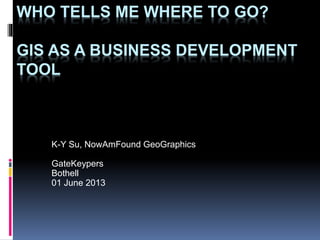
  • 1. WHO TELLS ME WHERE TO GO? GIS AS A BUSINESS DEVELOPMENT TOOL K-Y Su, NowAmFound GeoGraphics GateKeypers Bothell 01 June 2013
  • 2. What is GIS? GIS is just maps, right?  GIS’s real strength is as an analytical tool that answers questions and helps make decisions  GIS is a full-capability database, that does anything a database can do and more, especially querying and drilling down in data, but it (1) can query by location as well as by numbers, and (2) shows the results as a map rather than a table of data  Geographic (or Geospatial) Information Systems 2
  • 3. Several areas GIS contributes: Any business question that involves “where?” or “what’s there?”  Business Intelligence  Constituency  Siting  Territories  Tracking Assets/Staff/Customers/Prospects  Assessing zoning, available real estate  Matching members to lawmakers 3
  • 4. Could I benefit from GIS?  Deliver?  Provide service on-site?  Rent out assets?  Have a niche product/service?  Lot of competition?  Choosing a new site/territory?  (more) 4 Do you… Then yes!
  • 5. Simple GIS Analyses  Where are my customers?  Where are my prospect list?  Where is the competition?  What are the demographics in a given area? 5
  • 6. Less-Simple GIS Analyses  How many of my customers are in 5-acre residential zoning vs 8-per-acre zoning? Within x miles of high-scoring schools?  A store in the next county is for sale – who lives out there and what are they like? What do they want that I can provide? Are they different than my current customers?  Where should I put my next store, and what delivery radius should I provide, based on property costs, competition, customer location, zoning restrictions, local taxes, distance to suppliers, utility costs, visibility to walk-in traffic, etc? 6
  • 7. What data can I map?  Mostly publicly-available geographic data  Your data or someone else’s: Any spreadsheet/database data that is linked to a geographic unit (zip code, address, county) can be mapped  Even back-of-napkin data that has a rough geographic aspect (kids in this hood are big on this band), can be mapped 7
  • 8. Scenario: Site a Latino Dance Hall  Near Hispanic Population Centers  At least 6000 sq ft  Neighborhood business zoning  Near Overall Population Growth 8
  • 10. Filter It Down To Best/Most 10
  • 11. Then Add More Data 11
  • 14. Let the Computer Think For You 14
  • 17. Thank you!  Questions?  Would this help your business, church or other ministry?  Can you think of ways to use this to benefit your community? 17 K-Y Su 206-719-8709 NowAmFoundGeo@live.com

Editor's Notes

  1. Thank you so much for having me in today. My business tagline in some audiences is, “I tell you where to go”.
  2. I haven’t told you what GIS is yet. Like I said, my market is generally those who don’t already have GIS; thus I have to educate potential clients just what IS GIS and why should they care? This is the short answer I usually give. There’s a difference between reference maps like road maps, simple DIY maps like google maps that can plot your data but not analyze it, and GIS. Sometimes my product isn’t a map but it can be a list of names or numbers that have been grouped or prioritized by location.
  3. I mentioned before, GIS came from the envir resources mgmt field, but the basic technology can be applied to any field that has to know “where”. In business, these are the most common questions GIS is used for. Usefulness is in the ingenuity of person who formulates the questions.
  4. How do I know if my business is among the types that would find GIS worthwhile?
  5. Here are some simple analyses, and I’ll show you some of these in a minute.
  6. Here are some compound questions, to give you a flavor of what GIS is capable of. It’s not the software, it’s the smarts of the person composing the questions – that’s you.
  7. Ok, GIGO – what do you feed into GIS and where do you get it? Often you start with public data like census or OFM or state agencies, and for example KCLS has limited free access to databases like Dun & Bradsteet that normally cost money; but don’t forget you have a lot of useful data in your business records and your head.
  8. Let’s imagine a scenario of a complex business question to answer. I’ll speed you through some steps of how GIS would answer this.
  9. Again here’s a first data layer, an overall view of Hispanic population in and around Bothell. It’s a lot to look at, so…
  10. …we’ll filter it down to the hotspots.
  11. Next I“ll overlay commercial buildings, the red dots. Of course commercial buildings generally aren’t right in residential zoning, but hopefully they’re near the hotspots.
  12. Then I’ll add from that map a few pages back of peak recent population growth. You can see the overlap areas, or I could ask the computer to query and save those areas.
  13. Here we added zoning, specifically neighborhood-commercial, on the idea that we want to be close to where people live and where they can eat out before the show, rather than the office parks farther away.
  14. The blue patches are half-mile radii around the hi-Hispanic census blocks. If we can find the right zoning and the right building within those patches, that’d be ideal. But it’ll be hard to pick out with your eyes. So we let the computer extract the buildings within the qualifying areas.
  15. The qualifying buildings, it has marked in turquoise…
  16. …and flagged in a data list that I could export to excel and email to my realtor. Conversely, your realtor could send you a list of buildings for sale or rent, I could throw them on a map, filter them to the zoning and demographic qualifiers, and pick out the good ones. We can then apply some other criteria I mentioned earlier.
  17. Thank you again for hosting me today and giving me the oppty to tell you about GIS and about myself. I’ll leave you with some questions to ponder, and take some questions if we have time now.