SlideShare a Scribd company logo
1 of 38
Download to read offline
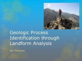
Geologic Process Identification through Landform Analysis 
Ian Thomsen
Topographic Position Index 
From Jenness 2006
Inherently Scalable 
Adjusts to capture features of different scales 
•Quickly 
•Easily 
•Repeatable 
Jenness, 2006
•Comparing elevation of each cell to the mean of all cells in an annulus of radius 100 cells (3000 meters) around it. 
•Only interested in large, regional-scale features 
Raster Calculator
Slope Tool
TPI < -6 = Canyon bottom 
-4 < TPI < 3 , Slope < 12° = Gentle Slope 
-4 < TPI < 3 ; Slope > 12° = Steep Slope 
3 < TPI < 6 = Steep Slope 
6 < TPI = Ridge top 
Raster Calculator
Focal Statistics Operations 
Areas of statistical operation can be customized to the scale of interest 
For example: 
•4500m square window discards signal from smaller features 
•19500m window only captures largest features
Identify all points which are classed as Steep Slope or Ridge Top at 4500x4500m scale but only class as Shallow Slope at 19500x19500m scale 
•Filters out all features too large to be fault generated 
•Removes smaller topographic relief 
Raster Calculator
Pamir
Results 
•Method successfully marks landforms which match characteristics of fault scarp structures 
•Successfully removes other topography from consideration 
But… 
•Issues of scale
Results 
•Defines SOME topographic relief as fault related, but not all 
•MORE problems of scale
Results 
Obvious problems: 
•Where are the faults?! They SHOULD be around here! 
Two possibilities: 
•There is no fault here 
Or 
•The scale of features of interest is lost in more recent features
Problems identifying fault features with TPI 
Extremely scale dependent 
Scale must be uniform 
Difficult to detect topography of interest within other geologic/erosional features
Implications of work 
Check the accuracy of map data 
Identify sites where fault-generated features are more and less likely to be found 
Can be applied to any geological features whose scale can be isolated from “background” topography
Future work 
Develop statistical methods to quickly combine 
TPI 
Lithologic changes 
Seismic activity 
Test method accuracy in the field 
Refine algorithm 
Apply TPI analysis to other geologic mapping projects

More Related Content

What's hot

matsuoka_igarss2011.ppt
matsuoka_igarss2011.pptmatsuoka_igarss2011.ppt
matsuoka_igarss2011.ppt
grssieee
 
Poster Presentation "Generation of High Resolution DSM Usin UAV Images"
Poster Presentation "Generation of High Resolution DSM Usin UAV Images"Poster Presentation "Generation of High Resolution DSM Usin UAV Images"
Poster Presentation "Generation of High Resolution DSM Usin UAV Images"
Nepal Flying Labs
 
SURF_Poster_REU2016Team3
SURF_Poster_REU2016Team3SURF_Poster_REU2016Team3
SURF_Poster_REU2016Team3
Pablo Valle
 
Intermediate-ArcGIS-Desktop
Intermediate-ArcGIS-DesktopIntermediate-ArcGIS-Desktop
Intermediate-ArcGIS-Desktop
Jordan Carmona
 
Investigating GIS Technologies - Group 01CW Final Presentation
Investigating GIS Technologies - Group 01CW Final PresentationInvestigating GIS Technologies - Group 01CW Final Presentation
Investigating GIS Technologies - Group 01CW Final Presentation
Simon Sweeney
 
Mapping From Unmanned Aircraft System (UAV)
Mapping From Unmanned Aircraft System (UAV)Mapping From Unmanned Aircraft System (UAV)
Mapping From Unmanned Aircraft System (UAV)
Nasr Khashoggi
 

What's hot (19)

Satellite communication (bett 4803)
Satellite communication (bett 4803)Satellite communication (bett 4803)
Satellite communication (bett 4803)
 
Accuracy Assessment Of An eBee UAS Survey
Accuracy Assessment Of An eBee UAS SurveyAccuracy Assessment Of An eBee UAS Survey
Accuracy Assessment Of An eBee UAS Survey
 
Generation of high resolution DSM using UAV Images
Generation of high resolution DSM using UAV Images  Generation of high resolution DSM using UAV Images
Generation of high resolution DSM using UAV Images
 
matsuoka_igarss2011.ppt
matsuoka_igarss2011.pptmatsuoka_igarss2011.ppt
matsuoka_igarss2011.ppt
 
G0343052058
G0343052058G0343052058
G0343052058
 
Mapping Santa Catarina, Brazil with SPOT 5 HRS and HRG by ENGEMAP
Mapping Santa Catarina, Brazil with SPOT 5 HRS and HRG by ENGEMAPMapping Santa Catarina, Brazil with SPOT 5 HRS and HRG by ENGEMAP
Mapping Santa Catarina, Brazil with SPOT 5 HRS and HRG by ENGEMAP
 
Poster Presentation "Generation of High Resolution DSM Usin UAV Images"
Poster Presentation "Generation of High Resolution DSM Usin UAV Images"Poster Presentation "Generation of High Resolution DSM Usin UAV Images"
Poster Presentation "Generation of High Resolution DSM Usin UAV Images"
 
Underground survey
Underground surveyUnderground survey
Underground survey
 
SURF_Poster_REU2016Team3
SURF_Poster_REU2016Team3SURF_Poster_REU2016Team3
SURF_Poster_REU2016Team3
 
All roads lead to ROMA
All roads lead to ROMAAll roads lead to ROMA
All roads lead to ROMA
 
POSTER_BUSTOS
POSTER_BUSTOSPOSTER_BUSTOS
POSTER_BUSTOS
 
Urban Sprawl for modelling using GIS
Urban Sprawl for modelling using GISUrban Sprawl for modelling using GIS
Urban Sprawl for modelling using GIS
 
Intermediate-ArcGIS-Desktop
Intermediate-ArcGIS-DesktopIntermediate-ArcGIS-Desktop
Intermediate-ArcGIS-Desktop
 
Investigating GIS Technologies - Group 01CW Final Presentation
Investigating GIS Technologies - Group 01CW Final PresentationInvestigating GIS Technologies - Group 01CW Final Presentation
Investigating GIS Technologies - Group 01CW Final Presentation
 
Mapping From Unmanned Aircraft System (UAV)
Mapping From Unmanned Aircraft System (UAV)Mapping From Unmanned Aircraft System (UAV)
Mapping From Unmanned Aircraft System (UAV)
 
Performances evaluation of surface water areas extraction techniques using l...
Performances evaluation of  surface water areas extraction techniques using l...Performances evaluation of  surface water areas extraction techniques using l...
Performances evaluation of surface water areas extraction techniques using l...
 
Remote sensing and gis
Remote sensing and gisRemote sensing and gis
Remote sensing and gis
 
Presentation
PresentationPresentation
Presentation
 
Presentation of survey
Presentation of surveyPresentation of survey
Presentation of survey
 

Similar to Thompson geologic process id through landform analysis

Week1 introductiontobasicsurveying
Week1 introductiontobasicsurveyingWeek1 introductiontobasicsurveying
Week1 introductiontobasicsurveying
Jackie Arul
 
4. lecture 3 data capturing techniques - total station and gps
4. lecture 3   data capturing techniques - total station and gps4. lecture 3   data capturing techniques - total station and gps
4. lecture 3 data capturing techniques - total station and gps
FenTaHun6
 

Similar to Thompson geologic process id through landform analysis (20)

383083585 planimetria-pptx
383083585 planimetria-pptx383083585 planimetria-pptx
383083585 planimetria-pptx
 
TUgis2010 Conference Presentation
TUgis2010 Conference PresentationTUgis2010 Conference Presentation
TUgis2010 Conference Presentation
 
361
361361
361
 
Air quality challenges and business opportunities in China: Fusion of environ...
Air quality challenges and business opportunities in China: Fusion of environ...Air quality challenges and business opportunities in China: Fusion of environ...
Air quality challenges and business opportunities in China: Fusion of environ...
 
Unit 2 Kinematic GNSS Lecture
Unit 2 Kinematic GNSS LectureUnit 2 Kinematic GNSS Lecture
Unit 2 Kinematic GNSS Lecture
 
Ausplots Training - Session 5
Ausplots Training - Session 5Ausplots Training - Session 5
Ausplots Training - Session 5
 
LiDAR_Project
LiDAR_ProjectLiDAR_Project
LiDAR_Project
 
Vector.pdf
Vector.pdfVector.pdf
Vector.pdf
 
Algorithmic Techniques for Parametric Model Recovery
Algorithmic Techniques for Parametric Model RecoveryAlgorithmic Techniques for Parametric Model Recovery
Algorithmic Techniques for Parametric Model Recovery
 
Gridding av klimadata
Gridding av klimadataGridding av klimadata
Gridding av klimadata
 
Week1 introductiontobasicsurveying
Week1 introductiontobasicsurveyingWeek1 introductiontobasicsurveying
Week1 introductiontobasicsurveying
 
Topology for data science
Topology for data scienceTopology for data science
Topology for data science
 
Automatic Delineation of Grid based and Geo-Morphological Slope Units for Sus...
Automatic Delineation of Grid based and Geo-Morphological Slope Units for Sus...Automatic Delineation of Grid based and Geo-Morphological Slope Units for Sus...
Automatic Delineation of Grid based and Geo-Morphological Slope Units for Sus...
 
Introduction to Seismic Method
Introduction to Seismic Method Introduction to Seismic Method
Introduction to Seismic Method
 
Development of a soil carbon map for the United Republic of Tanzania
Development of a soil carbon map for the United Republic of TanzaniaDevelopment of a soil carbon map for the United Republic of Tanzania
Development of a soil carbon map for the United Republic of Tanzania
 
Aitf 2014 pem_introduction_presentation_feb28_ram_version2
Aitf 2014 pem_introduction_presentation_feb28_ram_version2Aitf 2014 pem_introduction_presentation_feb28_ram_version2
Aitf 2014 pem_introduction_presentation_feb28_ram_version2
 
4. lecture 3 data capturing techniques - total station and gps
4. lecture 3   data capturing techniques - total station and gps4. lecture 3   data capturing techniques - total station and gps
4. lecture 3 data capturing techniques - total station and gps
 
4. lecture 3 data capturing techniques - total station and gps
4. lecture 3   data capturing techniques - total station and gps4. lecture 3   data capturing techniques - total station and gps
4. lecture 3 data capturing techniques - total station and gps
 
10 - Petrophysical applications.ppt
10 - Petrophysical applications.ppt10 - Petrophysical applications.ppt
10 - Petrophysical applications.ppt
 
Gps and planimeter
Gps and planimeterGps and planimeter
Gps and planimeter
 

More from GeCo in the Rockies

Fusion of Geodesy and GIS at NOAA as NGS
Fusion of Geodesy and GIS at NOAA as NGSFusion of Geodesy and GIS at NOAA as NGS
Fusion of Geodesy and GIS at NOAA as NGS
GeCo in the Rockies
 
Stone national spatial reference system heights
Stone national spatial reference system   heightsStone national spatial reference system   heights
Stone national spatial reference system heights
GeCo in the Rockies
 
Edwards frontier precision terrestrial imagingandmeasurement
Edwards frontier precision terrestrial imagingandmeasurementEdwards frontier precision terrestrial imagingandmeasurement
Edwards frontier precision terrestrial imagingandmeasurement
GeCo in the Rockies
 
Siddle connecting surveying and mgis to mesa countys rtrn
Siddle connecting surveying and mgis to mesa countys rtrnSiddle connecting surveying and mgis to mesa countys rtrn
Siddle connecting surveying and mgis to mesa countys rtrn
GeCo in the Rockies
 
Londe mobile devices appropriate uses
Londe mobile devices appropriate usesLonde mobile devices appropriate uses
Londe mobile devices appropriate uses
GeCo in the Rockies
 
Lowry colorado state address dataset data quality
Lowry colorado state address dataset data qualityLowry colorado state address dataset data quality
Lowry colorado state address dataset data quality
GeCo in the Rockies
 
Vetter employee residence reports weld county
Vetter employee residence reports weld countyVetter employee residence reports weld county
Vetter employee residence reports weld county
GeCo in the Rockies
 
Caldwell community sustainability and land use policy
Caldwell community sustainability and land use policyCaldwell community sustainability and land use policy
Caldwell community sustainability and land use policy
GeCo in the Rockies
 
Behunin and lasslo inexpensive mobile mapping solutions
Behunin and lasslo inexpensive mobile mapping solutionsBehunin and lasslo inexpensive mobile mapping solutions
Behunin and lasslo inexpensive mobile mapping solutions
GeCo in the Rockies
 

More from GeCo in the Rockies (20)

Fusion of Geodesy and GIS at NOAA as NGS
Fusion of Geodesy and GIS at NOAA as NGSFusion of Geodesy and GIS at NOAA as NGS
Fusion of Geodesy and GIS at NOAA as NGS
 
Stone national spatial reference system heights
Stone national spatial reference system   heightsStone national spatial reference system   heights
Stone national spatial reference system heights
 
Buck appgeo
Buck appgeoBuck appgeo
Buck appgeo
 
Edwards frontier precision terrestrial imagingandmeasurement
Edwards frontier precision terrestrial imagingandmeasurementEdwards frontier precision terrestrial imagingandmeasurement
Edwards frontier precision terrestrial imagingandmeasurement
 
Siddle connecting surveying and mgis to mesa countys rtrn
Siddle connecting surveying and mgis to mesa countys rtrnSiddle connecting surveying and mgis to mesa countys rtrn
Siddle connecting surveying and mgis to mesa countys rtrn
 
Stone four corners monument
Stone four corners monumentStone four corners monument
Stone four corners monument
 
Isaac esri living atlas
Isaac esri living atlasIsaac esri living atlas
Isaac esri living atlas
 
Londe mobile devices appropriate uses
Londe mobile devices appropriate usesLonde mobile devices appropriate uses
Londe mobile devices appropriate uses
 
Lowry colorado state address dataset data quality
Lowry colorado state address dataset data qualityLowry colorado state address dataset data quality
Lowry colorado state address dataset data quality
 
Lindemann arc gis forlocalgovt
Lindemann arc gis forlocalgovtLindemann arc gis forlocalgovt
Lindemann arc gis forlocalgovt
 
Duran here presentation
Duran here presentationDuran here presentation
Duran here presentation
 
Underwood esri serug
Underwood esri serugUnderwood esri serug
Underwood esri serug
 
Korris national map corps
Korris national map corpsKorris national map corps
Korris national map corps
 
Chamberlain hazus
Chamberlain hazusChamberlain hazus
Chamberlain hazus
 
Gup web mobilegis
Gup web mobilegisGup web mobilegis
Gup web mobilegis
 
Vetter employee residence reports weld county
Vetter employee residence reports weld countyVetter employee residence reports weld county
Vetter employee residence reports weld county
 
Caldwell community sustainability and land use policy
Caldwell community sustainability and land use policyCaldwell community sustainability and land use policy
Caldwell community sustainability and land use policy
 
Caldwell uas
Caldwell uasCaldwell uas
Caldwell uas
 
Gijselaers lights camerang911
Gijselaers lights camerang911Gijselaers lights camerang911
Gijselaers lights camerang911
 
Behunin and lasslo inexpensive mobile mapping solutions
Behunin and lasslo inexpensive mobile mapping solutionsBehunin and lasslo inexpensive mobile mapping solutions
Behunin and lasslo inexpensive mobile mapping solutions
 

Thompson geologic process id through landform analysis

  • 1. Geologic Process Identification through Landform Analysis Ian Thomsen
  • 2.
  • 3.
  • 4.
  • 5. Topographic Position Index From Jenness 2006
  • 6. Inherently Scalable Adjusts to capture features of different scales •Quickly •Easily •Repeatable Jenness, 2006
  • 7.
  • 8. •Comparing elevation of each cell to the mean of all cells in an annulus of radius 100 cells (3000 meters) around it. •Only interested in large, regional-scale features Raster Calculator
  • 10. TPI < -6 = Canyon bottom -4 < TPI < 3 , Slope < 12° = Gentle Slope -4 < TPI < 3 ; Slope > 12° = Steep Slope 3 < TPI < 6 = Steep Slope 6 < TPI = Ridge top Raster Calculator
  • 11. Focal Statistics Operations Areas of statistical operation can be customized to the scale of interest For example: •4500m square window discards signal from smaller features •19500m window only captures largest features
  • 12. Identify all points which are classed as Steep Slope or Ridge Top at 4500x4500m scale but only class as Shallow Slope at 19500x19500m scale •Filters out all features too large to be fault generated •Removes smaller topographic relief Raster Calculator
  • 13. Pamir
  • 14.
  • 15.
  • 16.
  • 17.
  • 18.
  • 19.
  • 20.
  • 21. Results •Method successfully marks landforms which match characteristics of fault scarp structures •Successfully removes other topography from consideration But… •Issues of scale
  • 22.
  • 23.
  • 24.
  • 25.
  • 26.
  • 27.
  • 28. Results •Defines SOME topographic relief as fault related, but not all •MORE problems of scale
  • 29.
  • 30.
  • 31.
  • 32.
  • 33.
  • 34.
  • 35. Results Obvious problems: •Where are the faults?! They SHOULD be around here! Two possibilities: •There is no fault here Or •The scale of features of interest is lost in more recent features
  • 36. Problems identifying fault features with TPI Extremely scale dependent Scale must be uniform Difficult to detect topography of interest within other geologic/erosional features
  • 37. Implications of work Check the accuracy of map data Identify sites where fault-generated features are more and less likely to be found Can be applied to any geological features whose scale can be isolated from “background” topography
  • 38. Future work Develop statistical methods to quickly combine TPI Lithologic changes Seismic activity Test method accuracy in the field Refine algorithm Apply TPI analysis to other geologic mapping projects