1. The Present and Future Impact of the
Hemlock Woolly Adelgid on the
Eastern Hemlock in Pennsylvania
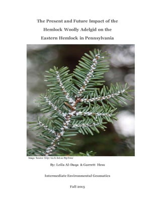
Image Source: http://na.fs.fed.us/fhp/hwa/
By: Leila Al-Daqa & Garrett Hess
Intermediate Environmental Geomatics
Fall 2015
2. Executive Summary
The eastern hemlock (Tsuga canadensis) is under threat by the invasive hemlock woolly
adelgid (Adelges tsugae) in the state that has defined it as its the state tree, Pennsylvania. The
hemlock woolly adelgid (HWA) is an aphid-like insect that was introduced to the U.S. from
Japan in the mid 1900s. The HWA feeds on the eastern hemlock and can seriously impair the
health of these trees by causing defoliation which ultimately can lead to tree mortality within as
little as four years. In Pennsylvania and throughout its natural range, stands of eastern hemlock
provide unique habitat and numerous ecological functions to ecosystems, making it an integral
tree to many forests.
The HWA has spread through just over half of the state of Pennsylvania since the late
1960s. The purpose of this analysis was to determine the current eastern hemlock forest health in
areas where the HWA is present along with predicting the future spread of the HWA into
uninfested Pennsylvania counties through the use of ArcGIS. The eastern hemlock forest health
was evaluated based on the assumption that the longer the HWA has been present and the less
basal area of the eastern hemlocks in an area, the forest health of the eastern hemlocks would be
poor. Then, to predict the future spread of the HWA in Pennsylvania, a habitat suitability
analysis was conducted for the HWA in uninfested counties of the state. Some geographic
conditions, including elevation, precipitation, temperature, and land cover type, have been found
to limit the spread of the HWA.
The results of this analysis show that the eastern hemlock health in eastern Pennsylvania
has been irritated by the presence of the HWA while the HWA also has the ability to spread
throughout all of Pennsylvania's counties within five years. Suitable habitat for the HWA is
found throughout the uninfested counties of Pennsylvania. However, areas of the highest suitable
3. habitat for the HWA are mostly found in clusters in about half of the uninfested counties of
Pennsylvania. Since there are still some areas of better eastern hemlock forest health towards
central Pennsylvania, these areas should be managed in order to minimize the impacts of the
HWA on these forests along with aiding in slowing down the future spread of the HWA.
Problem
Stands of eastern hemlock trees (Tsuga canadensis) are being decimated by the invasive
hemlock woolly adelgid (Adelges tsugae), an aphid-like insect, throughout the northeastern
region of the U.S. HWA has been known to spread throughout eastern U.S since being
introduced from Japan (American NurseryMan 12).This invasive insect causes needle loss, bud
mortality, and branch and tree mortality in the eastern hemlocks over the span of four years. The
problem area focused on is Pennsylvania. The problem concerning Pennsylvania was analyzed
based on the data that was found on this state. This state was chosen specifically because of the
ongoing research on the spread of the HWA and the treatments of the HWA. For forest health
and spread, the dynamic was wanted to see the effect of the HWA on stands of eastern hemlock
trees and how it spreads. Certain variables influenced the spread based on the niche of HWA and
where the eastern hemlocks are prone to grow. The spread of the HWA was predicted by
observing geographic factors that influence its spread: elevation, average temperature,
precipitation, landuse/landcover (Evans and Gregoire 380). As for forest health the basal area is
being taken into consideration: the lower basal area, the greater the impact. This is followed up
by the presence of HWA over the decades. The longer the presence of the HWA comes a
decrease in basal area (Louxenburg 125). This project intends to cover the HWA spread and
how it spreads in regards to geographic factors as well as comparing the spread to health.
4. Methods
Evaluating Eastern Hemlock Forest Health:
Forest health was observed by using quarantine status and basal area for the state of
Pennsylvania. Pennsylvania was chosen because there is an ongoing treatment of the eastern
hemlock tree due to the presence of the HWA as in the DNCR report (Louxenbourg 123).
Pennsylvania quarantine status was given by the USFS and was further used with the data known
of the basal area of the entire U.S. And the quarantine status and basal area were chosen to see if
there was a relationship between the two. Moreover, with the presence of the Adelgid since 1968
and 2/3 of the state being impacted it made sense to look at the quarantine status. “Eastern
hemlock (Pennsylvania's state tree) and Carolina hemlocks (found further south in the Smokey
Mountain sections of the Appalachians) are more susceptible to hemlock woolly adelgid damage
than Asian and western hemlock trees due to feeding tolerance and predators that protect the
latter species (Louxenburg 125)”.
The quarantine status layer had the years that the HWA has been present throughout the
decades starting with the 1970’s and onward meaning more of a presence of the HWA being
present and further treatment in those areas. The basal area was the volume of tree canopy for a
stand in a forest and in this data set there was a ranking from the lowest to the highest. It was
shown that the relationship between the basal area and the HWA is present because of the
reduction in volume of tree canopy when there is an outbreak and an increase in other species
populating the forest floor ( Eggen 45). Furthermore, the basal area data collected was a raster
file of the whole U.S. so it was masked by the Pennsylvania state shape file. From there it was
reclassified to into four categories. The quarantine status of Pennsylvania was reclassified based
on the presence of HWA where the 1970’s received a value of 1 and the 80’s a value of 2, etc up
5. until the early 2000’s where that received a value of 4 being the best because it was fairly recent.
Also with a presence of the HWA over the years can reduce pine needles and photosynthesis as a
result changes “regional succession pathways” thus showing a change in basal area and land
cover (Nurseyman 12).The quarantine status had to be converted to a raster because it was a
shape file and the quarantine status and the basal area had to be combined to see the impact of
the HWA. So the quarantine was converted to a raster by a polygon to raster tool in arc toolbox
where afterwards the quarantine status and the basal area were combined to show the basal are in
relation to the quarantine status. Later this result was broken into two parts based on the mean
that was generated from the "get raster properties" tool, around the mean of 2.108. The classes of
eastern hemlock forest health respectively fell into either side of the map of Pennsylvania.
Predicting the Potential Spread of the HWA:
To predict the spread of the HWA, different geographic variables providing favorable
habitat for the HWA were evaluated in the Pennsylvania counties not infested with the HWA.
The geographic variables evaluated included average daily minimum temperature, average
annual precipitation, elevation, and land cover type. A raster file was gathered for each of these
geographic variables and clipped to the area of the Pennsylvania counties not infested with the
HWA in order to conduct a habitat suitability analysis for the HWA using ArcGIS.
In the habitat suitability analysis, the land cover type was classified as the most important
geographic variable, providing data on likely eastern hemlock habitat as well as the locations of
urban areas. Eastern hemlock trees are the main host for the HWA which facilitates the
population growth and spread of the HWA, so where these trees are found, the invasive has the
potential to spread to those areas (Evans and Gregoire 380). Then, data on the locations of urban
areas helps to determine whether or not humans will aid in the dispersal of the HWA, which has
6. been found to increase their spread rates (Evans and Gregoire 380). The land cover type raster
file (Pennsylvania Land Cover, 2000) was reclassified, assigning the highest values to the areas
of Coniferous Forest and Mixed Forest, which represent likely eastern hemlock habitat, while the
areas of Low Density Urban and High Density Urban were given lower values to represent the
possible spread aided by human movement. The areas of Woody Wetland and Transitional were
assigned the lowest values because it is still possible that eastern hemlock trees can be found in
these locations. All other land cover types were assigned a value of 0 to remove them from the
habitat suitability analysis.
The average daily minimum temperature and elevation were classified as the next most
important geographic variables because they are associated with climate. Populations of the
HWA encounter increased mortality when facing colder temperatures (Evans and Gregoire 372).
Since the HWA does not fare well in cold temperatures, areas of lower average daily minimum
temperature were assigned lower values and areas of higher average daily minimum temperature
were assigned higher values, representing more suitable habitat for the HWA, when reclassifying
the raster file. Then, higher elevation is equated with lower temperatures, again representing less
suitable habitat for the HWA. In Shenandoah National Park in Virginia, it was found that "[...]
Eastern Hemlock trees at higher elevations were still impacted by HWA, crown condition on
average was twice as good at elevations above 750 m than below" (Abella 28). Following this
information, the elevation raster file was reclassified by assigning higher values to lower
elevations.
The average annual precipitation was classified as the least important geographic
variable. Previous research shows that "Eastern Hemlock has high moisture requirements, is
susceptible to drought, and might have reduced resistance to damaging agents on dry sites"
7. (Abella 18). However, Evans and Gregoire observed increased spread rates of the HWA in areas
of high annual precipitation in the HWA's most recent southern expansion (Evans and Gregoire
380). Precipitation may not be a very strong geographic variable since Eastern Hemlock trees
prefer higher precipitation as well as the HWA. In lieu of this information, the average annual
precipitation raster file was reclassified by assigning higher values to precipitation above 1194
mm.
With the combination of these four geographic variables, a map showing the most and
least suitable habitat for the HWA was produced. The amount of time for the HWA to spread
through this area was then evaluated. Research has shown that the HWA has an average spread
rate of 12.5 km/year and in areas north of Pennsylvania, the spread rate is closer to 8.13 km/year
(Evans and Gregoire 369). To show about 5 years in the future, an area of 45 km (assuming a
spread rate close to 9 km/year) from the edge of Pennsylvania counties infested with the HWA
was clipped from the raster file showing suitable HWA habitat.
Results
Evaluation of Eastern Hemlock Forest Health:
The results (represented in Figures 1 and 2) showed that the best hemlock health was
situated in the western part of the state where the color configuration showed that the basal area
was more or less the same as the area of the quarantine status for best forest health. The basal
area with the lowest volume showed the least forest health for the hemlock and did not have the
same color as the quarantine status because then it would not have been visible so the next to last
color associated with bad health, being blue, was shown. The map produced (Figure 1) showed
the basal area becoming darker to lighter in association with the color scheme of the quarantine
status. As for the second part of the results the data was split into two categories by determining
8. the mean and having the two values either above or below the mean that was calculated (which is
represented in Figure 2). This result showed the best results on the west side of Pennsylvania and
the worse values on the east side of the state of Pennsylvania. In the dncr report analysis there
was reason to believe that this data set matches the dataset of their findings because there was
treatment on the west side of the state, which shows in the map and the border of the best
quarantine site with a value of 4 is exactly where there was an implemented treatment in the
selected counties that they chose.
The Potential Spread of the HWA:
Two maps were produced from the methods explained above to display the potential
spread of the HWA based on habitat suitability. From examining both Figure 3 and Figure 4, in
five years, the HWA has the potential to spread through the majority of Pennsylvania that is not
yet infested with the HWA based on a spread rate of 9 km/year from the leading edges of
previously infested counties. Counties with some area to remain uninfested with the HWA in the
next five years include the western portion of Erie, Crawford, and Mercer counties. However, as
shown in Figure 3, the potential spread of the HWA is not homogenous throughout due to the
heterogeneous arrangement of suitable habitat for the HWA in these counties.
In some places, the likeliness of the potential spread of the HWA seems random. Small
patches of more suitable habitat for the HWA are scattered throughout the uninfested counties.
Along with randomness, there are also patterns within the predicted potential spread of the HWA
clearly displayed in Figure 3. Areas of the least suitable habitat for the HWA are mostly
clustered in eastern Erie and Crawford counties as well as northern Venango county. Areas of the
most suitable habitat for the HWA are spread throughout the uninfested counties but these areas
are still found in localized clusters. A localized area of the most suitable habitat for the HWA is
9. found in northern Erie county along Lake Erie. Other areas of highly suitable habitat for the
HWA include western Mercer county, southeastern Butler county, central Lawrence county, and
northern central Washington county.
A more generalized model of the potential spread of the HWA is illustrated in Figure 4,
displaying the potential spread of the HWA in terms of risk, low or high. Areas with a higher
calculated cell value will be at a higher risk of infestation by the HWA due to the availability of
more suitable habitat. Areas with a lower calculated cell value will be at a lower risk of
infestation by the HWA because the habitat is not as favorable for the HWA. The mean value of
all of the cells was calculated to be 15.744 within a range of values of 8 to 36 to create a division
between the two classes of risk. Figure 4 emphasizes the areas of the most suitable habitat, as
expressed in Figure 3, as areas of high risk along with a few other areas of the uninfested
counties that contained a slightly lower level of suitable habitat for the HWA. This more
generalized model points areas of highest priority to monitor for the possible infestation of HWA
and potentially manage if the HWA does indeed spread to these areas.
Greater Implications
Overall, the analysis conducted shows the areas of highest priority for management of the
HWA in Pennsylvania. Figure 1 displays that the forest health of areas impacted by HWA is very
poor, however, counties along the leading edge of the spread of the HWA (displayed in Figure 3)
and a small area in northeastern Pennsylvania are still relatively healthy in terms of the eastern
hemlock. These areas should be considered areas of highest priority for management and
treatment of the HWA. Prior research and management experience has shown that treating
eastern hemlocks for the HWA has been more effective where the eastern hemlocks are still
healthy in tandem with low population densities of the HWA (Ward et al. 13). In addition,
10. eastern hemlocks can survive for a few years after being infested with the HWA, but tree
mortality can occur within 2 to 12 years (Ward et al. 7). The "U.S. Exotic Forest Pests: County-
Level Distribution" map based on the Quarantine years of the HWA in Pennsylvania displays
that the areas pointed to in Figure 2 have been infested with the HWA for the shortest amount of
time or have not yet encountered widespread infestation. Managing areas of better eastern
hemlock stand forest health in Pennsylvania can help to minimize the impact of the HWA in
these areas and also limit the further spread of the HWA into new counties.
The counties at highest risk of future HWA infestation include Greene, Washington,
Lawrence, Mercer, Venango, and Erie based on the amount of highly suitable habitat for the
HWA. However, these areas are at a high risk of infestation only because they contain habitat
suitable for the HWA, it is not known for sure whether or not stands of eastern hemlock are
found in these areas. To determine where eastern hemlock trees are located in these areas, remote
sensing techniques can be utilized to locate the trees through examining aerial photography and
satellite images (Ward et al. 10). Once eastern hemlock stands of high risk of infestation by the
HWA are determined, these stands should be monitored yearly to evaluate the presence or
absence of the HWA on individual trees (Ward et al. 12).
A valuable member of forest ecosystems will be lost in the future if management actions
are not taken in the present to stop or slow the spread of the HWA. Measures should be taken to
conserve the eastern hemlock tree, Pennsylvania's state tree (Faulkenberry et al.1), as it provides
important winter cover habitat for wildlife, a source of forage for birds and mammals, and
support for many different arthropod species (Faulkenberry et al. 10). Eastern hemlocks also
have "[...] a role in microclimate amelioration, watershed stabilization, soil ecology, and nutrient
cycling [...]" (Abella 19). Over the next five years, the HWA has the potential to spread to all of
11. the counties of Pennsylvania. Even though the whole state of Pennsylvania may be infested with
the HWA in the near future, only about half of the state will be highly impacted by the presence
of the HWA in eastern hemlock stands, showing that there is still time to stop the eastern
hemlock destruction by the hemlock woolly adelgid.
12. Bibliography
Abella, Scott R. "Impacts And Management Of Hemlock Woolly Adelgid In National Parks Of
The Eastern United States." Southeastern Naturalist 13.6 (2014): 16-45. Academic Search
Premier. Web. 4 Nov. 2015.
Evans, A.M., and T.G. Gregoire. "A Geographically Variable Model Of Hemlock Woolly
Adelgid Spread." Biological Invasions 9.4 (2007): 369-382. Springer Link. Web. 4 Nov.
2015.
Faulkenberry, Mark, Ellen Shultzabarger, Donald A. Eggen, and Houping Liu. Eastern Hemlock
Conservation Plan. Pennsylvania Department of Conservation and Natural Resources,
Bureau of Forestry, 15 Nov. 2014. Web. 9 Nov. 2015.
<http://www.dcnr.state.pa.us/cs/groups/public/documents/document/dcnr_20030071.pdf>
Forest Health Report. Luxembourg: OOPEC, 1991. Common Wealth of
Pennsylvania. Web. 12 Oct. 2015.
<http://www.dcnr.state.pa.us/cs/groups/public/documents/document/dcnr_20026259.pdf>
Hemlock Woolly Adelgid Infestation Expands." AmericanNurseryman 193.11 (2001):10. MAS Ultra - School
Edition. Web. 11 Nov. 2015
"Understanding and Developing Resistance in Hemlocks to the Hemlock Woolly Adelgid."
vvvvvvvSoutheastern Naturalist SENA (2014): n. pag. Forest Health Fact Sheet: Hemlock
vvvvvvvWooly Adelgid. Web. 27 Oct. 2015.
vvvvvv<http://www.dcnr.state.pa.us/cs/groups/public/documents/document/dcnr_007179.pdf>.
Ward, Jeffrey S., Michael E. Montgomery, Carole A.S.-J. Cheah, Brad P. Onken, and Richard S.
Cowles. Eastern Hemlock Forests: Guidelines to Minimize the Impact of Hemlock Woolly
15. Figure 1: Eastern hemlock forest health in Pennsylvania over a range of values
16.
17. Figure 2: Eastern hemlock forest health split into two categories,good and bad
18. Figure 3: Potential spread of the HWA in Pennsylvania over the next five years
19. Figure 4: Risk level of potential infestation based on the degree of suitable HWA habitat
20. Data Dictionary
Name Data Type Source Download Location
Eastern hemlock
(Tsuga canadensis)
extent, North America
Shapefile (for
reference)
Elbert L. Little, Jr. ArcGIS.com
U.S. Eastern Hemlock
Basal Area
Raster file USDA Forest Service,
Northern Research
Station
Received from the
Forest Inventory
Analysis
Hemlock Woolly
Adelgid Summary:
State of Pennsylvania
CSV (for reference) USDA Forest Service,
Northern Research
Station
Northern Research
Station: Alien Forest
Pest Explorer
U.S. Counties Shapefile Rutgers Intermediate
Environmental
Geomatics Class Data
U.S. Exotic Forest
Pests - County-Level
Distribution
Shapefile USDA Forest Service,
Northern Research
Station
ArcGIS.com
Pennsylvania Land
Cover, 2000
Raster file Penn State University PASDA
(Pennsylvania Spatial
Data Access)
United States Annual
Average Daily
Minimum
Temperature, 2014
Raster file PRISM Climate
Group at Oregon State
University
PRISM Climate
Group
United States Annual
Total Precipitation,
2014
Raster file PRISM Climate
Group at Oregon State
University
PRISM Climate
Group
U.S. Digital Elevation
Model
Raster file PRISM Climate
Group at Oregon State
University
PRISM Climate
Group
21. Analysis Flow Chart
Creating the basic shapefiles
Gather all data
• U.S. Counties shape file (shp) and Hemlock Woolly Adelgid
presence by Pennsylvania counties data
From U.S. counties shp, select by attributes
• STATE_NAME = Pennsylvania
Copy features
• Create a new shp of Pennsylvania boundary and counties
Add text field to PA shp
• Title HWA
Select by attributes the counties without HWA
• NAME = Armstrong OR Butler OR Crawford OR Erie OR
Greene OR Lawrence OR Mercer OR Venango OR
Washington
Calculate HWA field with selection
• HWA = "Absent"
Switch selection and calculate HWA field
• HWA = "Present"
22. Preparing the data for analysis
Convert all data to the same geographic coordinate system
• GCS_WGS_1984
Clip all data to the PA shp and the PA counties without HWA shp
• Clip for shp and extract by mask for raster files
Make all raster files have the same cell size
• Use the Resample tool to make the raster files have the same cell
size as one of the raster files
23. Evaluating eastern hemlock forest health
Tif.1256 was masked through arc tool box with the pennsylvaniaCOUNTIES_shp.
Tif.1256 was renamed to msk.tif1256 and was reclassified by the reclassify tool into
four categories where one had the least basal area and 4 had the most basal area.
Quarantine stattus shapefile (Q_Penn.SHP) was reclassified by years in the attribute
table. the 1970's recieved a value 1 and the most recent years, 200's, recieved a value
of 4 with the 80's with a value of 2 and the 90's a value if 3. A value of 1 being th e
worse because of the longest presence of adelgid and 4 being the best with little to no
presence of adelgid.
Q_Penn.shp was then converted from polygon to raster in order to sum
quarantine and basal area.
24. Predicting the Potential Spread of the HWA
Reclass Minimum Temperature raster file
• Higher temperatures will be given a higher value
• Split all temperatures into 3 classes and assign values 1 to 3
Reclass Precipitation raster file
• Higher precipitation will be given a higher value
• precipitation > 1194 mm = 2
• precipitation < 1194 mm = 1
Reclass Elevation raster file
• Lower elevation will be given a higher value
• Split all levels of elevation into 3 classes adnd assign
values 1 to 3
Sum_BAQ was created and the color scheme was changed where red
showed values of 1s, pink values of 2, blue values of 3, and 4 a value of
white.
Sum_BAQ was then split into two values where a mean was calculated for
the values of the basal area and quarantine status. Anything above the mean
was white and anything below the mean was black.
Get raster properties was used inorder to split the Sum_BAQ into two
values of high or low which means either above the mean or below the
mean.
25. Reclass PA Land Use/Land Cover raster file
• Low Density and High Density Urban (2, 3) = 2
• Coniferous Forest (7) = 4
• Mixed Forest (8) = 3
• Woody Wetland (10) = 1
• Transitional (15) = 1
• All others = 0
Multiply reclassified Minimum Temperature raster file by 3
Multiply reclassified Precipitation raster file by 2
Multiply reclassified Elevation raster file by 3
Multiply reclassified PA LU/LC raster file by 4
26. Combine all weighted and reclassified raster files using the Sum
operation in Cell Statisitics
Convert the PA uninfested counties polygon shape file into a line
shape file
Create a new line shapefile
• Trace the border of the infested counties using the PA
uninfested counties line as a template
Buffer the new line shapefile 45 km to the right side
Clip the produced HWA habitat suitability map to the 45 km
buffer
• Extract by mask
27. Project Tasks
Leila
- Conducted the analysis on the potential spread of the HWA in the uninfested counties of
Pennsylvania
- Produced Figure 4 and Figure 3
- Wrote the executive summary, methods and results for the potential spread of the HWA, and
the greater implications section
Garrett
-Looked at the basal area and quarantine status of the Hemlock Woolly Adelgid and Hemlock
tree species.
-Produced figures 1 and 2
-Created cover page, background, methods and results of the Eastern hemlock forest health in
Pennsylvania over a range of values and Eastern hemlock forest health split into two categories, good and bad.