
Recommended
Recommended
More Related Content
What's hot
What's hot (19)
Viewers also liked
Viewers also liked (17)
Similar to 247 - 252_Malam1
Similar to 247 - 252_Malam1 (20)
247 - 252_Malam1
- 1. CLASSIFYING URBAN CLIMATE FIELD SITES BY LOCAL CLIMATE ZONES OF KADUNA METROPOLIS NIGERIA *S .U .Usmanb ,I.A. Abdulhameda ,M.Ibrahima ,E. O .Iguisib , I.M.Azarea and O. F .Atic a Department of Environmental Science, Federal University, Dutse, Nigeria b Department of Geography, Ahmadu Bello University, Zaria, Nigeria c Department of Geography and Planning, Federal University, Dutsin-ma, Katsina State, Nigeria E-mail: abdulhamidaz@yahoo.com Tel: +2348036525257 ABSTRACT This study assessed the local climate zones (LCZ) in Kaduna metropolis. It involved the categorization of the land use land cover using local climate zone scheme, as well as the determination of the canyon geometry of the study sites within the study area. 19 study sites were selected within and outside the metropolis Deploying meteorological stations in rural and urban areas as well as across urban areas reveal that in most cases, significant variability exists in the microclimates observed. And that this variability arises due to differences in surface characteristics. To further investigate this, various methods of systematic and logical division of the urban environment based on surface characteristics have been developed. This study utilized the local climate zones (LCZ) system of classification in classifying the urban climate field sites in a developing tropical city of Kaduna. The classification involves sky view factor, built surface fraction, roughness height and surface thermal admittance. The results demonstrate that LCZ system adequately suited the city. The zones identified include; BCZ2, BCZ3, BCZ4, BCZ5, BCZ6, BCZ7, BCZ8, BCZ9, BCZ10 and NCZ4. This Classification is good especially for observational urban heat island (UHI) studies. In order to produce a universal system of classification, more classification efforts are needed from tropical cities. Key words: classification system, inter-zone, local climate zones, metadata, INTRODUCTION In order to determine the effect of built environment on temperature fields within the urban canopy layer, researchers have been classifying urban areas for urban heat island (UHI) studies. In most cases, these classifications appear vague because of the failure of the researchers to provide adequate information on sites characteristics. This is because without adequate site description, inference of cross- study difference in the UHI phenomenon and replication of studies will not be possible. Oke (1984) pointed out the problem of lack of communication in urban climate studies and argued the need for the science part of urban climate to focus on achieving predictive power. That is through adopting scientific method of enquiry and reporting. In addition, Oke (2006) argued that for meaningful scientific interaction between the field of urban climate and cognate fields to be achieved, there is the need for better communication. Thus, the issue of standardization in reporting urban climate studies became an issue of concern To address this issue, Aguilaret al (2003) and Oke (2004) produced comprehensive World Meteorological Organization guidelines for siting meteorological instruments in cities. Oke (2004) developed a classification system known as urban climate zones (UCZ), which incorporated the classifications of Auer (1978) and Ellefsen (1990/91). This classification served as a precursor to those developed later. These include; ‘local-scale climate zones’ with 9 classes (Krayenhoff et al., 2009), ‘local climate zones’ (LCZ) With 19 classes (Stewart and Oke, 2009a), ‘thermal climate zones’ (TCZ) with 9 classes (Stewart and Oke, 2009b), ‘local climate zones’ with 16 classes (Stewart and Oke, 2010) and ‘local climate zones’ with 15 classes (Stewart, 2009). In a review of UHI literature (190 papers written between 1950 and 2007), Stewart (2010) concludes that the major area of weakness in UHI reporting is that majority failed to provide sufficient site metadata. Usman et al. Dutse Journal of Pure and Applied Sciences 2(1) June 2016 pp 247 - 252 247
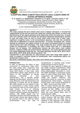
- 2. As of now, there is no better way of providing information on site metadata and expressing intra-urban UHI differences more objectively than through systematic and logical division of the urban environments based on surface properties as typified by the local climate zones. However, Schroeder et al (2010) identify additional parameters that need to be considered in classifying urban climate field sites which are not included in all the four different classification systems (including LCZ) used in the study. Local climate zones are defined as regions of relatively uniform surface-air temperature distribution across horizontal scales of 102 to 104 metres (Stewart and Oke, 2009a, 2009b). The zones are derived from divisions of the urban landscape into sub-divisions based on properties such as surface cover (built fraction, soil moisture, albedo), surface structure (sky view factor, roughness height) and cultural activity (anthropogenic heat flux) (Stewart and Oke, 2009a). In Nigeria, some of the classification systems have been adopted for observational UHI studies and were found to have excellently improved reporting of the phenomenon (Ibrahim et al., 2011; Nduka and Abdulhamed, 2011). 2. MATERIALS AND METHODS 2.1 Data collection The study area is Kaduna metropolitan area, comprising of different towns located between latitude 09°02'N and 11°32″Nandbetween longitude 06°15''E and 08°38.'E. The metadata needed to classify the sites was obtained through field study conducted from January 3 to February 28, 2011. These include height of buildings, sky view factor (SVF), built fraction and surface thermal admittance. Street and land use maps were obtained from Kaduna State Urban Planning and Development Authority (KUPDA). SVF was computed from sky view photographs taken with a digital camera (HP Photosmart-M425) fitted with a fish-eye lens (Digital King M- Power 180o ) mounted horizontally on a tripod 1 metre above ground level. Additional data such as satellite imageries and computer sketches were obtained from Google Earth and classification studies (e.g. Stewart and Oke, 2009b). 2.2 Methods The site was selected based on procedures laid down by Oke (2004, 2006) for collecting climatic data in urban areas. The sites were distributed based on the Land Use Land Cover (LULC) categorization designed by Stewart and Oke (2009a) known as the Local Climate Zones (LCZ). The sites that best represents a given category of LULCRadius of 200 metres was used in parameterizing the “circles of influence” for the sites by the general properties of LCZ. The most important parameters considered in this process are; SVF, built fraction and surface thermal admittance. SVF values were computed from the digital fish-eye lens photographs using BMSky View Program. Stewart’s (2009) prototype LCZ classification was adopted in this study. Data sheets were prepared for each zone which was then compared with those specifying the general properties of each zone (Stewart and Oke, 2009a). Best fit zones were then selected out of the prepared data sheets. (fig 1). Eye Level Sky View Aerial Figure 1: Sample data sheet for “Open-set high-rise.” 3. RESULTS AND DISCUSSION Results of the LCZ classification are summarised and presented in table 1. From this table, the identified zones are; BCZ2, BCZ3, BCZ4, BCZ5, BCZ6, BCZ7, BCZ8, BCZ9, BCZ10 (in the built series) and NCZ4 (in the natural series). In general, the Kaduna field sites appear to be well represented by LCZ except the BCZ1. Usman et al., Dutse Journal of Pure and Applied Sciences 2(1) June 2016 pp 247 - 252 248
- 3. In most cases, the metadata for each site are to a greater extent comparable with the general zone properties. The zones clearly portray the nature of urban terrains of Kaduna metropolis as differences in built form are captured by the zones. High, medium and low building density classes are identified from the urban sites. LCZ datasheets (Stewart and O provide useful guidelines for this classification. However, most of the site metadata obtained were not adequately aligned with those in the datasheets. This could be attributable to differences in Table 1: Classification of Kaduna field sites by local climate zones Site photographs Eye Level High Angle Lagos Round About Area Bamaiyi House Area Kaduna Polytechnic Main Campus Tudun Wada Usman et al., Dutse Journal of Pure and Applied Sciences 2(1) June 2016 In most cases, the metadata for each site are to a greater extent comparable with the properties. The zones clearly portray the nature of urban terrains of Kaduna metropolis as differences in built form are captured by the zones. High, medium and low building density classes are identified from the urban sites. LCZ datasheets (Stewart and Oke, 2009a) provide useful guidelines for this classification. However, most of the site metadata obtained were not adequately aligned with those in the datasheets. This could be attributable to differences in physical planning and development patterns between the cities from where the metadata used in producing the original classification were obtained and what is obtained in the study area. Thus, in most cases only best zones were selected based on the authors’ skilled judgement and knowledge of the fi sites rather than automated matching. These results are important as they illustrate how surface characteristics which are functions of physical planning and development patterns can be used to classify urban climate field sites. Table 1: Classification of Kaduna field sites by local climate zones Site photographs Eye Level High Angle Site Metadata Lagos Round About Area Urban Busy central area along the commercial axis. Buildings 5-10 stories, dense, solid construction materials. Abundant unpaved surface cover. Moderate traffic density. Abundant vegetation. SVF=0.65. built fraction>70% Bamaiyi House Area Urban BCZ3 Part of the CBD. Buildings 3-5 stories, mostly large and dense. Heavy, solid construction materials. Narrow inner streets. Heavy traffic flow. Scarce vegetation. SVF=0.61. built fraction >85% Kaduna Polytechnic Main Campus Urban Main campus of Kaduna Polytechnic. Buildings 2-4 stories, of different sizes, distribution and height. Heavy construction materials. Low traffic flow. Abundant vegetation SVF=0.71. Built fraction >30% Urban Dutse Journal of Pure and Applied Sciences 2(1) June 2016 pp 247 - 252 249 physical planning and development patterns een the cities from where the metadata used in producing the original classification were obtained and what is obtained in the study area. Thus, in most cases only best-fit zones were selected based on the authors’ skilled judgement and knowledge of the field sites rather than automated matching. These results are important as they illustrate how surface characteristics which are functions of physical planning and development patterns can be used to classify Local Climate Zone Classification BCZ2 BCZ3 BCZ4
- 4. Kaduna Polytechnic Staff Quarters Unguwan Dosa Layout Rafin Guza State House Area, Kawo Kakuri Industrial Area Usman et al., Dutse Journal of Pure and Applied Sciences 2(1) June 2016 Residential area - inner city. Buildings bungalows, semi detached and densely packed. Light traffic. Scarce vegetation. SVF=0.81. Built fraction >85% Kaduna Polytechnic Staff Quarters Urban Residential- Kaduna Polytechnic staff houses. Buildings small, separated by courtyards. Surface mostly pervious. Low traffic flow. Abundant vegetation. SVF=0.84. Built fraction <25 Dosa Layout Urban Residential- new Unguwan Dosa layout. Buildings low rise, 1-3 stories, detached, in rows and separated by courtyards. Light traffic flow.. Vegetation available. SVF=0.92. Built fraction ≈25% Suburban Residential and commercial – suburb (RafinGuza). Buildings semi-detached packed and separated by narrow unpaved streets. Light traffic. Vegetation scarce. SVF=0.91. Built fraction >75% State House Area, Kawo Urban Government offices, Kawo. Buildings large, detached and separated by open spaces. Moderate-high traffic flow. Abundant vegetation. SVF=0.78. Built fraction >50% Kakuri Industrial Area Urban Dutse Journal of Pure and Applied Sciences 2(1) June 2016 pp 247 - 252 250 BCZ5 BCZ6 BCZ7 BCZ8 BCZ9 BCZ10
- 5. Trade Fair Complex Area Uncultivated fields on the outskirts of the city. Low uniform grass cover soil. Very few buildings. Few scattered trees. No traffic flow. SVF=0.99. Built fraction <1% 4. CONCLUSION AND RECOMMENDATIONS This classification was used for observational urban heat island study, the result of which reveals that it is a robust indicator of urbanisation induced climate modification. Even though currently there is no universal urban classification system for urba stations in place, but LCZ system is indispensable. This is because significant inter-zone temperature differences were observed. The classification brings out differences in built forms and planning REFERENCES Aguilar, E., Auer, I., Brunet, M. Peterson, T. C. And Wieringa, J. (2003) Guidance on Metadata and Homogenization. WMO Technical Document No. 1186. World Meteorological Organisation: Geneva Auer, A. H. (1978) Correlation of land use land cover with meteorological anomalies. Journal of Applied Meteorology 17(5): 636 Ibrahim, A. A., Nduka, I. C., Iguisi, E. O. and Ati, O. F. (2011) An assessment of the impact of sky view factor (SVF) on the micro-climate of urban Kano. Australian Journal of Basic and Applied Sciences 5(7): 81 Krayenhoff, S., Stewart, I. D. And Oke, T. R. (2009) Estimating thermal responsiveness of local Usman et al., Dutse Journal of Pure and Applied Sciences 2(1) June 2016 Kakuri Industrial area – refinery and petrochemical plant, breweries, light arms factory, textile mills. Heavy and lightweight materials. Abundant natural surface cover. Low traffic flow. SVF=0.80. Built fraction >60% Trade Fair Complex Area Rural Uncultivated fields on the outskirts of the city. Low uniform grass cover-bare soil. Very few buildings. Few scattered trees. No traffic flow. SVF=0.99. Built fraction <1% 4. CONCLUSION AND RECOMMENDATIONS This classification was used for observational urban heat island study, the result of which reveals that it is a robust indicator of urbanisation induced climate modification. Even though currently there is no universal urban classification system for urban climate stations in place, but LCZ system is indispensable. This is because significant zone temperature differences were observed. The classification brings out differences in built forms and planning patterns that are seldom rivalled by any other method. It makes everything logical and cross-study differences especially in UHI phenomenon and replication of studies much easier. In order to move closer to producing a universal classification system, we recommend that urban climatologists from tropical and developing countries vigorously embark on classification campaign. This is due to the peculiarities of the background climate and urban planning and development patterns obtained in such environments. Aguilar, E., Auer, I., Brunet, M. Peterson, T. C. And Wieringa, J. (2003) Guidance Metadata and Homogenization. WMO Technical Document No. 1186. World Meteorological Organisation: 78) Correlation of land use land cover with meteorological Journal of Applied 17(5): 636-643 Ibrahim, A. A., Nduka, I. C., Iguisi, E. O. and O. F. (2011) An assessment of the impact of sky view factor (SVF) on e of urban Kano. Australian Journal of Basic and 5(7): 81-85 Krayenhoff, S., Stewart, I. D. And Oke, T. R. (2009) Estimating thermal responsiveness of local-scale climate zones with a numerical modeling approach. Reprints, Eighth Symposium on the Urban Environment, Phoenix, AZ Nduka, I. C. and Abdulhamed, A. I. (2011) Classifying urban climate field sites by “thermal climate zones” the case of Onitsha metropolis. Journal of Environmental Ea Sciences 3(2): 75-80 Oke, T. R. (1984) Towards a prescription for the greater use of climatic principles in settlement planning. Buildings (7):1-10 Oke, T.R. (2004) Initial Guidance to Obtain Representative Meteorological Observations at Urb Report 81, World Meteorological Organization, Geneva Applied Sciences 2(1) June 2016 pp 247 - 252 251 NCZ4 patterns that are seldom rivalled by any r method. It makes everything logical study differences especially in UHI phenomenon and replication of studies much easier. In order to move closer to producing a universal classification system, we recommend that urban climatologists from cal and developing countries vigorously embark on classification campaign. This is due to the peculiarities of the background climate and urban planning and development patterns obtained in such environments. zones with a numerical modeling Reprints, Eighth Symposium on the Urban Environment, January 11-15, Nduka, I. C. and Abdulhamed, A. I. (2011) Classifying urban climate field sites by “thermal climate zones” the case of Onitsha metropolis. Research Journal of Environmental Earth 80 Oke, T. R. (1984) Towards a prescription for the greater use of climatic principles in settlement planning. Energy and Oke, T.R. (2004) Initial Guidance to Obtain Representative Meteorological Observations at Urban Sites. IOM Report 81, World Meteorological Organization, Geneva
- 6. www.wmo.int/web/www/IMOP/publications- IMOP-series.html Oke, T. R. (2006) Toward better scientific communication in urban climate. Theoretical and Applied Climatology (84): 179-190 Schroeder, A. J., Basara, J. B. and Illston, B. G. (2010) Challenges associated with classifying urban meteorological stations: The Oklahoma City Micronet example. The Open Atmospheric Science Journal (4): 88-100 Stewart, I. D. (2009) classifying urban climate sites by ‘local climate zones’. Journal of the International Association for Urban Climate (34): 8- 11 Stewart, I.D. and Oke, T. R. (2009a) Newly developed ‘thermal climate zones’ for defining and measuring urban heat island magnitude in the canopy layer. Preprints, T. R. Oke Symposium & Eighth Symposium on Urban Environment, January 11-15, Phoenix, AZ Stewart, I.D. and Oke, T. R. (2009b) Classifying urban climate field sites by ‘local climate zones’: The case of Nagano, Japan. Preprints, Seventh International Conference on Urban Climate, June 29-July 3, Yokohama, Japan Stewart, I. D. (2010) A systematic review and scientific critique of methodology in modern urban heat island literature. International Journal of Climatology. www.wileyinterscience. DOI: 10.1002/joc.2141 (Accessed on 22/01/2011) Stewart, I. D. and Oke, T. R. (2010) Thermal differentiation of local climate zones using temperature observations from urban and rural field sites. Preprints, Ninth Symposium on Urban Environment, Keystone, CO, August 2-6 Usman et al., Dutse Journal of Pure and Applied Sciences 2(1) June 2016 pp 247 - 252 252