Going Full Tilt
•
1 like•337 views

The document discusses improvements being made to the Magma Flood Retarding Structure in Arizona to upgrade its stormwater infrastructure and protect the area from flooding. The project involves raising an earthen dam, widening and deepening part of the flood canal, and lining its slopes with riprap. Motor grader operator Hank George is using an advanced 3D machine control system from Topcon to precisely grade the steep canal slopes. The dual antenna setup allows accurate grading on slopes by ignoring the mainfall sensor. George values being able to dynamically adjust the blade for precise grading. He estimates the automated system reduces grading costs by 10% and prevents rework.

Recommended
Recommended
More Related Content
Similar to Going Full Tilt
Similar to Going Full Tilt (20)
More from Don Talend
More from Don Talend (20)
Recently uploaded
Recently uploaded (20)
Going Full Tilt
- 1. - Forester Network - http://foresternetwork.com - Going Full Tilt Posted By Forester Media On March 14, 2013 @ 12:00 pm In Construction | No Comments By Don Talend Combine fast-moving stormwater runoff with long-term population growth in the Phoenix area, and it’s no wonder that much of the stormwater infrastructure built decades ago needs upgrading. Such is the case with the Magma Flood Retarding Structure (FRS) located in Pinal County, AZ. The Magma FRS is part of a 336-mile long system of aqueducts, tunnels, pumping plants and pipelines comprising the Central Arizona Project, which was developed in 1968 and is designed to bring about 1.5 million acre-feet of Colorado River water per year to Pima, Pinal, and Maricopa counties from Lake Havasu. A plan to protect agricultural land, roads, and public utilities over 4.5 miles was developed, starting in the late 1950s, to provide a 100-year level of flood protection-i.e., contain a flood event that has a 1% chance of occurring during this period-in the area. Under the federal Watershed Protection and Flood Prevention Act, a 5.42-mile-long earthen dam and the canal totaling about 1 mile in length were constructed to compose the Magma FRS in 1964. About 10 years ago, the Arizona Department of Water Resources redefined the 100-year storm event criteria, rendering the Magma FRS obsolete and halting plans for downstream development. As a result of the new criteria development, the earthen dam is being raised 4 feet in 8-inch lifts and a trench is being excavated and filled with self-plugging central filter material to safeguard against failure. Stormwater enters the flood canal via a box culvert under a road located directly south of the dam and eventually makes its way toward Yuma, AZ. Nearly half the length of the flood canal, a 2,600-foot stretch, is being widened from 12 to 50 feet and deepened by 3 feet on average. Its slopes are being lined with riprap for stabilization and weir formation, the latter design concept intended to slow the flow and filter the stormwater. The Magma FRS top was widened to accommodate a 10-foot access road as well. Having started in January 2012, the project experienced major summer delays due to out-of- specification gradation of trucked-in sand and riprap and dirt cut from areas of the site. Improvements like this $7.5 million project, which was jointly funded by the National Resources Conservation Service and the owner, the Magma Flood Control District, are being made to several dams around the state. In this case, the most advanced automated grade- control system was used on a motor grader to ensure that the flood canal was graded to specifications-even on the 2:1 slopes. An Owner-Operator Standing next to the dam alongside his Caterpillar 140M motor grader, Hank George, president of AZ Grademaker Inc., of Queen Creek, AZ, recalls how he evolved into an owner- operator. About 15 years ago, George operated a motor grader for a grading and excavating contractor and found out that he could not always count on getting steady work. So he set out on his own, visited Empire Machinery in Phoenix and rented a 140H motor grader. “After about a year, I felt comfortable enough to go ahead and buy that machine,” he says. Back then, George and just about everybody else used 2D machine control, i.e., sonic tracers. A few years later, grade control was still 2D, but lasers began to be used. About 10 years ago, George began using 3D machine control and, a few years ago, began using GPS. As a motor grader operator, George’s business is fine grading. Such large-scale projects as airport runways and highways are the focus. The downturn in the housing market, which hit Phoenix harder than most areas, did not affect his business at all, George says. Long before the downturn, an exponential increase in his insurance premium forced him out of that sector. “I haven’t done residential in probably eight years,” he says. He did, however, use Millimeter GPS+ on the parking lot at University of Phoenix Stadium several years ago, using Page 1 of 4Forester Network Going Full Tilt - Forester Network 12/7/2015http://foresternetwork.com/daily/construction/going-full-tilt/print/
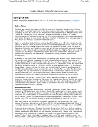
- 2. Photo: Topcon Topcon’s color touchscreen gives the operator a clear view of the situation. GNSS automated grade control to fine-grade the site with more than 50,000 square yards of dirt in only two days. Rob Binder at Branco Machinery, a Gilbert, AZ-based dealer of ground engagement tools and precise measurement products for the construction industry, introduced George to Topcon Positioning Systems’ high-speed 3D-MC 2 automated grade-control system in May 2012, while George was using a different manufacturer’s system. “I had given him simulators for his laptop, and by the time he bought it he was basically up and running,” Binder says. The 3D-MC2 system is an evolution of the machine-control concept initially developed for dozers. System components include a new MC-R 3 GNSS controller that works in conjunction with a 3D-MC 2 sensor; a color, touchscreen, GX-60 control box; and twin or dual conventional GNSS antennas mounted on a dozer blade. The 3D-MC2 sensor combines three electronic gyroscopes and three inertial measurement sensors to measure the X, Y, and Z position as well as roll, pitch, yaw, and acceleration of the dozer blade. Dual Antenna for a Grader Until now, the system has mainly been used on dozers for rough grading. Binder explains how the system was configured differently for George’s motor grader to yield finish-grading accuracy on the steep canal slopes. The 140M was equipped with a mast and GNSS antennas on either side of the blade, in contrast to the twin-antenna arrangement on one pole used that is used on the 3D-MC 2 system for a dozer. The machine frame has four sensors: the 3D-MC2 sensor, a slope sensor, a blade-rotation sensor, and a mainfall sensor that measures slope in the direction of travel. “The benefit of the dual antenna is difficult applications like steep slopes,” Binder points out. “Where the machine would be skewed on the slope in the past, we could not cut that accurately,” he says. “Now, with the dual-antenna 3D-MC 2 , the system is ignoring the mainfall sensor, if you will-which, in turn, allows steep slope grading.” When dual-antenna 3D-MC 2 is used, the 3D-MC 2 sensor, not the mainfall sensor, is the key to precisely grading a steep cross-slope, George adds. “What’s valuable to us is being able to dynamically roll the moldboard forward and maybe back and still maintain the position of the corner of the cutting edge-therefore maintaining the correct grade, even though we are pitching it forward or back,” George says. “Before we started using this system, we had to keep the mast perpendicular to the surface.” When a dual-antenna system is used on a grader, the blade slope sensor, rotation sensor, and mainfall sensor are not used in the blade position calculation. The 3D-MC 2 sensor is used to measure and compensate for forward and back blade-tip pitching. Finish-grading with a 3D-MC2 -equipped motor grader does not yield the real-time productivity savings as with a dozer, but it saves rework and, therefore, time in the long run by improving grading accuracy, according to George. He estimates that the system likely reduces grading costs by 10% on a typical project. The single-antenna grading system he previously used-which made use of a robotic total station-was subject to “sloshing” on steep slopes-i.e., gaps in sensor readings at both ends of the blade-which often led to undercutting and rework. “With dual, the measurement is positive and very accurate; there’s no sloshing,” he says. “It gives you a very accurate cross-slope reading.” Page 2 of 4Forester Network Going Full Tilt - Forester Network 12/7/2015http://foresternetwork.com/daily/construction/going-full-tilt/print/
- 3. Once he converted to Topcon equipment, George picked up the 3D-MC 2 system quickly, he recalls. Another benefit that George began to enjoy as he began working with Branco for automated grade control in general is that the dealer operates its TAZNet (Topcon Arizona Network), which reaches the Phoenix and Tucson metropolitan areas and eliminates the need for a base station on the job site. Once a modem that communicates with the TAZNet is installed on the machine, contractors like George can get to work immediately at the start of a shift, without the need to set up the base station. George made a technology change across the board earlier in the year when he also purchased the Millimeter GPS+ system, which combines GNSS and lasers to yield quarter- inch accuracy, and a large-screen Tesla data collector, which combines the functionality of a tablet PC and a rugged handheld computer. Another differentiation aspect of AZ Grademaker is the fact that George builds his own 3D digital terrain models (DTMs) for the 3D-MC 2 system using Topcon site software and AutoCAD Civil 3D. He has been doing this for more than 10 years, actually. On just his second project as an owner-operator, he was hired to raise the elevation of 20 slabs on grade for single- family homes and was to cut dirt from a retention basin for that purpose. Seeking the DTM from a third-party model builder to load into the grader’s automated grade-control system, he was told that it was not yet built, because it was thought that he would not start there. “We were shut down for a couple of days,” George recalls. “I thought, If I knew how to build the model, I could do it in an hour.” In other situations, contractors would hire him for finish- grading work because he could deliver lower costs with 3D machine control, but he sometimes would have to wait weeks for a third party to build the DTM. “I was missing these opportunities,” he says. These days, he uses the GNSS equipment on the grader to collect topographic data and the Topcon site software to generate a topographical model of the flood canal. He then uses his Tesla to e-mail a comma-separated values (.csv) file to FNF, which builds the 3D model for the grader. Using the Millimeter GPS + system increases George’s productivity on future projects, to the benefit of project owners, he adds. When he is hired to grade a surface adjacent to another one he graded previously, he can build on the model from the previous project. “With this system, we can actually put a [sonic] tracer on one side and match the existing grade and use the model to control the cross-slope,” he says. If lanes that are added to widen a highway have superelevations, for example, no longer is there a need for a topographical survey on the existing lanes; the Millimeter GPS+ system reads the superelevations automatically. The GNSS-laser combination on the Millimeter GPS+ system makes George more productive when doing multiple lifts on a finish-grading project. He recalls making a separate model for each lift with his previous system. Now, “instead of creating this whole surface and all of this work, all I need is one 3D line-that’s been a big deal and saved a lot of time in the office.” On the Magma FRS project, George and FNF were given a strict stockpiling specification that limited their stockpiles to 4,000 cubic yards to ensure accurate material gradation sampling in four locations within each stockpile. FNF’s scrapers excavated material from “borrow areas” that George marked using one side of the blade. “I take the grader and go around the outside edge of a borrow area and create a surface,” George says. “I create an alignment on one side and use that to control the size of our stockpile.” “I’d Be Running a Grade Checker to Death” George is reaping the benefits of automated grade control in general and maximized productivity with the 3D-MC2 system specifically on the Magma FRS project. For example, “Part of the dam spec is no lifts over 8 inches,” he notes. “Machine control is huge to us because we modeled those lifts. It’s a huge deal for us to be able to do that-we’re not putting in too much and we don’t have to take it out. On the other hand, we’re not putting in too little and putting in too many lifts.” When asked how he would ensure accurate grading without automated grade control, he said, “It would be very slow. I’d be running a grade checker to death. Without the machine control, it would take a couple, three grade checkers per crew to keep me going.” Page 3 of 4Forester Network Going Full Tilt - Forester Network 12/7/2015http://foresternetwork.com/daily/construction/going-full-tilt/print/
- 4. Binder points out that stakes, by themselves, cost money-not to mention the cost of putting them in. “If I was working in one area and, say, it rained tonight and it was too wet but we had another area I could go to-if I didn’t have stakes in, I’d be shut down,” George adds. “With machine control, I’m able to jump to another area and go right to work. But without machine control, if I didn’t have the stakes, I would call survey and it would take them two or three days to stake it.” George has no doubt that his ability to build models is allowing him to get grading work he would otherwise miss. He says that he now can target small contractors who otherwise would use conventional staking to aid in grade preparation. Dealing with change orders is another benefit, he adds, recalling a highway project in Tucson. George built the model for the general contractor and received design changes relating to tie-ins to existing concrete pavement. “Otherwise, I’d be taking as-built shots and e-mailing them to somebody and they’d be emailing them back. It saved a huge amount of time.” David Davis, senior project manager for FNF, says that the lower finish-grading cost that AZ Grademaker was able to provide resulted in its being hired for the Magma FRS project. “The accuracy is what prompted our bringing on a GPS system,” he says. “As we bring the dam up, they need to be controlled lifts. We got to where we’re putting in an 8-inch lift and compact that and then put in another 8-inch lift-it’s got to be right on. And we needed to have the ability, when the time came, to be able to cut the slopes with a 3D-MC 2 . We started out without any GPS equipment, thinking that we would be able to do the job without it. As it turned out, we couldn’t get the accuracy that the owner was looking for.” Author’s Bio: Don Talend specializes in covering sustainability, technology, and innovation. Article printed from Forester Network: http://foresternetwork.com URL to article: tilt/-full-http://foresternetwork.com/daily/construction/going Copyright © 2015 Forester Network. All rights reserved. Page 4 of 4Forester Network Going Full Tilt - Forester Network 12/7/2015http://foresternetwork.com/daily/construction/going-full-tilt/print/