
Recommended
Recommended
More Related Content
What's hot
What's hot (20)
Similar to Protecting Water Resources in Lower Saucon Township
Similar to Protecting Water Resources in Lower Saucon Township (20)
More from Kim Beidler
More from Kim Beidler (20)
Recently uploaded
Recently uploaded (20)
Protecting Water Resources in Lower Saucon Township
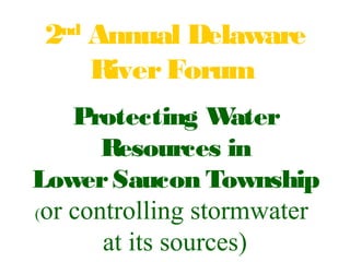
- 1. 2nd Annual Delaware RiverForum Protecting Water Resources in LowerSaucon Township (or controlling stormwater at its sources)
- 2. Natural Resource Protection Overlay (Performance) Zoning Ordinance
- 3. Goal The purpose is to protect and preserve the environment and characterof the Township through the preservation of natural resources including, but not limited to, wetlands, floodplains, floodplain soils, woodlands, steep slopes, rockoutcrops, lakes, ponds, streams, riparian corridors and areas underlain with carbonate geology.
- 4. Natural Resources and Protection Rates The applicant fora subdivision, land development and/or building permit shall be required to identify all natural resources when submitting an application forsubdivision, land development and/orbuilding permit. This inventory shall include the following resources: floodplains, floodplain soils, wetlands, Waters of the Commonwealth, Waters of the U.S., lakes and ponds, riparian, wetland and lake and pond buffers, steep slopes, rockoutcrops, woodlands, environmentally sensitive woodlands, carbonate geology areas, and watershed protection areas.
- 5. Floodplains & Floodplain Soils Floodplains shall have a protection rate of 100%. No structures, filling, piping or regrading shall be permitted in floodplains.
- 6. Wetlands Wetlands, Waters of the Commonwealth and Waters of the U.S. shall have a protection rate of 100%. No structures, filling, piping or regrading shall be permitted.
- 7. Wetland Buffers Wetland buffers shall consist of the area within 25' fromthe edge of any wetland as delineated by the Army Corps of Engineers orthe PA DEP. Wetland buffers shall have a protection rate of 85%
- 8. Riparian Buffers Riparian buffers shall include all areas located within 100 feet of any delineated Waters of the Commonwealth orWaters of the U.S. Riparian, wetland and shoreline buffers shall have a protection rate of 85%
- 9. Lakes and Ponds Lakes and ponds shall have a protection rate of 100%. No structures, filling, piping orregrading shall be permitted within any of these areas. Lake and pond buffers shall have a protection rate of 85%.
- 10. Steep Slopes Steep slopes shall include areas of 3,000 sf orgreater where the slope exceeds 8%. Steep slopes with a grade of 8 - 15% shall have a protection rate of 50%. Steep slopes with a grade of greaterthan 15% to 25% shall have a protection rate of 75%. Steep slopes with a grade of greaterthan 25% shall have a protection rate of 85%.
- 11. Steep Slopes
- 12. Woodlands Woodlands include all areas of 3,000 sf orgreaterwhich contain an average of one ormore trees measuring 6"in caliperorgreaterper1,000 sf. Woodlands shall have a protection rate of 80%. No more than 20% of areas of woodlands shall be cleared, thinned or regraded. Environmentally Sensitive Woodlands Environmentally sensitive woodlands shall include areas of woodlands which coexist with otherprotected natural resources including, but not limited to, floodplains, floodplain soils, steep slopes, lake and pond buffers, riparian buffers and wetland buffers. Environmentally Sensitive Woodlands shall have a protection rate of 85%.
- 13. Woodlands
- 14. Watershed Protection Areas Hellertown Watershed In orderto implement the provisions of this subsection, Watershed Protection Areas surrounding protected public watersupplies are hereby established and are shown on the Township Zoning Map. map is on file at the Township offices).
- 15. Source WaterProtection Areas Cooks CreekWatershed
- 17. LandownerOutreach Welcome to the EAC Waterpage Did yo u kno w...80% of water that fallson grassendsup asrunoff? Did yo u kno w...stormwater runoff causes morepollution than industrial sources? Build your own rain barrel so you can savemoney on your water bill and reduce water pollution. For easy instructionson how to build your own rain barrel, visit Center for Watershed Protection'sstep- by-step guideh
- 18. Welcome to the EAC Waterpage What is a Streamside Buffer? Why are they Important? Benefits of a Health Streamside Buffer How Do I Create a Streamside Buffer?
- 19. Community Partnerships •Watershed Organizations •Environmental Advisory Council •Township Staff and Officials •Parks and Recreation Board
- 20. Partnership Projects Rain Barrel Workshops Streamclean-ups MS4 Education and Outreach Riparian BufferPlantings in Public Parks Riparian BufferBrochure forLandowners
- 21. Lead by Example