
Recommended
Recommended
More Related Content
What's hot
Similar to Social media marketing
Similar to Social media marketing (20)
Recently uploaded
Recently uploaded (20)
Social media marketing
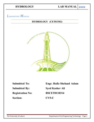
- 1. HYDROLOGY LAB MANUAL 2020 The University of Lahore Department of CivilEngineering Technology Page 1 LABORATORY MANUAL HYDROLOGY (CET03302) Submitted To: Engr. Hafiz Shehzad Aslam Submitted By: Syed Kasher Ali Registration No: BSCET0118314 Section: CV5-C
- 2. HYDROLOGY LAB MANUAL 2020 The University of Lahore Department of CivilEngineering Technology Page 2 PREFACE This course is designed to provide Civil Engineering Technology undergraduates with basic understanding of the theory and practice of Hdrology. Students will apply the knowledge gained from theoretical to practical application. Lab works covered in this manual include Equipment used in Hydrology, Velocity and Discharge by using current meter, Study of Barometer, Study of Rainfall gauges, Measurement of Wind Velocity, Elevation by using GPS etc. Procedures outlining each fieldwork have been comprehensively covered. It is hoped that students will gain valuable insight into engineering after completion of this course, which will also help them in their professional lives.
- 3. HYDROLOGY LAB MANUAL 2020 The University of Lahore Department of CivilEngineering Technology Page 3 ACKNOWLEDGMENT The author is highly indebted to his HOD and colleagues for their constant support and guidance during the course of preparing this manual. In addition thanks to the students for the pictures were collected from the laboratory.
- 4. HYDROLOGY LAB MANUAL 2020 The University of Lahore Department of CivilEngineering Technology Page 4 TABLE OF CONTENTS EXPERIMENT NO-1 LAB LAYOUT EXPERIMENT NO-2 EQUIPMENT USED IN HYDROLOGY EXPERIMENT NO-3 TO PLOT A GRAPH FOR THE GIVEN DATA OF THE TEMPERATURE “T” AND THE SATURATED VAPOUR PRESSURE “ES” OF AIR SHOWING THAT THE SATURATED VAPOUR PRESSURE IS FUNCTION OF THE TEMPERATURE. ALSO FIND THE FOLLOWING FOR THE GIVEN CONDITIONS: 1) SATURATION DEFICIT (ES –E) 2) RELATIVE HUMIDITY (F) 3) DEW POINT TEMPERATURE (TD) EXPERIMENT NO-4 DETERMINATION OF FLOOD ANALYSIS EXPERIMENT NO-5 FLOOD FREQUENCY ANALYSIS EXPERIMENT NO-6 DETERMINATION OF VELOCITY AND DISCHARGE BY USING CURRENT METER EXPERIMENT NO-7 DETERMINATION OF VELOCITY AND DISCHARGE BY USING FLOATS EXPERIMENT NO-8 STUDY OF BAROMETER EXPERIMENT NO-9 STUDY OF RAINFALL GAUGES EXPERIMENT NO-10 MEASUREMENT OF WIND VELOCITY EXPERIMENT NO-11 MEASUREMENT OF ATOMOSPHERE TEMPERATURE EXPERIMENT NO-12 • STUDY AND USES OF GPS (GLOBAL POSITIONING SYSTEM ) EXPERIMENT NO-13 DETERMINATION OF ELEVATION BY USING GPS EXPERIMENT NO-14 STUDY OF SPILLWAYS AND ITS TYPES
- 5. HYDROLOGY LAB MANUAL 2020 The University of Lahore Department of CivilEngineering Technology Page 5 TABLE OF FIGURES __________________________________________________________________ FIGURE NO 1.1: WIND VANE………………………………………………………….09 FIGURE NO 1.2: Plate Anemometer…………………………………………….……….10 FIGURE NO 1.3: Digital Anemometer…………………………………………..……….10 FIGURE NO 1.4: Hygrometer…………………………………………………………….11 FIGURE NO 1.5: Digital Thermometer……………………………………………….….12 FIGURE NO 1.6: Adjustable Bed Flow…………………………………………………..12 FIGURE NO 1.7: Basic Hydrology System…………………………………...………….12 FIGURE NO 1.8: Sediment Transport …………………………………………………...13 FIGURE NO 1.9: Tipping Bucket rain gauge…………………………………………….14 FIGURE NO 1.10 Weighing Precipitation Rain Gauge……………………………...……14 FIGURE NO 3.1: Current Meter ……………………………………………………...….16 FIGURE NO 4.1: Cross-Section of a Stream…………………………………………….22 FIGURE NO 4.2: Stream………………………………………………………………….30 FIGURE NO 5.1: Effect of Weather on Air-Pressure………………………………….…32 FIGURE NO 5.2: Water based Barometer …………………………………………….…35 FIGURE NO 5.3: Mercury Barometer………………………………………………...….36 FIGURE NO 5.4: Aneroid Barometer……………………………………………….……36 FIGURE NO 5.5: Barograph…………………………………………………………...…39 FIGURE NO 5.6: The Fortin Barometer………………………………………….………40 FIGURE NO 5.7: Chart of variation in Pressure ………………………………...……….43 FIGURE NO 5.8: Rain………………………………………………………………...….43 FIGURE NO 5.9: Better Air Pressure ……………………………………………………44 FIGURE NO 5.10: Fine Water …………………………………………………………….44 FIGURE NO 6.1: Symon’s Rain Guage…………………………………………….….…47 FIGURE NO 6.2: Standard Rain Gauge……………………………………………..……48 FIGURE NO 6.3: Weighing Bucket Rain gauge ………………………………........……49 FIGURE NO 6.4: Tipping Bucket Rain Gauge ……………………………………..……49 FIGURE NO 6.5: Floating Rain Gauge …………………………………………….....….50 FIGURE NO 6.6: Optical Rain gauge…………………………………………...……..….51 FIGURE NO 6.7: Acoustic Rain Gauge ………………………………………………..…51 FIGURE NO 6.8: Location for installing Rain gauge…………………………………..…54 FIGURE NO 7.1: Anemometer ………………………………………………………...…56 FIGURE NO 8.1: Humidity Measuring scale ………………………………………….…64 FIGURE NO 9.1: Thermometer………………………………………………………...…69 FIGURE NO 9.2: Analogue Thermometer …………………………………………….…70 FIGURE NO 9.3: Dual Sensor Thermometer …………………………………….………70 FIGURE NO 9.4: K-type Thermocouple……………………………………………….…72
- 6. HYDROLOGY LAB MANUAL 2020 The University of Lahore Department of CivilEngineering Technology Page 6 FIGURE NO 9.5: Infrared Thermometer …………………………………………………72 FIGURE NO 10.1: Simple GPS………………………………………………………….…74 FIGURE NO 12.1: Spill Way …………………………………………………………..….77 FIGURE NO 12.2: Over Fall Spill way ……………………………………………………77 FIGURE NO 12.3: Saddle Spill Way ……………………………………………..….……78 FIGURE NO 12.4: Shaft Spill Way ………………………………………………………78 FIGURE NO 12.5: Side Channel Spill Way ………………………………...……………79 FIGURE NO 12.6: Emergency Spill Way …………………………………………..……79 FIGURE NO 12.7: Siphon Spill Way …………………………………………………….80 FIGURE NO 14.1: Schematic Diagram of Indus River ……………………….………….82 FIGURE NO 15.1: Basic Hydrology System ……………………………………………..84
- 7. HYDROLOGY LAB MANUAL 2020 The University of Lahore Department of CivilEngineering Technology Page 7 LIST OF TABLES __________________________________________________________________ TABLE NO 3.1: Coefficient for Standard Vertical –Velocity Curve………………………...19 TABLE NO 3.2: Mean vertical velocity ……………………………………………………..23 TABLE NO 3.3: Calculations and Observations ……………………………………...……...…26 TABLE NO 7.1: Wind Speed and Description …………………………………………...….57 TABLE NO 8.1: Relative Humidity Determination Based on Water Vapor Content ……..…65 TABLE NO 8.2: Relative Humidity Determinations Using Dry &Wet Bulb Thermometer…66 TABLE NO 13.1: Observation and calculation of Flow Duration…………………………….….81 TABLE NO 15.1: Observation and Calculation of Ponding Time ……………………………….85
- 8. HYDROLOGY LAB MANUAL 2020 The University of Lahore Department of CivilEngineering Technology Page 8 EXPERIMENT NO-1 LAYOUT OF HYDROLOGY LAB PURPOSE: To get familiar with the different types of instruments, apparatus & their respective locations in laboratory of Hydrology. To get an idea about different experiments & their purpose, to be performed in the lab
- 9. HYDROLOGY LAB MANUAL 2020 The University of Lahore Department of CivilEngineering Technology Page 9 EXPERIMENT NO-2 EQUIPMENT USED IN HYDROLOGY WIND VANE: Objective: A wind vane is an instrument for showing the direction of the wind. Introduction: Wind vane consist of an asymmetrically shaped object mounted at the center of gravity about a vertical axis. The end, which offers the greater resistance to the motion of air, moves to the downwind position and subsequently, the direction of the wind is determined by reference to an attached compass rose. Figure 1.1: Wind Vane Uses: Research. Air quality. General purpose meteorological application. Wind profiles. ANEMOMETER: Objective: An anemometer is a device used for measuring wind speed, and is a common weather station instrument. The term is derived from the Greek word anemos, which means wind, and is used to describe any wind speed measurement instrument used in meteorology. The first known description of an anemometer was given by Leon Battista Alberti in 1450. Introduction: Most anemometer consist of 3 or 4 cups that catch the wind and spin. The rotations per minutes or RPM is translated to wind speed.
- 10. HYDROLOGY LAB MANUAL 2020 The University of Lahore Department of CivilEngineering Technology Page 10 Types: Velocity Anemometer Cup anemometer Windmill anemometer Hot-wire anemometer Laser Doppler anemometer Sonic anemometer Pressure Anemometer Plate anemometer Tube anemometer Digital anemometer Figure 1.2: Plate Anemometer Figure 1.3: Digital Anemometer HYGROMETER: Objective: Hygrometer is used for measuring temperature and humidity. Figure 1.4: Hygrometer
- 11. HYDROLOGY LAB MANUAL 2020 The University of Lahore Department of CivilEngineering Technology Page 11 Uses: At greenhouses, industrial units, incubators and museums. To aid humidity control in residential settings. Types: Metal/pulp coil type Hair tension Electronic hygrometer Ranges: For temperature (-10 to 60 ̊C) For Humidity (0 % to 100 %) ADJUSTABLE BED FLOW: Objective: This laboratory instrument is used to: Study the uniform and non-uniform flow through channels. Measure the local or point velocity of flow at a point. Measure the depth of flow at various sections. Figure 1.6: Adjustable Bed Flow BASIC HYDROLOGY SYSTEM: Objective: This Hydrology system is used for experimental rainfall runoff modelling and to determine the runoff coefficient. Figure 1.7: Basic Hydrology System
- 12. HYDROLOGY LAB MANUAL 2020 The University of Lahore Department of CivilEngineering Technology Page 12 THERMOMETER: Objective: Thermometer is used for measuring temperature of anything i.e. materials like asphalt, cement, sand etc. Figure 1.5: Digital Thermometer Range: For temperature (-50 to 200 ̊C) For temperature (-58 to 392 ̊F) SEDIMENT TRANSPORT: Objective: Sediment transport system is used to: Investigate the effect of velocity of flow on height and length of ripple. The Threshold for incipient motion for Plane bed Ripple bed Measure the bed load transport rate and investigate the effect of velocity on it. Figure 1.8: Sediment Transport DIFFERENT TYPES OF RAIN GAUGES: It is used by meteorologists and hydrologists to collect and measure the quantity of precipitation (rain) during a set period of time. Measurement: Most rain gauges generally measure the precipitation in millimeters. The level of rainfall is sometimes reported as inches or centimeters.
- 13. HYDROLOGY LAB MANUAL 2020 The University of Lahore Department of CivilEngineering Technology Page 13 Figure 1.9: Tipping Bucket Rain Gauge Figure 1.10: Weighing Precipitation Rain Gauge TYPES OF RAIN GAUGES: Standard rain gauge Tipping bucket rain gauge Optical rain gauge Acoustic rain gauge Weighing precipitation gauge Comments:
- 14. HYDROLOGY LAB MANUAL 2020 The University of Lahore Department of CivilEngineering Technology Page 14 Design Exercise No. 3 TO PLOT A GRAPH FOR THE GIVEN DATA OF THE TEMPERATURE “T” AND THE SATURATED VAPOUR PRESSURE “ES” OF AIR SHOWING THAT THE SATURATED VAPOUR PRESSURE IS FUNCTION OF THE TEMPERATURE. ALSO FIND THE FOLLOWING FOR THE GIVEN CONDITIONS: 1. SATURATION DEFICIT (ES –E) 2. RELATIVE HUMIDITY(F) 3. DEW POINT TEMPERATURE (TD) Condition Air Temperature (T) (◦C) Vapor Pressure (mm of Hg) 1 11 7.9 2 17 10.8 3 21 13 4 25 18.4 RELATED THEORY: HYDROLOGY Hydrology is the science of waters of the earth, their occurrence, circulation and distribution over the globe, their physical and chemical properties and their reaction / interaction with the physical and biological environment. It deals with precipitation, evaporation, infiltration, ground water flow, runoff, stream flow and the transport of substances dissolved or suspended in the flowing water. So, it is the scientific study of hydrological cycle. The hydrological cycle involves evaporation, transpiration, interception, infiltration, run-off, seepage and precipitation. Due to solar radiation, water from ocean, river, lakes or any other body on earth surface evaporates in gaseous form.
- 15. HYDROLOGY LAB MANUAL 2020 The University of Lahore Department of CivilEngineering Technology Page 15 ENGINEERING HYDROLOGY It includes those segments of the field pertinent to planning, design and operation of engineering projects for the control and u se of water. SIGNIFICANCE OF HYDROLOGY Study of water is extremely necessary as: i. It is the basic need for human life over the planet. ii. To cope with extreme hydrological events (For examples: Floods, droughts, etc) iii. To determine input data for the design and operation of hydraulic structures like dams, reservoirs, storm drainage system, water supply schemes, etc. METEOROLOGY It is the science of atmosphere which is gaseous envelope surrounding the earth.
- 16. HYDROLOGY LAB MANUAL 2020 The University of Lahore Department of CivilEngineering Technology Page 16 CLIMATIC FACTORS Meteorology of the region is affected by certain climatic factors: i. Amount and distribution of precipitation ii. The occurrence of snow and ice iii. Wind velocity iv. Temperature v. Humidity IMPORTANCE OF KNOWLEDGE OF METEOROLOGY i. Cloud formation ii. Occurrence of precipitation iii. Thunder storm formation iv. Movement of rainstorms v. Weather forecast vi. Flood warnings and forecasts ATMOSPHERE It is the gaseous envelope around the earth surface. It consists of many gases like nitrogen, oxygen, carbon dioxide, etc. Different layers of atmosphere are: i. Troposphere ii. Stratosphere iii. Mesosphere
- 17. HYDROLOGY LAB MANUAL 2020 The University of Lahore Department of CivilEngineering Technology Page 17 iv. Thermosphere TROPOSPHERE / HYDROSPHERE It is the layer of atmosphere adjacent to the surface of earth which contains about 99% of the total atmospheric water. Its average thickness is about 8-12km. It is the most important layer with reference to the Civil Engineering as all the hydrological processes takes place in this layer. ATMOSPHERIC WATER It is the water available in the atmosphere in the form of water vapors, ice crystals, clouds and precipitating particles etc. VAPORIZATION It is the process of transformation of water from liquid state to vapor state. VAPOR PRESSURE “e” Pressure exerted by the water vapors in air is known as Vapor pressure. The commonly used units are mm of Hg.
- 18. HYDROLOGY LAB MANUAL 2020 The University of Lahore Department of CivilEngineering Technology Page 18 SATURATION VPOR PRESSURE “es” It is the vapor pressure when air is fully saturated at a given temperature. It is the measure of moisture holding capacity of air which increases with the increase in the air temperature. Its values can be obtained from the Psychometric tables. It can also be obtained (within 1%range) from the value of temperature in the range of - 500C to 55oC by the use of following equation: es ≈3.38639 [ (0.00738T + 0.8072)8 – 0.000019( 1.8T + 48 ) + 0.001316] SATURATION DEFICIT The difference between the saturation vapor pressure and the vapor pressure of the air at the given temperature is known as the Saturation deficit. HUMIDITY It is the presence of moisture in the air. Humidity in the atmosphere can be assessed by vapor pressure of air. RELATIVE HUMIDITY It is the ratio between the vapor pressure and the saturation vapor pressure of the air at a given temperature. It is usually expressed in percentage. It is represented as “f”. f = (e / es) * 100 DEW POINT TEMPERTURE “Td” It can be defined as the temperature at which the air mass just becomes saturated if cooled at Constant pressure with moisture neither added nor remo ved. When air is cooled to this Temperature, dew drops are formed. PROCEDURE i. Plot a graph between saturated vapor pressure and air temperature. ii. Plot condition 1 for given value of “e” and “T” on es~T graph. iii. For point 1 draw a vertical line passing through the point up to the saturation line
- 19. HYDROLOGY LAB MANUAL 2020 The University of Lahore Department of CivilEngineering Technology Page 19 iv. Measure distance between saturation line, it is the saturation vapor pressure for point 1. v. Measure vertical distance between point 1 and saturated line, it is saturation deficit. vi. Compute relative humidity by using the equation. vii. Draw a horizontal line point 1 to the left; it may intersect with the saturation curve. Note down the temperature for the intersection point, it is the dew point temperature. viii. Repeat steps ii to vii for other points as well.
- 20. HYDROLOGY LAB MANUAL 2020 The University of Lahore Department of CivilEngineering Technology Page 20 CALCULATIONS: Table for plotting the Saturation curve: Sr. No. Air Temperature ( 0 C) Saturated vapor pressure (mm of Hg) 1 -4 4.32 2 -2 4.90 3 0 5.61 4 2 6.35 5 4 7.36 6 6 8.27 7 8 9.32 8 10 10.41 9 12 11.73 10 14 13.25 11 16 15 12 18 16.87 13 20 18.91 14 22 21.10 15 24 23.75 16 26 26.60 17 28 29.95 18 30 34.40
- 21. HYDROLOGY LAB MANUAL 2020 The University of Lahore Department of CivilEngineering Technology Page 21 Plot of saturated vapor pressure as a function ofair temperature showing the status offour conditions
- 22. HYDROLOGY LAB MANUAL 2020 The University of Lahore Department of CivilEngineering Technology Page 15 Table ofCalculations . No. Air Temperatur e “T” (~C) Vapor Pressure “e” (mm of Hg) Saturatd vapor pressure “es” mm of Hg) Saturatio n deficit “es-e” (mm of Hg) Relative humidity f=(e/es)*100 % Dew point temperatue “Td” (~C) 1 11 7.9 11 3.1 71.82 5 2 17 10.8 17 5.2 63.53 10.5 3 21 13 21 7 61.9 13.7 4 25 18.4 25 6.6 73.6 19.5 RESULTS AND COMMENTS:
- 23. HYDROLOGY LAB MANUAL 2020 The University of Lahore Department of CivilEngineering Technology Page 16 DESIGN EXERCISE NO.4 DETERMINATION OF FLOOD DISCHARGE ANALYSIS RELATED THEORY: PRECIPITATION: Precipitation is defined as all types of moisture reaching to the surface of earth from the atmosphere. The precipitation on the land surface is about one third of the total global precipitation. Precipitation is the basic input for a hydrological system. FORMS OF PRECIPITATION Precipitation may be in the form of one or more than one of the following forms: i. Drizzle / Mist ii. Rain iii. Snow iv. Sleet v. Glaze vi. Hail vii. Fogs viii. Frost ix. Trace
- 24. HYDROLOGY LAB MANUAL 2020 The University of Lahore Department of CivilEngineering Technology Page 17 MECHANISM TO FORM PRECIPITATION Following mechanisms are necessarily required for precipitation to occur over an area: i. Lifting mechanism ii. Formation of cloud droplets / Ice crystals iii. Growth of cloud droplets / ice crystals iv. Sufficient accumulation of moisture over an area RAIN GAUGE Rain gauge is an instrument used to measure the amount of rainfall or the intensity of rainfall at any place. AMOUNT OF PRECIPITATION It is the total amount of rainfall over an area usually in one day. It is measured in the units of mm or inches. INTENSITY OF PRECIPITATION It is the amount of precipitation at a place per unit time. It is usually expressed in mm/hr or inches/hr. TYPES OF STORM ISOLATED STORM When subsequent storm does not occur before the runoff of the previous storm ceases, that storm is called isolated storm COMPLEX STORM When subsequent storm occurs before the runoff of the previous storm ceases, such combined storms are called complex storm.
- 25. HYDROLOGY LAB MANUAL 2020 The University of Lahore Department of CivilEngineering Technology Page 18 HYDROGRAPH OF AN ISOLATED STORM: 1. SIMPLE JUDGEMENT: Table 1 T T+4 Discharge 1cm/h 2cm/h 3cm/h 4cm/h Q+4 0 4 0 4 8 12 16 1 5 6 10 20 30 40 2 6 13 17 34 51 68 3 7 22 26 52 78 104 4 8 16 20 40 60 80 5 9 11 15 30 45 60 6 10 7 11 22 33 44 7 11 4 8 16 24 32 8 12 2 6 12 18 24 9 13 1 5 10 15 20 10 14 0 4 8 12 16 (Graph of Simple Judgment Method)
- 26. HYDROLOGY LAB MANUAL 2020 The University of Lahore Department of CivilEngineering Technology Page 19 2. S HYDROGRAPH METHOD: Table 2 Time Discharge Discharge Combined (m3/sec) (m3/sec +8) 0 0 0 0 1 6 0 6 6 0 2 13 6 0 19 13 6 3 22 13 6 0 41 22 13 4 16 22 13 6 0 57 16 22 5 11 16 22 13 6 0 68 11 16 6 7 11 16 22 13 6 0 75 7 11 7 4 7 11 16 22 13 6 0 79 4 7 8 2 4 7 11 16 22 13 6 0 81 2 4 9 1 2 4 7 11 16 22 13 6 0 82 1 2 10 0 1 2 4 7 11 16 22 13 6 82 0 1 11 0 1 2 4 7 11 16 22 13 76 0 (Graph of S Hydrograph Method)
- 27. HYDROLOGY LAB MANUAL 2020 The University of Lahore Department of CivilEngineering Technology Page 20 COMMENS: DESIGN EXERCISE NO - 5 FLOOD FREQUENCYANALYSIS RELATED THEORY PRECIPITATION Precipitation is defined as all types of moisture reaching to the surface of earth from the atmosphere. The precipitation on the land surface is about one third of the total global precipitation. Precipitation is the basic input for a hydrological system. PROBABILITY PLOTTING Arrange the available discharge (say “n” in total) in descending order. Let the serial order of this specific discharge “m”. This serial order m is called rank or order of the observation. The recurrence interval and the probability of the specific discharge Q in the series can be calculated by the following methods. CALIFORNIA FORMULA Tr = 𝒏 𝒎 HAZEN’S FORMULA Tr = 𝒏 𝒎 − 𝟎.𝟓
- 28. HYDROLOGY LAB MANUAL 2020 The University of Lahore Department of CivilEngineering Technology Page 21 WEIBULL’S FORMULA Tr = 𝒏 + 𝟏 𝒎 GUMBELL’S FORMULA Tr = 𝒏 𝒎 + 𝑪 − 𝟏 Here, C is called gumbell’s correction. Its value depends on m and n as given in the following table.
- 29. HYDROLOGY LAB MANUAL 2020 The University of Lahore Department of CivilEngineering Technology Page 22 Sr No Discharge (m3/sec) Discharge (m3/sec) in descending order Return Period (Tr) California Formula (=n/m) Hazzen's Formula (=n/m-0.5) Weibul’s formula (=n+1/m) m/n C Gumbell’s formula (=n/m+C-1) 1 395 887 32.00 64.00 33.00 0.03 0.26 123.08 2 619 814 16.00 21.33 16.50 0.06 0.32 24.24 3 766 766 10.67 12.80 11.00 0.09 0.38 13.45 4 422 726 8.00 9.14 8.25 0.13 0.43 9.33 5 282 721 6.40 7.11 6.60 0.16 0.47 7.16 6 887 705 5.33 5.82 5.50 0.19 0.49 5.83 7 705 697 4.57 4.92 4.71 0.22 0.53 4.90 8 528 696 4.00 4.27 4.13 0.25 0.56 4.23 9 520 634 3.56 3.76 3.67 0.28 0.58 3.73 10 436 632 3.20 3.37 3.30 0.31 0.60 3.33 11 697 624 2.91 3.05 3.00 0.34 0.62 3.01 12 624 619 2.67 2.78 2.75 0.38 0.66 2.74 13 496 598 2.46 2.56 2.54 0.41 0.69 2.52 14 489 528 2.29 2.37 2.36 0.44 0.70 2.34 15 598 527 2.13 2.21 2.20 0.47 0.72 2.17 16 359 520 2.00 2.06 2.06 0.50 0.73 2.03 17 696 496 1.88 1.94 1.94 0.53 0.74 1.91 18 726 489 1.78 1.83 1.83 0.56 0.76 1.80 19 527 464 1.68 1.73 1.74 0.59 0.77 1.70 20 310 459 1.60 1.64 1.65 0.63 0.80 1.62 21 408 440 1.52 1.56 1.57 0.66 0.82 1.54 22 721 436 1.45 1.49 1.50 0.69 0.84 1.47 23 814 422 1.39 1.42 1.43 0.72 0.85 1.40 24 459 408 1.33 1.36 1.38 0.75 0.86 1.34 25 440 395 1.28 1.31 1.32 0.78 0.87 1.29 26 632 373 1.23 1.25 1.27 0.81 0.89 1.24 27 343 371 1.19 1.21 1.22 0.84 0.91 1.19 28 634 359 1.14 1.16 1.18 0.88 0.94 1.15 29 464 343 1.10 1.12 1.14 0.91 0.96 1.10 30 373 310 1.07 1.08 1.10 0.94 0.97 1.07 31 289 289 1.03 1.05 1.06 0.97 0.99 1.03 32 371 282 1.00 1.02 1.03 1.00 1.00 1.00 n = Total no of year (32) , m = No of year
- 30. HYDROLOGY LAB MANUAL 2020 The University of Lahore Department of CivilEngineering Technology Page 23 Graphs: 1. 2. 0 100 200 300 400 500 600 700 800 900 1000 0.00 20.00 40.00 60.00 80.00 Hazzen'sFormula Hazzen's Formula = n/m- 0.5 0 100 200 300 400 500 600 700 800 900 1000 0.00 10.00 20.00 30.00 40.00 CaliforniaFormula California Formula = n/m
- 31. HYDROLOGY LAB MANUAL 2020 The University of Lahore Department of CivilEngineering Technology Page 24 3. 4. COMMENS: 0 100 200 300 400 500 600 700 800 900 1000 0.00 10.00 20.00 30.00 40.00 Weibul’s formula Weibul’s formula = n+1/m 0 100 200 300 400 500 600 700 800 900 1000 0.00 50.00 100.00 150.00 Gumbell’s formula Gumbell’s formula = n/m+C-1
- 32. HYDROLOGY LAB MANUAL 2020 The University of Lahore Department of CivilEngineering Technology Page 25 DESIGN EXERCISE NO-6 DETERMINATIONOF VELOCITYAND DISCHARGE USING CURRENTMETER OBJECTIVES: The objective of this experiment is to review the techniques and instruments used to measure stream velocity and to calculate stream discharge. We review the methods for determining the vertically averaged velocity at a point and the factors affecting the accuracy of discharge measurement. APPARATUS: Current meter Wading rod Sounding Weights and Accessories Sonic Sounder Width Measuring Equipment RELATED THEORY: Stream Flow Discharge: Stream flow discharge is defined as the volume rate of flow of water that includes any substances dissolved or suspended in the water. Discharge is usually expressed in units of cubic feet per second (cfs or ft3 /sec). If the mean water velocity normal to the direction of flow (V) and the cross sectional area (A) of water flow is known, then the discharge (Q) can be computed as: Q=VA. Current Meter A current meter is an instrument that measures the velocity of flowing water. The current meter is based on the principle that the velocity of water is proportional to the angular velocity of the meter's rotor. The velocity of water at a given point can be determined by counting the number of revolutions of the rotor during a specified or measured interval of time. Figure 3.1: Current Meter
- 33. HYDROLOGY LAB MANUAL 2020 The University of Lahore Department of CivilEngineering Technology Page 26 TYPES OF CURRENT METER: Current meters are classified according to their rotors. Vertical Axis Current Meter: The most common vertical axis current meter used by the U.S. Geological Survey is the Price Meter, type AA. The rotor is 5 inches in diameter and 2 inches high with six cone shaped cups mounted on a stainless steel shaft. A type AA meter is also available for low velocities. The low velocity is normally rated from 0.2 to 2.5 cfs. It is recommended for use in streams where the mean velocity at a cross section is less than 1 cfs. Horizontal Axis Current Meter: Horizontal axis current meters are the Ott, Neyrpic, Haskell, Hoff, and Braystoke. The Ott meter is made in Germany, the Neyrpic, in France; both are used extensively in Europe. The Haskell and Hoff meters, both developed in the United States, are used in a limited extent. The Braystoke meter is used extensively in the United Kingdom. The Ott meter is not widely used in the United States because of a lack of durability under extreme conditions. Optical Current Meter: The U.S. Geological Survey has developed an optical current meter. It is designed to measure surface water velocities in open channel without requiring submersion of the equipment. Its primary advantages are for stream environments where the velocities are too high to be measured by a conventional meter, i.e. floods, or where there is significant debris flow that would be hazardous to a current meter. Acoustic Doppler Current Meters: Acoustic Doppler current meters determine stream velocity by measuring the change in sound energy reflected from particles or gas bubbles suspended in the water. Acoustic Doppler velocimeters (ADV) provide point estimates of water velocity, while Acoustic Doppler current profilers (ADCP) provide velocity estimates in a vertical series of "cells" or "layers" in the water column. WADING ROD There are two types of wading rods used for determining depth in a stream. Top wading rod: The top setting rod has the advantage of convenience in setting the meter at the proper depth; the hydrographer also keeps his hands dry in the process. The top setting rod has a 1/2 inch hexagonal main rod for measuring the depth and a 3/8 inch diameter round rod for setting the position of the current meter . This rod also has a number of design features that assist in setting the current meter at specific fractions (0.2, 0.4, 0.6, and 0.8) of the water depth. Round wading rod: The round wading rod has a base plate, lower section, three or four intermediate sections, and a sliding support and a rod end. The round rod is used typically in ice measurements. The most convenient length for an ice rod is approximately three feet.
- 34. HYDROLOGY LAB MANUAL 2020 The University of Lahore Department of CivilEngineering Technology Page 27 SOUNDING WEIGHTS AND ACCESSORIES: In streams that are swiftly flowing and too deep to wade, a current meter is suspended in the water by a cable attached to a boat, bridge, or cableway. A sounding weight is suspended below the meter to keep it stationary in the water. The weight also minimizes the damage to the meter when it is lowered to the streambed. The sounding weights are the Columbus weights or C type weights. SONIC SOUNDER: An alternative method of determining stream depth is with a portable sonic sounder. The USGS uses commercially available portable depth sounders with a narrow beam angle to minimize the errors on inclined streambeds and permits the hydrograph to work close to obstructions and piers. WIDTH MEASURING EQUIPMENT: The distance to any point in a stream's cross-section is measured from an initial point on the stream bank. Discharge measurements are marked at 2, 5, 10, or 20 feet intervals for cableways and bridges. Distance between the markings is estimated or measured with a rule or pocket tape. Measurements made by wading, in boats or on unmarked bridges. Steel or metallic tapes or tag lines are commonly used measuring devices. VERTICALLY AVERAGED VELOCITY DETERMINATION: Current meters measure velocity at a point in the stream cross section. Discharge measurement requires determining the mean velocity in each of the selected verticals. The mean velocity in a vertical cross section can be approximated by making several velocity observations at different depths and then using a known relationship between these velocities and the vertical mean velocity. MEAN VELOCITY METHODS: Vertical Velocity Curve Method: In this methodology, a series of velocity observations are made at points distributed between the water surface and the streambed. Normally observations are taken at 0.1 depth increments between 0.1 and 0.9 of the total depth. Observations are always taken at 0.2, 0.6 and 0.8 of the depth to facilitate comparison with other velocity methods. Coefficients for the standard vertical velocity curve are shown in Table.
- 35. HYDROLOGY LAB MANUAL 2020 The University of Lahore Department of CivilEngineering Technology Page 28 Table: 3.1 Coefficients for standard vertical-velocity curve. Typical velocity curve Fraction of total water depth Ratio of point velocity to mean vertical velocity 0.05 1.160 0.1 1.160 0.2 1.149 0.3 1.130 0.4 1.108 0.5 1.067 0.6 1.020 0.7 0.953 0.8 0.871 0.9 0.746 0.95 0.648
- 36. HYDROLOGY LAB MANUAL 2020 The University of Lahore Department of CivilEngineering Technology Page 29 Three-Point Method: The three point method is a combination of the two-point and the six-tenths depth methods and utilizes velocity measurements at 0.2, 0.6 and 0.8 of the depth. The mean velocity is determined by averaging the 0.2 and 0.8 depths; the result is then average with the 0.6 depth observation. In equation form, this is Vmean = (V0.2 + V0.8)/4 + (V0.6)/2 Two-Point Method: The two point methodology uses velocity observations at 0.2 and 0.8 of the depth below the surface. The average of these two observations is the mean velocity in the vertical. Six-Tenths Depth Method: This approach presumes that a velocity observation made in the vertical at 0.6 of the depth below the surface is the mean vertical velocity. Observational data and mathematical models have shown that the 0.6 depth produces reliable results. The U.S. Geological Survey used the 0.6 depth method under the following conditions: The depth is between 0.4 and 1.5 feet (Price pygmy meter) or 1.5 and 2.5 feet (Price type AA) Large amounts of slush ice or debris make it impracticable to observe the velocity at the 0.2 depth The distance between the meter and the sounding weight is too great to place the meter at the 0.8 depth The stream stage is changing rapidly and a measurement must be quickly made. Two-Tenths Depth Method: In the two-tenths depth method, the velocity is observed at 0.2 of the depth of the surface; a coefficient is then applied to the observed velocity to obtain the vertical mean velocity. The two-tenths depth method is not as reliable as either the two-point or the six-tenths depth methods, but it is used in situations where it is not possible to obtain depth sounding or position the current meter at the 0.6 or 0.8 depths. Subsurface Velocity Method: In this methodology, the velocity is observed at an arbitrary depth below the water surface. The observed depth should be at least 2 feet below the surface. The method has application when stream stage is available and sounding and depth data cannot be estimated reliably. Surface Velocity Method: The surface velocity method is preferable to the subsurface velocity method provided an optical current meter which accurately measures surface velocities is available. In natural channels, a surface velocity coefficient of 0.85 or 0.86 is used to compute the mean velocity. In a smooth channel, the coefficient is 0.90. Integration Method: In this methodology, the current meter is lowered in the vertical to the streambed and then raised to the surface at a uniform rate. During this time, the total number of revolutions and the total elapsed time are used in conjunction with the current meter rating table to estimate the mean vertical velocity. Five-Point Method:
- 37. HYDROLOGY LAB MANUAL 2020 The University of Lahore Department of CivilEngineering Technology Page 30 Another rarely used method in the United States is the five-point method. Observations are make in each vertical at 0.2, 0.6, and 0.8 of the depth below the water surface. Observations are also taken as close to the surface and the streambed as practical. The velocity observations are used to compute the mean vertical velocity, Vmean, using the equation, Vmean = 0.1( Vsurface + 3V0.2 + 3V0.6 + 2V0.8 + Vbed) Six-Point Method: The six-point method is also rarely used in the United States. Data points are collected at 0.2, 0.4, 0.6 and 0.8 of the depth below the water surface. The data are supplemented with observations close to the surface and the streambed. The mean velocity is computed from the equation, Vmean = 0.1( Vsurface + 2V0.2 + 2V0.4 + 2V0.6 + 2V0.8 + Vbed) DISCHARGE MEASURING METHODS Midsection Method: The USGS currently uses the midsection method of computing stream discharge using current meter velocity measurements. In this method, the stream cross section is divided into rectangular subsections as shown in Figure 2.2. At the center of each of these subsections (called a vertical), a depth and velocity measurement is made, and the distance from a datum point on the shore is determined. The total discharge can be determined using the procedure outlines.
- 38. HYDROLOGY LAB MANUAL 2020 The University of Lahore Department of CivilEngineering Technology Page 31 Figure 3.2: Midsection Method Velocity at an end vertical has to be adjusted as a percentage of the adjacent vertical, since it is not possible to measure the velocity accurately with the current meter close to a boundary. Laboratory data summarized in the table below suggest that the mean vertical velocity in the vicinity of a smooth wall of an idealized rectangular channel is related to the mean vertical velocity at a distance from the wall equal to the depth (Vd). Table: 3.2 Mean vertical velocity near a well as a function of velocity at one channel depth from the well. Distance from Wall Mean Vertical Velocity (Ratio of Depth) (fraction of Vd) 0.00 0.65 0.25 0.90 0.50 0.95 1.00 1.00
- 39. HYDROLOGY LAB MANUAL 2020 The University of Lahore Department of CivilEngineering Technology Page 32 Mean section Method: The mean section method was used by the U.S. Geological Survey prior to 1950. In this older method, discharges are computed for subsections between successive observation verticals. The velocities and depths at successive verticals are each averaged; each subsection extends laterally from one observation vertical to the next. The subsection discharge is the product of the average of two mean velocities, the average of two depths, and the distance between observation verticals. The total discharge is again given by Equation. Young (1950) determined that the midsection method is simpler to compute and is slightly more accurate than the mean section method. ASSUMPTION IN DISCHARGE MEASUREMENT Carter and Anderson (1963) performed statistical studies that analyzed discharge measurement error in natural streams under average conditions. Four assumptions were evaluated: The rating of the current meter is applicable to the measurement conditions. The observed velocity is a true time-average velocity. The ratio is known between the velocity of selected points in the vertical and the mean velocity in the vertical. The depth measurements are correct; the velocity and depth are a linear function of the distance between the verticals. PROCEDURE: 1. The first step in making a conventional current-meter measurement of discharge is to select a measurement cross section of desirable qualities. 2. After the cross section has been selected, the width of the stream is determined. A tag line or measuring tape is strung across the measurement section for measurements made by wading, from a boat, from ice cover, or from an unmarked bridge. 3. Then find the depth of the each section using depth measuring device. 4. Next the spacing of the verticals is determined to provide about 25 to 30 subsections. 5. The verticals should be so spaced that no subsection has more than 10 percent of the total discharge. 6. After the stationing of the observation verticals has been determined, the appropriate equipment for the current-meter measurement is assembled and the measurement note sheets for recording observations are prepared. 7. The following information will be recorded for each discharge measurement: 1. Name of stream and location to correctly identify the established gaging station; or name of stream and exact location of site for a miscellaneous measurement. 8. Date, party, type of meter suspension, and meter number. 3. Time measurement was started using military time (24-hr clock system). 4. Bank of stream that was the starting point. 5. Control conditions. 6. Gage heights and corresponding times. 7. Water temperature. 9. Assemble the current meter 10. The meter should balance on the hanger used and should spin freely; 11. The stopwatch should check satisfactorily in a comparison with the hydrographer’s watch.
- 40. HYDROLOGY LAB MANUAL 2020 The University of Lahore Department of CivilEngineering Technology Page 33 12. Depth (if any) at the edge of water is measured and recorded. The depth determines the method of velocity measurement to be used, normally the two-point method or the 0.6-depth method. 13. After the meter is placed at the proper depth and pointed into the current, the rotation of the rotor is permitted to become adjusted to the speed of the current before the velocity observation is started. 14. The stopwatch is started simultaneously with the first signal or click, which is counted as “zero,” and not “one.” The count is ended on a convenient number coinciding with one of those given in the column headings of the meter rating table. The stopwatch is stopped on that count and is read to the nearest second or to the nearest even second if the hand of the stopwatch is on a half-second mark. That number of seconds and the number of revolutions are then recorded. 15. After the meter has become adjusted to the current, the number of revolutions made by the rotor is counted for a period of 40 to 70 s. 16. The hydro-grapher moves to each of the observation verticals and repeats the above procedure until the entire cross section has been traversed. 17. Number of revolution corresponding to the velocity of the water. 18. Then area of the section is multiply with the velocity to determine the discharge of channel. Calculations and Observations: 1 2 3 4 5 6 7 8 Section Flow Velocity (m/s) Depth (m) Width (m) Area (m2) Flow (m/s) 0.2D 0.8D Mean 1 0.6 0.4 0.5 1.3 2.0 2.6 1.30 2 0.8 0.6 0.7 1.7 1.0 1.7 1.19 3 0.9 0.6 0.75 2.0 1.0 2.0 1.50 4 1.1 0.7 0.9 2.2 1.0 2.2 1.98 5 1.0 0.6 0.8 1.8 1.0 1.8 1.44
- 41. HYDROLOGY LAB MANUAL 2020 The University of Lahore Department of CivilEngineering Technology Page 34 FACTORS AFFECTING THE ACCURACY OF A DISCHARGE MEASUREMENT: 1. The measurement of discharge is affected by several issues that can bias, distort, and impact the stage discharge relationship. Accurate measurement requires that the measurement equipment be properly assembled and maintained. This is especially critical for current meters which are susceptible to damage. 2. The underlying characteristics of the measurement section also affects measurement accuracy. Ideally, a cross section lies within a straight reach resulting in streamlines that are parallel to each other. Velocities should be greater than 0.5 feet per second and depths should exceed 0.5 feet. The streambed should also be relatively uniform and free of slack water, eddies, and excessive turbulence. Finally, the measurement section should be located relatively close to the gaging station. Each of these conditions will impact the accuracy of the measurement data. 3. The spacing of the observation verticals also impacts the measurement accuracy. Ideally, 25 to 30 verticals should be used; the verticals should be spaced so that each subsection will have approximately equal discharge. 4. Inaccuracies in sounding and the placement of current meters are most likely to occur in those sections that have great depths and velocities. As a result, heavy sounding weights should be used to reduce the vertical angle made by the sounding weight. 5. Wind also affects the accuracy of discharge measurements. 6. Measurements during freezing winter conditions can be especially challenging. Comments:
- 42. HYDROLOGY LAB MANUAL 2020 The University of Lahore Department of CivilEngineering Technology Page 35 EXPERIMENT NO-7 DETERMINATION OF VELOCITY AND DISCHARGE USING FLOATS OBJECTIVE: To Measure volumetric flow rate (Q) and mean velocity (v) of a stream. INTRODUCTION: Stream flow or volumetric flow rate/discharge is defined as the volume rate of flow of water (including any sediment or other solids that may be dissolved or mixed with it) (Buchanan and Somers, 1969). Hundreds of thousands of stream flow measurements are done every year. They can be done on a wide array of water body discharges, from still waters to floods. Since the flow velocity varies at different points in a stream cross section, calculating the average velocity at many points within that cross section is highly recommended. APPARATUS: Tape measure Watch or stop-watch Rod, yard or meter stick to measure depth Buoyant objects such as a weighted block of wood or oranges (objects that float immersed at the water surface). Stakes for anchoring tape measure to stream banks Waders RELATED THEORY: Discharge: In hydrology, discharge is the volume rate of water flow that is transported through a given cross-sectional area. It includes any suspended solids (e.g. sediment), dissolved chemicals (e.g. CaCO3 (aq)), or biologic material (e.g. diatoms) in addition to the water itself. Stream velocity: Stream velocity is the speed of the water in the stream. Units are distance per time (e.g., meters per second or feet per second). Stream velocity is greatest in midstream near the surface and is slowest along the stream bed and banks due to friction. Reach: For the float method, measure out some convenient distance along the stream bank (try at least 30 meters).In hydrology, this is called a "reach".
- 43. HYDROLOGY LAB MANUAL 2020 The University of Lahore Department of CivilEngineering Technology Page 36 Float: To move or cause to move buoyantly, lightly, or freely across a surfaceor through air, water,etc. Types: Surface floats: Surface floats are small, light bodies, such as wood or wax, which float on the surface of the water and can readily be seen from the shore. Measurement by this means is rapid hut the velocities obtained may be greatly in error, due to the action of wind on the float. Double floats: The double float consists of a light surface float and a subsurface float somewhat heavier than water connected to it t>y a cord or a small rope. The office of the upper float is to support the lower float and indicate its position. The connecting cord can be lengthened at will and the lower float be placed at any desired depth. Float rod: Professor Cabeoc was the first to use the float rod for measuring velocity. This was in 1646. The rod is of wood or tin, from 1 to 2 inches in diameter, weighted at the lower end so as to float vertically. Its lower end should nearly touch the bottom and its upper end project a few inches above the surface of the water, so as to be visible. Float frame. For obtaining velocity, a light frame of wood which nearly filled the cross section of the channel, but there are practical difficulty in the way of the use of this instrument. CONDITIONS FOR FLOATING MEASUREMENT: The following are favorable conditions for float measurements: The river channel must be straight with more or less uniform cross-section along the entire reach. The length of the reach must be from 50 m to 100 m. There must be steady flow along the entire reach. The stream channel should have no under-water surface obstructions that would disturb the flow of water, and consequently the stream velocity.
- 44. HYDROLOGY LAB MANUAL 2020 The University of Lahore Department of CivilEngineering Technology Page 37 PROCEDURE: The following procedure outlines the methods to follow in making discharge measurements: 1. Reconnaissance is conducted along a segment of the stream to find a convenient site of observation. 2. When a favourable site is selected, the selected length of reach is measured, say 50 meters, marking the ends with a stake. 3. If possible, travel time should exceed 20 seconds. 4. A range line through each stake is constructed. Both range lines are made perpendicular to the axis of the stream by using the 3–4–5 triangle method of erecting perpendiculars, or by the compass or other means. Figure 4.1: Cross-section of a Stream 5. The width of the stream at the upper and lower ends are measured with a tape if the stream is narrow, and by the triangulation method if the stream is wide. 6. Tag lines, each spanning the stream at the upper end and at the lower end are laid. Similar tags are placed at the first, mid and third quarter points. The depths are measured at the upper and lower end tag lines. 7. Members of the survey team do the following: One observer at the upper end with a signal flag. One member of the team acts as a recorder. One observer at the lower end with a stop watch. One observer further upstream to release the float. One member of the team to retrieve the float.
- 45. HYDROLOGY LAB MANUAL 2020 The University of Lahore Department of CivilEngineering Technology Page 38 8. The chief of the survey team signals for the beginning of observations. The float is then released further upstream. Once the float passes the upper end tag line, upper end observer drips down his flag. The lower end observer receives the signal by taking note of the time with the stop watch. 9. When the float passes at the lower end tag line, the lower end observer again takes note of the time the float has travelled and then recorded. The float is retrieved. 10. Average your cross-sectional areas (A) to compute Q. 11. The above procedure is being repeated at the first, mid and third quarter points. Optional steps: If increased accuracy is desired and the stream is wide enough, you can divide the stream into 3 or more sections or float lanes, and measure surface velocities in each lane. Figure 4.2: Stream OBSERVATIONS AND CALCULATIONS: Vsurface = travel distance/ travel time = d/t Because surface velocities are typically higher than mean or average velocities V mean = k Vsurface where k is a coefficient that generally ranges from 0.8 for rough beds to 0.9 for smooth beds (0.85 is a commonly used value)
- 46. HYDROLOGY LAB MANUAL 2020 The University of Lahore Department of CivilEngineering Technology Page 39 V = d/t Q = VA Where: V = Stream velocity D = distance of float travelled (m) Q = rate of discharge A = [Width of the river (m)] × [average depth of water (m)] T = time (minutes) FACTORS CONTROLLING ACCURACY OF STREAM MEASUREMENT. The accuracy of a stream measurement depends largely upon the accuracy with which the cross- sectional area and the velocity are measured. The accuracy of a discharge measurement also depends much upon the physical features of the stream at the discharge section or point of measurement. When possible, this section should be on a straight reach and far enough from a bend t6 be out of its influence, the bed should be permanent and not stony, and the slope and wetted perimeter such that at high and low stages of the stream, the velocity in all parts of the section will he easily measureable. Rapid fluctuations of the water surface or river height during measurement and the condition of the velocity-measuring instrument are other factors which affect the accuracy of a stream measurement. Comments:
- 47. HYDROLOGY LAB MANUAL 2020 The University of Lahore Department of CivilEngineering Technology Page 40 EXPERIMENT NO-8 STUDYOF BAROMETER OBJECTIVE: To learn about this device, called barometer. Find out the history behind its discovery and how it functions. INTRODUCTION: A barometer is a scientific instrument used in meteorology to measure atmospheric pressure. Pressure tendency can forecast short term changes in the weather. Numerous measurements of air pressure are used within surface weather analysis to help find surface troughs, high pressure systems and frontal boundaries. A BRIEF HISTORY OF THE BAROMETER: The first barometer is thought to have been built sometime between 1640 and 1643 by Gasparo Berti, however, Evangelista Torricelli who is generally credited with inventing the barometer built the first barometer with mercury in 1643. It was not until around 1675 that barometers were used domestically for weather prediction. The stick barometer was the first made as a scientific instrument. As the popularity of the barometer grew so did their decoration and attractiveness and were considered prize pieces of furniture as well as being useful. The wheel barometer was devised around 1663 but gained popularity in the 1770’s. A problem with these mercury barometers was that they were not easily portable without spillage. By 1843 Vide had invented a barometer without mercury, an aneroid barometer, which consisted of a chamber being connected to the pointer by levers to enhance movement and thus more portable and used by scientists to measure heights of hills or at sea. WHAT IS ATMOSPHERIC PRESSURE? The atmospheric pressure is the force exerted by the weight of the Earth's atmosphere, expressed per unit area in a given horizontal cross-section. Thus, the atmospheric pressure is equal to the weight of a vertical column of air above the Earth's surface, extending to the outer limits of the atmosphere. HOW WEATHER AFFECTS AIR PRESSURE: One of things you see most frequently in weather forecasts is big “H” and “L” signs moving across a map. These are large swaths usually many hundreds of miles across of high or low pressure. There’s no number which indicates high or low; it’s merely a relative term an area of high pressure is higher than what is around it.An area of high pressure i.e. more downward force pushes air down. As the air descends, it warms, which inhibits the formation of clouds and storm systems. So high pressure is almost always a sign of good or fair weather.
- 48. HYDROLOGY LAB MANUAL 2020 The University of Lahore Department of CivilEngineering Technology Page 41 Figure 5.1: Effect of Weather on Air-Pressure TYPES OF BAROMETER: Water-based barometers: The water barometer consisted of a 30’ long vertical glass tube that was sealed at the top; the open bottom was immersed in a cistern of water. As the atmospheric pressure increased, the level of the water in the column rose, falling again as the atmospheric pressure decreased. Figure 5.2: Water-based Barometer Mercury Barometer: The standard mercury barometer design is the same as the water one only the glass tube is 29.92 inch high containing mercury.
- 49. HYDROLOGY LAB MANUAL 2020 The University of Lahore Department of CivilEngineering Technology Page 42 As a storm approaches, the atmospheric pressure drops and the level of the column of mercury also falls. Once the storm passes and high pressure returns, the height of the column of mercury rises with the increasing atmospheric pressure. Figure 5.3: Mercury Barometer HANDLING PRECAUTIONS FOR MERCURY: High-purity distilled and refined mercury is used in mercury barometers. When the mercury surface oxidizes, the interface between the surface and the ivory pointer becomes unclear. Heavily contaminated mercury surface requires cleaning. Since mercury is a toxic substance, it is necessary to pay attention to the following when handling mercury. A container of mercury must be sealed tightly to prevent leakage and breakage. Do not put mercury into any metal containers as mercury reacts and amalgamates almost all metals except for iron. The floor of the room where mercury is stored or used in large amounts should be shielded and laid with an impervious covering. It must not be stored together with other chemicals, especially with ammonia or acetylene. Mercury has a relatively low boiling point of 357 °C, and produces dangerous poisonous gas if on fire. It must not be stored close to a heat source. Check the mercury handling room and personnel periodically to make sure that the amount of mercury does not exceed the dangerous limit. (The environmental regulation on water contamination affecting personal health limits the total amount of mercury to 0.0005 mg/l.)
- 50. HYDROLOGY LAB MANUAL 2020 The University of Lahore Department of CivilEngineering Technology Page 43 Correction of barometer readings: The mercury barometer’s reading should be corrected to the one and the standard condition. Standard condition is defined as a temperature of 0 °C, where the density of mercury is 13.5951 g/cm3 and a gravity acceleration of 980.665 cm/s2. During actual observation, the reading should be corrected for the index error, temperature correction, and gravity acceleration as follows: Corrections on index error: Individual mercury barometers include index errors (difference between the value indicated by an individual instrument and that of the standard). The index error is found by comparison with the standard, and the value is stated on a "comparison certificate". Corrections for temperature: The temperature correction means to correct a barometric reading, obtained at a certain temperature, to a value when mercury and graduation temperatures are 0 °C. The temperature of the attached thermometer is used for this purpose. The height of the mercury column varies with temperature, even the atmospheric pressure is unchanged. The graduation of the barometer is engraved so that the correct pressure is indicated when temperature is 0 °C. In a case that when temperature is above 0°C, the graduation expands and the measured value will be smaller than the true value. This effect of temperature must be corrected from these two aspects collectively Correction for the expansion and contraction of mercury is much larger than that for the expansion and contraction of the graduation. The correction value for temperature Ct is expressed as follows: where: H hPa is the barometric reading after the correction for index error. t °C is the temperature indicated by the attached thermometer. is the volume expansion coefficient of mercury. is the linear expansion coefficient of the tube. There is a small difference in absolute values for correction between temperatures below and above 0 °C. The values for correction at temperatures above 0 °C are negative and those below 0 °C are positive.
- 51. HYDROLOGY LAB MANUAL 2020 The University of Lahore Department of CivilEngineering Technology Page 44 Corrections for gravity: Gravity affects the height of the mercury column. After the corrections for index error and temperature, the reading under the local acceleration of gravity has to be reduced to the one under the standard gravity acceleration. This is called corrections for gravity. The gravity value for correction Cg is derived by: where: g0 is the standard gravity acceleration. g is the gravity acceleration at an observing point. H is the barometric reading after the index error and temperature corrections H0 is the value already corrected for gravitation. The gravity acceleration used in corrections for gravity value is calculated to the fifth decimal place, in m/s2. When the gravity acceleration at the observing point is larger than the standard gravity acceleration, the gravity value for correction is positive. Otherwise, the value for correction is negative. To use a barometer for regular observations at a particular location, a synthesis correction table that summarizes values for correction for index error, temperature and gravity should be used. ANEROID BAROMETER: The aneroid barometer succeeded the water and mercury barometers and gives a very accurate measurement of atmospheric pressure. It consists of a small evacuated container with a corrugated top. As the atmospheric pressure rises, the corrugated top is pushed inwards and as the pressure decreases the top pops back up again. A system of levers connects the corrugated top to a dial that indicates atmospheric pressure in milli- bars. Figure 5.4: Aneroid Barometer
- 52. HYDROLOGY LAB MANUAL 2020 The University of Lahore Department of CivilEngineering Technology Page 45 BAROGRAPH: A barograph is a barometer that records the barometricpressure over time. The barograph is an automated version of the aneroid barometer, except there is a pen connected by levers to the corrugated top. This pen traces atmospheric pressures onto a barogram located on a revolving drum. Examples of barographs and barograms are shown below; Figure 5.5: Barograph Electronic Barometer: Stable and continuous power supply is required to measure atmospheric pressure with an electronic barometer. Testing vacuum in a barometer: Greater the atmospheric pressure, greater is the vertical height of the mercury column. The space above mercury is a vacuum. This empty space is called 'Torricellian vacuum'. This can be shown by tilting the tube till the mercury fills the tube completely. The Fortin Barometer: It is an improved version of the simple mercury barometer. It gives more accurate reading of the atmospheric pressure because a vernier scale is used here.
- 53. HYDROLOGY LAB MANUAL 2020 The University of Lahore Department of CivilEngineering Technology Page 46 Figure 5.6: The Fortin Barometer USES OF BAROMETERS: Measuring Weather: Barometers have long been used for measuring weather patterns. Air pressure from high and low pressure fronts that move throughout the globe is useful in determining or predicting what the weather will be like at a given time and on a given date. This is the most basic and historical use for barometers, and these devices help determine whether it will be hot or cold, or what the likelihood of precipitation might be on any given date. Pressure Reading Devices: Other types of barometers include the pressure devices found on pressure cookers, canning utensils and steam boilers. Any time an air pressure inside of a vessel has to be measured, a barometer is the most useful tool to perform this measurement. Air Travel: Other types of barometers include air pressure reading devices that report the air speed of an aircraft. Often called pitot tubes, these devices are a type of barometer that senses the pressure of air moving against an aircraft and then converts this reading into an estimated air speed indicator, allowing pilots to determine how fast they are moving relative to the air around them. Altitude Measurements: Yet another type of use for barometers on airplanes or elsewhere is as a measure of altitude. Since air gets thinner and lighter the higher up you travel into the atmosphere, a barometer can be useful for determining how high above sea level you are. Barometers that have this function are often called altimeters or altitude meters. PROCEDURE OF USING BAROMETER: Correct for altitude if using a stick barometer: To accurately measure the air pressure using a stick barometer, you will need to correct for your altitude using a conversion chart.[8] Look at the barometer at eye level and record the number next to the top of the mercury. This is the pressure in millimeters of mercury (mmHg). Find your elevation and then use to the chart to find the relevant correction factor. Add the correction factor to the reading on the barometer. This reading should match the reading of the local weather service. If you are at an elevation of over 1,000 ft, stick barometers do not work. Set the manual hand to the current reading: The set hand will serve as a reference that allows you to easily tell if the pressure is steady, rising or falling.
- 54. HYDROLOGY LAB MANUAL 2020 The University of Lahore Department of CivilEngineering Technology Page 47 Remember, this hand will only be present on an aneroid barometer. If you have an electronic barometer, you can simply check the reading. If you have a mercury barometer, you will need to correct for altitude if you’re above sea level. Check the barometer an hour later: Predicting weather using a barometer is all about changes in air pressure. You want to check the reading every few hours to determine if the pressure is changing or staying the same. If using an aneroid or mercury barometer, gently tap the face of the barometer to release any pressure changes stored in the mechanisms. Take the reading after the needle or mercury has stopped moving. Move the set hand if the pressure has changed so the next time you check it will be obvious what direction the air pressure is going. Chart the changes in pressure: Keep a journal of all the readings you take with your barometer. Sketch a small graph for the changes in a day to help with your forecasting. Is the pressure rising? Falling? Staying the same? This is all important information for predicting the weather. Do not expect large changes in the movement of needle. Daily changes are usually between 0.02 and 0.10 of an inch using the barometer scale. Larger variations may occur in winter and are dependent upon location and altitude. Take frequent readings (every few hours) and plot them on your graph. Figure 5.7: Chart of Variation in Pressure How Forecasting the Weather using Barometer: Predict rain if the air pressure is falling: Generally, if the pressure is falling, the weather is taking a turn towards storms and rain. The starting point of the reading is also important in the forecast. Higher readings indicate better weather even if the pressure is falling. If the reading is over 30.2 inches of mercury and falling rapidly, this indicates cloudy, but warmer weather.
- 55. HYDROLOGY LAB MANUAL 2020 The University of Lahore Department of CivilEngineering Technology Page 48 If the reading is between 29.8 and 30.2 inches of mercury and falling rapidly, rain is most likely on the way. If it’s under 29.8 inches of mercury and falling slowly, rain is likely; if it’s falling rapidly, a storm is imminent. Figure 5.8: Rain Forecast improving weather when air pressure rises: As the air pressure rises, the weather tends to improve as the high pressure systems moves through your location. Readings over 30.2 inches of mercury that rise indicate that the weather will continue to be fair. Readings between 29.8 and 30.2 inches of mercury that rise indicate that the weather will remain whatever it presently is. Readings under 29.8 inches of mercury that rise indicate that the weather is clearing, but will be cooler. Figure 5.9: Better Air Pressure Forecast fine weather when air pressure is steady: Steady air pressure indicates long periods of nice weather and suggests that you will be experiencing more of the same. If it’s sunny and the pressure is holding, expect more sunshine! Higher pressures indicate warmer weather, while lower pressures indicate cooler weather. A strong high pressure system is around 30.4 inches of mercury. Anything above 30 is considered high pressure. A typical low pressure system is around 29.5 inches of mercury. Anything below 29.9 is considered low pressure.
- 56. HYDROLOGY LAB MANUAL 2020 The University of Lahore Department of CivilEngineering Technology Page 49 Figure 5.10: Fine Weather BAROMETRIC PRECAUTION: The barometric pressure graph produced by this watch can be used to obtain an idea of upcoming weather conditions. Note that this graph provides only a rough idea of barometric pressure trends, and it is not intended for official weather predictions or reporting activities. Pressure sensor readings can be affected by sudden changes in temperature. Because of this, there may be some error in the readings produced by the watch. Comments:
- 57. HYDROLOGY LAB MANUAL 2020 The University of Lahore Department of CivilEngineering Technology Page 50 EXPERIMENT NO-9 STUDY OF THE RAINFALL GAUGES OBJECTIVE: To study about the rainfall gauge and different type of rainfall gauges. HISTORY: The first known rainfall records were kept by the Ancient Greeks, about 500 B.C.About 400 B.C. people in India also began to record rainfall. The readings were correlated against expected growth, and used as a basis for land taxes. RAINFALL GAUGE: Rain gauge is a type of instrument used by meteorologists and hydrologists to measure rainfall rate in a certain period of time. Rain gauges are also known as udometer, pluviometer and barometer. TYPES OF RAIN GAUGES: There are two types of rain gauges: 1. Non-Recording Type Rain Gauge: Symons Rain Gauge/standard rain gauge: Non-recording type rain gauge is most common type of rain gauge used by meteorological department. It consists of a cylindrical vessel 127mm in diameter with a base enlarged to 210mm diameter. At its top section, funnel is provided with circular brass rim which is 127mm exactly so that it can fit into vessel well. This funnel shank is inserted in the neck of a receiving bottle which is 75 to 100mm high from the base section and thinner than the cylinder, placed into it to receive rainfall. Figure 6.1: Symon’s Rain Gauge A Receiving bottle has capacity of 100mm and during heavy rainfall, amount of rain is frequently exceeded, so the reading should be measured 3 to 4 times in a day. Water contained in this receiving bottle is measured
- 58. HYDROLOGY LAB MANUAL 2020 The University of Lahore Department of CivilEngineering Technology Page 51 by a graduated measuring glass with accuracy up to 0. 1mm. For uniformity the rainfall is measured every day at 8:30Am IST and is recorded as rainfall of the day. Proper care, maintenance and inspection of rain gauge especially during dry weather is necessary to keep the instrument free form dust and dirt, so that the readings are accurate. Standard rain gauge: The standard NWS rain gauge, developed at the start of the 20th century, consists of a funnel emptying into a graduated cylinder, 2 cm in radius, which fits inside a larger container which is 20 cm in diameter and 50 cm tall. If the rainwater overflows the graduated inner cylinder, the larger outer container will catch it. When measurements are taken, the height of the water in the small graduated cylinder is measured, and the excess overflow in the large container is carefully poured into another graduated cylinder and measured to give the total rainfall. Sometimes a cone meter is used to prevent leakage that can result in alteration of the data. Figure 6.2: Standard Rain Gauge 2. Recording Type Rain Gauges: There are five types of recording rain gauges Weighing bucket type Tipping bucket type Floating or natural syphon type rain gauge Optical rain gauge Acoustic rain gauge Weighing Bucket Type Rain Gauge: Weighing bucket type rain gauge is most common self-recording rain gauge. It consists of a receiver bucket supported by a spring or lever balance or some other weighing mechanism. The movement of bucket due to its increasing weight is transmitted to a pen which traces record or some marking on a clock driven chart. Weighing bucket type rain gauge instrument gives a plot of the accumulated (increased) rainfall values against the elapsed time and the curve so formed is called the mass curve.
- 59. HYDROLOGY LAB MANUAL 2020 The University of Lahore Department of CivilEngineering Technology Page 52 Figure 6.3: Weighing Bucket Type Rain Gauge Tipping Bucket Type Rain Gauge: Tipping bucket type rain gauge is a 30cm sized circular rain gauge adopted for use by US weather bureau. It has 30cm diameter sharp edged receiver and at the end of the receiver is provided a funnel. Pair of buckets are pivoted under this funnel in such a manner that when one bucket receives 0.25mm of precipitation (rainfall), it tips discharging its rainfall into the container, bringing the other bucket under the funnel. Figure 6.4(a): Figure 6.4(b): Tipping Bucket Type Rain Gauges Tipping of bucket completes an electric circuit causing the movement of pen to mark on clock driven receiving drum which carries a recorded sheet. These electric pulses generated are recorded at the control room far away from the rain gauge station. This instrument is further suited for digitalizing the output signal. Floating or Natural Syphon Type Rain Gauge: The working of this type of rain gauge is similar to weighing bucket rain gauge. A funnel receives the water which is collected in a rectangular container. A float is provided at the bottom of container, and this float
- 60. HYDROLOGY LAB MANUAL 2020 The University of Lahore Department of CivilEngineering Technology Page 53 raises as the water level rises in the container. Its movement being recorded by a pen moving on a recording drum actuated by a clock work. When water rises, this float reaches to the top floating in water, then syphon comes into operation and releases the water outwards through the connecting pipe, thus all water in box is drained out. This rain gauge is adopted as the standard recording rain gauge in India and the curve drawn using this data is known as mass curve of rain fall. Figure 6.5(a) Figure 6.5(b) Floating Type Rain Gauge
- 61. HYDROLOGY LAB MANUAL 2020 The University of Lahore Department of CivilEngineering Technology Page 54 Optical rain gauge: These have a row of collection funnels. In an enclosed space below each is a laser diode and a photo transistor detector. When enough water is collected to make a single drop, it drops from the bottom, falling into the laser beam path. The sensor is set at right angles to the laser so that enough light is scattered to be detected as a sudden flash of light. The flashes from these photo detectors are then read and transmitted or recorded. Figure 6.6: Optical Rain Gauge Acoustic rain gauge: The acoustic disdrometer is an acoustic rain gauge. Also referred to as a hydrophone, it is able to sense the sound signatures for each drop size as rain strikes a water surface within the gauge. Since each sound signature is unique, it is possible to invert the underwater sound field to estimate the drop-size distribution within the rain. Selected moments of the drop-size distribution yield rainfall rate, rainfall accumulation, and other rainfall properties. Figure 6.7: Acoustic Rain Gauge SELECTION OF RAIN-GAUGING STATION: While selecting the site for rain-gauging station following points are taken into consideration: The spot at which rain-gauge is to be installed should be truly representative of the area, of which it is supposed to give depth of rainfall. The rain-gauging station should be easily accessible to the observer at all times.
- 62. HYDROLOGY LAB MANUAL 2020 The University of Lahore Department of CivilEngineering Technology Page 55 The gauge should be erected on level ground, not upon a slope or a terrace and never on a wall or a roof. All other conditions satisfied, a position sheltered from the wind is preferable to an exposed one. In mountains and near sea coasts it is very essential to ensure that the gauge is not un-dully exposed to the swept of wind. The gauge should be properly secured by a barbed wire fencing and locking arrangement. The rain-gauging station should not be too close to the buildings or trees etc. The nearness of such objects affects entry of rainfall in the funnel. Its distance from other objects should not be less than twice the height of the object above the rim of the gauge. Network of Rain-Gauges: The network of observation stations has to be properly designed to cover all the representative portions of the basin area with due care to the topography, orography so as to get equitable coverage of spatial variations in the basin. The broad guide lines set up for the required network of rain-gauge stations as per World Meteorological Organization (WMO) is as follows: For plain areas of the basin 1 rain-gauge for every 500 km2. For hilly areas of the basin: 1 rain-gauge for every 150 km2. Limitations of Accuracy: The most significant influences on the accuracy of precipitation measurement are the environment and wind at the installation site rather than the performance of the instrument itself. Such influences are difficult to eliminate. Additionally, because precipitation is strongly characterized by locality, it is difficult to choose observation sites with a sufficient level of representation. Site selection without such consideration may result in observations that have very poor accuracy. Windshields: Wind exerts a significant influence on the observation of precipitation with snow and rain gauges, and there is no way to avoid its effects. However, accurate collection of precipitation in a rain gauge is possible when the wind around the receptacle is horizontal and its speed is equal to that at ground level or when no vortices develop near the gauge. A windshield is effective in reducing the influence of wind. SOURCES OF ERRORS: Observation errors in measuring precipitation are caused by the influences of the environment, instrument errors and errors due to wetting and evaporation. Some initial rainwater may get lost in moistening gauge funnel and inside surface. Blowing wind may tilt the rain from vertical which thus brings less rain catch in the gauge. Vertical upward air currents may impact upward acceleration to precipitation thus brings less rain catch in gauge. Mistake in reading the scale of gauge. Dents in collector rim may change its receiving area. Some rain water may get lost due to splash from the collector. Gauge inclined 10 ̊ from vertical will approx. cater 1.5 % less rain than it should. Tipping of bucket may be affected due to rusting or accumulation of dust on pivot.
- 63. HYDROLOGY LAB MANUAL 2020 The University of Lahore Department of CivilEngineering Technology Page 56 HOW TO INSTALL A RAIN GAUGE: Step#1: Location: Find a good spot outside for your rain gauge. Look for an open area away from buildings and with nothing overhead such as trees, electric wires, or the edge of a roof. These obstacles can direct rainwater into or away from the opening of your gauge and cause inaccurate measurements. Examples of Good Locations for Rain Gauges (a) Deck Railing (b) Fence (c) Mailbox Post (d) Middle of Yard Figure 6.8: Location for installing rain gauge Step#2: Mounting: Once you've found the perfect spot, it's time to place the rain gauge. For the State Water Survey rain gauge pictured in the upper left-hand corner of this page, there are two different mounting methods: Ground Insertion: Firmly push the rain gauge into the ground, pointy-end first. Remember storm winds can be strong so be sure to push the gauge deep enough for it to stand upright in bad weather. Surface Attachment: The easiest way to mount the rain gauge to wood is to nail it in place using the two mounting holes located on the bottom "stake" of the rain gauge.
- 64. HYDROLOGY LAB MANUAL 2020 The University of Lahore Department of CivilEngineering Technology Page 57 Find two nails with heads small enough to slide completely through the mounting holes. Finish nails work well. You don't want to use screws or large-headed nails since the gauge must be removed from the fence or post in order to dump out old rainwater. Holding the rain gauge in your hand, position the tube so the open top of the gauge will be an inch or two above the wood post, fence, or stick (see pictures a, b, and c on earlier page). That way the wood won't shelter the gauge from full rainfall. Test to see if your gauge can slide easily on and off the nails. If not, adjust the nails. PRECAUTIONS TO BE CONSIDERED WHILE INSTALLING A RAIN GAUGE: Do not place a rain gauge under trees or roofs to avoid extra collection of water Prevent it from any obstruction Place it on a raised fixed platform to avoid splashing water from entering While measuring the rainfall it is required to note that rain gauge should not be inserted totally inside the ground. Rain water should not be lost in the ground. Rain water should not be evaporated. Comment
- 65. HYDROLOGY LAB MANUAL 2020 The University of Lahore Department of CivilEngineering Technology Page 58 EXPERIMENT NO-10 MEASUREMENT OF WIND VELOCITY OBJECTIVE: To measurement of wind velocity using an anemometer. APPARATUS: Anemometer RELATED THEORY: Wind: Wind is the horizontal movement of air. Wind velocity: Wind speed is the rate or movement of air flow as it travels from high to low pressure, in relation to the Earth. Warm air rises because it weighs less than cold air, and the cold air then moves in and replaces the warm air. Anemometer: The instrument used to measure wind speed is called an anemometer, which is an indicator that will spin in the wind. The anemometer rotates at the same speed as the wind. It gives a direct measure of the speed of the wind. Figure 7.1: Anemometer
- 66. HYDROLOGY LAB MANUAL 2020 The University of Lahore Department of CivilEngineering Technology Page 59 The Beaufort Scale: The Beaufort scale was devised by Sir Francis Beaufort from Navan, County Meath. It is a way of estimating the wind strength according to the appearance of the sea or land. Table 7.1 wind speed and description Category Wind speed Description 0 < 1 km/h Calm - Smoke rises vertically. 1 1–5 km/h Light air- Direction of wind shown by smoke but not by wind vanes. 2 6–11 km/h Light breeze- Wind felt on face, leaves rustle. 3 12–19 km/h Gentle breeze - Leaves and small twigs in constant motion. 4 20–28 km/h Moderate breeze - Raises dust and loose paper, small branches are moved. 5 29–38 km/h Fresh breeze - Small trees in leaf begin to sway, crested wavelets form on inland waters. 6 39–49 km/h Strong breeze - Large branches in motion, whistling heard in telegraph wires, umbrella used with difficulty. 7 50–61 km/h Near gale - Whole trees in motion, inconvenience walking against the wind. 8 62–74 km/h Gale - Breaks twigs off trees, generally impedes progress 9 75–88 km/h Strong gale- Slight structural damage occurs (chimney pots and slates removed). 10 89–102 km/h Storm - Seldom experienced inland, trees uprooted, considerable structural damage occurs 11 103–117 km/h Violent storm - Very rarely experienced, accompanied by widespread damage.
- 67. HYDROLOGY LAB MANUAL 2020 The University of Lahore Department of CivilEngineering Technology Page 60 12 ≥ 118 km/h Hurricane. FACTORS AFFECTING WIND SPEED: Pressure gradient: Is a term to describe the difference in air pressure between two points in the atmosphere or on the surface of the Earth. It is vital to wind speed, because the greater the difference in pressure, the faster the wind flows (from the high to low pressure) to balance out the variation. The pressure gradient, when combined with the Coriolis effect and friction, also influences wind direction. Rossby waves: Are strong winds in the upper troposphere. These operate on a global scale and move from West to East (hence being known as Westerlies). The Rossby waves are themselves a different wind speed from what we experience in the lower troposphere. Local wof hurricanes, weather conditions: Play a key role in influencing wind speed, as the formation monsoons and cyclones as freak weather conditions can drastically affect the flow velocity of the wind. PROCEDURE: 1. Divide the into small groups with the following roles (optional) One time keeper who will be responsible for timing one minute for each trial. One official "counter" for the day. The others may count on their own, but the counter's readings will be the ones recorded. One holder who will hold the anemometer while the spins are counted; the holder should make sure that he holds the anemometer so that the wind is unobstructed. 2. Mount or hold the anemometer in a place that has full access to the wind from all directions. 3. When the time keeper says "Go", the counter in each group will count how many times the marked cup passes them in one minute and write it down. 4. If possible, repeat the above step four (4) times and record the average number of spins Optional: You can multiply the average number of spins by 60 to find out how many times the anemometer would spin in an hour and come up with a statement such as: the speed of the wind today is about 1,000 spins per hour.
- 68. HYDROLOGY LAB MANUAL 2020 The University of Lahore Department of CivilEngineering Technology Page 61 PROCEDURE FOR DIGITAL ANEMOMETER: 1. Turn the instrument ON by pushing and holding the MODE button for 4 seconds. Release the MODE button after turn ON. 2. Set the instrument into Manual Mode by holding the MODE button for 6 seconds. You will see a flashing group of letter on the right. 3. Push the Plus (+) key until the m/s is displayed then release the MODE button. The display will default to measuring wind speed in meters per second (m/s) in about 6 seconds. 4. Blow on the impeller mechanism for a few seconds and verify that the display indicates wind speed measured in meters per second. The last wind speed reading will remain on the screen until the next reading is taken. 5. Turn the floor fan ON to the highest speed setting. 6. Place the anemometer’s impeller at various points in front of the moving air from the fan – left, right and middle – and note the readings you obtain. 7. Place the anemometer’s impeller closer to and away from the moving air and note the reading you obtain. 8. Find the spot where you obtain the highest wind speed and note that position as the spot to place the Wind Pitch wind turbine in subsequent experiments. 9. The bar graph on the left side of the LCD that moves up and to the right is the Beaufort Wind Scale reading (bft). It shows in relative terms the general nature of the wind speed based on generalized weather conditions. The actual wind speed number and the Beaufort numbers are different. For example, a wind speed of 5.8 m/s will generate a bft of 4. Refer to the Table above for wind speed and bft ranges. SAFETY PRECAUTION USING ANEMOMETER: 1. The use of the environment: It is forbidden to use an anemometer in a flammable gas environment. It is forbidden to place the anemometer probe in a flammable gas. Failure to do so may result in fire or even explosion. 2. Note: Do not disassemble or modify the anemometer. Failure to do so may result in electric shock or fire. In use, if the anemometer emits an unusual smell, sound or smoke, or if liquid flows into the interior of the anemometer, Please turn off the battery immediately to remove the battery. 3. MAINTENANCE: Do not expose the probe and anemometer body to rain. Otherwise, there may be electric shock, fire and personal injury. Do not touch the internal sensor area of the probe. When the anemometer is not used for a long time, please take out the internal battery. Otherwise, the battery may leak, causing damage to the anemometer.
- 69. HYDROLOGY LAB MANUAL 2020 The University of Lahore Department of CivilEngineering Technology Page 62 Do not place the anemometer in a place with high temperature, high humidity, dust and direct sunlight. Failure to do so may result in damage to internal components or deterioration of anemometer performance. Do not wipe the anemometer with volatile liquid. Otherwise, the anemometer housing may be deformed and discolored. When the surface of the anemometer is stained, it can be wiped with a soft fabric and a neutral detergent. Do not drop or press the anemometer. Failure to do so will result in malfunction or damage to the anemometer. Instructions for use: Please use the anemometer correctly according to the requirements of the instruction manual. Improper use can result in electric shock, fire, and damage to the sensor. Do not touch the sensor part of the probe while the anemometer is energized. Otherwise, it will affect the measurement results or cause damage to the internal circuit of the anemometer. Comments:
- 70. HYDROLOGY LAB MANUAL 2020 The University of Lahore Department of CivilEngineering Technology Page 63 EXPERIMENT NO-11 MEASUREMENT OF ATMOSPHERIC TEMPERATURE OBJECTIVE: Upon completion of this unit of instruction, student aviators and flight officers will demonstrate knowledge of meteorological theory enabling them to make intelligent decisions when confronted with various weather phenomena and hazards. INTRODUCTION: The purpose of this assignment sheet is to introduce the student to the general composition and structure of the atmosphere, the properties of temperature and atmospheric pressure, and their effect on aircraft altimeters. This lesson will discuss the basic building blocks of the atmosphere, beginning with the lower layers in which most flight activity occurs. These layers have particular temperature characteristics affecting many aspects of weather and are important to the understanding of later chapters. APPARATUS: A mercury thermometer A radiator An ice pack A notepad A pen Graph-paper RELATED THEORY: Temperature refers to how hot or cold the atmosphere is as measured by a thermometer in Celsius (C) or Fahrenheit (F) Kelvin (K).A traditional thermometer consists of mercury red sprite or green sprite in a glass tube and operates on the principal that the liquid expands more that the glass does when heated. HOW DO I CONVERT READINGS FROM CELSIUS TO FAHRENHEIT? To convert between the two, we use the following equations: TC = (TF − 32) ÷ 1.8 When the temperature is given in TF and need to convert it into Celsius TF = (TC × 9/5) + 32 When the temperature is given in TC and need to convert it into TF TC= Means temperature in Celsius. TF= Means temperature in Fahrenheit. Thermometer: A thermometer measures the air temperature. Most thermometers are closed glass tube containing liquids such as alcohol or mercury. When air around the tube heats the liquid, the liquid expands and move up the
- 71. HYDROLOGY LAB MANUAL 2020 The University of Lahore Department of CivilEngineering Technology Page 64 tube. Figure 9.1: Thermometer Types of Thermometer: Analogue Thermometers DualSensorThermometers (Indoor Outdoor) Temperature Labels K-typeThermocouples (K-typeThermometers) InfraredThermometers Probe Thermometers. Analogue Thermometers: Analogue thermometers are often one the cheapest and most popular types of thermometer. They are ideal for use in the home or in non-specialist environments where traceable accuracy is not required. Most people associate analogue with liquid filled devices. But the term is inclusive of a range of Bi-Metal devices that operate using mechanical components. The visual display is often a dial or pointer or scale. Figure 9.2: Analogue Thermometer Dual Sensor Thermometers (Indoor Outdoor): Indoor outdoor thermometers are unique due to how they record and display data. Unlike many other devices they contain two probes. These probes come in a variety of forms. The most common arrangement
- 72. HYDROLOGY LAB MANUAL 2020 The University of Lahore Department of CivilEngineering Technology Page 65 is an internal probe within the unit itself and an external probe sometimes connect via a wire. The external probe can be placed a long distance away from the unit. Some external probes can be wireless for a longer range. The display shows both readings at the same time allowing direct comparisons. A common use is as fridge freezer thermometers. They are also common in storage areas and classrooms. They are an inexpensive but more durable alternative to analogue devices. Figure 9.3:Dual Sensor Thermometers (Indoor Outdoor) Temperature Labels: Temperature indicator labels are not strictly a type of thermometer but boy are they useful. These labels are self-adhesive temperature proofing foils. They are ideal for use in processes which need to reach specific temperature values such as sterilization. Labels are great for a clear indication of when temperature values are exceeded. We sell a great deal of these to breweries for monitoring tanks during brewing. Each foil segment on a label is sensitive to a different temperature and when exposed to its rating will turn black. The most common models are irreversible meaning they are a one-time use once activated Figure 9.4:Temperature Labels K-type Thermocouples (K-type Thermometers): K-Type thermocouples are one of the more specialized and niche types of thermometer. They deal with extreme temperatures and are most common in laboratories and industry. This type of device caters for applications that need high precision. Their most notable feature is the ability to facilitate a range of interchangeable plug in probes. ‘K-type’ actually refers to the probe metal composition. We still refer to the unit as a K-Type as it is the most common type of probe. Each probe has a specific purpose. Models with multiple sensors allow comparative readings. We recommend you check out our thermocouple probes
- 73. HYDROLOGY LAB MANUAL 2020 The University of Lahore Department of CivilEngineering Technology Page 66 before purchasing. Due to the high precision needed with these devices we always recommend calibration. Figure 9.5:K-type Thermocouples (K-type Thermometers) Infrared Thermometers: Infrared thermometers are one the go-to types of thermometer for non-contact measurement. The non- contact feature makes them the best tool for measuring extremely high or low surface temperatures. It is common for them to include a laser targeting system designed to show the Centre of the measurement area. Out of all thermometers, they can be the most complex to use due to complexities such as spot-size and emissivity. We recommend you visit our Infrared page to learn more about them. They find use in places such as the automotive trade and air conditioning systems. Figure 9.6:Infrared Thermometers PROCEDURE: Find a place outside to keep the thermometer. At the same time every day (for example 10.00 a.m.), record the temperature at this place. Repeat this every day for a month. Record the data on the notepad. Choose one month in winter and one in summer to show differences. After a month of recording, draw a graph to represent the data. Plot the days along the horizontal axis and the temperatures along the vertical axis.
- 74. HYDROLOGY LAB MANUAL 2020 The University of Lahore Department of CivilEngineering Technology Page 67 Join the dots. Analyzing results: Ask the following questions: 1. Has the temperature has changed over the month? Are there any differences between winter and summer months? What was the coldest reading (minimum temperature)? What was the hottest reading (maximum temperature)? 1. Calculate the average (mean) temperature for the month by adding up the temperature recorded on each day and dividing your result by the total number of days in the month. Comments:
- 75. HYDROLOGY LAB MANUAL 2020 The University of Lahore Department of CivilEngineering Technology Page 68 EXPERIMENT NO-12 STUDY AND USES OF GPS (GLOBAL POSITIONING SYSTEM ) OBJECTIVES: The Global Positioning System (GPS) tells you where you are on Earth. GPS is the only system today that can show your exact position on the Earth anytime, in any weather, no matter where you are! It also tells the elevation from the sea level. GPS HAS THREE ‘SEGMENTS’: 1. The space segment now consists of 28 satellites, each in its own orbit about 11,000 nautical miles above the Earth. 2. The user segment consists of receivers, which you can hold in your hand or mount in your car. 3. The control segment consists of ground stations (five of them, located around the world) that make sure the satellites are working properly. Figure 10.1: A simple GPS Comments:
- 76. HYDROLOGY LAB MANUAL 2020 The University of Lahore Department of CivilEngineering Technology Page 69 EXPERIMENT NO-13 DETERMINATION OF ELEVATION BY USING GPS OBJECTIVES: When the elevation is not on the level ground like slope and mountains. Then we take two readings of elevation Elevation 1 and Elevation 2.then we subtract smaller value from the greater one and we divide it by the distance between these two points. Elevation 1 Elevation 2 Distance = 𝐸𝑙𝑒𝑣𝑎𝑡𝑖𝑜𝑛 2 – 𝐸𝑙𝑒𝑣𝑎𝑡𝑖𝑜𝑛 1 𝑑𝑖𝑠𝑡𝑎𝑛𝑐𝑒 Comments:
- 77. HYDROLOGY LAB MANUAL 2020 The University of Lahore Department of CivilEngineering Technology Page 70 EXPERIMENT NO-14 STUDY OF SPILLWAYS AND ITS TYPES SPILL WAY: When the water in the reservoir increases the large amount of reservoir increases the large amount of water in dangers the stability of dam structure to avoid this a structure is provided in the body of dam or near the dam this structure is called spill way. OR A spill way is a structure used to provide the controlled released of flow from a dam in a downstream area. Figure 10.1:spill way TYPES OF SPILL WAYS: i. Over fall spill way: It allows water to pass over it crust widely used on gravity arch and buttruss dam this is a simplest type of spillway. Figure 10.2:over fall spillway ii. Saddle spill way:
- 78. HYDROLOGY LAB MANUAL 2020 The University of Lahore Department of CivilEngineering Technology Page 71 This type is mainly used when other types are not favorable in some basins formed by a dam there may be one or more natural depressions or saddle in the rim of the basin which can be used as spill way. Figure 10.3:saddle spillway iii. Shaft spill way: This shape is just like a funnel water drops through a vertical shaft in a foundation material to horizontal conduit that conveys the water passed the dam. Figure 10.4:shaft spillway iv. Side channel spill way: When the Dam in not rigid and it is undesirable to passed flood water over the dam this type of spill way is used. Figure 10.5: side channel spillway
- 79. HYDROLOGY LAB MANUAL 2020 The University of Lahore Department of CivilEngineering Technology Page 72 v. Emergency spill way: It is design to safely pass the inflow design flood routed though the reservoirs if the flow is controlled by gates it is a controlled spill way and if the flow is not controlled by gates then it is called an uncontrolled spill way. Figure 10.6:over fall spillway vi. Siphon spill way: It is designed by the principal of a siphon when water rises over the FRL (full reservoir level) then water starts spilling. Figure 10.7:siphon spillway Comments: