
Recommended
More Related Content
Viewers also liked
Viewers also liked (13)
More from standrewmlewis
More from standrewmlewis (19)
Recently uploaded
Recently uploaded (20)
Welcome to the palmetto state
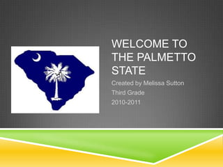
- 1. WELCOME TO THE PALMETTO STATE Created by Melissa Sutton Third Grade 2010-2011
- 2. Chapter One THE GEOGRAPHY OF SOUTH CAROLINA
- 3. LESSON 1: EXPLORE SOUTH CAROLINA A LANDFORM is a shape or part of Earth’s surface, such as a hill or a swamp. South Carolina’s coastline has salt marshes, sand dunes, and beaches. Where is South Carolina? http://mapsof.net/south_carolina/static- maps/png/where-is-south-carolina-located Hemisphere? Continent? Country? State? What part of the Country? What states border South Carolina? What bodies of water border South Carolina? Columbia is the capital of South Carolina where our state leaders work. Charleston is home to one of the oldest museums in our country. The Blue Ridge Mountains are located in the northern and western corner of South Carolina.
- 4. UNDERSTAND HEMISPHERES The EQUATOR runs east to west and divides the earth into Northern and Southern Hemispheres. The PRIME MERIDIAN runs north to south and divides the earth into Western and Eastern Hemispheres.
- 5. LESSON 2: GEOGRAPHY SHAPES OUR COMMUNITIES An URBAN community is a city where a large number of people live. What might you see in an urban community? A SUBURBAN community is located near a big city. What might you see in a suburban community? A RURAL community is a place in the countryside where towns are small and farther apart. What might you see in a rural community? Charleston is located along the Atlantic Ocean where the Ashley River and Cooper River join together. Why are communities built near water? CULTURE is the way a group of people live.
- 6. LESSON 3: NATURAL SOUTH CAROLINA CLIMATE is the kind of weather a place has over time. What is the climate of South Carolina? An ECOSYSTEM includes the plants and animals that live in a particular place. I.e.: salt marsh, swamp, cove forest, Carolina Bays What ecosystem is located in the valleys of the Blue Ridge Mountains? CONSERVATION is the protection of our forests, rivers, and other natural resources. Why is it important to protect South Carolina’s ecosystems?
- 7. Chapter Two REGIONS OF SOUTH CAROLINA
- 8. LESSON 1: THE BLUE RIDGE AND THE PIEDMONT A REGION is a large area of land that has special features, such as landforms, climate, and plants. BLUE RIDGE REGION: Smallest of the six regions Mountain forests, streams, and waterfalls Blue Ridge Mountains PIEDMONT REGION: Piedmont means “foot of the mountains” Monadnock – an isolated, or single, hill made of very hard rock Rolling hills and wide river valleys Spartanburg Textiles and peaches are important industries
- 9. LESSON 2: THE SANDHILLS AND THE INNER COASTAL PLAIN SANDHILLS REGION: SC’s old coastline Hilly land Aiken, Columbia, Camden, Cheraw Fall line – water drops rapidly from higher land to lower land causing rushing water and rapids; Why are cities built along the fall line? INNER COASTAL PLAIN REGION: Congaree National Park Also has rolling hills More than half of region is covered in forests SC’s best soil is found here Center of the state’s cotton production; wheat and soybeans are also grown here
- 10. LESSON 3: THE OUTER COASTAL PLAIN AND THE COASTAL ZONE OUTER COASTAL PLAIN REGION: Flat and broken up by many rivers and streams Swamps cover much of the land along the rivers Railroads and canals were built; why? COASTAL ZONE REGION: Tourism has been the focus for more than 75 years Fishing is an important industry Beaches, marshes, and islands “Grand Strand” Leading seaports: Charleston, Georgetown, and Port Royal A narrow, sandy island between the ocean and the mainland is called a BARRIER ISLAND; it protects the mainland from the effects of the ocean.