The Ganga System
•Download as PPT, PDF•
44 likes•30,221 views

this helps students of IX CBSE to visualise the picturesqueness the Ganga river system from its source to its delta and the role of each individual to preserve the holy river

Recommended
More Related Content
What's hot
What's hot (20)
Viewers also liked
Viewers also liked (20)
Similar to The Ganga System
Similar to The Ganga System (20)
Recently uploaded
Recently uploaded (20)
The Ganga System
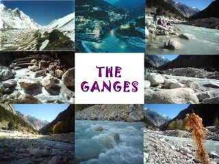
- 1. THE GANGES
- 2. The Ganges Length : Over 2500 km Drainage : Dendritic pattern Ambala : Water divide between Indus and Ganga Length of plains: 1800 km Fall in slope : Hardly 300 metres, i.e.one metre for every 6 km therefore ,the river develops large meanders
- 3. River Indus Am ba la wa ter div Ri ide ve rG an ga
- 4. The Ganga River System
- 5. The Ganges river is one of the largest and by far the most important rivers in India. She has been a symbol of India’s age long culture and civilization, ever changing, ever flowing, and yet ever the same Ganga.
- 6. The river Ganges is officially and popularly known by it’s hindu name,Ganga. The Ganges is 1560 miles long and flows through China, India, Nepal and Bangladesh. The river flows through 29 cities and about 48 towns.
- 11. Hindus, who constitute the vast majority of India's population, consider the Ganges a sacred river: Ganga (or Ganges) is the daughter of the mountain god, Himavan or Himalaya.
- 12. Every day people bathe in the sacred water believing that it will wash away their sins. It is believed that even a few drops on their tongue will clean their bodies. To bathe in the Ganga is a lifelong ambition for Hindus.
- 13. It is believed that any water that mixes with the smallest amount of Ganges river becomes holy with healing powers. Hindus also cast the ashes of their dead in the river in the belief that this will guide the souls of the deceased to paradise.
- 15. The Ganges has been used for irrigation since ancient times, the use of irrigation canals has increased the production of cash crops like sugarcane, cotton and oilseeds.
- 16. Floods of the Ganges have enriched thethe Ganges have Floods of soil. This makes the Ganges Valley amakes the enriched the soil. This great Ganges Valley a great agricultural agricultural region in India. region in India. Fishing also is an important use of the Ganges. The Ganges is also a burial ground for the dead.
- 19. Drinking- Many cities get their drinking water from the Ganges, which is a large problem because the water is very polluted in some parts of the Ganges.
- 20. Energy-Only 20% of the estimated capacity of dams has been developed. At the upper part of the Ganges River, electricity is generated at the waterfalls of the Ganges River.
- 21. Gangotri glacier
- 23. Gnagotri glacier
- 24. Melt waters from Gangotri glacier
- 25. Source of river Ganga
- 28. The source of the river Bhagirathi. Gaumukh ("The mouth of a cow") is the cave in the glacier, from which the river emerges in full force.
- 29. Bhagirathi river in the Himalayas falling down a cliff in Gangotri, Uttaranchal, India.
- 30. Bhagirathi river cutting through rocks
- 32. Source of Alaknanda river
- 33. Alkapuri, the origin of Alaknanda river.
- 34. The five river confluences of Alakananda are Vishnu Prayag, Nandaprayag, Karnaprayag, Rudraprayag and Devaprayag… All five along the path of the Alakananda river, that goes on assimilating other rivers… Till it reaches Devaprayag, where Alakandanda meets Bhagirathi and thereon, is known as Ganga.
- 35. It is the confluence of the Dhauliganga with the Alaknanda. Vishnu Prayag Vishnu Prayag,
- 36. It is the confluence of the Dhauliganga with the Alaknanda. Vishnu Prayag,
- 37. (confluence of Alakananda and Nandakini. (Pindari) river ) Nandaprayag
- 38. Nandaprayag
- 39. The confluence of Alaknanda and Mandakini rivers. karnaprayag
- 42. Alaknanda River
- 43. RIVER RAFTING >> GANGA-ALAKNANDA
- 44. Stones under water. Beautiful patterns of filtered sunlight on the submerged ...
- 45. RUDRAPRAYAG Confluence of Mandakini and Alaknanda river
- 46. Neelkanth Parvat & Badrinath Temple
- 47. BADRINATH - ALAKNANDA RIVER
- 50. The confluence of Alaknanda and Bhagirathi rivers. DEVAPRAYAG
- 51. Alakananda river Bagirathi river Devaprayag the confluence of the two rivers
- 52. The confluence of Alaknanda and Bhagirathi rivers DEVAPRAYAG
- 53. River Alakananda & River Bagirathi meet at the river confluence Of Devaprayag and from here it flows as River Ganga.
- 55. The headwaters of the Ganga called the ‘Bhagirathi’ is fed by the Gangotri Glacier and joined by the Alaknanda at Devaprayag in Uttaranchal. At Haridwar the Ganga emerges from the mountains on to the plains.
- 57. Flowing through the valley to flow through the plains at Rishikesh
- 58. fans l ia ll uv A
- 60. Gnaga leaves the mountains and joins its tributaries at Haridwar
- 62. Gnaga leaves the mountains and joins its tributaries at Haridwar
- 63. The Ganga is joined by many tributaries from the Himalayas, a few of them being major rivers such as the Yamuna, the Ghaghara, the Ghandak and the Kosi. The river Yamuna rises from the Yamunotri Glacier in the Himalayas.
- 67. Ganga Yamuna Sangam at Allahabad
- 69. MAMALLAPURAM
- 70. A scene carved into rocks near Mamallapuram, India, depicts the descent of the sacred river Ganges from the Himalayas. Following a natural crack in the rock, the carving is 6 m (20 ft) high.
- 71. It depicts gods, celestial beings, and animals gathered along the river’s (Ganges) path. The carvings date from the 7th century AD. The monuments of Mamallapuram are excellent specimen of Dravidian temple architecture and Pallava art.
- 72. THE GANGES AT ROME
- 73. The picture shows River Ganges as visualised by Bernini. It symbolises four of the world’s great rivers (the Ganges, the Nile, the Danube and the Plata), representing the four continents known at the time.
- 74. River yamuna at yamunotri
- 75. RIVER YAMUNA
- 76. VARANASI
- 78. Varanasi is probably one of the most ancient living cities in India. Varanasi is closely associated with Ganges. The temple town has many temples along the banks of the Ganges.
- 80. Varanasi is situated on the crescent shaped left bank of the holy Ganga, it is one of the ancient seats of learning in India, it is said to be respectively a compound of the names of two streams, the Varuna and the Assi, which still flow.
- 81. Till May 24, 1956, Varanasi was known by the name Banarus. From time immemorial Varanasi, has been a great religious center for Hindus and one of their most sacred places of pilgrimage, visited by millions each year.
- 82. Himalayan tributaries of River Ganga
- 83. Yamuna river
- 84. Ghaghara river
- 85. Gandak river / kali river
- 86. Kosi river
- 87. Tributaries from the Peninsular Uplands
- 88. River Chambal a Tributary of Yamuna
- 89. River Chambal
- 90. River Betwa a Tributary of Yamuna
- 91. River Betwa
- 92. River son
- 93. River son a tributary of Ganga
- 94. Farakka Dam
- 95. Bhagirathi – Hoogly a distributary of Ganga
- 96. Bhagirathi – Hoogly a distributary of Ganga
- 97. After Ganga- Brahmaputra (Padma)has merged the combined river is known as Meghna River
- 98. After Ganga- Brahmaputra has merged the combined river is known as Meghna River
- 99. Meghna River
- 100. Meghna river is one of the major rivers in Bangladesh, specially famous for it’s great estaury that discharges the flow of Ganga-Padma, Brahmaputra-Jamuna and the Meghna itself. It is a flood-prone river.
- 101. The downstream of Surma river from Ajmiriganj is often referred to as the Meghna. The Meghna has 2 distinct parts: the Upper Meghna and the Lower Meghna.
- 102. The Upper Meghna from Kuliarchar to Shatnol is a comparatively small river. The Lower Meghna below Shatnol is one of the largest rivers in the world because of its wide estuary mouth. The Lower Meghna is at times treated as a separate river.
- 103. There are two major dams on the Ganga. One at Haridwar diverts much of the Himalayan snowmelt into the Upper Ganges Canal, built by the British in 1854 to irrigate the surrounding land.
- 104. The other dam is a serious hydroelectric affair at Farakka, close to the point where the main flow of the river enters Bangladesh, and the tributary Hooghly (also known as Bhagirathi) continues in West Bengal past Calcutta.
- 105. THE SUNDERBAN DELTA
- 107. The Sunderbans delta is the largest mangrove forest in the world. It lies at the mouth of the Ganges and is spread across areas of Bangladesh and West Bengal, India. It is largely a tangled swampland.
- 108. The silt deposits of the delta covers an area of 23000 sq miles. The river courses in the delta are broad and active, carrying a vast amount of water. The rains from June to October cause most of the Bangladeshi delta region to flood.
- 109. On the seaward side of the delta are swamplands and tidal forests called Sunderbans. The delta experiences strong cyclonic storms before and after the monsoon season, which can be devastating.
- 110. GANGES RIVER DELTA
- 111. The Ganges Fan is a large submarine accumulation of sediment at the northern end of the Bay of Bengal, and stretches from India, through Bangladesh, to Myanmar from west to east, and past Sri Lanka to the south.
- 112. The sediment is carried through a series of underwater canyons, some of which are more than 1500 miles (2,414km) in length. (the Ganges Fan is not to be confused with the Ganges Delta.)
- 113. GANGES CANAL
- 114. Ganges Canal was dug from Haridwar to Kanpur in later half of 19th century and a very wide network of small tributary canals were constructed from the main canal to act as source of irrigation in the fertile plains of Western Uttar Pradesh .
- 116. This canal is still supplying water to thousands of villages in western Uttar Pradesh and water of Ganga, flowing in this canal, is in true sense the life line of western Uttar Pradesh an area which played a central role in the Green revolution of India.
- 117. HOW CLEAN ARE OUR WATERS???
- 118. Pollution of the Ganges has become so serious that bathing in and drinking it’s water has become very dangerous. The major polluting industry along the Ganges is the leather industry especially near Kanpur.
- 119. In Kanpur, hides of goats, horses and cows are bought in for tanning. The large amount of water used in this process, mixed in with chemicals are dumped into the Ganges.
- 121. A recent study has proved that the amount of sewage flowing in Ganges has doubled since 1985. Nearly 1 billion liters of mostly untreated raw sewage that enters the sewage everyday.
- 123. Also, inadequate cremation procedures contributes to a large number of partially burnt or unburnt corpses floating down the Ganga, not to mention livestock corpses.
- 126. There has been many clean up acts, such as GAP (Ganges Action Plan) and the Oswald Plan. The GAP act began in 1985.
- 127. The GAP act was meant to clean up India’s most important river, but after twelve years of work and $300 million funding, the GAP has achieved very few of it’s objectives.
- 128. The Oswald plan was to release thousands of turtles, which were supposed to eat the rotting corpses floating in the water. Some people thought that the turtles would leave the area.
- 129. In November 1991 a survey that was conducted showed that 60% of the turtles remained in Varanasi area and were seen nibbling on human flesh.
- 130. Hopefully, in the future the river Ganges will be as clean as the Hindu pilgrimages believe it to be. It maybe a while but with more coordinated effort the waters of the Ganges will be clean.
- 144. Can we help???
- 146. Central government approves Rs 7K crore for cleaning Ganga
- 147. The Ganga will flow clean and free from pollution by 2020, ...???
- 148. The Ganges River, considered to be sacred in India is getting a $1 billion clean up loan from the World Bank. The Ganges River (or Ganga as it also called) is 2500 km long and has incredibley high pollution, everything from industrial chemicals to raw sewage. The $1billion World Bank Ganga River Loan will support the clean up efforts launched by the Indian government. Clean up efforts that inlcude building water treatment plants, fixing dams and other water quality improvement measures.
- 149. “ Environmentalists say the river supports over 400 million people, and if the unabated pollution is not controlled, it will be the end of communities
- 150. “Let each one of us be responsible and ensure we are not contributors to pollution of our environment.”