SlideShare a Scribd company logo
1 of 29
Investigating the seismic cycle in Italy by multitemporal analysis of ALOS, COSMO-SkyMed and ERS/Envisat DInSAR data sets C.Tolomei , S. Atzori, J. P.Merryman, G. Pezzo, S. Salvi  (1) (1) Istituto Nazionale di Geofisica  e Vulcanologia  - Rome, italy
Outline ,[object Object],[object Object],[object Object],[object Object],Further information:  www.sigris.it
Two operations mode ,[object Object],[object Object],[object Object],[object Object],[object Object],[object Object]
What we produce Ground velocity maps at the fault scale The SIGRIS PR1 products are maps showing the small (mm/yr) progressive movements of the Earth’s surface occurred over a period of years. We use them to quantify the crustal deformation associated to the  seismic cycle , in particular in the inter-seismic and post-seismic phases. The amount and patterns of crustal deformation are related to the tectonic stress accumulated and then released during the earthquakes .
What data we use ,[object Object],[object Object],[object Object],[object Object],[object Object],[object Object],[object Object],[object Object],[object Object],[object Object],[object Object],[object Object],[object Object]
DInSAR techniques ,[object Object],[object Object],[object Object],[object Object],[object Object],[object Object],[object Object],[object Object],[object Object]
SIGRIS Test Sites The SIGRIS Project considers 4 test areas in Italy. We processed over  1100  SAR images from ERS, ENVISAT, ALOS, and COSMO-SkyMed satellites. We generated, validated, and delivered to the Italian Civil Protection over  100  PR1 product items.
The Straits of Messina The largest earthquake of the XX century in Italy Mw = 7.1, in 1908 Debated earthquake source (at least 5 different fault models) To be crossed by a 4-km long suspended bridge From Amoruso et al, 2002, JGR Inter-seismic phase
Ground deformation using time-series DInSAR SAR Data: ERS   (1992-2001) 71 images (D), 37 (A) ENVISAT   (2003-2008) 34 images (A) ALOS   (2007-2010) 22 images (A) COSMO-Skymed   (2009-2010) 17 images (D)
Mean Ground Velocity Maps (LoS) Ascending Orbit  Descending orbit ERS+ENVISAT
Time Series examples
Up & East Velocity Maps Up Component East Component ,[object Object],[object Object]
Up Component Legend Up Velocity (mm/yr) _ +
East Component 4 mm/yr 0 mm/yr -5 mm/yr -1 mm/yr -4 mm/yr -9 mm/yr Legend East Velocity (mm/yr)
Temporal span: 10/01/07- 05/06/10 22 images ALOS Mean Ground Velocity Map (LoS) Processed with SARscape
What ALOS can detect 2 1 2007-2010 1992-2010 1 N S S W E 2
COSMO-SkyMed Ground Velocity map (LoS) Ascending orbit 1 2 Area 1 1st of October, 2009: Mud landslide, 30 casualties 1 1 2 2
The April 6, 2009 L’Aquila earthquake Co-seismic & post-seismic phase
Co-seismic deformation maps:  first clear SAR interferogram (ENVISAT desc) -27 cm LoS  displacement
Co-seismic deformation maps:  second clear SAR interferogram (COSMO asc) -25 cm LoS  displacement
Co-seismic deformation maps:  vertical ground displacement
Co-seismic deformation maps:  East ground displacement
The L’Aquila case ,[object Object],[object Object],[object Object],[object Object],[object Object],[object Object],[object Object],[object Object]
Descending Pass Ascending Pass 26/02/2003- 14/07/2010 02/09/2003- 22/06/2010 ASAR Mean Velocity Map  (LoS) earthquake
ALOS Mean Velocity Map  (LoS) Track 639 Frame 830 Temporal span: 15/01/2007-26/07/2010 Processed with SARscape 16 images
Temporal span: 29/04/2009-13/10/2009 23 slc used Ascending Orbit COSMO-SkyMed Mean Ground Velocity Map  (LoS) Processed with SARscape earthquake earthquake
COSMO-SkyMed Displacement Map  (LoS)
Conclusions ,[object Object],[object Object],[object Object],[object Object],[object Object],[object Object],Acknowledgements:  Dr. Paolo Riccardi, Dr. Alessio Cantone (SARMAP);   Dr. Simona Zoffoli, Italian Space Agency.
Thank you for your attention!

More Related Content

What's hot

2011IgarssMetaw.ppt
2011IgarssMetaw.ppt2011IgarssMetaw.ppt
2011IgarssMetaw.pptgrssieee
 
GPS surveying/DIGITAL SURVEYING
GPS  surveying/DIGITAL SURVEYINGGPS  surveying/DIGITAL SURVEYING
GPS surveying/DIGITAL SURVEYINGAvinash Kumar Gupta
 
Advances in Satellite Conjunction Analysis with OR.A.SI
Advances in Satellite Conjunction Analysis with OR.A.SIAdvances in Satellite Conjunction Analysis with OR.A.SI
Advances in Satellite Conjunction Analysis with OR.A.SIAntonios Arkas
 
Presentation for the 19th EUROSTAR Users Conference June 2011
Presentation for the 19th EUROSTAR Users Conference June 2011Presentation for the 19th EUROSTAR Users Conference June 2011
Presentation for the 19th EUROSTAR Users Conference June 2011Antonios Arkas
 
A_Ku_Band_Geosyncrhonous_Synthetic_Aperture_Radar_Mission_Analysi.ppt
A_Ku_Band_Geosyncrhonous_Synthetic_Aperture_Radar_Mission_Analysi.pptA_Ku_Band_Geosyncrhonous_Synthetic_Aperture_Radar_Mission_Analysi.ppt
A_Ku_Band_Geosyncrhonous_Synthetic_Aperture_Radar_Mission_Analysi.pptgrssieee
 
Earthquake ground motion simulation during 1992 cairo earthquake
Earthquake ground motion simulation during 1992 cairo earthquakeEarthquake ground motion simulation during 1992 cairo earthquake
Earthquake ground motion simulation during 1992 cairo earthquakeAmin khalil
 
GEO Grid災害タスクフォース 〜東日本大震災における活動〜 GIS学会2011
GEO Grid災害タスクフォース 〜東日本大震災における活動〜 GIS学会2011GEO Grid災害タスクフォース 〜東日本大震災における活動〜 GIS学会2011
GEO Grid災害タスクフォース 〜東日本大震災における活動〜 GIS学会2011Naotaka YAMAMOTO CHIKASADA
 
Lagios_et_al_IGARSS_2011.ppt
Lagios_et_al_IGARSS_2011.pptLagios_et_al_IGARSS_2011.ppt
Lagios_et_al_IGARSS_2011.pptgrssieee
 
Spacecraft Formation Flying Navigation via a Novel Wireless Final
Spacecraft Formation Flying Navigation via a Novel Wireless FinalSpacecraft Formation Flying Navigation via a Novel Wireless Final
Spacecraft Formation Flying Navigation via a Novel Wireless FinalShu Ting Goh
 
introduction-of-GNSS-1
introduction-of-GNSS-1introduction-of-GNSS-1
introduction-of-GNSS-1Kutubuddin ANSARI
 
History of Earth Gravity Model
History of Earth Gravity ModelHistory of Earth Gravity Model
History of Earth Gravity ModelPawan Singh
 
WE2.L09 - DESDYNI LIDAR FOR SOLID EARTH APPLICATIONS
WE2.L09 - DESDYNI LIDAR FOR SOLID EARTH APPLICATIONSWE2.L09 - DESDYNI LIDAR FOR SOLID EARTH APPLICATIONS
WE2.L09 - DESDYNI LIDAR FOR SOLID EARTH APPLICATIONSgrssieee
 
Gaussian Orbital Determination of 1943 Anteros
Gaussian Orbital Determination of 1943 AnterosGaussian Orbital Determination of 1943 Anteros
Gaussian Orbital Determination of 1943 AnterosMatthew Li
 
Surveying with gps
Surveying with gpsSurveying with gps
Surveying with gpsengr jafar
 
Scatterometry quik scat
Scatterometry quik scatScatterometry quik scat
Scatterometry quik scatSafdar Wattu
 
PR3 MODIS_VIIRS_Geo_Error_Trend_with_Kalman_Filter.pptx
PR3 MODIS_VIIRS_Geo_Error_Trend_with_Kalman_Filter.pptxPR3 MODIS_VIIRS_Geo_Error_Trend_with_Kalman_Filter.pptx
PR3 MODIS_VIIRS_Geo_Error_Trend_with_Kalman_Filter.pptxgrssieee
 

What's hot (20)

2011IgarssMetaw.ppt
2011IgarssMetaw.ppt2011IgarssMetaw.ppt
2011IgarssMetaw.ppt
 
GPS surveying/DIGITAL SURVEYING
GPS  surveying/DIGITAL SURVEYINGGPS  surveying/DIGITAL SURVEYING
GPS surveying/DIGITAL SURVEYING
 
Advances in Satellite Conjunction Analysis with OR.A.SI
Advances in Satellite Conjunction Analysis with OR.A.SIAdvances in Satellite Conjunction Analysis with OR.A.SI
Advances in Satellite Conjunction Analysis with OR.A.SI
 
Presentation for the 19th EUROSTAR Users Conference June 2011
Presentation for the 19th EUROSTAR Users Conference June 2011Presentation for the 19th EUROSTAR Users Conference June 2011
Presentation for the 19th EUROSTAR Users Conference June 2011
 
A_Ku_Band_Geosyncrhonous_Synthetic_Aperture_Radar_Mission_Analysi.ppt
A_Ku_Band_Geosyncrhonous_Synthetic_Aperture_Radar_Mission_Analysi.pptA_Ku_Band_Geosyncrhonous_Synthetic_Aperture_Radar_Mission_Analysi.ppt
A_Ku_Band_Geosyncrhonous_Synthetic_Aperture_Radar_Mission_Analysi.ppt
 
Earthquake ground motion simulation during 1992 cairo earthquake
Earthquake ground motion simulation during 1992 cairo earthquakeEarthquake ground motion simulation during 1992 cairo earthquake
Earthquake ground motion simulation during 1992 cairo earthquake
 
Esap2011
Esap2011Esap2011
Esap2011
 
M Sc Poster_Jackson_Hydro_13
M Sc Poster_Jackson_Hydro_13M Sc Poster_Jackson_Hydro_13
M Sc Poster_Jackson_Hydro_13
 
GEO Grid災害タスクフォース 〜東日本大震災における活動〜 GIS学会2011
GEO Grid災害タスクフォース 〜東日本大震災における活動〜 GIS学会2011GEO Grid災害タスクフォース 〜東日本大震災における活動〜 GIS学会2011
GEO Grid災害タスクフォース 〜東日本大震災における活動〜 GIS学会2011
 
Lagios_et_al_IGARSS_2011.ppt
Lagios_et_al_IGARSS_2011.pptLagios_et_al_IGARSS_2011.ppt
Lagios_et_al_IGARSS_2011.ppt
 
Spacecraft Formation Flying Navigation via a Novel Wireless Final
Spacecraft Formation Flying Navigation via a Novel Wireless FinalSpacecraft Formation Flying Navigation via a Novel Wireless Final
Spacecraft Formation Flying Navigation via a Novel Wireless Final
 
introduction-of-GNSS-1
introduction-of-GNSS-1introduction-of-GNSS-1
introduction-of-GNSS-1
 
History of Earth Gravity Model
History of Earth Gravity ModelHistory of Earth Gravity Model
History of Earth Gravity Model
 
WE2.L09 - DESDYNI LIDAR FOR SOLID EARTH APPLICATIONS
WE2.L09 - DESDYNI LIDAR FOR SOLID EARTH APPLICATIONSWE2.L09 - DESDYNI LIDAR FOR SOLID EARTH APPLICATIONS
WE2.L09 - DESDYNI LIDAR FOR SOLID EARTH APPLICATIONS
 
Glonass
GlonassGlonass
Glonass
 
Gnss data-processing
Gnss data-processingGnss data-processing
Gnss data-processing
 
Gaussian Orbital Determination of 1943 Anteros
Gaussian Orbital Determination of 1943 AnterosGaussian Orbital Determination of 1943 Anteros
Gaussian Orbital Determination of 1943 Anteros
 
Surveying with gps
Surveying with gpsSurveying with gps
Surveying with gps
 
Scatterometry quik scat
Scatterometry quik scatScatterometry quik scat
Scatterometry quik scat
 
PR3 MODIS_VIIRS_Geo_Error_Trend_with_Kalman_Filter.pptx
PR3 MODIS_VIIRS_Geo_Error_Trend_with_Kalman_Filter.pptxPR3 MODIS_VIIRS_Geo_Error_Trend_with_Kalman_Filter.pptx
PR3 MODIS_VIIRS_Geo_Error_Trend_with_Kalman_Filter.pptx
 

Viewers also liked

IGARSS-wj.pptx
IGARSS-wj.pptxIGARSS-wj.pptx
IGARSS-wj.pptxgrssieee
 
Act 00038 mesures des déplacements 2 d d’un barrage d’hydro-québec à partir d...
Act 00038 mesures des déplacements 2 d d’un barrage d’hydro-québec à partir d...Act 00038 mesures des déplacements 2 d d’un barrage d’hydro-québec à partir d...
Act 00038 mesures des déplacements 2 d d’un barrage d’hydro-québec à partir d...ACSG - Section Montréal
 
YellowIGARSS.ppt
YellowIGARSS.pptYellowIGARSS.ppt
YellowIGARSS.pptgrssieee
 
4 Nalli-Barnet-Zhou-etal oral - JPSS EDR Val - IGARSS Jul-2011 v1.pdf
4 Nalli-Barnet-Zhou-etal oral - JPSS EDR Val - IGARSS Jul-2011 v1.pdf4 Nalli-Barnet-Zhou-etal oral - JPSS EDR Val - IGARSS Jul-2011 v1.pdf
4 Nalli-Barnet-Zhou-etal oral - JPSS EDR Val - IGARSS Jul-2011 v1.pdfgrssieee
 
Approaches to communication in response to geo-hydrological risk: The Europea...
Approaches to communication in response to geo-hydrological risk: The Europea...Approaches to communication in response to geo-hydrological risk: The Europea...
Approaches to communication in response to geo-hydrological risk: The Europea...Global Risk Forum GRFDavos
 
Groundwater Level and Subsidence in the Texas Gulf Coast
Groundwater Level and Subsidence in the Texas Gulf Coast Groundwater Level and Subsidence in the Texas Gulf Coast
Groundwater Level and Subsidence in the Texas Gulf Coast The Texas Network, LLC
 
TH1.L09 - ADVANCES IN THE GENERATION OF DEFORMATION TIME SERIES FROM SAR DATA...
TH1.L09 - ADVANCES IN THE GENERATION OF DEFORMATION TIME SERIES FROM SAR DATA...TH1.L09 - ADVANCES IN THE GENERATION OF DEFORMATION TIME SERIES FROM SAR DATA...
TH1.L09 - ADVANCES IN THE GENERATION OF DEFORMATION TIME SERIES FROM SAR DATA...grssieee
 
Surface subsidence associated with block caving
Surface subsidence associated with block cavingSurface subsidence associated with block caving
Surface subsidence associated with block cavingDr. Alex Vyazmensky
 
TH4.L09 - GEOLOGICAL AND GEOHAZARD APPLICATIONS OF RADARSAT-2
TH4.L09 - GEOLOGICAL AND GEOHAZARD APPLICATIONS OF RADARSAT-2TH4.L09 - GEOLOGICAL AND GEOHAZARD APPLICATIONS OF RADARSAT-2
TH4.L09 - GEOLOGICAL AND GEOHAZARD APPLICATIONS OF RADARSAT-2grssieee
 
Subsidence control in coal mines
Subsidence control in coal minesSubsidence control in coal mines
Subsidence control in coal minesSunil Varma
 
Geohazard mapping and assessment program
Geohazard mapping and assessment programGeohazard mapping and assessment program
Geohazard mapping and assessment programMarho Realty
 

Viewers also liked (12)

IGARSS-wj.pptx
IGARSS-wj.pptxIGARSS-wj.pptx
IGARSS-wj.pptx
 
Act 00038 mesures des déplacements 2 d d’un barrage d’hydro-québec à partir d...
Act 00038 mesures des déplacements 2 d d’un barrage d’hydro-québec à partir d...Act 00038 mesures des déplacements 2 d d’un barrage d’hydro-québec à partir d...
Act 00038 mesures des déplacements 2 d d’un barrage d’hydro-québec à partir d...
 
YellowIGARSS.ppt
YellowIGARSS.pptYellowIGARSS.ppt
YellowIGARSS.ppt
 
4 Nalli-Barnet-Zhou-etal oral - JPSS EDR Val - IGARSS Jul-2011 v1.pdf
4 Nalli-Barnet-Zhou-etal oral - JPSS EDR Val - IGARSS Jul-2011 v1.pdf4 Nalli-Barnet-Zhou-etal oral - JPSS EDR Val - IGARSS Jul-2011 v1.pdf
4 Nalli-Barnet-Zhou-etal oral - JPSS EDR Val - IGARSS Jul-2011 v1.pdf
 
Approaches to communication in response to geo-hydrological risk: The Europea...
Approaches to communication in response to geo-hydrological risk: The Europea...Approaches to communication in response to geo-hydrological risk: The Europea...
Approaches to communication in response to geo-hydrological risk: The Europea...
 
Groundwater Level and Subsidence in the Texas Gulf Coast
Groundwater Level and Subsidence in the Texas Gulf Coast Groundwater Level and Subsidence in the Texas Gulf Coast
Groundwater Level and Subsidence in the Texas Gulf Coast
 
TH1.L09 - ADVANCES IN THE GENERATION OF DEFORMATION TIME SERIES FROM SAR DATA...
TH1.L09 - ADVANCES IN THE GENERATION OF DEFORMATION TIME SERIES FROM SAR DATA...TH1.L09 - ADVANCES IN THE GENERATION OF DEFORMATION TIME SERIES FROM SAR DATA...
TH1.L09 - ADVANCES IN THE GENERATION OF DEFORMATION TIME SERIES FROM SAR DATA...
 
Surface subsidence associated with block caving
Surface subsidence associated with block cavingSurface subsidence associated with block caving
Surface subsidence associated with block caving
 
In sar 1-1-2011
In sar 1-1-2011In sar 1-1-2011
In sar 1-1-2011
 
TH4.L09 - GEOLOGICAL AND GEOHAZARD APPLICATIONS OF RADARSAT-2
TH4.L09 - GEOLOGICAL AND GEOHAZARD APPLICATIONS OF RADARSAT-2TH4.L09 - GEOLOGICAL AND GEOHAZARD APPLICATIONS OF RADARSAT-2
TH4.L09 - GEOLOGICAL AND GEOHAZARD APPLICATIONS OF RADARSAT-2
 
Subsidence control in coal mines
Subsidence control in coal minesSubsidence control in coal mines
Subsidence control in coal mines
 
Geohazard mapping and assessment program
Geohazard mapping and assessment programGeohazard mapping and assessment program
Geohazard mapping and assessment program
 

Similar to IGARSS_2011_final.ppt

Rocca.ppt
Rocca.pptRocca.ppt
Rocca.pptgrssieee
 
FR01_01_GlezetalIGARSS2011.ppt
FR01_01_GlezetalIGARSS2011.pptFR01_01_GlezetalIGARSS2011.ppt
FR01_01_GlezetalIGARSS2011.pptgrssieee
 
FR01_01_GlezetalIGARSS2011.ppt
FR01_01_GlezetalIGARSS2011.pptFR01_01_GlezetalIGARSS2011.ppt
FR01_01_GlezetalIGARSS2011.pptgrssieee
 
WE4.L10.5: ADVANCES IN NIGHTTIME SATELLITE REMOTE SENSING CAPABILITIES VIA TH...
WE4.L10.5: ADVANCES IN NIGHTTIME SATELLITE REMOTE SENSING CAPABILITIES VIA TH...WE4.L10.5: ADVANCES IN NIGHTTIME SATELLITE REMOTE SENSING CAPABILITIES VIA TH...
WE4.L10.5: ADVANCES IN NIGHTTIME SATELLITE REMOTE SENSING CAPABILITIES VIA TH...grssieee
 
TH4.TO4.2.ppt
TH4.TO4.2.pptTH4.TO4.2.ppt
TH4.TO4.2.pptgrssieee
 
موقعیت صفحه توران.pdf
موقعیت صفحه توران.pdfموقعیت صفحه توران.pdf
موقعیت صفحه توران.pdfmahnazsabahi
 
First Observation of the Earth’s Permanent FreeOscillation s on Ocean Bottom ...
First Observation of the Earth’s Permanent FreeOscillation s on Ocean Bottom ...First Observation of the Earth’s Permanent FreeOscillation s on Ocean Bottom ...
First Observation of the Earth’s Permanent FreeOscillation s on Ocean Bottom ...Sérgio Sacani
 
Karakterisasi Letusan Merapi menggunakan Data SAR (Synthetic Aperture Radar)
Karakterisasi Letusan Merapi menggunakan Data SAR (Synthetic Aperture Radar)Karakterisasi Letusan Merapi menggunakan Data SAR (Synthetic Aperture Radar)
Karakterisasi Letusan Merapi menggunakan Data SAR (Synthetic Aperture Radar)Achmad Darul
 
VALIDATING SATELLITE LAND SURFACE TEMPERATURE PRODUCTS FOR GOES-R AND JPSS MI...
VALIDATING SATELLITE LAND SURFACE TEMPERATURE PRODUCTS FOR GOES-R AND JPSS MI...VALIDATING SATELLITE LAND SURFACE TEMPERATURE PRODUCTS FOR GOES-R AND JPSS MI...
VALIDATING SATELLITE LAND SURFACE TEMPERATURE PRODUCTS FOR GOES-R AND JPSS MI...grssieee
 
In tech recent-advances_in_synthetic_aperture_radar_enhancement_and_informati...
In tech recent-advances_in_synthetic_aperture_radar_enhancement_and_informati...In tech recent-advances_in_synthetic_aperture_radar_enhancement_and_informati...
In tech recent-advances_in_synthetic_aperture_radar_enhancement_and_informati...Naivedya Mishra
 
ÖNCEL AKADEMİ: İSTANBUL DEPREMİ
ÖNCEL AKADEMİ: İSTANBUL DEPREMİÖNCEL AKADEMİ: İSTANBUL DEPREMİ
ÖNCEL AKADEMİ: İSTANBUL DEPREMİAli Osman Öncel
 
Envi sat satellite
Envi sat satelliteEnvi sat satellite
Envi sat satelliteEhsanYousaf1
 
gps_details.ppt
gps_details.pptgps_details.ppt
gps_details.pptMaheshUpari1
 
gps_details.ppt
gps_details.pptgps_details.ppt
gps_details.pptMaheshUpari1
 
TH1.T04.2_MULTI-FREQUENCY MICROWAVE EMISSION OF THE EAST ANTARCTIC PLATEAU_IG...
TH1.T04.2_MULTI-FREQUENCY MICROWAVE EMISSION OF THE EAST ANTARCTIC PLATEAU_IG...TH1.T04.2_MULTI-FREQUENCY MICROWAVE EMISSION OF THE EAST ANTARCTIC PLATEAU_IG...
TH1.T04.2_MULTI-FREQUENCY MICROWAVE EMISSION OF THE EAST ANTARCTIC PLATEAU_IG...grssieee
 
ÖNCEL AKADEMİ: İSTANBUL DEPREMİ
ÖNCEL AKADEMİ: İSTANBUL DEPREMİÖNCEL AKADEMİ: İSTANBUL DEPREMİ
ÖNCEL AKADEMİ: İSTANBUL DEPREMİAli Osman Öncel
 
SBAS-DInSAR processing on the ESA Geohazards Exploitation Platform
SBAS-DInSAR processing on the ESA Geohazards Exploitation PlatformSBAS-DInSAR processing on the ESA Geohazards Exploitation Platform
SBAS-DInSAR processing on the ESA Geohazards Exploitation PlatformEmmanuel Mathot
 
Tp fb tutorial velocity_estimationviaraybasedtomo _i_jones_100201
Tp fb tutorial velocity_estimationviaraybasedtomo _i_jones_100201Tp fb tutorial velocity_estimationviaraybasedtomo _i_jones_100201
Tp fb tutorial velocity_estimationviaraybasedtomo _i_jones_100201Ajay Pundir
 
2019-10-15 Small-scale deformation of active volcanoes measured by
2019-10-15 Small-scale deformation of active volcanoes measured by 2019-10-15 Small-scale deformation of active volcanoes measured by
2019-10-15 Small-scale deformation of active volcanoes measured by Yosuke Aoki
 
TerraSAR-X and TanDEM-X
TerraSAR-X and TanDEM-XTerraSAR-X and TanDEM-X
TerraSAR-X and TanDEM-XAbran Idrees
 

Similar to IGARSS_2011_final.ppt (20)

Rocca.ppt
Rocca.pptRocca.ppt
Rocca.ppt
 
FR01_01_GlezetalIGARSS2011.ppt
FR01_01_GlezetalIGARSS2011.pptFR01_01_GlezetalIGARSS2011.ppt
FR01_01_GlezetalIGARSS2011.ppt
 
FR01_01_GlezetalIGARSS2011.ppt
FR01_01_GlezetalIGARSS2011.pptFR01_01_GlezetalIGARSS2011.ppt
FR01_01_GlezetalIGARSS2011.ppt
 
WE4.L10.5: ADVANCES IN NIGHTTIME SATELLITE REMOTE SENSING CAPABILITIES VIA TH...
WE4.L10.5: ADVANCES IN NIGHTTIME SATELLITE REMOTE SENSING CAPABILITIES VIA TH...WE4.L10.5: ADVANCES IN NIGHTTIME SATELLITE REMOTE SENSING CAPABILITIES VIA TH...
WE4.L10.5: ADVANCES IN NIGHTTIME SATELLITE REMOTE SENSING CAPABILITIES VIA TH...
 
TH4.TO4.2.ppt
TH4.TO4.2.pptTH4.TO4.2.ppt
TH4.TO4.2.ppt
 
موقعیت صفحه توران.pdf
موقعیت صفحه توران.pdfموقعیت صفحه توران.pdf
موقعیت صفحه توران.pdf
 
First Observation of the Earth’s Permanent FreeOscillation s on Ocean Bottom ...
First Observation of the Earth’s Permanent FreeOscillation s on Ocean Bottom ...First Observation of the Earth’s Permanent FreeOscillation s on Ocean Bottom ...
First Observation of the Earth’s Permanent FreeOscillation s on Ocean Bottom ...
 
Karakterisasi Letusan Merapi menggunakan Data SAR (Synthetic Aperture Radar)
Karakterisasi Letusan Merapi menggunakan Data SAR (Synthetic Aperture Radar)Karakterisasi Letusan Merapi menggunakan Data SAR (Synthetic Aperture Radar)
Karakterisasi Letusan Merapi menggunakan Data SAR (Synthetic Aperture Radar)
 
VALIDATING SATELLITE LAND SURFACE TEMPERATURE PRODUCTS FOR GOES-R AND JPSS MI...
VALIDATING SATELLITE LAND SURFACE TEMPERATURE PRODUCTS FOR GOES-R AND JPSS MI...VALIDATING SATELLITE LAND SURFACE TEMPERATURE PRODUCTS FOR GOES-R AND JPSS MI...
VALIDATING SATELLITE LAND SURFACE TEMPERATURE PRODUCTS FOR GOES-R AND JPSS MI...
 
In tech recent-advances_in_synthetic_aperture_radar_enhancement_and_informati...
In tech recent-advances_in_synthetic_aperture_radar_enhancement_and_informati...In tech recent-advances_in_synthetic_aperture_radar_enhancement_and_informati...
In tech recent-advances_in_synthetic_aperture_radar_enhancement_and_informati...
 
ÖNCEL AKADEMİ: İSTANBUL DEPREMİ
ÖNCEL AKADEMİ: İSTANBUL DEPREMİÖNCEL AKADEMİ: İSTANBUL DEPREMİ
ÖNCEL AKADEMİ: İSTANBUL DEPREMİ
 
Envi sat satellite
Envi sat satelliteEnvi sat satellite
Envi sat satellite
 
gps_details.ppt
gps_details.pptgps_details.ppt
gps_details.ppt
 
gps_details.ppt
gps_details.pptgps_details.ppt
gps_details.ppt
 
TH1.T04.2_MULTI-FREQUENCY MICROWAVE EMISSION OF THE EAST ANTARCTIC PLATEAU_IG...
TH1.T04.2_MULTI-FREQUENCY MICROWAVE EMISSION OF THE EAST ANTARCTIC PLATEAU_IG...TH1.T04.2_MULTI-FREQUENCY MICROWAVE EMISSION OF THE EAST ANTARCTIC PLATEAU_IG...
TH1.T04.2_MULTI-FREQUENCY MICROWAVE EMISSION OF THE EAST ANTARCTIC PLATEAU_IG...
 
ÖNCEL AKADEMİ: İSTANBUL DEPREMİ
ÖNCEL AKADEMİ: İSTANBUL DEPREMİÖNCEL AKADEMİ: İSTANBUL DEPREMİ
ÖNCEL AKADEMİ: İSTANBUL DEPREMİ
 
SBAS-DInSAR processing on the ESA Geohazards Exploitation Platform
SBAS-DInSAR processing on the ESA Geohazards Exploitation PlatformSBAS-DInSAR processing on the ESA Geohazards Exploitation Platform
SBAS-DInSAR processing on the ESA Geohazards Exploitation Platform
 
Tp fb tutorial velocity_estimationviaraybasedtomo _i_jones_100201
Tp fb tutorial velocity_estimationviaraybasedtomo _i_jones_100201Tp fb tutorial velocity_estimationviaraybasedtomo _i_jones_100201
Tp fb tutorial velocity_estimationviaraybasedtomo _i_jones_100201
 
2019-10-15 Small-scale deformation of active volcanoes measured by
2019-10-15 Small-scale deformation of active volcanoes measured by 2019-10-15 Small-scale deformation of active volcanoes measured by
2019-10-15 Small-scale deformation of active volcanoes measured by
 
TerraSAR-X and TanDEM-X
TerraSAR-X and TanDEM-XTerraSAR-X and TanDEM-X
TerraSAR-X and TanDEM-X
 

More from grssieee

Tangent height accuracy of Superconducting Submillimeter-Wave Limb-Emission S...
Tangent height accuracy of Superconducting Submillimeter-Wave Limb-Emission S...Tangent height accuracy of Superconducting Submillimeter-Wave Limb-Emission S...
Tangent height accuracy of Superconducting Submillimeter-Wave Limb-Emission S...grssieee
 
SEGMENTATION OF POLARIMETRIC SAR DATA WITH A MULTI-TEXTURE PRODUCT MODEL
SEGMENTATION OF POLARIMETRIC SAR DATA WITH A MULTI-TEXTURE PRODUCT MODELSEGMENTATION OF POLARIMETRIC SAR DATA WITH A MULTI-TEXTURE PRODUCT MODEL
SEGMENTATION OF POLARIMETRIC SAR DATA WITH A MULTI-TEXTURE PRODUCT MODELgrssieee
 
TWO-POINT STATISTIC OF POLARIMETRIC SAR DATA TWO-POINT STATISTIC OF POLARIMET...
TWO-POINT STATISTIC OF POLARIMETRIC SAR DATA TWO-POINT STATISTIC OF POLARIMET...TWO-POINT STATISTIC OF POLARIMETRIC SAR DATA TWO-POINT STATISTIC OF POLARIMET...
TWO-POINT STATISTIC OF POLARIMETRIC SAR DATA TWO-POINT STATISTIC OF POLARIMET...grssieee
 
THE SENTINEL-1 MISSION AND ITS APPLICATION CAPABILITIES
THE SENTINEL-1 MISSION AND ITS APPLICATION CAPABILITIESTHE SENTINEL-1 MISSION AND ITS APPLICATION CAPABILITIES
THE SENTINEL-1 MISSION AND ITS APPLICATION CAPABILITIESgrssieee
 
GMES SPACE COMPONENT:PROGRAMMATIC STATUS
GMES SPACE COMPONENT:PROGRAMMATIC STATUSGMES SPACE COMPONENT:PROGRAMMATIC STATUS
GMES SPACE COMPONENT:PROGRAMMATIC STATUSgrssieee
 
PROGRESSES OF DEVELOPMENT OF CFOSAT SCATTEROMETER
PROGRESSES OF DEVELOPMENT OF CFOSAT SCATTEROMETERPROGRESSES OF DEVELOPMENT OF CFOSAT SCATTEROMETER
PROGRESSES OF DEVELOPMENT OF CFOSAT SCATTEROMETERgrssieee
 
DEVELOPMENT OF ALGORITHMS AND PRODUCTS FOR SUPPORTING THE ITALIAN HYPERSPECTR...
DEVELOPMENT OF ALGORITHMS AND PRODUCTS FOR SUPPORTING THE ITALIAN HYPERSPECTR...DEVELOPMENT OF ALGORITHMS AND PRODUCTS FOR SUPPORTING THE ITALIAN HYPERSPECTR...
DEVELOPMENT OF ALGORITHMS AND PRODUCTS FOR SUPPORTING THE ITALIAN HYPERSPECTR...grssieee
 
EO-1/HYPERION: NEARING TWELVE YEARS OF SUCCESSFUL MISSION SCIENCE OPERATION A...
EO-1/HYPERION: NEARING TWELVE YEARS OF SUCCESSFUL MISSION SCIENCE OPERATION A...EO-1/HYPERION: NEARING TWELVE YEARS OF SUCCESSFUL MISSION SCIENCE OPERATION A...
EO-1/HYPERION: NEARING TWELVE YEARS OF SUCCESSFUL MISSION SCIENCE OPERATION A...grssieee
 
Test
TestTest
Testgrssieee
 
test 34mb wo animations
test  34mb wo animationstest  34mb wo animations
test 34mb wo animationsgrssieee
 
Test 70MB
Test 70MBTest 70MB
Test 70MBgrssieee
 
Test 70MB
Test 70MBTest 70MB
Test 70MBgrssieee
 
2011_Fox_Tax_Worksheets.pdf
2011_Fox_Tax_Worksheets.pdf2011_Fox_Tax_Worksheets.pdf
2011_Fox_Tax_Worksheets.pdfgrssieee
 
DLR open house
DLR open houseDLR open house
DLR open housegrssieee
 
DLR open house
DLR open houseDLR open house
DLR open housegrssieee
 
DLR open house
DLR open houseDLR open house
DLR open housegrssieee
 
Tana_IGARSS2011.ppt
Tana_IGARSS2011.pptTana_IGARSS2011.ppt
Tana_IGARSS2011.pptgrssieee
 
IGARSS-GlobWetland-II_2011-07-20_v2-0.ppt
IGARSS-GlobWetland-II_2011-07-20_v2-0.pptIGARSS-GlobWetland-II_2011-07-20_v2-0.ppt
IGARSS-GlobWetland-II_2011-07-20_v2-0.pptgrssieee
 

More from grssieee (20)

Tangent height accuracy of Superconducting Submillimeter-Wave Limb-Emission S...
Tangent height accuracy of Superconducting Submillimeter-Wave Limb-Emission S...Tangent height accuracy of Superconducting Submillimeter-Wave Limb-Emission S...
Tangent height accuracy of Superconducting Submillimeter-Wave Limb-Emission S...
 
SEGMENTATION OF POLARIMETRIC SAR DATA WITH A MULTI-TEXTURE PRODUCT MODEL
SEGMENTATION OF POLARIMETRIC SAR DATA WITH A MULTI-TEXTURE PRODUCT MODELSEGMENTATION OF POLARIMETRIC SAR DATA WITH A MULTI-TEXTURE PRODUCT MODEL
SEGMENTATION OF POLARIMETRIC SAR DATA WITH A MULTI-TEXTURE PRODUCT MODEL
 
TWO-POINT STATISTIC OF POLARIMETRIC SAR DATA TWO-POINT STATISTIC OF POLARIMET...
TWO-POINT STATISTIC OF POLARIMETRIC SAR DATA TWO-POINT STATISTIC OF POLARIMET...TWO-POINT STATISTIC OF POLARIMETRIC SAR DATA TWO-POINT STATISTIC OF POLARIMET...
TWO-POINT STATISTIC OF POLARIMETRIC SAR DATA TWO-POINT STATISTIC OF POLARIMET...
 
THE SENTINEL-1 MISSION AND ITS APPLICATION CAPABILITIES
THE SENTINEL-1 MISSION AND ITS APPLICATION CAPABILITIESTHE SENTINEL-1 MISSION AND ITS APPLICATION CAPABILITIES
THE SENTINEL-1 MISSION AND ITS APPLICATION CAPABILITIES
 
GMES SPACE COMPONENT:PROGRAMMATIC STATUS
GMES SPACE COMPONENT:PROGRAMMATIC STATUSGMES SPACE COMPONENT:PROGRAMMATIC STATUS
GMES SPACE COMPONENT:PROGRAMMATIC STATUS
 
PROGRESSES OF DEVELOPMENT OF CFOSAT SCATTEROMETER
PROGRESSES OF DEVELOPMENT OF CFOSAT SCATTEROMETERPROGRESSES OF DEVELOPMENT OF CFOSAT SCATTEROMETER
PROGRESSES OF DEVELOPMENT OF CFOSAT SCATTEROMETER
 
DEVELOPMENT OF ALGORITHMS AND PRODUCTS FOR SUPPORTING THE ITALIAN HYPERSPECTR...
DEVELOPMENT OF ALGORITHMS AND PRODUCTS FOR SUPPORTING THE ITALIAN HYPERSPECTR...DEVELOPMENT OF ALGORITHMS AND PRODUCTS FOR SUPPORTING THE ITALIAN HYPERSPECTR...
DEVELOPMENT OF ALGORITHMS AND PRODUCTS FOR SUPPORTING THE ITALIAN HYPERSPECTR...
 
EO-1/HYPERION: NEARING TWELVE YEARS OF SUCCESSFUL MISSION SCIENCE OPERATION A...
EO-1/HYPERION: NEARING TWELVE YEARS OF SUCCESSFUL MISSION SCIENCE OPERATION A...EO-1/HYPERION: NEARING TWELVE YEARS OF SUCCESSFUL MISSION SCIENCE OPERATION A...
EO-1/HYPERION: NEARING TWELVE YEARS OF SUCCESSFUL MISSION SCIENCE OPERATION A...
 
EO-1/HYPERION: NEARING TWELVE YEARS OF SUCCESSFUL MISSION SCIENCE OPERATION A...
EO-1/HYPERION: NEARING TWELVE YEARS OF SUCCESSFUL MISSION SCIENCE OPERATION A...EO-1/HYPERION: NEARING TWELVE YEARS OF SUCCESSFUL MISSION SCIENCE OPERATION A...
EO-1/HYPERION: NEARING TWELVE YEARS OF SUCCESSFUL MISSION SCIENCE OPERATION A...
 
Test
TestTest
Test
 
test 34mb wo animations
test  34mb wo animationstest  34mb wo animations
test 34mb wo animations
 
Test 70MB
Test 70MBTest 70MB
Test 70MB
 
Test 70MB
Test 70MBTest 70MB
Test 70MB
 
2011_Fox_Tax_Worksheets.pdf
2011_Fox_Tax_Worksheets.pdf2011_Fox_Tax_Worksheets.pdf
2011_Fox_Tax_Worksheets.pdf
 
DLR open house
DLR open houseDLR open house
DLR open house
 
DLR open house
DLR open houseDLR open house
DLR open house
 
DLR open house
DLR open houseDLR open house
DLR open house
 
Tana_IGARSS2011.ppt
Tana_IGARSS2011.pptTana_IGARSS2011.ppt
Tana_IGARSS2011.ppt
 
IGARSS-GlobWetland-II_2011-07-20_v2-0.ppt
IGARSS-GlobWetland-II_2011-07-20_v2-0.pptIGARSS-GlobWetland-II_2011-07-20_v2-0.ppt
IGARSS-GlobWetland-II_2011-07-20_v2-0.ppt
 

Recently uploaded

Repurposing LNG terminals for Hydrogen Ammonia: Feasibility and Cost Saving
Repurposing LNG terminals for Hydrogen Ammonia: Feasibility and Cost SavingRepurposing LNG terminals for Hydrogen Ammonia: Feasibility and Cost Saving
Repurposing LNG terminals for Hydrogen Ammonia: Feasibility and Cost SavingEdi Saputra
 
Axa Assurance Maroc - Insurer Innovation Award 2024
Axa Assurance Maroc - Insurer Innovation Award 2024Axa Assurance Maroc - Insurer Innovation Award 2024
Axa Assurance Maroc - Insurer Innovation Award 2024The Digital Insurer
 
Architecting Cloud Native Applications
Architecting Cloud Native ApplicationsArchitecting Cloud Native Applications
Architecting Cloud Native ApplicationsWSO2
 
DEV meet-up UiPath Document Understanding May 7 2024 Amsterdam
DEV meet-up UiPath Document Understanding May 7 2024 AmsterdamDEV meet-up UiPath Document Understanding May 7 2024 Amsterdam
DEV meet-up UiPath Document Understanding May 7 2024 AmsterdamUiPathCommunity
 
Why Teams call analytics are critical to your entire business
Why Teams call analytics are critical to your entire businessWhy Teams call analytics are critical to your entire business
Why Teams call analytics are critical to your entire businesspanagenda
 
EMPOWERMENT TECHNOLOGY GRADE 11 QUARTER 2 REVIEWER
EMPOWERMENT TECHNOLOGY GRADE 11 QUARTER 2 REVIEWEREMPOWERMENT TECHNOLOGY GRADE 11 QUARTER 2 REVIEWER
EMPOWERMENT TECHNOLOGY GRADE 11 QUARTER 2 REVIEWERMadyBayot
 
Cyberprint. Dark Pink Apt Group [EN].pdf
Cyberprint. Dark Pink Apt Group [EN].pdfCyberprint. Dark Pink Apt Group [EN].pdf
Cyberprint. Dark Pink Apt Group [EN].pdfOverkill Security
 
AXA XL - Insurer Innovation Award Americas 2024
AXA XL - Insurer Innovation Award Americas 2024AXA XL - Insurer Innovation Award Americas 2024
AXA XL - Insurer Innovation Award Americas 2024The Digital Insurer
 
presentation ICT roal in 21st century education
presentation ICT roal in 21st century educationpresentation ICT roal in 21st century education
presentation ICT roal in 21st century educationjfdjdjcjdnsjd
 
Apidays New York 2024 - Accelerating FinTech Innovation by Vasa Krishnan, Fin...
Apidays New York 2024 - Accelerating FinTech Innovation by Vasa Krishnan, Fin...Apidays New York 2024 - Accelerating FinTech Innovation by Vasa Krishnan, Fin...
Apidays New York 2024 - Accelerating FinTech Innovation by Vasa Krishnan, Fin...apidays
 
Ransomware_Q4_2023. The report. [EN].pdf
Ransomware_Q4_2023. The report. [EN].pdfRansomware_Q4_2023. The report. [EN].pdf
Ransomware_Q4_2023. The report. [EN].pdfOverkill Security
 
Apidays New York 2024 - The Good, the Bad and the Governed by David O'Neill, ...
Apidays New York 2024 - The Good, the Bad and the Governed by David O'Neill, ...Apidays New York 2024 - The Good, the Bad and the Governed by David O'Neill, ...
Apidays New York 2024 - The Good, the Bad and the Governed by David O'Neill, ...apidays
 
Biography Of Angeliki Cooney | Senior Vice President Life Sciences | Albany, ...
Biography Of Angeliki Cooney | Senior Vice President Life Sciences | Albany, ...Biography Of Angeliki Cooney | Senior Vice President Life Sciences | Albany, ...
Biography Of Angeliki Cooney | Senior Vice President Life Sciences | Albany, ...Angeliki Cooney
 
Apidays New York 2024 - The value of a flexible API Management solution for O...
Apidays New York 2024 - The value of a flexible API Management solution for O...Apidays New York 2024 - The value of a flexible API Management solution for O...
Apidays New York 2024 - The value of a flexible API Management solution for O...apidays
 
Apidays New York 2024 - Scaling API-first by Ian Reasor and Radu Cotescu, Adobe
Apidays New York 2024 - Scaling API-first by Ian Reasor and Radu Cotescu, AdobeApidays New York 2024 - Scaling API-first by Ian Reasor and Radu Cotescu, Adobe
Apidays New York 2024 - Scaling API-first by Ian Reasor and Radu Cotescu, Adobeapidays
 
Modular Monolith - a Practical Alternative to Microservices @ Devoxx UK 2024
Modular Monolith - a Practical Alternative to Microservices @ Devoxx UK 2024Modular Monolith - a Practical Alternative to Microservices @ Devoxx UK 2024
Modular Monolith - a Practical Alternative to Microservices @ Devoxx UK 2024Victor Rentea
 
Boost Fertility New Invention Ups Success Rates.pdf
Boost Fertility New Invention Ups Success Rates.pdfBoost Fertility New Invention Ups Success Rates.pdf
Boost Fertility New Invention Ups Success Rates.pdfsudhanshuwaghmare1
 
Apidays New York 2024 - APIs in 2030: The Risk of Technological Sleepwalk by ...
Apidays New York 2024 - APIs in 2030: The Risk of Technological Sleepwalk by ...Apidays New York 2024 - APIs in 2030: The Risk of Technological Sleepwalk by ...
Apidays New York 2024 - APIs in 2030: The Risk of Technological Sleepwalk by ...apidays
 
Exploring Multimodal Embeddings with Milvus
Exploring Multimodal Embeddings with MilvusExploring Multimodal Embeddings with Milvus
Exploring Multimodal Embeddings with MilvusZilliz
 
Strategize a Smooth Tenant-to-tenant Migration and Copilot Takeoff
Strategize a Smooth Tenant-to-tenant Migration and Copilot TakeoffStrategize a Smooth Tenant-to-tenant Migration and Copilot Takeoff
Strategize a Smooth Tenant-to-tenant Migration and Copilot Takeoffsammart93
 

Recently uploaded (20)

Repurposing LNG terminals for Hydrogen Ammonia: Feasibility and Cost Saving
Repurposing LNG terminals for Hydrogen Ammonia: Feasibility and Cost SavingRepurposing LNG terminals for Hydrogen Ammonia: Feasibility and Cost Saving
Repurposing LNG terminals for Hydrogen Ammonia: Feasibility and Cost Saving
 
Axa Assurance Maroc - Insurer Innovation Award 2024
Axa Assurance Maroc - Insurer Innovation Award 2024Axa Assurance Maroc - Insurer Innovation Award 2024
Axa Assurance Maroc - Insurer Innovation Award 2024
 
Architecting Cloud Native Applications
Architecting Cloud Native ApplicationsArchitecting Cloud Native Applications
Architecting Cloud Native Applications
 
DEV meet-up UiPath Document Understanding May 7 2024 Amsterdam
DEV meet-up UiPath Document Understanding May 7 2024 AmsterdamDEV meet-up UiPath Document Understanding May 7 2024 Amsterdam
DEV meet-up UiPath Document Understanding May 7 2024 Amsterdam
 
Why Teams call analytics are critical to your entire business
Why Teams call analytics are critical to your entire businessWhy Teams call analytics are critical to your entire business
Why Teams call analytics are critical to your entire business
 
EMPOWERMENT TECHNOLOGY GRADE 11 QUARTER 2 REVIEWER
EMPOWERMENT TECHNOLOGY GRADE 11 QUARTER 2 REVIEWEREMPOWERMENT TECHNOLOGY GRADE 11 QUARTER 2 REVIEWER
EMPOWERMENT TECHNOLOGY GRADE 11 QUARTER 2 REVIEWER
 
Cyberprint. Dark Pink Apt Group [EN].pdf
Cyberprint. Dark Pink Apt Group [EN].pdfCyberprint. Dark Pink Apt Group [EN].pdf
Cyberprint. Dark Pink Apt Group [EN].pdf
 
AXA XL - Insurer Innovation Award Americas 2024
AXA XL - Insurer Innovation Award Americas 2024AXA XL - Insurer Innovation Award Americas 2024
AXA XL - Insurer Innovation Award Americas 2024
 
presentation ICT roal in 21st century education
presentation ICT roal in 21st century educationpresentation ICT roal in 21st century education
presentation ICT roal in 21st century education
 
Apidays New York 2024 - Accelerating FinTech Innovation by Vasa Krishnan, Fin...
Apidays New York 2024 - Accelerating FinTech Innovation by Vasa Krishnan, Fin...Apidays New York 2024 - Accelerating FinTech Innovation by Vasa Krishnan, Fin...
Apidays New York 2024 - Accelerating FinTech Innovation by Vasa Krishnan, Fin...
 
Ransomware_Q4_2023. The report. [EN].pdf
Ransomware_Q4_2023. The report. [EN].pdfRansomware_Q4_2023. The report. [EN].pdf
Ransomware_Q4_2023. The report. [EN].pdf
 
Apidays New York 2024 - The Good, the Bad and the Governed by David O'Neill, ...
Apidays New York 2024 - The Good, the Bad and the Governed by David O'Neill, ...Apidays New York 2024 - The Good, the Bad and the Governed by David O'Neill, ...
Apidays New York 2024 - The Good, the Bad and the Governed by David O'Neill, ...
 
Biography Of Angeliki Cooney | Senior Vice President Life Sciences | Albany, ...
Biography Of Angeliki Cooney | Senior Vice President Life Sciences | Albany, ...Biography Of Angeliki Cooney | Senior Vice President Life Sciences | Albany, ...
Biography Of Angeliki Cooney | Senior Vice President Life Sciences | Albany, ...
 
Apidays New York 2024 - The value of a flexible API Management solution for O...
Apidays New York 2024 - The value of a flexible API Management solution for O...Apidays New York 2024 - The value of a flexible API Management solution for O...
Apidays New York 2024 - The value of a flexible API Management solution for O...
 
Apidays New York 2024 - Scaling API-first by Ian Reasor and Radu Cotescu, Adobe
Apidays New York 2024 - Scaling API-first by Ian Reasor and Radu Cotescu, AdobeApidays New York 2024 - Scaling API-first by Ian Reasor and Radu Cotescu, Adobe
Apidays New York 2024 - Scaling API-first by Ian Reasor and Radu Cotescu, Adobe
 
Modular Monolith - a Practical Alternative to Microservices @ Devoxx UK 2024
Modular Monolith - a Practical Alternative to Microservices @ Devoxx UK 2024Modular Monolith - a Practical Alternative to Microservices @ Devoxx UK 2024
Modular Monolith - a Practical Alternative to Microservices @ Devoxx UK 2024
 
Boost Fertility New Invention Ups Success Rates.pdf
Boost Fertility New Invention Ups Success Rates.pdfBoost Fertility New Invention Ups Success Rates.pdf
Boost Fertility New Invention Ups Success Rates.pdf
 
Apidays New York 2024 - APIs in 2030: The Risk of Technological Sleepwalk by ...
Apidays New York 2024 - APIs in 2030: The Risk of Technological Sleepwalk by ...Apidays New York 2024 - APIs in 2030: The Risk of Technological Sleepwalk by ...
Apidays New York 2024 - APIs in 2030: The Risk of Technological Sleepwalk by ...
 
Exploring Multimodal Embeddings with Milvus
Exploring Multimodal Embeddings with MilvusExploring Multimodal Embeddings with Milvus
Exploring Multimodal Embeddings with Milvus
 
Strategize a Smooth Tenant-to-tenant Migration and Copilot Takeoff
Strategize a Smooth Tenant-to-tenant Migration and Copilot TakeoffStrategize a Smooth Tenant-to-tenant Migration and Copilot Takeoff
Strategize a Smooth Tenant-to-tenant Migration and Copilot Takeoff
 

IGARSS_2011_final.ppt

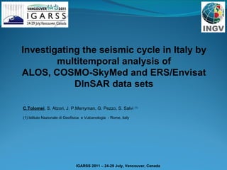
  • 1. Investigating the seismic cycle in Italy by multitemporal analysis of ALOS, COSMO-SkyMed and ERS/Envisat DInSAR data sets C.Tolomei , S. Atzori, J. P.Merryman, G. Pezzo, S. Salvi (1) (1) Istituto Nazionale di Geofisica e Vulcanologia - Rome, italy
  • 2.
  • 3.
  • 4. What we produce Ground velocity maps at the fault scale The SIGRIS PR1 products are maps showing the small (mm/yr) progressive movements of the Earth’s surface occurred over a period of years. We use them to quantify the crustal deformation associated to the seismic cycle , in particular in the inter-seismic and post-seismic phases. The amount and patterns of crustal deformation are related to the tectonic stress accumulated and then released during the earthquakes .
  • 5.
  • 6.
  • 7. SIGRIS Test Sites The SIGRIS Project considers 4 test areas in Italy. We processed over 1100 SAR images from ERS, ENVISAT, ALOS, and COSMO-SkyMed satellites. We generated, validated, and delivered to the Italian Civil Protection over 100 PR1 product items.
  • 8. The Straits of Messina The largest earthquake of the XX century in Italy Mw = 7.1, in 1908 Debated earthquake source (at least 5 different fault models) To be crossed by a 4-km long suspended bridge From Amoruso et al, 2002, JGR Inter-seismic phase
  • 9. Ground deformation using time-series DInSAR SAR Data: ERS (1992-2001) 71 images (D), 37 (A) ENVISAT (2003-2008) 34 images (A) ALOS (2007-2010) 22 images (A) COSMO-Skymed (2009-2010) 17 images (D)
  • 10. Mean Ground Velocity Maps (LoS) Ascending Orbit Descending orbit ERS+ENVISAT
  • 12.
  • 13. Up Component Legend Up Velocity (mm/yr) _ +
  • 14. East Component 4 mm/yr 0 mm/yr -5 mm/yr -1 mm/yr -4 mm/yr -9 mm/yr Legend East Velocity (mm/yr)
  • 15. Temporal span: 10/01/07- 05/06/10 22 images ALOS Mean Ground Velocity Map (LoS) Processed with SARscape
  • 16. What ALOS can detect 2 1 2007-2010 1992-2010 1 N S S W E 2
  • 17. COSMO-SkyMed Ground Velocity map (LoS) Ascending orbit 1 2 Area 1 1st of October, 2009: Mud landslide, 30 casualties 1 1 2 2
  • 18. The April 6, 2009 L’Aquila earthquake Co-seismic & post-seismic phase
  • 19. Co-seismic deformation maps: first clear SAR interferogram (ENVISAT desc) -27 cm LoS displacement
  • 20. Co-seismic deformation maps: second clear SAR interferogram (COSMO asc) -25 cm LoS displacement
  • 21. Co-seismic deformation maps: vertical ground displacement
  • 22. Co-seismic deformation maps: East ground displacement
  • 23.
  • 24. Descending Pass Ascending Pass 26/02/2003- 14/07/2010 02/09/2003- 22/06/2010 ASAR Mean Velocity Map (LoS) earthquake
  • 25. ALOS Mean Velocity Map (LoS) Track 639 Frame 830 Temporal span: 15/01/2007-26/07/2010 Processed with SARscape 16 images
  • 26. Temporal span: 29/04/2009-13/10/2009 23 slc used Ascending Orbit COSMO-SkyMed Mean Ground Velocity Map (LoS) Processed with SARscape earthquake earthquake
  • 28.
  • 29. Thank you for your attention!