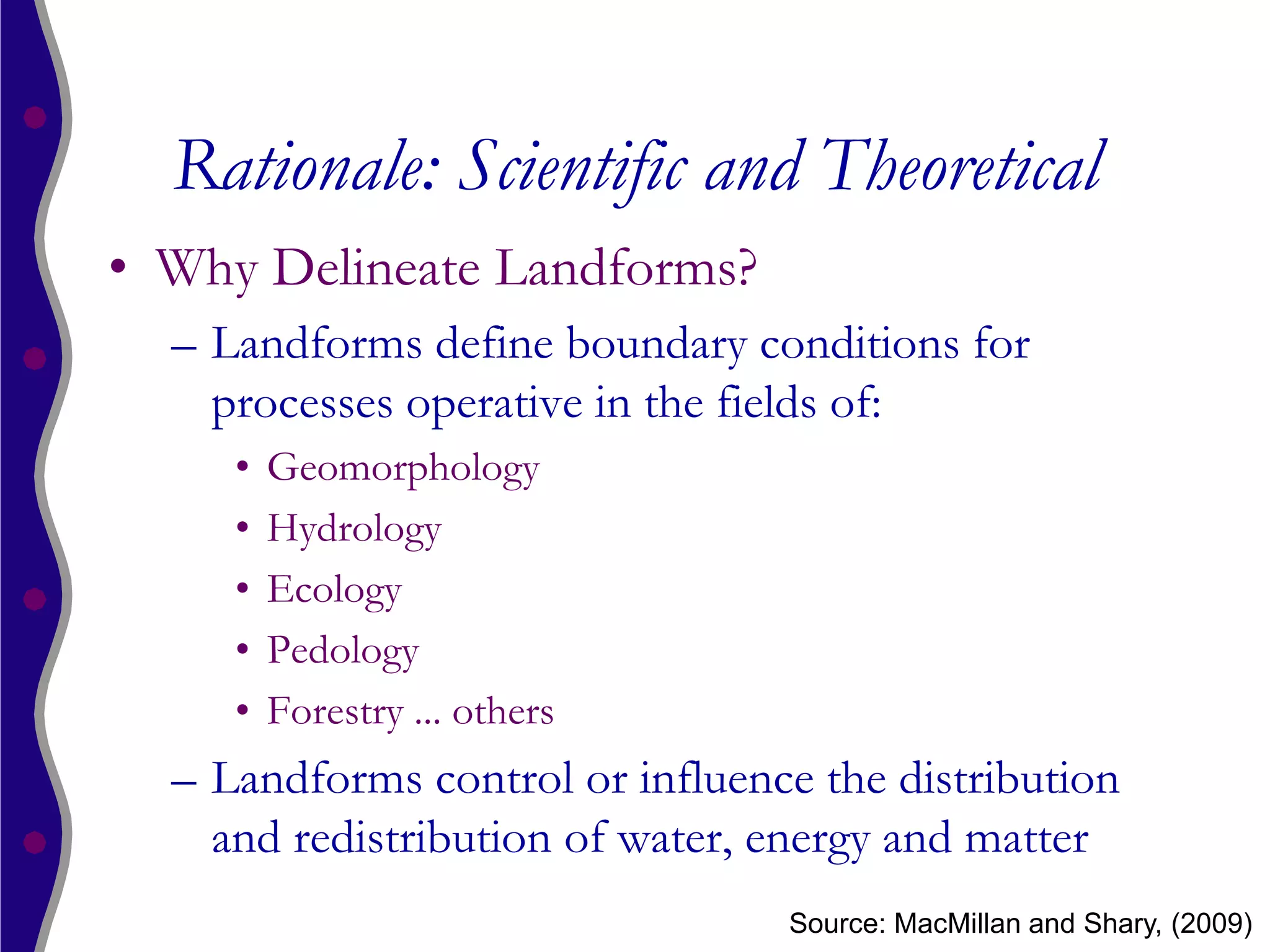
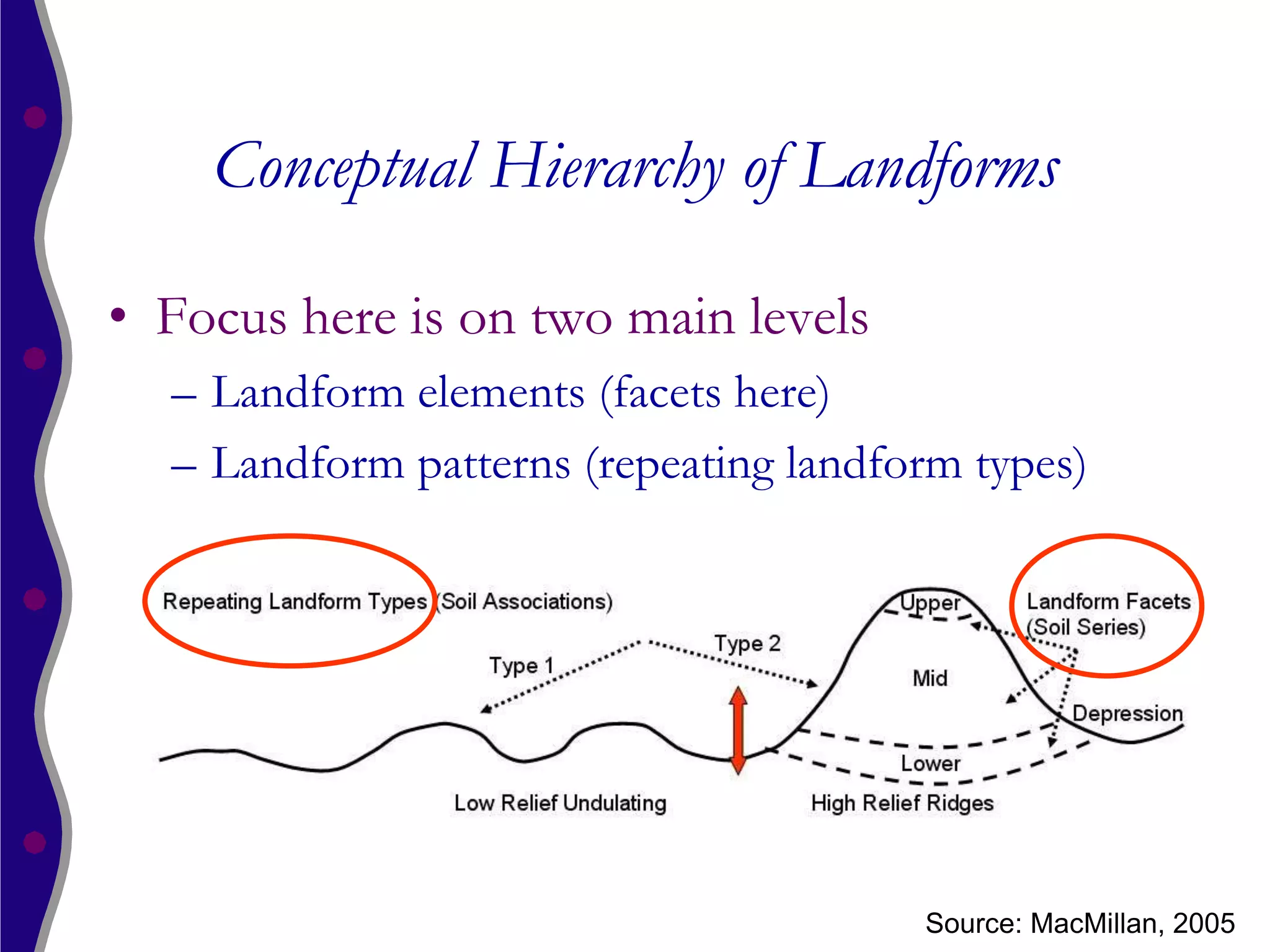
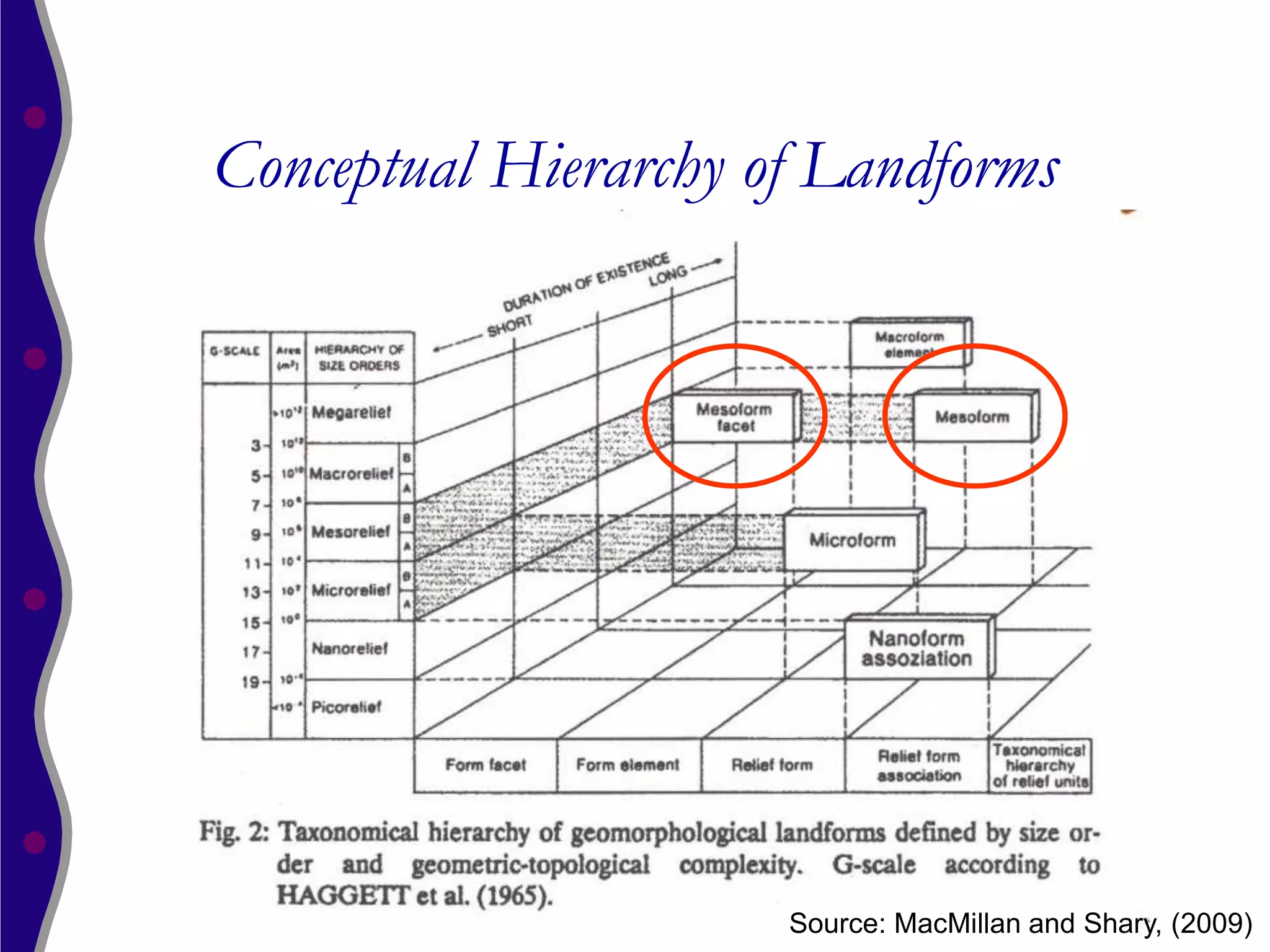
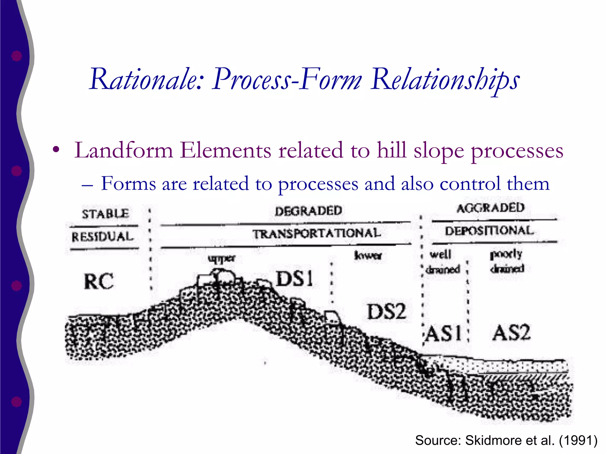
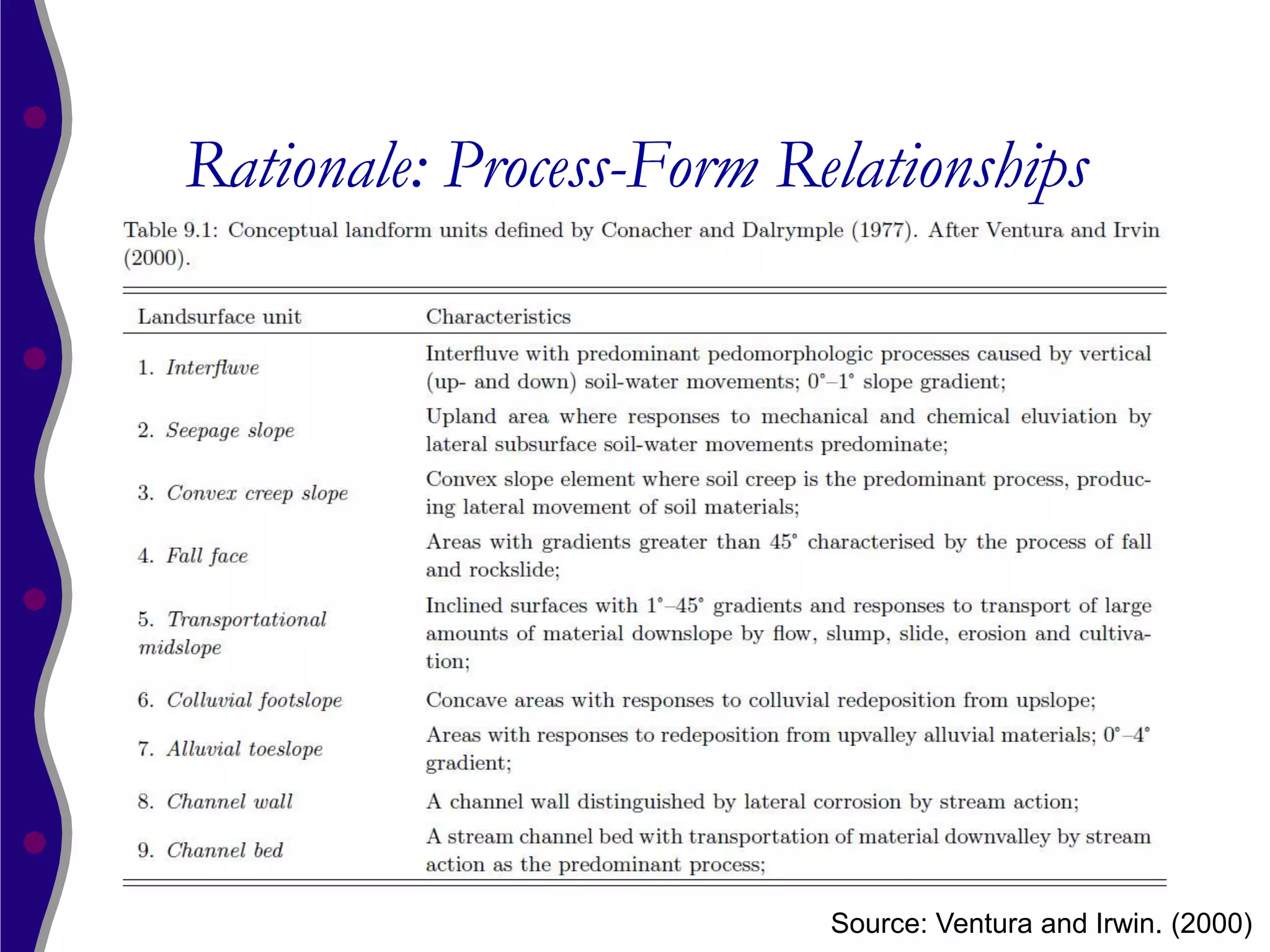
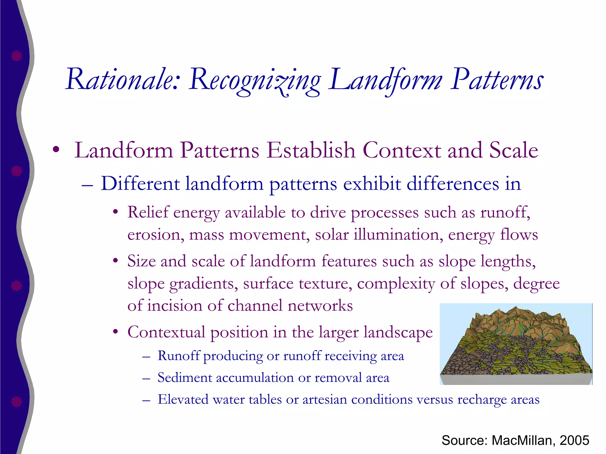
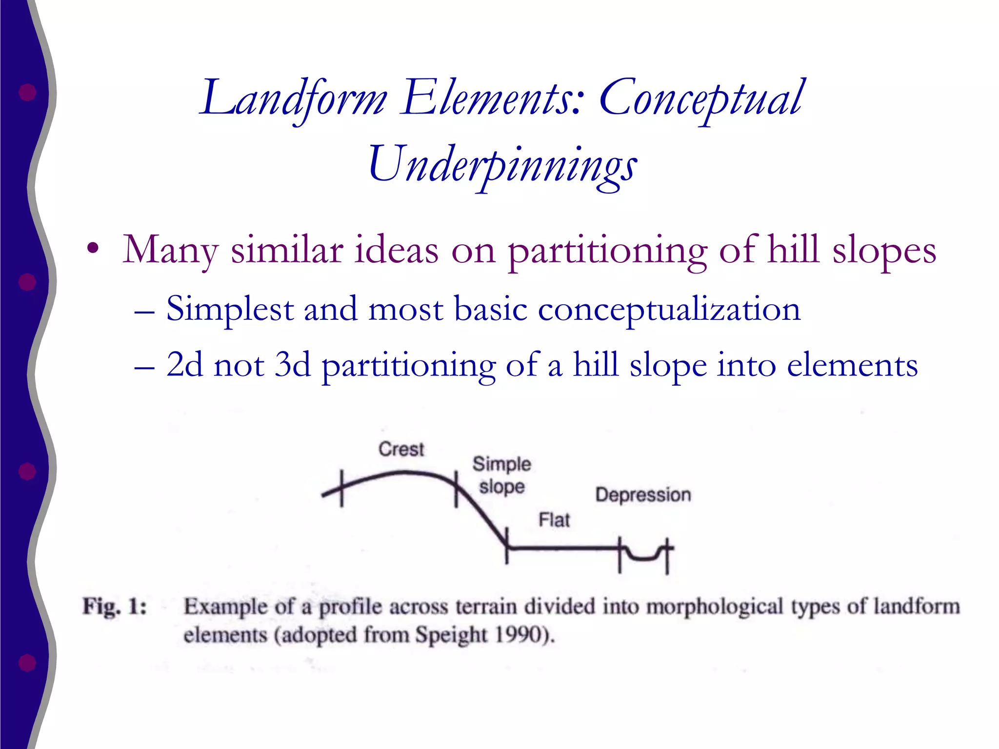
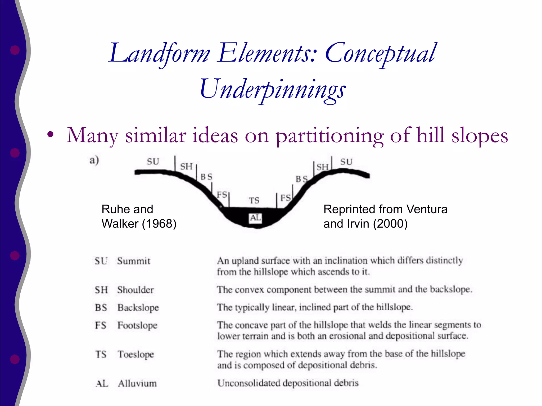
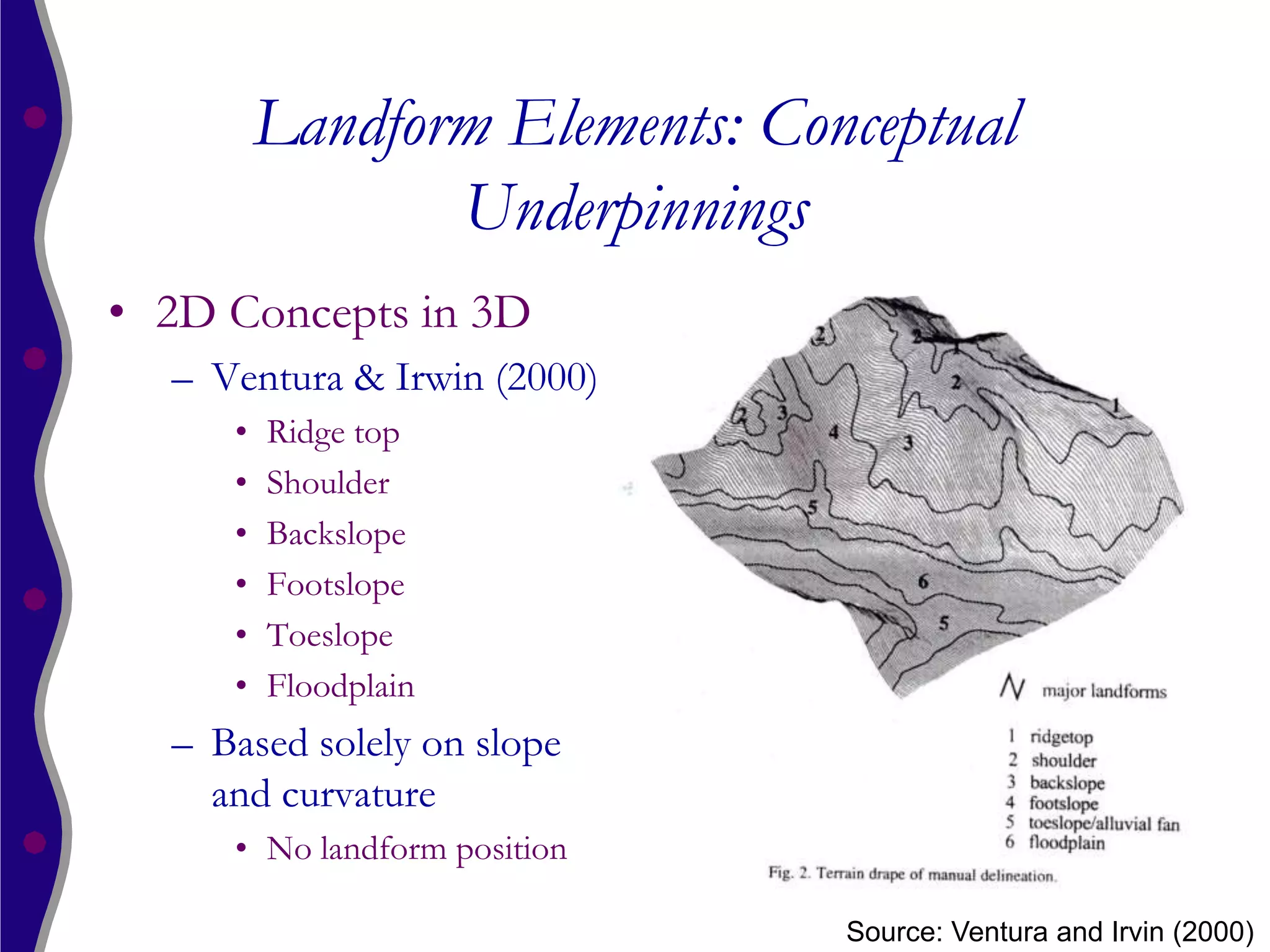
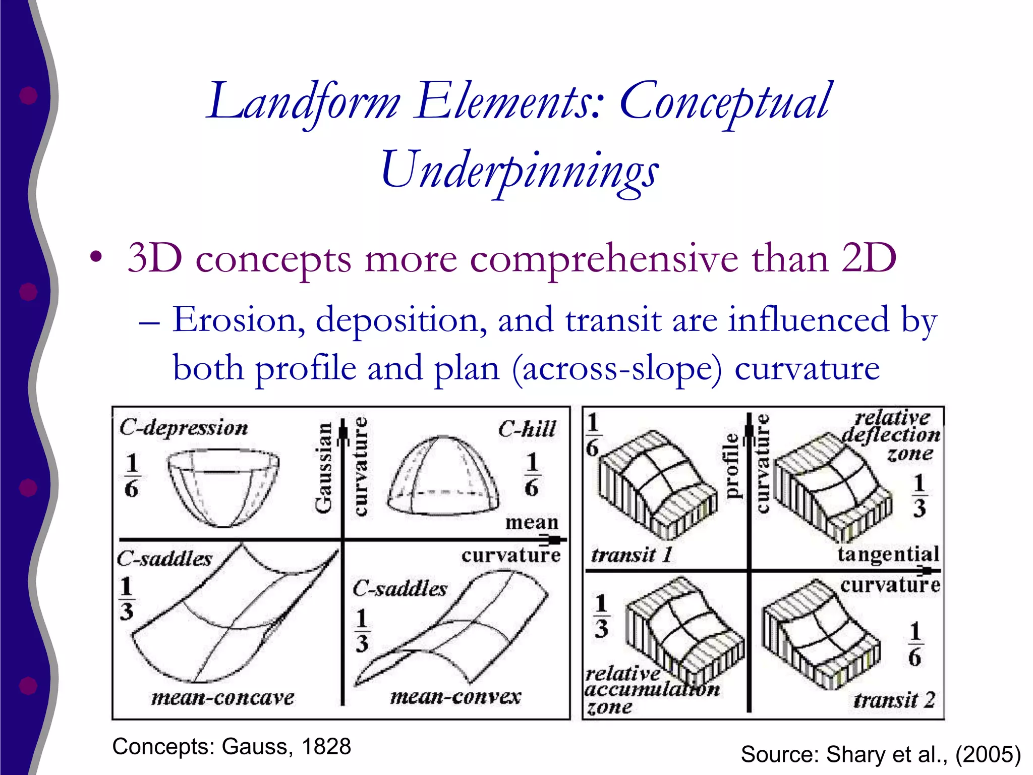
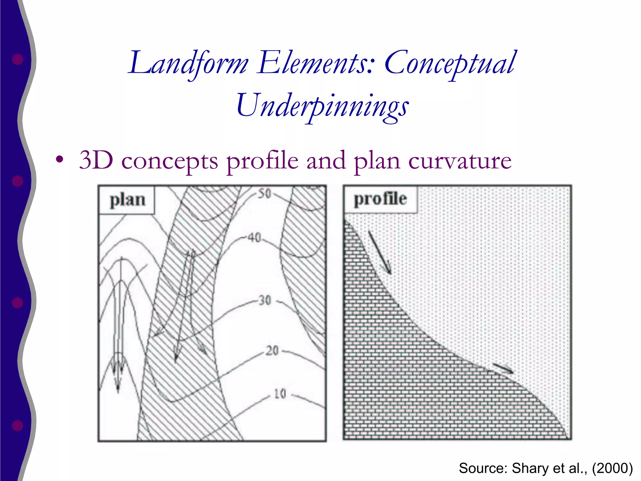
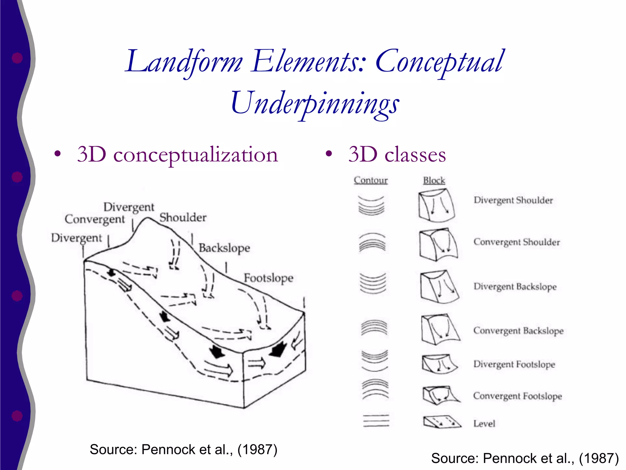
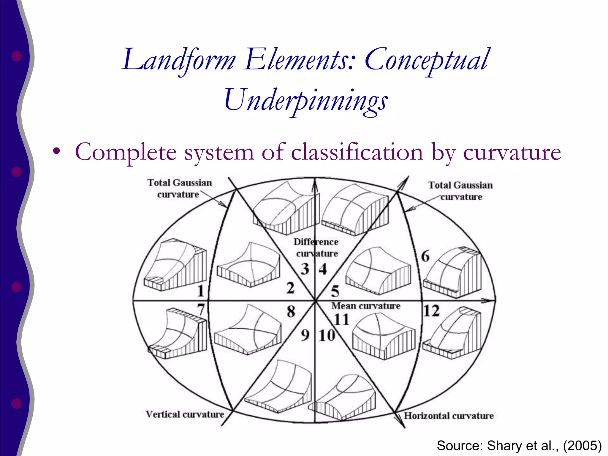
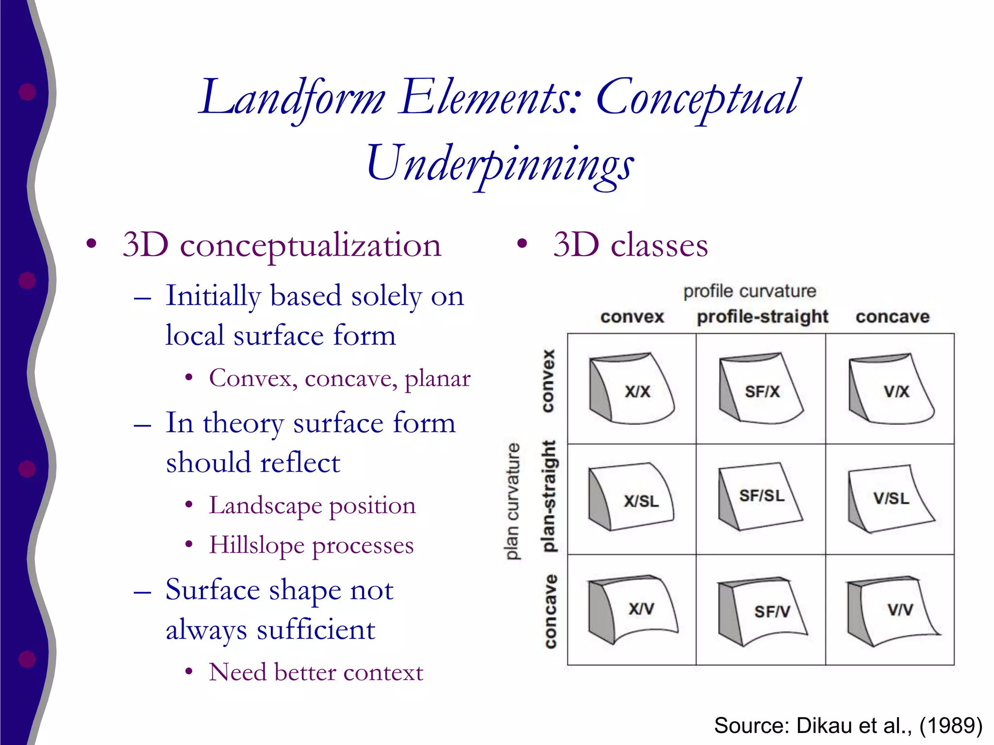
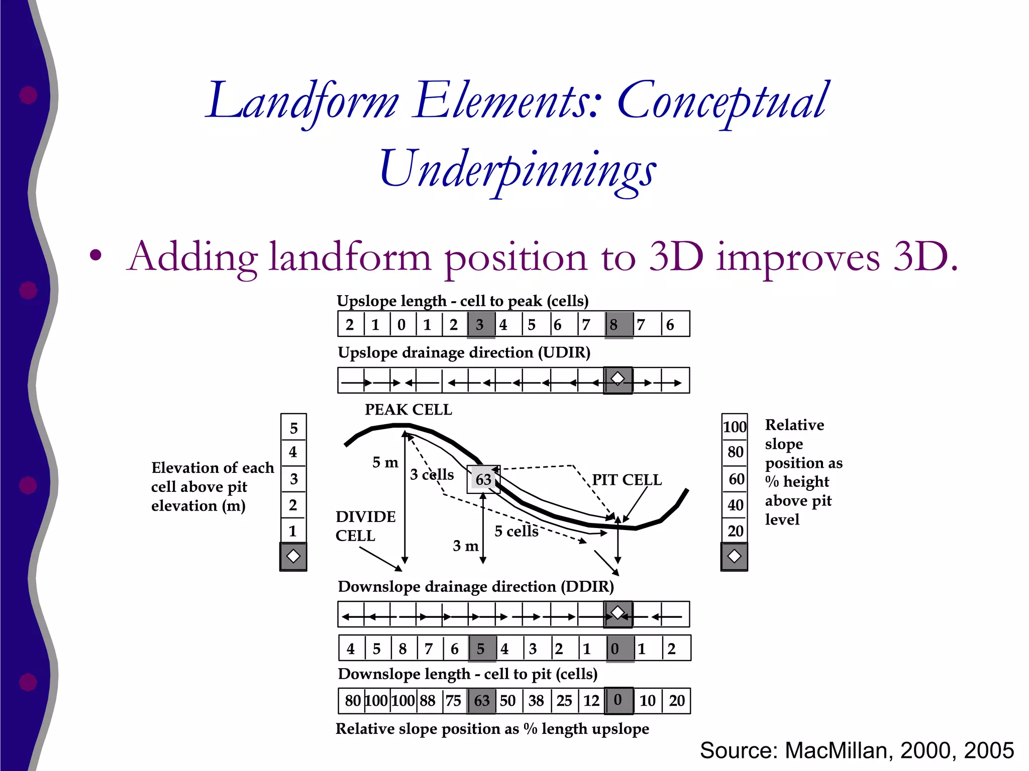
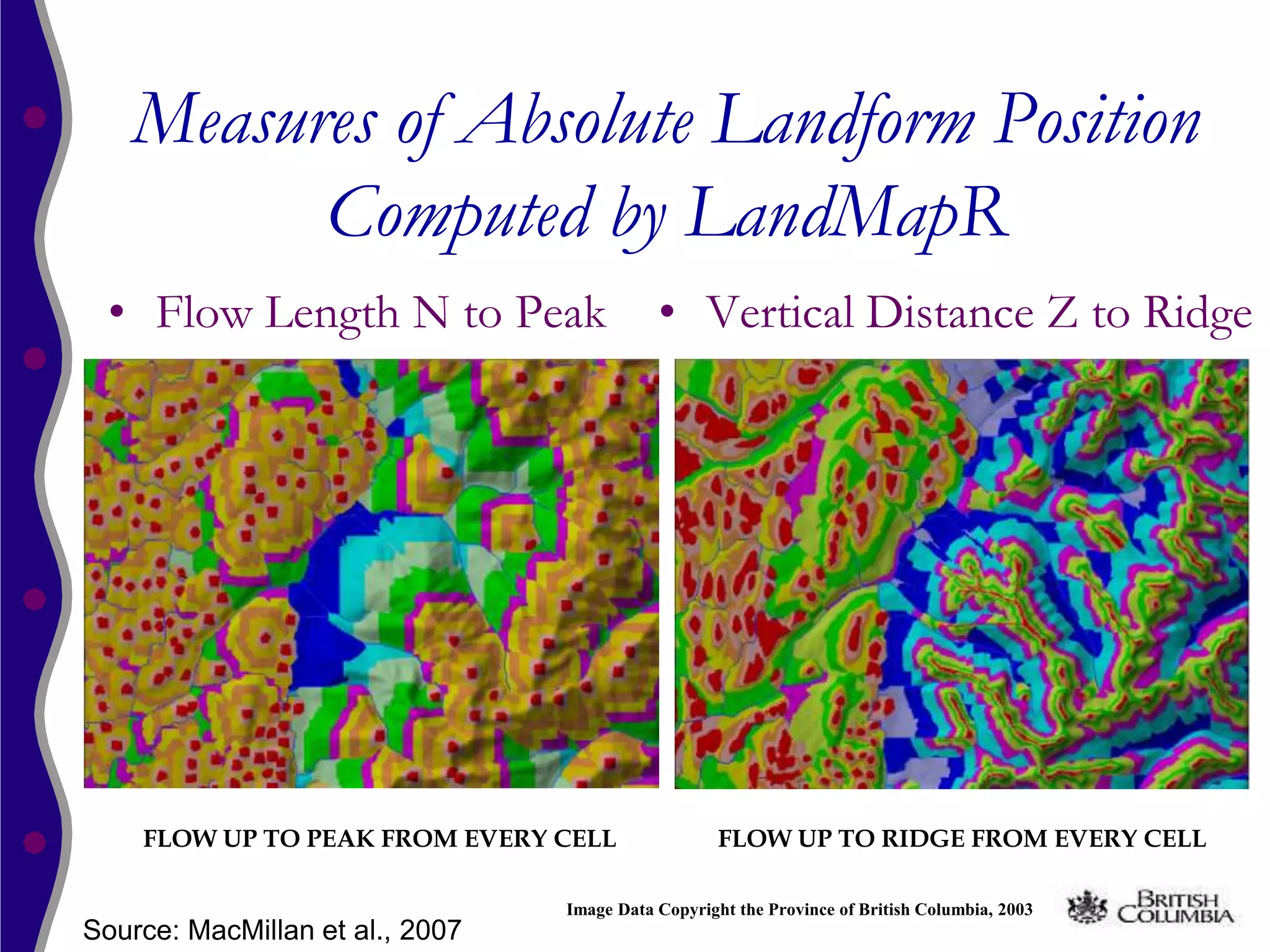
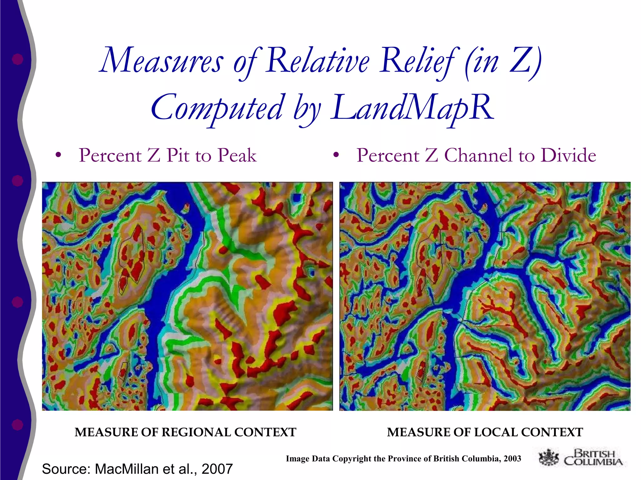
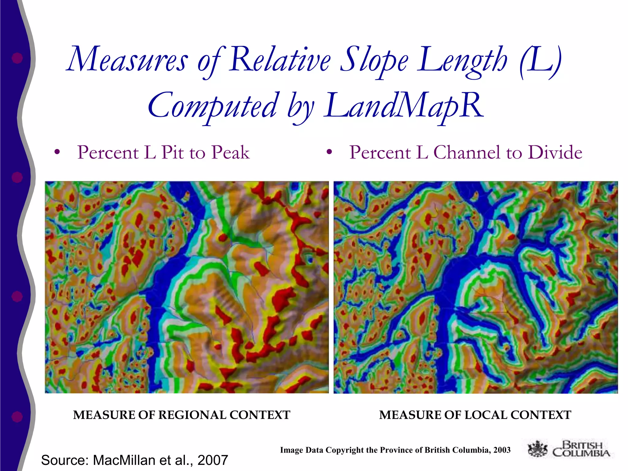
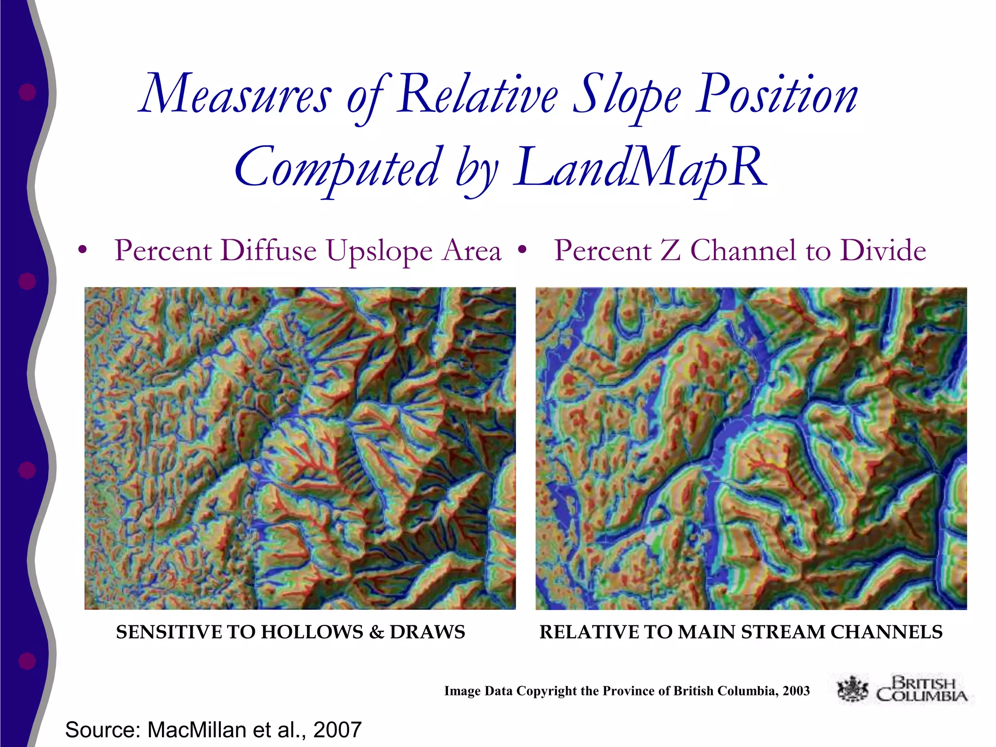
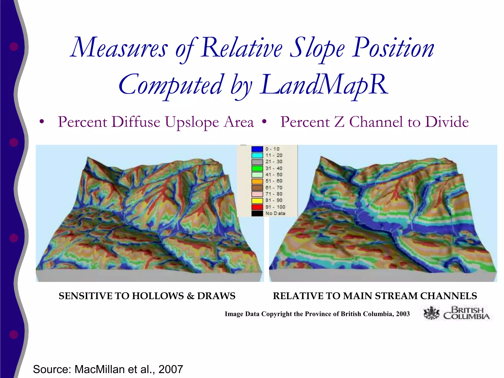
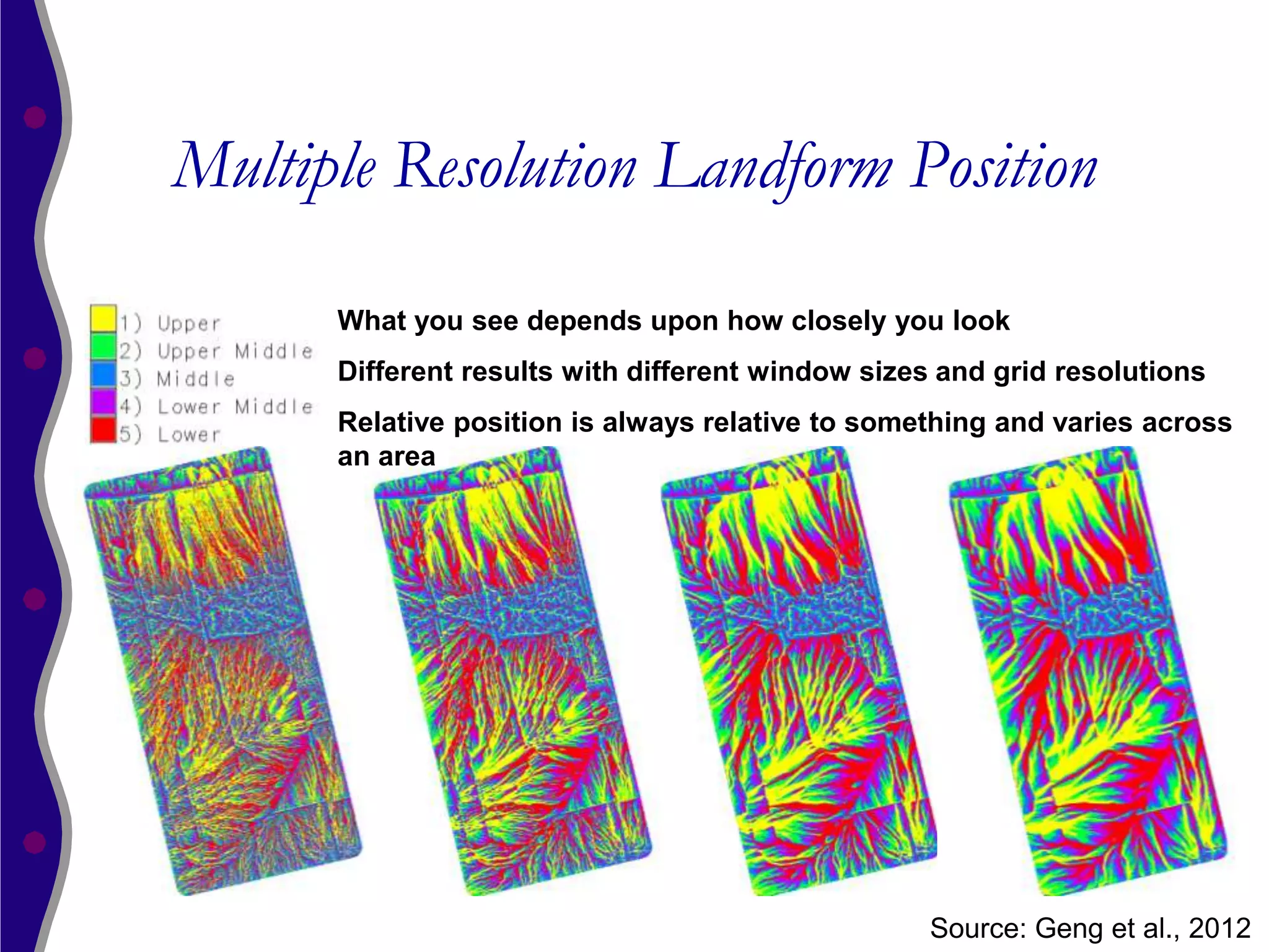
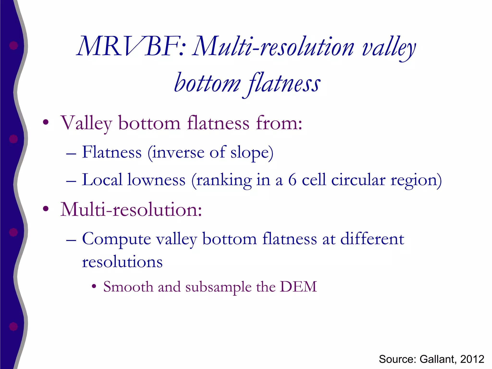
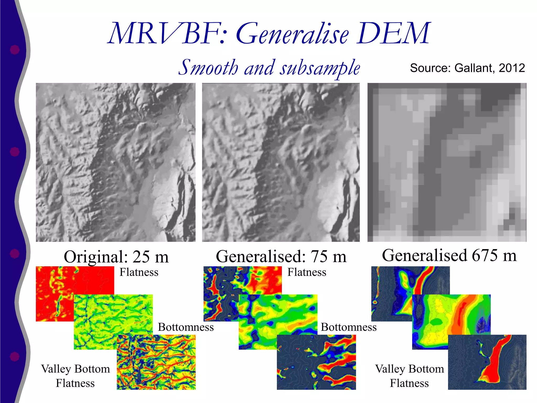
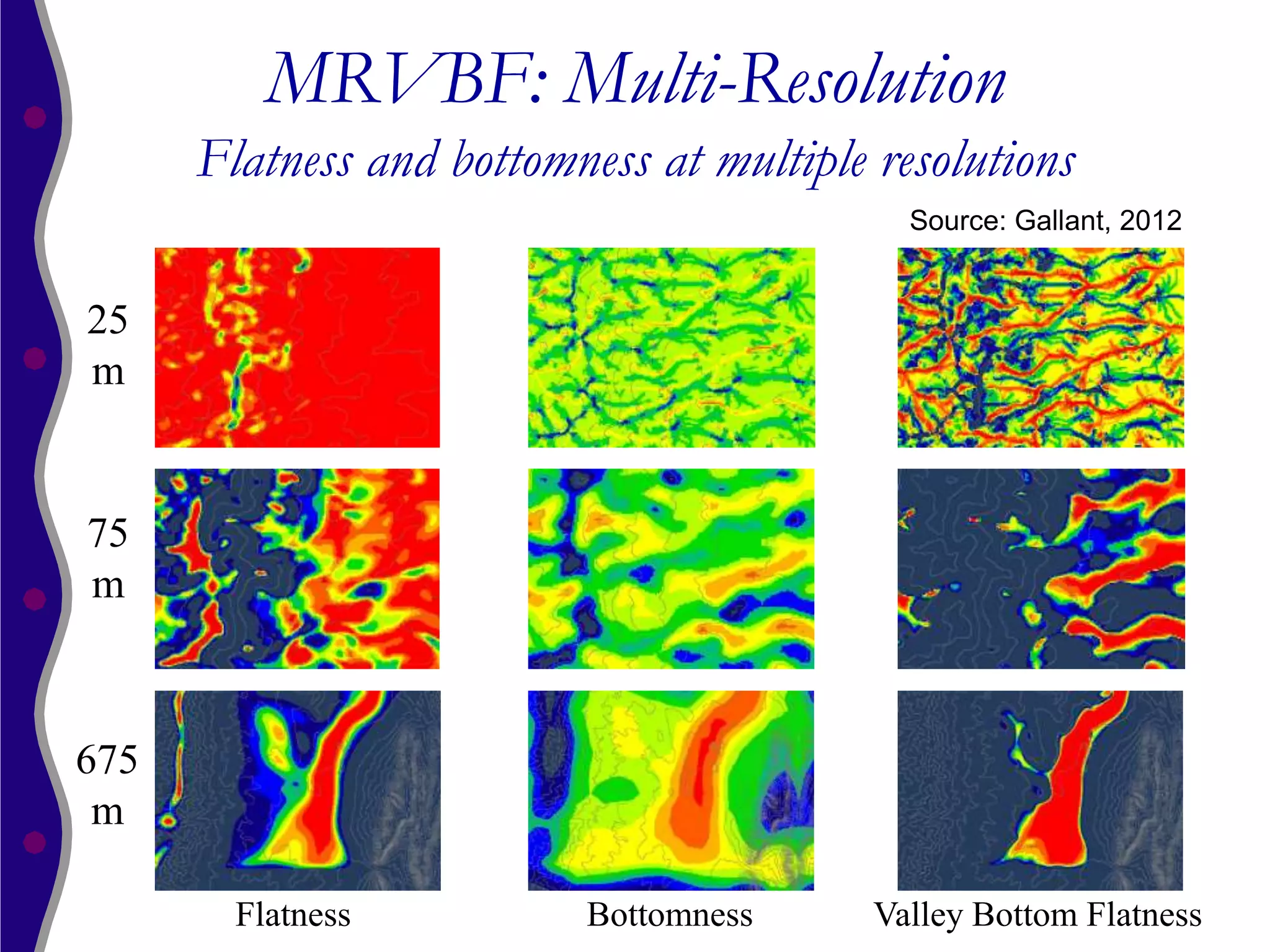
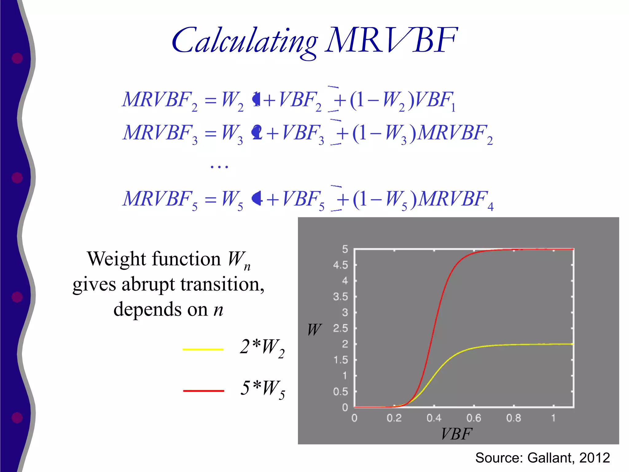
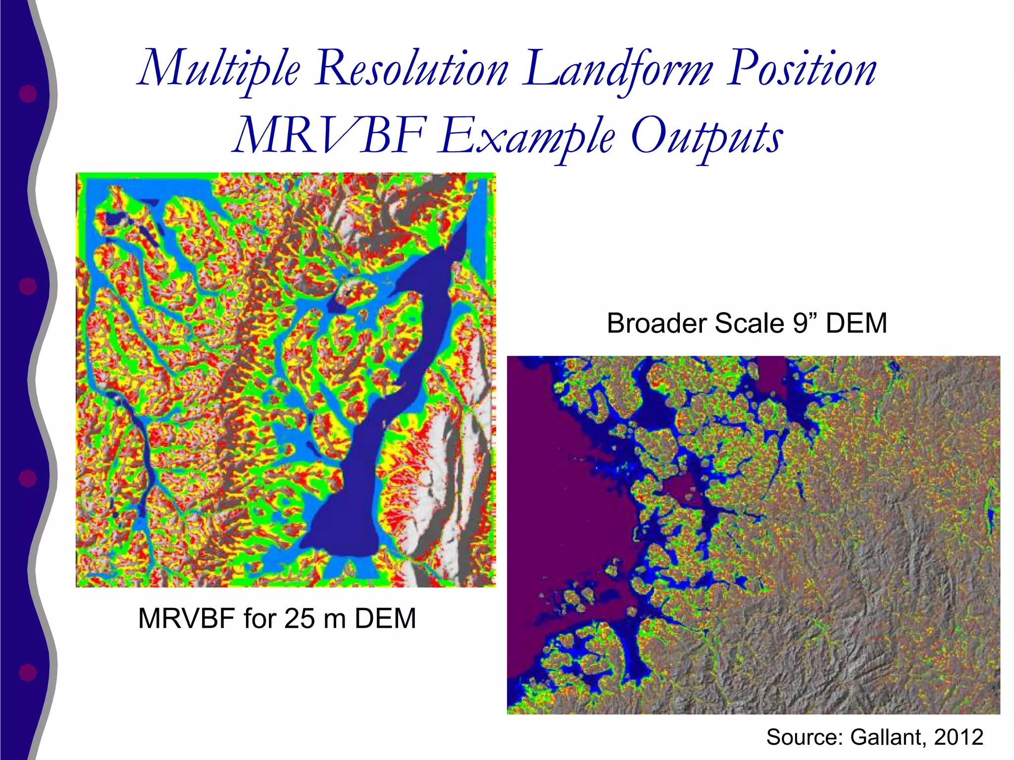
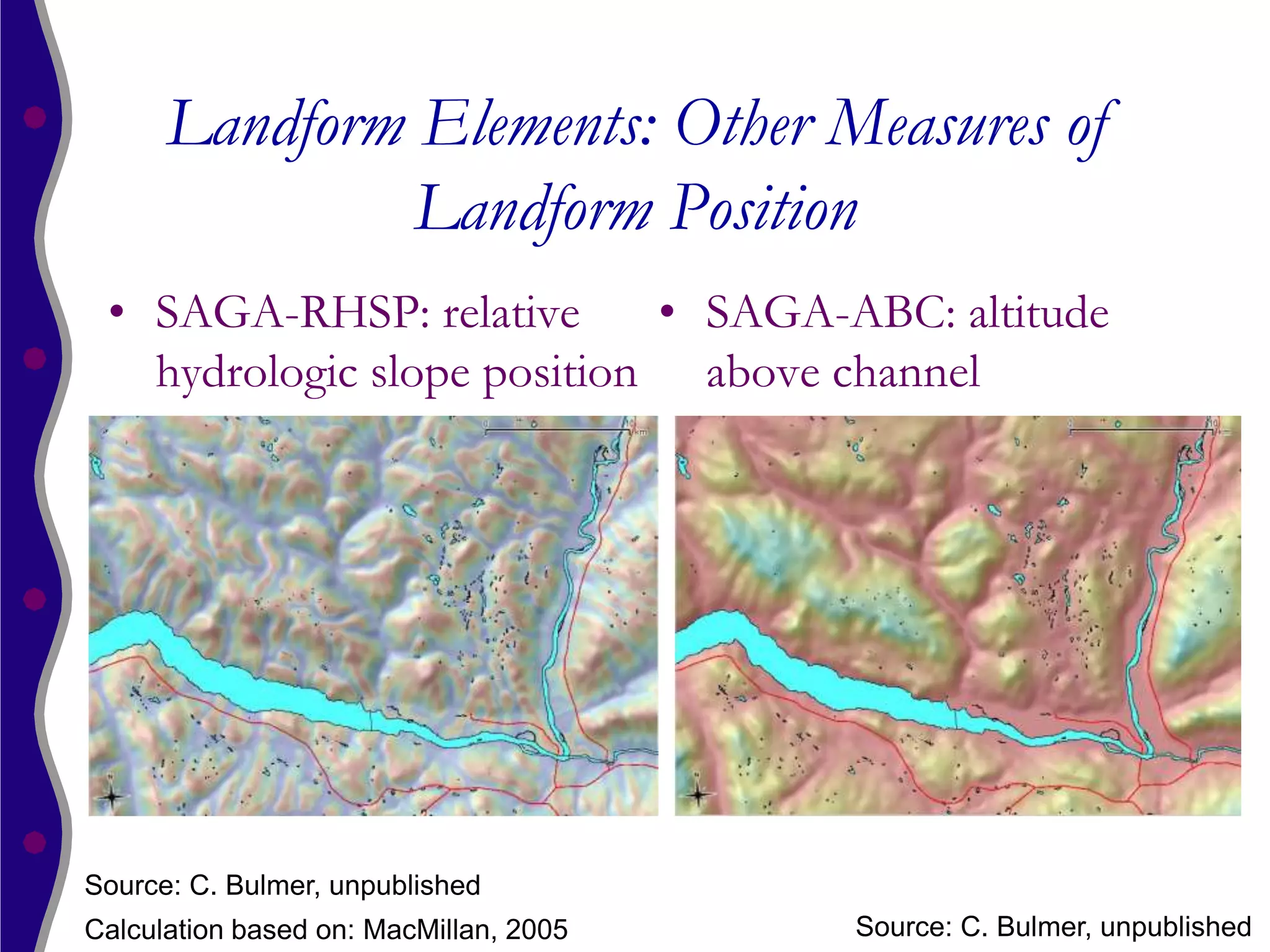
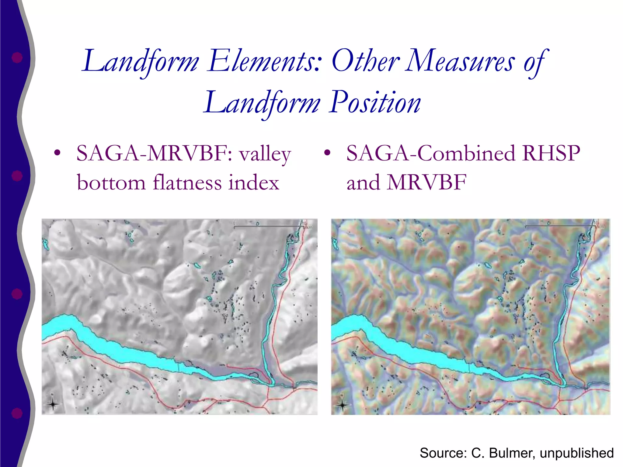
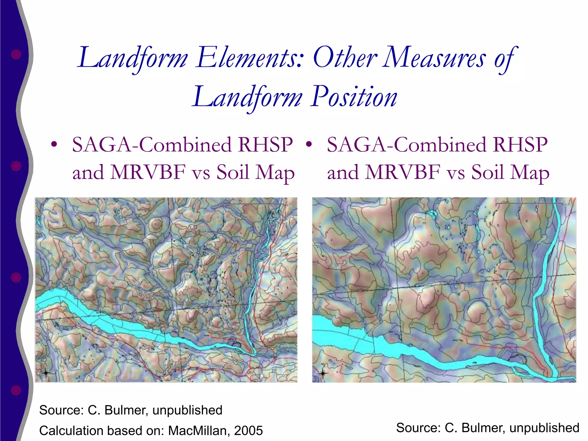
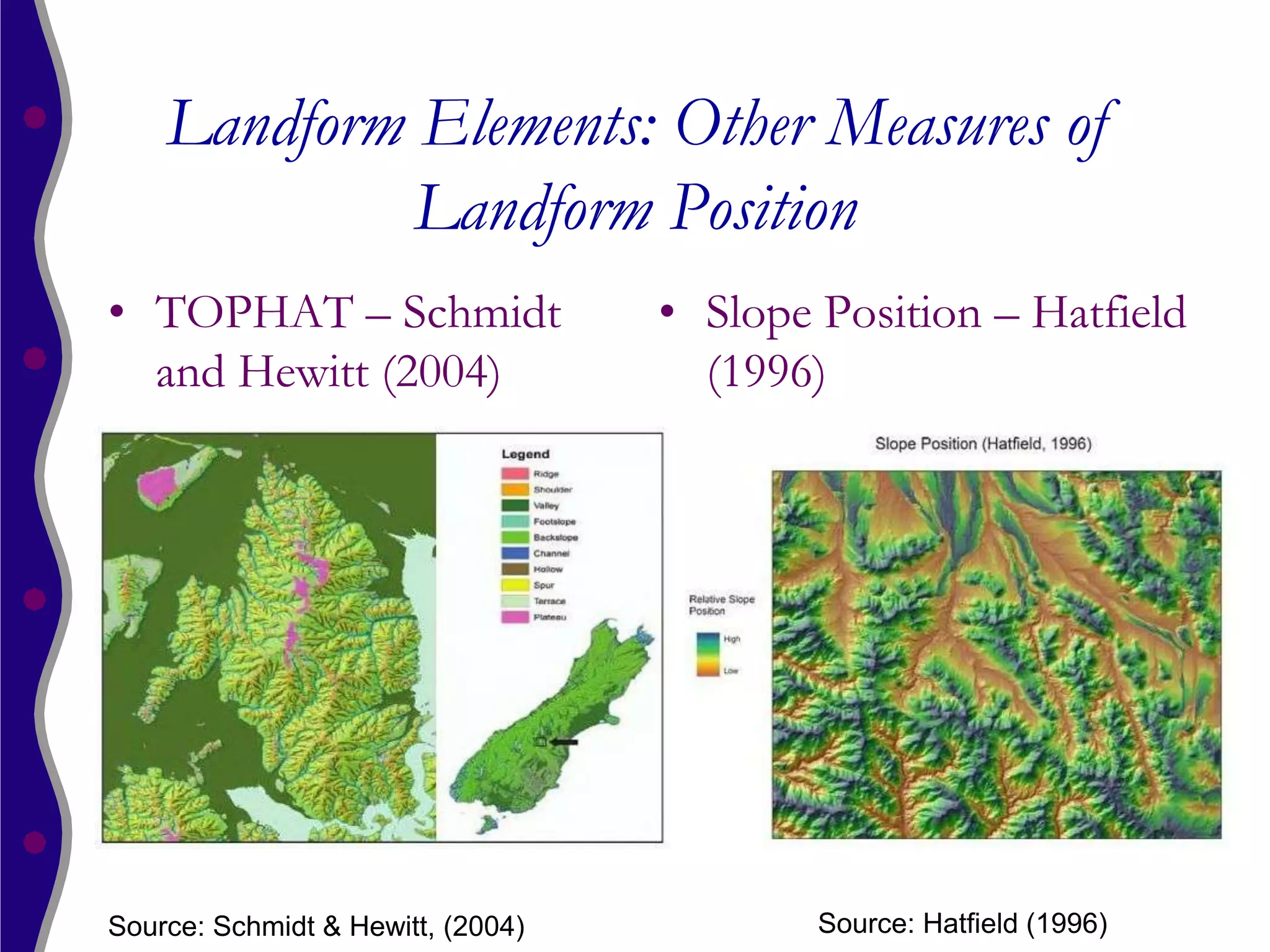
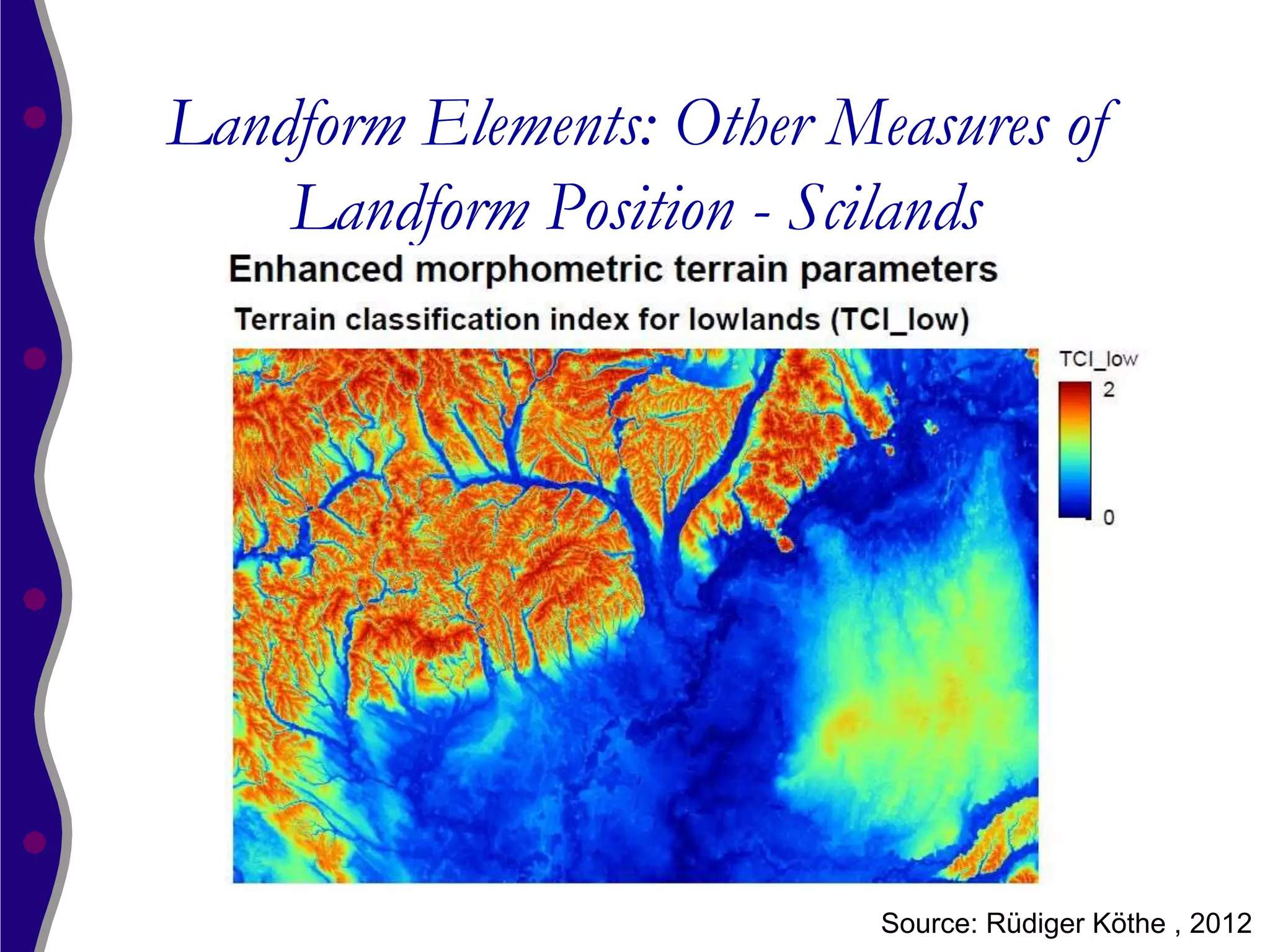
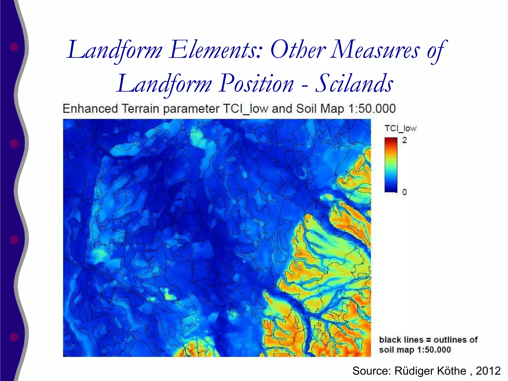
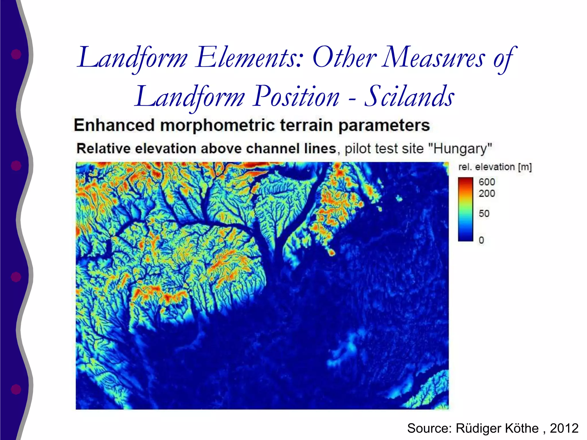
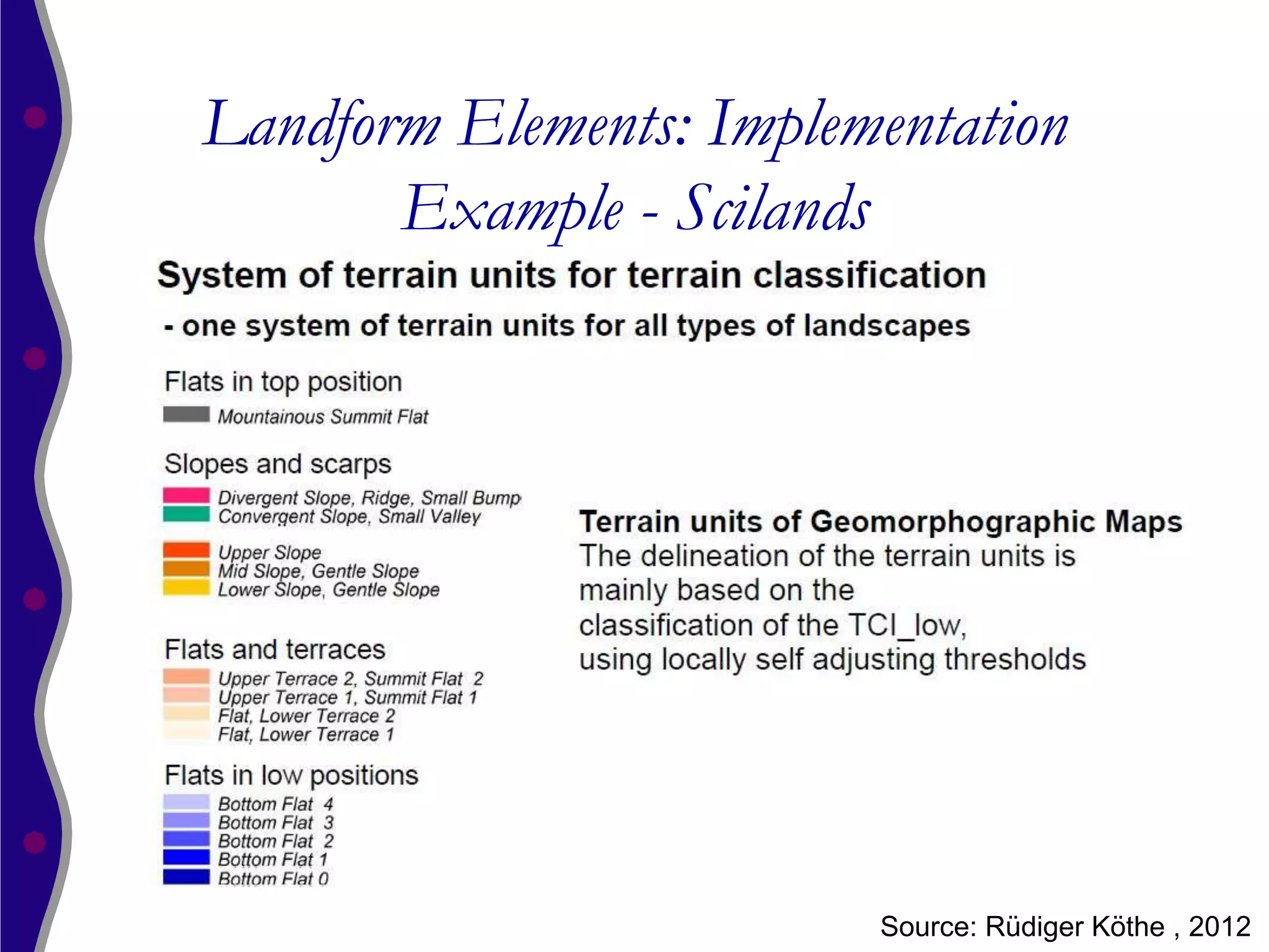
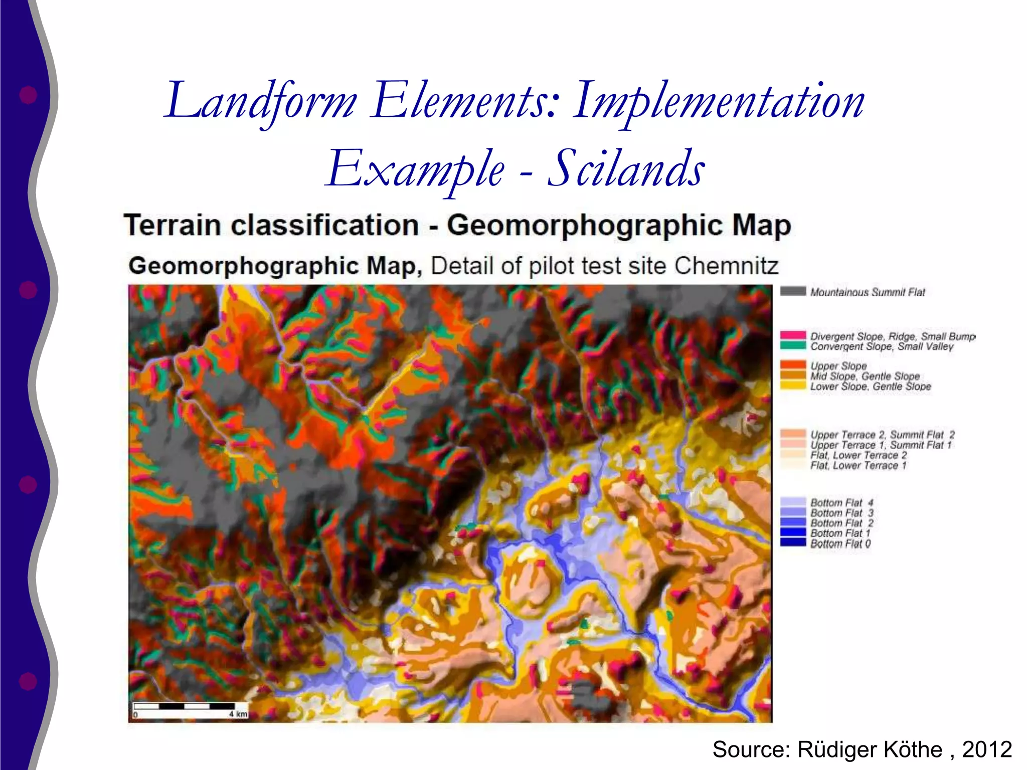
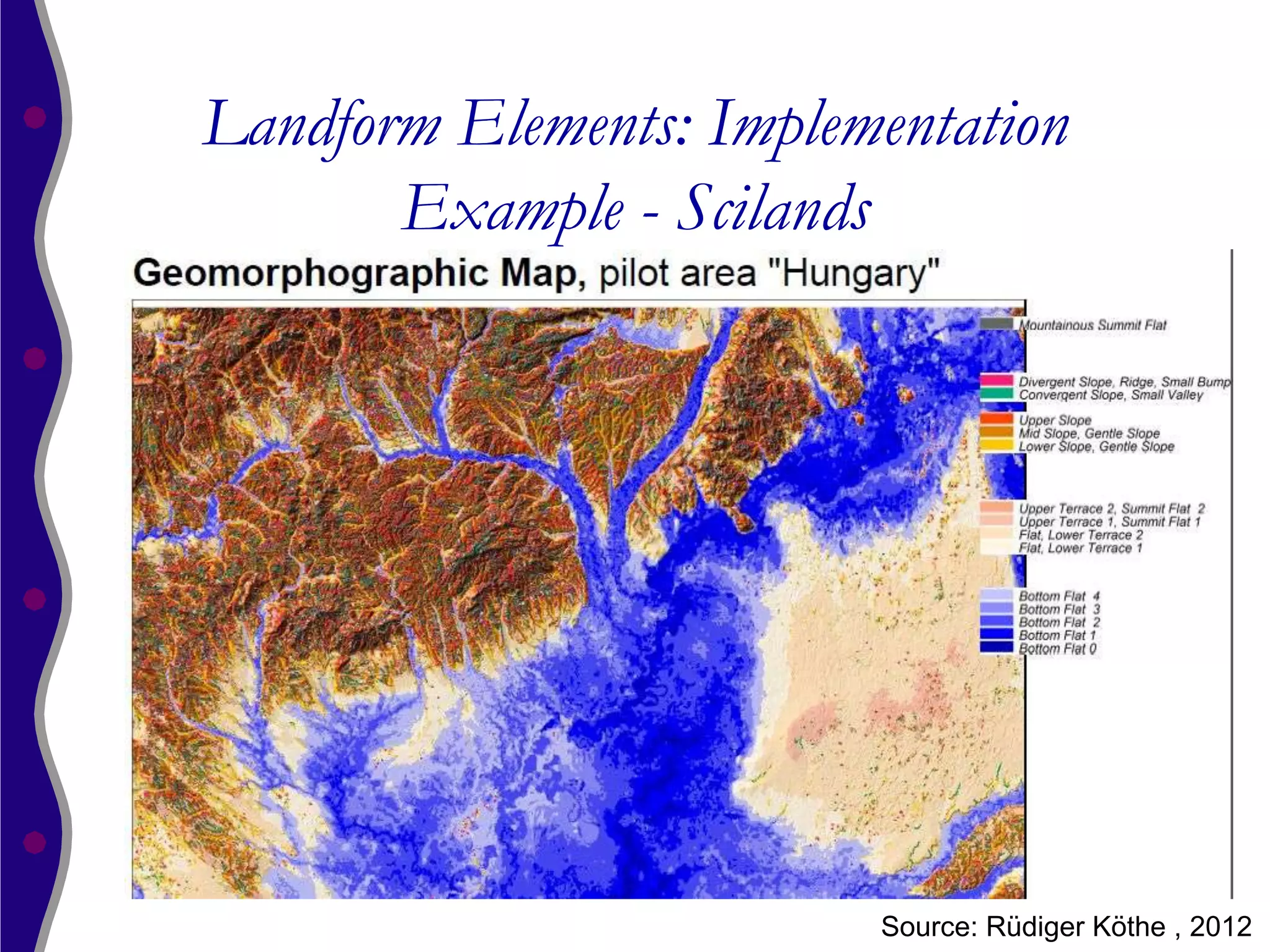
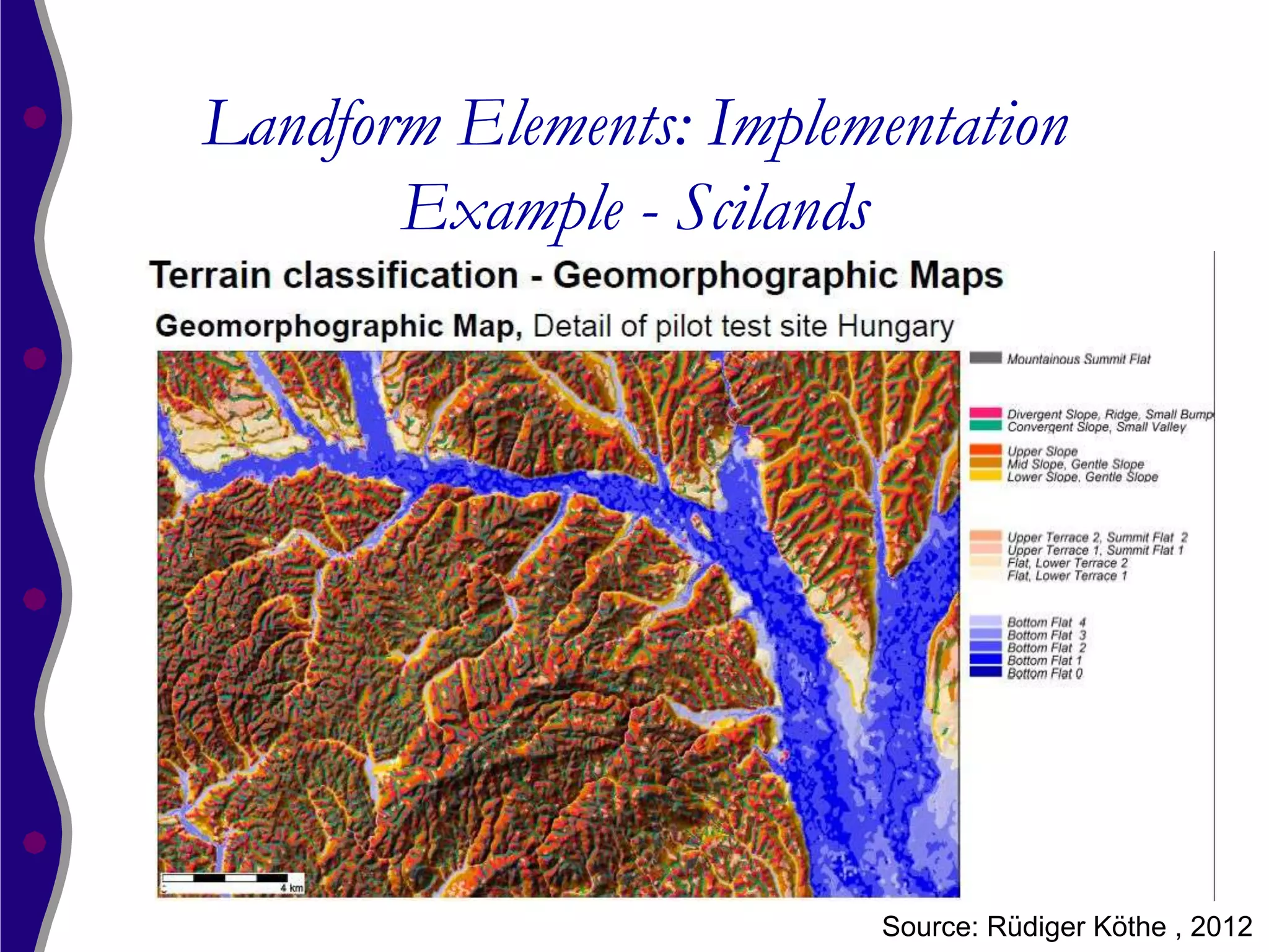
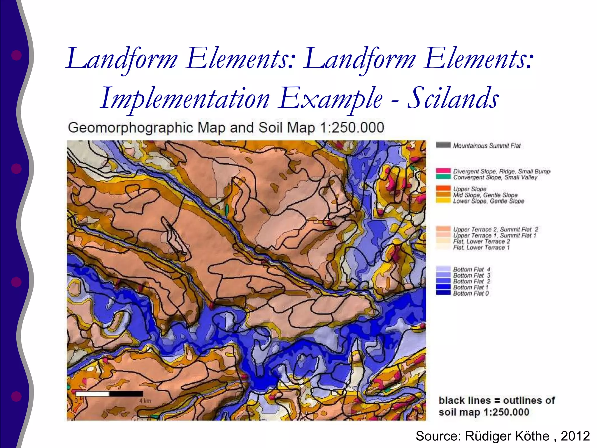
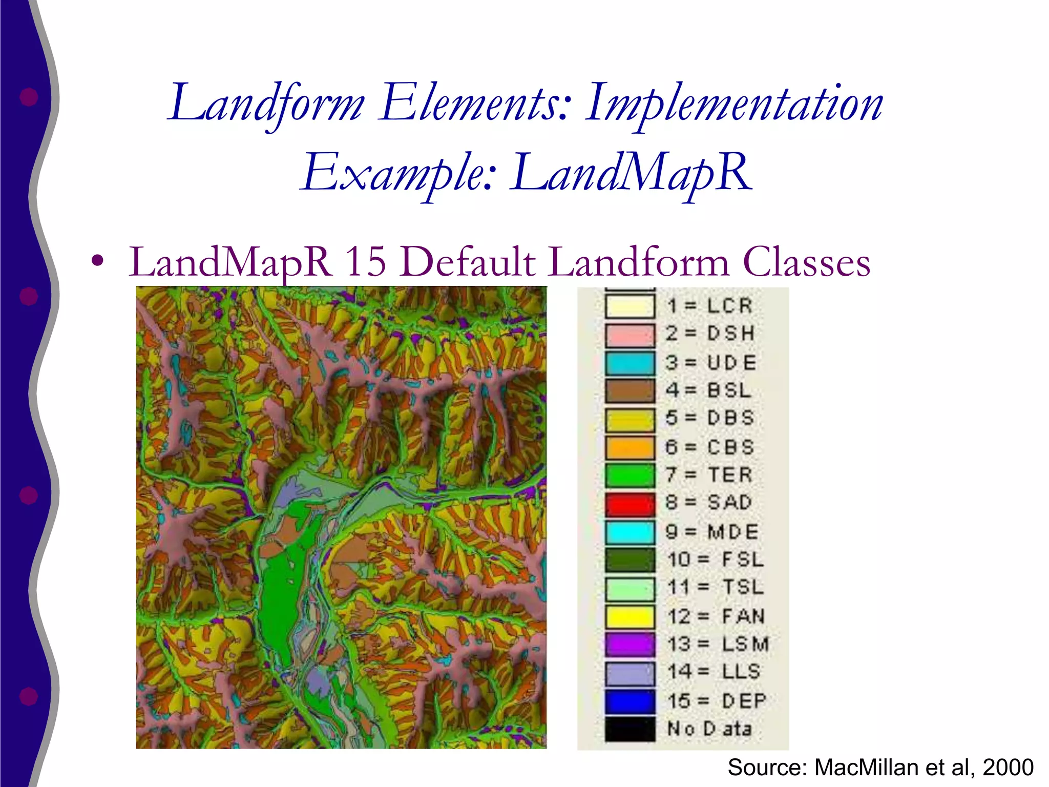
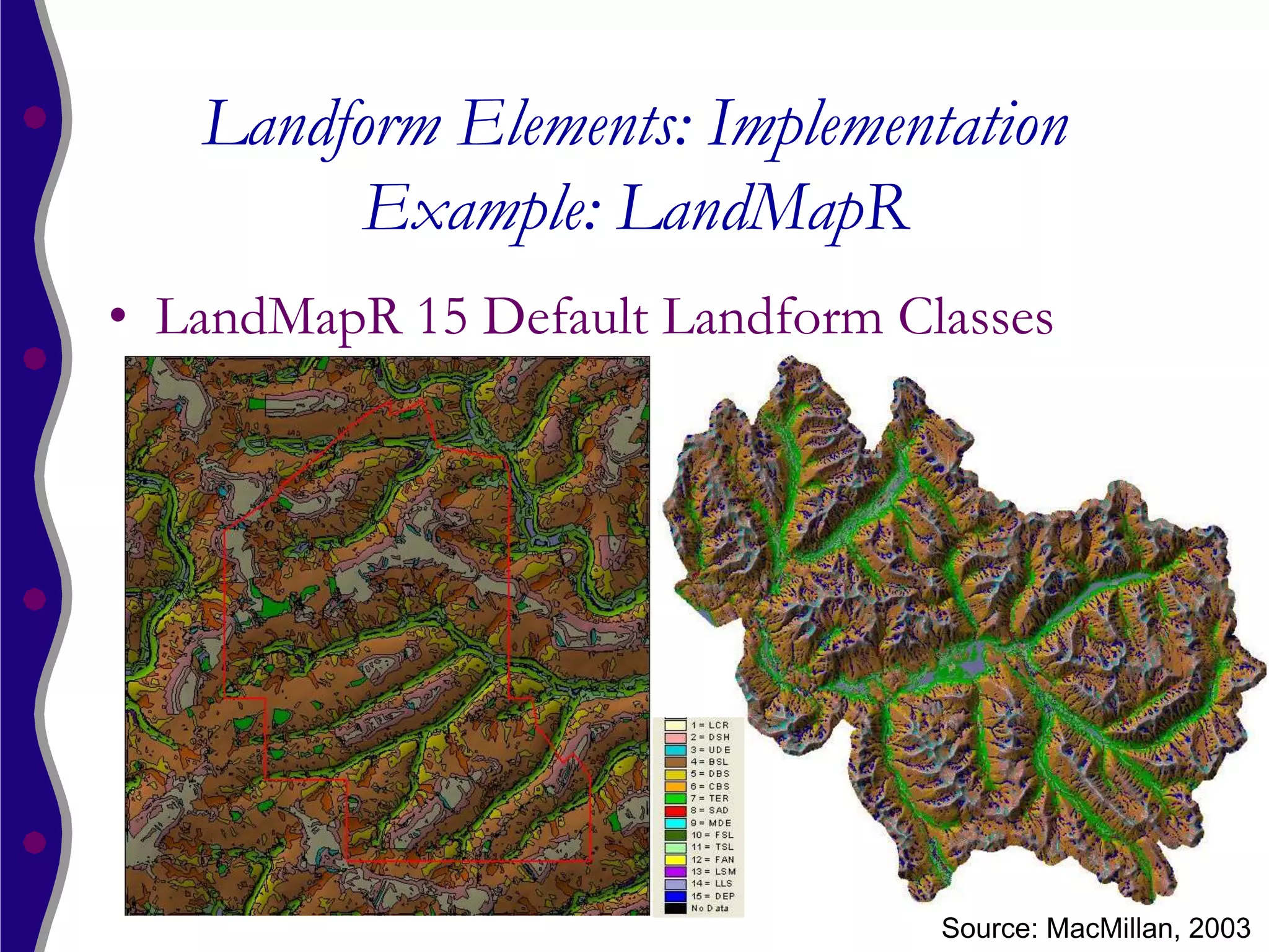
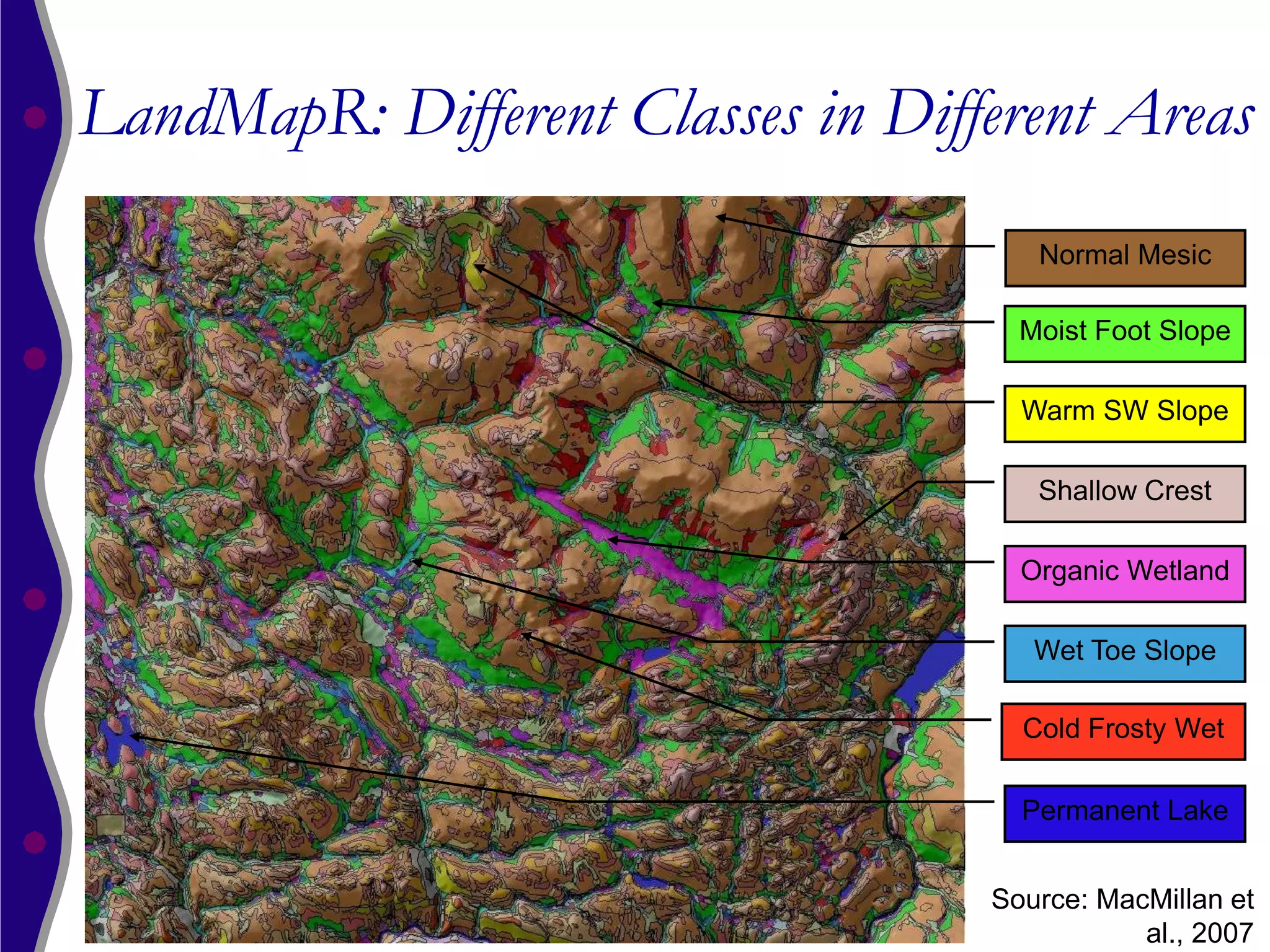
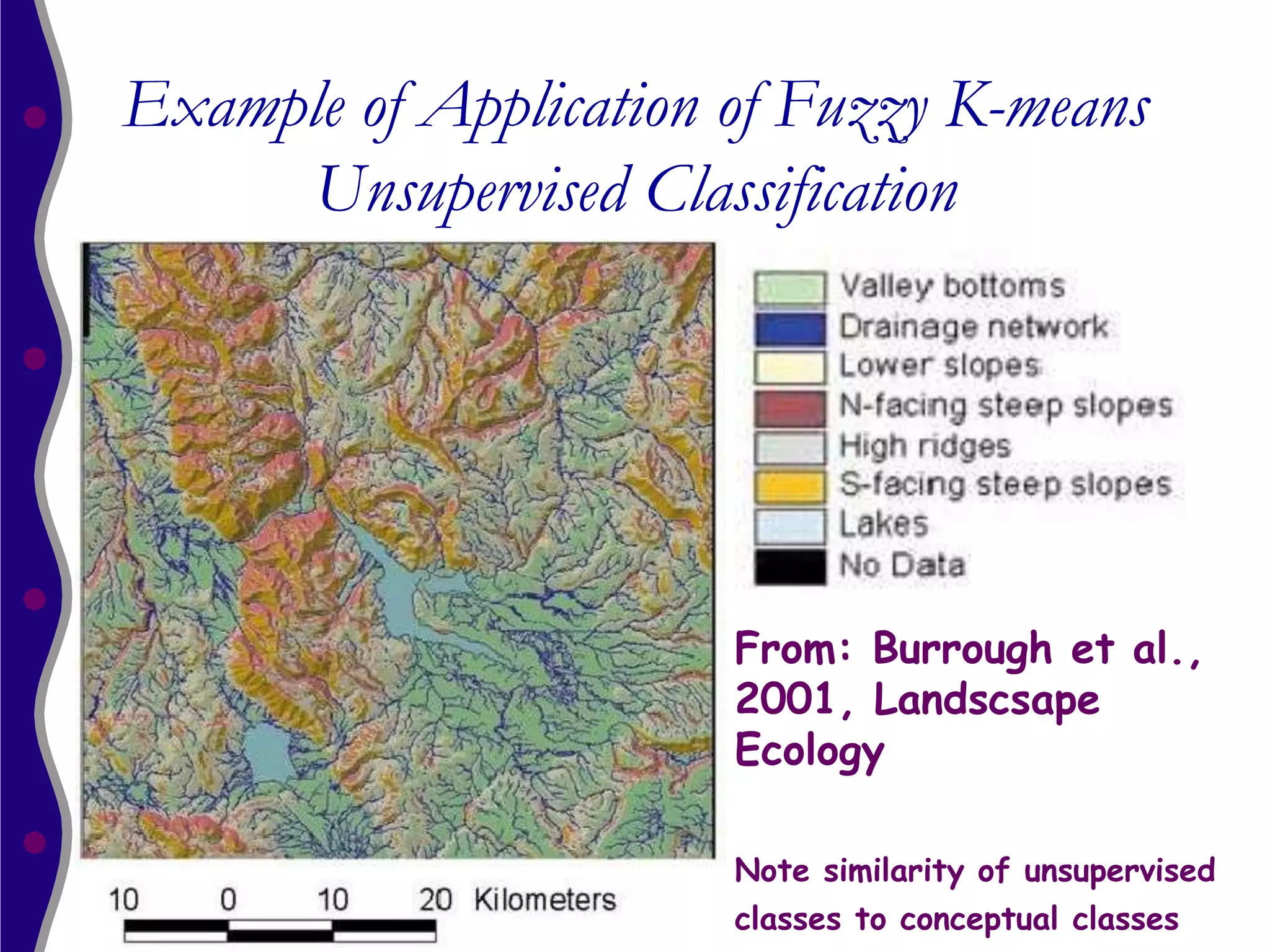
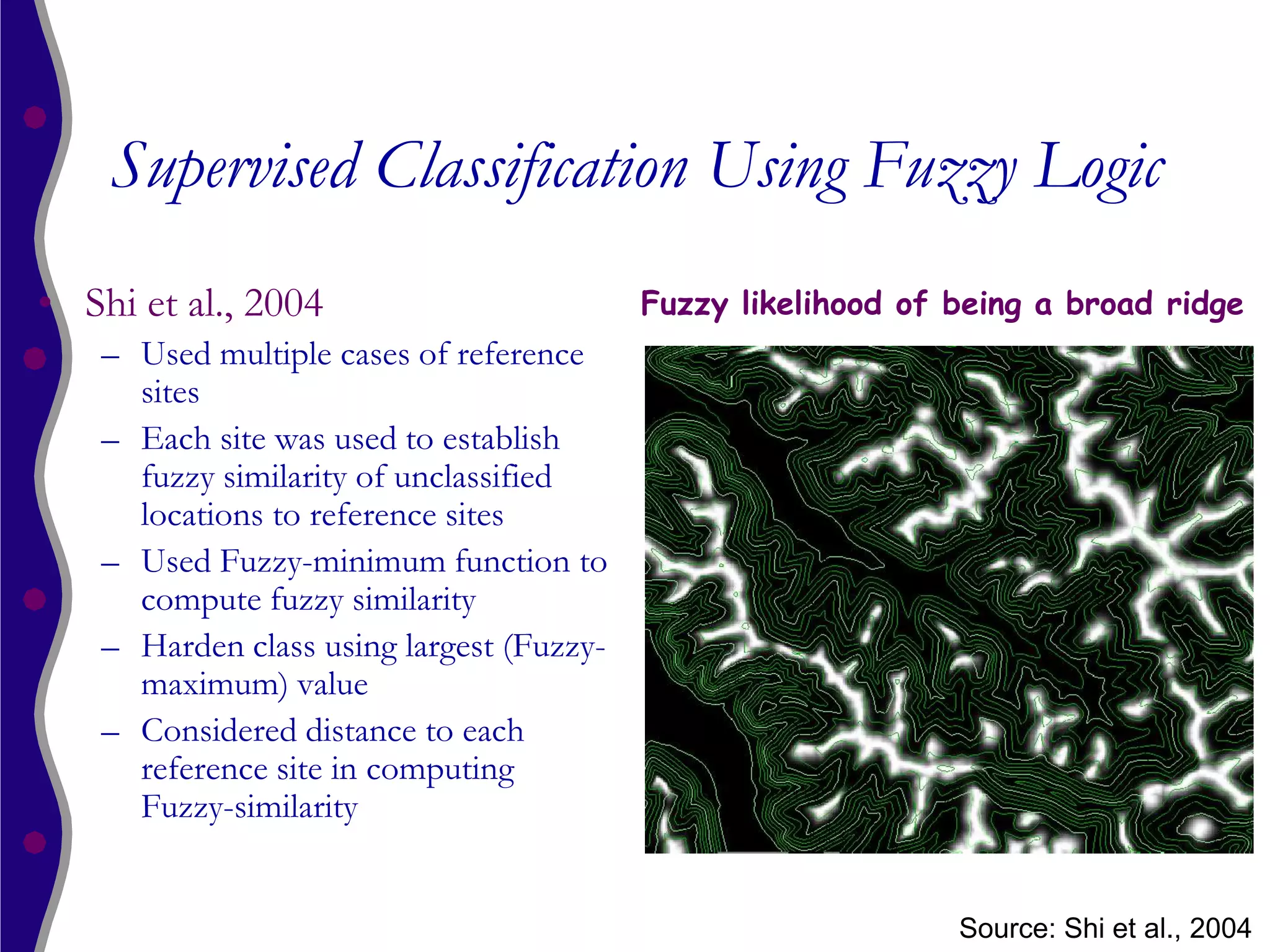
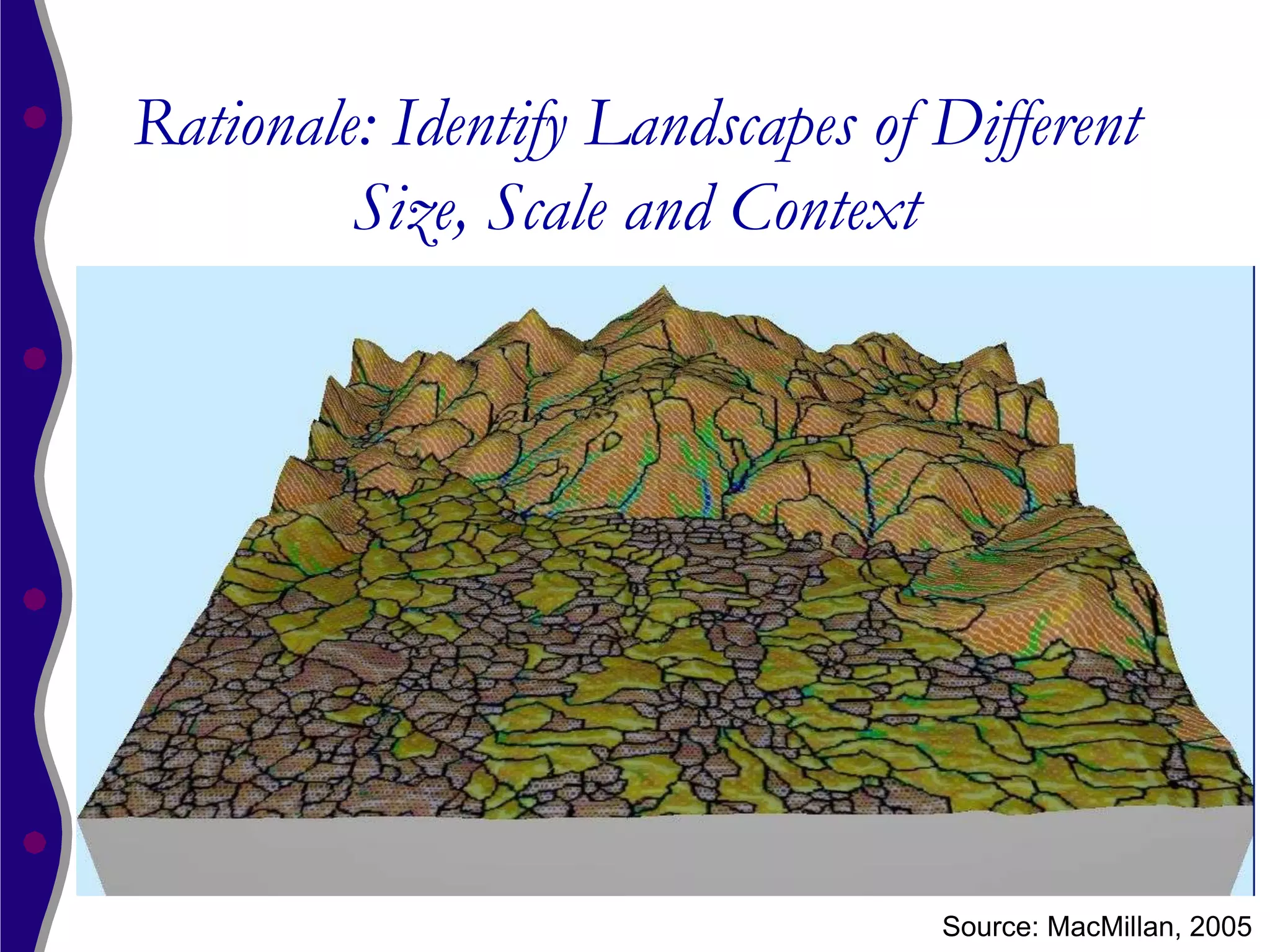
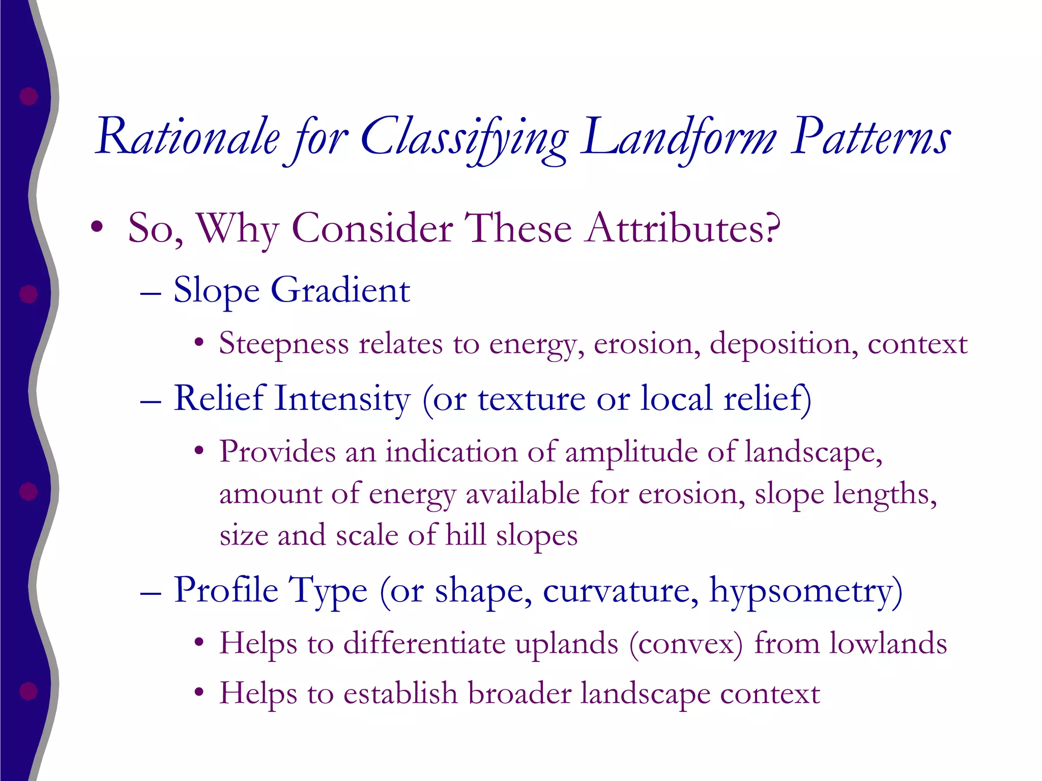
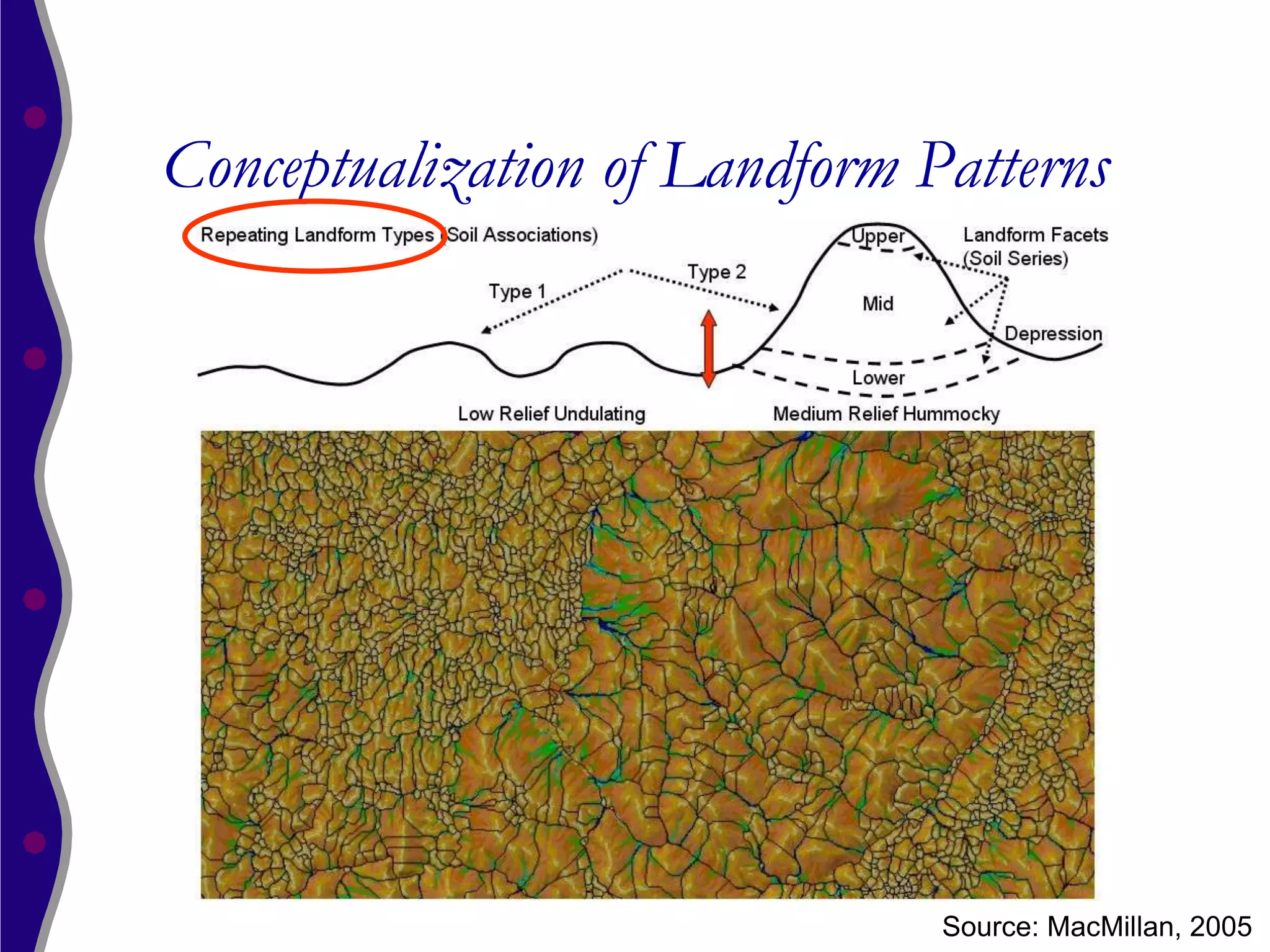
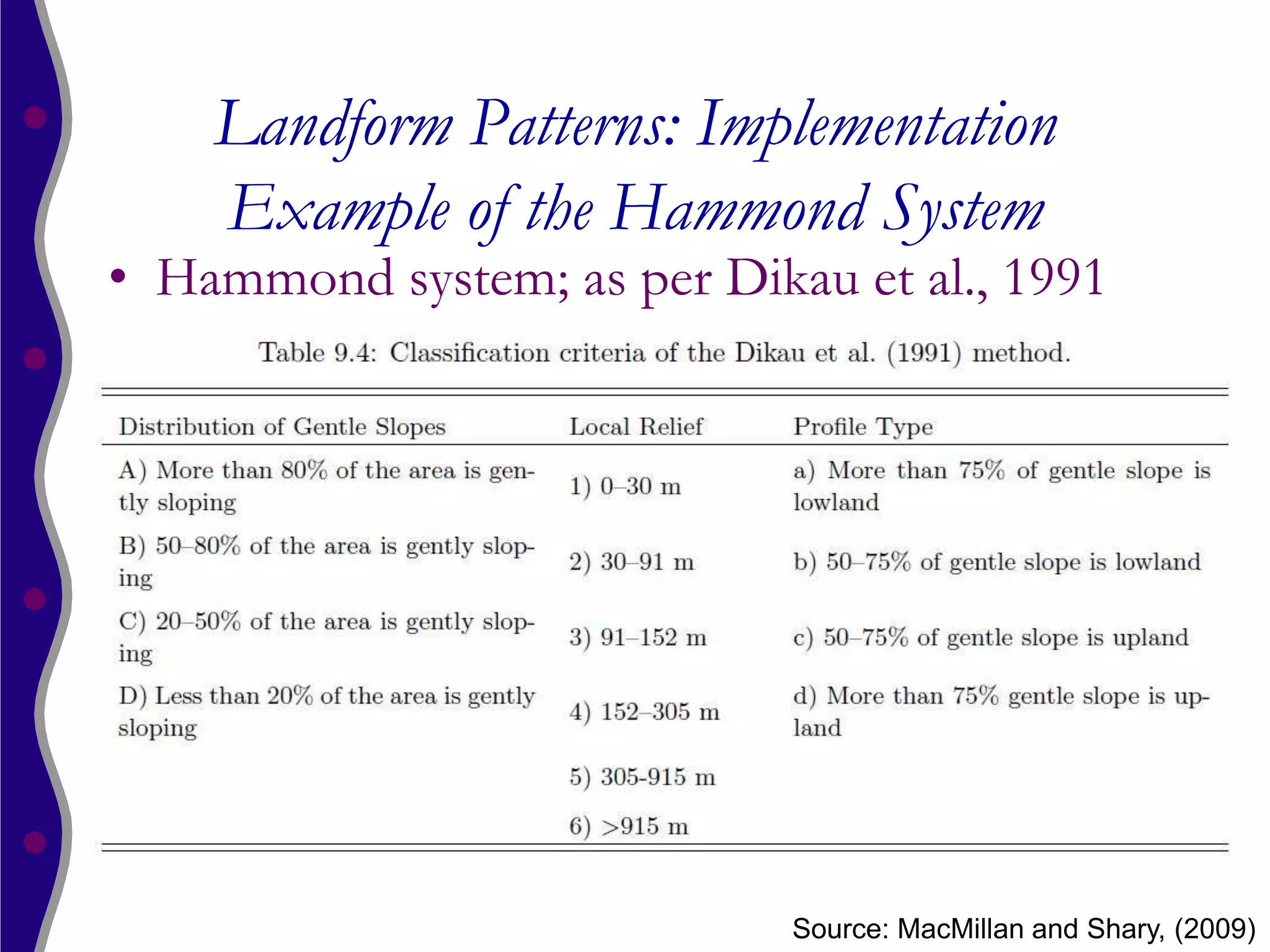
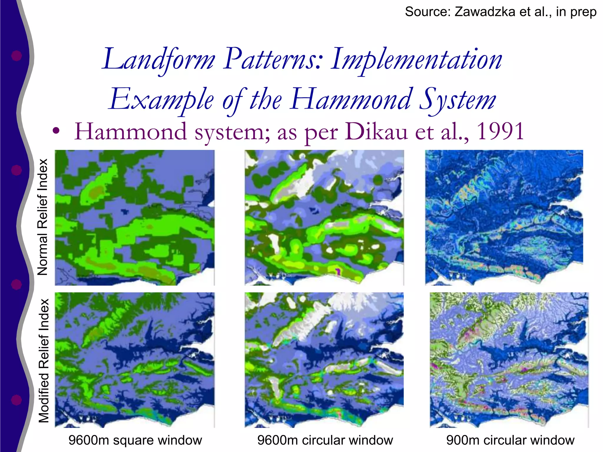
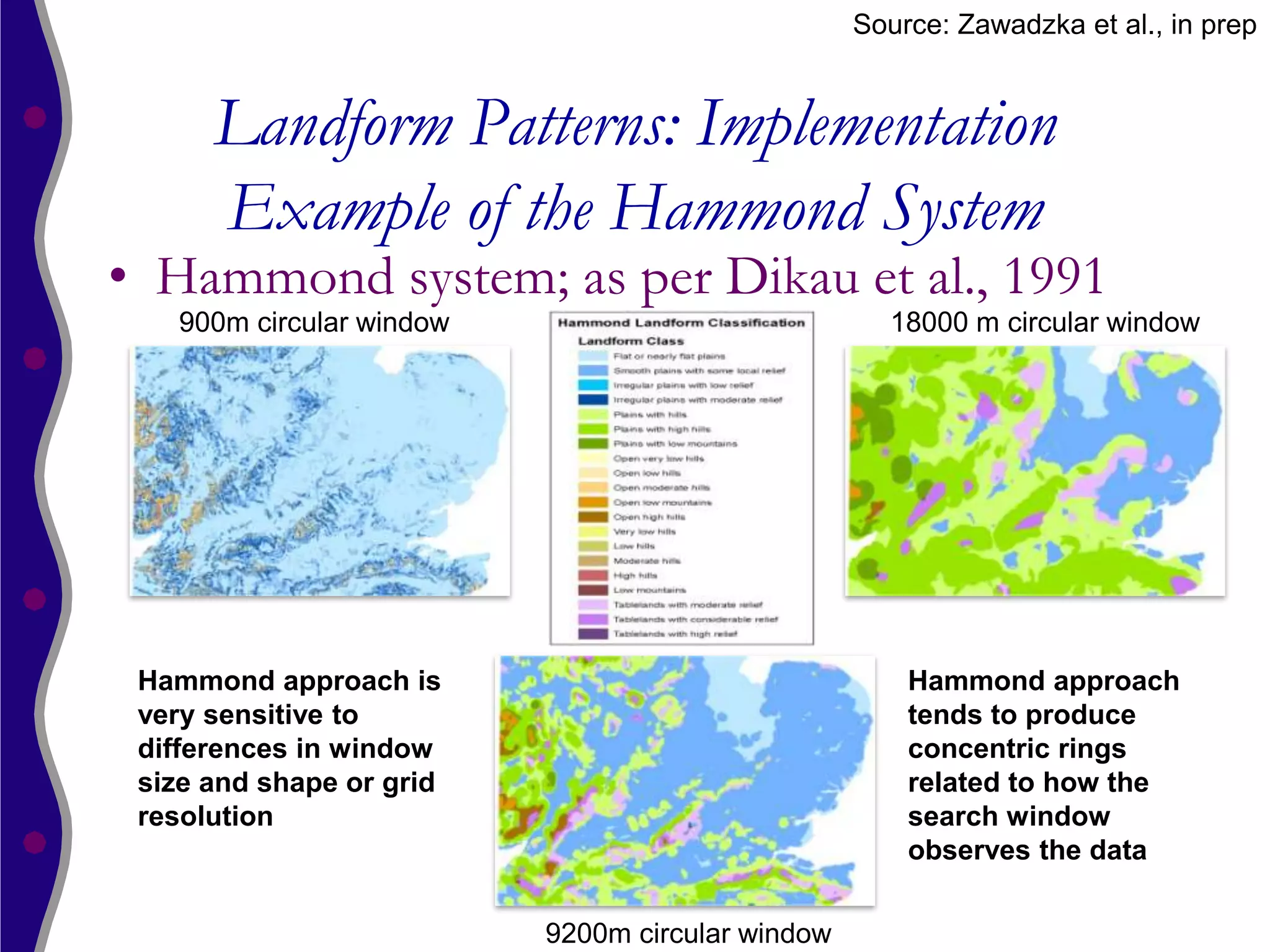
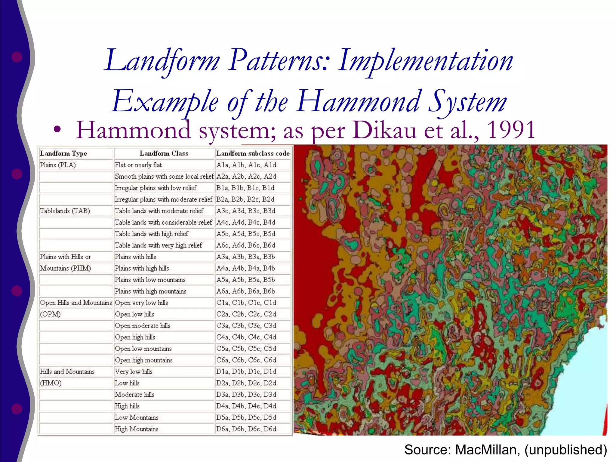
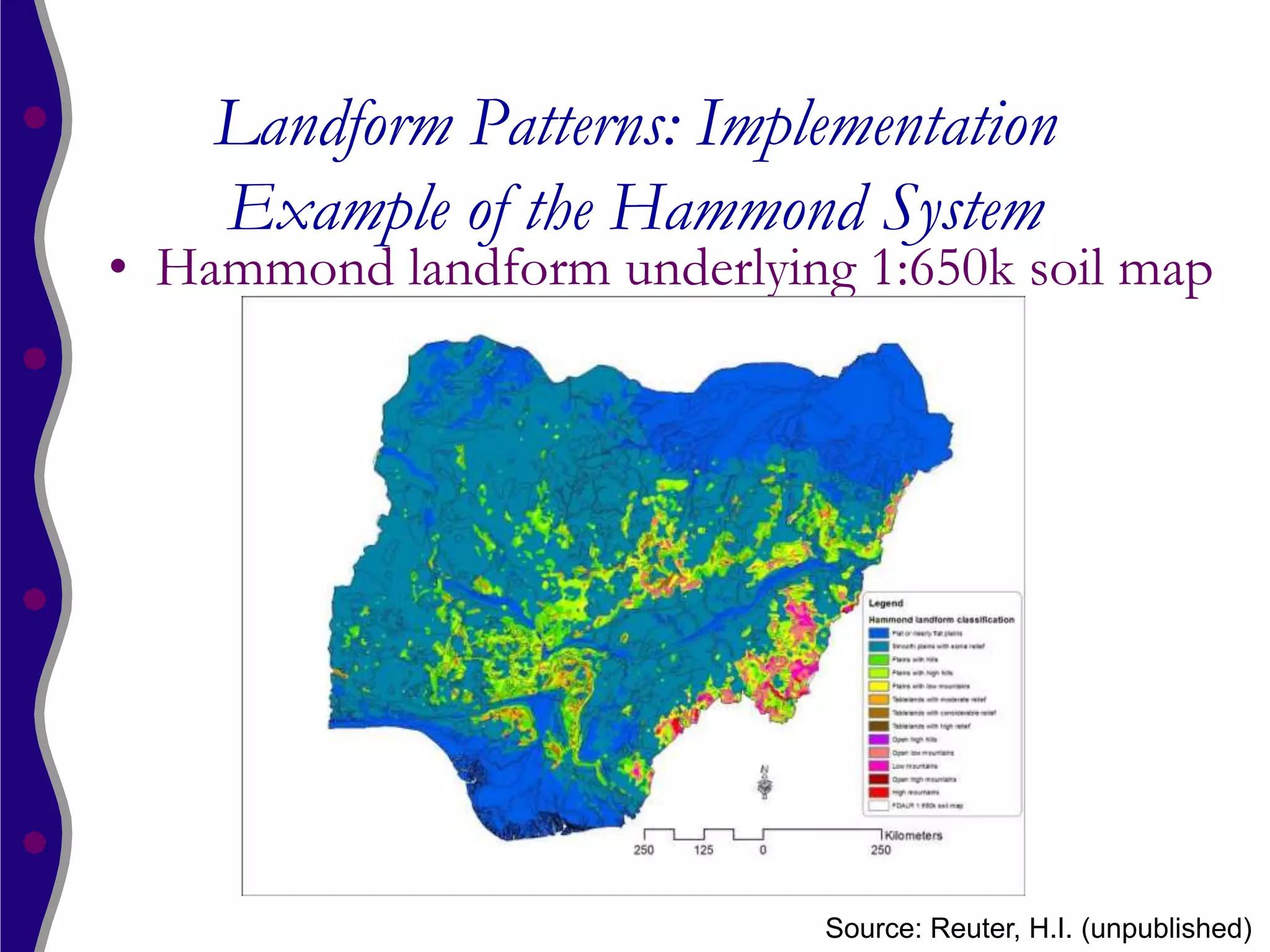
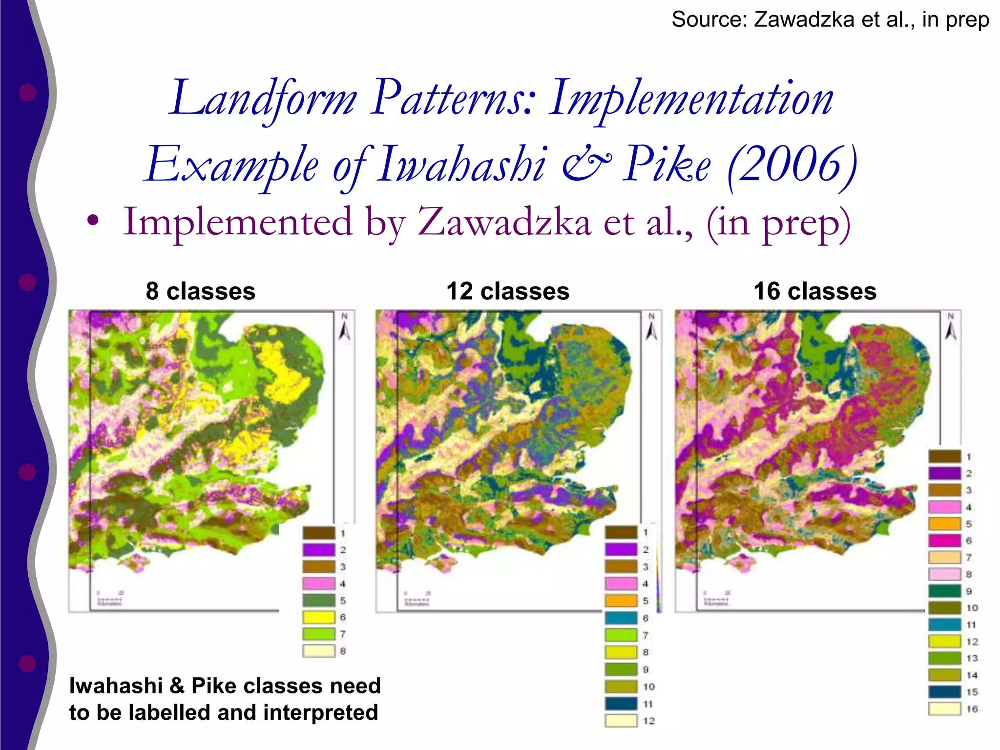
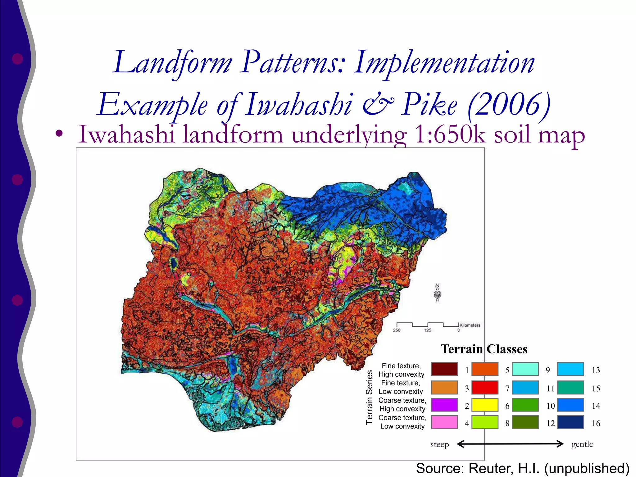
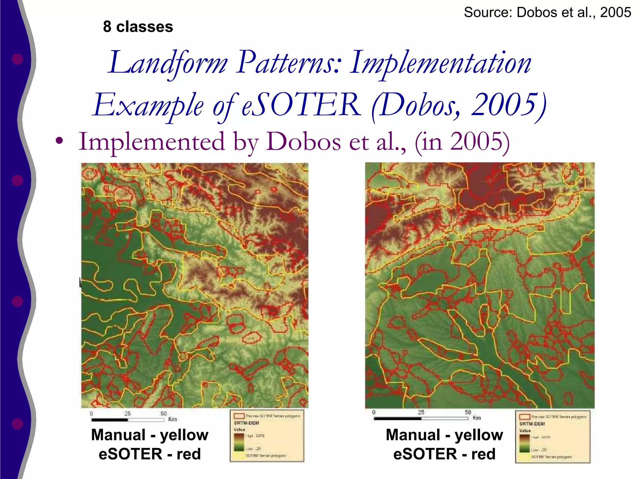
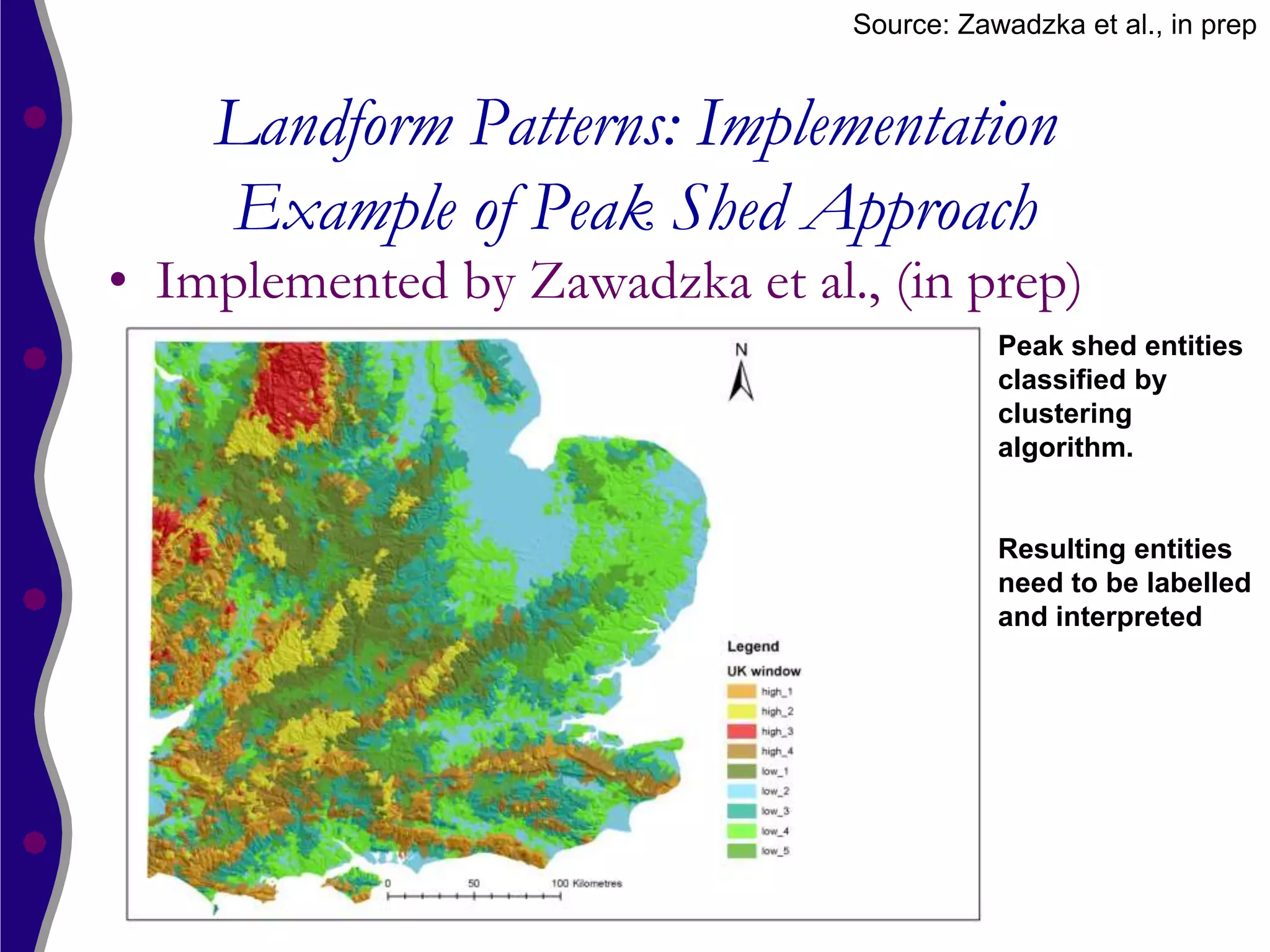
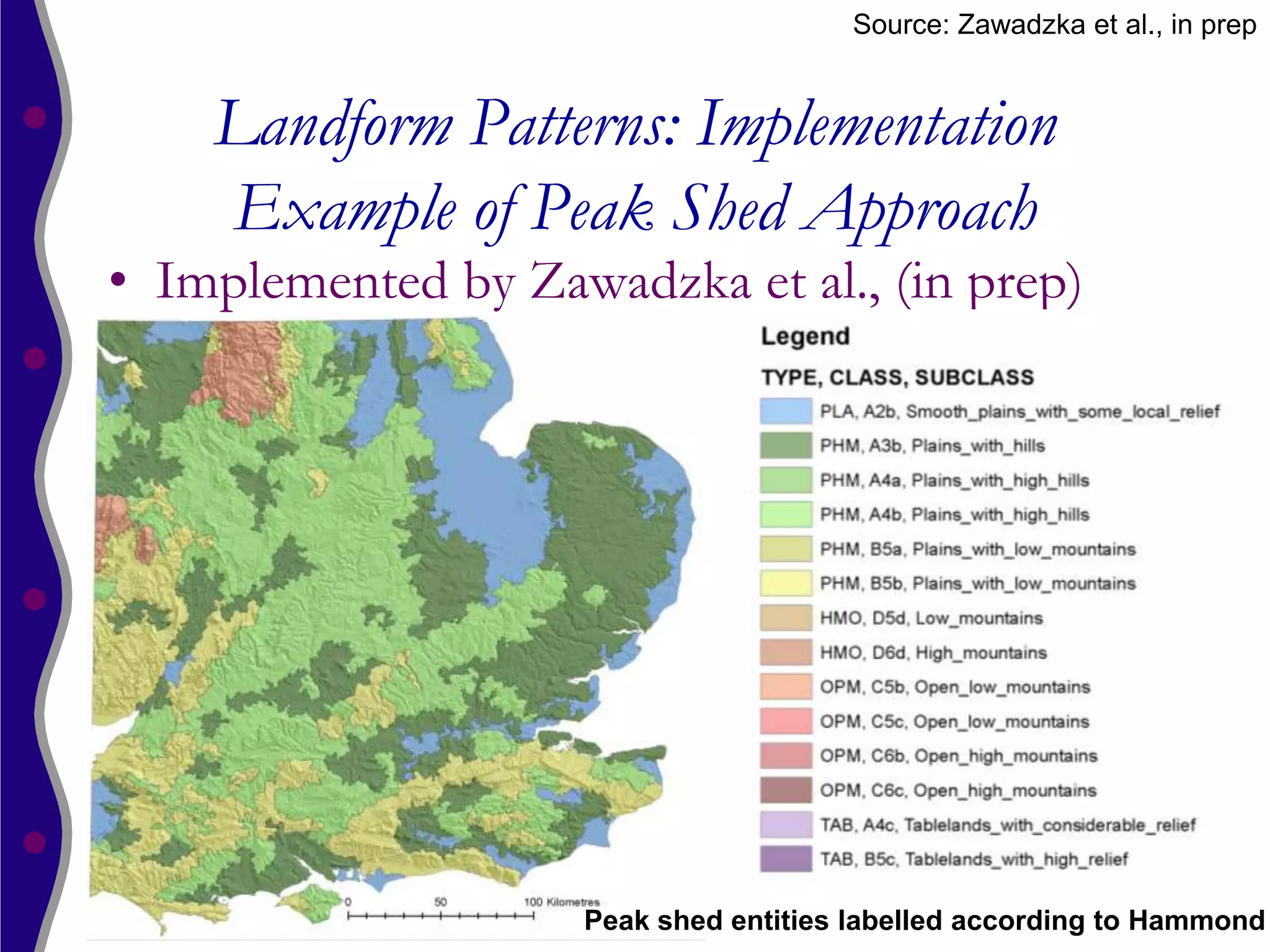
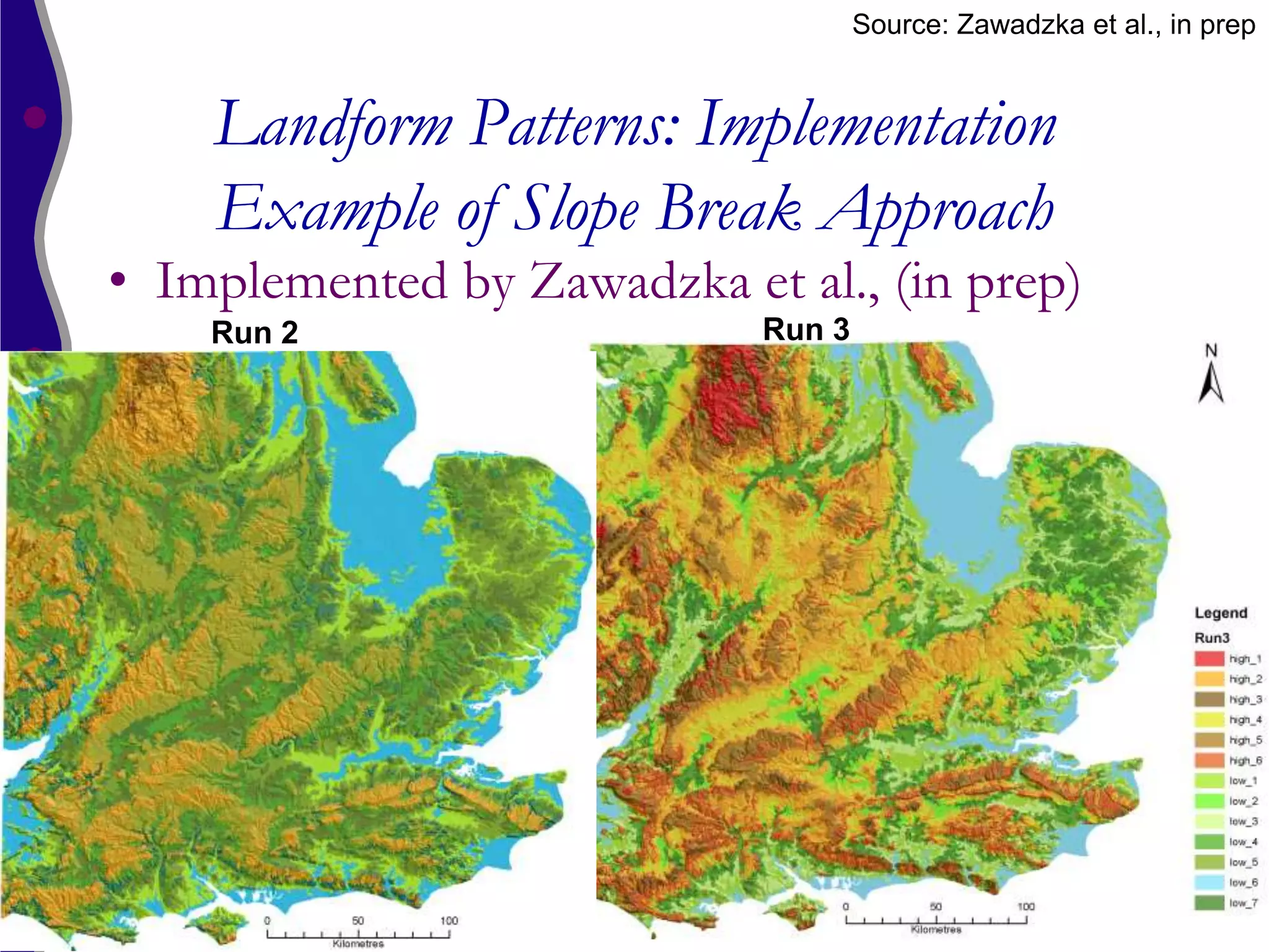
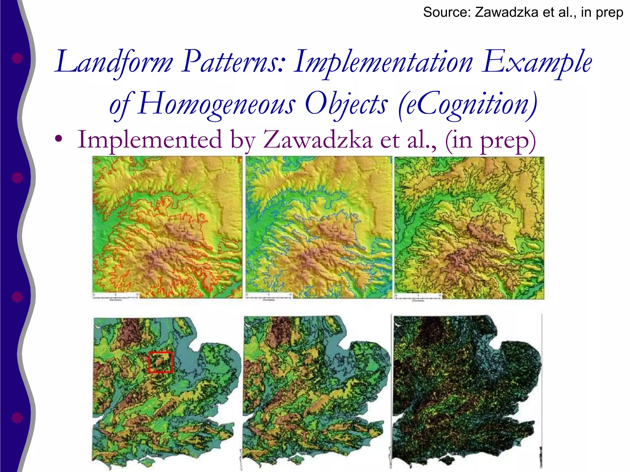
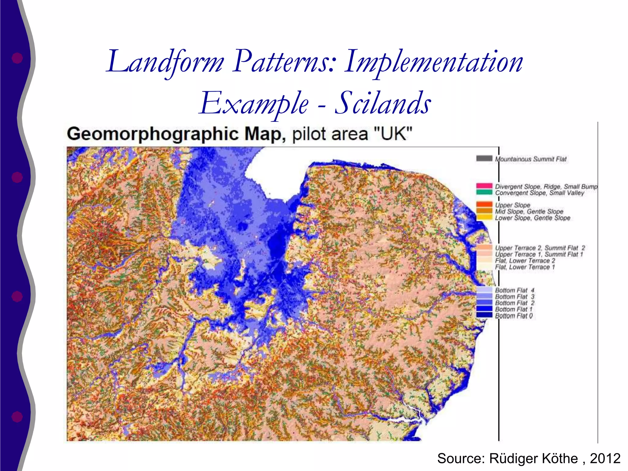
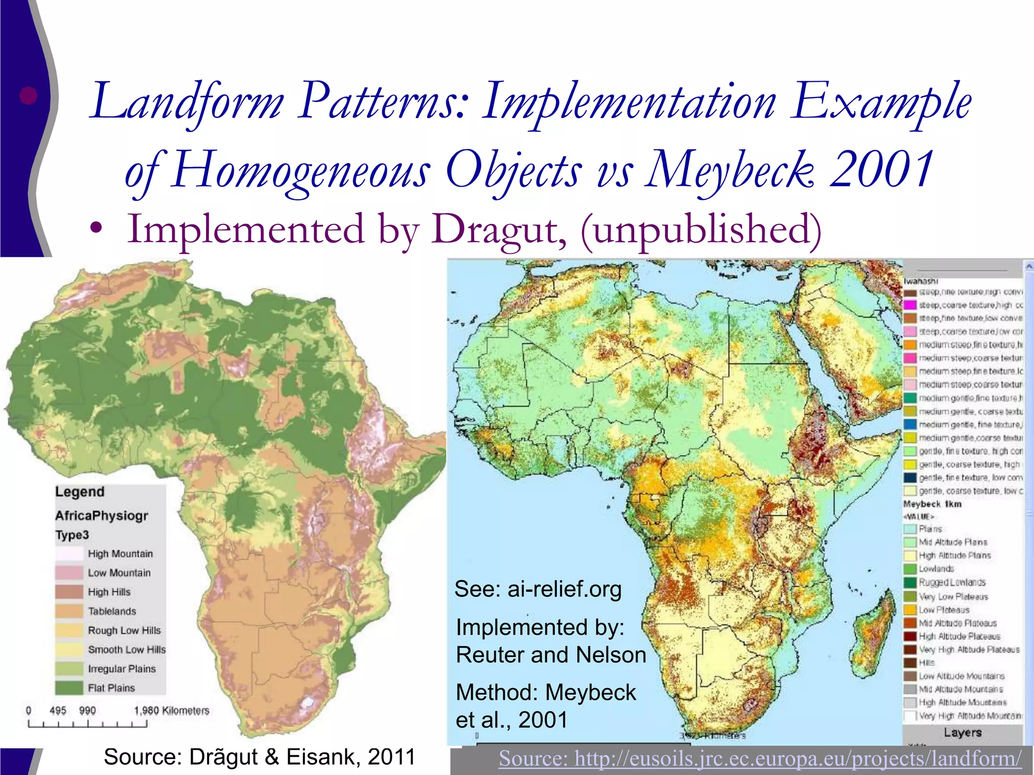
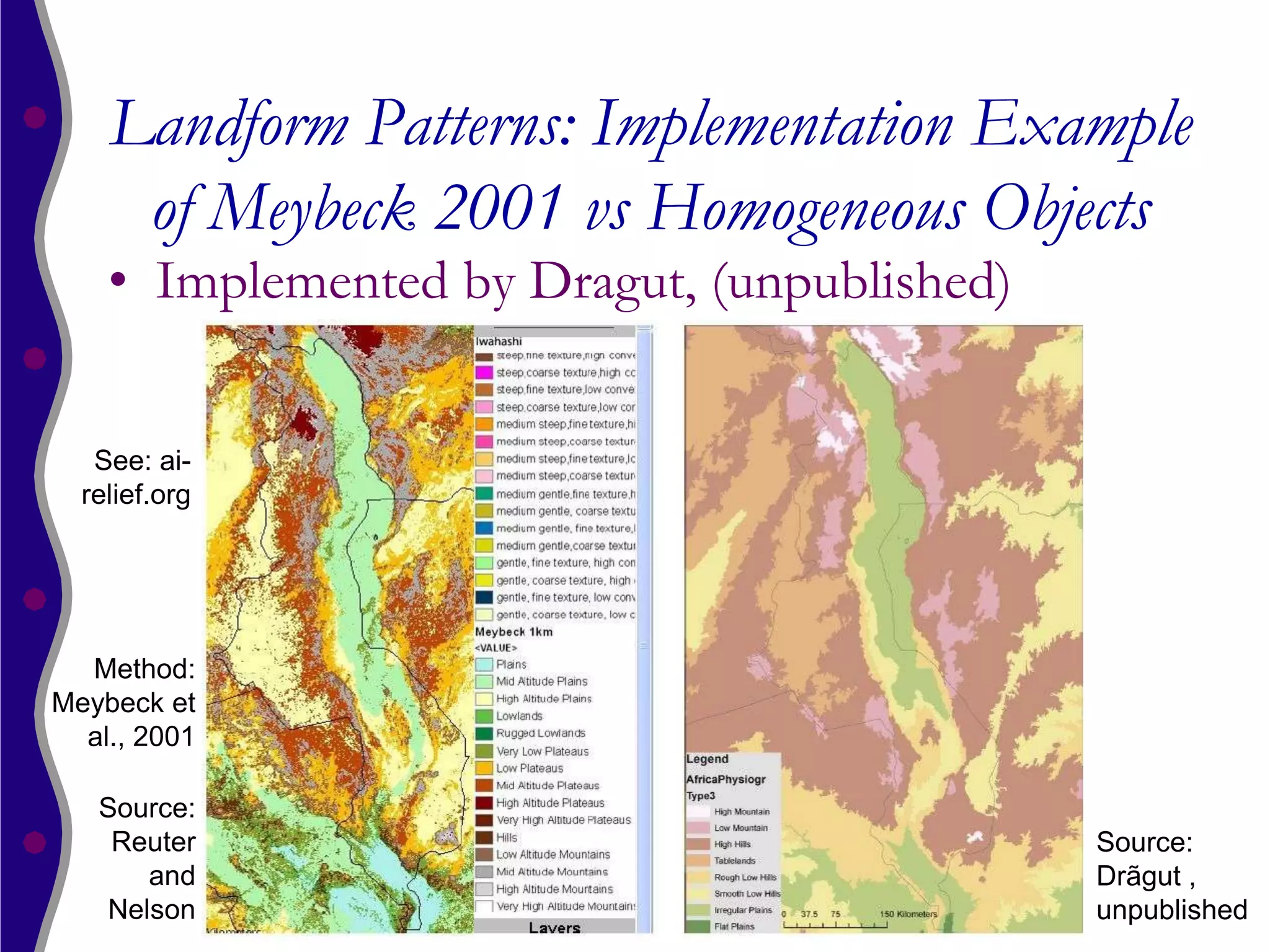
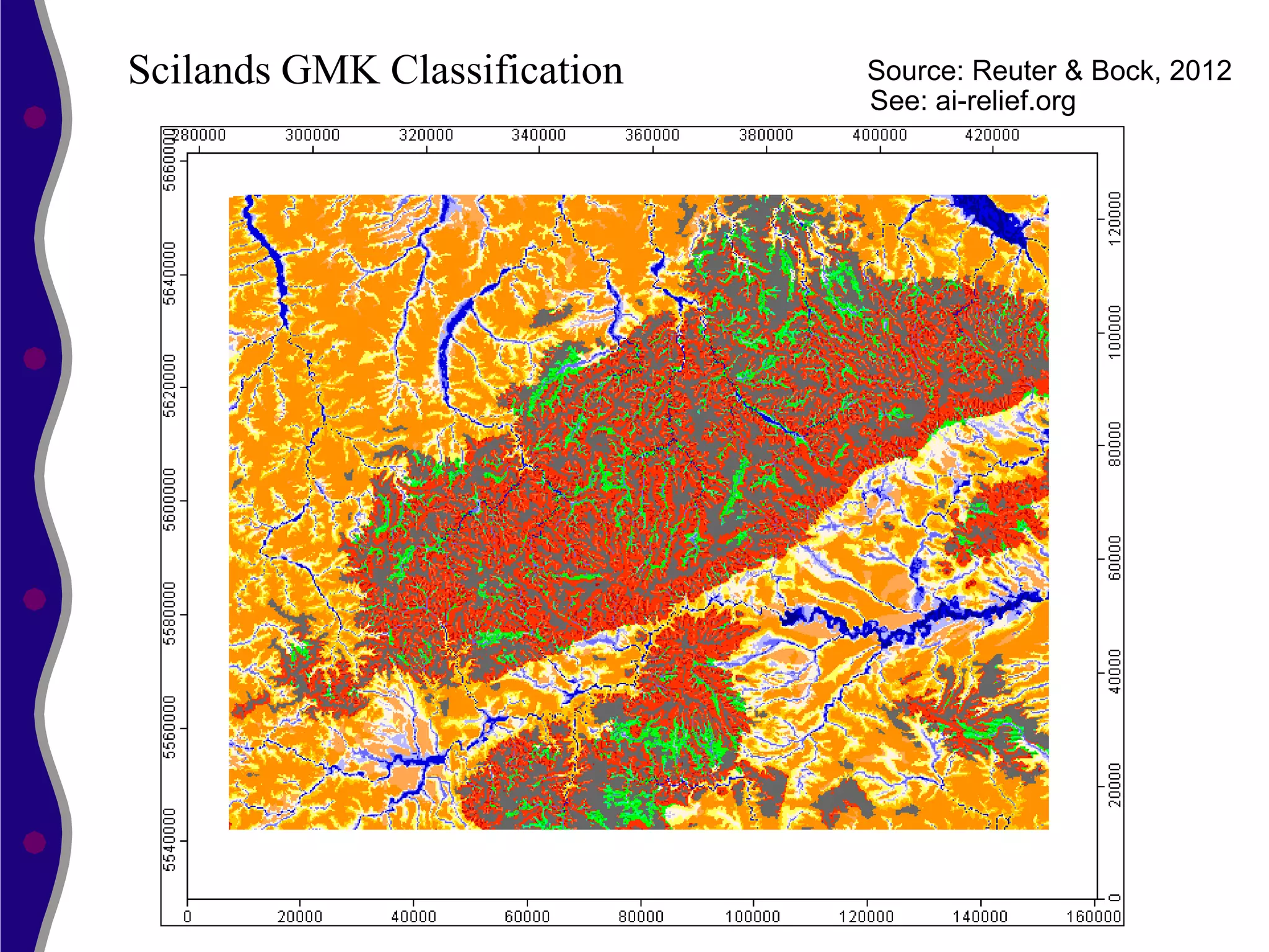
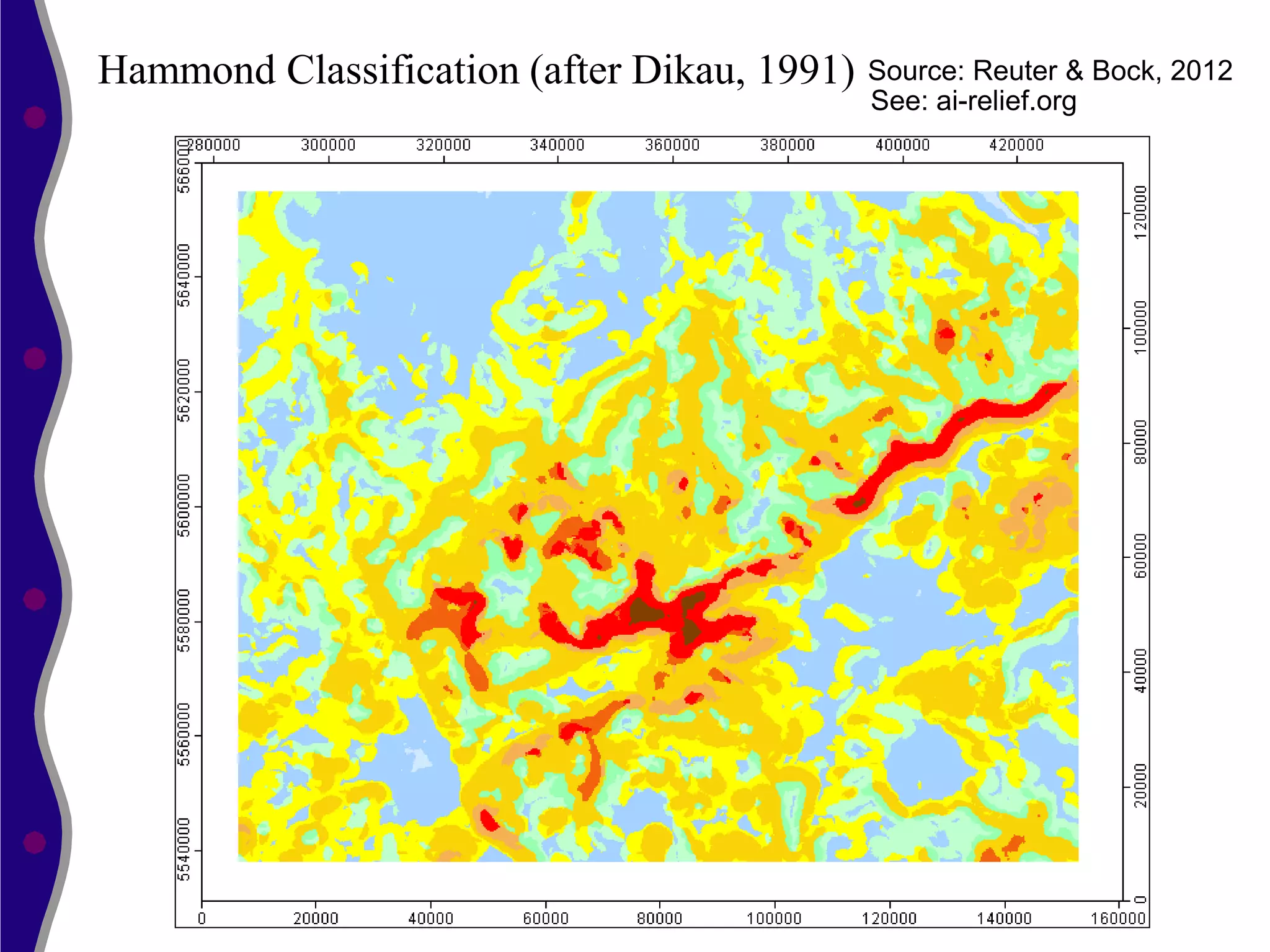
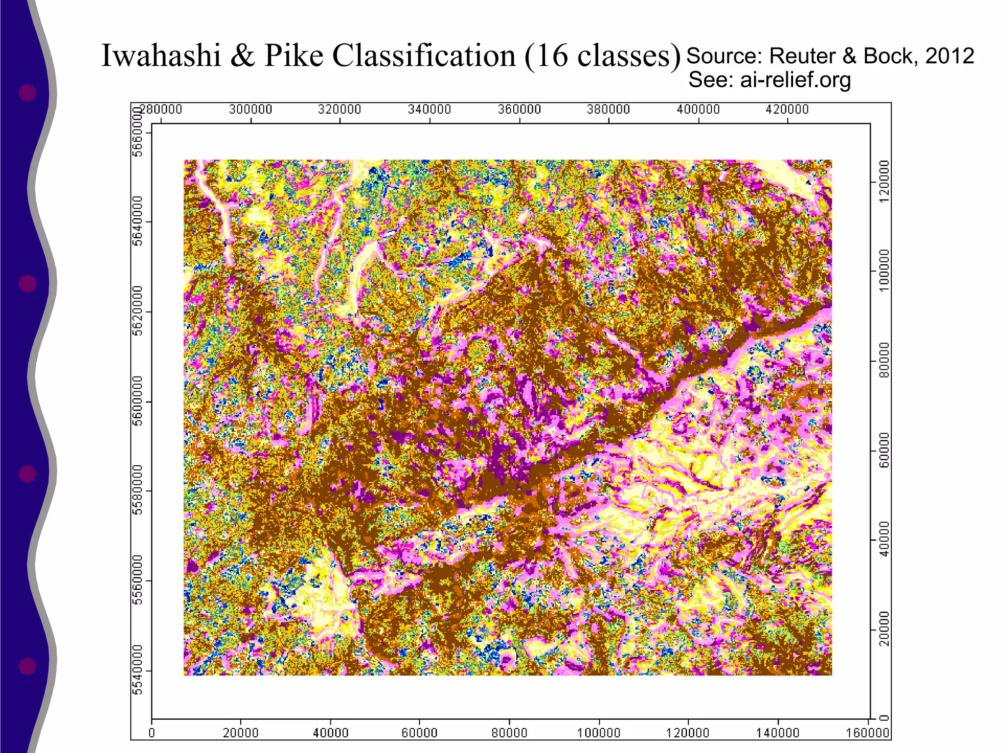
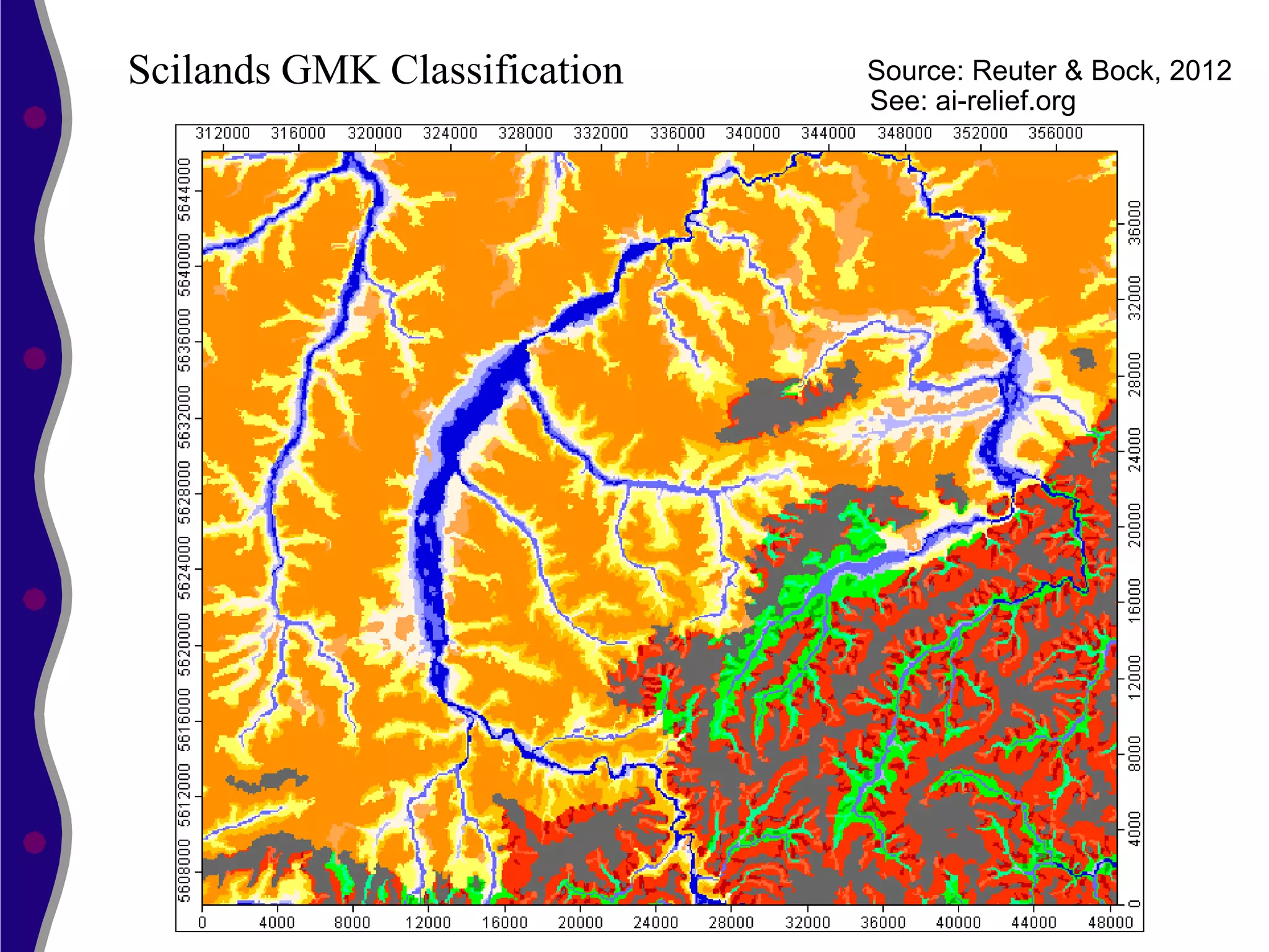
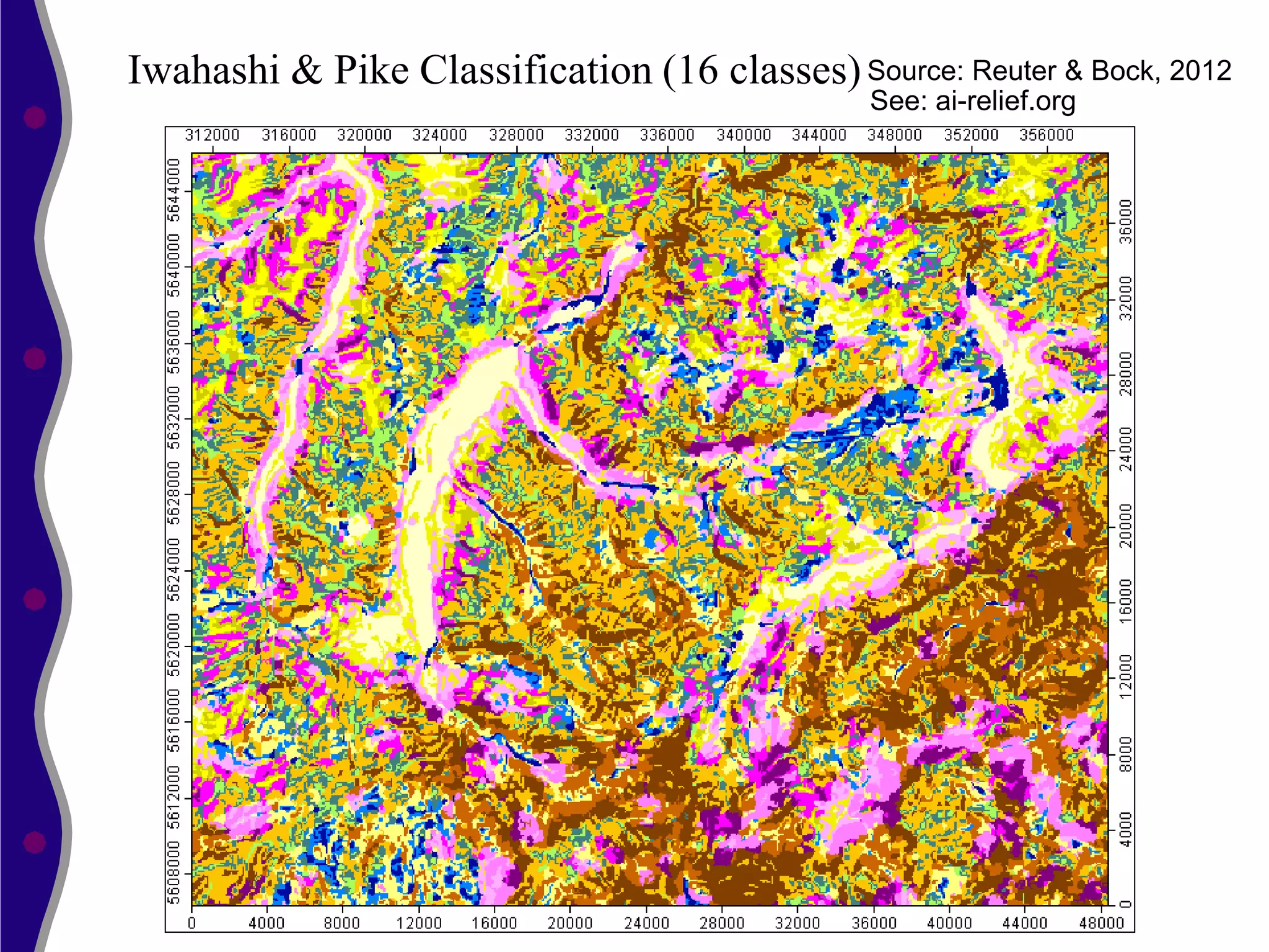
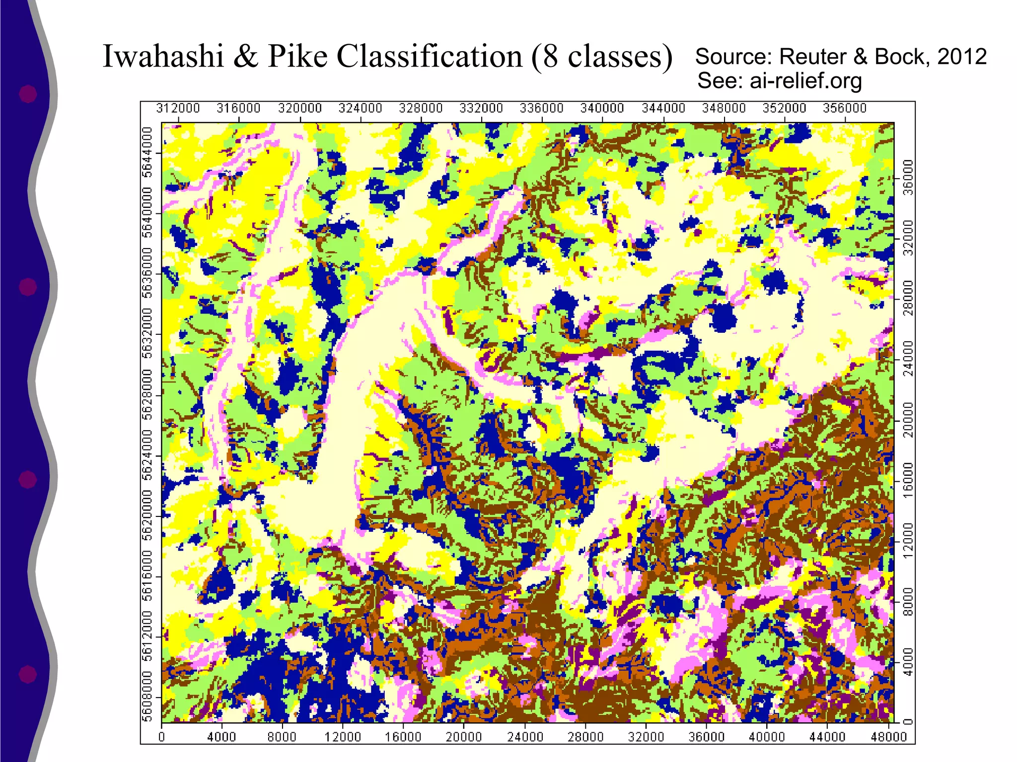
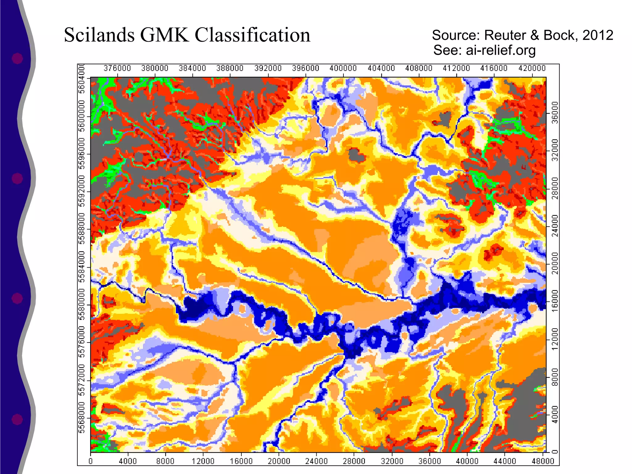
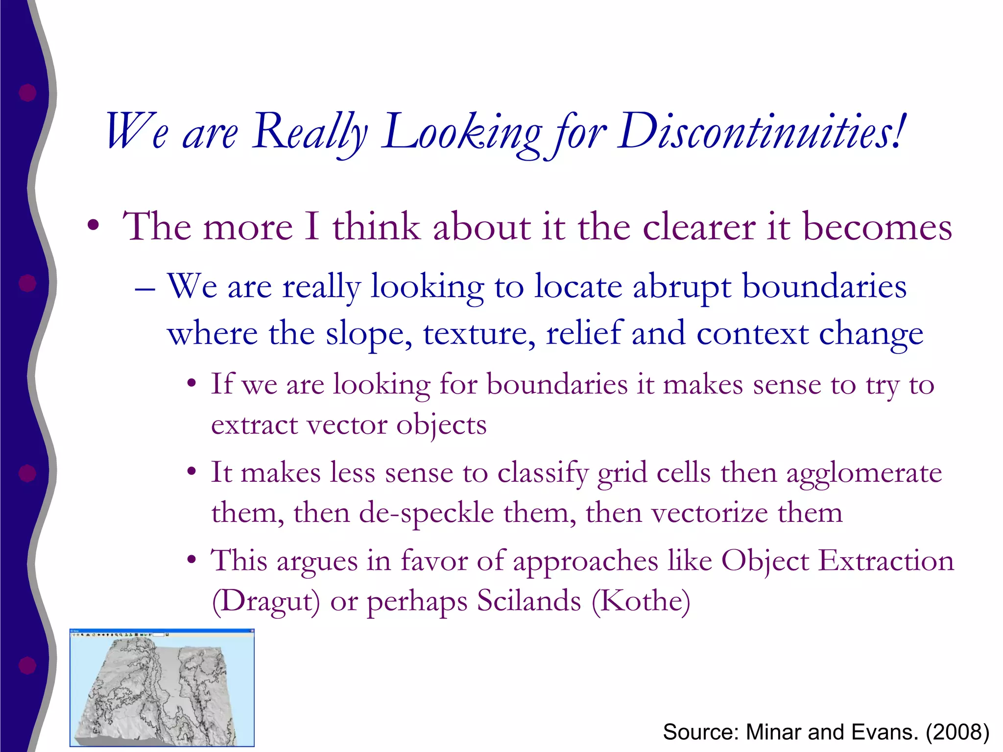
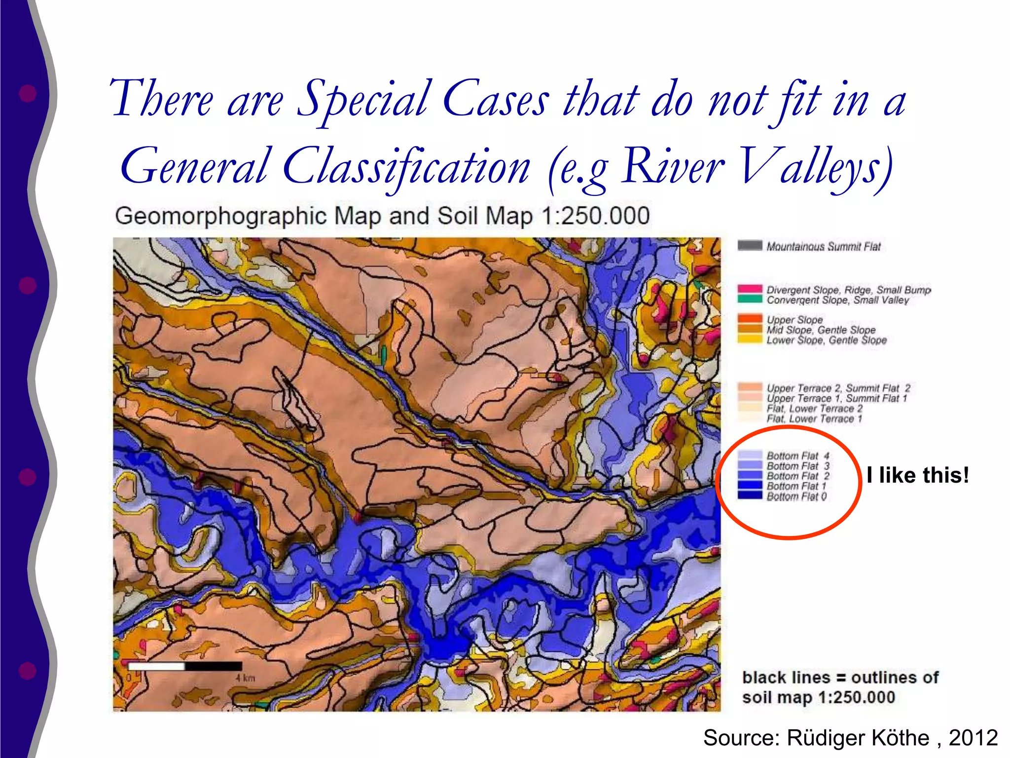
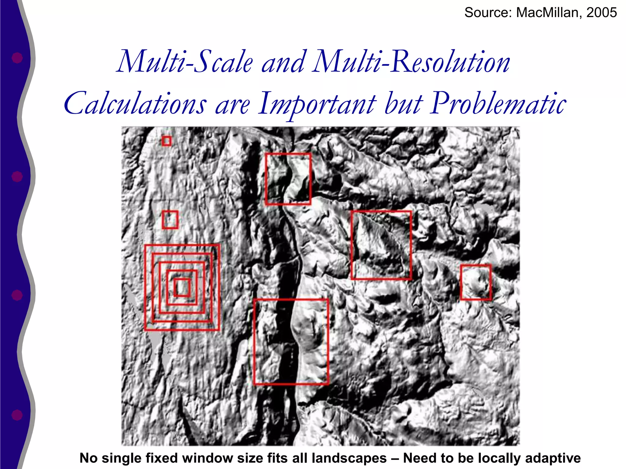
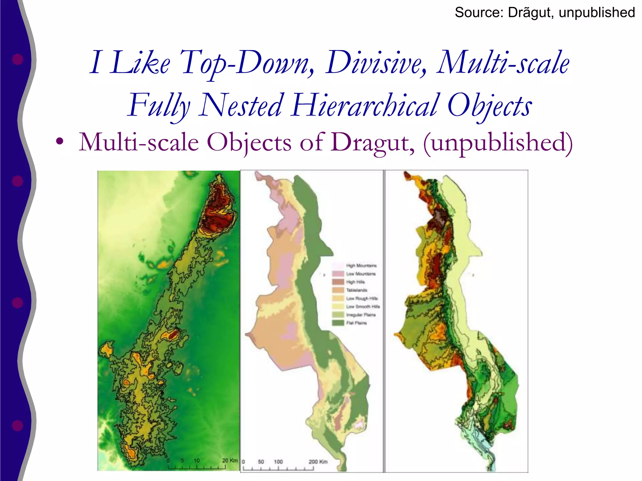
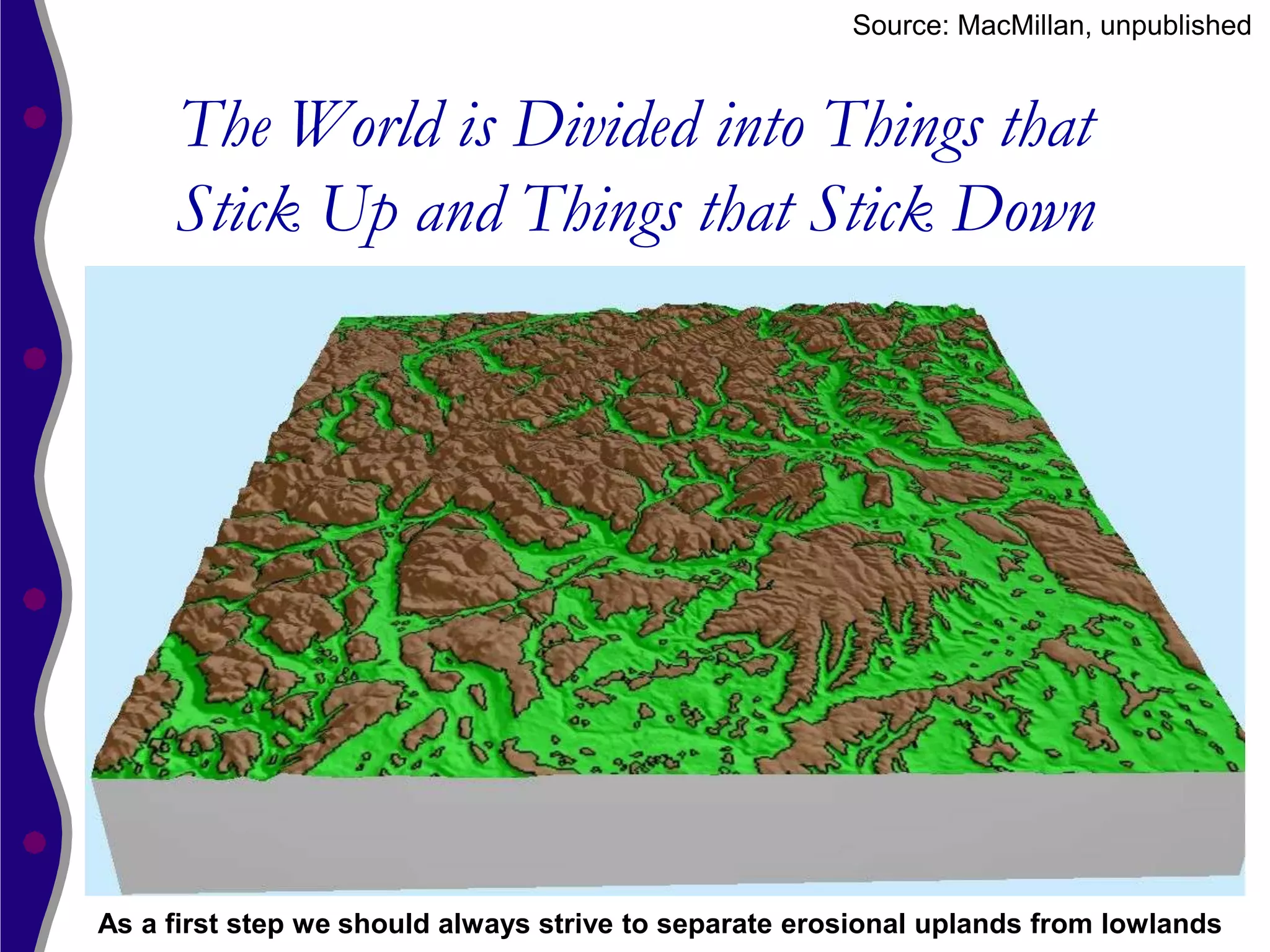
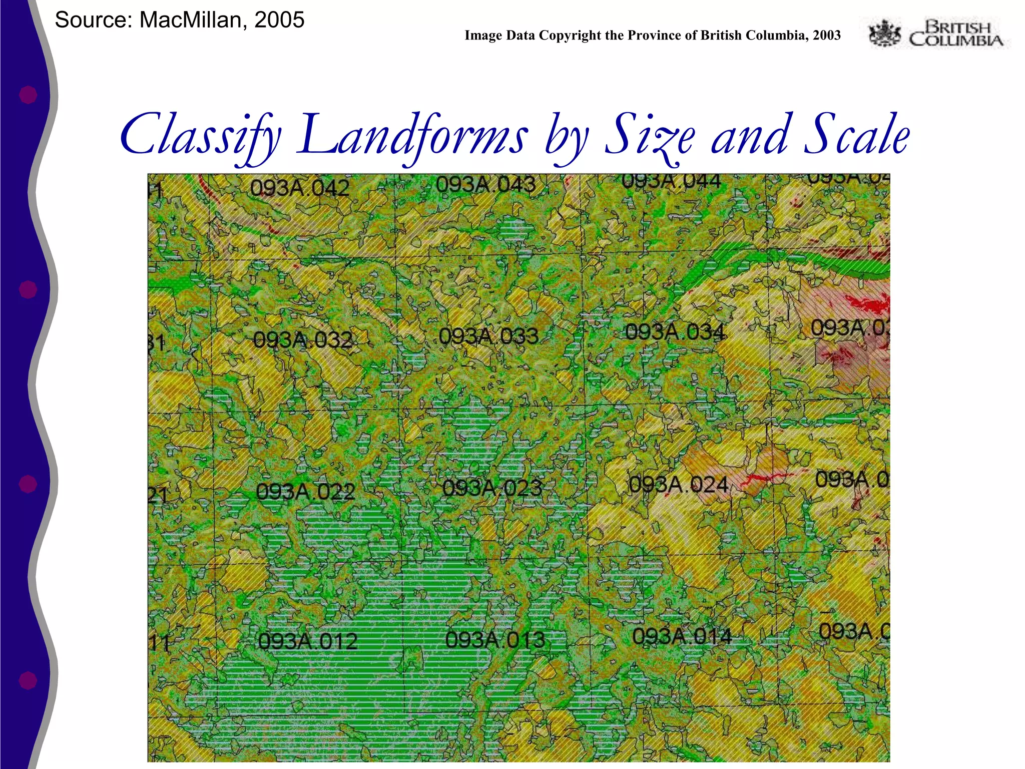
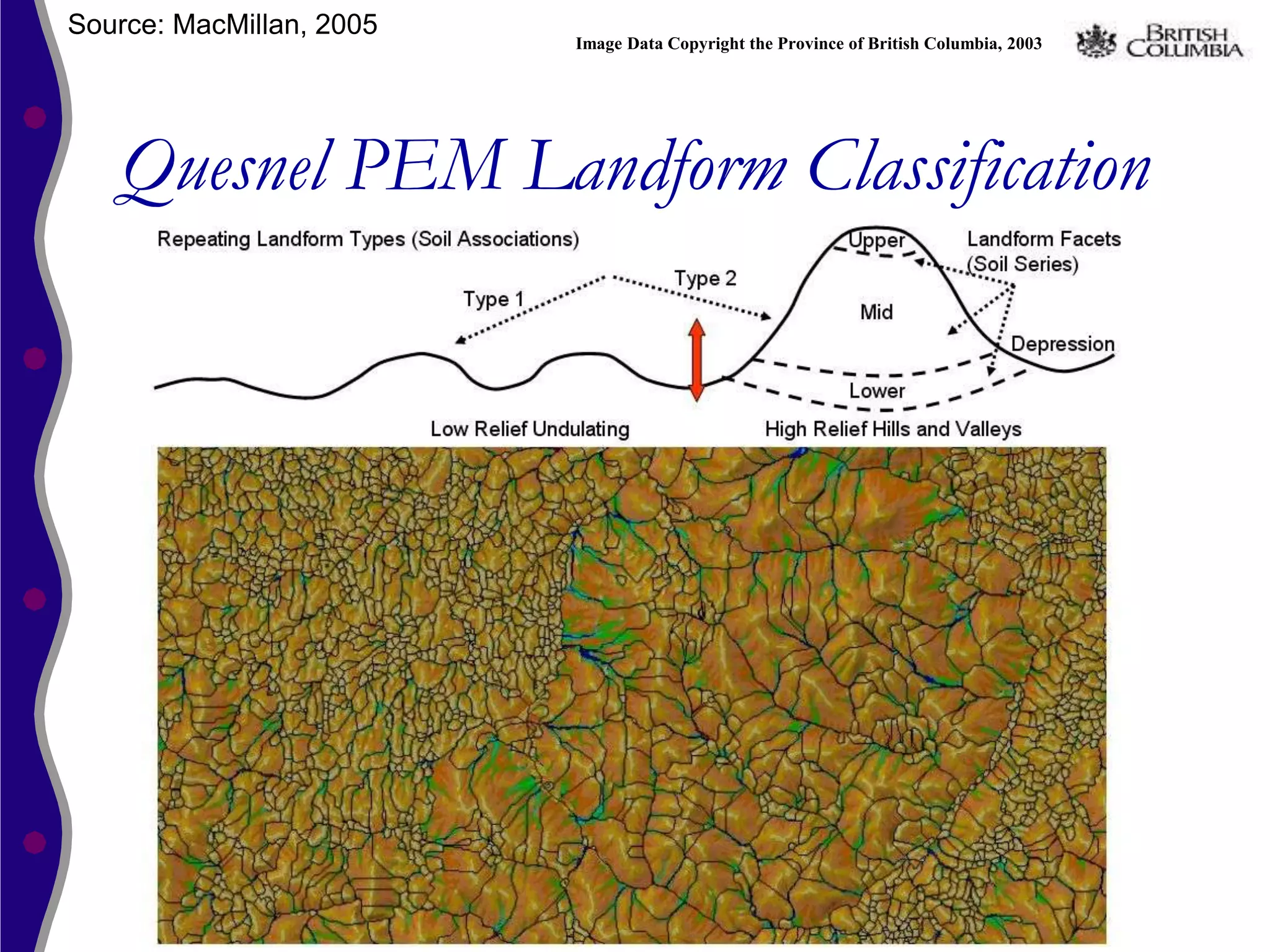
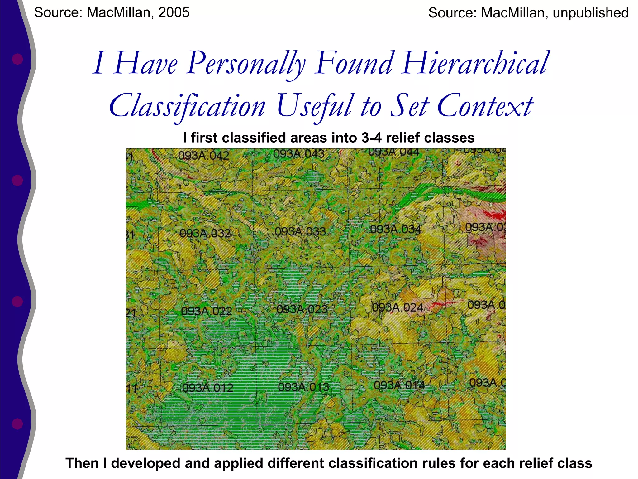
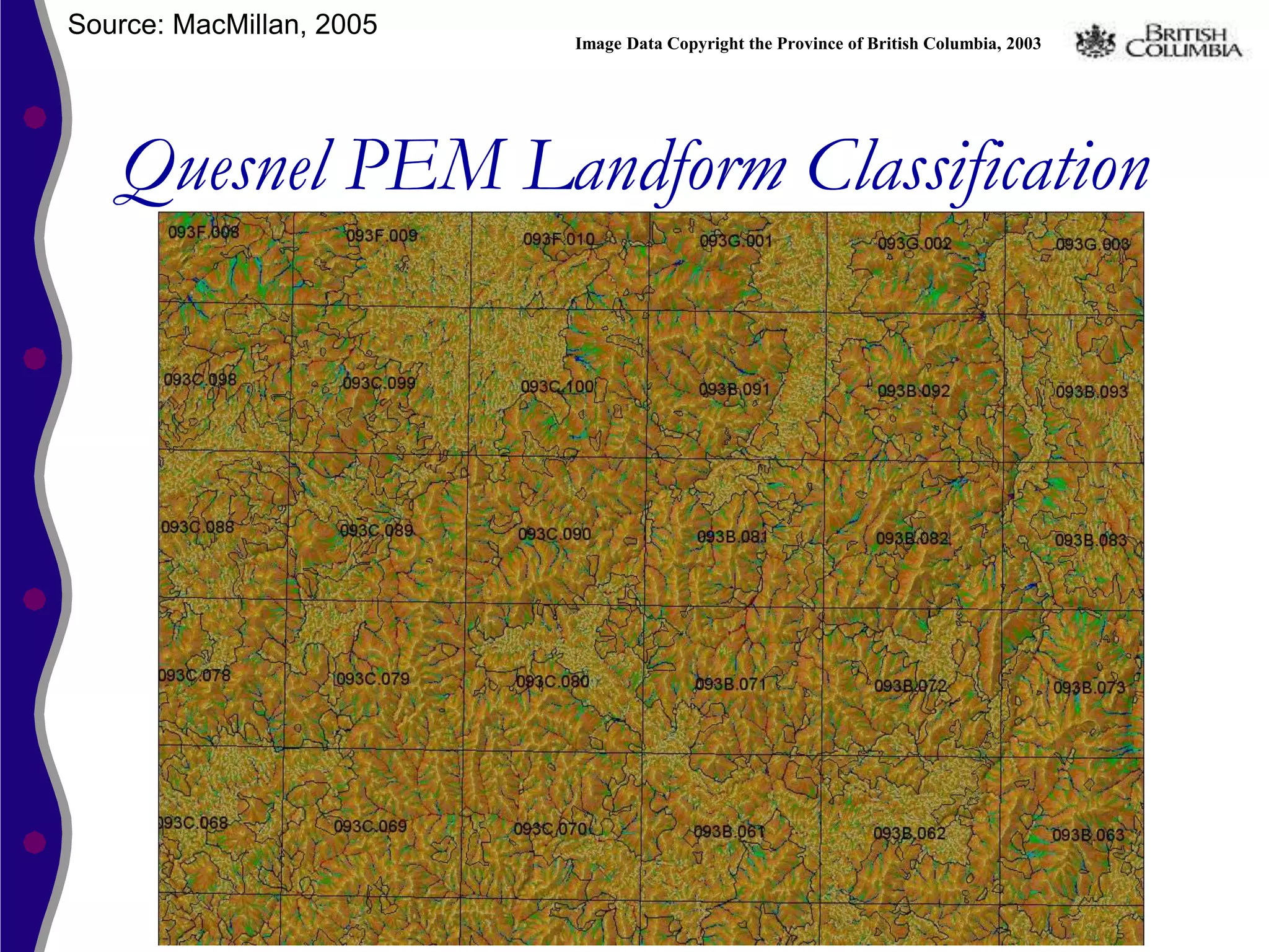
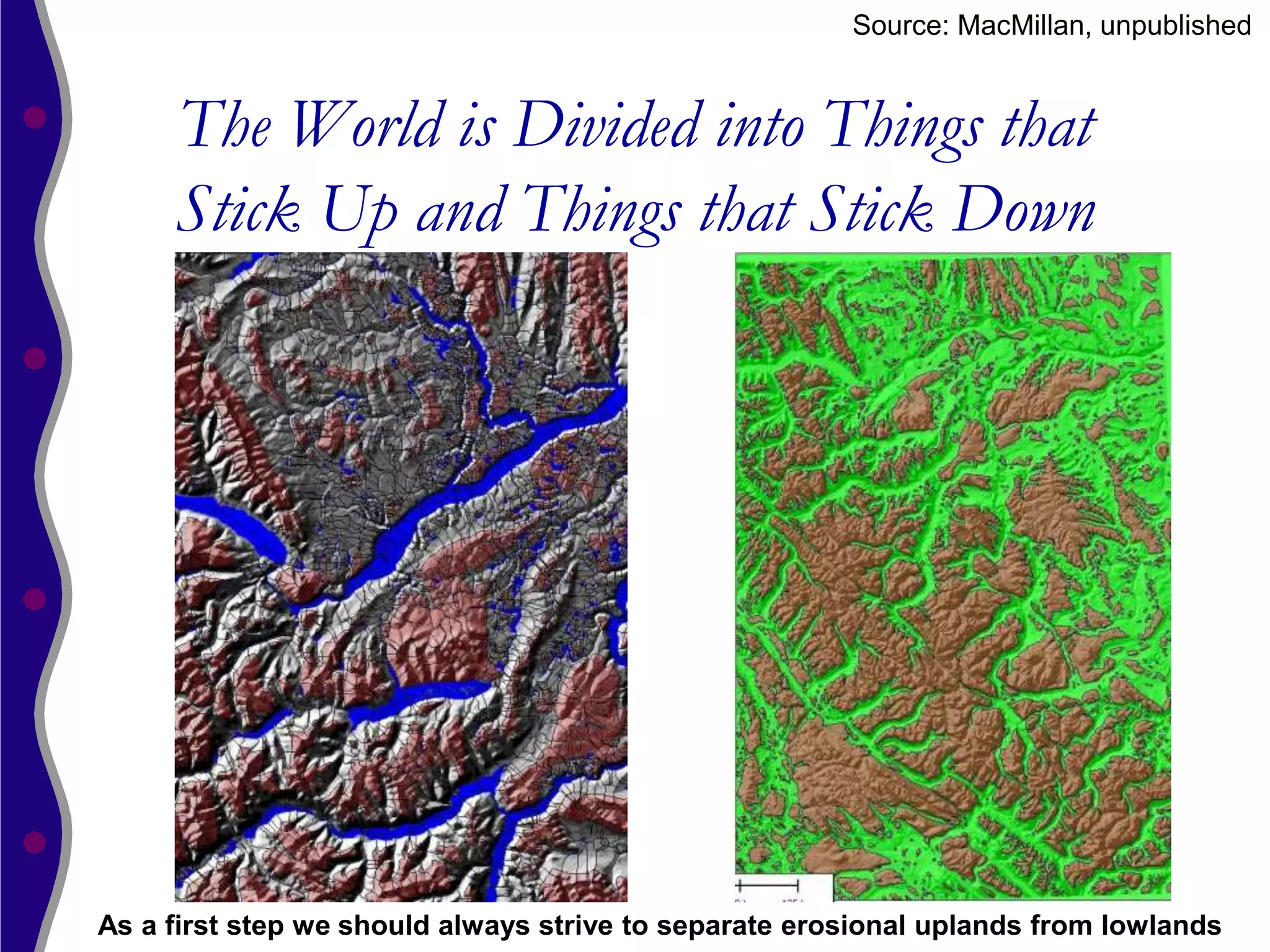
The document outlines the rationale, methodology, and implementation of automated landform classification from digital elevation model (DEM) data, emphasizing the need for efficiency and reproducibility over manual interpretation. It discusses the conceptual underpinnings of classifying landform elements and patterns, including the relationships between landforms and various environmental processes. Examples of implementation and classification methods are provided, showcasing different approaches to analyzing landform size, shape, and context.


![Vibe Coding vs. Spec-Driven Development [Free Meetup]](https://cdn.slidesharecdn.com/ss_thumbnails/vibecodingvsspecdrivendevelopment-251209105622-43f455e7-thumbnail.jpg?width=640&height=640&fit=bounds)


