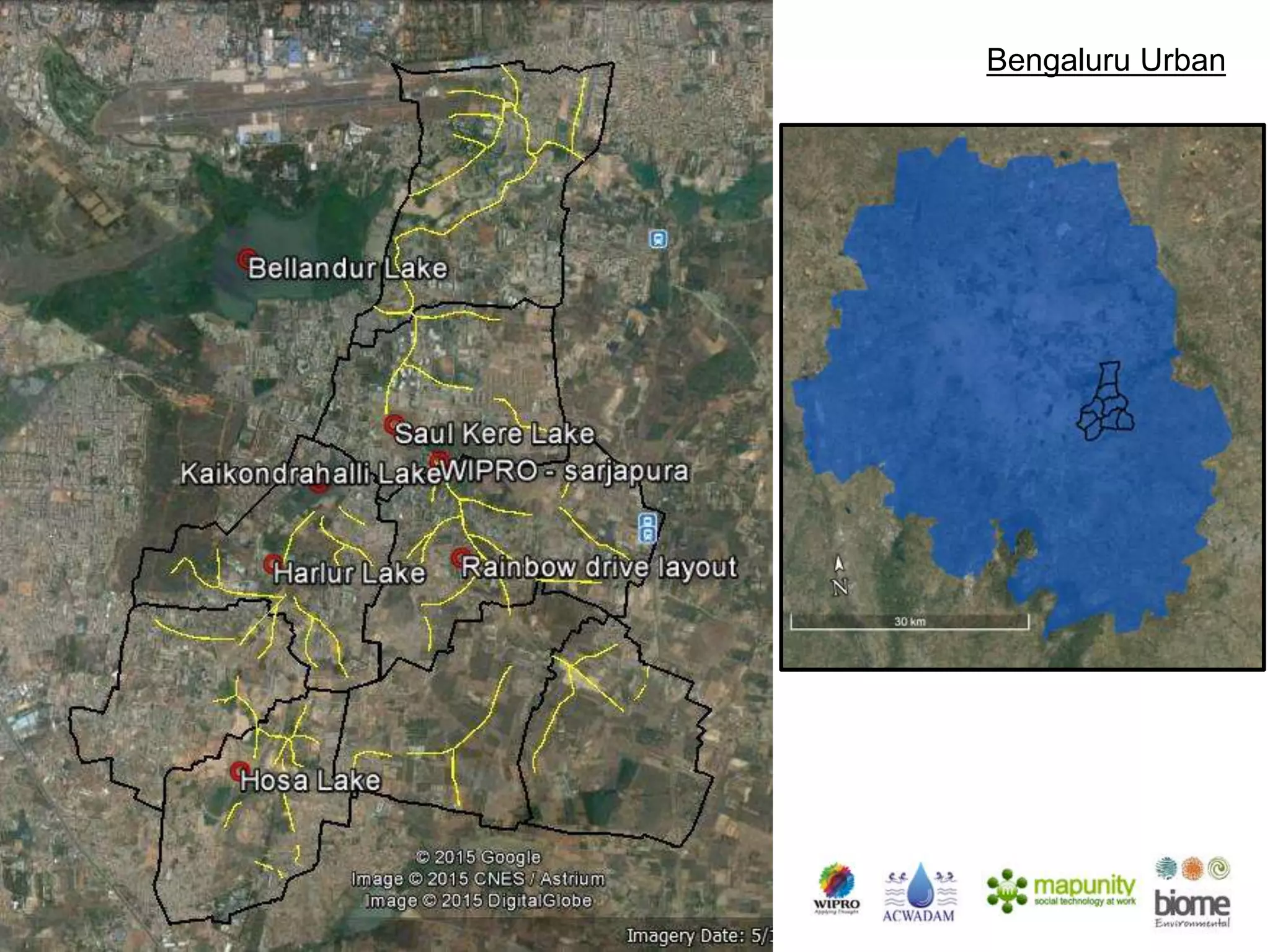
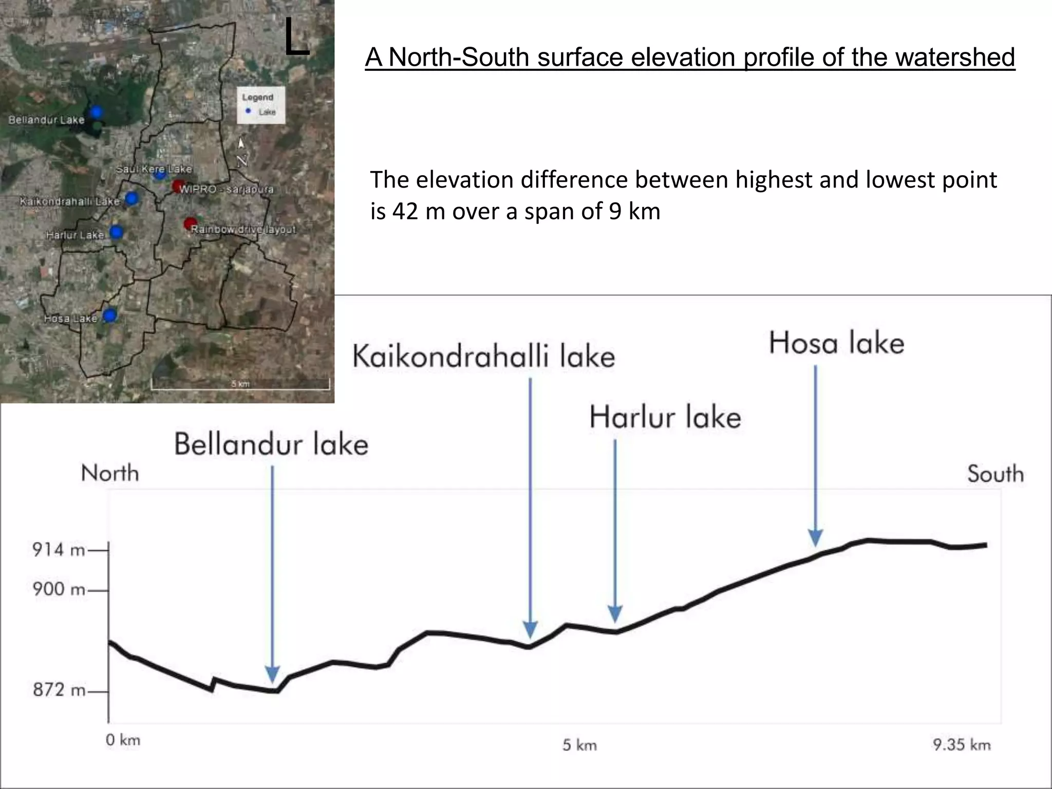
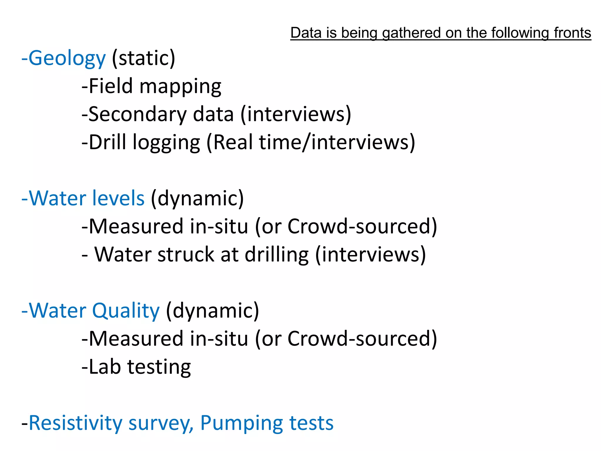
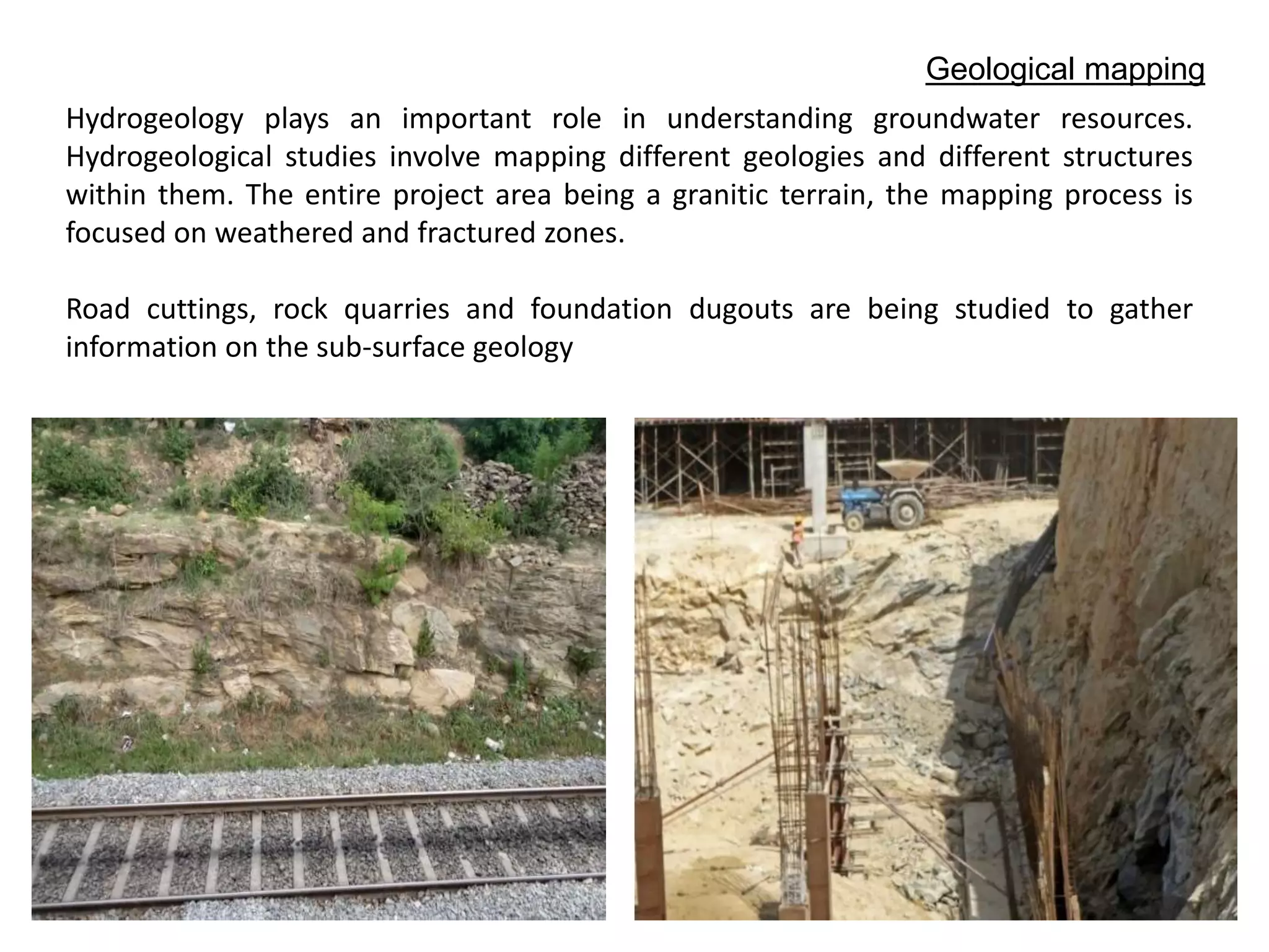
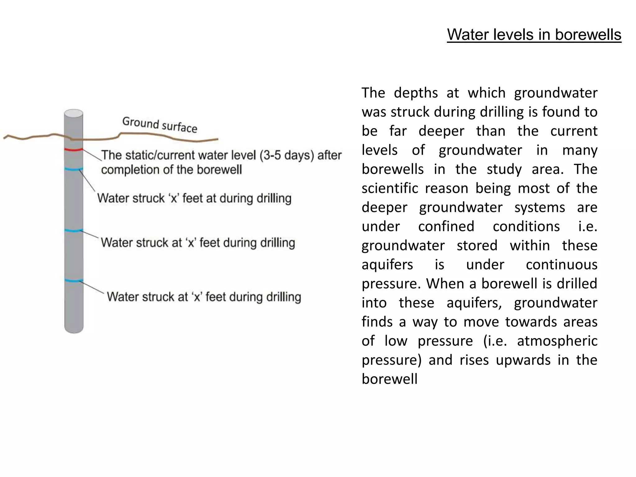
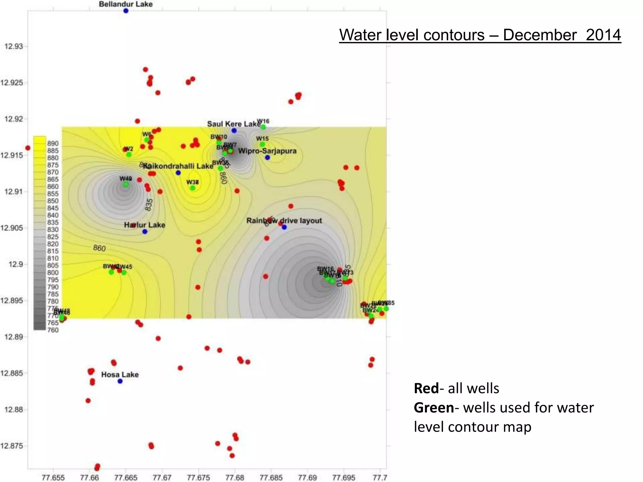
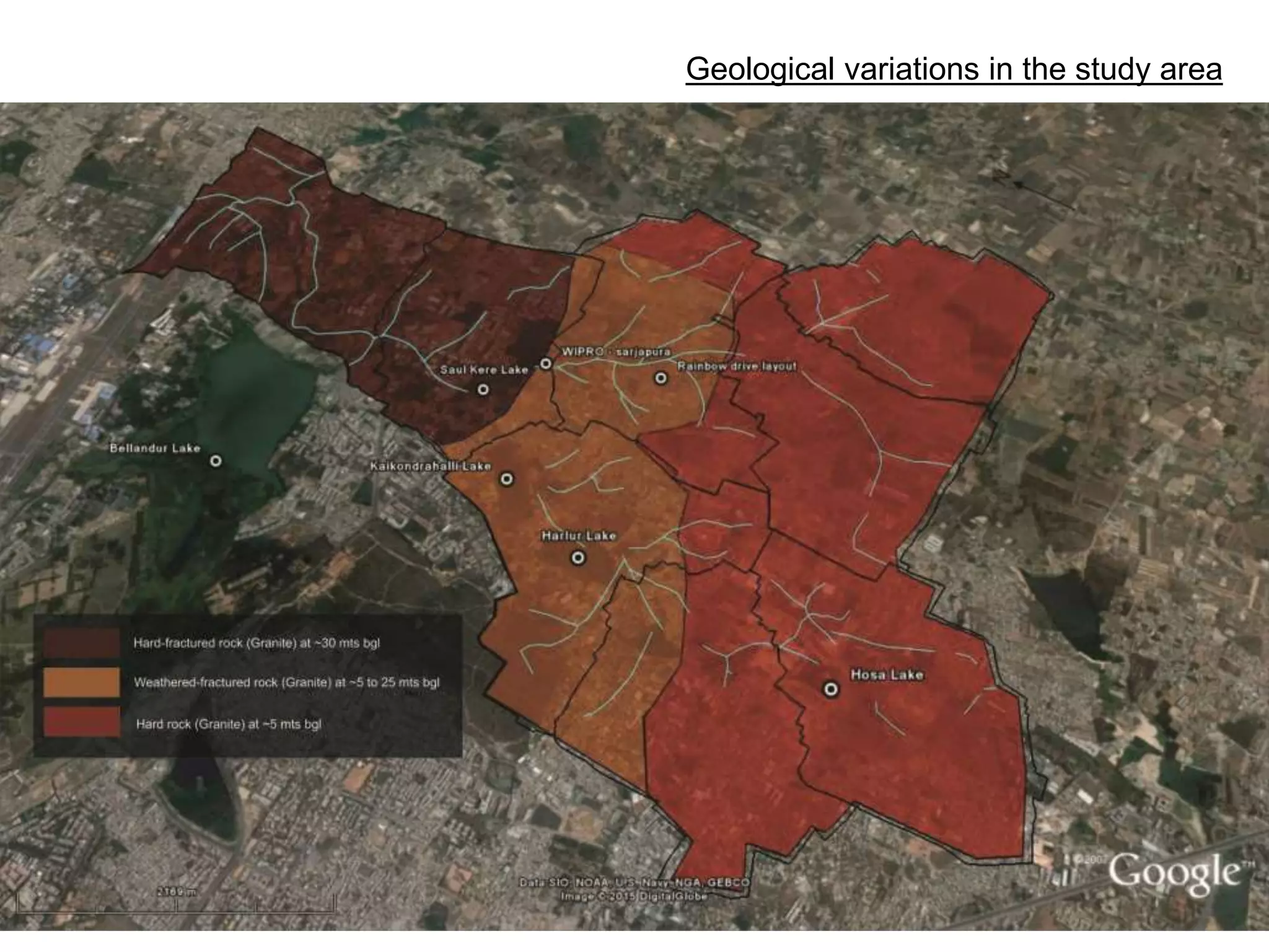
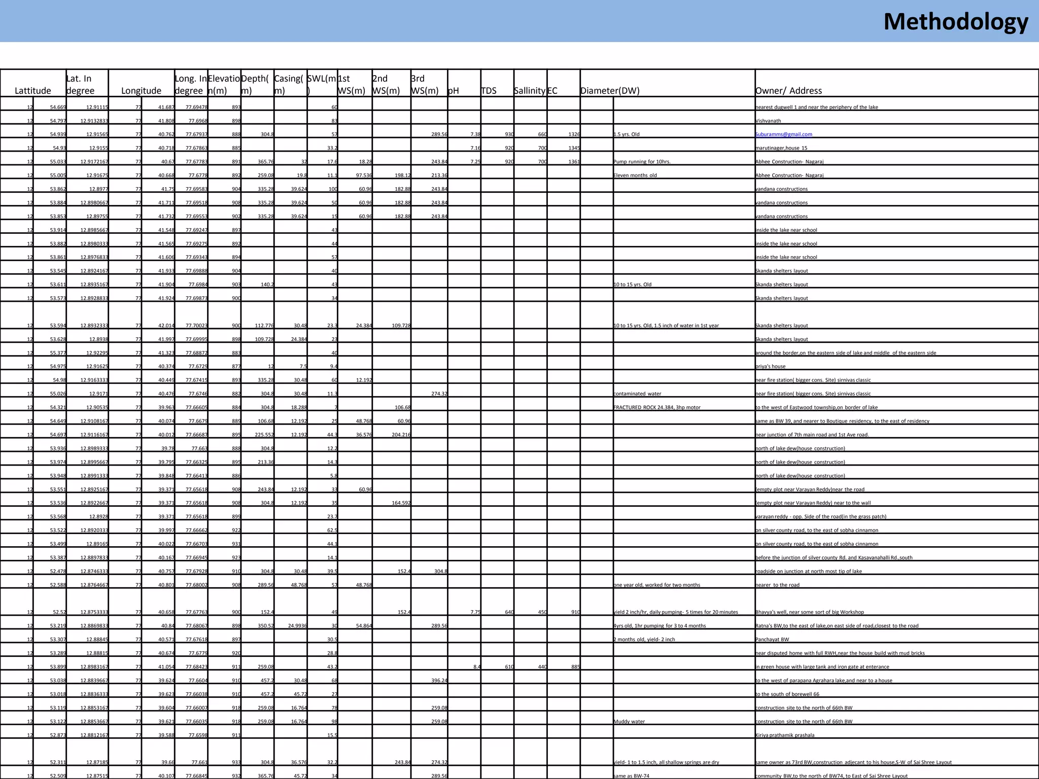
The document details a hydrogeological study in Bengaluru, focusing on the surface elevation profile, geological mapping, and groundwater resources in granitic terrain. It involves analyzing borewell data, water levels, and groundwater quality to understand confined aquifer systems and their dynamics. Ongoing monitoring and mapping will enhance the understanding of groundwater movement and aquifer boundaries in the study area.


![Pollution.ppt [Autosaved].ppt yogesh kumbhar](https://cdn.slidesharecdn.com/ss_thumbnails/pollution-251205194856-d30cfee8-thumbnail.jpg?width=640&height=640&fit=bounds)


