
Recommended
Recommended
More Related Content
Similar to Groundwater recharge at Cubbon Park.pdf
Similar to Groundwater recharge at Cubbon Park.pdf (20)
More from biometrust
More from biometrust (20)
Recently uploaded
Recently uploaded (20)
Groundwater recharge at Cubbon Park.pdf
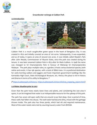
- 1. Groundwater recharge at Cubbon Park 1.0 Introduction Cubbon Park is a much sought-after green space in the heart of Bengaluru City. It was created in 1870 and initially covered an area of 100 acres. Subsequently, it was expanded, and as of today, it spans an area of around 200 acres. It was initially called Meade’s Park after John Meade, Commissioner of Mysore State, since the park was created during his tenure. It was later renamed Cubbon Park in 1873 after Sir Mark Cubbon. In 1948 the name was changed to Sri Chamarajendra Park in honour of Maharaja Sri Chamarajarendra Wadeyar. The park plays multiple roles; as a garden, it hosts various botanical species, both native and exotic. It has 196 species, with a total of 8866 trees. It is a preferred destination for early-morning walkers and joggers and hosts important government buildings like the Karnataka High Court, State Archeological Museum, etc. Hence, this place is rich in history and diverse in terms of its utility to Bengaluru. * (*https://cubbonpark.in/history/, https://cubbonpark.in/tree-info/tree_mapping_report.html) 2.0 Water situation prior to 2017 Given that the park hosts nearly 6000 trees and plants, and considering the vast area it spans, it can be imagined that water is an indispensable resource for the upkeep of this park. The park has seven old open wells that are around 20-40 feet deep. Over a period of time, these wells had fallen into disuse. The well water had become dirty, mixed with the garbage thrown inside. The park also has three ponds, which had silt and required maintenance. Most of the water needs were met by sourcing Cauvery water from BWSSB. 1
- 2. 3.0 Rejuvenation of open wells, ponds and digging of recharge wells A project to rejuvenate the old wells and ponds in Cubbon Park and also to recharge groundwater was taken up by Biome Environmental Trust, India Cares Foundation (ICF) and Friends of Lakes (FoL), together called the Waterlife Consortium. The project was funded by First American India (FAI). The concept of this project came from the thought that the park could be self-sustainable for its water requirements and should not have to depend on external water sources. Given the presence of a robust shallow aquifer and open wells, it was planned to see if the park could demonstrate best practices for water management by highlighting the use of the shallow aquifer. The recharge wells and the ponds recharge groundwater, and the open wells are sources from which groundwater can be drawn. The wells can also be monitoring points, which can instruct future groundwater management actions in the park. This project was completed in two phases: Phase I and II. 3.1 Phase I Phase I was carried out in May 2017. The objective of this phase was to revive the 7 open wells and to interconnect them. A team of well-diggers led by Peddanna cleaned the wells and de-silted them. Pumps were installed in each of the wells. Water from 6 wells is pumped into the 7th well located near the library building. All the collected water is pumped from the 7th well to a storage tank and then to the overhead tank (OHT). The water drawn from the wells is used to water trees, the lawn and the rose garden. Within a year, by Sept 2018, the open wells together started yielding 80,000 litres per day. 3.2 Phase II Phase II was started around Oct 2018. The objective of this phase included the digging of recharge wells and rejuvenation of three ponds. In order to make the withdrawal of water from the open wells sustainable, it is important to put water back into the underlying shallow aquifer. For this, around 73 recharge wells were planned. There are three ponds in the park, which help recharge groundwater, control flooding, and host local biodiversity, apart from being landscape features. Two of the ponds were taken up for rejuvenation. This included cleaning the ponds, desilting them and strengthening the bunds. Recharge wells As part of this project, a total of 73 recharge wells were dug. The dimensions of these wells were 3 ft wide and an average depth of 15 ft (actual depth varies between 14 ft to 16 ft, depending on the soil condition of a particular well). The wells have three-foot diameter concrete rings stacked on top of one another, with four one-inch holes on the side of each ring. Surrounding these rings is coarse aggregate - large, rough gravel which creates many 2
- 3. holes for the water to flow through. Each well is covered by a concrete slab, either three or four feet in diameter, with two small holes in it. This slab is quite heavy, requiring two men to lift it, and acts as protection so that no debris or person falls in. In addition, there is a wire mesh grill below the top concrete ring to prevent anything large from falling into the well. The aggregate is filled right up to the slab, and around it, long grasses have been planted. This makes the wells recognisable around the park. A silt trap cum filter has been created around each well by placing aggregates to a depth of 1 ft and a width of 1 ft around it. This ensures that large amounts of silt do not enter the well directly from the top. There is also planting that has been taken up around the well. This is not only for beautification but also ensures that silt does not enter the well. Map of 73 recharge wells in Cubbon Park Mural at Cubbon Park Metro station The mud from the digging of the recharge wells was put to use in a unique way - mud of different colours was used to create a large mural on one of the walls of the Cubbon Park Metro station, telling the water story of Bengaluru, and depicting the lives of the traditional well-diggers. During a two-week period in the latter half of 2019, passing commuters could participate in the painting of the mural under the guidance of the Srishti School of Art and 3
- 4. Design, which executed the project in collaboration with Biome Environmental Trust. The funding for this project was provided by the Bangalore Sustainability Forum. When the mural was unveiled to the public, some events were organised involving the well-diggers who dug the wells, including a Kaavya Sanje and a virtual tour of the mural (due to the pandemic), called Namma Ooru Namma Neeru. 4
- 5. Recharge capacity of 73 wells Each well has a static volume of around 3 kilolitres (KL), and each well can potentially recharge around 4.5 KL each time it rains (assuming each well can recharge one and a half times its static volume of 3 KL). This means the recharge potential of all the wells is 73 x 4.5 KL = 328.5 KL We have around 60 rainy days a year in Bengaluru. Assuming that the wells recharge to their full capacity on at least 30 of those days, 328.5 x 30 = 9855 KL = 9.8 million litres (ML) of rainwater will get recharged annually through the recharge wells (the actual recharge volume is likely to be higher, as rainfall intensity will vary through the 60 rainy days, with at least a few really heavy showers). Natural groundwater recharge To estimate the annual natural recharge that occurs, we need to consider the overall park area, which is around 200 acres. This means annually, the park receives 809371 sqm (200 acres) x 970 mm (average annual rainfall) = 785090 KL = 785 ML of rainfall annually. If we assume a natural recharge rate of 5% (natural recharge rates vary between 5% and 10% in the peninsular hard rock regions of India), a volume of at least 5% x 785 = 39.25 ML of rainwater is available for recharge. The actual volume of natural recharge may be more. The park has mostly loamy and silty soil, which is good for water percolation; however, the tree roots can trap most of the moisture in the top surface of the soil and consequently affect how much water reaches the shallow aquifer. A recharge well can bypass this root layer and provide an easier pathway from the surface for water to reach the groundwater table. 5
- 6. Clockwise from top left: Concrete rings with gravel aggregate around them, wire mesh grill in the well, completed recharge well, concrete slab well cover Pond rejuvenation Of the three ponds, two were taken up for rejuvenation. These are ● Karagada Kunte (0.005 hectares, or 50 square metres) and ● The pond behind the Wodeyar statue (0.023 hectares, or 230 square metres) 6
- 7. 3 feet of dirt and silt were removed from these ponds, and the bunds were strengthened. Channels which lead rainwater into the ponds were also opened up. Desilting the ponds helped improve their groundwater recharge rates. One of the ponds (behind the Wodeyar statue) has a recharge well in it, which means the percolation rate is higher. The other pond (Karaguda Kunte) does not have any recharge well in it; it tends to hold water for a longer duration due to a lower percolation rate. This is intentionally designed so that there is a presence of a water body in the park, which attracts local fauna and is also a landscape feature. The third pond (Lotus pond) was not taken up due to its bigger size and because bamboo grows in it. Recharge potential of the revived ponds The recharge potential of these ponds was calculated as follows. Assuming a recharge rate of 5 mm / day for the ponds, and assuming that the ponds hold water for at least 240 days (8 months) of the year, the annual recharge volume (in litres) of each pond would be Recharge rate x no. of days x area of pond in sqm For Karagunde Kunte (KK), this works out to 5 x 240 x 50 = 60000 litres = 60 KL For the pond behind Wodeyar Statue (PWS), this works out to 5 x 240 x 230 = 276000 litres = 276 KL However, PWS also has a recharge well inside it, which would be able to recharge 4.5 KL for at least 240 days of the year = 1080 KL. So the total annual recharge potential of PWS is 276 + 1080 = 1356 KL The total annual recharge potential of both ponds is 60 + 1356 = 1416 KL = 1.41 ML So annually, the total volume of rainwater recharged at Cubbon Park (not considering the Lotus pond) is at least 9.8 (from recharge wells) + 39.25 (natural recharge) + 1.41 (from two ponds) = 50.46 ML, which is several times more than the volume of groundwater drawn (0.55 ML). We have had to make assumptions about several of the parameters used because of the lack of data. 7
- 8. Ponds being desilted and cleaned 8
- 9. Cleaned pond filled with rainwater 4.0 Conclusion and next steps Cubbon Park is a confluence of the old and the new. It is a historical place, seamlessly blending with the modern world. The revival of old wells and ponds, and the digging of the recharge wells have made shallow groundwater available for park needs. It has also brought back the tradition of the Tigala community that uses the well water and soil for their annual Karaga festival. The murals in the nearby Metro station tell the story of these wells and the relevance of the well-digger Mannu Vaddar community. Situated in the heart of the city, Cubbon Park is one of the areas that has a robust shallow aquifer. The huge volume of rainwater that it recharges helps replenish the groundwater table of not only the park but the surrounding areas as well. Regular monitoring of the well water levels and documentation of the usage of well water for the park’s needs would help greatly in understanding this shallow aquifer’s behaviour. A hydrogeological study of the park and surrounding areas would help delineate this aquifer’s extent and, thereby, its volume. This would provide valuable information on the capacity of this aquifer and its potential to meet the park’s water needs. A study of the borewells and open wells (if any) in the surrounding areas would help in understanding the park’s role in keeping the water table replenished. 9