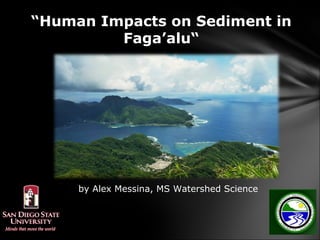
1. “Human Impacts on Sediment in
Faga’alu“
by Alex Messina, MS Watershed Science
2. Thank you to our collaborators in
American Samoa:
CRAG
DMWR
DOC
ASEPA
ASCC/DOC-Intern:
Rocco Tinitali
3. Motivation and Research Question
Land-based sources of sediment and nutrients
can damage coral…
Pristine Southern reef Damaged Northern reef
…so where and when is the sediment generated in
the watershed?
4. What is a watershed and why is it
important for Faga’alu Reefs?
*Source and transportation
of sediment and pollutants
that can harm coral
ecosystems
Storms cause muddy plume
from stream to reefs
5. Turbid,
freshwater layer
during rains
Polluted,
degraded
ecosystem
Shallow, near rivermouth
Deeper, near reef crest
Pristine,
functioning
ecosystem
6. A history of monitoring in Faga’alu
•E. Bardi, 2005: Showed that Faga’alu was
highly impacted by turbidity relative to other streams
•P. Houk, 2006: Related coral health to stream water
quality and showed Faga’alu as highly degraded
•M. Sabater, 2007: Measured high rates of
sediment accumulation on reefs in Faga’alu
•S. Curtis, 2011: Measured stream water quality
parameters up and down stream to identify likely
sources of sediment runoff
7. Objectives:
1) Reconnaissance of watershed to identify likely
sources of sediment and nutrients
2) When, How much: Quantify streamflow,
sediment, and nutrients during storm
and inter-storm periods
3) Where: Where does the sediment go?
4) Watershed model and management scenarios
5) Build capacity for field monitoring and land-
based pollution assessment in A.S.
15. Conclusion from reconnaissance:
Sediment is most important,
sources include:
1. Quarry
2. Hospital storm drain/urban area
3. Unpaved areas/sparse grass
4. Agriculture
5. Landslides
16. Objectives:
1) Reconnaissance of watershed to identify likely
sources of sediment and nutrients
2) When, How much: Quantify streamflow,
sediment and nutrient loading during storm
and inter-storm periods
3) Where: Where does the sediment go?
4) Watershed model and management scenarios
5) Build capacity for field monitoring and land-
based pollution assessment in A.S.
17. 4 Tipping Bucket rain gauges
1 Rain gauge on Mt. Matafao:
• 2,142 feet, Highest point on the island
• Very difficult access trail, ~35% slope
• Starting point of watershed
18. Objective 2: Load (tons) = Q x C
Measure stream flow (Q) and sediment concentration (C) at 3 locations
a) Upper watershed (“Dam”, PT#3)
b) Stream below quarry (“Quarry”, PT#2)
c) Outlet to the ocean (“LBJ”, PT#1)
North
North
0.5mi.
19. Measuring stream flow (Q) (L/sec)
Measure depth
Or “Stage”
(like a ruler)
Outlet site
Flow measurements
relate “Stage” to
Stage
streamflow (Q)
(Height to Volume)
Measuring flow at
dam above quarry
20. Measuring sediment (C): Storm, inter-storm sampling
a. Manual/Auto sampling - six storms, >300 samples
b. Turbidimeter – continuous, January – May 2012, two sites
Convert turbidity to sediment concentration using
observed relationship
Auto-sampler at Quarry site
Filtering and weighing sediment
at DMWR lab
22. Results: Example from one sampled storm
(March 7, 5.6 cm of rain)
•Sediment load highest at LBJ, outlet to ocean
•Responsive to rainfall – essential to monitor storms
•Sediment flux higher near hospital
•Responsive to rainfall
Turbidimeter above quarry
23. Results: Storm Data % of Total
Sediment(Tons) Sediment
Duration Precipitation
# Date (Days) (mm) Upper Lower Total Upper Lower
1 1/31/12 11 224 0.88 7.28 8.15 10 89
2 2/05/12 2.5 104 0.73 4.84 5.57 13 86
3 3/05/12 2.5 78 0.31 1.12 1.43 21 78
4 3/08/12 3 50 0.43 0.26 0.69 62 37
5 3/15/12 4 88 0.15 0.53 0.68 22 77
6 3/16/12 3 77 0.16 0.49 0.65 23 76
Total: 26 621 3 15 Average: 26 74
74% of sediment comes from the human- impacted
lower watershed, most of it from the quarry
26% of sediment comes from the upper
watershed from natural erosion and landsliding
Over 90% of sediment is moved during storms
24. Objectives:
1) Reconnaissance of watershed to identify likely
sources of sediment and nutrients
2) When, How much: Quantify streamflow
sediment and nutrient loading during storm and
inter-storm periods
3) Where: Where does the sediment go?
4) Watershed model and management scenarios
5) Build capacity for field monitoring and land-
based pollution assessment in A.S.
25. Measuring sedimentation rates
on Faga’alu reef (pilot study)
1. Differences between North and South reefs
2. Gradient away from rivermouth
3. Only 2 Monthly samples: Feb and March
Hypothesized flow, and sediment accumulation
Assembly
N
e r
rg ve
ater
ha ri
sc id
h
Seaw
di rb
Fres
Tu
S
Installation
26. Improving models with new datasets
MODELS: Predict sediment load based on processes but need
to be calibrated to local conditions
Model Objectives:
1. Scientific
a. Extend existing datasets
b. Quantify human impacts
2. Management
a. Scenarios
b. Watersed prioritization
Equations developed for Map-based tools developed in
mid-west agricultural management the tropics for coral conservation
27. Objectives:
1) Reconnaissance of watershed to identify likely
sources of sediment and nutrients
2) When, How much: Quantify streamflow
sediment and nutrient loading during storm and
inter-storm periods
3) Where: Where does the sediment go?
4) Watershed model and management scenarios
5) Build capacity for field monitoring and land-
based pollution assessment in A.S.
28.
29. Next phase: CRTF Priority Watershed
->Management and Restoration
• If BMPs implemented at the quarry, and Village Watershed Plan
implemented, how much is sediment reduced?
• How much coral will grow back naturally? With help?
•Sediment control at quarry
•Village Watershed Protection
Plan implemented
-->cleaner stream
•Less sediment on reef
•Coral restoration
--> healthier coral