A Rangeland Assessment Method: Comparing Two Grazing Management Systems by Gregg Simonds and Eric Sant, Open Range Consulting
•
1 like•1,737 views


Recommended
Recommended
More Related Content
What's hot
What's hot (19)
Viewers also liked
Viewers also liked (16)
Similar to A Rangeland Assessment Method: Comparing Two Grazing Management Systems by Gregg Simonds and Eric Sant, Open Range Consulting
Similar to A Rangeland Assessment Method: Comparing Two Grazing Management Systems by Gregg Simonds and Eric Sant, Open Range Consulting (20)
More from Utah Section Society for Range Management
More from Utah Section Society for Range Management (20)
Recently uploaded
Recently uploaded (20)
A Rangeland Assessment Method: Comparing Two Grazing Management Systems by Gregg Simonds and Eric Sant, Open Range Consulting
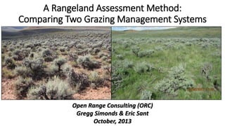
- 1. A Rangeland Assessment Method: Comparing Two Grazing Management Systems Open Range Consulting (ORC) Gregg Simonds & Eric Sant October, 2013
- 2. Food and Fiber Water Security Carbon Cycle University of Idaho, Karen Launchbaugh and Eva Strand, with input from the SRM I&E committee.
- 3. Grazing is Ubiquitous Cost Effective and Statistically Valid Monitoring
- 4. Historical Rangeland Assessment Spatially Limited
- 5. Historical Rangeland Assessment Spatially Limited Historical Landscape Assessment
- 6. Historical Rangeland Assessment Temporally Limited 1966 1965 1964 Lee Sharp, 1990
- 7. ORC’s Rangeland Assessment Historical Landscape Assessment
- 8. ORC’s Rangeland Assessment Historical Landscape Assessment
- 9. ORC’s Rangeland Assessment Historical Landscape Assessment
- 10. ORC’s Rangeland Assessment Historical Landscape Assessment
- 11. ORC’s Rangeland Assessment Historical Landscape Assessment
- 13. ORC’s Rangeland Assessment • Upland Assessment • Riparian Assessment • Three Creeks vs. DLL Comparison
- 14. ORC’s Rangeland Assessment Focus on Functional Cover Types • • • • Bare Ground Herbaceous Litter Shrubs
- 15. Upland Assessment • • • • Bare Ground Herbaceous Litter Shrubs High Resolution Photos On-The-Ground 6x7 m 2mm 18 Million Pixels
- 16. Upland Assessment High Resolution Photos On-The-Ground 6x7 m 2mm 18 Million Pixels • • • • Bare Ground Herbaceous Litter Shrubs
- 20. Crop Year Precipitation & Treatments 5% 16 4% 14 4% 12 3% 10 3% 8 2% 6 2% 4 1% 2 1% % Treated Crop Year Precip 2010 2010 2009 2009 2008 2008 2007 2007 2006 2006 2005 2005 2004 2004 2003 2003 2002 2002 2001 2001 2000 2000 1999 1999 1998 1998 1997 1997 1996 1996 1995 1995 1994 1994 0 0% PERCENT TREATED 5% 18 INCHES 20
- 21. 2010 2005 2004 2003 2002 2001 2000 1999 1998 1997 1996 1995 Average Percent Cover Sagebrush Cover Continuous (1995 -2010) 20 19 18 17 16 15 14 13 12 11 10
- 22. 2010 2005 2004 2003 2002 2001 2000 1999 1998 1997 1996 1995 Average Percent Cover Bare Ground Continuous Cover (1995-2010) 35 34 33 32 31 30 29 28 27 26 25
- 23. 2010 2005 2004 2003 2002 2001 2000 1999 1998 1997 1996 1995 Average Percent Cover 35 Herbaceous Continuous Cover (1993-2010) 34 33 32 31 30 29 28 27 26 25
- 24. Shrub Cover Change 1995-2010 • Warm Colors Decreasing Shrub • Cool Colors Increasing Shrub
- 25. Riparian Assessment Focus on Important Functional Ground Cover • • • • Upland Veg. Bare Ground Riparian Veg. Water
- 26. Assess Within the Potential Riparian Area (PRA)
- 29. Increasing Riparian Vegetation Within the PRA Correlated to Positive Changes in the Following Riparian Indicators Water Table PFC Fish Populations Sediment Water Temperature
- 30. Three Creeks vs. DLL Comparison
- 31. Physically Similar Elevation Climate Woodruff Weather Station • Temperature • Precipitation Different Management DLL • Mostly Private • Adaptive, Time Controlled (1976) • 4.4 Acres/AUM Three Creeks • Mostly Public • Season Long Grazing • 6.75 Acres/AUM
- 32. Standards and Guidelines 1. Sufficient cover and litter to protect the soil surface from excessive water and wind erosion, promote infiltration, detain surface flow, and retard soil moisture loss by evaporation USFS Objectives for Range Management 1. Manage range vegetation to protect basic soil and water resources
- 33. Overall Comparison 50 40 30 20 10 0 Perennial Grass Tall Sagebrush DLL Short Sagebrush Three Creeks Average Continuous Cover 70 Average % Cover Percent Cover Bare Ground by Dominant Landcover 60 50 40 30 20 10 0 Bareground Sagebrush Herbaceous/Litter
- 34. Semi-Desert Loam Comparison Analysis Area NRCS ESD: Bare Ground Ranges from 25% - 35% 28% 15% 20% 25% 30% 36% 35% DLL 3 Crks 40% Average Cover (Semi-Desert Loam) 60% 50% 40% 30% 20% 10% 0% Bareground Shrub Herb/litter Semi Desert Loam Analysis Areas DLL Three Creeks Deseret Three Creeks 0 1 2 4 6 8 10 Miles ´
- 35. Standards and Guidelines 2. Riparian and wetland areas are in properly functioning condition….
- 36. Riparian PFC Comparison Percent of Streams in PFC Rating 80% 60% 40% 20% 0% NF FAR DLL PFC Three Creeks
- 37. Allotment Comparison % Riparian Vegetation within the PRA 60% 50% 40% 30% 1976 2006 2009 20% 10% 0% Allotments
- 38. Long Term Trend of Riparian Vegetation Within the PRA Percent Riparian Vegetation withing the PRA (By Grazing Management) 30% 25% Exclosure 20% Season Long 15% Time Control 10% 5% 2010 2008 2006 2004 2002 1999 1997 1995 1991 1989 1986 1980 1978 0% 1974 Percent Riparian within the PRA 35%
- 39. Standards and Guidelines 3: Desired species, including native, threatened, endangered and special status species, are maintained at a level appropriate for the site and species involved.