What’s in my mobile geo toolkit? by @gingemonster

The world of geo can be a confusing place full of a multitude of new concepts, frameworks, toolkits and services. To someone who hasn’t spent half their life working with maps it can all be a little daunting and sometimes look insurmountable. This talk will discuss some of the best tools, shortcuts and performance tips that will show you how to build powerful location based apps and services with considerable less effort and pain than you might have imagined. About Brian Brian is web & mobile developer with 14 years’ experience developing first in the travel industry and now in mapping. Seven years ago he co-founded Earthware to focus on developing innovative but practical mapping experiences and has worked on a wide range of projects for the likes of Microsoft, London 2012, Financial Times and Tfl. His real passion is in ensuring maps are seen as more than just marketing gimmicks by ensuring they add real value to a user’s experience.

Recommended
More Related Content
What's hot
What's hot (20)
Similar to What’s in my mobile geo toolkit? by @gingemonster
Similar to What’s in my mobile geo toolkit? by @gingemonster (20)
Recently uploaded
Recently uploaded (20)
What’s in my mobile geo toolkit? by @gingemonster
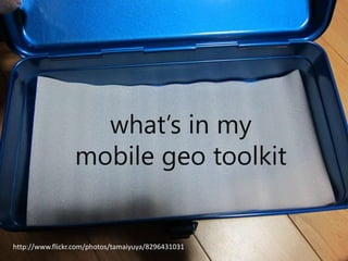
- 1. what’s in my mobile geo toolkit http://www.flickr.com/photos/tamaiyuya/8296431031
- 6. what’s in my toy box http://www.flickr.com/photos/35168673@N03/6062629948
- 8. Open Data • Open Street Map • Ordnance Survey • GeoNames • GeoLytix
- 11. Open Source Js SDKs http://leafletjs.com/ http://openlayers.org/
- 12. Open Source iOS SDKs https://www.mapbox.com/mapbox-ios-sdk/ https://github.com/route-me/route-me
- 13. Open Source Android SDKs https://www.mapbox.com/blog/mapbox-android/ https://code.google.com/p/osmdroid/
- 14. Map Ninja Tools
- 17. Making Map Data Fly • Understanding precision • GeoJSON • TopoJSON + MapShaper
Editor's Notes
- Well this is the title of my talk
- The safe option would be to talk you through what I use with screenshots…
- But really this talk is called
- Soim going to play with my toys with you, but things will probably break a bit along the way
- http://www.openstreetmap.orgWorld wide vector datasetCrowd SourcedThousands of updates dailyOther than attribution pretty much license freeUK extremely accuratehttps://www.ordnancesurvey.co.uk/opendatadownload/products.htmlNow have a wide range of free data products, with very open licensesMost useful are probably postcode positions for every postcode and place names and locations (Gazeteer)http://www.geonames.org/Worldwide places names gazeteerFree data and hosted webservicesMultilanguagePretty good qualityhttp://geolytix.co.uk/geodata/postal-boundaries Using OS open data have created postcode boundaries again open licensed
- http://account.cloudmade.com/signinhttp://maps.cloudmade.com/?styleId=26560https://www.mapbox.com/editor/#styleCloudmade and Mapbox has limited free options with very competitive paid options as wellMapquestion open has free and paid options as well http://open.mapquest.com/OSOpenspace has a free option that is reasonable generous http://www.ordnancesurvey.co.uk/business-and-government/help-and-support/web-services/os-openspace/web-map-builder.html
- Obvious a big question in mobile at the moment and just as big in mapping
- LeafletVery lightweight open source js control used by many commercial and open source projects including OpenStreetMapVery fast at rendering and really good on mobileActively developed and supported by companies like CloudMade and MapboxOpenLayersThe old king, has more features but tends to not perform as well, although improving with new releases
- Offline mapsNative controlPlugs into all mapbox servicesOpenSourceA fork of https://github.com/route-me/route-me OS also have one
- Offline mapsNative controlPlugs into all mapbox servicesOpenSourceA fork of https://code.google.com/p/osmdroid/OS also have one
- There is a massive open source geo community creating hundreds of brilliant projectshttp://www.osgeo.org/ is a organisation which brings together and supports many of the key projects and even produces a live cd with them all installed to play with at http://live.osgeo.org/Quantum GIS OS alternative to ArcGIS and MapInfo etc lots of plugins http://www.qgis.org/ Gdal is an amazing command line library mostly based and transforming raster images for use on mapsGdal used by many other projects like qgis . One brilliant util that is part of Gdal is OGR2OGR which is you one stop show for converting geo data formats especially into and out of databases with spatial supportTilemill is a product from Mapbox (open source again) that lets you design your own map canvas in a very powerful yet easy to use way and export the maps in a variety of formats including for use on web maps
- Spatial databases allow you to use geo data like lines & polygons as part of your queriesYou might already have a spatial database and not know it like SQL server since 2008 and Oracle But there are some excellent alternatives from Postgres + PostGIS http://postgis.net/And CartoDB which is a really easy to use web frontend built on top of PostGIS http://cartodb.com/ and provides a REST webservice with all the power of PostGIS/PostGres queries
- http://d3js.org/http://bl.ocks.org/mbostock/2374239http://bl.ocks.org/mbostock/4055908http://bl.ocks.org/dwtkns/4973620http://bl.ocks.org/mbostock/4060366http://mbostock.github.io/d3/talk/20111116/airports.htmlhttp://bl.ocks.org/mbostock/4060606http://cartodb.github.io/torque/ - best one gen 2
- 5 decimal places is around 1m (depending where on the globe) so don’t waste space in transmiting dataXML is verbose check out geojson http://geojson.org/If you are transferring polygons that line up, like boundaries look at https://github.com/mbostock/topojson/wikiIf you want to create topojson easily and simplify it look at http://www.mapshaper.org/