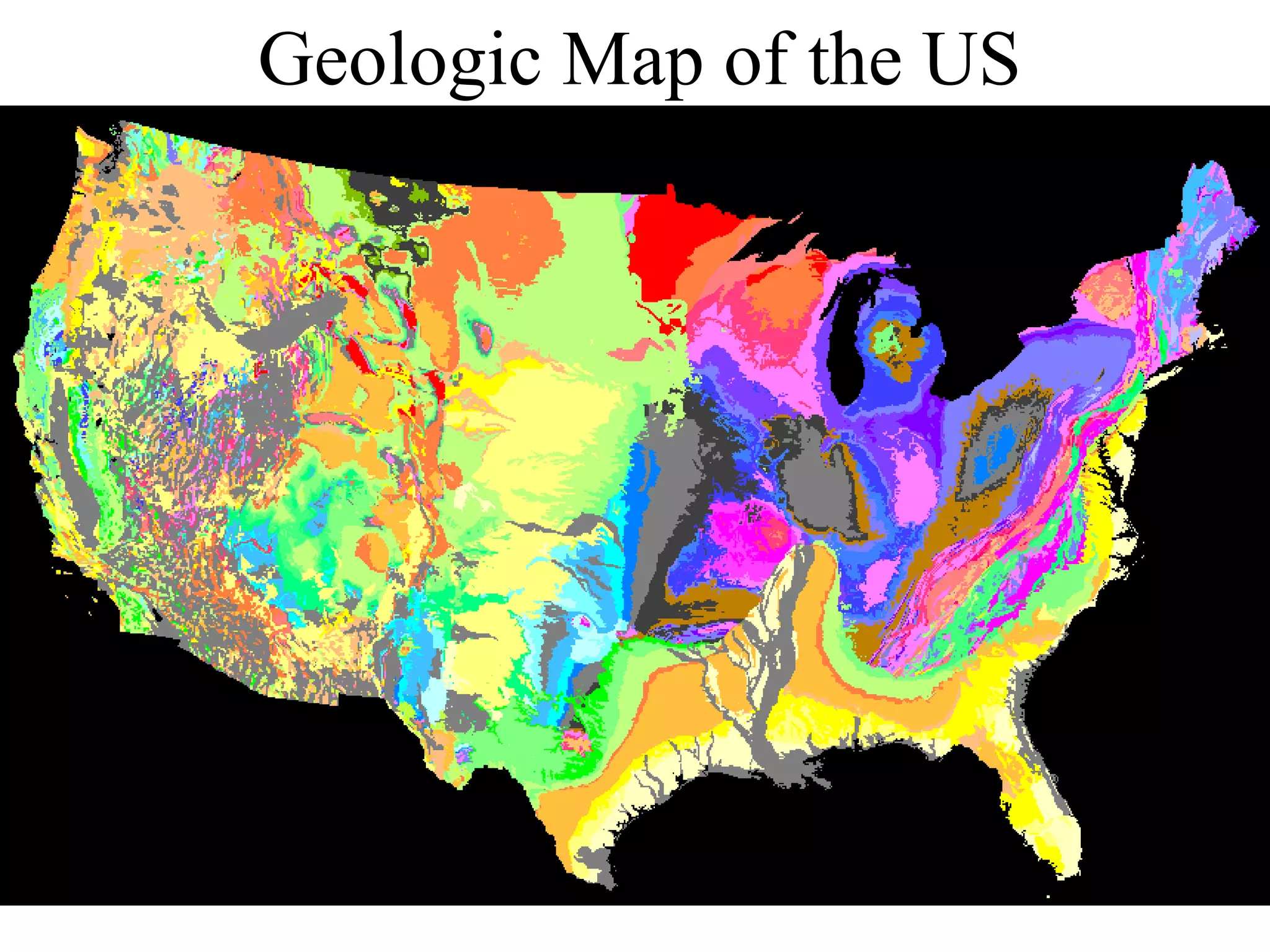
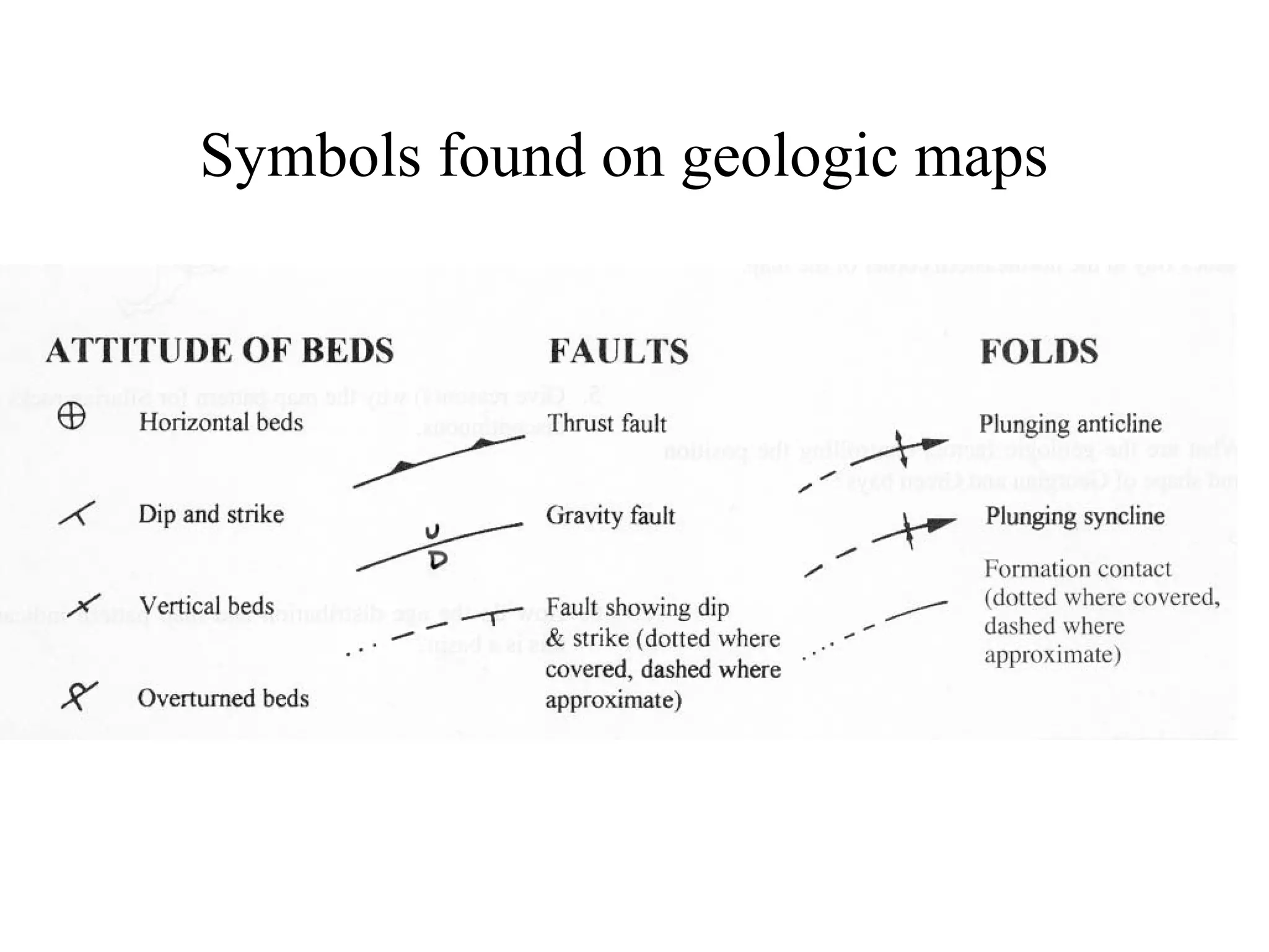
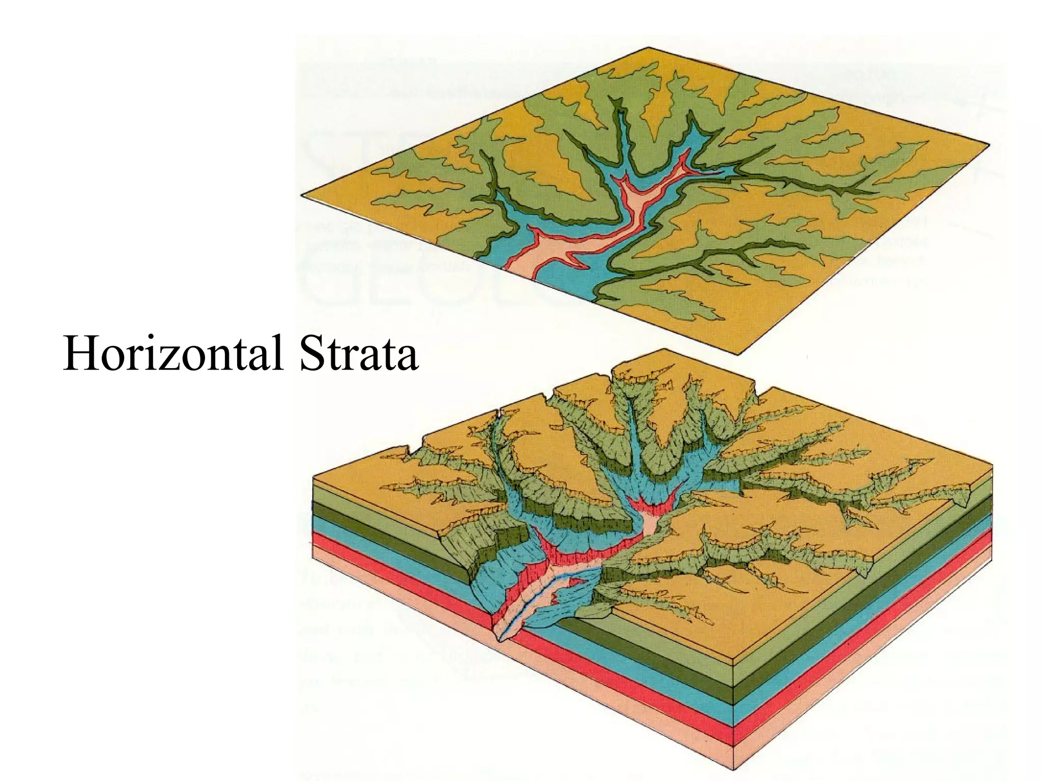
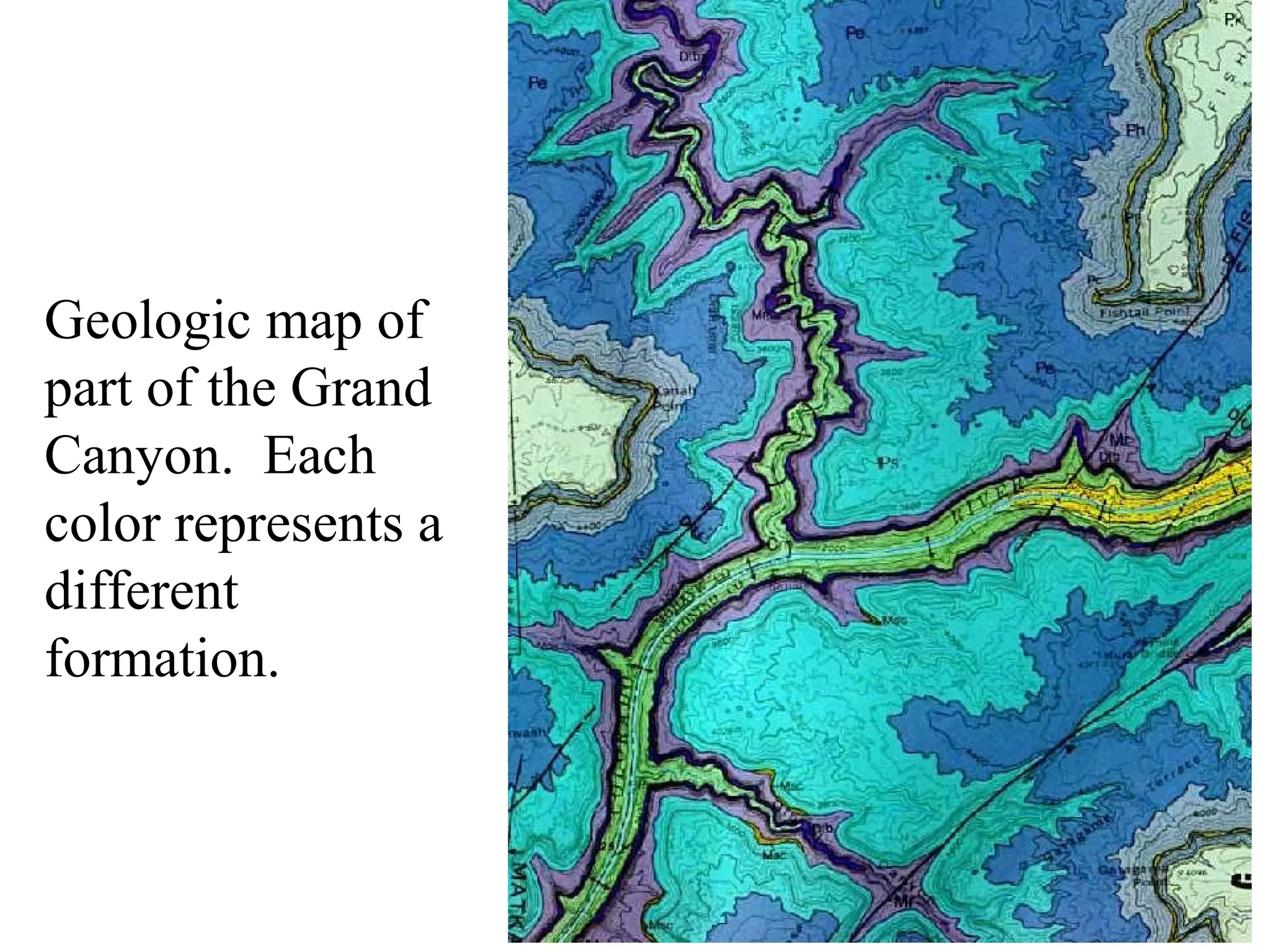
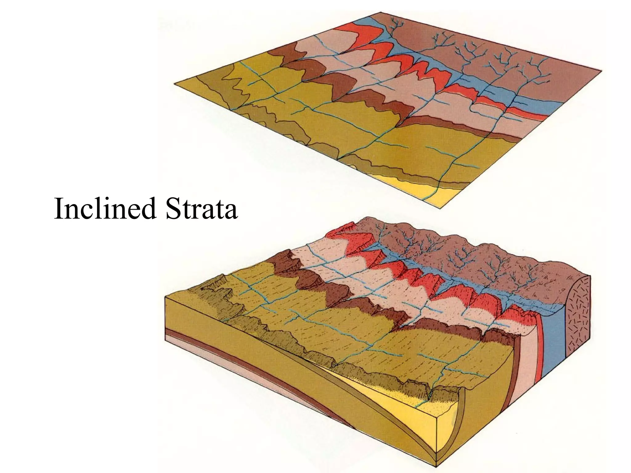
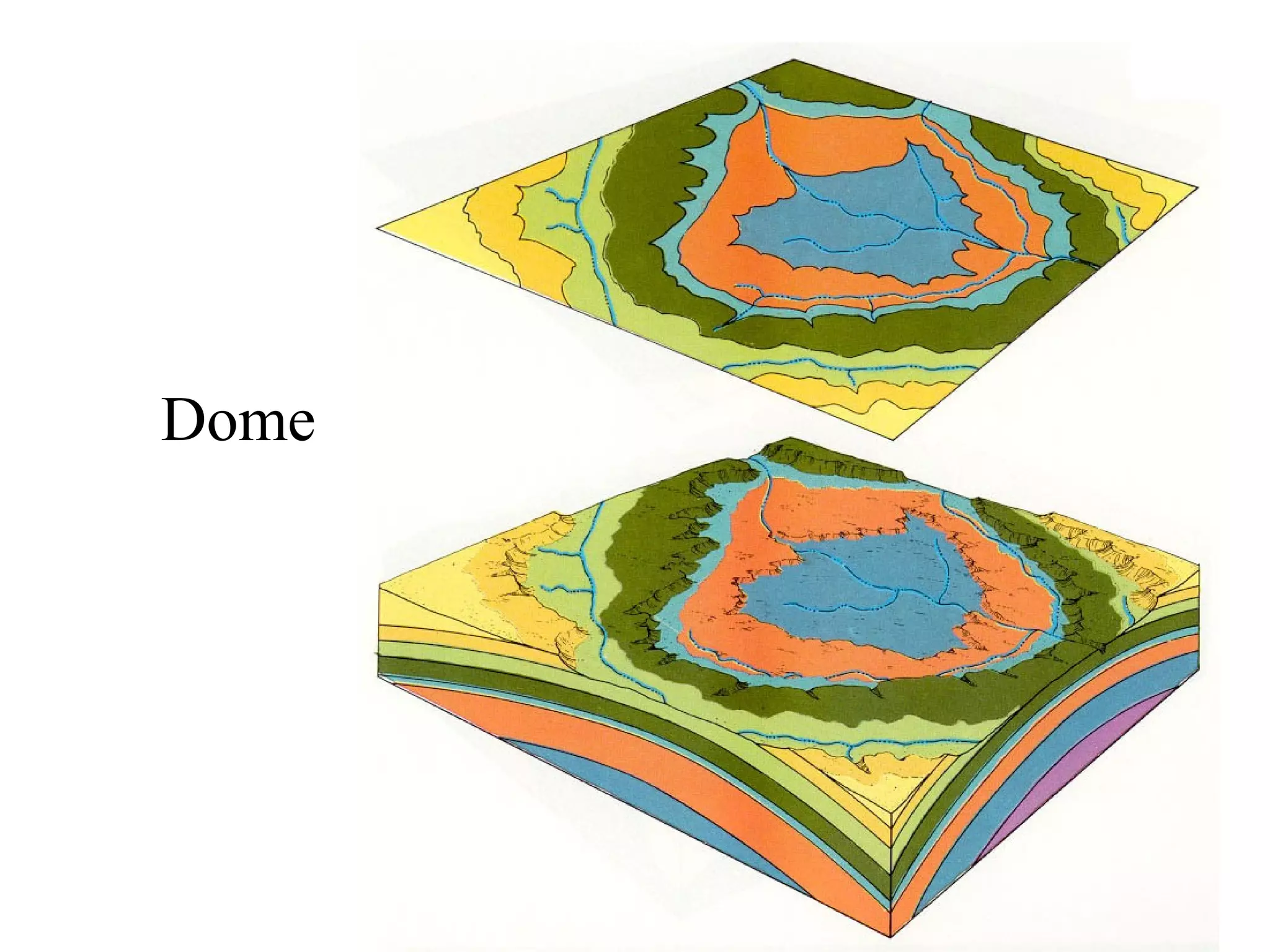
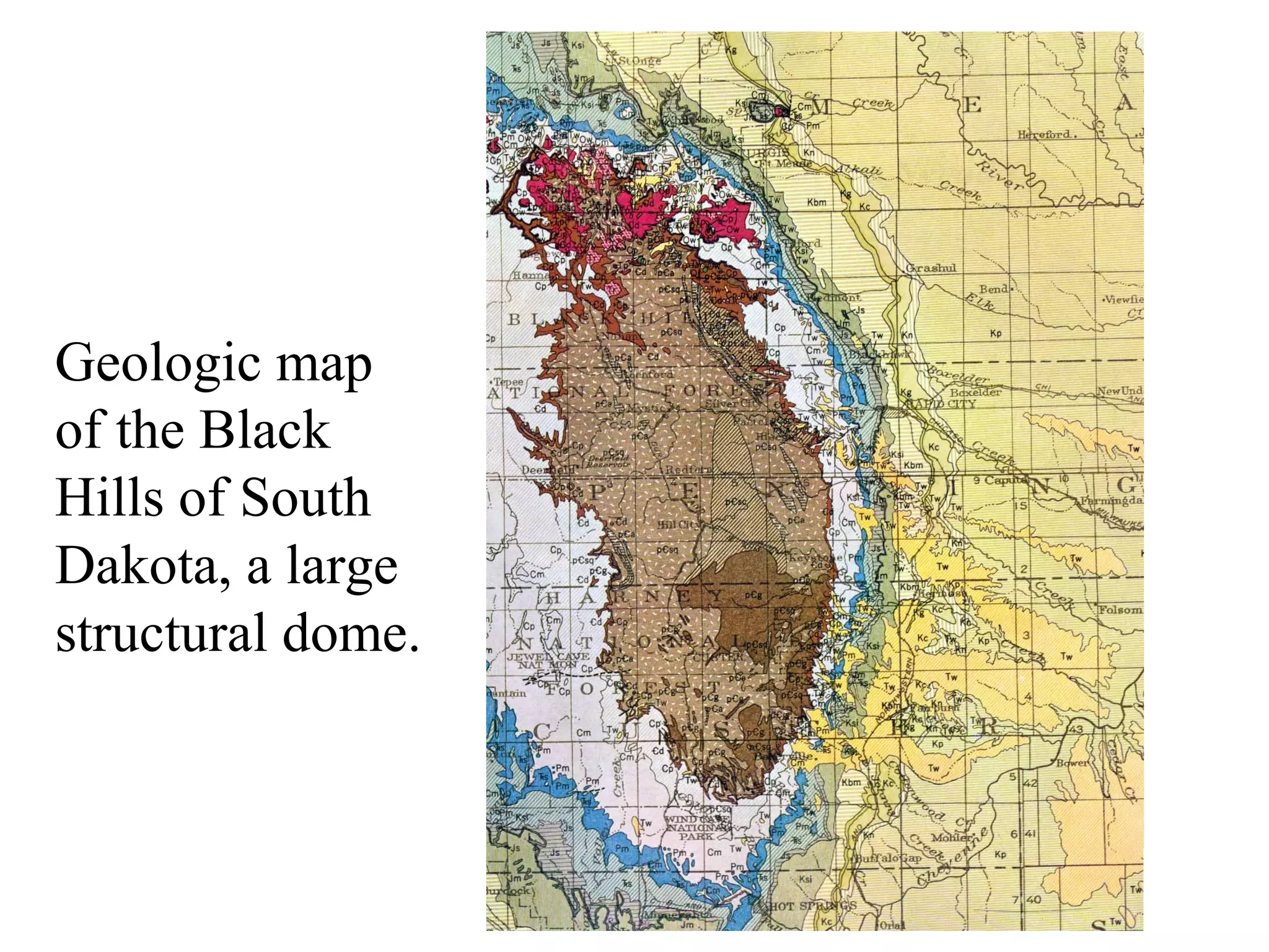
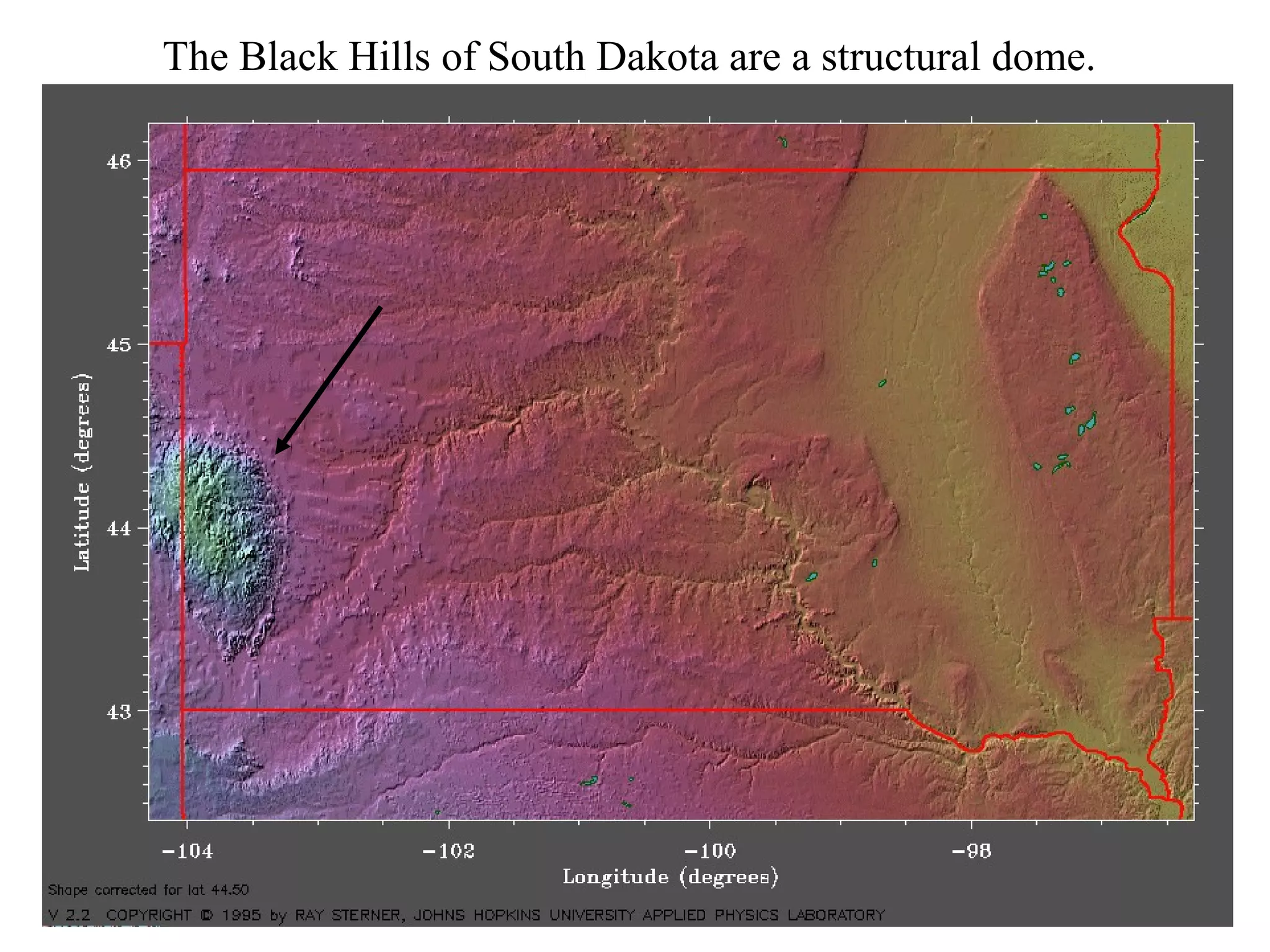
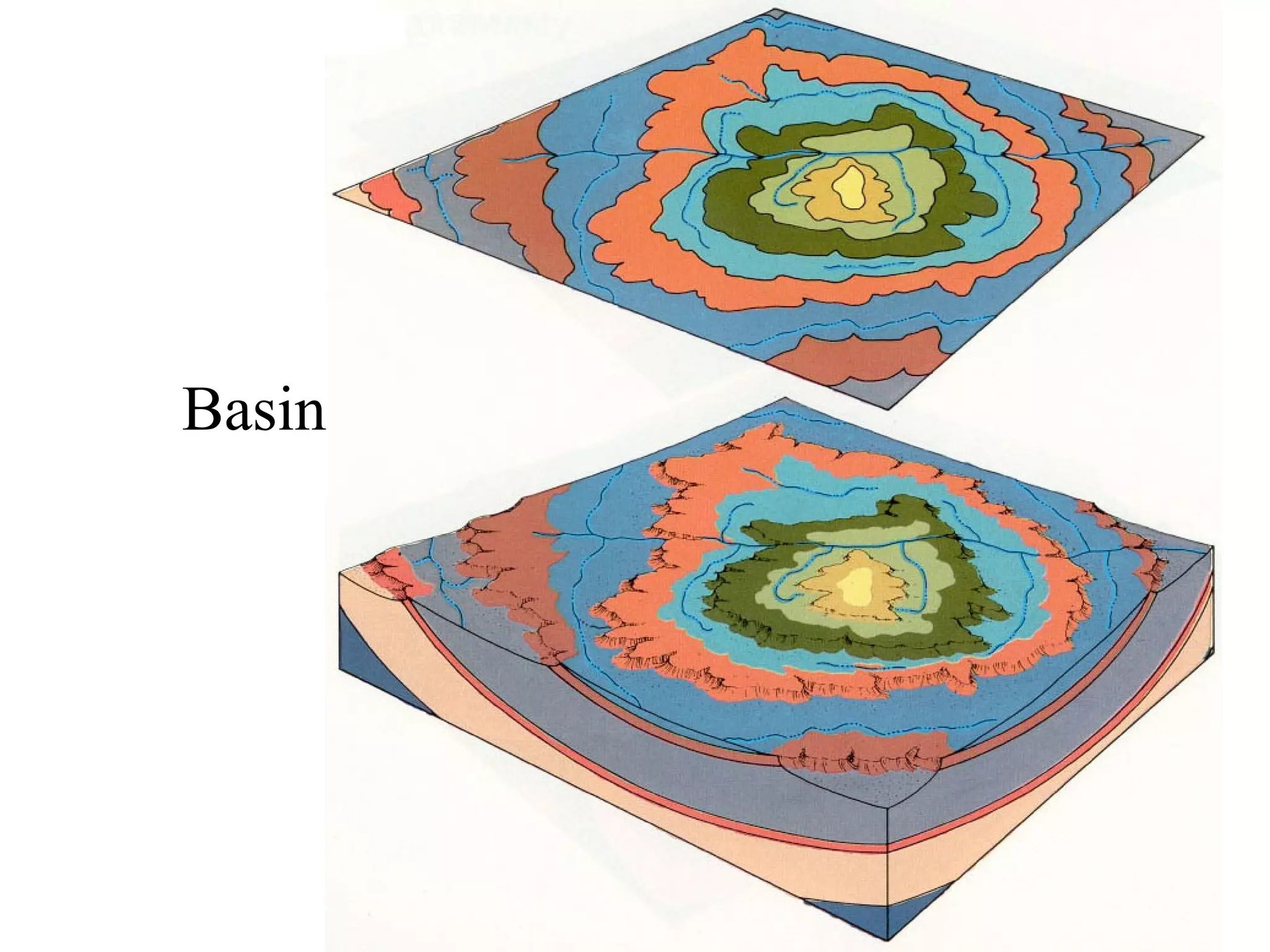
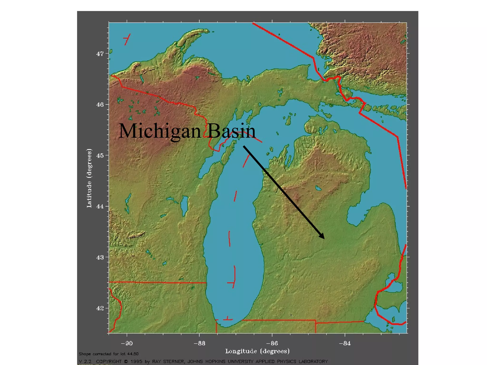
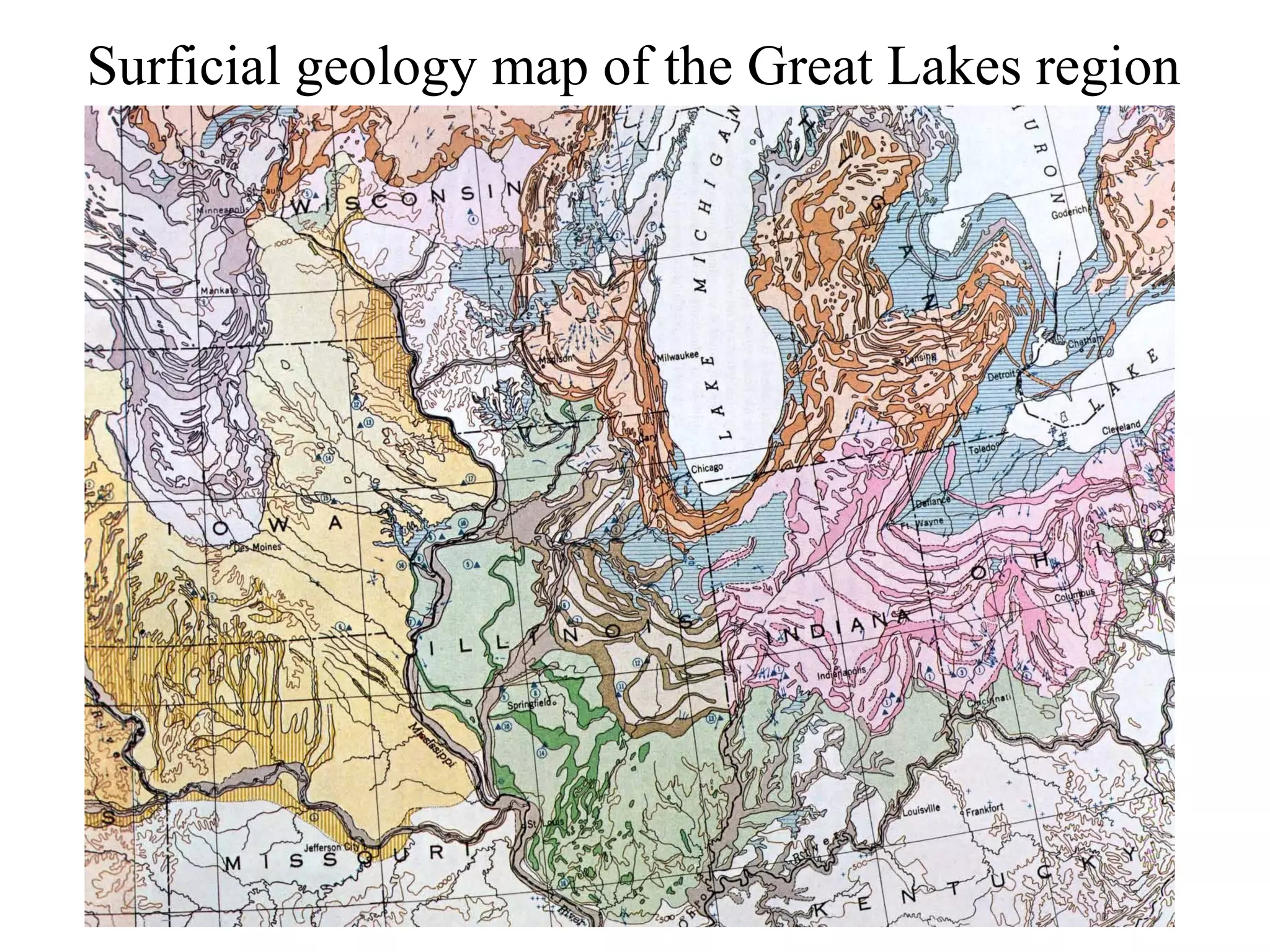
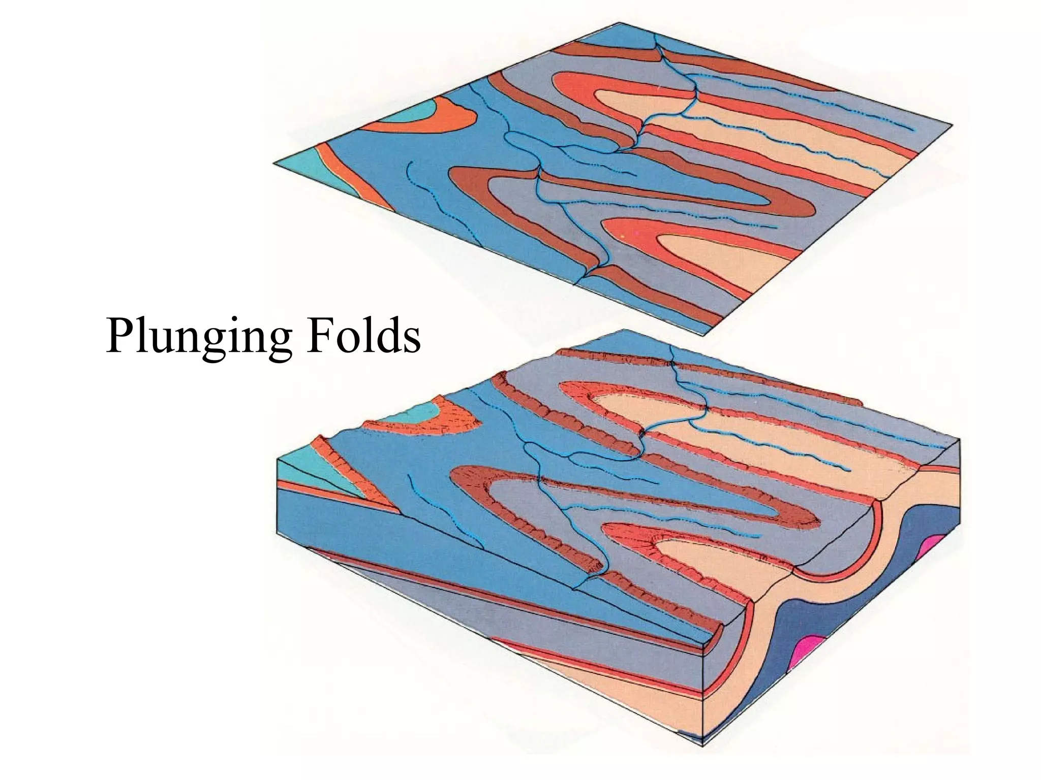
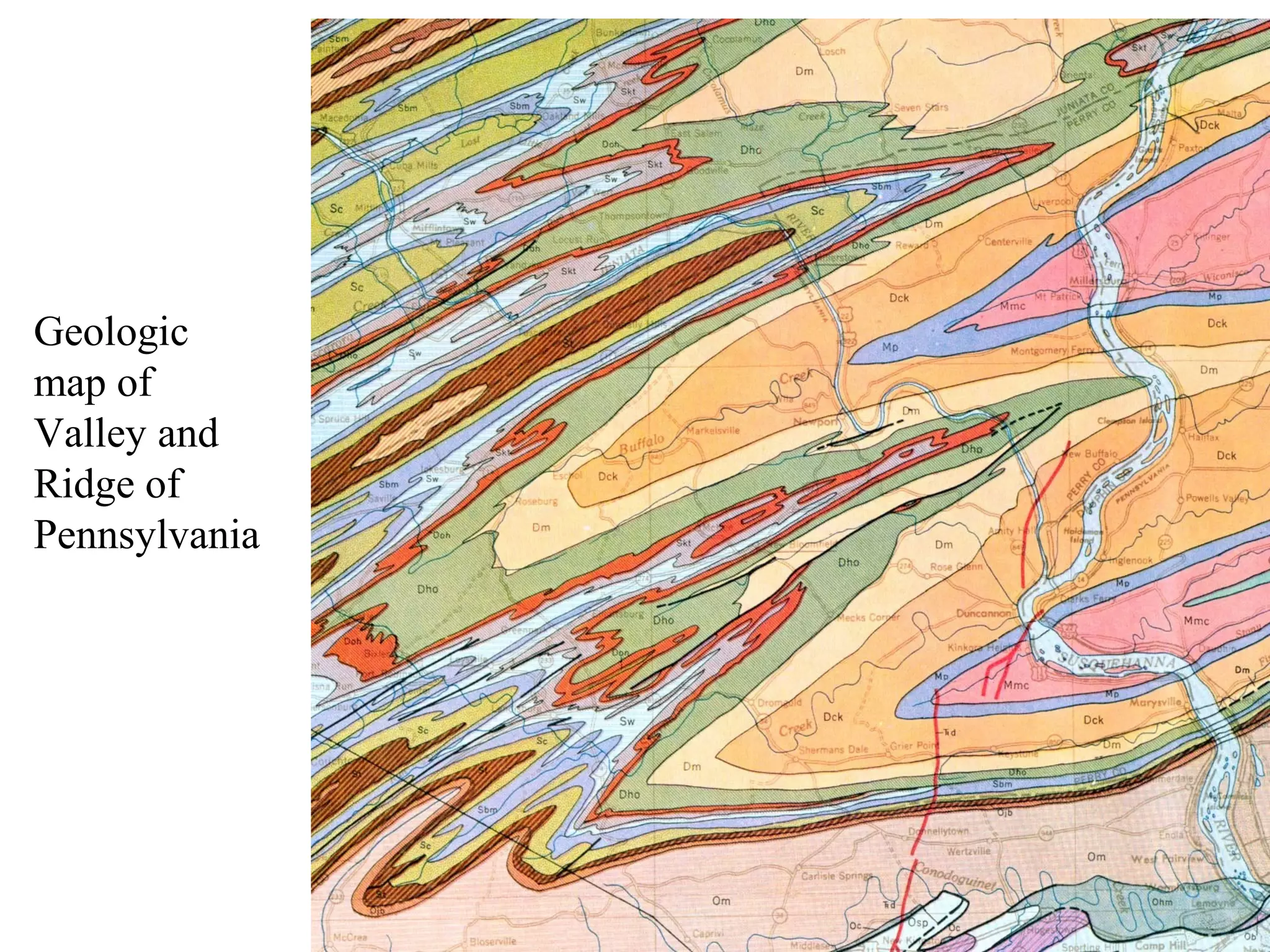
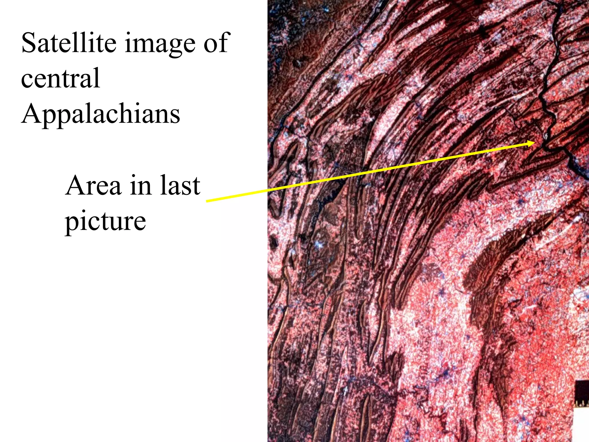
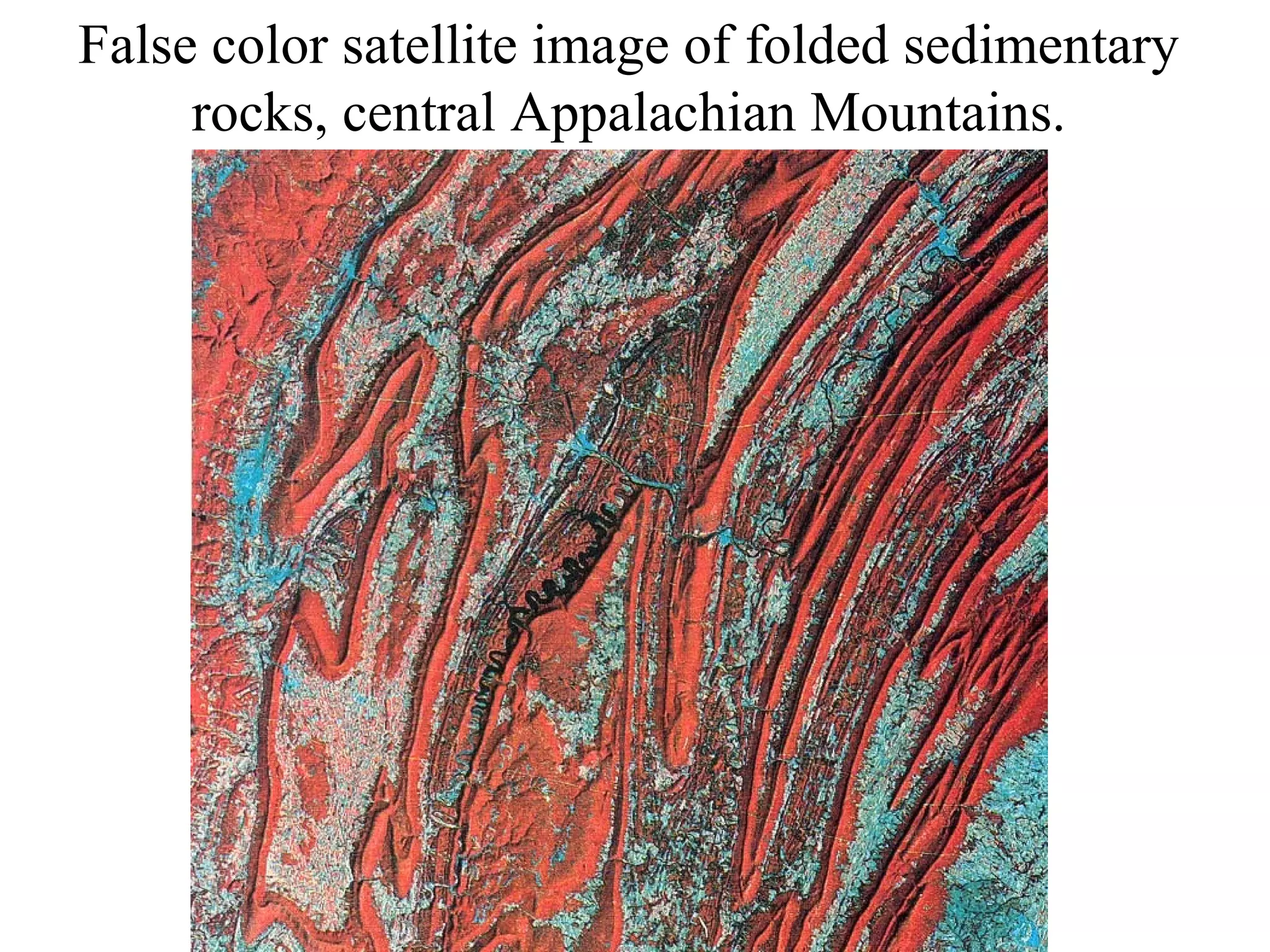
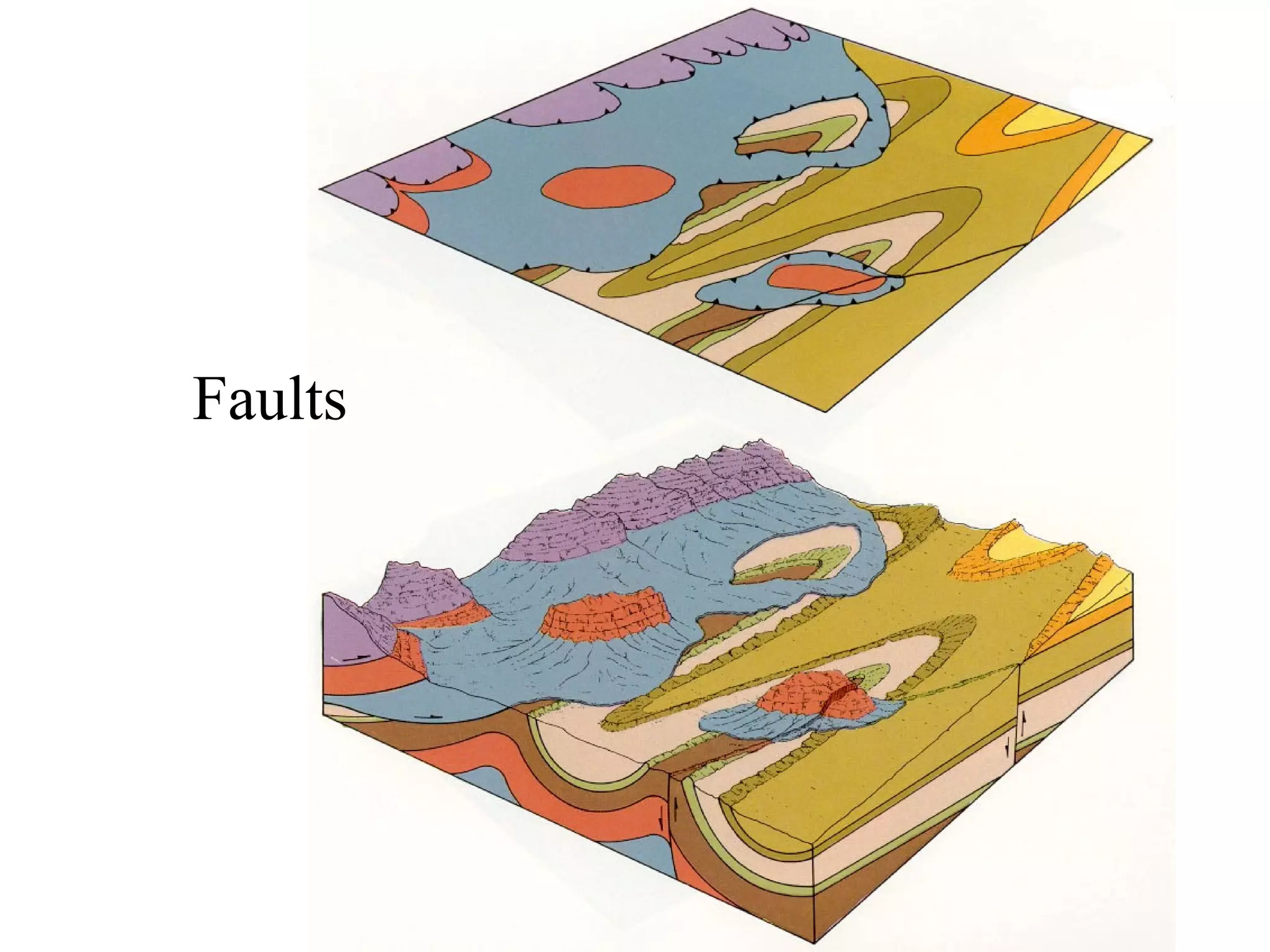
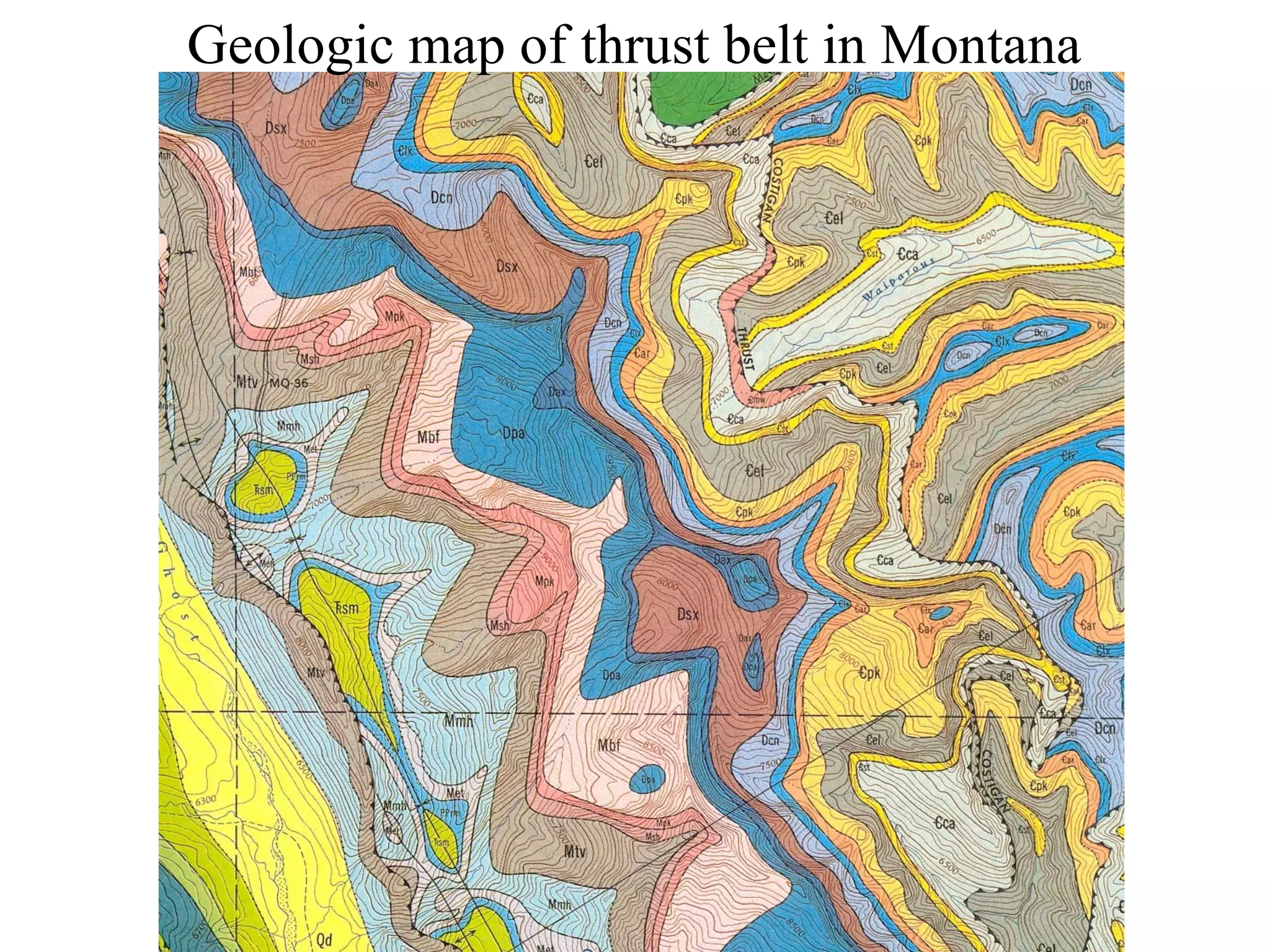
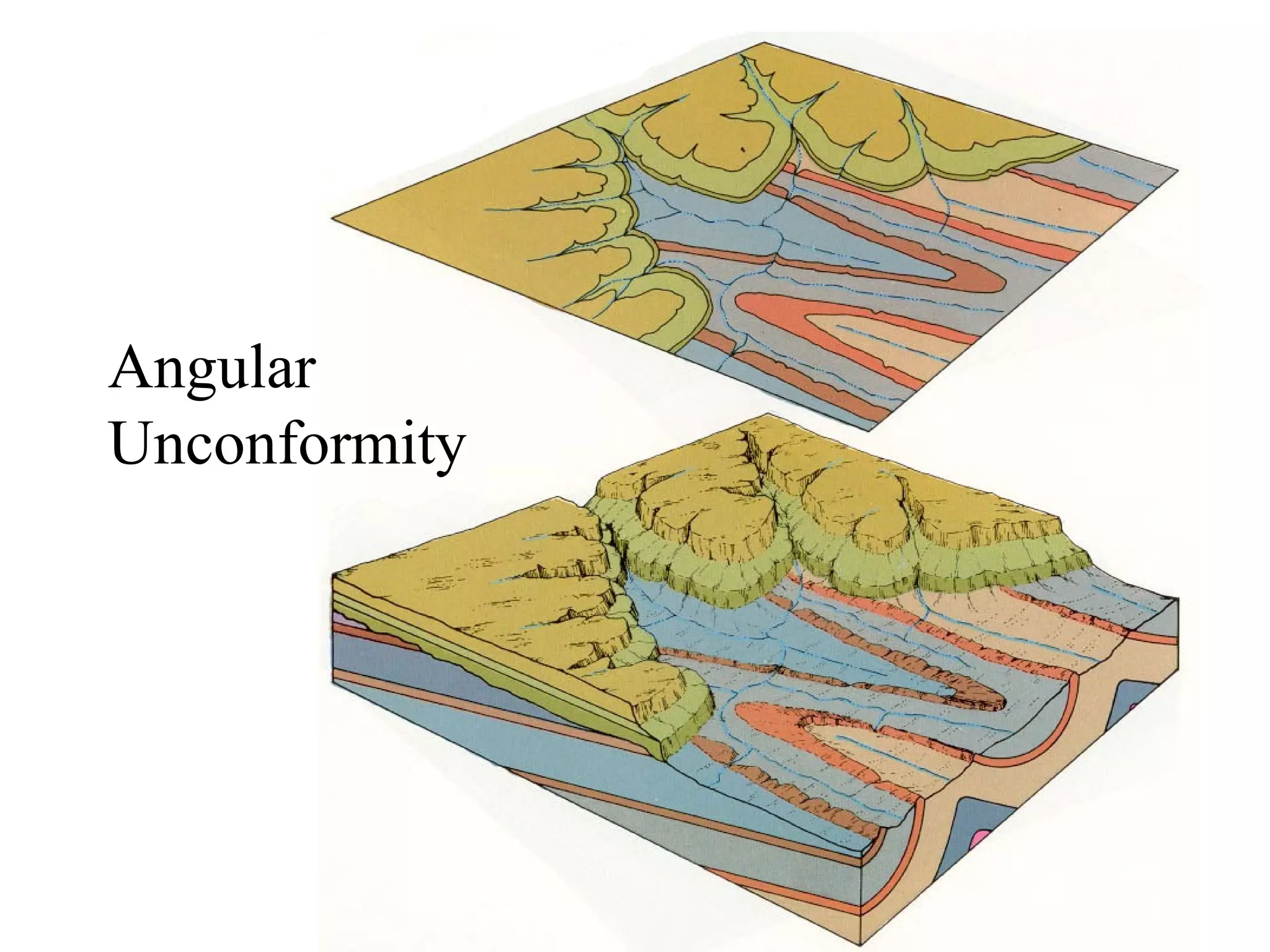
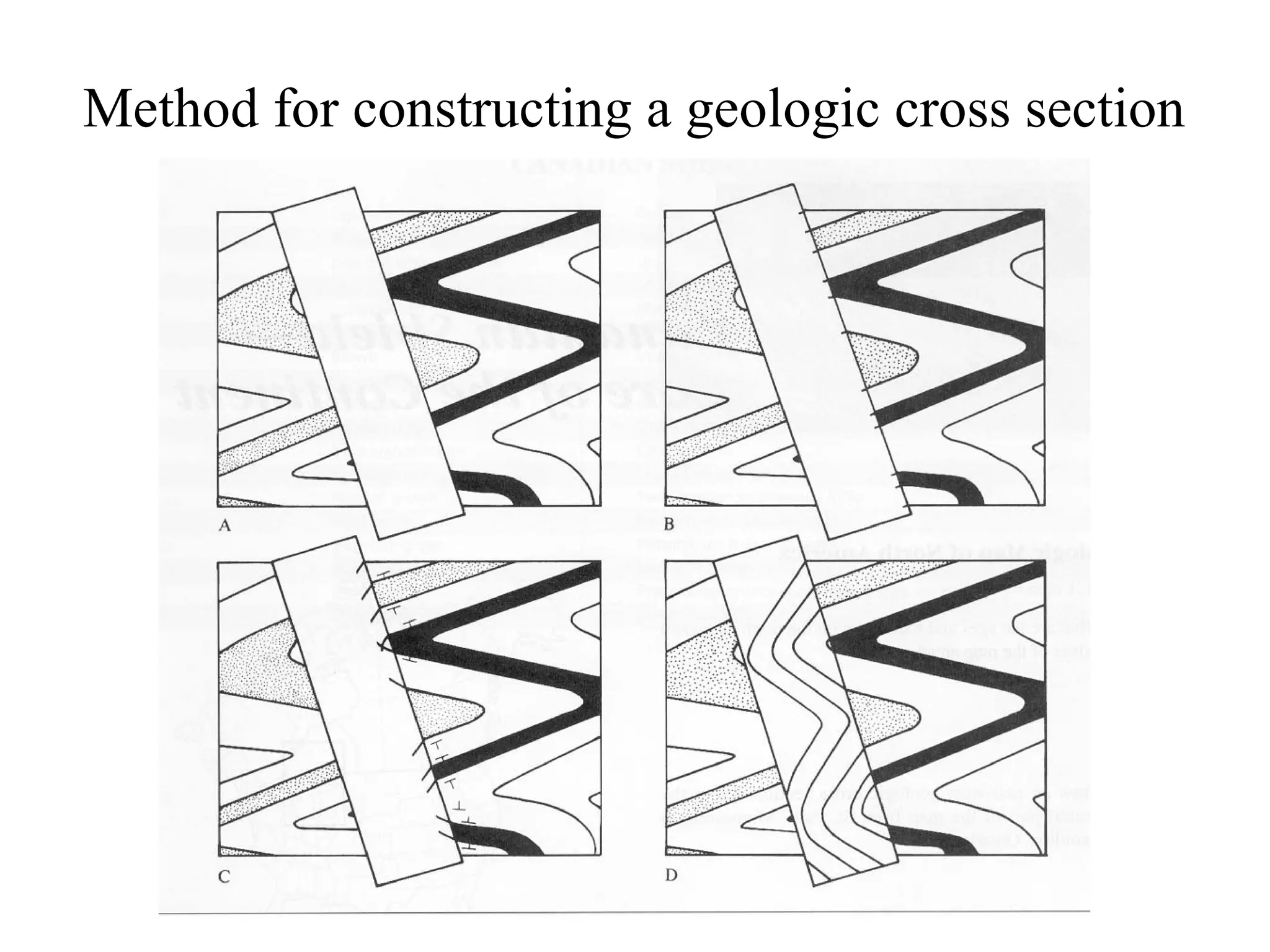
This document provides an overview of geologic maps and the symbols used to depict different geologic features on maps. It includes examples of geologic maps showing horizontal and inclined rock strata, domes, basins, plunging folds, faults, and unconformities. It also presents a satellite image demonstrating folded sedimentary rocks in the Appalachian Mountains.