
Recommended
More Related Content
Recently uploaded
Recently uploaded (20)
Featured
Featured (20)
Top Ten Tips for National Geographic Bee
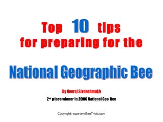
- 1. Top tips for preparing for the 10 National Geographic Bee By Neeraj Sirdeshmukh 2 nd place winner in 2006 National Geo Bee
- 2. Learning geography starts with the basic tool, the atlas . Familiarize yourself with the major cities, countries, provinces/territories, and other physical and political divisions of our planet. TIP # 1: LOCATIONS A good atlas is Geographica . Another one is National Geographic Family Atlas of the World . A free world atlas can be found online at www.encarta.msn.com . Go to www.geography.about.com to find blank maps of every county.
- 3. This port city was founded in 1177 when a castle over the Lagan River was built. ANSWER: Belfast, United Kingdom What river is this? ANSWER: Rhine River This is the second largest city in Germany and is located on the Elbe River. ANSWER: Hamburg, Germany This is the southernmost point of mainland Europe. What is it called? ANSWER: Point Tarifa, Spain Identify what location is represented by each symbol on the blank map: The best way to memorize locations is to practice filling in blank maps .
- 7. CLIMATE GRAPHS These types of questions pop up occasionally and require you to analyze a climate graph , a chart that shows temperature and precipitation patterns for a particular location. You are given a few cities and asked to find the one that best fits the graph. For example, look at this graph. The red line represents the temperature in degrees Celsius. You can tell that it is hot year round- around 28 degrees C. There are no extremes in temperature. This should immediately tell you that this city is close to the equator. The blue bars represent precipitation. It is very wet. The highest amount of precipitation occurs from November-January. If you know that the northeast monsoon winds blow during this period, you can tell that this city is located somewhere in southern Asia. SO WHAT CITY IS IT ???? What city matches this climagraph? A) Rio de Janeiro B) Stockholm C) Washington, D.C. D) Singapore E) Sydney ANSWER: Singapore
- 8. Don’t forget to study regularly . Utilize any free time you have. Use your weekends, after-school free time and vacations fruitfully. It’s up to you to decide how much you should study. TIP # 5: STUDY REGULARLY
- 16. TIP # 8: CREATE YOUR OWN CHART When I was studying, I created my own chart, filled with all the facts I needed to know about every country. Using a chart to memorize is much easier than just reading a book with facts. I made columns for the following: country name, capital, major cities, highest points, physical features, independence, religions, languages, ethnic groups, maps, bordering countries, currencies, major exports, and facts . My table looked like this: Major exports/ facts Currency Bordering countries Ethnic groups Languages Religion Independence Physical features Highest points Major cities Capital Country
- 17. TIP # 9: PLAY QUIZZES TO TEST YOUR KNOWLEDGE Playing quizzes is a great way to prepare, especially if you have limited time to study. Good websites : www.mygeotrivia.com - thousands of questions (you can also view a sample of the chart I created here) www.geography.about.com - go to “Test your Knowledge” www.nationalgeographic.com/geobee /- new Geo Bee Challenge every day www.epals.com – go to Geography Central www.hillmanwonders.com- top 100 wonders of the world
- 18. TIP # 10: PARTICIPATE IN GEOGRAPHY DISCUSSION FORUMS One great discussion forum is www.geobeecentral.com , where you can keep in touch with many other geography bee contestants and fans like you….. There are also quiz questions, more advice on how to prepare, and other tips. Another one is www.epals.com . There is a blog called Geography Central.