Demolition, Deformation, and Demarcation: Scanning to Enable Design and Construction by John Smits
•
0 likes•870 views

This presentation will illustrate through real life examples how the Faro laser scanner was used to enable accurate documentation and fast tracking of construction though a better understanding of the physical state of existing conditions. Discussed will be methods of data acquisition in often adverse or cluttered site conditions, scanning in high traffic public areas and active construction sites. A variety of deliverables will be shown: 3D models, 2D drawings, topographic surface mappings, even direct use of printed scalable scan data sections.

Recommended
Recommended
More Related Content
Viewers also liked
Viewers also liked (16)
Similar to Demolition, Deformation, and Demarcation: Scanning to Enable Design and Construction by John Smits
Similar to Demolition, Deformation, and Demarcation: Scanning to Enable Design and Construction by John Smits (16)
More from Melissa Tiffany
More from Melissa Tiffany (20)
Recently uploaded
Recently uploaded (20)
Demolition, Deformation, and Demarcation: Scanning to Enable Design and Construction by John Smits
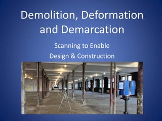
- 1. Demolition, Deformation and Demarcation Scanning to Enable Design & Construction
- 8. St. Patrick’s Cathedral, NY
- 26. Former New York Life Building McKim Mead & White 1894-1898
- 31. Cross Section through Building
- 32. Entry Lobby at Center of Building
- 37. Clock Tower featured in movie 9 ½ Weeks
- 41. Claiborne Pell Bridge, Newport, RI
- 43. Project Goals: Scan entire bridge 11,248 LF (3,428m) Scan at night, complete within two weeks Tie scan data in geo-coordinates Use data as basis for CAD documents
- 46. The key element the Bridge Authority wanted to document was the numerous patches in the roadway.
- 47. Faro Focus: Quick Scan Time Fine Detailed Resolution Perfect Solution
- 48. The Faro Focus 3D and the Faro 330 were used. Scans were taken at 1/4 resolution, set 60’ (18.3m) apart to gain sufficient detail and resolution of the roadway surface.
- 52. Almost 400 scans were taken over a period of nine nights, documenting both lanes (22,500LF / 6,856m) of the bridge.
- 60. Actus3d Laser Scanning & Consulting Services www.actus3d.com Thank You